Near Ohio Route 73, 0.9 miles west of Homer Chapel Road (County Road T-116), on the right when traveling west.
The serpent head was first described by Squire and Davis in "Ancient Monuments of the Mississippi Valley" 1843
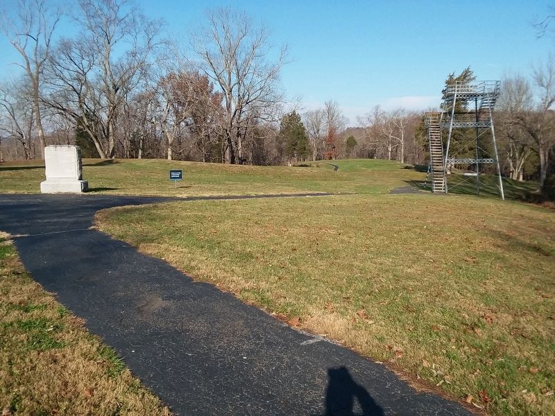
Saved from destruction in 1885 by Fredrick Ward Futnam, Professor of American Archaeology and Ethnology, Harvard University. . . . — — Map (db m214416) HM
This original alloy steel school bell rang for the children attending the Sharp School located on Delong Road. The Sharp School was built in 1870 and was one of eleven one-room school houses in Shawnee Township by 1874. In 1926, ten of the schools . . . — — Map (db m196047) HM
On Buckeye Road east of Ft. Amanda Road, on the right when traveling east.
Through the study of the development of the United
States flag, we better understand our American
heritage, learn an appreciation for the sacrifices of all
U.S. veterans and realize the need to continue strong
leadership, strong citizenship . . . — — Map (db m196381) HM
Founding of Ashland College
The dream of establishing a college was born in the hearts of members of the German Brethren Church. In March 1877, a meeting was held at the Maple Grove Brethren Church to discuss the establishment of a college in . . . — — Map (db m97072) HM
Erected in 1957 by George and Jessie Jones in loving memory of their son, Earl E. Jones, Ashland College student 1920-21, who died in 1921.
This terrace is dedicated to the pleasurable growth and development of the young people who attend . . . — — Map (db m25836) HM
On North Main Street (U.S. 250) at East Main Street, on the right when traveling north on North Main Street.
This bell rang here at Savannah Academy from 1859 thru 1924. It was then moved to the new Savannah-Clear Creek School. In 1970, the bell was taken to Crestview High School. Finally, in 1993, it was returned to its home here in Academy Park. — — Map (db m202314) HM
On Center Road (Ohio Route 45) 0.1 miles north of Lampson Road, on the right when traveling south.
Betsey Mix Cowles dedicated her life to fighting slavery and improving the status of women. Her desire for a formal education led her to Oberlin College, where she completed two years of study in 1840. An advocate of immediate abolition, Cowles . . . — — Map (db m121528) HM
On Clinton Street at Washington Road, on the right when traveling west on Clinton Street.
Albany
The village of Albany was established in 1838 as a market center for the surrounding agricultural area, which saw its first white settlement in the early years of the nineteenth century. Education was always a major concern of Albany's . . . — — Map (db m52872) HM
On State Street (Ohio Route 550), on the left when traveling east on State Street.
Pioneers began arriving in Ames Township in 1797, making it one of the earliest settlements in the Northwest Territory. As early as 1804, the village purchased enough books to create a library. It is known today as the Coonskin Library because it . . . — — Map (db m15537) HM
On State Street (Ohio Route 550), on the right when traveling east.
In the years leading to Ohio statehood in 1803, Ames Township citizens decided to establish a stock-owned circulating library. Since cash was scarce during Ohio's frontier era, some citizens paid for their $2.50 shares by the sale of animal pelts, . . . — — Map (db m15540) HM
Near Union Street at College Street, on the right when traveling east.
[Campus side of the marker]
In commemoration of the Bicentennial
of the
Northwest Ordinance of 1787
Ohio University, the first public university established in the Old Northwest Territory, was founded on the principles of the . . . — — Map (db m15635) HM
On Richland Avenue just south of South Shafer Street, on the right when traveling south.
In tribute to Donald R. Johnson (1904-1973) who faithfully, devotedly and effectively served as secretary-treasurer of the Hocking Conservancy District
from its inception until the completion of the Athens Flood Protection Project (1972) of . . . — — Map (db m189702) HM
On South Shafer Street, 0.1 miles east of Richland Avenue, on the left when traveling east.
Presented by President Kazuo Yamada Chubu Institute of Technology
In honor of the 175th anniversary of Ohio University and in recognition of the exchange program between Chubu Institute and Ohio University September 14, 1979 — — Map (db m189701) HM
On Park Place close to University Terrace, on the right when traveling east.
Keen and original in mind, honest and independent in thought, appealing and forceful as a teacher, he inspired his students with zeal for the truth. In grateful remembrance they placed this tablet. — — Map (db m189692) HM
On University Terrace, 0.1 miles north of East Mulberry, on the right when traveling north.
This building is a gift to the alumni of Ohio University from Dr. and Mrs. Wilfred R. Konneker. Dr. Konneker, class of 1943, physicist, is a pioneer in nuclear medicine, former president of the alumni association, and a loyal friend of the . . . — — Map (db m189691) HM
Oldest building of the first institution for higher education of the Northwest Territory
This tablet is dedicated to honor
Manassah Cutler
1742 - 1823
Chaplain in the Revolutionary War
Minister, Physician, Scentist, Teacher and . . . — — Map (db m53820) HM
Memorial Auditorium stands as a testament to the dedication of Ohio University alumni, who raised funds for its construction. Completed in 1928, Memorial Auditorium was erected to honor those who have died serving our country; this includes past . . . — — Map (db m53845) HM
On Richland Avenue at Plains Road (Ohio Route 682), on the left when traveling south on Richland Avenue.
In honor of the War Correspondents who landed in Normandy, France, on D Day, June 6, 1944, with Allied Invading Forces; and others who joined them to report the Crusade Across Europe to bring freedom to that continent and the eventual end of a . . . — — Map (db m53863) HM
On Union Street at Court Street, on the right when traveling east on Union Street.
[Marker front]
Manasseh Cutler, Rufus Putnam, Winthrop Sargeant, and Benjamin Tupper of the Ohio Company conceived Ohio University, which was encouraged by the Ordinance of 1787 and the Northwest Territorial Legislature in 1799, . . . — — Map (db m15564) HM
On Union Street at Court Street, on the right when traveling east on Union Street.
The Ohio University Alumni Gate was built with funds contributed by many alumni, with the original intent of honoring the class of 1815, which was the first graduating class. The largest contribution, however, came from Edward C. Berry, a black man . . . — — Map (db m15562) HM
On University Terrace, 0.1 miles south of East Union Street, on the left when traveling north.
Site of first Ohio University
building erected in 1807
Here Hon. Thomas Ewing
was graduated in 1815
One of the first two graduates — — Map (db m42164) HM
Susan Brownell Anthony
Woman Suffrage Leader
Visited October 19, 1878
"To secure both national and 'domestic tranquility,' to 'establish justice,' to carry out the spirit of our Constitution, put into the hands of all women....the . . . — — Map (db m53838) HM
On South Shafer Street, 0.1 miles east of Richland Avenue, on the left when traveling east.
The blossoms of Ohio University's iconic cherry trees symbolize the arrival of springtime in Athens. The trees serve as a living commemoration of the University's longest institutional partnership, with Chubu University, located in Kasugai, . . . — — Map (db m189699) HM
College Green has served as a forum for the voices of Ohio University's students throughout its history. Whether supporting civil rights, advocating for the abolishment of women's curfews, or in protest, students have and will continue to play a . . . — — Map (db m15570) HM
The elm trees President McGuffey planted near this path in the 1840s stood for over 100 years. Their beauty is recalled each year when the community members gather for the Concerts under the Elms.
Dedicated by the Class of 2005 — — Map (db m15571) HM
The Kissing Circle holds fond memories for decades of Ohio University Alumni, and symbolizes our affection and dedication to one another. May it remind future students, as it has those of the past, of valued friendships formed here and inspire . . . — — Map (db m53075) HM
On Richland Avenue at South Shafer Street and South Green Drive, on the left when traveling north on Richland Avenue.
Silas Bingham arrived in Athens in 1797. His home, originally built on South College Street, is the oldest house in Athens and one of the few remaining examples of a two-story log building in the area.
Since the commissioners held meetings in . . . — — Map (db m10909) HM
On Park Place close to South Court Street, on the right when traveling east.
The Walter International Education Center is made possible through the generosity of Robert D. and Margaret M. Walter and Sigma Chi Fraternity. This location was the former site of the Sigma Chi chapter house from 1949 to 2003. — — Map (db m189694) HM
On West Washington Street at Fort Street, on the left when traveling east on West Washington Street.
This tablet is erected in honor of
Daniel Nelson
founder of Nelsonville
who donated the ground for the
Fort Street Cemetery
the Public Square and this lot
for School and Meeting House purposes
This stone was a part of the doorway . . . — — Map (db m37040) HM
On East Main Street east of South Water Street, on the right when traveling east.
Cridersville was founded by Ephraim and Polly Crider and their family in 1856. They platted their town along the proposed route of the new Dayton & Michigan Railroad. When the railroad was completed in 1858, the village began to grow. A railroad . . . — — Map (db m237776) HM
Near East Main Street east of South Water Street, on the right when traveling east.
Cridersville was established in 1856. As the new village grew, a local one-room school was built in 1866 on East Main Street. Over years of growth, a new larger school was built on South Waverly Street in 1875 and it was replaced in 1907. As the . . . — — Map (db m237804) HM
On East Main Street at South Water Street, on the right when traveling east on East Main Street.
In 1939 a new school was built on this site. It was the fourth school since the first one-room schoolhouse was built in 1866. Between 1939 and 1966, 518 students would graduate from this school. As Cridersville grew, the number of students in the . . . — — Map (db m237773) HM
On East Main Street east of South Water Street, on the right when traveling east.
The first one room school opened in Cridersville in 1866. In 1924 the Village added its first four year high school curriculum. Before then, high school age students attended and graduated from schools in Lima or Wapakoneta. With a new high . . . — — Map (db m237775) HM
On Saint Marys River Road (County Road 41A) south of Noble Road (County Road 170), on the left when traveling north.
This Township Park was established in 2005 by the Township Trustees to preserve this school and it's history in Noble Township. This bell came from the one room Doute School just north of here on this property and was erected sometime before 1862. . . . — — Map (db m235859) HM
On North Chestnut Street at East Spring Street (Ohio Route 29/66), on the right when traveling north on North Chestnut Street.
Members-at-large:
Ray Barber • Wanda Dammeyer • Arnold Meckstroth • Ray Schmidt • Eva Sell • Elois Wierwille
Charter members of SMLFO:
Deanna Barber • Ray and Jan Barber • Patricia Barber • Dr. Paul and Holly Blaine • Mr. . . . — — Map (db m232772) HM
On Apollo Drive north of Saturn Drive, on the right when traveling north.
Neil Armstrong and Life After Walking on the Moon
After commanding the Apollo 11 mission to the Moon in 1969, Armstrong received a job as the Deputy Associate Administrator for Aeronautics at NASA Headquarters in Washington D.C. in which he . . . — — Map (db m237759) HM
On Ohio Route 385 at Felkert Road, on the right when traveling east on State Route 385.
This is the former site of a one room school house that was established in 1882. It later became known as the Manchester School. — — Map (db m101810) HM
On 35th Street at Guernsey Street, on the right when traveling east on 35th Street.
Side 1
Bellaire High School Clock Tower
The Bellaire High School Clock Tower was erected in 1925 as the second town clock to be mounted on Bellaire’s public schools. C.W. Bates of Wheeling designed this tower, built by C.D. Keyser & . . . — — Map (db m78492) HM
On 5th Street (James Wright Way) at Hanover Street (Ohio Route 647), on the left when traveling south on 5th Street (James Wright Way).
Side A: William Dean Howells
"The Dean of American Letters"
Author, editor, and social critic William Dean Howells (1837-1920) was born in Martins Ferry, the son of an itinerant printer and publisher. Self-educated, Howells learned the . . . — — Map (db m28477) HM
On Water Street south of 3rd Street, on the right when traveling south.
Grant attended local schools from 1827 to 1838, most of those years
in Georgetown and in this building. Public schools as we know
them did not exist at the time. This was a private or subscription
school. Parents paid a tuition of $1.50 to $2 . . . — — Map (db m166308) HM
On Water Street south of 3rd Street, on the right when traveling south.
Date of Birth
April 27, 1822
Education
1827-1836 Local subscription school in Georgetown, Ohio
1836-1837 Boarding school in Maysville, Kentucky
1838-1839 Boarding school in Ripley, Ohio
1839-1843 U.S. Military Academy at West . . . — — Map (db m166309) HM
On Locust Street east of North Front Street, on the left when traveling east.
Charles Young in RipleyUpon his death in 1922, Colonel Charles Young was the highest ranking African American officer in the United States Army. Born into slavery in Kentucky in 1864, Young moved to Ripley with his parents Gabriel and . . . — — Map (db m180613) HM
On North Front Street north of Locust Street, on the right when traveling north.
• Born into slavery 1827
• First sold at age 8
• Forced to march from Norfolk Virginia to Mobile Alabama
• Bought by a doctor
• The doctor’s sons taught him to read and write
• Learned the trade of iron moulding
• Bought his freedom at . . . — — Map (db m135475) HM
On Front Street north of Mulberry Street, on the right when traveling north.
In 1838 Mr. Thomas Kirker resided in this house, with whom General U. S. Grant boarded, while attending the Whittmore private school, his parents living in Georgetown. — — Map (db m135536) HM
On North Front Street north of Locust Street, on the right when traveling north.
John and Miranda had seven children.
1. John P. Parker, Jr. (1849–1871), Oberlin College. Died while in college.
2. Hale Giddings Parker (1851–1925), Oberlin College and Law School. Was Superintendent & Lawyer.
3. Cassius Clay . . . — — Map (db m135474) HM
On Hamilton-Trenton Road at Busenbark Road, on the right when traveling north on Hamilton-Trenton Road.
Side A: Busenbark
In 1833, Robert Busenbark deeded land to the directors of School District No. 6 for Busenbark School. Twenty years later, Robert and son David granted a right-of-way on their property for a station on the Cincinnati, . . . — — Map (db m28533) HM
On Third Street, on the right when traveling north.
Side A
Clark Lane built this library in 1866 and donated it to the people of Hamilton two years later. The 1913 Great Miami River flood catastrophe damaged much of the building and many of its books and records. The refurbished library . . . — — Map (db m122413) HM
Side A:
James Elrick, a local carpenter, built the Lane-Hooven House in 1863 for Clark Lane (1823-1907), a Hamilton industrialist and philanthropist. Lane, who first came to the area at age twenty-one as a blacksmith, resided in the house for . . . — — Map (db m28775) HM
On Reily Millville Road, 0.1 miles east of Salman Road, on the left when traveling east.
William Holmes McGuffey, author of the Eclectic Series of Readers, was ordained a Presbyterian minister in a log meeting house on this site in 1829. The ordination was performed by Robert Bishop, President of Miami University, and other ministers . . . — — Map (db m24060) HM
On Elk Creek Road at Howe Road, on the right when traveling north on Elk Creek Road.
The village of Miltonville, located along the banks of Elk Creek, was platted in 1816 by George Bennett, Theophilus Eaglesfield, and Richard V. V. Crane. The creek served two grist mills, one built around 1804 and operated by a free black, Bambo . . . — — Map (db m28776) HM
Edward Bebb, father of William Bebb and first Welshman to settle in Paddy's Run, Morgan Township, Butler County purchased this cabin in 1801. Originally the cabin stood four miles southeast of this site on the Dry Fork of the Whitewater River. It . . . — — Map (db m24001) HM
On East Walnut Street at South Campus Ave, on the left when traveling east on East Walnut Street.
In October 1833 was organized
at Old Miami a chapter of Alpha
Delta Phi- the first Greek letter
fraternity to expand west of
the Alleghenies. With this event
Miami became the fourth college
in the United States to . . . — — Map (db m107742) HM
On Western College Drive, on the left when traveling south.
Alumnae Hall
Built: 1890- 1892
Razed: 1977
Born of the vision of President Leila McKee and built through the generousity of
Olivia Meily Brice, Class of 1866 and Western’s first woman Trustee,
Alumnae Hall was truly the gift of women to . . . — — Map (db m107803) HM
On Patterson Avenue (U.S. 27), on the left when traveling south.
Side A: Langstroth Cottage Reverend Lorenzo Langstroth, renowned as "The Father of American Beekeeping," lived in this simple two-story, eight-room house with his wife, Anne, and their three children from 1858 to 1887. Unchanged externally, the . . . — — Map (db m24009) HM
On South Campus Ave at East Walnut, on the right when traveling south on South Campus Ave.
In 1833, Samuel Eells founded Alpha Delta Phi (ΑΔΦ), the first fraternity west of the Allegheny Mountains and the first fraternity at Miami University. The formation of Miami's Alpha (founding) chapters followed in the next two . . . — — Map (db m107741) HM
On South College Ave, on the right when traveling south.
Oxford Female Institute Chartered in 1849, the Institute was the first of three women's colleges established in Oxford. The original brick building was completed in 1850, and forms the core structure. The Reverend John Witherspoon Scott, a . . . — — Map (db m107675) HM
Near Bishop Circle, 0.1 miles west of South Patterson Avenue (U.S. 27), on the right when traveling south.
Percy Mackaye
Percy MacKaye (1875-1956) was a poet and dramatist elected to the National Institute of Arts and Letters in 1914. From 1920-1924, MacKaye held the position of writer-in-residence at Miami University, the first position of its . . . — — Map (db m140417) HM
On East Park Place at East High Street (U.S. 27), on the left when traveling south on East Park Place. Reported missing.
Thomas Cowan Bell, James Parks Caldwell, Daniel William Cooper, Isaac M. Jordan, William Lewis Lockwood, Benjamin Piatt Runkle, and Franklin Howard Scobey met in a second floor room of this building to found Sigma Chi (ΣΧ) in early . . . — — Map (db m227310) HM
On East Spring Street at Oak Street, on the left when traveling west on East Spring Street.
Stanton's "Magnificent Dwelling"
Home of Two Miami University Presidents
Built by “Old Miami” University President Robert L. Stanton, D.D. (1810-1885) as his private home and president’s office, Stanton’s 1868 Italianate house faced . . . — — Map (db m225372) HM
(bust of Washington)
The Act of 1794
In the name of the United States of America: It is hereby declared that
one complete township or tract of land, of six miles square, to be located
with the approbation of the governor, for the . . . — — Map (db m116659) HM
Side A: The DeWitt Family
Zachariah Price DeWitt was born of a Dutch family in New Jersey in 1768. With brothers Jacob and Peter, he migrated to Kentucky where, in 1790, he married Elizabeth Teets, who was born in Pennsylvania in 1774. By . . . — — Map (db m24064) HM
Near Bishop Circle, 0.2 miles west of South Patterson Avenue (U.S. 27), on the right when traveling south.
This building is named for
the fourteenth president
of the university
1928-1945
who met the challenges
of depression and war
Alfred H. Upham
Member of the class of 1897
whose "Old Miami" tells the
story of her first . . . — — Map (db m140481) HM
On Campus Avenue at Spring Street, on the right when traveling north on Campus Avenue.
Who, while professor in Miami
University compiled the famous
McGuffey Readers which established
the social standards of the Great
Middle West of the United States
for three-quarters of a century.
Professor of Miami University 1825-36 . . . — — Map (db m24781) HM
On Spring Street at Oak Street, on the right when traveling east on Spring Street.
William Holmes McGuffey (1800-1873) was a Miami University faculty member in 1836 when he compiled the first edition of the McGuffey Eclectic Reader in this house. His Reader taught lessons in reading, spelling, and civic education by . . . — — Map (db m24012) HM
On West Ritter Street at Mill Street (Ohio Route 503), on the left when traveling west on West Ritter Street.
The Seven Mile Academy was built in 1857 and was in continuous service until razed in 1993. This bell was in service at that Academy for many years. It was discovered in storage at the old Academy and was removed to the Board of Education until . . . — — Map (db m157051) HM
On North Union Street (Ohio Route 212 at milepost 6), 0.1 miles north of Liberty Street, on the left when traveling north.
Orange Twp. High School operated from 1906 until 1933, and continued as an elementary school until 1963. Through the efforts of Reuben Preston and the ornage Twp. Alumni Association this memorial is dedicated to T.W.McCreary of Leesville, second . . . — — Map (db m159764) HM
On Deacon Road Southwest (County Road 115) at Autumn Road Southwest (County Road 19), on the right when traveling east on Deacon Road Southwest.
The New Hagerstown Academy, built on this site in 1837, operated as a fully qualified educational institution until the turn of the century. It offered a well rounded curriculum and some of the most eminent physicians, lawyers, educators and . . . — — Map (db m159760) HM
On Main Street (Ohio Route 29), on the left when traveling east.
in memory of
Asa B. Buroker
superintendent of
Adams Township Schools
1907- 1920
the guilding influence throughout
his life was service. He gave the
rarest of gifts – himself — — Map (db m80736) HM
Albert B. “A. B.” Graham was born in Champaign County on March 13, 1868, the son of Joseph and Esther Graham. He was raised in a small rural home, but a fire destroyed the house in 1879, and the family moved to Lena where Graham attended . . . — — Map (db m13789) HM
On College Way, on the right when traveling south.
Bailey and Barclay Halls. Urbana University was established by the Swedenborgian Church in 1850. Bailey Hall (1853), named after Francis Bailey (1735-1815), was designed by W. Russell West, architect of the Statehouse of Ohio. Bailey was an . . . — — Map (db m13808) HM
On Blue Knight Drive, on the right when traveling south.
These Urbana University MBA students lost their lives in an auto accident in Springfield, OH.
Gone but not forgotten
Xue, Bing (Jo)
12/31/1982-3/8/2007
Liaoning Province
Bian, Jin (Jack)
10/13/1979-3/8/2007
Liaoning Province
Sun, . . . — — Map (db m13810) HM
On Spangler Road at East Main Street, on the right when traveling north on Spangler Road.
Benjamin Garver Lamme
Born January 12, 1864 on a farm on Lower Valley Pike, Bethel Township. Died July 8, 1924 Pittsburgh, PA.
Lamme joined the Westinghouse Electric Company in 1880, where he helped develop the Niagara Falls power system. . . . — — Map (db m175277) HM
On West National Road (U.S. 40) 0.2 miles east of Lammes Lane, on the right when traveling west.
Olive Branch High School has been placed on the National Register of Historic Places in 2009 by the United States Department Of The Interior — — Map (db m221943) HM
On Limestone Street, on the left when traveling north.
On January 15, 1902, Mr. Albert B. Graham called to order the first meeting of a “Boys' and Girls' Agriculture Experiment Club”. Before growing season 85 children from 10 to 15 years of age had already volunteered to join. One hundred . . . — — Map (db m13217) HM
"Mother Stewart" as she is affectionately called, is the pioneering spirit behind the local and statewide temperance movement. In 1858 she lectures on and promotes temperance for the "Good Templars Society". During the Civil War she serves the . . . — — Map (db m81938) HM
Jeremiah and his wife Ann, wealthy Quakers from Philadelphia, arrive in Springfield in 1830 to claim extensive acreage inherited from his late father’s estate. That same year, he purchases from the estate the village of Lagonda consisting of . . . — — Map (db m81890) HM
This bell from Springfield's first City Hall, located on this site in 1848, is placed here to honor the school children of Springfield and Clark County who participated in the Esplanade/Fountain Square Project.
Time capsule encased beneath this . . . — — Map (db m13356) HM
On Limestone Street, on the left when traveling north.
In this building, on January 15, 1902, A. B. Graham organized the first boys and girls agricultural club in the United States out of which grew the 4-H Clubs of America. — — Map (db m13220) HM
On Limestone Street at Columbia Street, on the left when traveling north on Limestone Street.
A. B. Graham, superintendent of Springfield Township Rural schools in Clark County, established the "Boys and Girls Agricultural Experiment Club," which revolutionized agricultural education and non-formal youth development methods. The first . . . — — Map (db m13216) HM
On East Campus Drive, on the left when traveling north.
Dedicated October 30, 1991, by alumni and friends to commemorate133 years of Lutheran theological education at Hamma School of Theology, and to honor pastors prepared here to respond to the call to the church. The Hamma legacy is carried forward . . . — — Map (db m217314) HM
On Southern Parkway at West Parkwood Avenue, on the right when traveling south on Southern Parkway.
Zeta Phi Beta Sorority, Incorporated
was founded by: Arizona Cleaver Stemons, Pearl Anna Neal, Myrtle Tyler Faithful, Viola Tyler Goings and Fannie Pettie Watts. The five founders were women who possessed modesty, strength of character and . . . — — Map (db m157081) HM
On Lucy Run Cemetery Loop Road, on the left when traveling north.
The nearby Lucy Run School (1885) is an example of
the one-room schoolhouses that served rural Clermont
County from 1800 to 1930. Before an Ohio law
assessing taxes for public schools was passed in
1825, the first schools were by . . . — — Map (db m99693) HM
On Goshen- Belfast Road (County Route 57), on the right when traveling south.
Side A In 1907, the Goshen School Building, later known as both Goshen Intermediate School and Sheila Green Elementary, was erected. The two-story, buff-colored, pressed-brick building was the first attempt at school consolidation in Goshen . . . — — Map (db m99433) HM
On Clermontville-Laurel Road, 0.1 miles east of Ohio River Scenic Parkway (U.S. 52).
The first place of higher learning in Clermont County. A woman’s dream, a man’s covenant with God.
Built in the valley below by Rev. Daniel Parker’s family. Graduated 1500 students of many professions.
First Principal—James, their son, . . . — — Map (db m204649) HM
On Clermontville Laurel Road (County Route 31), on the left when traveling north.
Mt. Zion Chapel The Mount Zion Chapel of the Christian Church was built in 1872 on this hill adjacent to the members' cemetery outside of Clermontville. The site was part of a two-acre parcel that had been secured from the farm of William R. . . . — — Map (db m99887) HM
Near Locust Street north of West Main Street (Ohio Route 50).
One of the oldest fairs in Ohio. The first fair
was held in Franklin, Monroe Township, in 1846.
The fair was held in Bantam, 1849 - 1856. and
Olive Branch, 1857 - 1863. The fair relocated to
Boston; now called Owensville. The Clermont
County . . . — — Map (db m202990) HM
On Shawnee Trace Road (County Route 263), on the right when traveling east.
Side A Descendants of Lemuel Garrison Sr., a Revolutionary War soldier, were among the first Europeans to own and settle land at Garrison Corner (intersection of State Route 123 and Shawnee Trace) . Garrison Cemetery burials took place from . . . — — Map (db m121044) HM WM
After World War II, colleges across the country struggled to house students following surges in enrollments made possible by the G.I. Bill. Wilmington College was no exception. The College's enrollment doubled compared to pre-war levels. On April . . . — — Map (db m121047) HM WM
On Birdsall Street, on the left when traveling east.
Smith Place School was built on this site in 1893 as a high school. It was an outstanding example of Romanesque architecture and the arched stone entrances were quarried locally from Todd's Fork. Many generations attended classes here and it became . . . — — Map (db m18730) HM
The 19th century saw a great migration of Quakers from the Carolinas and from eastern Ohio to southwestern Ohio. Attracted by rich soil and abundance of fresh water and springs, Quakers became the dominant religious group in the region. Clinton . . . — — Map (db m27837) HM
On Sprucevale Road (County Route 428) north of Spruce Court, on the left when traveling north.
Dustin Marshall Huffman lived his life with a “Pay It Forward” attitude, always there to help out, even if it was for a stranger. He was pure goodness with a touch of orneriness and a smile that could light up a room.
On June 30th 2009, Dustin . . . — — Map (db m55113) HM
671 entries matched your criteria. The first 100 are listed above. Next 100 ⊳