English:
Remarkable for the range of trompe l'œil effects and skillful execution, the wall and ceiling paintings inside this residence, part of a row of similar town houses, reflect the taste of the High Victorian era, . . . — — Map (db m140107) HM
English:
In 1867, brothers George and William Barbour started a wholesale operation on South Market Wharf supplying fish, eggs, poultry and other local goods to vessels and area retailers. Although the building burned in the . . . — — Map (db m145582) HM
English:
Look out to the head of the harbour, and you'll see Partridge Island, a major point of entry for European immigrants during the 19th and 20th centuries, almost 100 years before Ellis Island.
Many of our ancestors . . . — — Map (db m145397) HM
English:
Partridge Island has been home to natural and human communities for a long time.
It began about 300 million years ago when ash from an ancient volcano created the island. Sand and soil slowly built up, seeds took . . . — — Map (db m145599) HM
English What do you do for a 225th anniversary The answer in Canada’s first incorporated city was celebrate! Saint John 225: The Original City/La ville originale was a year-long celebration of the city’s heritage, creativity and . . . — — Map (db m77568) HM
This historic city block of attached late-Victorian buildings was designed and constructed immediately after the Great Fire of 1877 that swept away much of Saint John. Prominent architects from Canada and the United States vied for the honour of . . . — — Map (db m77457) HM
English
Constructed in 1879, on the site of the 1815 “Auld Kirk”, the present church is a faithful representation of the Gothic Revival style. One highlight of the interior is the Gothicized pulpit by local carver John Rogerson. . . . — — Map (db m77483) HM
English:
From 1881 to 1960, a massive building with a central dome and two elaborate towers dominated the Saint John waterfront.
The Custom House was three storeys high on Prince William Street and five storeys on Water . . . — — Map (db m145399) HM
English:
Saint John Harbour has long been strategically important. There are many sites in and around the harbour relating to its defense — from Fort Saint Marie, now known as Fort LaTour, a fortified fur-trading settlement . . . — — Map (db m145591) HM
English The New Brunswick Electric Power Commission’s DOCK STREET PLANT, built on this site in 1889, was the longest continually operating electrical generation station in the world.
Built by the Saint John Railway Company, the 18,000 . . . — — Map (db m77558) HM
English:
Saint John Energy was established by the Saint John Common Council in 1922 to manage and operate the transmission and distribution of electrical power and energy in the City of Saint John. The Union Street substation . . . — — Map (db m145395) HM
English
The first vessel in the world propelled by a compound steam engine was the REINDEER launched for service on the Saint John, in 1845. Both the vessel and engine were designed by Benjamin Tibbets, a native of Queen’s County, New . . . — — Map (db m77428) HM
English
In 1854, Robert Foulis of St. John, N.B., first advocated the use of a steam horn or whistle to give warning to vessels in foggy weather. An apparatus devised by him was installed on Partridge Island in 1859. This was the first . . . — — Map (db m77430) HM
English
The increase of population consequent upon the large influx of Loyalists in 1783 and 1784 convinced the British government of the desirability of creating the Province of New Brunswick. This was done on 16 August 1784. Brigadier . . . — — Map (db m77519) HM
Here stood the house occupied by Gen. Benedict Arnold, famous Revolutionary War soldier, prominent merchant and trader 1787 to 1791. — — Map (db m147887) HM
English
Constructed in 1912-1913 to the designs of Philadelphia architect A.E. Westover, this structure was built by the Keith-Albee chain of New York City and its Canadian subsidiary, the Saint John Amusements Company. Dramatic, musical . . . — — Map (db m77506) HM
This Celtic cross, erected in 1967 by descendants of the Irish settlers, is a half scale replica of a cross which stands on Partridge Island in Saint John Harbour.
A reproduction of the plaque on the original cross is shown below.
This . . . — — Map (db m78253) HM
English
The Memorial Bandstand was designed and built in 1908 for the City Coronet Band by Neil Brodie, a local architect. One year later, it was donated to the City of Saint John in the name of Edward VII of England.
The bandstand is . . . — — Map (db m77531) HM
English
King’s Square, named for King George III of England, was granted to the City of Saint John by royal charter in 1785. During its early years, the grounds were the site of such public uses as oxen roasts, fireworks displays, militia . . . — — Map (db m77534) HM
English:
This gracious building is a well-preserved example of the homes built by prosperous United Empire Loyalists and their descendants. Constructed before 1820 by the merchant David Merritt, this house was maintained with . . . — — Map (db m139999) HM
Established on October 8, 1892 in connection with King’s College, Windsor, N.S., New Brunswick’s first School of Law was located in this building until 1953. The school is now the Faculty of Law of the University of New Brunswick. This plaque was . . . — — Map (db m77482) HM
English
The cry “Fire!” so terrified Canadians in the early 19th century that communities began to construct permanent fire stations. Erected in 1840, this elegant Neoclassical building is a pioneer example of a firehall . . . — — Map (db m77508) HM
1867 The year has great significance — not only did it mark Canada's confederation, but it also marked the year that Susannah Oland introduced her family's October Brown Ale to the public.
1870 John Oland died unexpectedly, but . . . — — Map (db m145396) HM
English:
Look toward the mouth of the harbour and you'll see Partridge Island, an official National and Provincial Historic Site. Only 600 metres (654 yards) long by 300 metres (327 yards) wide, the rocky island was home to . . . — — Map (db m145596) HM
This marker has plaques on both sides.English
Before the 1877 Fire
The year is 1865, and you are looking across Market Square at the “Imperial Building.” This was the site of the famous “Coffee House” and now the home of . . . — — Map (db m77480) HM
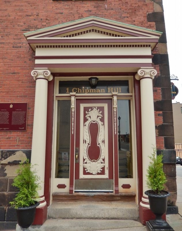
English: This historic streetscape is distinguished by its rare concentration of homogeneous, primarily late 19th century architecture. Traditionally referred to as “Wall Street,” the area contains major public buildings, banks, . . . — — Map (db m137519) HM
English:
For more than two hundred years the City of Saint John and its sheltered, ice-free port, have been critical to the economic success of New Brunswick. Historically providing a port of entry for people and products, the . . . — — Map (db m145394) HM
English:This Clock commemorates the 225th Anniversary of the Incorporation of the City of Saint John on May 18th 1785 as Canada’s First Incorporated City.
It also recognizes May 18th, celebrated in Saint John as Loyalist Day, for . . . — — Map (db m147895) HM
English
Built between 1874 ad 1876, the Saint John City market narrowly escaped the fire that swept through the town in 1877 and stands today as a rare and distinguished example of a 19th century market building. Designed in the Second . . . — — Map (db m77535) HM
English:
Saint John Harbour has been a strategic military site from the 1600’s through 1945. Each conflict led to the construction of defensive installations reflecting changing naval technologies.
Français: . . . — — Map (db m145597) HM
English
Saint John’s original burial ground was established on this site shortly after the landing of the United Empire Loyalists in 1783. After its closure as a cemetery in 1845, the site became a memorial garden with tree lined walkways . . . — — Map (db m77518) HM
English
Saint John has a strong Scottish presence. The breakup of the clan system in the late 18th century caused massive emigration from the Highlands. As a result, some 25 percent of the population has Scottish ancestry. Scottish . . . — — Map (db m77458) HM
English:
Where does a nickname come from?
No one can say why the Three Lamps light is better known as The Three Sisters. Nevertheless, local residents know the landmark by its nickname and have many stories to explain it. . . . — — Map (db m145600) HM
English:
Constructed in 1824-1825, St. John’s is one of the earliest Gothic Revival churches in Canada. Its name, the Stone Church, reflects the high quality of its regularly coursed masonry. The skillful treatment of its Gothic . . . — — Map (db m140105) HM
1842 • A navigational signal lamp was erected on this site
1847 • A single gas lamp was erected by the Saint John Gas Co. and dedicated to the harbour pilots of Saint John
1848 • The Saint John Gas Co. commissioned Alexander . . . — — Map (db m145598) HM
English
A three-masted full-rigged ship with a modified clipper hull, the Marco Polo earned a reputation as the “fastest ship in the world” and drew international attention to New Brunswick shipyards. Built in 1851 by . . . — — Map (db m77456) HM
There are two side to this markerEnglish
The Great Fire of 1877
One of the most destructive fires of modern times occurred at Saint John, N.B., on Wednesday, June 20th, 1877. It was more calamitous in its character than . . . — — Map (db m77570) HM
English
On 10 May 1783 the Spring Fleet, carrying over 2,000 Loyalists, arrived at the Saint John River mouth. The exiles, mostly civilians from the Middle Colonies, established themselves in the newly-surveyed townsites of Parr and . . . — — Map (db m77432) HM
English:
Imagine the harbour full of sails, wooden vessels of every shape and size navigating the tricky tidal currents to enter port.
Imagine the snap of the canvas and the shouts of sailors dropping the massive sheets to . . . — — Map (db m145400) HM
(English:)The Marco Polo and the Golden Age of Sail The Fastest Ship in the World Saint John, New Brunswick, Canada In the background you can see Saint John as it appeared in 1851, twenty-six years before the great fire of 1877 . . . — — Map (db m138894) HM
English:
West meets East… by Harbour Ferry
Long before a bridge spanned the harbour, passenger ferries linked the east and west sides of Saint John.
From 1841 to 1954, eight different ferries provided service between . . . — — Map (db m145398) HM