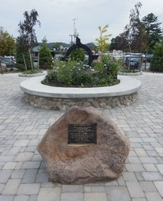
These three iron parts of the old forge and this mill stone from the old grist mill were used by agents sent here by JOHN BROWN of RHODE ISLAND who acquired this tract in 1798. They were again used about 1817 on the south side of the river near this . . . — — Map (db m35553) HM
Lake George played an important role throughout the American Revolution as a transportation route, staging area and outpost. In December 1775, as some American troops were ferried north during their abortive invasion of Canada, Colonel Henry Knox’s . . . — — Map (db m16111) HM
On this site are re-interred 118 exhumed remains from Lot 17, Friends Burying Grounds, adjacent to Damascus Friends Church on Walnut Street. Among those re-interred here are: Catlit Jones, a scout with Quaker Daniel Boone in Kentucky, a captain in . . . — — Map (db m78943) HM
On this site, the first meetinghouse owned by the Hudson Congregational Church was dedicated March 1, 1820, twenty-one years after David Hudson first came to the Hudson area. Its members met here until they completed their sanctuary on Aurora Street . . . — — Map (db m36192) HM
On this site stood a log schoolhouse built in 1801, the first in Summit County. It was used as a meeting-place by the Hudson Congregational Church formed by David Hudson, its lifetime Deacon, and organized September 4, 1802, by Rev. Joseph Badger. . . . — — Map (db m36193) HM
Born in West Chester in 1888. Pippin occupied this house from 1920 until his death in 1946. A self-taught black artist, he painted while living here such notable works as "Domino Players," "John Brown Going to His Hanging," and the "Holy Mountain" . . . — — Map (db m8156) HM
Near this spot Captain John E. Cook, of John Brown’s Army of Liberation, was captured and disarmed on October 25, 1859 by Daniel Logan and others. He was hanged at Charlestown, Virginia, December 16, 1859. — — Map (db m201764) HM
A staunch abolitionist, Hazlett became a lieutenant in John Brown’s provisional army and participated in the raid on Harper’s Ferry Arsenal in 1859. He was captured, tried, convicted, and hanged for his involvement following the failed Harper’s . . . — — Map (db m40562) HM
This talented author was born here July 22, 1898; died in New York March 13, 1943. “John Brown's Body” and his other poems and stories give vivid expression to the best in American spirit and tradition. — — Map (db m79675) HM
The antislavery meeting hall here, opened in 1856, brought many leading abolitionist speakers as guests of George Corson and his wife, Martha Maulsby Corson. Built over a carriage shed, the hall could accommodate up to 200 visitors. The family's . . . — — Map (db m23524) HM
A self-taught Black artist, Bowser, who lived here, began his career as a landscape, sign emblem, and banner painter. He also painted portraits including several of Lincoln and one of abolitionist John Brown. — — Map (db m82645) HM
The ship George Washington was the last of three ships all named by John Brown after his friend and compatriot. The 624-ton ship George Washington, designed for the India trade, was built in Providence in 1793 and made its first voyage . . . — — Map (db m151748) HM
In 1788, this Baptist congregation, while still a branch of Cashaway Church (1756), purchased this land from the Rev. John Brown. The branch became an independently constituted church in 1789 named Muddy Creek and by 1829 was known as Brownsville. . . . — — Map (db m31691) HM
This Federal-style home was built c1810 for John Brown Craighead and his first wife Jane Erwin Dickinson. Craighead was the son of early Nashville settler the Rev. Thomas Craighead. In 1823, Craighead married Lavinia Robertson Beck, youngest . . . — — Map (db m53382) HM
About 3.3 miles north, near the route of the Great War and Trading Path, John Brown, a Cherokee half-breed, established a ferry and tavern in 1800. It was much used by drovers going to and from markets. Legends say that some were robbed and murdered . . . — — Map (db m4485) HM
The Firehouse was built in 2012, and is modeled after the firehouse in Harper's Ferry Arsenal, West Virginia, the site of abolitionist John Brown's 1859 slave revolt and capture by Robert E. Lee. — — Map (db m106065) HM
Built 1886, when Indians still raided nearby apple trees. Wheeler County's second school. Of native stone. Site gift of Tom Baley. Other donors: John Brown, Frank Chilton, Mr. Clark, Henry Frye, Bill Miller, J. E. Pior, Fred H. Rathjen, Jenkins . . . — — Map (db m153563) HM
Built in 1939 by the Works Projects Administration. Purchased by John Brown and used on his farm after the WPA was disbanded. Typical of the type of "Necessary House" found in the back if every house in Alpine from beginning until the 1950's. . . . — — Map (db m224313) HM
This church, seven and a half miles west, was organized by John Blair in 1746. Five successive church buildings have been erected. The first pastor was John Brown. Samuel Brown, second pastor, had as wife Mary Moore, captured in youth by Indians . . . — — Map (db m122187) HM
Here lived the leading influence in America's largest indigenous religious movement, Christian Church (Disciples of Christ), and founder of Bethany College. Built in four periods: the John Brown Mansion, completed in 1793; Buffalo Seminary, in 1819; . . . — — Map (db m20826) HM
Colonel Lewis Washington, who lived here, was one of the hostages captured by John Brown in 1859 in his raid on Harpers Ferry. When captured, Brown wore a sword, once owned by George Washington, taken from this home. (1 Mi. N.). — — Map (db m12066) HM
Founded in 1786 by Charles Washington, brother of the President. Here John Brown was tried and convicted of treason. Home of W. L. Wilson, Postmaster General, 1896, who here started the first rural free delivery in America. — — Map (db m1650) HM
On the site of this Post Office stood the Jefferson County Jail where John Brown and his fellow prisoners were confined after their raid on Harpers Ferry in October 1859.
After court trial John Brown was taken from the Jail here to his death on . . . — — Map (db m2027) HM
Jefferson County’s association with significant events in Civil War history began in October 1859, when abolitionist John Brown raided the U.S. Arsenal at Harpers Ferry. Quickly captured, Brown and his followers were brought here to Charles Town . . . — — Map (db m41671) HM
Jefferson County's Most Famous Trial
In the room immediately behind this wall, the abolitionist John Brown and five of his raiders were tried for treason against the state of Virginia, murder and inciting slaves to rebel. Brown had led 21 men . . . — — Map (db m21767) HM
Hearing praise for "faithful slaves" during the dedication of the Heyward Shepherd memorial (to your left), Peal Tatten interrupted the ceremony. "I am the daughter of a [Union soldier]… who fought for the freedom of my people, who which John . . . — — Map (db m238207) HM
Two brick arsenal buildings, which once housed about 100,000 weapons produced at the Harpers Ferry Armory, occupied these grounds. Capture of the firearms was the objective of John Brown’s 1859 raid. Eighteen months after Brown’s attack, the Civil . . . — — Map (db m12969) HM
Heyward Shepherd On October 17, 1859, abolitionist John Brown attacked Harpers Ferry to launch a war against slavery, Heyward Shepherd, a free African American railroad baggage master, was shot and killed by Brown’s men shortly after midnight. . . . — — Map (db m171726) HM
“we are Building a Large & Long Breast work on the South Side.” - Pvt. Thomas Killam, August 19, 1776 When the American Northern Army arrived at Ticonderoga in mid-July 1776, the 300-acre peninsula opposite on the Vermont . . . — — Map (db m19543) HM
Among the events in the 1850s that helped drive the nation into civil war, the Christiana Riot put a controversial new law to a bloody test. The Fugitive Slave Act of 1850 ordered federal officers to arrest suspected runaway slaves; it also . . . — — Map (db m200503) HM
"I will pledge myself that there is not a spot in the United States which combines more or greater requisites...."
George Washington May 5, 1798 Harpers Ferry's history and geography have influenced each other for . . . — — Map (db m12065) HM
In July 1896, members of the National League of Colored Women traveled here from Washington, D.C. and posed for their picture in front of John Brown’s Fort. The women came to pay homage to Brown and his raiders, establishing a pilgrimage . . . — — Map (db m8317) HM
A key junction on the Underground Railroad in Oberlin, Ohio connected at least five routes that led from slavery to freedom. No fugitive in Oberlin was ever returned to bondage. Freedom seekers lived openly in the town, and were supported by its . . . — — Map (db m144166) HM
In 1793, John Brown and associates built the first bridge to connect India Point with what is now East Providence. A toll bridge was variously called John Brown's Bridge, India Bridge, and finally Washington Bridge, because of a wooden statue of . . . — — Map (db m151685) HM
Thousands of blacks seeking refuge from slavery and protection behind Union lines fled to Harpers Ferry during the Civil War.
Recognizing the importance of education for former slaves, the government’s Freedmen’s Bureau began a school here . . . — — Map (db m238230) HM
Madronia Cemetery is Saratoga’s oldest institution. The first burials occurred on this site in 1854. Other burials followed over the next several years prior to its dedication as a cemetery.
This land was originally part of the Quito Land . . . — — Map (db m41447) HM
It was on this site that Smith Riggs, 65, emerged into the
public eye in 1928, for his work on instruments of death – two
electric chairs. It took a great deal of persuading on the part
of Indianapolis hospital consultant, JF. Gregries to accept . . . — — Map (db m222408) HM
Harpers Ferry, Virginia - Charter from Virginia Legislature 1851
Jeremiah Fuss - 1851-1852
John C. Umseld - 1852-1853
Solomon V. Yantis - 1853-1855, 1879-1880, 1882-1885
George Mauzy - 1855-1857
Isaac Fouke - 1858-1859
Fontaine . . . — — Map (db m143935) HM
The original thirty-two Code Talkers were organized to develop codes based on their native language which were used extensively during World War II. These and many other Native Americans served bravely throughout the Pacific and other combat zones. . . . — — Map (db m33344) HM
Named in 1732 for Torrington in Devonshire, England, this was one of the townships of the Western Lands allotted to Windsor. Since the early settlers were taxpayers in that town, their shares in the division of land depended upon the amount of taxes . . . — — Map (db m56057) HM
Julia Ward Howe (1819-1910) was a poet, author, composer, abolitionist, suffragist and more—but she is most remembered for writing the lyrics to The Battle Hymn of the Republic. According to the story, she and her husband were asleep at the . . . — — Map (db m141266) HM
Just East of the railroad from here and 200 yards North of Wauhatchie Spring and Branch, stood the home of Wauhatchie, Chief of the Cherokees. In the War of 1812 he served in a company of Cherokees under Capt. John Brown, Col. Gideon Morgan and Maj. . . . — — Map (db m57996) HM
General John Brown Gordon (1832-1904), CSA, lawyer, statesman, owned this farm, “Beechwood,” from 1888 until his death. Here he raised Texas ponies, goats, horses and cattle. For a time he lived in “the old John D. Mitchell home”; later, he moved to . . . — — Map (db m244274) HM
Presented by the Ladies of the Grand Army of the Republic Department of Illinois. 1861-5 — 1914 Ida E. Wright President Commemorating the Deeds of the Union Veterans of the Civil War ————— ”With malice toward none with charity for all” Lincoln . . . — — Map (db m213925) WM
This "battle" was part of the struggle to make Kansas a free state. In May, 1856, Proslavery men destroyed buildings and newspaper presses in Lawrence, Free-State headquarters. John Brown's company then killed five Proslavery men on Pottawatomie . . . — — Map (db m20059) HM
New Inscription
One witness to this event later wrote that it was “no joke” to attack old John Brown. The abolitionist inspired such terror that in January 1859, about 1.5 miles north of here, a U.S. marshal fled at the mere sight of him. . . . — — Map (db m228347) HM
John Reid placed the bulk of his proslavery militia men in a line here to charge the center of John Brown's Free State guerilla's line of defense and charged the center of Brown's line in the brush lining the Marais Des Cygnes River. Brown's . . . — — Map (db m69224) HM
John Brown defended Osawatomie against an attack by Pro Slavery Militia in the largest battle during the Bleeding Kansas Era on August 30, 1856 — — Map (db m69288) HM
Cumberland Gap, the break in the ridgeline you see ahead, is far more than just a pass through a long, rugged mountain barrier. For a generation of American pioneers this was the gateway from their old lives and limitations out to a frontier . . . — — Map (db m35899) HM
Born in Hagerstown, Ann Carroll Fitzhugh moved to New York State with her family at age twelve. She married wealthy abolitionist and philanthropist Gerrit Smith in 1822. Together, they were pioneers in the abolition and womens' rights movements, . . . — — Map (db m146015) HM
Both Union Soldiers training at Ft. Warren and Confederate prisoners of war were quartered along this side of the fort, often in adjoining rooms. his area also contained a schoolroom, 1900-volume library, and a chapel which was used almost daily by . . . — — Map (db m59282) HM
From the beginning, Fort Warren’s heart was the six-acre parade ground. When the Civil War broke out soon after the fort was completed, the area was still covered in construction debris. Newly enlisted Massachusetts regiments cleaned it up as they . . . — — Map (db m108116) HM
John Bayley • Henry Brown • Isaac Brown • John Brown • Henry Cadmus • Issac Cadmus • John H. Cadmus • John P. Cadmus • Peter Cadmus • Lt. Col. Thomas Cadmus • James Campbell • Minard Cumen • Capt. Amos Dodd • Thomas Doremus • Anthony Francisco • . . . — — Map (db m54164) HM
Unserheim, meaning "Our Home" in German, is the name of this ante-bellum Queen Anne style home, which was placed on the National Register of Historic Places in 1998. From 1857-1878, it was home to Daniel Howell Hise, a Quaker and ardent . . . — — Map (db m65429) HM
Maple-Dell was the home of John Butler, a Quaker who expressed his religious faith by working for humanitarian causes. An early Goshen Township teacher, Butler opened his home to orphans, the homeless, and runaway slaves, and devoted 20 years of his . . . — — Map (db m78944) HM
Completed in 1865, this home was the vacation retreat of Jay Cooke and his family. Known as the "financier" for the Union states during the Civil War, Cooke organized a program to sell millions of dollars worth of bonds to support the war effort. . . . — — Map (db m35954) HM
The Underground Railroad
The Underground Railroad was neither underground nor a railroad, but a system of loosely connected safe havens where those escaping the brutal conditions of slavery were sheltered, fed, clothed, nursed, concealed, . . . — — Map (db m207605) HM
The Underground Railroad
The Underground Railroad was neither underground nor a railroad, but a system of loosely connected safe havens where those escaping the brutal conditions of slavery were sheltered, fed, clothed, nursed, concealed, . . . — — Map (db m189183) HM
Reverend Thomas E Hughes recognizing the need for a school for the frontier obtained approval and full support from the Erie Presbytery April 13, 1802 to construct a building and form a seminary. He proceeded to build the so called stone pile and . . . — — Map (db m122308) HM
In memory of the men on the USS Laffey DD-724 who gave their lives protecting their ship and their shipmates in action on Radar Picket Station #1, Okinawa, 16 April 1945 May they rest in Peace and may their Memory be Eternal James Williams . . . — — Map (db m224201) HM WM
Lynching in America
Thousands of African Americans were victims of lynching and racial violence in the United States between the Civil War and World War II. The lynching of African Americans during this era was a form of racial terrorism . . . — — Map (db m168751) HM
On December 23, 1863, Capt. James Speed of General Napoleon J.T. Dana's Brownsville-based Federal Army force raided unguarded King Ranch. Objectives: to capture or kill Captain Richard King and destroy the Confederate cotton trade. King, . . . — — Map (db m165582) HM
The Rev. John Blair, a minister influenced by the Great Awakening, organized New Providence Presbyterian Church about 1746. The congregation moved to a site seven miles west of here about 1760, and the present Greek Revival-style sanctuary was . . . — — Map (db m172318) HM
One and a half miles north is The Retreat, home to three distinguished generations of the Parker family. Thomas Parker, a general in the War of 1812, constructed this imposing Federal-style house in 1799. Richard Parker, his nephew, was a U.S. . . . — — Map (db m75497) HM
Explore the Washington Heritage Trail George Washington knew the portion of the Shenandoah Valley that forms West Virginia's Eastern Panhandle well. The Washington Heritage Trail lets you drive the scenic backroads that join Charles Town to . . . — — Map (db m12596) HM
Born in November 1820, in Fredericksburg, Virginia, Thomas Green relocated to Charles Town where he began practicing law in 1843. Later, he became a judge and the Mayor of Charles Town. When John Brown's selected legal counsel did not appear in time . . . — — Map (db m193315) HM
High above the storied town of Harpers Ferry, with the tranquil waters of the Shenandoah River flowing just below, sits historic St. Peter’s Church. Deeply rooted in the rich history of the Church in West Virginia, the Civil War, and one of the . . . — — Map (db m124619) HM
In June 1864, Confederate Gen. Robert E. Lee sent Gen. Jubal A. Early's corps from the Richmond battlefield to the Shenandoah Valley to counter Union Gen. David Hunter's army. After driving Hunter into West Virginia, Early invaded Maryland . . . — — Map (db m169873) HM
With its Southern border on the Mason-Dixon Line, and located in the middle of the Great Valley that stretched back through Maryland to Virginia, Franklin County became a Civil War hotspot.
Even before war came this way, abolitionist John . . . — — Map (db m242171) HM
This bridge opened for traffic in 1930 and known as the Washington Bridge first opened to traffic on April 12th 1793 and which carried the following inscription on an abutment
Washington Bridge.
Built by John Brown . . . — — Map (db m222506) HM
In 1836, brothers Daniel and Henry Forrer, in partnership with Samuel Gibbons, purchased land here for an ironworks and built a cold-blast furnace, called Furnace #1. Some 6,249 acres provided trees for charcoal, quarries and mines for limestone and . . . — — Map (db m16641) HM
Underground Railroad Sites
Rochester's proximity to Lake Ontario afforded runaway slaves a direct route to freedom in Canada. Hundreds of runaway slaves were "conducted" from one "station" to another along this secret network of escape routes . . . — — Map (db m65156) HM
Southern California's largest gold rush followed the discovery of rich placer deposits by William F. Holcomb and Ben Choteau on May 4, 1860. Miners rushed to the valley and established boom towns. Belleville, the largest, rivaled San Bernardino in . . . — — Map (db m50702) HM
Also known as Cedar Hill, this site encompasses the estate owned by Frederick Douglass from 1877 until his death in 1895. In honor of Douglass’ work as an author, orator, abolitionist, statesman, and civil rights leader, this site is designated a . . . — — Map (db m40846) HM
August Bondi was born July 21, 1831, in Vienna, Austria. The Bondis, Jewish European refugees, fled the Austrian Empire after the failed revolutions of 1848 and settled in St. Louis, Missouri. August Bondi moved to Pottawatomie Creek in Franklin . . . — — Map (db m134060) HM
On this site stood the Anglican chapel, St. Catharines (1795 - 1836), the first public building in the community. The name St. Catharines became associated with the community and the church. By 1797 a log school house was situated just east of this . . . — — Map (db m76085) HM
[English] Built for Dr. Brown, a dentist, in 1902, this attractive little bungalow was tangible proof that affluent residents had confidence in the future of Dawson City and were willing to put down roots. While this may have been somewhat . . . — — Map (db m49345) HM
Organized 1838 with 41 charter members. The first minister was Rev. A. K. Atkins. First deacons were J. S. Reynolds, A. R. Pool and N. Lloyd. Originally named North Tuscaloosa Baptist; changed 1854, to Northport Baptist. A wooden structure erected . . . — — Map (db m217161) HM
To the memory of the Confederate Dead of Walton Co. Florida. Erected by the Ladies of the Walton County Female Memorial Association. Southwest face Angus D. McLean, Col., 6th Fla. Vols. Murdoch M. Gillis, Capt. 6th Fla. Vols. Daniel D. . . . — — Map (db m39775) HM
The Presbyterian Church at Washington was organized in 1790, under the Presbytery of South Carolina, with the Rev. John Springer as first pastor. Services were held in private homes, in the Court House, the Academy, and in the Methodist Church, . . . — — Map (db m25936) HM
In 1852 John Brown, a stonemason, built this last remaining vestige of the early canal era in FortWayne.
A native of Glasgow, Scotland, Brown came by canal boat to Allen County in 1847 with his wife Mary. He and his Scottish business partner, . . . — — Map (db m100141) HM
Lawrence was established in 1854 by the Emigrant Aid Company, a New England organization formed to prevent the new Kansas territory from becoming a slave state. When the first legislature enacted the so-called Bogus Laws with severe penalties for . . . — — Map (db m20460) HM
Pro- and anti-slavery forces made their way to this area on horseback and on foot in the fight over whether Kansas would be a free state or a slave state. Skirmishes, scuffles and screams could be heard in the woodlands nearby.
The Marias des . . . — — Map (db m33944) HM
Near here the towns of Plymouth and Lexington once stood as outposts on the Lane Trail, approximated today by US-75. Named for abolitionist James H. Lane, the trail was established in 1856 to bypass proslavery strongholds in Missouri and provide . . . — — Map (db m52952) HM
Topeka was founded in 1854 at the site of Papan's Ferry where a branch of the Oregon Trail crossed the Kansas river as early as 1842. Anti-slavery leaders framed the Topeka Constitution, 1855, in the first attempt to organize a state government. The . . . — — Map (db m20479) HM
During the early hours of the battle, Col. John Brown Gordon promised Robert E. Lee, "These men are going to stay here, General, till the sun goes down or victory is won." The Confederate troops that Gordon commanded were part of a well protected . . . — — Map (db m20742) HM
Sacred to Liberty & the Rights of mankind!!! The Freedom & Independence of America, Sealed and defended with the blood of her sons. This Monument is erected by the inhabitants of Lexington, under the patronage & at the expense of the Commonwealth . . . — — Map (db m42586) HM
These men gave everything dear in life, yea and life itself in support of the common cause. Back of Monument: Memorial to the Lexington Minute Men who were on the Green in the early morning engagement April 19, 1775 Capt. John Parker • Lt. . . . — — Map (db m18631) HM
This village, which comprises much of Wildwood's commercial core on Old Manchester Road, was originally called St. Friedling and Maple Grove. The first post office was established during the Grover Cleveland Administration and John Brown, the first . . . — — Map (db m241126) HM
Allen and Barbara (Kagy) Mayhew moved to Nebraska in 1854 and built this cabin in 1855. The Mayhews had two sons when they first moved to Nebraska and had four more children while here. Barbara’s younger brother, John Henri Kagi (he preferred the . . . — — Map (db m177270) HM
In the mid-18th century, this battlefield was a focal point in the Seven Years’ War, a world war between France and Great Britain. Here the two super-powers struggled for control of the Lake Champlain Lake George water highway, the strategic . . . — — Map (db m9590) HM
The earthen walls in front of you, called the French Lines, are the remains of a defensive wall built in the eighteenth century to defend Fort Ticonderoga from attack. The French Lines as you see them today are the original un-restored remains of . . . — — Map (db m126143) HM
In October 1780 Sir John Johnson led an British raiding force of 875 men up the Schoharie Creek and then west along the Mohawk River, destroying almost every farm in their path. At Stone Arabia, the vanguard of his troops engaged Massachusetts . . . — — Map (db m120862) HM
[1920 plaque — on west side of monument]1917 • 1918 In Grateful Memory of the Men of Wilkes County who Gave Their Lives in The World War. Lt. Thomas Joe James • Lt. Mack Joines • James W. Crysel • Silas Triplett . . . — — Map (db m182952) WM
Four decades after the Civil War, the June 1863 fire at Wrightsville still loomed in Confederate General John Brown Gordon's memory. "The Union Troops stationed at Wrightsville had," he wrote, "after their retreat across it, fired the bridge which I . . . — — Map (db m174168) HM
This log structure, c. 1820, was owned by Bvt. Brig. General Michael P. Small from 1862-1863.
General Small began his military career as a West Point graduate in 1855. He served during the entire Civil War for the United States Army.
He . . . — — Map (db m152306) HM
Wharfs began to develop on the west side of the river. Shipping and commerce caused the center of town to move south and across the river.
The merchant fleet had grown to 120 ships and surpassed Newport's. John Brown's East India trade fleet . . . — — Map (db m222710) HM
Early Years: Providence is a city with a long waterfront tradition. In 1636 Providence was established on the banks of the Providence River. During the 1600's, Providence, initially a farming community, grew slowly, spreading out along the . . . — — Map (db m151744) HM
Canal Passages The Blackstone Canal opened for business on a sunny day in July, 1828 with thundering artillery salutes and roaring crowds. Stretching 45 miles from Providence to Worcester, the Blackstone Canal was built with the strength and . . . — — Map (db m197119) HM
Marker Front: In 1788, this Baptist congregation, a branch of Cashaway Church (1756) founded by Welsh Neck Church (1738), purchased land 2 miles SW of here from the Rev. John Brown. The congregation was independently constituted in 1789 and . . . — — Map (db m31669) HM
382 entries matched your criteria. Entries 101 through 200 are listed above. ⊲ Previous 100 — Next 100 ⊳
* Inflectional forms of words are their plurals, singulars, and possessives as well as gramatical tenses and similar variations.