1753 entries match your criteria. The first 100 are listed. Next 100 ⊳
E Clampus Vitus Historical Markers
The Ancient and Honorable Order of E Clampus Vitus (ECV) is a fraternal organization dedicated to the preservation of the heritage of the American West, especially the history of the Mother Lode and gold mining regions of the area. More than 1,400 markers point the way to the past.
By Lost Dutchman Chapter No. 5917+4 E Clampus Vitus
Tombstone, Arizona dates to 1877, when prospector Ed Schieffelin discovered silver and named his first mine Tombstone. By 1879, a town had sprung up in a relatively flat area nearby. Gunslingers, gamblers, prospectors, Chinese laborers, and fancy . . . — — Map (db m220542) HM
In 1877 prospector Ed Schieffelin searched for silver in Apache land. He was told he would only find his own tombstone. Schieffelin ignored the advice. The result was a strike worth at least forty million dollars.
This brought not only miners . . . — — Map (db m48507) HM
In the summer of 1857 former Navy Lt. Edward F. Beale was chosen by the Buchanan Administration to develop a wagon road from Fort Defiance, New Mexico Territory (now Arizona) to the Colorado River along the 35th parallel. Secretary of War John B. . . . — — Map (db m48347) HM
The area around what now is Williams, Arizona, was first explored by a Mountain Man who came to this area in 1876, William Shirley Williams, who was called “Old Bill”.
The town site was created by a cowboy named C.T. Rogers in 1879. . . . — — Map (db m48351) HM
In 1916, Jakes Corner originally called Felton, started as a stage stop, on the Annie Hardt homestead.
As a pull out on the road to Globe, stages used to stop and wait as the occasional flooding Salt River receded. Annie Hardt had a vegetable . . . — — Map (db m48354) HM
One of the West’s Longest and Bloodiest feuds took
place here and around Pleasant Valley. The Grahams and
the Tewksburys had been in the cattle business and it
seems probable that they first fell out over the division of cattle they jointly . . . — — Map (db m78742) HM
Camp Bouse
September 1943 to March 1944
"The Kid Battalion"
From Normandy to the Elbe:
•Normandy
•Northern France
•Ardennes
•Rhineland
•Central Europe — — Map (db m78563) HM
Dedicated to the men who gave time in their lives to serve honorably and courageously for our country. We take this moment in time to recognize their achievements which were done with pride and dignity.
* * *
Campaigns
Ardennes - Alsace - . . . — — Map (db m29160) HM
Campaigns
Ardennes, Rhineland and Central Europe
The 739th Tank Battalion was activated in March 1943 at Fort Lewis, Washington. The officers were from various states, the enlisted personnel from Oklahoma, Texas and Louisiana.
The . . . — — Map (db m78558) HM
The 740th tank battalion was activated at Fort Knox, Ky. on March 1, 1943. It trained at Fort Knox and at Camp Bouse, Az. as a canal defense light (CDL) unit and as a standard medium tank battalion from October 15, 1943 to April 24, 1944 then sailed . . . — — Map (db m78562) HM
The 748th Tank Battalion, Medium was activated on 20 August 1942 at Camp Rucker, Alabama. The Rhinos headed for Fort Knox on the 15th of April 1943 for training and on 20 April 1943 were reorganized as a special battalion equipped with CDL . . . — — Map (db m92814) HM
This building was built prior to 1912. The mercantile was known to do business with the A & C and Swansea railroads in 1916. It has been open continuously since that time. Bouse postmaster Cora L. Johnston moved the US Post Office to the store in . . . — — Map (db m39504) HM
Camp Bouse was established in Butler Valley 30 miles behind this monument in Sept. of 1943. It was one of twelve such camps built in the southwestern deserts to harden and train United States troops for service on the battlefields of World War II. . . . — — Map (db m78566) HM
Campaigns
Central Europe Northern France Rhineland
The 701st tank battalion was activated 3/28/43 at Camp Campbell, KY. Here 553 young men and officers began their journey into history. These men began their basic training and for many saw . . . — — Map (db m78564) HM
Activated 1 April, 1943 at Camp Perry, OH. Completed basic training and then sent to Ft. Knox, KY. Unit then assigned to Camp Bouse, AZ arriving there 9 November, 1943. Maintaining operation of special tanks named "Leaflets" was specific assignment. . . . — — Map (db m78557) HM
United States Army
World War II
1924 – 2002
Whose dedication to the memory of his brothers in
arms, who fell in the Battle of the Ardennes, made this
historical park possible. — — Map (db m78542) HM
He was our drinking buddy
While on duty
He drank our beer
He was
Full of good cheer
And went to the nurses' quarters around the bend
And came to an untimely end,
Of the Colonel, he was unaware
That it would be the crime of all time . . . — — Map (db m78536) HM
We bring to a close
We tried to find
We must now impose
Units not found
748th Tank Battalion
150th Station Hospital
538th Ordnance Company
166th Quartermaster
629th Quartermaster — — Map (db m29161) HM
In honored memory of those soldiers of the battalion who trained here at Camp Bouse and gave their lives in combat to preserve the freedom of the United States and to set the Peoples of Europe free.
Headquarters Company
Donald D. . . . — — Map (db m78537) HM
Gold and silver strikes in the 1860's created growth in the area. It is said Wyatt Earp served as sheriff of Cibola for one year in the 1890's. The town of Cibola formed in 1898 and construction began on a 16 mile canal to bring water from the river . . . — — Map (db m78552) HM
Ferries of various size and design once provided transportation across the lower Colorado River linking Arizona with California, Nevada and Utah.
Ferrymen plied their trade from Yuma to Pearce Ferry. The first ferry on the river was started at . . . — — Map (db m78553) HM
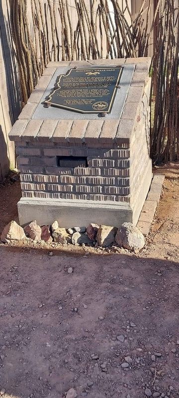
This monument built to
perpetuate the memory of
the pioneers, trailblazers,
and adventurers that rest
in these unmarked graves.
(Arizona Highway Department, 1934)
Rededicated: April 27, 2003 (CY 6008)
By the Ancient and . . . — — Map (db m31188) HM
Robson’s Mining World was originally opened by the Westley Rush Family in 1917 as the Gold Leaf Mine. Ned Creighton acquired the mine in 1924. He renamed the mine the “Nellie Meda” in honor of the two Rush daughters. The mine operated until 1942 . . . — — Map (db m158284) HM
Jacob Waltz was born in the kingdom of Wurttemberg Germany circa 1810. He immigrated to the USA in 1839 and became a naturalized citizen in 1864. Waltz was prospecting in Arizona and is reputed to have found a gold deposit near the superstition . . . — — Map (db m74397) HM
In 1924 construction of a new schoolhouse began. Classes were being held in an old cook shack that had once been used by muleskinners to clear the land. The school, named after Charles Rittenhouse, would be a three-room, u-shaped building made of . . . — — Map (db m32393) HM
In 1863 Austrian Henry Wickenburg discovered gold, legend has it, while retrieving a vulture he had shot. The vulture mine went on to become one of Arizona's richest gold mines and sparked the development of Arizona and the city of Phoenix. In the . . . — — Map (db m40319) HM
Originally built in 1899 as the Arizona and Utah Railway, this short-line reached almost twenty five miles from the siding at McConnico on the Sante Fe to the White Hills. In 1904, a storm washed out much of the route. In 1905, the Sante Fe acquired . . . — — Map (db m48288) HM
Founded in 1862 with the discovery of silver, Chloride became the first mining town of the Cerbat Mountains. During it's heyday, 1900 to 1920, the population swelled to over 2000 with 75 mines in operation. Chloride was the first incorporated town . . . — — Map (db m31845) HM
This camp, established March 25, 1871 by Company F, 12th Infantry commanded by Capt. Thomas Bryne, was located at a spring used by Indians for centuries. It was named for Navy Lt. Edward F Beale who established a wagon road along the 35th parallel. . . . — — Map (db m29411) HM
Trovatore is Italian for troubadour or traveler. Developer John E. Miller built the Nevada Hotel in Las Vegas, Nevada which was later named Sal Sagev (Las Vegas spelled backwards). He moved to Kingman, Arizona in 1935 after Hoover Dam was completed, . . . — — Map (db m68934) HM
Constructed in 1909, Hotel Brunswick was built by prominent businessmen, John Mulligan and J. W. Thompson. Kingman's first three story building, constructed of local quarried tufa stone, featured 50 cowboy rooms with shared bath facilities, a dining . . . — — Map (db m29425) HM
The Old Spanish Trail, the main trade route between Santa Fe and Los Angeles, passed this way beginning in 1829. At the end of the Mexican-American War this portion of the route evolved into what was variously known as the Salt Lake Road, the . . . — — Map (db m78535) HM
You are standing on the site of what used to be the ARIZONA HOTEL. In 1915, it was one of seven hotels that existed in Oatman during the early years. The hotel had 45 rooms and numerous baths. It had concrete fire walls and two separate water mains . . . — — Map (db m114809) HM
In 1900 Jose Jerez discovered gold here in a
chunk of quartz. It was assayed out 40 ounces to
the ton! The claim was resold for $275,000. By
1907 the mine milled 140,625 ounces of gold
worth $2,250,000. Addwest Minerals acquired
the mine in . . . — — Map (db m50762) HM
Oatman was founded around 1906 as part of Arizona's richest gold mining area. Oatman was reborn in the late 1960's and early 1970's as a tourist town. The main attraction was the wild burro herd. The burros roaming the Oatman area are descendants of . . . — — Map (db m78570) HM
The mine manager’s house was built in 1919
by John O. Greenway, General Manager of Calument & Arizona Mining Co. Michael Curley, the first occupant lived here until his retirement in 1939. Of the 14 subsequent managers, 12 lived in this house. It . . . — — Map (db m83227) HM
Originally called the Superstition Mining District, this district had its heyday from 1893 to 1898.
The greatest producing mines were the Mammoth, Black Queen and Bull Dog. Their output was around a million dollars in gold and silver based on . . . — — Map (db m34059) HM
Dedicated October 1961
To the Memory of
Jacob Von Walzer
1808 – 1891
One of America's most famed legendary figures, whose exploits have stimulated the imagination of peoples everywhere by his contribution to the heritage of his . . . — — Map (db m74394) HM
March 12 1825 - Jan 11 1891
Judge- District court of New Mexico
Delegate to Confederate Congress
Arizona Mounted Volunteers CSA
Territorial legislature
US Congress
Pioneer- Soldier- Statesman — — Map (db m32394) HM
Established June 14, 1887. A small conical red peak gave Red Rock its name. Red Rock was a major cattle shipping point via the S.P. Railroad. This post office celebrated its
Centennial in June 1987. — — Map (db m31190) HM
Born in Rutledge, Tennessee, he became a self-taught construction engineer and builder of railroads. In 1909, he settled in the mining town of Superior, site of the Magma Copper Company. He opened his first drug store in Superior in 1913, later . . . — — Map (db m34104) HM
This historical trail began in 1997 when Broken Hill Proprietary Company Limited ( BHP ) donated local mining artifacts from the 120 year old magma mine to the Superior Historical Society, Inc. due to their age and size, it was determined that these . . . — — Map (db m67494) HM
Cypress Copper ― Bagdad Corporation
In memory of
WJ. Pace and J.M. Murphy
Who filed the Bagdad claim January 1, 1882;
John Lawler who patented the claim in
1889; and the Lincoln family who developed
the mine. — — Map (db m31552) HM
The U.V.C.C. Clarkdale smelter was built through the vision of William A. Clark, owner of the United Verde Mine in Jerome. The Smelter was constructed between 1912-1915 to replace the outdated Jerome smelter.
On May 26, 1915 the first furnace . . . — — Map (db m33199) HM
In 1863 Pauline Weaver and Abraham Peeples came from California to find gold. They found gold and the rush was on. In 1887 The Congress mine was formed and the town had a name. On March 14, 1895 the railroad came. Congress was booming. In 1910, . . . — — Map (db m59977) HM
Congress, Arizona was born as a gold mining camp on the side of the
Date Creek Mountains where locally known prospector Dennis May claimed
to have discovered gold in 1870, although his claim of discovery continues
to be disputed. In 1887, May . . . — — Map (db m235866) HM
The first mining claims were filed in 1876, within 20 years Jerome was a billion dollar copper mecca and one of the wildest, wickedest mining towns in the west. Drinking, gambling, brawls and frolicking with ladies of the night occurred . . . — — Map (db m33149) HM
In the late 1800's, Thomas Earnhart erected the Kirkland Store on the site of today's Kirkland Bar and Steakhouse.
In the early 1900's, Louis Haselfeld assumed ownership and opened the Haselfeld Store. The original wood frame building burned in . . . — — Map (db m33046) HM
To those responsible for the Arizona Pioneers' Home
A. J. Doran
Introduced enabling legislation - 1907
Supervised construction - 1910
First Superintendent – 1911
George D. Morris
Reintroduced
Successful enabling . . . — — Map (db m32903) HM
This is the site of ‘the crossing' on the Mojave-Prescott "Hardyville" toll road. The road was authorized by the first territorial legislature and was built by W. H. Hardy, connecting Prescott with Hardyville on the Colorado River.
William John . . . — — Map (db m72625) HM
Founded in Jan. 1921 and named after the famous Rough Rider William "Bucky" O'Neill, the post is the oldest active VFW post in Arizona. Born Feb. 2, 1860 in St. Louis, Missouri, his many accomplishments include being a Lawyer, Judge, Sheriff, Editor . . . — — Map (db m68732) HM
Cleator was established in 1884 as a placer gold mining site in the Turkey Creek Mining District. A post office opened in July of 1869, but closed a few months later. James Cleator came to Arizona in 1900 to prospect in the Bradshaw mountains. In . . . — — Map (db m74224) HM
From 1857 to 1860 Lt. Edward F. Beale and a crew of 100 men built the first federal highway in the southwest. The 1857 Beale Expedition used 22 camels and dromedaries for pack animals. This road went from Fort Smith, Arkansas to Los Angeles, . . . — — Map (db m32206) HM
Datelan Army Air Field was established here January 1, 1943. The site was chosen due to the availability of water and the adjacent location of the Yuma Gunnery Range. Construction was completed June 1, 1943. Datelan AAF was a sub-base of Yuma Army . . . — — Map (db m78545) HM
Camps Hyder & Horn were established 10 miles north of Dateland in the fall of 1943. They were 2 of 15 desert camps built to harden and train United States Troops for service in World War II. The Desert Training Center was a simulated theater of . . . — — Map (db m78546) HM
Camp Laguna operated from April 1942 to April 1944. It was one of twelve such camps built in the southwestern deserts to train United States troops during World War II.
The Desert Training Center, a simulated theater of operations, included . . . — — Map (db m29061) HM
In 1863 Jacob Snively, founder of Gila City, and right hand to Sam Houston, avenger of the Alamo, following blazes left on the saguaros by Mexican and Conquistador predecessors, came to Castle Dome, and within 15 years, Castle Dome City’s population . . . — — Map (db m48924) HM
This is the point of discovery for the Flora Temple Mine. In the early 1870’s, a Colorado River steamboat captain named Isaac Polthamus purchased the Flora Temple Mine. This mine was the 2nd patented claim in Arizona (1871). Polthamus and his . . . — — Map (db m91925) HM
Built in 1879 by Patrick and Ann Britt,
This building was originally named the Britt Hotel.
In 1883, promoter and entrepreneur Johnny Croll purchased the saloon and soon the entire building became known as Croll's. This site was famous as the . . . — — Map (db m243880) HM
Once a hiding and trading place in the 1850's for the notorious bandit Joaquin Murrieta, known in California as "El Famoso," this canyon has produced many rodeos dating back to the rancho days circa 1820.
Harry Rowell, originally from England, . . . — — Map (db m94033) HM
Site of the home of Peter and Wilhelmina Rasmussen from 1914 until 1937. Peter came to America from Denmark in 1871. He was part of a wave of Danish immigrants who settled in Alameda County. The house was a Craftsman Bungalow built on twenty acres . . . — — Map (db m112846) HM
During World War II 3,396 acres were purchased for the largest naval installation in the U.S. Three navy bases sat adjacent to each other in an area known as Fleet City. Camp Parks located along Dougherty Road, The U.S. Naval Hospital among . . . — — Map (db m94022) HM
For 86 years a favorite congregating spot. Built by John Green in 1860, with a balcony over the porch and a gabled roof. A famous cross-roads stop and transfer point on the Oakland-Stockton and Martinez-San Jose stagecoach routes intil the 1890's . . . — — Map (db m59944) HM
Jose Maria Amador, born 1794 at San Francisco Presidio, spent his early years in the Mexican Army, as soldier, explorer, Indian fighter, and was later administrator at Mission San Jose.
Amador was paid for his service with land, a grant . . . — — Map (db m69727) HM
This ten-acre park is on the site where Dublin was originally settled in 1850.
Within the park are the:
Murray Schoolhouse, 1856
Old St. Raymond Church, 1859
Sunday School Barn, c. 1860
Kolb’s Old House, c. 1870
Hay Barn, c. 1900
Kolb . . . — — Map (db m201625) HM
Commander John "Jack" Clement Mape USN, was Dublin's first casualty of the Vietnam War. A 40-year old father of seven, Mape lived in Dublin and was stationed in Alameda, CA. He was assigned to Squadron VA-52 of the USS Ticonderoga in September, . . . — — Map (db m69725) HM WM
Built at the crossroads in 1862 by James Witt Dougherty where it served travelers going by stagecoach from Oakland to Stockton and from San Jose to Martinez and Sacramento. This area was named Dougherty Station from 1862 until 1878, and the hotel . . . — — Map (db m69726) HM
With the discovery of gold in California, the town around the Mission San Jose became the gateway and provision center for the “49er” on his way to the Southern Mines.
To meet these demands, the firm of Strauss and Co. was founded by . . . — — Map (db m64904) HM
Washington Hotel originally located across the street as a two story adobe building. Destroyed by the 1868 earthquake. Rebuilt on the present site in the same year.
The building has served as a hotel, stage stop, state library, and present . . . — — Map (db m54668) HM
A Portuguese-American fraternal benefit society receiving members of all nationalities established in the State of California in 1889 to assist widows and orphans. This local chapter, Council #14, was organized on April 23, 1898, by its founder and . . . — — Map (db m94557) HM
Built in 1886 for Neal and Sarah McConaghy, this 12 room Victorian farmhouse represents the beauty and elegance of a bygone era. Members of the family resided here until 1972. In response to community interest, Hayward Area Recreation District . . . — — Map (db m94565) HM
Built in 1869 by William Meek, a pioneer of commercial agriculture, the mansion is characteristic of the affluent agricultural society of the Victorian era in California.
The estate is on the site of the former Rancho San Lorenzo. This area . . . — — Map (db m149204) HM
The legend of Joaquin Murrieta is one of the most enduring and fascinating of chapters in California history. Facts, fiction and romantic tales entangle to create a legend of unique aura that had become part of California's folklore, especially in . . . — — Map (db m130947) HM
This railroad station having been located about half a mile west of the old town of Laddsville, on land owned by Wm. M. Mendenhall. Established the location of the town Livermore. The first depot was a freight car that was soon replaced by a . . . — — Map (db m194530) HM
[Upper Marker:]
Built 1875, this building was first a hotel then the Livermore Valley Bank. It was the Livermore Town Hall from 1905 to 1957. The jail was in the rear, and to the left the firehouse. It was here a light bulb was lit and . . . — — Map (db m19982) HM
Eight miles southwest of this location, in the Spring of 1904, Charles Tolliver built an airship.
With an aluminum superstructure covered with 6,000 yards of rongee silk, the craft was to be 250 feet long, 40 feet wide and 44 feet high. Four . . . — — Map (db m19968) HM
Here the first Wente Vineyards of 47 acres was established by C.H. Wente in 1883. In 1935 his sons, Ernest and Herman, introduced California’s first varietal wine label, Sauvignon Blanc. The efforts of the Wente family have helped to establish the . . . — — Map (db m100563) HM
Western history owes the Carter Brothers a great debt, for they were the general contractors for the first six narrow gauge railroads in California. From 1874 to 1902 they built freight, passenger, cable and street cars. Their plant became Newark's . . . — — Map (db m94310) HM
“May God continue the unity of our country as this railroad unites the two great oceans of the world.” The gold spike ceremony at Promontory, Utah in May of 1869 united the tracks of the Central Pacific and Union Pacific Railroads. . . . — — Map (db m143737) HM
"There's more to life than being a passenger"
Amelia Mary Earhart
Just 600 feet south of where you now stand was Oakland's old North Field runway where aviatrix
Amelia Earhart made history. On January 11, 1935, Earhart flew . . . — — Map (db m179015) HM
Within this crescent shaped valley is the beautiful 37-room Dunsmuir House, an example of colonial revival Victorian architecture. Built in 1899 on a 415 acre estate by Alexander Dunsmuir, heir to a Canadian coal and lumber fortune, for his bride . . . — — Map (db m72061) HM
This bay front site originally bordered Ohlone Indian settlements. In 1820 the Spanish crown granted it to Luis Maria Peralta. In 1842 it was given to his son Antonio Maria Peralta. The area was acquired by Horace Carpenter (first mayor of Oakland), . . . — — Map (db m71212) HM
Opened in 1903, the timber-lined Kennedy Tunnel was the fast route between Oakland and Lafayette, saving four hours of driving around the San Pablo Reservoir. In 1914, it was wired for lights and renamed the Broadway Tunnel. In 1937, after the . . . — — Map (db m71764) HM
On this spot on June 1, 1904, the first Key Route electric train arrived to be welcomed by a crowd of excited residents. From a new ferry pier on the bay off Emeryville it had brought officials and guests to a dedication ceremony here. Key founder . . . — — Map (db m72279) HM
Oakland’s famed native son was the noted author of “The Call of the Wild”, “The Sea Wolf” and “South Sea Tales”. He was at various times a sailor, Alaskan gold miner, salmon fisher and longshoreman.
For a time he was politically involved in . . . — — Map (db m71295) HM
Here stands one the first commercial buildings in Pleasanton, possibly as old as 1864. Originally a general store, this building has been a bar, brothel, bank and unofficial Wells Fargo stagecoach stop. Since 1959 it has become well-known as the . . . — — Map (db m211819) HM
On Feb. 8, 1871 two men, the names of Neal F. Taylor and Timothy Cox, were looking for coal in the area and found more than they were looking for. On this creek which comes down through the then Dougherty Ranch the two men found a gold nugget. They . . . — — Map (db m69728) HM
John W. Kottinger (1819 – 1892) was Murray Township Justice of the Peace from 1853 to 1870. His home was the Seat of Justice for the township; The northwest corner of this adobe barn was used to jail prisoners. A frequent visitor was Joaquin . . . — — Map (db m24507) HM
The Heritage House has been the center of historical horse racing activities in the Livermore – Amador Valley for over 90 years. Built around 1900, it is the sole remaining structure from the days of the privately-owned racing business that . . . — — Map (db m112794) HM
This cemetery, a part of the Jose Joaquin Estudillo land grant, became the property of two pioneer San Lorenzo farmers, John Lewelling and William Meek in 1863. The first burial of record was April 10, 1853. Between 1854 and 1863 the number of . . . — — Map (db m94559) HM
In 1869, the first Transcontinental Railroad passed this spot on its way to the shore of the San Francisco Bay. In 1984 the Southern Pacific Railroad abandoned this historic line between Niles and Tracy, California.
Volunteers of the Pacific . . . — — Map (db m63766) HM
Named in honor of Antonio Maria Sunol, merchant, naval man and cattlebarron, who acquired a Spanish / Mexican land grant in 1840.
Along with the vast ranching and fertile farmlands, coal and gold were found in the Sunol area in the 1870’s. . . . — — Map (db m24495) HM
This Sierra Crossing used by Jedediah Smith 1821 - Major John Ebbetts 1850 - Snowshoe Thompson 1856-76 - Gold Seekers 1850's. Old road left Carson Pass Road in Hope Valley, crossed Border Ruffian Pass to Hermit Valley, Pacific Summit and through . . . — — Map (db m10730) HM
This building has been the pioneer home of the Kirkwood and Taylor families since it was built by Zachary Kirkwood in 1864. This building was one of the first resorts operated in the Sierra Nevada Mountains. — — Map (db m100580) HM
“…there ought to be a shaft raised to Snow-Shoe Thompson: Not of marble; Not carved and not planted in the valley, but a rough shaft of basalt or of granite, massive and tall, with top ending roughly as if broken short, to represent a life . . . — — Map (db m12028) HM
Originally built in 1862 as the Fiske House in Silver Mountain City. It was dismantled, board by board, in 1886 by A.M. Grover and a crew of men. Each board was marked and many of the old square nails were saved. It was re-erected on this site and . . . — — Map (db m20631) HM
On December 18, 1872, Ernst Reusch, a jealous husband shot and killed E.H. Erickson through the window of Erickson’s Saloon in Silver Mountain City as Erickson played cards. Reusch believed that Erickson had been having an affair with his wife and . . . — — Map (db m116094) HM
1753 entries matched your criteria. The first 100 are listed above. Next 100 ⊳