A founder of Lafayette County
First governor of Arkansas
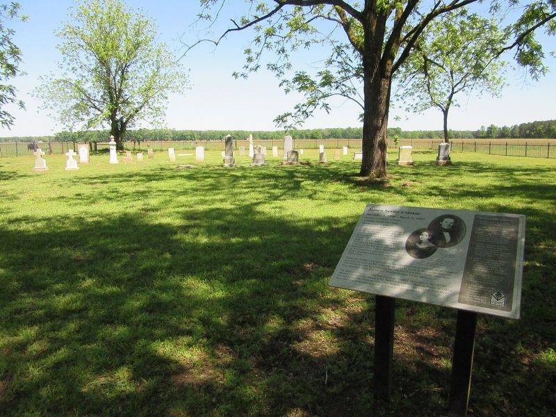
In 1823 James Sevier Conway began a successful plantation in the rich soils near the Red River. In 1826 he married Mary Jane Bradley, a beautiful young women who had moved to the . . . — — Map (db m181517) HM
[ south side ]
“Make Us Free”
This monument is a memorial to the 1839 Amistad Revolt and its leader, Sengbe Pieh, also known as Joseph Cinque. Sengbe Pieh was one of the millions of Africans kidnapped from their homes and . . . — — Map (db m48428) HM
On this site, August 29. 1839, federal investigative inquiry indicted 38 enslaved Mende Africans accused of revolt on the high seas and murder of the Captain and cook of the Spanish slave ship Amistad which was captured and brought into New London . . . — — Map (db m66444) HM
Across the street you can see the Marie H. Reed Community Learning Center. It opened in 1977 on the former sites of Morgan Community School and Happy Hollow Playground.
Both the Adams and Morgan elementary schools became "community schools" . . . — — Map (db m130703) HM
Long before Europeans arrived, Meridian Hill was a sacred place for Native Americans. As recently as 1992, a delegation of Native Americans walked across the continent to this park to mourn the 500th anniversary of Columbus’s arrival. They were . . . — — Map (db m130706) HM
Today's Walter Pierce Park was once the site of two cemeteries—the Friends (Quaker) Burying Ground, in use from 1807 to 1890, and Mt. Pleasant Plains Cemetery, where more than 8,400 African Americans were buried between 1870 and 1890. . . . — — Map (db m236776) HM
The Rock Creek Valley, once home to Native Americans, had attracted European settlers by 1703. Before he became president in 1825, John Quincy Adams purchased Adams Mills on Rock Creek from his cousin. The mills, just down the hill, processed . . . — — Map (db m130713) HM
”. . . Now I shall plant, if at all, more for the public than for myself.”
John Quincy Adams, diary entry for July 5, 1826, shortly before beginning the first major planting program at the White House. Massachusetts . . . — — Map (db m61677) HM
Dedicated in honor of the Marquis de Lafayette (1757-1834), a hero of the American Revolution, defender of liberty, statesman, and good friend of George Washington.
In 1777 the 20-year old Marie-Joseph-Paul-Yves-Roch-Gilbert du Motier, Marquis . . . — — Map (db m95180) HM
Adams Mill, a flour mill built by Benjamin Stoddert between 1795 and 1799, was one of eight large mills along Rock Creek Park. Originally it was named Columbian Mill in honor of the newly created District of Columbia. The brick mill was 50 × 54 . . . — — Map (db m210141) HM
Of all the foundations of establishments for pious or charitable uses which ever signalized the spirit of the age or the comprehensive beneficence of the founder. None can be named more deserving of the appropriation of mankind than the . . . — — Map (db m211392) HM
This is Christ Church, Washington Parish, the first Episcopal church established in Washington City (1794), and attended by Presidents Thomas Jefferson and John Quincy Adams.
At first Christ Church met in a nearby tobacco warehouse. In . . . — — Map (db m130727) HM
Side 1
During the American War of Independence, the Marquis de Lafayette came from France to the United States to offer not only his personal services as a major general in the Continental Army but also some $200,000 of his private fortune . . . — — Map (db m146795) HM
Side 1
During the American War of Independence, the Marquis de Lafayette came from France to the United States to offer not only his personal services as a major general in the Continental Army but also some $200,000 of his private fortune . . . — — Map (db m146797) HM
Side 1
During the American War of Independence, the Marquis de Lafayette came from France to the United States to offer not only his personal services as a major general in the Continental Army but also some $200,000 of his private fortune . . . — — Map (db m146794) HM
A nearly two year ordeal for 100 enslaved Africans in Florida ended when they departed from Fernandina in 1829 and relocated to a settlement for freed slaves called New Georgia, in Liberia, Africa.
The Spanish slave ship Guerrero, . . . — — Map (db m144894) HM
From small acorns come massive live oak trees-and mighty ships. The live oak's dense, rot-resistant wood and large arching branches were ideal for building ships in the 1700s and 1800s. Over 2,000 live oaks might be used to build one hull. To . . . — — Map (db m120482) HM
Governor of Georgia 1823 - 1827
United States Senator 1816 - 1818 and 1829 - 1833
Champion and militant defender of State Rights.
This principle above all in his answer to President John Quincy Adams:
“The argument has been . . . — — Map (db m107338) HM
From these humble and obscure Georgia pinelands, assisted by the plantation-owning South Carolina Calhouns, George McDuffie rose to become Congressman, Senator, and Governor of South Carolina.
McDuffie's political prominence involved him in a . . . — — Map (db m16065) HM
Mark Thrash
=====================
This former slave served the
National Military Park
for 28 years
During the early 1900s a two-room log cabin stood not far from here. This was the home of Mark Thrash, known locally as . . . — — Map (db m107119) HM
In 1804, the Sac and Fox cede their land between the Illinois and Mississippi Rivers to the United States. Nine years later, General Howard and 1,400 mounted rangers burn a Sac village near the future site of Quincy. Legend has it that the . . . — — Map (db m150073) HM
A veteran of the Battle of Tippecanoe, General Tipton was apointed to the Indian Agency located in Ft. Wayne Indiana, by President Monroe.
John Quincy Adams appointed Major General Tipton Indian Commissionder to oversee treaties with the Indians . . . — — Map (db m76577) HM
Look up to see sails. Look down and around you to see the outline of a small ship. Imagine what it would have been like to immigrate to the United States on a sailing ship in the 1800s. The journey may take 6 to 14 weeks. Why are you leaving your . . . — — Map (db m236682) HM
Henry Clay, born in Virginia in 1777, came to Lexington at the age of twenty and quickly established a successful law practice. In 1799 he married Lucretia Hart, daughter of one of this city’s most prominent families.
He served six years in . . . — — Map (db m119135) HM
One of the oldest houses in Bardstown, the west side stone portion has to date from before 1795. On one side of the "settled lots," improved by Samuel Duncan under the lottery terms of settlement, it was the residence of both William Pope Duval and . . . — — Map (db m74288) HM
County named, 1836, for Robert Trimble, U.S. Supreme Court Justice, 1826-28, appointed by Pres. John Quincy Adams. Born in Va., 1777, came to Ky., 1780. Capt., Bourbon County regiment, 1796. Practiced law in Paris, Ky., 1800. Member State . . . — — Map (db m136154) HM
Downtown Cumberland
The Flood of March 29, 1924 inflicted almost $5 million worth of destruction in the City of Cumberland. Telephone, telegraph, roads and electric wires were washed away. Though not as bad, another flood occurred on May 12th . . . — — Map (db m139111) HM
“Ruffian, Patriot, and Philanthropist…” John Quincy Adams. Born in Calvert County, by 1813 John Stuart Skinner was a Purser for the U.S. Navy, in charge of purchases and accounts for the United States Chesapeake Flotilla. When the . . . — — Map (db m81064) HM
The History of the St. Leonard Garden of Remembrance (1990 - Present)
The Original Garden
The Road and Garden of Remembrance began in the spring of 1990 as a project of a committee of the St. Leonard Area Citizens Association . . . — — Map (db m181827) HM
Here is the final resting place of 40 members of the Col. John Addison family, some of Maryland's earliest colonial settlers. Their story began when Col. John Addison, the Emigrant (1634 – 1706) arrived on Maryland shores from England (1667). . . . — — Map (db m144137) HM
This building was Congressman Roman's home from the time he purchased it in 1845 until his death in 1867. A prominent member of the Whig Party, Roman was elected to the House of Representatives during the 30th Congress (1847-1849). He declined . . . — — Map (db m194737) HM
In the spring of 1636, a small band of early settlers from Roxbury, Massachusetts ventured up the Connecticut River to settle in Springfield, then known by its Indian name of Agawam. Together they executed an agreement which in part reads: "Wee . . . — — Map (db m158500) HM
“Improve your understanding for acquiring useful knowledge and virtue, such as will render you an ornament to society, an Honour to your Country, and a Blessing to Your parents.” Abigail Adams in a letter to her 10-year-old son, John . . . — — Map (db m18502) HM
From this spot, with her son, John Quincy Adams, then a boy of seven, by her side, Abigail Adams watched the smoke of burning Charlestown, while listening to the guns of Bunker Hill. Saturday, 17 June, 1775. < Lower Marker : > The Adams . . . — — Map (db m191821) HM
In memory of
Three Brothers
who lived and died
in the service
of their Country.
Sons of Thomas Boylston
and Ann Harrod Adams
————————————
Thomas Boylston . . . — — Map (db m119177) WM
Within this church are the tombs of two Presidents of the United States and their wives John Adams – Second President 1735 1826 Abigail Adams 1744 1818 their son John Quincy Adams – Sixth President 1767 1848 Louisa Catherine Adams 1775 . . . — — Map (db m18051) HM
1835
Congressman John Quincy Adams, representing the Plymouth County District, recommended to the government that a lighthouse be built in Mattapoisett.
1837
Barnabus Hiller sold four acres at Ned's point to . . . — — Map (db m88157) HM
The land you are standing on was once known as Russia Wharf, one of dozens of wooden piers built to accommodate traffic in busy Boston Harbor. Between 1790 and 1850, many of the ships were bound for far-off Russia.
Vessels left New England . . . — — Map (db m215471) HM
Father Gabriel Richard received this triangular plot of land by way of a grant from President John Quincy Adams on April 1, 1825. This area, known as Catholic Point, contains, among other buildings a church, a rectory, a convent, the former high . . . — — Map (db m41196) HM
The Town Hall School built on the Geddes farm, carries with it a rich family and educational tradition. The first Geddes came to this area in 1824 and the family possesses the 1827 deed to the farm signed by President John Quincy Adams. In 1852, . . . — — Map (db m95367) HM
I am threatened with violence and death because I dare to advocate, in any way, the cause of the oppressed…And I am prepared to abide the consequences. Elijah P. Lovejoy, 1835
The vista along Court Street from Niagara Square to Lafayette Square embraces a continuum of human struggle for freedom and justice. In the center of the vista stands a monument to the soldiers and sailors who perished in the war to preserve the . . . — — Map (db m92834) HM
1. Fifty-two "Sloopers," the first group of Norwegian immigrants to North America, departed from Stavanger on July 4, 1825. Fifty-three arrived in New York City on October 9, a baby having been born en route. 2. Their 54 feet long slop, the . . . — — Map (db m92529) HM
July 1839, Joseph Cinque, leader of Mende
Captives from Sierra Leone, overpowered the crew
of the slave ship La Amistad off Cuba and landed
at Culloden Point, Long Island. Captured and
tried in a New Haven Court, the Africans were . . . — — Map (db m140143) HM
For generations everyone from prince to pauper arrived in Cincinnati at the "public landing" along the banks of the Ohio River. "The Landing" as the local population knew it, greeted the new arrivals to the young city and still serves as a social . . . — — Map (db m201219) HM
Side A:
Prompted by response to his popular lectures, astronomer Ormsby MacKnight Mitchel (1809-1862) founded the Cincinnati Astronomical Society (CAS) in 1842. With CAS funding, Mitchel traveled to Munich, Bavaria, to acquire the optical . . . — — Map (db m24623) HM
Originally called Mt. Ida, Mt. Adams was a significant section of the Nicholas Longworth Vineyard, which developed the Catawba grape from which America's first champagne was produced. The name was changed to Mt. Adams in 1843 to honor President John . . . — — Map (db m113323) HM
Life at North Bend
As the War of 1812 concluded, William Henry Harrison resigned his post, content to make public appearances and live a settled life with his family here in North Bend.
Though his presidential campaign would . . . — — Map (db m167277) HM
"We claim that country - for what? To make the wilderness blossom as the rose, to establish laws, to increase, multiply, and subdue the earth..." -- John Quincy Adams, Congressional Globe, February 9, 1846
Arguing that God had manifestly . . . — — Map (db m114064) HM
“The incorruptible statesman whose walk was upon the mountain ranges of the law.”
Life long friend Jermiah S. Black
U.S. Attorney General 1857-1860, U.S. Secretary of State 1860-1861
A Brief Timeline of Freedom and Slavery at this Site
Before • For hundreds of years, Algonquian-speaking peoples lived here.
1682 • The city of Philadelphia was founded.
1767 • The house was built by Mary Lawrence Masters, a slaveholder . . . — — Map (db m102465) HM
Claysville has the distinction of being one of the original “pike towns” along the National Road. In 1817, an early settler and land owner, John
Purviance, learned that the new National Road, that was being constructed between Cumberland, Maryland . . . — — Map (db m9372) HM
Demolition threatened The Elms and the surrounding summer houses in the 1960s, a critical period when the architectural landmarks of Bellevue Avenue were on the verge of complete destruction. In 1962, The Preservation Society of Newport County . . . — — Map (db m107353) HM
Obelisk
[South]
"I do not believe that the men who served in uniform in Vietnam have been given the credit they deserve. It was a difficult war against an unorthodox enemy."
Gen. Wm. C. Westmoreland
. . . — — Map (db m88502) WM
John C. Calhoun's Plantation Office was his private sanctuary and housed both his study and library during his twenty-five year residency at Fort Hill. In this building Calhoun developed and set forth his most historically significant . . . — — Map (db m9566) HM
Until the late 18th Century, Zion's only visitors were the original inhabitants of the region. The earliest appearance of Europeans came in 1776 when the Dominguez-Escalante expedition after abandoning their quest for an overland route to . . . — — Map (db m80538) HM
William Slade was one of Vermont’s great public servants and an ardent abolitionist. Born when Vermont was an independent republic, he died just before the Civil War.
A graduate of Middlebury College admitted to the bar in 1810, Slade was a . . . — — Map (db m135841) HM
Hiram Powers, one of the most famous nineteenth century sculptors, was born in 1805 in a farmhouse that stood on this hillside. Although he went west with his family at a young age, and took up residence in Florence, Italy, in 1837, Powers always . . . — — Map (db m32221) HM
One block south is The Alexandria Lyceum, formed as a public education organization in 1834 by Quaker schoolmaster Benjamin Hallowell and other civic leaders. In 1839, the founders joined with the Alexandria Library Company to construct a . . . — — Map (db m115718) HM
Built in 1839 by the Alexandria Lyceum Company under the leadership of Benjamin Hallowell, this building housed the Alexandria Library and was the scene of concerts, meetings, debates and lectures featuring such speakers as John Quincy Adams and . . . — — Map (db m8607) HM
In the summer of 1862, Confederate authorities imprisoned four Union men from Fredericksburg and Spotsylvania County. The arrested Unionists were local citizens in good standing, but who refused to renounce their allegiance to the United States. . . . — — Map (db m1146) HM
The Loudoun County Courthouse, first occupied in 1895, is the third on this site, which was designated for that use on the 1759 plat of Leesburg. On 12 Aug. 1776, the Declaration of Independence was read from the doorway of the first courthouse. The . . . — — Map (db m876) HM
Temple Hall was the home of William Temple Thomson Mason, son of Thomson Mason of Raspberry Plain and nephew of George Mason, author of the Virginia Declaration of Rights. The house was constructed about 1810 and was the centerpiece for the farm . . . — — Map (db m106399) HM
This Is Temple Hall!
Discover Loudoun County's agricultural roots on a working farm at Temple Hall Farm Regional Park in Leesburg, Virginia. Home of the popular Fall Festival and Corn Maize, visitors can meet heritage breed farm . . . — — Map (db m197006) HM
Moses Myers (1753-1835) was a shipping merchant who came to Norfolk in 1787 from New York. He acquired this site in September 1791 and built his distinguished Federal town house in 1792. It was one of the early brick buildings to be constructed in . . . — — Map (db m35092) HM
"The advice nearest to my heart and deepest in my convictions is that the Union of the States be cherished an perpetuated." -James Madison, Advice to My Country, 1834 The Madison Family Cemetery is the understated resting place for two of . . . — — Map (db m24117) HM
Convinced of the need to more quickly and efficiently repair the nation's Navy ships, President John Quincy Adams and Congress agreed in 1827 to follow engineers' recommendations to build two dry docks, one here and one in Boston.
The . . . — — Map (db m76838) HM
He has in every instance, maintained the reputation of a brave, active, and sensible officer. (George Washington, 1779)
Turn his soul wrong out side outwards and there is not a speck on it. (Thomas Jefferson, 1787)
There . . . — — Map (db m176526) HM
In the early 19th century what is today the northwest coast of Washington State might have become a Russian colony, an extension of Alaska, if the Sv. Nikolai voyage had been successful. This could have led to this section of New Albion, the . . . — — Map (db m129579) HM
Rail transportation in the United States began in Baltimore, Maryland on July 4, 1828, when Charles Carroll, the only living signer of the Declaration of Independence, laid the cornerstone of the Baltimore and Ohio Railroad.
On the same day . . . — — Map (db m12060) HM
Hier verbleef van juli tot
december 1814 de amerikaanse
delegatie geleid door
John Quincy Adams,
later VIe President van de U.S.A.
tijdens de onderhandelingen met
de brise gevolmachtigden
voor de ondertekening van
het . . . — — Map (db m223421) HM