By Barry Swackhamer, June 29, 2017
Baker Marker
| Near Campbell Street near Sunridge Lane, on the right when traveling west. |
| On Resort Street at Broadway Street, on the right when traveling north on Resort Street. |
| Near Campbell Street near Sunridge Lane, on the right when traveling west. |
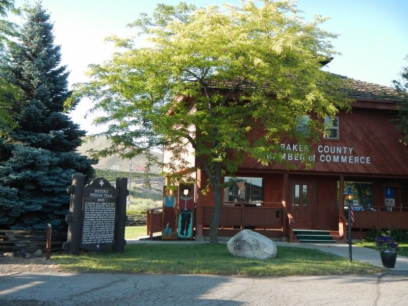
| On Front Street (La Grande-Baker Highway) near 4th Street, on the left when traveling north. |
| On Interstate 84 at milepost 293 near Medical Springs Highway (Chandler Lane) (Oregon Route 203), on the right when traveling west. |
| Near Front Street (La Grande-Baker Highway) near 4th Street, on the left when traveling north. |
| Near Huntington Highway (Business U.S. 30) near Interstate 84, on the right when traveling north. |
| On Lockett Road near Vietnam Veterans Memorial Highway (Interstate 84), on the right when traveling south. |
| On Oregon Trail Boulevard (Business U.S. 30) near Frontage Road, on the left when traveling north. |
| On Oregon Trail Boulevard (Business U.S. 30) when traveling north. |
| On Washinton Street East (Business U.S. 30) near 1st Street East. |
| On Mill Street at Sumpter Highway (Oregon Route 410), on the right when traveling north on Mill Street. |
| Near Interstate 84 near Gate Road/Sisley Creek Road, on the right when traveling north. |
| On SW Avery Park Drive, on the left when traveling east. |
| On SW 1st Street north of SW Jefferson Avenue, on the right when traveling north. |
| On SW Madison Ave at SW 8th St, on the right when traveling west on SW Madison Ave. |
| On SW Campus Way, 0.5 miles west of SW 35th Street, on the left when traveling west. |
| On Northwest Van Buren Avenue. |
| On Dawson Rd, on the right when traveling east. |
| On Bellfountain Rd, on the left when traveling south. |
| On Pacific Hwy (U.S. 99) at Main Street, on the right when traveling south on Pacific Hwy. |
| Near Mount Union Avenue north of Benton View Drive, on the right when traveling north. |
| On James Street, 0 miles east of Newton St, on the left when traveling east. |
| On Old Barlow Road near Barlow Road (Forest Road NF-3530), on the left when traveling east. |
| On East Perry Vickers Road near East Chimney Rock Road, on the left when traveling south. |
| On Government Camp Loop near East Wyeast Trail, on the right when traveling west. |
| On Government Camp Loop near 2nd Street, on the left when traveling west. |
| On Government Camp Loop at 2nd Street (East Little Trail), on the right when traveling west on Government Camp Loop. |
| On Wilbur Street at Durham Street, on the left when traveling east on Wilbur Street. |
| On Wilbur Street at Durham Street, on the right when traveling east on Wilbur Street. |
| Near Old River Road at Green Street. |
| On McVey Avenue west of South State Street, on the right when traveling west. |
| On Leonard Street, on the left when traveling east. |
| Near Washington Street, on the right when traveling north. |
| Near South Gronlund Road near Carver Road, on the right when traveling west. |
| Near South Gronlund Road near Carver Road, on the right when traveling west. |
| On South Gronlund Road near Carver Road, on the right when traveling west. |
| Near South Gronlund Road near Carver Road, on the right when traveling west. |
| On 3rd Avenue at Hedges Street, on the right when traveling west on 3rd Avenue. |
| On Center Street near 8th Street. |
| On McLoughlin Boulevard (Oregon Route 99) at S. 2nd Street, on the right when traveling south on McLoughlin Boulevard. |
| On Centre Street at 7th Street, on the left when traveling north on Centre Street. |
| Near Washington Street near Abernethy Road, on the right when traveling north. |
| Near Washington Street near Abernethy Road, on the right when traveling north. |
| Near Washington Street near Abernethy Road, on the right when traveling north. |
| Near Washington Street near Abernethy Road, on the right when traveling north. |
| On McLoughlin Boulevard (Pacific Highway) (State Highway 99) at 6th Street on McLoughlin Boulevard (Pacific Highway). |
| Near Washington Street near Abernethy Road, on the right when traveling north. |
| On Center Street near 7th Street. |
| Near Washington Street near Abernethy Road, on the right when traveling north. |
| Near Washington Street near Abernethy Road, on the right when traveling north. |
| Near Washington Street near Abernethy Road, on the right when traveling north. |
| On McLoughlin Boulevard (Oregon Route 99) near S. 2nd Street, on the right when traveling south. |
| On McLoughlin Boulevard (Oregon Route 99) near South 2nd Street, on the right when traveling south. |
| Near Washington Street near Abernethy Road, on the right when traveling north. |
| On South Gronlund Road near Carver Road, on the right when traveling west. |
| Near South Gronlund Road near Carver Road, on the right when traveling west. |
| Near South Gronlund Road near Carver Road, on the right when traveling west. |
| Near Washington Street near Abernethy Road, on the right when traveling north. |
| Near Washington Street near Abernethy Road when traveling north. |
| Near Washington Street near Abernethy Road, on the right when traveling north. |
| On Mt. Hood Highway (U.S. 26), on the left when traveling west. |
| On East Arlie Mitchell Road near Mt. Hood Highway (U.S. 26), on the left when traveling west. |
| On Mt. Hood Highway (U.S. 26) at Main Park Road, on the left when traveling west on Mt. Hood Highway. |
| On Northbound Rest Area (Interstate 205), on the right when traveling north. |
| On Northbound Rest Area (Interstate 205), on the right when traveling north. |
| Near SW Boones Ferry Road at SW Tauchmann Street. |
| On Oregon Coast Highway (U.S. 101) north of Carnahan Road N, on the right when traveling north. |
| On Exchange Street at 7th Street, on the left when traveling east on Exchange Street. |
| On West Marine Drive (U.S. 101) at Taylor Street on West Marine Drive. |
| Near Coxcomb Drive, 0.7 miles 15th Street. |
| On Astor Street at 9th Street, on the left when traveling east on Astor Street. |
| Near East Columbia River Highway (U.S. 30) east of 15th Street, on the left when traveling east. |
| On Jerome Avenue at 15th Street, on the left when traveling east on Jerome Avenue. |
| On Exchange Street at 15th Street on Exchange Street. |
| On Beach Drive near Avenue A. |
| Near Columbia River Highway (U.S. 30) near Clifton/Shingle Mill Road, on the right when traveling west. |
| On Columbia River Highway (U.S. 30) at SW Old Portland Road, on the left when traveling north on Columbia River Highway. |
| On Columbia River Highway (U.S. 30) at SW Old Portland Road, on the left when traveling north on Columbia River Highway. |
| On Yachts Landing at The Strand, on the left when traveling west on Yachts Landing. |
| On Parkersburg Road, on the right when traveling south. |
| On South Empire Boulevard south of Wisconsin Avenue, on the right when traveling north. |
| On Oregon Coast Highway (U.S. 101) south of Central Avenue, on the right when traveling south. |
| On NE Elm Street south of NE 3rd Street (U.S. 26), on the right when traveling south. |
| On Ellensburg Avenue (U.S. 101) north of Gauntlett Street, on the right when traveling north. |
| Near Harbor Drive west of Lower Harbor Road, on the right when traveling west. |
| On Oregon Coast Hwy (U.S. 101), on the right when traveling south. Reported missing. |
| On Oregon Coast Highway (U.S. 101) at Jefferson Street, on the right when traveling east on Oregon Coast Highway. |
| On Oregon Coast Highway (U.S. 101) at Jefferson Street, on the right when traveling east on Oregon Coast Highway. |
| On Cape Blanco Road west of Oregon Coast Highway (U.S. 101), on the right when traveling west. |
| Near Cape Blanco Road, 3.9 miles west of U.S. 101, on the right when traveling west. |
| Near Northwest Brooks Street near Northwest Franklin Avenue. |
| Near Northwest Broadway Street near Northwest Franklin Avenue. |
| Near SW Columbia Street east of SW Shevlin Hixon Drive when traveling north. |
| Near SW Powerhouse Drive north of SW Columbia Street when traveling west. |
| Near Northwest Brook Street near Northwest Oregon Avenue. |
| On Pilot Butte Summit Drive. |
| On Southwest 5th Street at South East Canyon Street, on the right when traveling east on Southwest 5th Street. |
322 entries matched your criteria. The first 100 are listed above.
Next 100 ⊳