By William Pfingsten, April 20, 2008
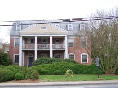
This house now stands behind the marker
GEOGRAPHIC SORT Title Sort Marker Number Sort Marker Number Sort N Marker Number Sort T Publication Order Sort Publication Order Sort A Erected Year Sort Most Viewed Sort Most Recent-Interest Sort Most Recently Changed Sort SEE FAQ #33 FOR DESCRIPTIONS
On Alt. US 13 Front Street at Courthouse Ave., on the right when traveling north on Alt. US 13 Front Street.
On South Street at Market Street, in the median on South Street.
On West Street at Market Street, on the right when traveling south on West Street.
On Cassatt Avenue (Virginia Route 316) at Mary Street, on the right when traveling south on Cassatt Avenue.
On Ivy Road (Business U.S. 250) near Colonnade Drive. Reported permanently removed.
On Ivy Road (Business U.S. 250) just west of Colonnade Drive, on the right when traveling east.
Near Woodbrook Drive west of Seminole Trail (U.S. 29).
Near Woodbrook Drive west of Seminole Trail (U.S. 29).
Near Woodbrook Drive west of Seminole Trail (U.S. 29).
On East Market Street (County Road 1105) 0.2 miles south of Riverside Avenue, on the right when traveling east.
On Rio Mills Road (County Route 643) at Seminole Road (U.S. 29), on the right when traveling west on Rio Mills Road.
On Ivy Road (U.S. 250) east of Three Notched Road (Virginia Route 240). Reported missing.
On Ivy Road (U.S. 250) 0.1 miles west of Gillums Ridge Road (Virginia Route 787), on the right when traveling west.
On East Main Street (Virginia Route 6) just east of Valley Street (Virginia Route 20), on the right when traveling east.
On Hardware Street (Virginia Route 795) 0 miles north of Valley Street (Virginia Route 20).
Paid Advertisement
On Eisenhower Avenue, 0.8 miles east of Metro Road, on the right when traveling east.
On North Paxton Street at Cloude's Mill Drive, on the right on North Paxton Street.
On King Street (Virginia Route 7) near South Taylor Street, on the right when traveling east.
On King Street (Virginia Route 7) near South Taylor Street, on the right when traveling east.
On South Lee Street just south of Wilkes Street, on the left when traveling south.
Near North Union Street east of Fayette Alley, on the right when traveling north. Reported missing.
On King Street at North Union Street, on the left when traveling east on King Street.
Near Wilkes Street at South Royal Street, in the median.
On South Lee Street at Green Street, on the right on South Lee Street.
On Prince Street east of South Alfred Street, on the left when traveling east.
On Prince Street at South Pitt Street on Prince Street.
On King Street (Virginia Route 7) at North Columbus Street, on the left when traveling east on King Street.
Near North Fairfax Street south of Cameron Street, on the right when traveling north.
On North Washington Street south of Cameron Street, on the right when traveling south.
On King Street at North Pitt Street, on the left when traveling east on King Street.
On North Union Street at Princess Street, on the right when traveling north on North Union Street.
Paid Advertisement
On King Street (Virginia Route 7) at North West Street, on the right when traveling west on King Street.
On King Street at North Royal Street, on the right when traveling west on King Street.
Near Jefferson Street at South Lee Street when traveling east.
On King Street at North Fairfax Street, on the left when traveling east on King Street.
On Oronoco Street east of North Washington Street (Virginia Route 400), on the right when traveling east. Reported permanently removed.
On King Street at North Washington Street (Virginia Route 400), on the right when traveling west on King Street.
Near North Union Street south of Cameron Street, on the right when traveling north. Reported permanently removed.
On King Street at South Pitt Street, on the right when traveling east on King Street.
Near Wilkes Street east of South Royal Street, on the left when traveling east.
On Oronoco Street just east of North Washington Street, on the right when traveling west.
On North Royal Street at Cameron Street, on the right when traveling north on North Royal Street.
On King Street at South Fairfax Street, on the right when traveling east on King Street.
On King Street (Virginia Route 7) at North Washington Street (Virginia Route 400), on the right when traveling east on King Street.
On King Street at South Lee Street, on the right when traveling east on King Street.
On Prince Street just west of South Royal Street, on the right when traveling west.
Paid Advertisement
Near Ford's Landing Way at Franklin Street, on the left when traveling south.
On North Union Street at Cameron Street, on the right when traveling north on North Union Street.
On South Washington Street (Virginia Route 400) at Prince Street, on the right when traveling south on South Washington Street. Reported permanently removed.
On Strand Street just south of King Street, on the right when traveling north.
Near Jones Point Drive, 0.2 miles South Royal Street, on the right when traveling east.
On South Washington Street (Virginia Route 400) south of Prince Street, on the right when traveling south.
On King Street, on the right when traveling east. Reported permanently removed.
On Prince Street east of The Strand, on the right when traveling west.
Near Cameron Street east of North Union Street, on the right when traveling east. Reported permanently removed.
On Jones Point Drive east of South Royal Street, on the right when traveling east.
Near Wilkes Street at South Royal Street, in the median.
On South Union Street, 0.1 miles south of Wolfe Street, on the right when traveling south.
On South Union Street just north of Gibbon Street, on the left when traveling north.
On South Lee Street south of Franklin Street, on the right when traveling north.
Near Madison Street east of Mt. Vernon Trail, on the right when traveling east.
On Wythe Street just east of North Pitt Street, on the right when traveling east.
Paid Advertisement
On North Washington Street south of Pendleton Street, on the right when traveling north.
On North Washington Street just north of Princess Street, on the left when traveling north.
On King Street (Virginia Route 7) at Commonwealth Avenue on King Street.
On North Patrick Street (U.S. 1) just north of Pendleton Street, on the right when traveling north.
On Pendleton Street west of North Fayette St., on the right when traveling west.
Near Commonwealth Avenue north of Luna Park Drive, on the left when traveling north.
On West Braddock Road, 0.2 miles west of Marlboro Drive, on the right when traveling west.
On West Braddock Road, 0.2 miles west of Marlboro Drive, on the right when traveling west.
Near West Braddock Road, on the right when traveling west.
On West Braddock Road, on the right when traveling east.
Near West Braddock Road, on the right when traveling west.
Near West Braddock Road, on the right when traveling west.
On West Braddock Road (County Route 420).
On North Quaker Lane at Coventry Lane, on the left when traveling north on North Quaker Lane.
On St Stephens Road west of North Garland Street, on the left when traveling west.
Paid Advertisement
Near West Braddock Road, 0.1 miles west of Marlboro Drive, on the right when traveling west.
Near West Braddock Road, on the right when traveling west.
Near West Braddock Road, on the right when traveling west.
Near West Braddock Road, on the right when traveling west.
Near West Braddock Road, 0.2 miles west of Marlboro Drive, on the right when traveling west. Reported damaged.
On Cemetery Circle south of Wilkes Street, on the right when traveling south.
On West Street at Duke Street (Virginia Route 236) on West Street.
Near Wilkes Street west of Hamilton Avenue when traveling west.
On Washington Street (Virginia Route 400) at Wolfe Street, on the right when traveling north on Washington Street.
Near Wilkes Street west of Hamilton Avenue when traveling west.
Near Wilkes Street, 0.1 miles east of Hamilton Avenue, on the right when traveling east.
On Wilkes Street, 0.1 miles east of Hamilton Avenue, on the right when traveling east.
On South Washington Street north of Wolfe Street, on the right when traveling north.
On South Washington Street south of Church Street, on the right when traveling south.
Near Wilkes Street, 0.1 miles east of Hamilton Avenue, on the right when traveling east.
Near South Washington Street at Church Street, on the right when traveling south.
Paid Advertisement
On Duke Street (Virginia Route 236).
On South Washington Street (Local Route 400) at Church Street, on the right when traveling south on South Washington Street.
Near South Washington Street just south of Church Street, on the right when traveling south.
On South Washington Street at Church Street, on the right when traveling south on South Washington Street.
On Jamieson Avenue at Daingerfield Road, on the right when traveling west on Jamieson Avenue.
4565 entries matched your criteria. The first 100 are listed above.
Next 100 ⊳