By Mike Stroud, October 12, 2013
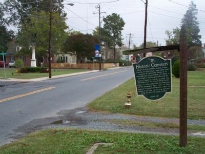
Historic Cemetery Marker seen along Market Street, looking east
GEOGRAPHIC SORT Title Sort Marker Number Sort Marker Number Sort N Marker Number Sort T Publication Order Sort Publication Order Sort A Erected Year Sort Most Viewed Sort Most Recent-Interest Sort Most Recently Changed Sort SEE FAQ #33 FOR DESCRIPTIONS
On Market Street near South Street, on the left when traveling west.
On US 13 at W. Main Street, on the left when traveling north on US 13.
Near Saxis Road at VA 699.
On Gordonsville Road (Virginia Route 231) 1.5 miles Virginia Route 640, on the left when traveling north.
On Stony Point Road at Winding River Lane, on the right when traveling north on Stony Point Road.
On Stony Point Road (Virginia Route 20) just north of Richmond Road (U.S. 250), on the right when traveling north. Reported permanently removed.
Near Thomas Jefferson Parkway (Virginia Route 53) west of James Monroe Parkway (County Route 795), on the right when traveling east.
On Ivy Road (Business U.S. 250) near Colonnade Drive.
Near Monticello Loop, 0.3 miles east of Thomas Jefferson Parkway, on the right when traveling east.
On University Avenue (Virginia Route 250) east of McCormick Road, on the left when traveling west.
On Barracks Farm Road (County Route 658) east of Garthfield Lane, on the right when traveling east.
Near Richmond Road (U.S. 250) 0.9 miles east of Exit 124 (Interstate 64).
On Ivy Farm Road (County Route 1015), on the left when traveling east.
On Louisa Road (Virginia Route 22) 0.2 miles east of Cobham Station Lane (Virginia Route 640), on the right when traveling north.
On Louisa Road (Virginia Route 22) 0.1 miles west of Whitlock Road (Virginia Route 616), on the left when traveling west.
Paid Advertisement
On James River Road (Virginia Route 742) 0.2 miles east of Warren Ferry Road, on the right when traveling east.
On Richmond Road (U.S. 250) east of Exit 124 (Interstate 64), on the right when traveling east.
On Thomas Jefferson Parkway (Virginia Route 53) just south of Colle Lane, on the right when traveling south.
Near North Union Street east of Fayette Alley, on the right when traveling north. Reported missing.
On Cameron Street east of North Royal Street, on the right when traveling east.
On King Street east of South Fairfax Street, on the right when traveling east.
On Prince Street just east of South Fairfax Street, on the right when traveling east.
On Cameron Street just west of North Fairfax Street, on the right when traveling west.
On King Street near North St Asaph Street, on the right when traveling west.
On Duke Street east of South Fairfax Street, on the right when traveling east.
On Cameron Street east of North Washington Street, on the right when traveling west.
On King Street at Union Street on King Street.
On King Street at North Washington Street (Virginia Route 400), on the right when traveling west on King Street.
Near North Union Street south of Cameron Street, on the right when traveling north. Reported permanently removed.
Near North Columbus Street just south of Cameron Street, on the right when traveling north.
Paid Advertisement
On Oronoco Street just east of North Washington Street, on the right when traveling west.
On South Fairfax Street south of Prince Street, on the right when traveling north.
On King Street (Virginia Route 7) at North Washington Street (Virginia Route 400), on the right when traveling east on King Street.
Near Jones Point Drive, 0.2 miles South Royal Street, on the right when traveling east.
On North Royal Street south of Cameron Street, on the right when traveling south.
On South Union Street just north of Gibbon Street, on the left when traveling north.
On North Washington Street (Virginia Route 400) at Oronoco Street, on the right when traveling south on North Washington Street.
On Oronoco Street at North Washington Street (Virginia Route 400), on the right when traveling east on Oronoco Street.
On Oronoco Street at North Washington Street (Virginia Route 400), on the right when traveling east on Oronoco Street.
On Oronoco Street at North Washington Street (Virginia Route 400), on the left when traveling east on Oronoco Street.
On Hamilton Avenue south of Wilkes Street, on the right when traveling south.
On Richmond Highway (U.S. 460) at Village Highway (Virginia Route 24), on the right when traveling east on Richmond Highway.
Near North Harrison Street north of Fairfax Drive, on the right when traveling north.
On Sherman Drive north of Sheridan Drive, on the right when traveling north.
On Roosevelt Drive east of Weeks Avenue, on the left when traveling west.
On Humpherys Drive, on the right when traveling north.
Paid Advertisement
On Sheridan Avenue at Reba Place, on the right when traveling north on Sheridan Avenue.
On North Old Glebe Road south of North Randolph Court, on the right when traveling north.
On Marshall Drive near Richmond Highway. Reported permanently removed.
On Marshall Drive near Richmond Highway. Reported permanently removed.
On Washington Boulevard, on the right when traveling west.
On MIddle River Road (County Route 736) north of Union Church Road (County Route 732), on the left when traveling north.
On East Side Highway (U.S. 340), on the left when traveling north.
On Lee Jackson Highway (U.S. 11) at Howardsville Road (Virginia Route 701), on the right when traveling south on Lee Jackson Highway.
On Lee Jackson Highway (U.S. 11) at Spottswood Road (Virginia Route 620), on the right when traveling south on Lee Jackson Highway.
On East Main Street (Business U.S. 460) at Court Street, on the right when traveling west on East Main Street.
On Lynchburg Highway (U.S. 460) at County Route 649, on the right when traveling east on Lynchburg Highway.
On Roanoke Road (U.S. 220) south of International Parkway, in the median.
On Cumberland Street (Business Virginia Route 113) at Lee Street on Cumberland Street.
Paid Advertisement
On Lee Highway (U.S. 11/19) 0.1 miles west of Forsythe Road, on the right when traveling west.
On Old Stage Road, 0.4 miles south of Smoky Ordinary Road.
Near North Main Street at Bank Street, on the right when traveling north.
On James Madison Highway (U.S. 15) at Francisco Road (County Route 626), on the right when traveling south on James Madison Highway.
On Main Street (Business U.S. 29) at Wards Droad (U.S. 29), on the left when traveling south on Main Street.
On Red Hill Road (County Route 677) 1 mile south of Staunton Hill Road (County Route 619).
Near Red Hill Road (County Route 677) 1 mile south of Staunton Hill Road (County Route 619), on the left when traveling south.
On Wickliffe Road (Virginia Route 40) at Mt. Calvary Road (County Route 600), on the right when traveling east on Wickliffe Road.
On Main Street south of East Rush Street (County Route 1103), on the right when traveling south.
On Lusardi Drive (U.S. 501) at Rush Street when traveling north on Lusardi Drive.
On Richmond Highway (U.S. 460) 0.3 miles west of Mount Athos Road (County Route 726), on the right when traveling east.
On Alum Springs Road (County Route 858) at Town Fork Road (County Route 623), on the right when traveling east on Alum Springs Road.
On Main Street (State Highway 2) near Courthouse Lane.
On Dawn Boulevard (Virginia Route 30) 0.8 miles west of Calno Road, on the right when traveling east.
On Richmond Turnpike (U.S. 301) at Mt Gideon Road, on the left when traveling north on Richmond Turnpike.
On Richmond turnpike (U.S. 301) 0.2 miles north of Sparta Road, on the right when traveling north.
Paid Advertisement
On U.S. 17, 0.5 miles south of Ware Creek Road, on the right when traveling south.
On Tidewater Trail (U.S. 17) 0.1 miles north of Hazelwood Lane (Virginia Route 675), on the right when traveling north.
On Jefferson Davis Hwy (U.S. 1), on the right when traveling north.
Near Harrison Landing Road, 0.7 miles south of Westover Road (Virginia Route 633), on the right when traveling south.
On John Tyler Memorial Highway (Virginia Route 5) at Kimages Road, on the right when traveling east on John Tyler Memorial Highway. Reported permanently removed.
On John Tyler Memorial Highway (Virginia Route 5) 0.2 miles east of Kimages Road (Virginia Route 658), on the right when traveling east.
On John Tyler Memorial Highway (Virginia Route 5) at Courthouse Road (Virginia Route 155), on the right when traveling west on John Tyler Memorial Highway. Reported permanently removed.
On Courthouse Road (Route 644) at John Tyler Memorial Highway (Virginia Route 5), on the right when traveling north on Courthouse Road.
Near Courthouse Road (Virginia Route 155) at Watermelon Fields Road.
On John Tyler Memorial Highway (Virginia Route 5) 0.2 miles east of Sturgeon Point Road (Virginia Route 614), on the right when traveling west.
Near Harrison Landing Road, 0.7 miles south of Westover Road (Virginia Route 633), on the right when traveling south.
On John Tyler Memorial Highway (State Highway 5) 2.8 miles east of Wilcox Wharf Road (County Route 618), on the right when traveling east.
On John Tyler Memorial Highway (Virginia Route 5) at Kimages Road, on the right when traveling east on John Tyler Memorial Highway.
On John Tyler Memorial Highway (Virginia Route 5) 0.4 miles east of Barnetts Road (Route 609), on the right when traveling east.
On John Tyler Memorial Highway (Virginia Route 5) at Sandy Point Road (Virginia Route 613), on the right when traveling east on John Tyler Memorial Highway.
On John Tyler Memorial Highway (Virginia Route 5) 0.1 miles east of Virginia Route 156, on the right when traveling east.
Paid Advertisement
Near Red Hill Road (County Route 677) 1 mile Staunton Hill Road (County Route 619).
Near Red Hill Road (County Route 677) 1 mile Staunton Hill Road (County Route 619).
On Red Hill Road at Staunton Hill Road (County Route 619) on Red Hill Road.
On David Bruce Avenue (Virginia Route 40) at County Road 9093 (County Route 9093), on the right when traveling east on David Bruce Avenue.
On George Washington Highway (Virginia Route 40) at Greenfield Road (County Route 656), on the right when traveling west on George Washington Highway.
805 entries matched your criteria. The first 100 are listed above.
Next 100 ⊳