2121 entries match your criteria. Entries 401 through 500 are listed.⊲ Previous 100 — Next 100 ⊳
Abolition & Underground RR Topic
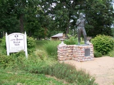
By William Fischer, Jr., August 31, 2013
John Brown Statue and Marker
401 ► Kansas, Miami County, Osawatomie — John Brown Statue — 1935 —  |
| Near Main Street. | |||
| 402 ► Kansas, Miami County, Osawatomie — Old Stone Church — Ad Astra Per Aspera — [To the stars through difficulties] — |
| On 6th Street north of Parker Avenue, on the right when traveling north. | |||
| 403 ► Kansas, Miami County, Osawatomie — 6 — Old Stone Church — Osawatomie Driving Tour — |
| On 6th Street north of Parker Avenue, on the right when traveling north. | |||
| 404 ► Kansas, Miami County, Osawatomie — 9 — Soldiers Monument — Osawatomie Driving Tour — |
| On Main Street at 9th Street, on the right when traveling west on Main Street. | |||
| 405 ► Kansas, Nemaha County, Sabetha — 32 — The Lane Trail — |
| On Acorn Road (U.S. 75) 0.8 miles 280th Road (State Highway 246), on the right when traveling south. | |||
| 406 ► Kansas, Saline County, Salina — August Bondi — 1833-1907 — Jewish-American Abolitionist, Salina Resident — |
| On West Iron Avenue. | |||
| 407 ► Kansas, Shawnee County, Topeka — A Turning Point for Equality — |
| On SE Monroe Street south of SE 15th Street, on the left when traveling south. | |||
| 408 ► Kansas, Shawnee County, Topeka — 15 — Capital of Kansas |
| On 37th Street at Topeka Boulevard, on the right when traveling west on 37th Street. Reported permanently removed. | |||
| 409 ► Kansas, Shawnee County, Topeka — Constitution Hall -Topeka — 1855 - — |
| On Kansas Avenue near SW 5th Street, on the right when traveling south. | |||
| 410 ► Kansas, Shawnee County, Topeka — Ichabod Washburn — 1798-1868 — |
| Near Southwest Jewell Avenue. | |||
| 411 ► Kansas, Wyandotte County, Kansas City, Quindaro Bluffs — John Brown — |
| On 27th Street at Sewell Avenue, on the left when traveling north on 27th Street. | |||
| 412 ► Kansas, Wyandotte County, Kansas City, Quindaro Bluffs — Quindaro Ruins Archaeological Park — |
| On North 27th Street. | |||
| 413 ► Kansas, Wyandotte County, Kansas City, Quindaro Bluffs — Quindaro, Kansas — 1857 1862 — A Kansas City, Kansas Historic Site — |
| On 27th Street at Sewell Avenue, on the left when traveling north on 27th Street. | |||
| 414 ► Kentucky, Boone County, Burlington — Passage To Freedom From Slavery — Memorial to the Undergrond Railroad in Boone County, Kentucky — Another Marker in Rabbit Hash — |
| Near Lower River Road. | |||
| 415 ► Kentucky, Boyle County, Danville — 1606 — John Marshall Harlan / Kentucky's "Great Dissenter" — (1833-1911) — |
| On W Main Street. | |||
| 416 ► Kentucky, Bracken County, Germantown — 2076 — John Gregg Fee / Arnold Gragston — (1816–1901) / — |
| On Bridgeville Road (Kentucky Route 875) south of Brooksville-Germantown Road ( Route 10), on the right when traveling south. | |||
| 417 ► Kentucky, Campbell County, Bellevue — 1351 — Bellevue, Kentucky — |
| On Fairfield Avenue (Kentucky Route 8) near Patchen Avenue, on the right when traveling east. | |||
| 418 ► Kentucky, Campbell County, Newport — 121 — General James Taylor Home — |
| On East Third Street at Overton Street, on the right when traveling west on East Third Street. | |||
| 419 ► Kentucky, Daviess County, Maceo — 1241 — Uncle Tom Lived Here — |
| On U.S. 60 1.2 miles east of Kelly Cemetery Road, on the right when traveling east. | |||
| 420 ► Kentucky, Fayette County, Lexington — 2466 — Second Presbyterian Church — |
| On East Main Street (Business U.S. 25) at Ransom Avenue, on the right when traveling south on East Main Street. | |||
| 421 ► Kentucky, Fayette County, Lexington, Historic South Hill — 2 — Thriving Black Entrepreneurs — Freed Blacks Lived in this Neighborhood — Downtown African-American Heritage Trail — |
| On South Limestone north of West Maxwell Street, on the left when traveling north. | |||
| 422 ► Kentucky, Franklin County, Frankfort — 2235 — Emily Thomas Tubman House — |
| On Washington Street south of West Broadway Street, on the right when traveling south. | |||
| 423 ► Kentucky, Green County, Greensburg — 846 — Lincoln's Law Partner — |
| On S. Main Street (U.S. 68) south of W. Columbia Avenue, on the right when traveling south. | |||
| 424 ► Kentucky, Green County, Summersville — 719 — Lincoln's Mentor — |
| On Hudgins Highway (State Highway 569) at Hodgenville Road (State Highway 61), on the right when traveling west on Hudgins Highway. | |||
| 425 ► Kentucky, Jefferson County, Louisville, Butchertown — Lincoln Memorial — [Louisville, Kentucky] — |
| On East River Road at E Witherspoon Street, on the right when traveling east on East River Road. | |||
| 426 ► Kentucky, Jefferson County, Louisville, Downtown — 2072 — Kentucky Fugitives to Canada — |
| On W. Main Street (U.S. 31W) at N. 4th Street, on the right when traveling west on W. Main Street. | |||
| 427 ► Kentucky, Jefferson County, Louisville, Downtown — 1990 — Slave Trading In Louisville / Garrison Slave Pen Site — |
| On S 2nd Street at W Main Street, on the right when traveling north on S 2nd Street. | |||
| 428 ► Kentucky, Jefferson County, Louisville, University — Freedom Park: A Journey to Freedom — The Underground Railroad — |
| On South 3rd Street south of West Cardinal Boulevard, on the left when traveling south. | |||
| 429 ► Kentucky, Jefferson County, Louisville, University — The Freedom Park: A Journey to Freedom — The Free Black Community of Louisville — |
| On West Cardinal Boulevard at South 3rd Street ( Route 1020), on the right when traveling east on West Cardinal Boulevard. | |||
| 430 ► Kentucky, Jessamine County, Nicholasville — African American Enlistment — |
| Near Danville Road Loop 2 0.4 miles south of Fitch Road. | |||
| 431 ► Kentucky, Jessamine County, Nicholasville — The Thirteenth Amendment — |
| Near Danville Road Loop 2 0.4 miles south of Fitch Road. | |||
| 432 ► Kentucky, Kenton County, Covington — 1862 — First City Hall — |
| On Roebling Way (Kentucky Route 17) at Greenup Street, on the right when traveling north on Roebling Way. | |||
| 433 ► Kentucky, Kenton County, Covington — James Bradley — |
| On Riverside Drive at Kennedy Street, on the left when traveling east on Riverside Drive. | |||
| 434 ► Kentucky, Kenton County, Covington — 1863 — Slave Escape / Controversial Judgment — |
| On Main Street at West 6th Street, on the left when traveling south on Main Street. | |||
| 435 ► Kentucky, Kenton County, Ludlow — 2422 — Somerset Hall — |
| On Somerset Street at Ringgold Street, on the right when traveling east on Somerset Street. | |||
| 436 ► Kentucky, Larue County, Hodgenville — Slavery in the Valley — |
| Near Bardstown Road (U.S. 31E) north of White City Road ( Route 470), on the left when traveling north. | |||
| 437 ► Kentucky, Madison County, Berea — 1767 — Church of Christ, Union — |
| On Main Street S at Prospect Street ( Route 21) on Main Street S. | |||
| 438 ► Kentucky, Madison County, Richmond — 533 — "Lion of White Hall" |
| On Lexington Road (US 25 / US 421) at Boonesborough Road, on the right when traveling south on Lexington Road (US 25 / US 421). Reported missing. | |||
| 439 ► Kentucky, Madison County, Richmond — 533 — “Lion of White Hall” — |
| On White Hall Shrine Road (Kentucky Route 3055) 0.1 miles west of U.S. 421, on the right when traveling west. | |||
| 440 ► Kentucky, Madison County, Richmond — Abraham Lincoln & Cassius Marcellus Clay — Kentucky Abraham Lincoln Heritage Trail — |
| Near White Hall Shrine Road (Kentucky Route 3055) 0.4 miles south of Fox Town Road. | |||
| 441 ► Kentucky, Madison County, Richmond — Kentucky & the Emancipation Proclamation — Kentucky Abraham Lincoln Heritage Trail — |
| Near White Hall Shrine Road (Kentucky Route 3055) 0.4 miles south of Fox Town Road. | |||
| 442 ► Kentucky, Madison County, Richmond — White Hall State Historic Site — |
| Near White Hall Shrine Road (Kentucky Route 3055) 0.4 miles south of Fox Town Road. | |||
| 443 ► Kentucky, Mason County, Maysville — Paxton Inn — |
| On Paxton Street at Old Main Street ( Route 2515), on the left when traveling east on Paxton Street. | |||
| 444 ► Kentucky, Mason County, Maysville — 2206 — Ryan-Pogue House / H. E. Pogue Distillery Co. — |
| On West 2nd Street/Mary Ingles Highway 0.3 miles north of Dryden Lane, on the right when traveling north. | |||
| 445 ► Kentucky, Mason County, Maysville — Underground Rail Road — Circa 1840 — |
| Near East McDonald Parkway 0.1 miles Limestone Street. | |||
| 446 ► Kentucky, Mason County, Maysville, Old Washington — Harriet Beecher Stowe — |
| On Old Main Street (Kentucky Route 2515) north of Jail Street, on the right when traveling north. | |||
| 447 ► Kentucky, Mason County, Maysville, Old Washington — Harriet Beecher Stowe Slavery to Freedom Museum — c.1807 — |
| On Old Main Street (Kentucky Route 2515) north of Jail Street, on the right when traveling north. | |||
| 448 ► Kentucky, Meade County, Brandenburg — Underground Railroad Statue — |
| On Water Street, on the right when traveling west. | |||
| 449 ► Kentucky, Nelson County, Bardstown — Abolitionism, War, Emancipation — |
| Near East Stephen Foster Avenue (U.S. 150) east of Bloomfield Road (U.S. 62). | |||
| 450 ► Kentucky, Oldham County, La Grange — 2536 — James and Amanda Mount Home / J.C. Barnett Library and Archives — |
| On North 2nd Avenue south of West Jefferson Street ( Route 146), on the right when traveling south. | |||
| 451 ► Kentucky, Oldham County, Westport — 2594 — Westport Courthouse / The Courthouse and Enslavement — |
| On Westport Road (Kentucky Route 524) west of 4th Street, on the right when traveling west. | |||
| 452 ► Kentucky, Trimble County, Bedford — 1822 — Trimble County Jail — |
| On Main Street (U.S. 421) south of Church Street, on the right when traveling south. | |||
| 453 ► Kentucky, Trimble County, Milton — 1099 — Petticoat Abolitionist — |
| On Peck Pike Road (Kentucky Route 625 at milepost 12) at Liberty Road ( Route 1256), on the left when traveling south on Peck Pike Road. | |||
| 454 ► Louisiana, Ascension Parish, Donaldsonville — Freedom Seekers — |
| On Williams Street east of Lessard Street, on the right when traveling east. | |||
| 455 ► Louisiana, Ascension Parish, Donaldsonville — Louisiana's Underground Railroad — Why Learn About The Underground Railroad In Louisiana? — |
| On Williams Street east of Lessard Street, on the left when traveling east. | |||
| 456 ► Louisiana, Ascension Parish, Donaldsonville — The Culture — |
| Near Williams Street east of Lessard Street, on the right when traveling east. | |||
| 457 ► Louisiana, Ascension Parish, Donaldsonville — The Swamp — |
| On Williams Street east of Lessard Street, on the left. | |||
| 458 ► Louisiana, Grant Parish, Pollock — Oction House — |
| On Howard Street (State Highway 8) near Haney Street, on the left when traveling west. | |||
| 459 ► Louisiana, Natchitoches Parish, Derry — Escaped! Freedom Seekers in 1804 — |
| Near Louisiana Route 119 1 mile north of Highway 1, on the right when traveling north. | |||
| 460 ► Louisiana, Natchitoches Parish, Derry — Escaped! Freedom Seekers in 1863 — |
| Near Louisiana 119 (at milepost 119), 1 mile north of Highway 1, on the right when traveling north. | |||
| 461 ► Louisiana, Natchitoches Parish, Natchez — Escaped! Freedom Seekers in 1863-1864 — |
| Near Louisiana 494 (State Highway 494) near State Highway 119. | |||
| 462 ► Maine, Cumberland County, Brunswick — Harriet Beecher Stowe House — |
| On Federal Street at Maple Street, on the right when traveling north on Federal Street. | |||
| 463 ► Maine, Cumberland County, Brunswick, Merepoint — The Harriet Beecher Stowe House — 63 Federal Street — |
| Near Federal Street at Maple Street, on the left when traveling south. | |||
| 464 ► Maine, Cumberland County, Portland, Downtown — 11 — First Parish Church, Unitarian Universalist — Portland Maine Freedom Trail — |
| On Congress Street at Temple Street, on the left when traveling north on Congress Street. | |||
| 465 ► Maine, Cumberland County, Portland, Downtown — Hack Stand of Reuben Ruby — Portland Freedom Trail — |
| On Federal Street at Temple Street, on the left when traveling north on Federal Street. | |||
| 466 ► Maine, Cumberland County, Portland, East Bayside — Christopher Christian Manuel — 1781 - 1845 — Portland Freedom Trail — |
| On Congress Street near Mountfort Street, on the right when traveling north. | |||
| 467 ► Maine, Cumberland County, Portland, East Bayside — Eastern Cemetery — Portland Freedom Trail — |
| On Congress Street at Mountfort Street, on the right on Congress Street. | |||
| 468 ► Maine, Cumberland County, Portland, East Bayside — 1 — Franklin Street Wharf — Portland Freedom Trail — |
| On Commercial Street (U.S. 1) at Franklin Arterial (U.S. 1), on the right when traveling north on Commercial Street. | |||
| 469 ► Maine, Cumberland County, Portland, East Bayside — Hack Stand of Charles H.L. Pierre — Portland Freedom Trail — |
| On Middle Street at India Street, on the right when traveling west on Middle Street. | |||
| 470 ► Maine, Cumberland County, Portland, East Bayside — Home of Amos Noë and Christiana Williams Freeman — Portland Freedom Trail — |
| On Federal Street at Hancock Street, on the left when traveling south on Federal Street. | |||
| 471 ► Maine, Cumberland County, Portland, East Bayside — 5 — Home of Charles Frederick Eastman, Harriet Stephenson Eastman, and her father, Alexander Stephenson — Portland Freedom Trail — |
| On Newbury Street at Mountfort Street, on the right when traveling east on Newbury Street. | |||
| 472 ► Maine, Cumberland County, Portland, East Bayside — 7 — Home of Elias and Elizabeth Widgery Thomas — Portland Freedom Trail — |
| On Congress Street at India Street, on the right when traveling north on Congress Street. | |||
| 473 ► Maine, Cumberland County, Portland, East Bayside — The Abyssinian Church — |
| On Newbury Street near Mountfort Street, on the left when traveling north. | |||
| 474 ► Maine, Cumberland County, Portland, East End — Charles F. Eastman — Conductor on the Underground Railroad & Entrepreneur — Portland Freedom Trail — |
| On Congress Street at North Street, on the left when traveling north on Congress Street. | |||
| 475 ► Maine, Cumberland County, Portland, East End — The poet & the view — |
| On Eastern Promenade at Morning Street, on the right when traveling north on Eastern Promenade. | |||
| 476 ► Maine, Cumberland County, Portland, Old Port — 9 — Friends (Quaker) Meeting House — Portland Maine Freedom Trail — |
| On Pearl Street at Federal Street, on the right when traveling north on Pearl Street. | |||
| 477 ► Maine, Cumberland County, Portland, Old Port — Home of Deacon Brown Thurston, 32 Union Street — Portland Freedom Trail — |
| On Fore Street at Union Street, on the left when traveling east on Fore Street. | |||
| 478 ► Maine, Cumberland County, Portland, Old Port — 13 — Mariner's Church — Portland Maine Freedom Trail — |
| On Moulton Street south of Wharf Street, on the left when traveling south. | |||
| 479 ► Maine, Cumberland County, Portland, Old Port — 12 — Secondhand Clothing Store of Lloyd Scott — Portland Freedom Trail — |
| On Exchange Street, on the left when traveling north. | |||
| 480 ► Maine, Kennebec County, Augusta — 26 — An Ornament to the City / Un joyau de la ville — Augusta, Maine — The Museum in the Streets — |
| On Water Street north of Oak Street, on the left when traveling north. | |||
| 481 ► Maine, Kennebec County, Augusta — 12 — Maine's Voice Against Slavery / Le Maine Proteste Contre l'Esclavage — Augusta, Maine - The Civil War — The Museum in the Streets — |
| On Winthrop Street at Wyman Street, on the right on Winthrop Street. | |||
| 482 ► Maine, Kennebec County, Augusta — 10 — The American Rembrandt's Augusta Home / Maison du Rembrandt d'Augusta — Augusta, Maine – The Civil War — The Museum in the Streets® — |
| On Winthrop Street just west of Pleasant Street, on the right when traveling west. | |||
| 483 ► Maine, Penobscot County, Brewer — Chamberlain - Freedom Park — Brewer Historical Society — |
| Near North Main Street (Maine Route 178) at State Street, on the right when traveling south. | |||
| 484 ► Maine, Penobscot County, Brewer — John Holyoke House — |
| Near North Main Street (Maine Route 178) at State Street ( Route 15B), on the right when traveling south. | |||
| 485 ► Maine, York County, Biddeford — 12 — Journal Building in 1916 / Le Bâtiment du Journal Quododien en 1916 — Biddeford, Maine — The Museum in the Streets® — |
| On Adams Street south of Main Street, on the right when traveling south. | |||
| 486 ► Maine, York County, Biddeford — 20 — McArthur Library / La Bibliothèque McArthur — |
| On Main Street just west of Jefferson Street, on the right when traveling west. | |||
| 487 ► Maryland, Allegany County, Cumberland — Crossroads of America Mural — |
| On Canal Street 0.1 miles south of Baltimore Street, on the left when traveling south. | |||
| 488 ► Maryland, Allegany County, Cumberland — Crossroads of America Mural — |
| On Canal Street 0.1 miles north of West Harrison Street, on the left when traveling north. | |||
| 489 ► Maryland, Anne Arundel County, Annapolis — Dred Scott, 1799 - 1858 — Freedom Denied by the United States Supreme Court |
| On State Circle. Reported permanently removed. | |||
| 490 ► Maryland, Anne Arundel County, Annapolis — Roger Brooke Taney, 1777 - 1864 — Chief Justice of the United States Supreme Court |
| On State Circle. Reported permanently removed. | |||
| 491 ► Maryland, Anne Arundel County, Crownsville — Belvoir — |
| On Generals Highway (Maryland Route 178) at Rockbridge Academy Belvoir Estate, on the right when traveling west on Generals Highway. | |||
| 492 ► Maryland, Anne Arundel County, Highland Beach — Highland Beach Maryland — Founded 1893 • Incorporated 1922 — |
| On Wayman Avenue at Bay Avenue when traveling north on Wayman Avenue. | |||
| 493 ► Maryland, Anne Arundel County, Highland Beach — Twin Oaks — National Historic Register — 3200 Wayman Ave. — |
| On Wayman Avenue. | |||
| 494 ► Maryland, Baltimore, Bolton Hill — Hugh Lennox Bond — 1828-1893 — |
| On West Lanvale Street, on the right when traveling east. | |||
| 495 ► Maryland, Baltimore, Bromo Arts District — Black slavery in and around Lexington Market — |
| On West Lexington Street just west of North Eutaw Street, on the left when traveling west. | |||
| 496 ► Maryland, Baltimore, Bromo Arts District — Robert & Rosetta — Oletha Devane and Christopher Kojzar — 2022 — |
| On West Lexington Street at North Eutaw Street, in the median on West Lexington Street. | |||
| 497 ► Maryland, Baltimore, Canton — Frederick Douglass' Escape from Slavery — |
| On Boston Street just east of South Kenwood Avenue, on the right when traveling east. | |||
| 498 ► Maryland, Baltimore, Canton — The Railroad to Freedom — |
| On Boston Street just east of South Kenwood Street, on the right when traveling east. | |||
| 499 ► Maryland, Baltimore, Carroll Park — Mount Clare — Freedom Seekers at Georgia Plantation — National Underground Railroad-Network to Freedom — |
| On Washington Blvd.. | |||
| 500 ► Maryland, Baltimore, Cherry Hill Park — Cherry Hill — |
| On South Hanover Street (Maryland Route 2), on the right when traveling north. | |||
2121 entries matched your criteria. Entries 401 through 500 are listed above. ⊲ Previous 100 — Next 100 ⊳