By Duane Hall, June 6, 2010
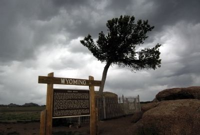
Tree Rock
| On Interstate 80 at milepost 332, in the median. |
| On State Highway 230 near County Route 33, on the left when traveling west. |
| On U.S. 287 at Cavalryman Ranch Road, on the right when traveling north on U.S. 287. |
| Near Interstate 80 at Happy Jack Road (Wyoming Highway 210), on the right when traveling west. |
| Near Interstate 80 at Wyoming Highway 210. |
| On State Highway 230 near Gerhart Road, on the left when traveling west. |
| On Snowy Range Road (State Highway 130) near Cactus Hill Road, on the right when traveling west. |
| On Banzhaf Lane (County Route 67) at U.S. 30, on the left when traveling north on Banzhaf Lane. |
| On U.S. 287, on the right when traveling north. |
| On Greybull Hwy (U.S. 20 / 16), on the left when traveling west. |
| On Alternate U.S. 14A at milepost 71 near Old U.S. Highway 14A, on the left when traveling east. |
| On East Main Street (U.S. 310) near Montana Avenue, on the right when traveling east. |
| On U.S. 14A at Old U.S. Highway 14A, on the left when traveling east on U.S. 14A. |
| On Ranch Drive, 0.1 miles south of State Highway 387, on the left when traveling south. |
| On State Highway 387 at milepost 124 near Brown Road, on the left when traveling west. |
| Near State Highway 387 at Ranch Drive, on the right when traveling west. |
| On Elk Mountain-Arlington Road near Interstate 80 when traveling south. |
| On Elk Mountain-Arlington Road (County Route 402) near Interstate 80, on the left when traveling west. |
| On East Main Street (County Route 72) at Elk Mountain-Medicine Bow Road (County Route 402), on the left when traveling south on East Main Street. |
| Near Interstate 80 at Elk Mountain Arlington Road. |
| On U.S. 30 near Medicine Bow-McFadden Road. |
| On State Highway 220 near U.S. 287, on the right when traveling north. |
| On State Highway 130, 0.7 miles south of Pass Creek Rd, on the right when traveling south. |
| On County Route 347 near Interstate 80, on the right when traveling north. |
| Near County Route 347 near Interstate 80, on the right when traveling west. |
| On County Route 347 near Interstate 80, on the right when traveling west. |
| On State Highway 789 near Interstate 80, on the right when traveling south. |
| On State Highway 93, on the right when traveling north. |
| On Brownfield Road (County Route 61) near West Center Street (Business Interstate 25), on the left when traveling south. |
| On Brownfield Road (County Route 61) near West Center Street (Business Interstate 25), on the left when traveling south. |
| On Brownfield Road (County Route 61) near West Center Street (Business Interstate 25), on the left when traveling south. |
| On Cold Springs Road (State Highway 91) near Bedtick Road (County Route 8), on the right when traveling west. |
| Near Natural Bridge Road (County Road 13) 2.5 miles south of Spring Canyon Road (County Road 11). |
| On Natural Bridge Road (County Route 13) near County Route 11, on the left when traveling south. |
| On Esterbrook Road (State Highway 94 at milepost 10) near County Route 4, on the left when traveling south. |
| On State Highway 96 near Spring Canyon Road (Route 11), on the left when traveling west. |
| On Big Muddy Road near Cole Creek Road (County Route 22), on the left when traveling east. |
| On South 4th Street (Business Route 25), on the left when traveling south. |
| On Interstate 25 at milepost 152 near Natural Bridge Road (County Route 13), on the right when traveling east. |
| On Deer Creek Road (County Highway 19) 1 mile south of I-25 (U.S. I-25), on the left when traveling south. |
| Near Interstate 90 near U.S. 14, on the right when traveling west. |
| Near Union Pass Road (Forest Road 600) near Forest Road 534, on the right when traveling south. |
| On U.S. 287 at Union Pass Road on U.S. 287. |
| On U.S. 287 at Union Pass Road, on the left when traveling west on U.S. 287. |
| Near U.S. 287, 1 mile west of California Emigrant Road, on the right when traveling west. |
| Near U.S. 287, 1 mile west of California Emigrant Rd, on the right when traveling west. |
| On U.S. 287, 2.5 miles west of California Emigrant Road, on the right when traveling west. |
| Near U.S. 287, 1 mile west of California Emigrant Road, on the right when traveling west. |
| Near U.S. 287, 1 mile west of California Emigrant Road, on the right when traveling west. |
| Near Wyoming 789 near Wyoming Highway 220, on the right when traveling west. |
| Near U.S. 287, 12 miles east of Wyoming Highway 28. |
| On Emigrant Trail near Oregon Bluffs Road, on the right when traveling west. |
| On Emigrant Trail near Oregon Bluffs Road, on the right when traveling west. |
| On Oregon Buttes Road at Emigrant Trail, on the left when traveling south on Oregon Buttes Road. |
| On Dickinson Avenue (State Highway 28) at Red Canyon Road, on the right when traveling west on Dickinson Avenue. |
| On Oregon Trail, on the right when traveling west. |
| Near State Highway 28, 0.8 miles north of Lander Cutoff Road. |
| Near State Highway 28, 0.7 miles south of Lander-Pinedale Stage Road. |
| Near State Highway 28, 0.7 miles south of Lander-Pinedale Stage Road. |
| On Emigrant Trail near Oregon Buttes Road. |
| Near State Highway 28, 0.7 miles south of Lander-Pinedale Stage Road. |
| Near State Highway 28, 0.7 miles south of Lander-Pinedale Stage Road. |
| On U.S. 28, on the right when traveling west. |
| Near State Highway 28, 0.7 miles south of Lander-Pinedale Stage Road. |
| On Wyoming Route 28, on the right when traveling north. |
| On Oregon Trail, on the right when traveling west. |
| On U.S. 20, 0.4 miles north of Brannon Road, on the left when traveling north. |
| On Dickinson Avenue (State Highway 28) near Lander Cut-Off Road, on the left when traveling south. |
| On Dickinson Avenue (State Highway 28) near South Pass City Road / B Street, on the right when traveling west. |
| Near Lewiston Road near Oregon Trail, on the left when traveling east. |
| On Wyoming 789 (U.S. 287) at Sand Draw Road (Wyoming Highway 135), on the right when traveling west on Wyoming 789. |
| On Wyoming 789 (U.S. 287) at Wyoming Highway 135 on Wyoming 789. |
| Near Wyoming 789 (U.S. 287) at Sand Draw Road (Wyoming Highway 135), on the right when traveling west. |
| On U.S. 26 near Otis Street, on the left when traveling north. |
| Near State Highway 160, on the left when traveling west. |
| Near Road 92 (County Route 50) near Gray Rocks Road, on the right when traveling west. |
| On East Merriam Street (U.S. 26) at Lawton Avernue on East Merriam Street. |
| On U.S. 26, on the right when traveling west. |
| On Road 92 near Gray Rocks Road, on the right when traveling west. |
| On State Highway 151 at 3rd Avenue, on the left when traveling west on State Highway 151. |
| On U.S. 29/85 near Road 81, on the right when traveling west. |
| On West 4th Steet (U.S. 26) near Main Street, on the right when traveling west. |
| On 2nd Street at Main Street, on the right when traveling west on 2nd Street. |
| On State Highway 157 near Road 27, on the left when traveling west. |
| On State Highway 156 at Power Plant Road on State Highway 156. |
| On Main Street (U.S. 25) near Wyoming Highway 156, on the left when traveling north. |
| On U.S. 85 near Industrial Park Road, on the left when traveling north. |
| On CanAm Highway (Route 85) near East 3rd Avenue, on the left when traveling south. |
| On CanAm Highway (U.S. 85) near Industrial Park Road, on the left when traveling south. |
| On U.S. 26 near Road 63 (County Route 197), on the right when traveling west. |
| On U.S. 20 near Gebo Oil Field Road, on the right when traveling north. |
| On Broadway Street near North 7th Street, on the right when traveling west. |
| Near Buffalo Sussex Cutoff Road near Irigaray Road, on the right when traveling north. |
| On E Hart Street (U.S. 16) at Interstate 25, on the right when traveling east on E Hart Street. |
| On E. Fetterman Street at Main Street (Business Interstate 25), on the right when traveling west on E. Fetterman Street. |
| On North Main Street (Business Interstate 25) at Fort Street, on the right when traveling south on North Main Street. |
| Near Kennedy Road near Central Avenue, on the right when traveling east. |
| On Telephone Road (County Route 120) near Atlas Road (County Route 224), on the right when traveling south. |
| On Capitol Avenue near West 22nd Street, on the right when traveling north. |
| On West Linclonway near Carey Avenue, on the right when traveling west. |
277 entries matched your criteria. The first 100 are listed above.
Next 100 ⊳