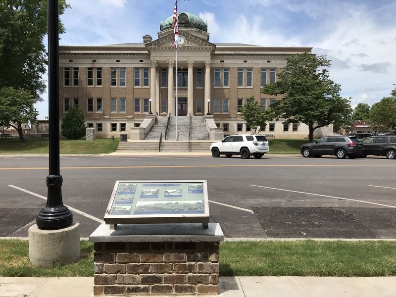
Left, top: Athens citizens celebrated the unveiling of the first Confederate monument in 1909. Due to objections to the bowed head, which suggested defeat, a second statue was ordered.
Left, center: Watermelon rinds litter the . . . — — Map (db m154206) HM
Approx. ¼ mile North is the site of Ft. Hampton, built in 1810 and named in honor of
Brig. General Wade Hampton of Revolutionary War fame. Two Companies of soldiers were
stationed here in log buildings. The purpose of the fort, and its garrison . . . — — Map (db m154231) HM
The second Confederate Monument was erected in June 1912. This view shows the intersection of Market and Marion streets.
The 4-H'ers parade their cattle on the courthouse lawn in 1959. Judges were on hand to give a blue ribbon for the best . . . — — Map (db m93881) HM
Top row, left to right:
• The Commercial Hotel, owned by George L. Sherrill in the late 1800s, adertised in 1885 that it catered to commercial travelers at $2 a day. After many years of operation by the Sherrill family, it was torn down in . . . — — Map (db m154230) HM
Shorter was originally called Cross Keys for the birthplace in South Carolina of an early settler, J.H. Howard. It was later named Shorter for former Alabama Governor John Gill Shorter. The town embodies the memories of the proud Creek Indian . . . — — Map (db m85463) HM
Rosa Louise McCauley Parks (1913 – 2005) was an iconic activist during the mid twentieth century civil rights movement. Born in Tuskegee, Parks later moved with her mother to Pine Level located near Montgomery, Alabama. She was encouraged by . . . — — Map (db m134670) HM
This building served as the garage for Moton Field's small fleet of support vehicles. It provided storage at night and "drive-through" vehicle maintenance by day. Rooms on the north side provided office space for maintenance staff and file storage . . . — — Map (db m100256) HM
C.B. "Bill" Miller, of Miller and Miller, Inc., had a positive impact in all areas of the transportation industry across the State of Alabama. He has erected bridges, railroads, parks, pedestrian walks, airports, drainage, wastewater facilities, . . . — — Map (db m54247) HM
Church Street was formerly
named Henry Street, after
Patrick Henry. He was an attorney,
an orator, and the first Governor
of the Commonwealth of Virginia.
He is most remembered for his address to the House of Burgesses in 1775, which he ended . . . — — Map (db m279910) HM
This unmarked cemetery site was discovered during the relocation of a section of Meridianville Bottom Road in July 2012. Though no marked graves are present, this might be a family graveyard associated with the early settlers of Madison County. . . . — — Map (db m154283) HM
Site of Hotel Monte Sano, built in 1887 by the North Alabama Improvement Company with the assistance of Michael and James O’Shaughnessy. The 233-room hotel opened on June 1, 1887 and served as a health resort and haven for famous visitors including . . . — — Map (db m27796) HM
Madison Street is named after James Madison, author of the first ten Amendments to the Constitution, called "The Bill of Rights." He served as the fourth President of the United States and is often called "The Father of the Constitution." — — Map (db m279905) HM
Holmes Avenue is named after David Holmes who was the fourth Governor of the Mississippi Territory and the first Governor of the state of Mississippi.
He would later represent Mississippi in the United States Senate. — — Map (db m279896) HM
Andrew Jackson returned victorious from the Battle of New Orleans along this path to Tennessee after the War of 1812. Already in use by 1812, it was improved with federal funds in 1816. The road handled foot, horse, wagon, and stagecoach traffic and . . . — — Map (db m96483) HM
Hamilton was established on November 17, 1882 and was named in honor of Capt. Albert James Hamilton. Hamilton was first known as "Toll Gate," named for a toll gate on the Jackson Military Road. The original county seat of Marion County was . . . — — Map (db m96479) HM
Side 1{Map of Early Toll Gate Area
Hamilton, Alabama
County Seat Location}
Captain Albert J. Hamilton, Judge Terrell's son-in-law, petitioned the Alabama legislature for a new county seat election. Toll Gate won the . . . — — Map (db m96793) HM
The route crossed at Ditto's Landing, passed over Brindlee Mountain into Brown's Vally, thence over Sand Mountain into Coosa Valley. This became the first wagon road in Marshall County. — — Map (db m281994) HM
Starting as an ancient Indian trail, the north–south road through Arab in 1816 was known as Bear Meat Cabin Road. By 1818, it had become an important Federal trade route through the Alabama Territory known as the St. Stephens – . . . — — Map (db m40134) HM
Built in 1878 in the Italianate style. In 1852, Bettie Hunter was born a slave in Dallas County, Alabama and later moved to Mobile after the Civil War. She and her brother, Henry Hunter, had a profitable carriage business in downtown Mobile. She . . . — — Map (db m86389) HM
Patton began his hauling business with two mules and grew to become a prominent real estate entrepreneur and contractor, building many area roads and schools. Patton purchased this site in 1900. According to oral tradition, he commissioned architect . . . — — Map (db m111313) HM
Retired from the Toulminville - To - Lafayette Street run in 1904.
Restored by W.C. Martin in 1964. Building was erected in 1969, under the administration of
Commissioners: Lambert C. Mims
Arthur R. Outlaw
Joseph N. Langan
Proj. . . . — — Map (db m172190) HM
By the turn of the 21st century, much of the grandeur of Mobile's longest
north-south roadway, Broad Street, had faded. The streetcar that once
connected the southern neighborhood of Oakdale to the city's northern
communities along Springhill and . . . — — Map (db m286249) HM
In 1811, the Mount Vernon Cantonment, located on a hill about three miles west of the Mobile River, was laid out by Col. Thomas H. Cushing. The cantonment was on the site of a spring called Mount Vernon Springs. In 1814, the garrison at Mt. Vernon . . . — — Map (db m85911) HM
When the U.S. Army built Fort Stoddert here in 1799, one could
travel by dugout canoe and flatboat on the water or by foot and
horseback on the Indian trails that crisscrossed the landscape. There
were, however, no roads wide enough for wagons or . . . — — Map (db m149307) HM
Burnt Corn, Monroe County's earliest settlement, became the crossroads of the Great Pensacola Trading Path and The Federal Road. Settler Jim Cornells returned from Pensacola in 1813, finding his home destroyed and his wife kidnapped by a Creek . . . — — Map (db m47687) HM
During the westward expansion of the United States in the early 1800’s, those whose destination was the new Mississippi Territory took a right fork off the Federal Road which led to the Alabama River ferry at Claiborne. After the land cessions of . . . — — Map (db m47638) HM
The Old Federal Road was the major highway connecting Washington,
D.C. to New Orleans from 1806 through the late 1830s. Only horse
paths existed until there was need for the US Government to
get mail, munitions and troops to New Orleans. A . . . — — Map (db m305882) HM
North of Salem Cemetery and the former church was the site of Price's Hotel, the first place to spend the night on the Federal Road after Greenville. Mr Price was also the stagecoach driver for this section between Greenville and his hotel. Mrs . . . — — Map (db m84986) HM
The second black Baptist Church in Montgomery. First pastor was Rev. C. O. Boothe. Present structure built 1885. Designed by Pelham J. Anderson; built by William Watkins, a member of the congregation.
Many prominent black citizens of Montgomery . . . — — Map (db m25128) HM
The Federal-Aid Highway Act of 1956, signed into law by President Dwight D. Eisenhower, authorized the construction of 41,000 miles of the Interstate Highway System over a ten year period - the largest public works project in American history to . . . — — Map (db m210249) HM
On multiple occasions in 1955, black women were arrested for challenging Montgomery's law requiring racial segregation on buses. The arrest of Rosa Parks sparked a mass protest that launched the modern civil rights movement and brought to prominence . . . — — Map (db m118040) HM
Side A A Lady of Courage
Born in Tuskegee, AL on February 4, 1913, to James McCauley, a carpenter, and Leona Edwards, a teacher. Moved with mother and brother to Pine Level, AL after parents' separation. Enrolled in Mrs. White's School . . . — — Map (db m36503) HM
This 2.8-mile road connecting U.S. highways 331 and 31 first appeared on Montgomery County road maps in 1928. Land for the road was deeded to Montgomery County in September 1926 by local landowners from the Teague, Bellingrath and Matthews families. . . . — — Map (db m70932) HM
This 2.8-mile road connecting U.S. highways 331 and 31 first appeared on Montgomery County road maps in 1928. Land for the road was deeded to Montgomery County in September 1926 by local landowners from the Teague, Bellingrath and Matthews families. . . . — — Map (db m99235) HM
In this house, built in 1948, Frank and Alberta Smith raised their six children.
Through their activism and participation in two landmark suits, members of the Smith family played critical roles in the Civil Rights Movement. The family attended St. . . . — — Map (db m223847) HM
Side 1
The Federal Road
The 1803 Louisiana Purchase acquired 828,000 sq. mi. for the U.S., doubling its size. The Federal Road was built to provide a shorter route from Washington to New Orleans and the new territory. The Treaty . . . — — Map (db m71535) HM
In 1860, the Memphis and Charleston Railroad was the only east-west route through the United States south of the Mason-Dixon Line. Maintaining control of this rail line was essential to Confederate strategy. Union Brigadier General Ormsby Mitchell . . . — — Map (db m28262) HM
Old Bethel Road first came into use during the mid-nineteenth century. It ran adjacent to the property deeded to George Hartselle by President Polk in 1845 and President Buchanan in 1858. The road later connected with Fletcher Ferry Road and Georgia . . . — — Map (db m217103) HM
This area's first settlers arrived in the 1830s and established the Crossroads community at the intersection of the Columbus-Tuscaloosa and Vienna-Fayette stagecoach roads, one mile northeast of Gordo's present location on Highway 82. The name . . . — — Map (db m152577) HM
In the early 1800s, south Alabama was still inhabited by many groups of Native Americans: Creek, Chickasaw, and Choctaw among others. They traveled, hunted, traded, and made war on the many ancient trails here. European settlers improved these roads . . . — — Map (db m95359) HM
Built by U.S. Army, 1824,
from Ft. Barrancas, at Pensacola
to Ft. Bainbridge, S.E. of Tuskegee.
Here it joined Federal Road leading to
Ft. Mitchell in Russell County.
Road followed Indian trade trail
Became main road . . . — — Map (db m76745) HM
Oldest route from Atlantic to Southwest. In 1805 it became Federal Road, over which pioneers traveled from Milledgeville to St. Stephens. Oglethorpe, Lafayette, Burr and others used this trail. — — Map (db m165635) HM
The Old Federal Road that opened the southeastern United States to
settlers once crossed at this location. In 1805, the United States Congress
granted funds to build a post road from Georgia to New Orleans to
cross the sparsely settled wilderness . . . — — Map (db m237220) HM
Founder of Buffalo Rock Company (1901) in Birmingham and creator of Buffalo Rock Ginger Ale, a medicinal tonic first used in the Civil War. Lee's vision and influential support inspired the construction of this road across Double Oak Mountain . . . — — Map (db m52693) HM
Hernando de Soto brought his 700-man army to Alabama, in the fall of 1540. This was the first major European expedition to the interior of the southeastern United States. The De Soto expedition had landed at Tampa Bay, Florida, in the spring of . . . — — Map (db m294530) HM
1492 — Columbus visits Caribbean islands
1519 — Pineda visits Mobile area
1528 — Narvaez reaches Mobile area
1540 — De Soto explores Alabama
1559 — De Luna retraces De Soto's route in Alabama
1702 — . . . — — Map (db m294532) HM
Here was northern terminus
of 60 miles of toll road
operated from Wetumpka.
Built of wooden boards.
Prior to railroads this was
an important artery of travel.
Chartered to connect navigable
parts of the Alabama, Coosa,
and Tennessee River. — — Map (db m288230) HM
Byler Road
Pioneer's settled path to new lands, agriculture, transport and commerce that began in Northwest Alabama.
140 mile corridor/route designated on December 19th, 1819 by the State Legislature. This was Alabama's first . . . — — Map (db m308392) HM
One half mile east is a portion of the original Byler Road. Legislation authorizing construction signed into law December 1819 by Alabama's first governor, William Wyatt Bibb. Built by John Byler, Alabama's first public road opened November 1822, . . . — — Map (db m304342) HM
In 1940, the U.S. Army put out a call to automobile manufacturers to produce a fast, lightweight, all terrain vehicle. The answer came in the form of the Willys MB. The Jeep was instrumental in World War II, the Korean War, and Vietnam.
This . . . — — Map (db m35515) HM
In the mid-1820s, founding settler Eldridge Mallard
established the Byler Toll Road central collection
booth near the artesian springs along the Byler Road,
leading to the founding of the Camp Springs
settlement. Named by General Andrew . . . — — Map (db m293278) HM
A major toll booth along the Byler Road, the Eldridge
Mallard Toll Booth was located about 2 miles north of
the present-day town of Eldridge. Eldridge's origins
date from 1822 after the Byler Road was completed,
making it older than Walker . . . — — Map (db m303061) HM
Covering the Byler Road and all of Walker County, the Mountain Eagle began as a weekly newspaper in 1872, shortly after Rev. John Anthony hired James M.
Williams to haul a printing press by wagon from Tuscaloosa to Jasper. Williams said that with . . . — — Map (db m301594) HM
Two miles north of this point was the intersection of two important postal routes of early Alabama, the Saint Stephens-Cahawba Road and the Tuskaloosa-Prairie Bluff Road. — — Map (db m38495) HM
Just south of the town of Delmar and traveling in an
easterly direction before joining U.S. Highway 278,
Yankee Trace, known now as County Road 17, crosses
over the Byler Road. As was one of the paths that
U.S. General James Harrison Wilson's . . . — — Map (db m309082) HM
Ark Post Office
Winston County
Established on November 11, 1881, the Ark Post Office
served this area along the Byler Road and operated
for less than 10 years, when the Haleysville Post
Office took over mail service on March 5, . . . — — Map (db m309085) HM
By 1821, the state finished construction on the Byler
Road through what would become Haleyville. Travelers
who used the road began settling here. The first
individual to obtain a land title in the area was
Richard McMahan, Buckie Davis and . . . — — Map (db m289185) HM
Organized two years after the Byler Road was completed, New Prospect
Baptist Church is reportedly the oldest Baptist church in Winston County
and one of the oldest in the state of Alabama. Located several yards north
of the Byler Road, New . . . — — Map (db m299717) HM
The Byler Road was Alabama's first state road. Governor W. W. Bibb signed into law a bill authorizing its construction December 16, 1819.
The turnpike was named for John Byler, its chief promoter. Byler and his associates were directed to build . . . — — Map (db m153313) HM
Bald Rock
Winston County
Located about 3,000 feet west of the Byler Road
and 3,500 feet southwest of the natural bridge,
stands Bald Rock, an outcropping of exposed rock
about 600 feet in length. Geologically, it is
part of the . . . — — Map (db m309077) HM
Byler Road
Byler Road, which passes through Natural Bridge, was
Alabama's first state road. Governor W.W. Bibb signed into law a bill authorizing its construction on December 16, 1819. The turnpike was named for John Byler, its chief . . . — — Map (db m153261) HM
By 1887, the growing number of travel options
created competition for the Byler Road. The Sheffield
and Birmingham Railroad completed a line from
Sheffield as far south as Natural Bridge.
The railroad crossed the Byler Road in several
places, . . . — — Map (db m309081) HM
Natural Bridge Park is located in the vicinity of early
historic crossings of three Native American paths. The
Mobile Trace served as the primary north-south route.
The Chickasaw Trading Path, the main east-west route,
was in use by the early . . . — — Map (db m309076) HM
Taking its name from the Pebble Post Office, Pebble
School educated generations of children who lived
along or near the Byler Road since it opened in 1906.
The first school operated in the Pearson home until
the state constructed a school . . . — — Map (db m289186) HM
The south side of Thompson Pass was the steepest part of the military trail across the mountains. Savage snowstorms could make travel through the pass difficult and dangerous. On two occasions freighters left gold unattended while they sought . . . — — Map (db m311101) HM
In the early 1900’s this wagon was used to carry passengers and freight on the 371 mile trail between Valdez and Fairbanks, todays Richardson Highway. The trip took 7 to 9 days. In winter, sleds were used. Automobiles began replacing horse drawn . . . — — Map (db m310608) HM
The U.S. Army arrived at Valdez during the Gold Rush to build a trail into the interior. They found the Valdez Glacier impassable much of the year. To bypass the glacier, they cut a narrow trail along the walls of rugged Keystone Canyon. The “Goat . . . — — Map (db m49611) HM
Miners in 1897 built the Valdez-Eagle Trail. In Klondike Gold Rush, it was used for telegraph lines to Fairbanks. 1910 upgrade, called the Valdez-Fairbanks Wagon Road, under Gen. Wiles P. Richardson, improved for wagon use in the Keystone Canyon . . . — — Map (db m257002) HM
On the far side, just above the water are the remains of the old sled trail, used in the early days. It was cut out of the rock, just wide enough for 2 horses abreast. 200 ft. above can be seen the old goat trail. This road was used till 1945. — — Map (db m49610) HM
Providing food and lodging for travellers, roadhouses are and have been essential in Alaska's transportation history. As travel to the Interior, beginning in 1900 over trails to Fairbanks and Eagle from Valdez and later from Cordova increased, . . . — — Map (db m294719) HM
The Alaska Road Commission served a multitude of purposes
including Road Work for over 50 years - starting in 1905.
Its work involved Ferries, Harbors, Canals, Flood Control,
Navigational Aids, Trails, Radio, Wireless and Telephone . . . — — Map (db m255513) HM
Our long national experience in pushing our highways ahead of the controlling wave of settlement ought to convince us that the broadest liberality towards roads in Alaska will be sure to bring
manifold returns.
President Warren . . . — — Map (db m255380) HM
When you ride the rails, you hurdle yawning canyons
and wide rivers that challenged the engineering know-how of the day.
The Hurricane Gulch bridge, one of the marvels of the line,
crosses a gorge more than 900 feet across and . . . — — Map (db m283588) HM
1915 Construction begins on the Government Railroad, later renamed the Alaska Railroad.
1917 Mount McKinley National Park is established. Enterprising pioneers have already built homesteads outside park boundaries, near . . . — — Map (db m283782) HM
As the number of ways to get to the park grew, so did the number of visitors.
If you wanted to visit the park prior to 1957, rail travel was not only a good option, it was about your only option. A few visitors arrived by chartered . . . — — Map (db m283550) HM
By the late 1960's, snowmobiling had become the fastest growing winter sport. Each year, innovations and vast improvements in performance were showcased on race tracks across the snowbelt. By 1970, production topped 500,000 units with over 100 . . . — — Map (db m257576) HM
The "Iron Dog" or Snowmobile transformed village life in the 1960's when it began to replace dog teams as the main mode of winter travel.
In the late 50's, the Polaris Company of Minnesota released the original Sno-Traveler.
Although the . . . — — Map (db m257577) HM
Thermosyphons keep the permafrost frozen
Thompson Drive crosses areas of continually frozen ground, known as permafrost. If the permafrost thaws and settling occurs, the entire roadway structure, including sidewalks, curbs and the . . . — — Map (db m256289) HM
Air convection embankments keep the air moving
The rock layers along the sides of Thompson Drive are part of a system known as an air convection embankment. This special type of roadway embankment has large rocks that allow air to . . . — — Map (db m256288) HM
The role of transportation in advancing the civilization of the north can be traced from the very first forms of river travel between settlements on Alaska's river systems. Long before the first Russian traders sailed . . . — — Map (db m257398) HM
The Alaska Highway was built in 1942 in 8 months. The Highway stretches 1422 miles from Dawson Creek, British Columbia, to Delta Junction. The Highway was built as a military necessity and followed along a line of existing airfields, winter . . . — — Map (db m257075) HM
Completed in 1942
Constructed in just 8 months in 1942, this 2,450 kilometre highway provided an essential transportation link to the northwest of North America during the Second World War, and has since remained a major . . . — — Map (db m257084) HM
“Instead of row after row of empty houses (Dawson), they are building new stores. The place is alive and busy-a little too crowded when we got there.” – a tourist in Fairbanks, 1928 — — Map (db m47406) HM
Construction of an overland route from Valdez on Prince William Sound to Eagle on the Yukon River near the Canadian border started in 1899. Events in the Tanana Valley soon necessitated a trail from Fairbanks to Valdez. Between 1905 and 1906, the . . . — — Map (db m256556) HM
Downtown Juneau has been bustling with commerce since the 1880s, well before the advent of the automobile. Hillside homes were linked by stairways and boardwalks, now named and maintained as city streets. Muddy summers and snowy winters prompted . . . — — Map (db m257955) HM
The nearby Alaskan Hotel is the oldest operating hotel in Alaska. When its front doors swung open in 1913, the keys were attached to a balloon and sent skyward, symbolizing that the doors would always be open to guests. Structures uphill from it . . . — — Map (db m257940) HM
Most Westerly Highway
Point in North America.
This point is Mile 157
Sterling Highway.
Lat.: 59° 48.1' North.
Long.: 151° 50.2' West.
1971 — — Map (db m299225) HM
At the turn of the century, Ketchikan's pioneer townsite sprouted up from the base of a rugged, uncleared rocky mountainside where it meets deep tidewater. The downtown business district was literally built upon pilings and planked decking, with . . . — — Map (db m181910) HM
Shipments of iced halibut from Ketchikan to outside markets was pioneered by F.J. Hunt and H.C. Strong, following similar successful methods with salmon, and a thriving business was built through the construction of two large cold storage . . . — — Map (db m181914) HM
The Glenn Highway is the main
connection for the people of this valley.
Can you imagine this place without it?
Nature's Highway
The Matanuska Glacier helped carve a wide path through the Chugach and
Talkeetna mountain ranges. As the . . . — — Map (db m255121) HM
The Matanuska River valley has always been a transportation corridor. Before 1900 the
Chickaloon-Knik-Nelchina Trail connected coastal Dena'ina and the interior Ahtna Hwt'aene'
(Peoples) including Nay'dini'aa Na' (Chickaloon Native Village). In . . . — — Map (db m254959) HM
Dedicated to the indomitable spirit of the
sled dogs of the Iditarod Trail Sled Dog Race.
“The Last Great Race on Earth”
Endurance • Fidelity • Intelligence
Dedicated the first Saturday of March, 2012
Historic replica of . . . — — Map (db m80411) HM
Joe Redington, Sr.
Born in Oklahoma, February 1, 1917 • Died in Alaska, June 24, 1999
Joe was an accomplished man; homesteader, big-game guide, bush pilot,
commercial fisherman, boat builder, fish-plant manager, and mountain . . . — — Map (db m80410) HM
In loving memory of
Dean H. Christopherson
1916-1992
Made possible by a generous
contribution from
Mrs. Elaine G. Christopherson
in memory of her husband
The cabin is similar to the cabin at Rohn
the eighth checkpoint on the . . . — — Map (db m80413) HM
Running down Front Street and passing this monument to the Iditarod National Historic Trail--Authorized By the US Congress 1978, the Trail begins in Seward, Alaska with Tripod Milepost #0. The trail winds its way through the heart of the . . . — — Map (db m290377) HM
460 Miles south of the Arctic Circle on Meridian Elevation 1014ft. Road built 1898 to 1900. This is one of many scenic spots enroute to Atlin and Dawson — — Map (db m283060) HM
11730 entries matched your criteria. Entries 101 through 200 are listed above. ⊲ Previous 100 — Next 100 ⊳