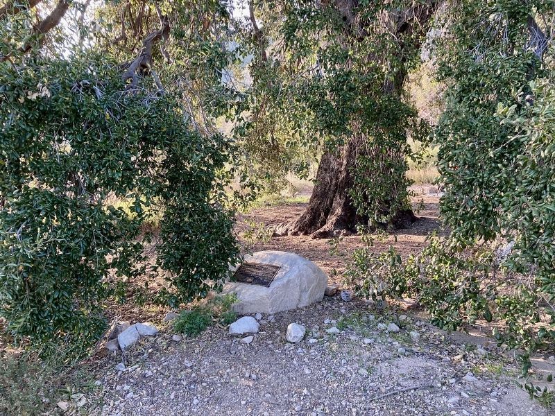
Near Dunsmore Avenue 0.5 miles north of Markridge Road, on the left when traveling north.
In recognition of the leadership of Assistant City
Manager Bob McFall to preserve this heritage oak
during the 2009 Station Fire, the Community Services
& Parks Department has designated this stately tree as
"The McFall Oak." — — Map (db m239335) HM
On Rosemont Avenue at Fairway Avenue, on the right when traveling north on Rosemont Avenue.
On this site American Legion Post 288 once stood. The great flood swept through its walls shortly after midnight on New Year’s Day, taking with it 12 local residents. Most had taken refuge inside from the torrential rain and two were dedicated Red . . . — — Map (db m143027) HM
Near Elizabeth Lake Road (County Highway N2) 0.8 miles east of Lake Hughes Road, on the right when traveling east.
The C.C.C. and the Forest Service
The Civilian Conservation Corps was established by President
F.D. Roosevelt in 1933 to maintain public lands and provide
jobs during the Great Depression. The CCC were active in fire
prevention . . . — — Map (db m264035) HM
In remembrance of those who lost their lives in the St. Francis Dam disaster March 12-13, 1928. This was one of California’s greatest disasters with over 400 lives lost; five of whom were laid to rest at Lancaster Cemetery. — — Map (db m143730) HM
On Los Feliz Place at Seneca Avenue, on the left when traveling east on Los Feliz Place.
In remembrance of those who perished on January 26, 2005, when their trains were derailed, and in gratitude to the heroes of that day who helped so many others, the Atwater Village Neighborhood Council, on behalf of the City of Los Angeles, . . . — — Map (db m287502)
Near Alameda Street just north of U.S. 101, on the right when traveling north.
On June 24, 1971, an explosion and fire took the lives of seventeen construction workers building a tunnel in Sylmar, California. The tunnel was being built for the Metropolitan Water District of Southern California by the Lockheed Shipbuilding . . . — — Map (db m126024) HM
In the early years of the Great Depression, Los Angeles battled joblessness by borrowing money through the Reconstruction Finance
Corporation. A local bond measure was passed to fund relief programs. Griffith Park, large and rustic, was made to . . . — — Map (db m222321) HM
On Onizuka Street south of 1st Street, in the median.
Colonel (USAF) Ellison Shoji Onizuka
Astronaut/National Aeronautics and Space Administration, June 24, 1946 — January 28, 1986.
Colonel Onizuka was the first Japanese American astronaut selected to
participate in America's Space . . . — — Map (db m183925) HM
On Audie Murphy Drive just north of George S. Patton Jr Drive, on the right when traveling north.
May 19, 1995, 9:02 A.M.
In honor of Victims and Survivors
of the bombing of the Oklahoma City Federal Building,
April 19, 1995, 9:02 A.M. — — Map (db m163222) HM
On Lankershim Boulevard at Weddington Street, on the right when traveling north on Lankershim Boulevard.
In Memory of Apparatus Operator Thomas G. Taylor
Fire Station 60
Los Angeles Fire Department
Thomas Taylor lost his life here while bravely battling a structure fire on January 28, 1981. He is greatly missed by his family, . . . — — Map (db m262534) HM
Near Victory Boulevard 0.2 miles west of Coldwater Canyon Avenue, on the right when traveling west.
Following Spanish and Mexican rule, Ex Rancho Mission de San Fernando, the land today known
as the San Fernando Valley, was sold by Governor Pio Pico to Don Eugolio de Celis for $14,000. After California
Statehood in 1849, the subdivision of . . . — — Map (db m202497) HM
Near Lindley Avenue north of Nordhoff Street, on the left when traveling north.
On January 17, 1994, Los Angeles and the surrounding region experienced a 6.7 magnitude earthquake centered in Northridge. To commemorate the rebuilding of the region and CSUN, we created the sculpture garden incorporating remnants of the . . . — — Map (db m155780) HM
Near Figueroa Street south of Exposition Boulevard, on the right when traveling south.
On Saturday night, October 29, 1960, a plane carrying the California State
Polytechnic College of San Luis Obispo 1960 football team, which was
returning from a football game with Bowling Green State University,
Bowling Green, Ohio, crashed at . . . — — Map (db m238461) HM
This tablet presented February 9, 1979, to the Veterans Memorial Park, in loving memory of the many veterans, nurses, and aides of the San Fernando Valley Veterans Hospital, whose lives were lost during the earthquake of February 9, 1971. — — Map (db m150941) HM
Near Hubbard Street 0.8 miles north of Interstate 210, on the right when traveling north.
This park and memorial stand as a tribute to the young men who lost their lives on the Loop Fire, to those who survived, and to firefighters everywhere.
On November 1, 1966, the El Cariso Hot Shots, a USDA Forest Service Interregional . . . — — Map (db m79155) HM
Near Glenoaks Boulevard north of Foothill Boulevard.
On November 14, 2008, the Sayre (or Sylmar) Fire, a wind-driven fire, quickly moved through the hillside brush into residential areas above the 210 freeway and west of the 5 freeway. The fire was contained on November 20, 2008 after burning . . . — — Map (db m128526) HM
The tiles surrounding the entry door and on the planters in the courtyard are examples produced by Malibu Potteries. The company had been established in 1926 by Mrs. Adamson's mother, May K. Rindge.
The 1920's was the golden age of tile making . . . — — Map (db m237683) HM
On State Highway 14 2.4 miles north of Angeles Forest Highway, on the right when traveling north.
One of the most outstanding geological features in California, extending for over 650 miles from Point Arena, north of San Francisco, to south of San Gorgonio Pass, between twenty and thirty miles deep and more than a mile wide in some . . . — — Map (db m149749) HM
On Altadena Drive 0.1 miles north of New York Drive, on the right when traveling north.
Why is Eaton Canyon Closed?
Safety First
In January 2025, the Eaton Fire swept through the canyon, followed by dangerous debris flows in February and
March. These forces dramatically altered the terrain, creating uneven . . . — — Map (db m274002) HM
Near San Francisquito Canyon Road just north of San Francisquito Motorway, on the right when traveling north.
Tataviam Native Americans
The Tataviam - a name applied to the people occupying this
region by other tribal groups, and varying in meaning from
"people facing the sun" to "people of the south facing slope"
- lived in . . . — — Map (db m285463) HM
Near San Francisquito Canyon Road just north of San Francisquito Motorway, on the right when traveling north.
Problems With Design
Too Tall
Final design was 20 ft higher than the
original plan, without increasing the base
width to support the additional height.
Hydraulic Uplift
The design did not . . . — — Map (db m285494) HM
Near San Francisquito Canyon Road just north of San Francisquito Motorway, on the right when traveling north.
Geology That Contributed to the Failure
Landslides of the eastern abutment, oversaturated
sandstone and conglomerate of the western abutment,
and an active thrust fault under the footing contributed
to the failure. The Sespe . . . — — Map (db m285501) HM
Near San Francisquito Canyon Road just north of San Francisquito Motorway, on the right when traveling north.
Hello Girls
Telephone operators such as Louise Gipe in Santa
Paula and Reicel Jones in Saticoy - subsequently
nicknamed the "Hello Girls" - bravely stayed at
their posts after being notified of the flood headed
their way. They . . . — — Map (db m285495) HM
On San Francisquito Canyon Road 4.9 miles north of Copper Hill Drive, on the left when traveling north.
San Francisquito Canyon is located within the Angeles National Forest. The canyon is characterized by unique geology, a perennial creek that hosts sensitive plant and animal species, and vital water infrastructure.
The Los Angeles . . . — — Map (db m264073) HM
Near San Francisquito Canyon Road 9 miles north of Copper Hill Road, on the right when traveling north.
The St. Francis Dam, part of the
Los Angeles Aqueduct system,
stood 1½ miles north of this site.
On March 12, 1928, the 185-foot high
concrete dam collapsed just
before midnight, sending 12⅓ billion
gallons of water roaring down . . . — — Map (db m146564) HM
Near San Francisquito Canyon Road just north of San Francisquito Motorway, on the right when traveling north. Reported missing.
On this site in August of 1924 construction started on the St. Francis Dam, a unit of the Los Angeles Aqueduct. When it was completed in May of 1926, this concrete dam stood 185 feet above the stream bed, impounding a 610 surface-acre lake.
. . . — — Map (db m143721) HM
On San Francisquito Canyon Road 9 miles north of Copper Hill Road, on the right when traveling north.
The 185-foot concrete St. Francis Dam, part of the Los Angeles aqueduct system, stood 1½ miles north of this site. On March 12, 1928, the 185-foot high concrete dam collapsed just before midnight, sending 12½ billion gallons of water roaring down . . . — — Map (db m143722) HM
Near San Francisquito Canyon Road just north of San Francisquito Motorway, on the right when traveling north.
Policy Changes
In response to the failure of the St. Francis Dam,
the California Department of Water Resources
Division of Safety of Dams was established on
August 14, 1929, by the State Legislature. The
division was . . . — — Map (db m285496) HM
Near San Francisquito Canyon Road just north of San Francisquito Motorway, on the right when traveling north.
Tony Harnischfeger
Tony was the dam keeper who frantically called
Mulholland earlier that day worried about the
muddy water coming from the dam. It is believed
that his girlfriend Leona, his 6-year old son Coder,
and
he, were . . . — — Map (db m285498) HM
Near San Francisquito Canyon Road just north of San Francisquito Motorway, on the right when traveling north.
What Were the Water Wars?
The California Water Wars were a series of political conflicts that took place in the
late 19th and early 20th centuries in Owens Valley. These conflicts centered around
Los Angeles' expanding population . . . — — Map (db m285492) HM
On Temple Avenue, on the right when traveling north.
Dedicated to the victims of September 11, 2001, including those who lost their lives and those who lost their loved ones. This monument is a symbol of our nation’s renewed strength and unity, blending five operate metals (stainless steel, brass, . . . — — Map (db m100534) HM
On Panorama Drive, on the right when traveling west.
High concentrations of natural gas posed a constant danger to oilmen developing the Signal Hill field in the form of “gassers,” “gushers,” gas flares and fires. When Shell Oil completed its second well in 1921. It was a “gasser” that blew out and . . . — — Map (db m100454) HM
On Chimney Rock Road near Sir Francis Drake Boulevard, on the left when traveling east.
Since 1889, United States Life-Saving Service and Coast Guard crews have risked their lives to save shipwreck victims at Point Reyes. Brave crews of highly trained men struggled in some of the worst conditions in North America, sacrificing comfort, . . . — — Map (db m102689) HM
Near Chimney Rock Road near Sir Francis Drake Boulevard, on the left when traveling east.
The heyday of life-saving at Point Reyes is over, but this 1927 lifeboat station still stands alive with a history nearly lost along our coast. While the station preserves the last intact marine railway on the Pacific Coast, the history of ordinary . . . — — Map (db m102690) HM
On Chimney Rock Road near Sir Francis Drake Boulevard, on the left when traveling east.
No one knows how many cries for help went unanswered along this isolated coast. If shipwreck victims were not overcome by pounding surf, they would perish in a cold sea. But once the Life-Saving Station was established in 1889, victims of the coast . . . — — Map (db m102676) HM
On San Anselmo Avenue, on the right when traveling south.
San Anselmo has a long history of flooding.
This line is the high water mark from 2005.
For more information visit the Town of San
Anselmo website by scanning the QR code below. — — Map (db m189464) HM
On San Anselmo Avenue, on the right when traveling south.
San Anselmo has a long history of flooding. This line is the high water mark from 2005. For more information visit the Town of San Anselmo website by scanning the QR code below. — — Map (db m197253) HM
On San Anselmo Avenue near Pine Street, on the right when traveling south.
San Anselmo has a long history of flooding. This line is the high water mark from 2005. For more information visit the Town of San Anselmo website by scanning the QR code below. — — Map (db m197256) HM
On San Anselmo Avenue near Pine Street, on the right when traveling south.
San Anselmo has a long history of flooding. This line is the high water mark from 1982. For more information visit the Town of San Anselmo website by scanning the QR code below. — — Map (db m197259) HM
On Francisco Boulevard East at Main Street, on the right when traveling north on Francisco Boulevard East.
History
The Richmond-San Rafael Bridge opened to traffic in 1956, following 2 years of planning and design and 4 years of construction. At the time, its 4.5 mile-length and double-decker design made it one of the most complex bridges in the . . . — — Map (db m223322) HM
The Coulterville Main Street Historical District includes 25 structures, including this one story building built circa 1860. This building's stone and brick walls survived the 1879 and 1899 fires that destroyed Coulterville.
Using the walls, . . . — — Map (db m301071) HM
This structure was built around 1860. After a fire, it was reconstructed in 1890. At this time, the building was owned by Tom Hollow and housed a blacksmith’s shop. The upper level was added around 1900 and eventually the building became a bar and . . . — — Map (db m301074) HM
On California Route 140 north of 5th Street, on the left when traveling north.
The fire of 1866 destroyed most of this block. When rebuilding the Bogan and Company store to your left and the hotel to your right, the space in between them remained an alley leading to Mariposa Soda Works.
In 1935, Emile Trabucco built a . . . — — Map (db m301004) HM
On Central Yosemite Highway (California Route 140), on the right when traveling south.
Rebuilt of brick in 1867, one year after the devastating Mariposa fire, Joseph H. Miller's Capital Saloon also saw duty as the Mariposa Post Office. Miller served as Postmaster until his death in 1887. Daughter-in-law Lucy Miller severed as . . . — — Map (db m192088) HM
Near California 140 (California Route 140) at 6th Street, on the left when traveling north.
This was the site of the Gishel Hotel and Bakery until the fire of 1866. Later, John Fritz built both a home and butcher shop that were destroyed in the Gallison Hotel fire of 1887. In 1892, Emily and W. S. Zeller bought the property and built their . . . — — Map (db m301092) HM
On Central Yosemite Highway (California Route 49/140) south of 6th Street, on the right when traveling south.
Charles Hertel purchased this property from J.C. Fremont in 1859. The original building burned down in 1866 and was replaced with a fireproof brick structure that has a sod roof. The brick is now covered with plaster. It operated under various . . . — — Map (db m301100) HM
On California Route 140 north of 5th Street, on the right when traveling north.
In 1860 the Mariposa Restaurant was built and owned by I. Cavasso & Co. and specialized in French and Italian cuisine. The owner lived in a house in the back.
The restaurant and home, which changed owners frequently, were destroyed by the fire . . . — — Map (db m301088) HM
On California 140, on the left when traveling north.
This site has housed many businesses as several fires have ravaged this building that was originally constructed as fireproof. The last fire, in 2012, completely burned this block from Highway 49 to Mariposa Creek.
The first business here was . . . — — Map (db m299241) HM
On State Highway 140 (California Route 140) at 5th Street, on the right when traveling north on State Highway 140.
In 1857 Pierre Van Bever purchased the lot on this corner and constructed a large brick building. This became the Challenge Saloon. In 1866 the building, like many others in Mariposa, was destroyed by fire. It lay in ruin for years.
With the . . . — — Map (db m301080) HM
On Tioga Road (California Route 120), on the right when traveling east.
The Tioga Road, one of the few roads that crosses the Sierra Nevada, reaches the highest point of any at Tioga Pass (9,945ft, 3km). It provides a gateway to the park, wilderness, and high country. The long winters and rigorous road-opening . . . — — Map (db m192086) HM
Near Lighthouse Road near Point Cabrillo Drive, on the left when traveling north.
Our Captain's voice boomed above the roar of the surf. "Heave about! Turn the ship!"
With a mighty jolt a rock took our rudder and punched a hole in her hull. The Frolic was sinking and none of us knew how to swim! Captain Faucon, bless . . . — — Map (db m96476) HM
Ladd Construction Co. Plane Crash Site
9:03 AM November 6, 2007
In memory of our crew
Mark William Christopher
May 8, 1949
November 6, 2007
Tom Daniel Capener
September 17, 1965
November 6, 2007
Bruce George Mandville . . . — — Map (db m189614) HM
On Mill Creek Powerhouse Road at Highway 395 on Mill Creek Powerhouse Road.
Not far from this site, in the early morning hours of March 7, 1911, a massive avalanche roared down the east slope of Copper Mountain and wiped out the town of Jordan. Eight people were killed including Robert Mason, the chief engineer of the power . . . — — Map (db m50074) HM
On California Route 395 north of the town of Walker, on the right when traveling north.
In loving and grateful memory of the C-130 crew - Steve Wass, Craig Labare and Mike Davis - who gave their lives to save our community on June 17, 2002. — — Map (db m23036) HM
On 17 Mile Drive west of Old 17 Mile Drive, on the right when traveling south.
Early mariners mistook Point Joe as the entrance to Monterey Bay, making it the site of many shipwrecks. In the early 1900s, a man named Joe lived in a driftwood hut here, selling trinkets to tourists and tending goats. It is debated whether Joe . . . — — Map (db m296617) HM
In 1904 the Coalinga Oil Transportation Company laid 168 miles of six-inch pipeline from the Belridge Field in San Joaquin Valley to the Tidewater-Associated Marine Terminal on Monterey Bay (top). Its purpose was to deliver heavy fuel oil for use in . . . — — Map (db m55215) HM
Recurring winter storms wreaked havoc on the Monterey fishing fleet every few years (top). On April 29, 1915, such a storm, with 60-mile-per-hour winds, destroyed or damaged nearly 50 boats. On Thanksgiving morning 1919, more than 93 vessels were . . . — — Map (db m55214) HM
On Parkfield-Coalinga Road, on the left when traveling south.
This rift extends from El Centro on the south, 650 miles northwesternly the length of California to Point Arenas, where it continues seaward. The most publicized of California's geologic faults, it is the source of dozens of . . . — — Map (db m262945) HM
Dense fog, dark night, jagged rocks and bounding surf have always made navigating these waters difficult. On a foggy night in 1896, the iron-hulled St. Paul slammed in the submerged rocks. The crew and livestock cargo were rescued . . . — — Map (db m92509) HM
The Donner family and their hired teamsters left Springfield, Illinois in April, 1846. At Independence, Missouri, their wagons joined hundreds of others traveling west on the Oregon-California Trail.
The New Captain Takes a Shortcut . . . — — Map (db m129925) HM
Near State Highway 89 3.5 miles north of Interstate 80, on the right when traveling north.
On October 28, 1846 the six covered wagons brought west by George and Jacob Donner and their families halted here for repairs. By March of 1847 one half of the party of 22 adults and children had died of starvation and cold. They came west seeking a . . . — — Map (db m60507) HM
Near this spot stood the tree which marked what was believed to be the campsite of the family of George Donner in the winter of 1846. The tree stood for 150 years (missing) the Donner families camped in Alder Creek before it succumbed to Mother . . . — — Map (db m129928) HM
On Donner Pass Road at South Shore Road, on the right when traveling west on Donner Pass Road.
History
The Donner Lake area is not only an exciting place to live and adventure, but also has lots of interesting history. The story of the Donner Party crossing over this amazing and majestic mountain range (1847) has spread through the . . . — — Map (db m129736) HM
Near State Highway 89 3.5 miles north of Interstate 80, on the right when traveling north.
Donner Party Camp at Alder Creek Valley
In the Fall of 1846, 25 Members of The Donner Party became Trapped by an Early Snowstorm here at Alder Creek Valley. The George and Jacob Donner Families, their Teamsters, and Fellow Travelers Suffered . . . — — Map (db m60303) HM
With threatening weather overhead, the Donners quickly set up camp. Crowded into inadequate shelters, these desperate people watched it snow.
As the snow got deeper, it wiped out all hope of leaving before spring.
People (age) at . . . — — Map (db m129927) HM
Near State Highway 89 0.6 miles north of Alder Creek Road, on the right when traveling north.
In February, 1847, the first relief party from Sutter's Fort arrived. Two more relief parties came in March. These relief parties took 14 people from here out across the frozen Sierra. Only 11 survived (8 were children). Five people remained at . . . — — Map (db m146235) HM
Near State Highway 89 0.6 miles north of Alder Creek Road, on the right when traveling north.
By December 20th, the outlook was grim. Jacob Donner and three of the teamsters had died. The cold and dampness were constant. As snow piled higher, dry fire wood was harder to find.
Tall tree stumps were once numerous throughout this area. They . . . — — Map (db m146234) HM
They were the first to take wagons through the new Hastings Cutoff. Although shorter, it was a difficult detour through rugged mountains and arid deserts. The emigrants lost valuable time, oxen, and supplies. One person was banished. Five people . . . — — Map (db m129926) HM
The pioneers began their trek across the continent with expectations of a new life. In sparsely populated California they could have land with fertile soil and a pleasant climate.
They heard about the wonders of California through letters sent . . . — — Map (db m129946) HM
This Police Memorial is dedicated to the Cypress Police Officers who gave their lives in the line of duty protecting the citizens of Cypress, May their memory and sacrifice never be forgotten.
Sergeant Donald J. Sowma
April 14, 1932 - . . . — — Map (db m195337) HM WM
On June 27, 1943,
near this site, a
P-38 fighter plane
on a training
mission from March
Air Force Base
crashed on the beach,
killing four children
and injuring dozens
of others.
With this marker we pay tribute to both the Silva and . . . — — Map (db m215822) HM
With reverence and humility
the City of Mission Viejo
remembers the victims
and honors the heroes
of the September 11, 2001,
terrorist attacks
on the World Trade Center,
the Pentagon, and
United Airlines Flight 93. — — Map (db m215657) HM
On Pacific Coast Highway 0.3 miles north of Tustin Avenue, on the right when traveling north.
The Santa Ana River once made an estuary along Mariner's Mile. The 1916 flood prompted efforts since to confine the river to its concrete bed on the border with Huntington Beach. A 1920 county bond issue enhanced the dredging of the bay to establish . . . — — Map (db m81924) HM
The 3-story flour and feed mill established by
Thomas Dillin and his sons began operation
Nov. 1, 1882. Its motive power was derived
from a turbine turned by Santa Ana River
irrigation water flowing down to the valley
below. On Sept 29, 1889, . . . — — Map (db m230936) HM
On El Camino Real just north of Acjachema Street, on the right when traveling north.
The site before you and the surrounding areas have been utilized by the Juaneno Indians (Original inhabitants of the Capistrano Valley). Mission San Juan Capistrano, and residents of this community in a variety of capacities over the years. . . . — — Map (db m188549) HM
This portrait by artist Nancy Fontaine dedicated in August 1985 of the "7" not forgotten American hostages in Lebanon stands as a reminder that Americans in Westminster and in the United States will not forget — — Map (db m196429) WM
The redwood trees along this path are dedicated in memory of the seven Challenger Crew Members
who lost their lives in the Space Shuttle accident which occurred on January 28, 1986.
Dedicated January 28. 1987
Gregory B. Jarvis •
Sharon . . . — — Map (db m195651) HM
May 1893: Another block fire raged on Rocklin’s Front Street; 25 businesses were destroyed and chambermaid Alice Irish lost her life. In that same year, the City of Rocklin was incorporated. Foremost on the new city’s agenda was the need for fire . . . — — Map (db m239929) HM
This monument is dedicated to all
airtanker pilots who have lost their
lives while protecting federal, state,
and private lands of the United States
of America, and in particular to the
flight crew of Airtanker 82 who gave
their lives in . . . — — Map (db m257953) HM
On Ortega Highway 5.2 miles west of Grand Avenue, on the left when traveling west.
California Wildland Firefighters Memorial
Each year thousands of wildfires are fought in
California. Each year, hundreds of firefighters are
injured protecting public and private property, and
natural resources from destruction. . . . — — Map (db m314420) HM
In the Spring of 1905, the Colorado River, swollen by heavy rainfall and snow-melt, surged into an irrigation canal east of where you are standing. The great "red bull" as settler called the river, overflowed the canals banks and spilled into the . . . — — Map (db m210761) HM
On Center Street west of Orange Street, on the right when traveling west.
Within the building on this site stand the remaining walls of the Trujillo Adobe. The adobe was the center of La Placita de Los Trujillos, a village founded here in the 1860s. Many generations of the Trujillo family lived in the adobe. La Placita . . . — — Map (db m143382) HM
On Mission Inn Avenue, on the right when traveling west.
Built in the Richardsonian Romanesque style from a design by architect A.C. Willard, this building was remodeled in 1918 to resemble more closely the Mission Revival architecture of neighboring buildings. Originally the home of City Hall, the . . . — — Map (db m226121) HM
Near Kim Wilcox Drive West near University Avenue, on the right when traveling north.
Philip Brett (1937-2002) was a musician, musicologist, and distinguished professor in the Music department at UC Riverside from 1991 to 2001. A renowned authority on William Byrd and the English Renaissance, he was also instrumental in creating . . . — — Map (db m299258) HM
On October 12, 1865 the town of Rio Vista gained brief national attention
when Sacramento's newest and most luxurious river steamboat,
Yosemite, burst a boiler in her starboard side. Yosemite was bound
down river for San Francisco . . . — — Map (db m185611) HM
"Barge Burnt - On Friday afternoon last, the barge Monitor,
bound for Sacramento, was burnt and sunk two miles
below Rio Vista. This barge was built of the hull of the
steamer Monitor, the machinery having been removed and
the hulk . . . — — Map (db m185610) HM
On 16th Street at Capitol Avenue, on the left when traveling north on 16th Street.
This Restorative Art Exhibit is Dedicated in Honor of Jack McGarey, Who Tragically Lost His Life in the Performance of His Duties on May 22, 2020, at the East End Complex. Family, Friends & Coworkers Honor Jack, Whose Dedication to . . . — — Map (db m266277) HM
Near K Street at Interstate 5, on the right when traveling east.
A stock market panic in 1893 threw many out of work and created hard times. Labor strikes became increasingly aggressive until a strike of the Pullman Factory near Chicago in 1894 resulted in a nation-wide railroad boycott. Railroad workers in . . . — — Map (db m229897) HM
Near K Street at Interstate 5, on the right when traveling east.
Floods, fires, and disease tested Sacramento’s resolve to survive. Floods were nearly an annual event and sometimes occurred several times in a winter season. City residents responded by building increasingly larger levees. Meanwhile, two fires in . . . — — Map (db m229814) HM
Near K Street at Interstate 5, on the right when traveling east.
Floods, like fires, required extraordinary solutions. The City of Sacramento had been building levees with limited success since 1849. After a devastating flood in 1862, the community mobilized a massive effort to raise the central City as much as . . . — — Map (db m229815) HM
"Believe with the heart of a child;
find courage, comfort, and strength there."
- Kerri Francis McCluskey, Kristi's Twin Sister
In loving memory of the children
Kristin "Kristi” Dawn Francis ·
Elaine June Jugum · . . . — — Map (db m162348) HM
In Celebration of the
U.S.Geological Survey's Centennial
1879 - 1979
Dedicated July 4, 1979
by
SAN JUAN BAUTISTA CHAMBER OF COMMERCE
In Cooperation With
Old Mission San Juan Bautista-Diocese of . . . — — Map (db m15340) HM
During the years 1930 and 1931 the Department of Defense built a network of emergency airfields for use by commercial aviation. During WWII the government converted many of them to military use.
This is the location of Bagdad Auxiliary . . . — — Map (db m241176) HM
On Park Boulevard, on the right when traveling south.
The sky filled with smoke, roads and trails were closed,
and some campgrounds had to be evacuated. - Ernest Quintana, Joshua Tree National Park superintendent, 1999
No one predicted it, and no one would have guessed its . . . — — Map (db m290104) HM
On Keller Peak Road 5.5 miles south of Highway 18.
This plaque is dedicated to
the brave men and women who have served
in the armed forces of
the United States of America,
especially:
1. 2d Lt Frank A. Kobal
2. 2d Lt Joseph B. Maloney
3. Tsgt Waldo C. Jensen
4. Sgt Roger F. . . . — — Map (db m277300) WM
On Buena Vista Drive just west of Adobe Road, on the left when traveling west.
Originating in 49 Palms Canyon in the mountains above 29 Palms during desert thunderstorms, flash floods would race down the canyon, onto the highway and through the downtown area, flooding businesses and residences. The Flood Control Channel, . . . — — Map (db m165755) HM
4217 entries matched your criteria. Entries 201 through 300 are listed above. ⊲ Previous 100 — Next 100 ⊳