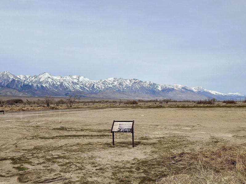
Here at Manzanar's main baseball field,
thousands of fans gathered for epic match-ups
between the Scorpions, Padres, Has Beens, and
other teams in the camp's 12 leagues. Baseball
was a powerful symbol of an American way of
life that boosted . . . — — Map (db m243190) HM
Explore its Layers of History
Throughout human history, water drew people to this arid
land in the shadow of Mt. Williamson.
It is complex history - from the 1860s battles between
Paiutes and the US Army to the . . . — — Map (db m272836) HM
In Spring 1942, the U.S. Government transformed the
landscape southwest of here from an abandoned town to
a "city" where it would forcibly confine more than
11,000 Japanese Americans. The abundance and quality
of water was critical.
. . . — — Map (db m273406) HM
The first dinner served at Manzanar, to 84
people on March 21, 1942, consisted of
canned Army rations. The incarcerated Japanese
American cooks slept in an unfinished mess hall,
next to Manzanar's only operating stove. By the
end of April, . . . — — Map (db m304750) HM
Original plans for Manzanar did
not include ironing rooms. But as
Togo Tanaka reported in June
1942, people ironing in their
barracks "blew out fuses and
plunged the rest of the entire
barrack into darkness."
The War Relocation . . . — — Map (db m304754) HM
Life at Manzanar was uncertain, but the prospect of dying behind barbed wire, far from home, may have been unthinkable. On May 16, 1943, Matsunosuke Murakami, 62, became the first of 150 men, women, and children to die in camp. He and 14 others, . . . — — Map (db m70534) WM
Before you is a survivor, a remnant orchard from a
time when hundreds of apple, pear, and peach
orchards occupied the Manzanar landscape. Since
farmer Romeo Wilder planted these pear trees
about 1918, they have thrived in years of . . . — — Map (db m299796) HM
Perhaps no other event in the history of
Manzanar has evoked more emotion,
produced more rumors, or inspired more
debate than the fatal confrontation
between US Army Military Police and
incarcerated Japanese Americans at this
site on the . . . — — Map (db m300573) HM
Near Manzanar Reward Road west of U.S. 395 when traveling west.
Before the war, judo dojo (studios) thrived in many
Japanese American communities. Under the guidance of
Seigoro Murakami and Shigeo Tashima, 400 judo students
practiced here on a 40' by 60' canvas-covered sawdust
platform. Judo's demanding . . . — — Map (db m300244) HM
Here in an old pear orchard, 101 American-born
children ranging from newborns to 18 year olds lived in
the Children's Village, the only orphanage in any war
relocation center. Living in three specially-built
barracks and nurtured by a . . . — — Map (db m299805) HM
You are standing before San-shi-en, or 3-4
Garden. Water once flowed over these silent
stones, soothing troubled spirits and easing
the monotony of long mealtime lines.
Designed and built by internees, mess hall
gardens served as a source . . . — — Map (db m288410) HM
"We have problems to combat here which are new to us.
We don't know these hot dry winds. There were no
rabbits to plague us... Everything is so different and we
have to do much experimenting."
-John Fukasawa,
a Manzanar farm . . . — — Map (db m288411) HM
America went to work for the war effort in 1942, and Manzanar was no exception. More than 500 young Japanese Americans wove camouflage nets here for the U.S. Army. Since citizenship was a job requirement, most saw weaving nets as a chance to . . . — — Map (db m70551) HM
The Chinese community was an early and significant element of the population of Kern County.
Chinese immigrants contributed to the social, economic and industrial growth of Kern County by mining, farming, building railroads, and owning . . . — — Map (db m25318) HM
On East F Street, on the right when traveling east.
Avelino Martinez was of Mexican, Indian and Chinese descent, four feet-four inches tall and thirteen years of age when he came with a group of drovers to the United States from Sonora, Mexico, searching for his father. He worked as a groom for . . . — — Map (db m52918) HM
Near Huntington Drive west of Baldwin Avenue, on the left when traveling west.
Early in 1942 the US government designated Santa Anita Park for special usage during the war years.
Pursuant to Executive Order 9066 signed by President Franklin D. Roosevelt, from March 30, 1942 until October 27, 1942 the facility was used as . . . — — Map (db m165491) HM
In Memory of more than 200,000 Asian and Dutch women who were removed from their homes in Korea, China, Taiwan, Japan, the Philippines, Thailand, Vietnam, Malaysia, East Timor, and Indonesia, to be coerced into sexual slavery by the Imperial Armed . . . — — Map (db m138945) HM WM
This plaque was dedicated on the 50th Anniversary of the establishment of the Long Beach-Yokkaichi Sister City Association to honor the citizens of both cities who are dedicated to each through personal diplomacy. November 8, 2013
Bob . . . — — Map (db m73101) HM
The President of the United States of America, authorized by Act of Congress, March 3, 1863, has awarded in the name of The Congress the Medal of Honor to Private First Class Kiyoshi K. Muranaga, United States Army, for conspicuous gallantry and . . . — — Map (db m291402) HM
On Fickett Street at 1st Street, on the right when traveling south on Fickett Street.
Immigrant Japanese doctors prevailed in 1928 U.S. Supreme Court case.
Cultural Heritage Commission
Cultural Monument No. 1131.
City of Los Angeles — — Map (db m230009) HM
On 1st Street just east of Mathews Street, on the right when traveling east.
aka Otemo Sushi Cafe.
Established 1956
in Boyle Heights.
Oldest continuously operating
Japanese restaurant in the
City of Los Angeles.
Japanese characters:
Mr/Miss Otomi — — Map (db m223360) HM
Near Broadway north of College Street, on the left when traveling north.
The Bruce Lee Statue Project is a community initiative aimed at
celebrating the life and legacy of Bruce Lee through the placement of a
statue in Los Angeles Chinatown. Bruce Lee's contributions to martial
arts and action films were truly . . . — — Map (db m219261) HM
On Yale Street south of College Street, on the left when traveling south.
Old School
Castelar School is the second oldest school in the Los Angeles Unified School District, the first to hire a Chinese-American principal, and has taught the largest number of refugee children in the city. Castelar was . . . — — Map (db m219344) HM
On Broadway at Alpine Street, on the right when traveling south on Broadway.
Population Explosion
Although official immigration quotas had
been limited to just 105 annually after the
Exclusion Acts were overturned in 1943,
many immigrants entered the country
through the 1945 War Brides Act and . . . — — Map (db m229254) HM
On Broadway north of College Street, on the left when traveling north.
Chinatown Redefined
In 1933, when Old Chinatown was torn
down to make way for the construc
tion of Union Station, everyone began
to think about what form a new Chinese
community might take. Peter Soo Hoo,
the first Chinese hired . . . — — Map (db m219859) HM
On Bernard Street west of Broadway, on the right when traveling west.
Victorian Remains
The houses at 411 and 415 Bernard Street — today home to the Chinese Historical Society of Southern California and Chinatown Heritage and Visitors Center — were once part of a three-home complex built by Philip . . . — — Map (db m219848) HM
On Los Angeles Street north of U.S. 101, on the right when traveling south.
Due to cultural needs and social discrimination, Chinese Americans formed distinct communities
in Los Angeles. They established their first Los Angeles community on the east side of what is
today's El Pueblo de Los Angeles Historical Monument. . . . — — Map (db m229242) HM
On Los Angeles Street north of U.S. 101, on the right when traveling south.
Chinese immigrants established their first community in Los Angeles in what is now part of El Pueblo de Los Angeles Historical Monument. By 1870 about two hundred Chinese had settled in
Los Angeles Street across from the Garnier Building, then . . . — — Map (db m140033) HM
On Broadway north of Ord Street, on the left when traveling north.
Dragons On Parade
Nothing in Western culture compares to the celebration of Chinese
New Year, which is why each
year 50,000 spectators gather
along North Broadway to
join in the festivities and
watch the Golden Dragon
Parade. . . . — — Map (db m219839) HM
On Los Angeles Street north of U.S. 101, on the right when traveling south.
Philippe Garnier, a settler from Gap, France, hired Abraham Edelman to design this brick and sandstone building for Chinese tenants. This was the oldest and most significant building of the original Chinatown of Los Angeles which was located here. . . . — — Map (db m155778) HM
On Broadway north of Ord Street, on the right when traveling north.
The Sepulveda House
The family that owns the
building at 706 North Broadway can trace its roots in
Los Angeles back to July
31, 1847, when the Ayuntamiento (Common Council)
deeded a piece of property bordered by what was
then . . . — — Map (db m229753) HM
On Spring Street at Ord Street, on the right when traveling south on Spring Street.
"Chinese Movie Land"
China City — bordered by Ord, Spring,
and Main streets — pandered unabashedly to Chinese stereotypes. The entire
block was enclosed within a miniature
"Great Wall." Tourists rode rickshaws
down the "Passage . . . — — Map (db m229918) HM
Near Broadway north of College Street, on the left when traveling north.
Sun Mun Way was named in honor
of Dr. Sun Yat-Sen. Dr. Sun was a
revolutionary and the ideological
father of modern China. He became
the first President of the
Republic of China. Educated in
Hawaii, he came to Los Angeles in
1905 to gather . . . — — Map (db m219254) HM
On Los Angeles Street just north of U.S. 101, on the right when traveling south.
The Sun Wing Wo Company was one of the first general merchandise stores in the original
Chinatown. The owner, Ow Bue Lew opened its doors in 1891. The store remained in business on
this site until it was relocated to Broadway in 1948.
. . . — — Map (db m229244) HM
On Los Angeles Street north of U.S. 101, on the right when traveling south.
The Garnier Building was built in 1890 by Philippe Garnier, a French settler who arrived in Los
Angeles in 1859 at the age of eighteen. Philippe Garnier and his brothers, Eugene, Abel, and
Camille, owned the 4,400 acre Rancho Los Encinos in . . . — — Map (db m229248) HM
On North Broadway just north of Cesar E. Chavez Avenue, on the right when traveling north.
Los Angeles' historic Chinatown has long served as a gateway for countless Chinese and Asian
immigrants coming to the United States. To commemorate this historic fact, the Los Angeles
Chinatown Community, City of Los Angeles Community . . . — — Map (db m183620) HM
On North Broadway just north of Cesar E. Chavez Avenue, on the left when traveling north.
Los Angeles' historic Chinatown has long served as a gateway for countless Chinese and Asian
immigrants coming to the United States. To commemorate this historic fact, the Los Angeles
Chinatown Community, City of Los Angeles Community . . . — — Map (db m228170) HM
On Hill Street 0.1 miles north of College Street, on the right when traveling north.
"Cooperate to Achieve"
At the grand opening of New Chinatown in 1938, guests passed through the
West Gate - the first of Chinatown's four
gates to be constructed. Chinese
Consul T.K. Chang composed an
inscription for the top of . . . — — Map (db m219856) HM
Pio Pico
Mexico‘s Last California Governor
The importance of Afro-Mexicans in Los Angeles is
best represented by Pío de Jesús Pico (1801-1894), who
was the last governor of California under Mexican rule.
Born at the San Gabriel . . . — — Map (db m261685) HM
Near Flower Street south of 5th Street, on the left when traveling south.
The World Peace Bell is an internationally recognized symbol of world peace. The bell is cast
from coins and medals donated by 103 countries and represents a common bond among the
nations of the world.
The World Peace Bell Association, . . . — — Map (db m220125) HM
Near Eastern Avenue just south of 1st Street, on the left when traveling south.
The initial wave of Chinese immigration to California began in the mid-1800's. As their
Caucasian counterparts, the Chinese first came to prospect for gold, but their formidable
enthusiasm and energies were soon to be relegated to quasi-slave . . . — — Map (db m226868) HM
Near Zoo Drive 0.1 miles east of Forest Lawn Drive.
During World War II, before the mass incarceration of West Coast Japanese Americans, thousands of Japanese, German, and Italian immigrant leaders were confined without due process in U.S. detention and internment camps as suspected threats to . . . — — Map (db m222305) HM
This monument is the oldest surviving structure of Chinese settlement in the Los Angeles area. It illustrates the use of traditional ceremonies brought from China and honors the lives of 19th century Chinese Americans.
The Chinese Historical . . . — — Map (db m149116) HM
Between June 2005 and May 2006, over 174 burial sites of unknown
persons were discovered during the construction of the Metro Gold
Line Eastside Extension. They were part of the indigent cemetery or
"potter's field,” located at the eastern end of . . . — — Map (db m191169) HM
On 1st Street at Lorena Avenue, on the left when traveling east on 1st Street.
Established in 1877, Evergreen Cemetery is the oldest secular cemetery still operating
in Los Angeles and is the final resting place of many prominent Los Angeles citizens.
At its inception, Evergreen Cemetery dedicated land for a public . . . — — Map (db m149115) HM
Near Evergreen Avenue north of First Street, on the right when traveling north.
In Sacred Memory
This memorial is reverently placed here by the Japanese American Community, under the auspices of the Southern California Burial and Memorial Committee, in memory of American soldiers of Japanese ancestry who fought, . . . — — Map (db m74081) HM WM
On Hollywood Boulevard just east of Western Avenue, on the left when traveling east.
Presented to the people of Los Angeles by the Thai Community Development Center and the Thai Town Formation Committee, June 15, 2007, with funding from the Department of Public Works and the Redevelopment Agency of the City of Los Angeles. . . . — — Map (db m226381) HM
Rising to the defense of their
country, by the thousands they came
- these young Japanese American
soldiers from Hawaii, the States,
America's concentration camps - to fight in Europe and the Pacific
during World War II. Looked upon
with . . . — — Map (db m227990) HM
On Central Avenue just south of 1st Street, on the right when traveling south.
The mural, Home is Little Tokyo is the culmination of three years of work by almost 500 individuals, groups and organizations. At over 130 years old, Little Tokyo is
the heart of the Southern California Japanese American community. The . . . — — Map (db m228144) HM
Near Central Avenue north of 1st Street, on the left when traveling north.
Ficus Macrophylla
(Moreton Bay Fig)
planted circa 1920.
Declared 2008,
Historic-Cultural
Monument No. 920,
Cultural Heritage Commission, City of Los Angeles. — — Map (db m183767) HM
On 1st Street at Alameda Street, on the right when traveling east on 1st Street.
Birth of the Atomic
Atomic Cafe is popularly known in the cultural history of Little Tokyo as ground
zero of the 1970s and 1980s punk rock and Downtown LA Arts movements.
But dig deeper and you'll unearth a shared history of the . . . — — Map (db m227986) HM
On Onizuka Street south of 1st Street, in the median.
Colonel (USAF) Ellison Shoji Onizuka
Astronaut/National Aeronautics and Space Administration, June 24, 1946 — January 28, 1986.
Colonel Onizuka was the first Japanese American astronaut selected to
participate in America's Space . . . — — Map (db m183925) HM
On Astronaut Ellison S Onizuka Street at San Pedro Street, on the left when traveling north on Astronaut Ellison S Onizuka Street.
Dedicated in the memory of Dr. Morinosuke Kajima, diplomat, scholar and international businessman whose vision and generosity initiated the revitalization of Little Tokyo — — Map (db m291441) HM
On 1st Street just west of Central Avenue, on the left when traveling west.
America is a continuing story of a breaking from
the past the departure from old homes to build a
new life.
The late 19th century boats bringing Japanese
immigrants to the United States carried a cargo of
ambition, industry and . . . — — Map (db m228046) HM
Near 1st Street at Central Avenue, on the right when traveling west.
Los Angeles Hompa Hongwanji Buddhist Temple,
built 1924-26.
Declared
October 24, 1986
Historic-Cultural Monument No. 313
by the
City of Los Angeles
Cultural Heritage Commission,
Cultural Affairs Department.
. . . — — Map (db m312432) HM
Near San Pedro Street north of 3rd Street, on the right when traveling north.
Dedicated in honor of the Americans of Japanese heritage who gave their lives in the defense of our
Country and the freedom of other nations. May their sacrifice be honored and remembered forever.
To Forget will be Dishonor.
To Remember . . . — — Map (db m230719) WM
On 1st Street east of San Pedro Street, on the right when traveling east.
At this site in 1884
Hamanosuke Sugita
opened Kame Restaurant, the
first Japanese-owned business
in Los Angeles sparking the
beginning of Little Tokyo. — — Map (db m314006) HM
On 1st Street west of Alameda Street, on the right when traveling west.
"Enemy Ears are Listening!"
The posters, with caricatures of the eavesdropping enemy triumvirate of Hitler, Hirohito and Mussolini, hung in millions of public places throughout North America.
It was World War II, and the . . . — — Map (db m227993) HM
On Judge John Aiso Street just north of 1st Street, on the right when traveling north.
As early as 1869, a Japanese guidebook,
based on reports from countrymen
who had tried their luck in California,
described the state's climate as mild
and its produce rich and varied. It
promised, "the person having no pennies
will become . . . — — Map (db m231218) HM
Near 2nd Street west of Central Avenue, on the right when traveling west.
Sei Fujii was born in Yamaguchi Prefecture, Japan and
arrived in Los Angeles in 1903. An early graduate of
USC Law, he and colleague J. Marion Wright won a US
Supreme Court ruling to build the Japanese Hospital in
1929. Sei Fujii also challenged . . . — — Map (db m230723) HM
On 1st Street at Vignes Street, on the left when traveling east on 1st Street.
Founder of Jodo Shinshu — The true teaching of Pure Land Buddhism.
Calligraphy “Shinran Shonin” by Monshu Kosho Ohtani.
This statue depicts Shiren Shonin when he walked through the
many remote provinces of Japan wearing straw . . . — — Map (db m279931) HM
On 1st Street at Vignes Street, on the left when traveling east on 1st Street.
This huge bell was contributed by Mr. Yehan
Numata of Tokyo, Japan, the president of the
Buddhist Promoting Foundation. It is Mr. Numata's
sincere desire to share the blessings and
teachings of Buddha with all mankind.
In . . . — — Map (db m279928) HM
On 1st Street at Vignes Street, on the left when traveling east on 1st Street.
In the year 1207, the Kamakura government banned the practice
of the Nembutsu and exiled those who were prominent in spreading this teaching. Shinran Shonin was one of those exiled.
Shinran Shonin's long road to the place of his exile . . . — — Map (db m279936) HM
Near Van Nuys Boulevard at Oneida Avenue, on the right when traveling north.
Pacoima means “Rushing Waters”, named by the first occupants of the land: the Gabrielino Native Americans.
Pacoima’s First Elementary School, 1888.
Pacoima’s First Railroad Station, 1888.
Pacoima Flood, 1891. . . . — — Map (db m175733) HM
On Harbor Boulevard south of 5th Street, on the right when traveling north.
In 1892 Southern California Fish Corp. was the first cannery in Los Angeles Harbor. In 1903 a technique of preparing and canning was developed to can sardines, mackerel, bluefin tuna, yellowfin tuna and albacore. In 1912 the first fresh fish market . . . — — Map (db m85153) HM
Near Paseo Del Mar 0.3 miles east of Western Avenue, on the left when traveling east.
Between the 1890s and World War II, several thousand Japanese settled in San Pedro. Their community centered on fishing,
shellfish and canning enterprises. It had its own doctors, dentists, shops, social and athletic clubs and a newspaper. . . . — — Map (db m155641) HM
On South Seaside Avenue south of Terminal Way, on the left when traveling south.
Panel 1:
Terminal Island Memorial
From the early 1900s until World War II, the fishing village of "Fish Harbor" on Terminal Island was a thriving community of 3,000 people – primarily Japanese immigrants and their U.S.-born children. . . . — — Map (db m72145) HM
On West Paseo Del Mar 0.2 miles east of Western Avenue, on the right when traveling east.
White Point fountain is a relic of the one-time
White Point Sulphur Springs spa complex which
was built on the shore below the cliff. Made of
concrete, it stood at the center of the hot
springs building complex near the sea wall and
outdoor . . . — — Map (db m147327) HM
On Paseo Del Mar 0.3 miles east of Western Avenue, on the left when traveling east.
The land before you has witnessed 5,000 years of human history,
some still etched on the landscape. Once the food gathering land of
the Tongva, the grazing land of Spanish and Mexican ranchers, the
center of an abalone industry, the farmlands . . . — — Map (db m173907) HM
On Crenshaw Boulevard north of 39th Street, on the right when traveling north.
The Japanese in Crenshaw
Though it is mostly known as an African American community, Crenshaw was also home to the largest Japanese American population in the United States for decades, a population that lived and worked alongside blacks . . . — — Map (db m272530) HM
On Crenshaw Boulevard north of Coliseum Street, on the right when traveling north.
A Place For All
Opened in 1958 by a group of Japanese restaurateurs, the Holiday Bowl was for 40 years a culinary and recreational nexus for Crenshaw's African American and Japanese populations, and just about anyone else who came . . . — — Map (db m208108) HM
On Catalina Street just south of Jefferson Boulevard, on the right when traveling south.
Craftsman style.
Significant as the first
permanent headquarters for
the Young Korean Academy.
Built 1910. Declared 2023,
Historic-Cultural
Monument No. 1274,
Cultural Heritage Commission,
City of Los Angeles. — — Map (db m231682) HM
On 34th Street 0.2 miles west of Figueroa Street, on the right when traveling west.
This house was residence to the wife and five children of Ahn Chang Ho (1878-1938),
Korean patriot, educator, social reformer and statesman. Ahn and his wife Helen were
the first Koreans to legally immigrate to America as a married couple. . . . — — Map (db m229279) HM
On Venice Boulevard at Lincoln Boulevard, on the right when traveling west on Venice Boulevard.
In April 1942, during World War II, more than
a thousand American men, women, and
children of Japanese ancestry in Venice,
Santa Monica, and Malibu reported to this
corner at Venice and Lincoln Boulevards.
They were allowed to bring with . . . — — Map (db m213114) HM WM
On Aviation Boulevard at 111th Street, on the right when traveling north on Aviation Boulevard.
The collapse of China seemed imminent when President Franklin D. Roosevelt authorized, by secret executive order, the formation of the American Volunteer Group in April of 1941. It allowed the recruitment of one hundred pilots and two hundred . . . — — Map (db m205452) HM WM
Near Artesia Boulevard at Peck Avenue, on the right when traveling west.
Mira Costa sits on land previously owned by the Uyematsu family, whose
patriarch arrived in California in 1904. Despite fierce anti-Asian sentiment and
racist restrictions on land ownership and citizenship, 22-year-old F.M. . . . — — Map (db m283612) HM
On West Holly Street at Holly Street, on the left when traveling north on West Holly Street.
Beginning in the late 1800s, generations of African Americans, Japanese Americans, Mexican Americans, and other residents lived in this neighborhood. They raised families, ran businesses, built churches, and shaped Pasadena's social fabric while . . . — — Map (db m288026) HM
On North Fair Oaks Avenue south of Walnut Street, on the left when traveling south.
Nearly a half-dozen churches anchored this neighborhood's communities: Scott Methodist Church on Mary Street (close to where you're standing), Japanese Union Church on Kensington Place, First AME on Vernon, Friendship Baptist on Dayton, and St. . . . — — Map (db m287863) HM
On North Pasadena Avenue at Holly Street, on the right when traveling north on North Pasadena Avenue.
It's hard to envision this neighborhood before freeways sliced through the landscape. Instead of massive overpasses, imagine quiet streets, busy churches, and small businesses. Although their family homes and familiar places have been erased, the . . . — — Map (db m287864) HM
On South Fair Oaks Avenue, on the left when traveling north.
Dedicated to the memory of Yuen Kee Laundry and the early Chinese settlers of Pasadena, who helped build the railroads, labored on the citrus and grape farms, and established successful businesses. On November 6, 1885 a mob threw stones into the . . . — — Map (db m308031) HM
On North Los Robles Ave north of East Colorado Boulevard (U.S. 66), on the right when traveling north.
Grace Nicholson, a noted collector and authority on American Indian and Asian Art and artifacts, supervised the design of her combination gallery and museum which was completed in 1929. It has been called an outstanding example of 1920s revival . . . — — Map (db m59818) HM
On Mills Place near Green Street, on the left when traveling east.
Dedicated to the memory of Yuen Kee Laundry and the early Chinese settlers of Pasadena, who helped build the railroads, labored on the citrus and grape farms, and established successful businesses. On November 6, 1885, a mob threw stones into the . . . — — Map (db m308029) HM
On McKinley Avenue at Canyon Way, on the right when traveling west on McKinley Avenue.
The Los Angeles County Fairgrounds was one of 15 temporary assembly centers established during World War II pursuant to Executive Order 9066, signed by President Franklin D. Roosevelt on February 19, 1942.
The U S. Army confined at this site . . . — — Map (db m165492) HM
Near Trump National Drive 0.2 miles south of Palos Verdes Drive.
This site was designated a Point of Historical Interest at a meeting in regular session on May 1, 1992 in Sacramento. It particularly honors Kumekichi Ishibashi, who built the first Japanese-American farmhouse in 1906. He was born in Japan and came . . . — — Map (db m31245) HM
George Freeth was born in Honolulu November 8, 1883 of royal Hawaiian and Irish ancestry. As a youngster he revived the lost Polynesian art of surfing while standing on a board. Henry H. Huntington was amazed at Freeths surfing and swimming . . . — — Map (db m93273) HM
The dry landscape garden developed in a unique way
in Japan, combining the basic elements of a Japanese
garden -- water, rocks, and
plants -- in abstract or symbolic
forms. Inspired by a garden
at Daitokuji, Japan, this design
uses the . . . — — Map (db m293853) HM
Union at the End of the Tunnel is near the site of a significant event in
California history: the 'wedding of the rails,' which took place on September 5,
1876. Previously accessible by ship and wagon, Los Angeles was an isolated
outpost . . . — — Map (db m282659) HM
On this centennial we honor over three thousand Chinese who helped build the Southern Pacific Railroad and the San Fernando Tunnel. Their labor gave California the first north-south railway, changing the state’s history. — — Map (db m133729) HM
The courageous work done on the San Fernando Tunnel culminated
in the Southern Pacific Railroad's extension to Southern California
in 1876. Thousands of immigrants from China were recruited to
work on this connection between San Francisco and . . . — — Map (db m234711) HM
The San Fernando Tunnel is widely considered one of the great historical treasures
of Los Angeles. Following completion of the first transcontinental railroad in 1869,
the Southern Pacific began a rail extension from Sacramento to Los . . . — — Map (db m298050) HM
On Panorama Drive, on the right when traveling west.
Signal Hill was home to fruit, flower and vegetable farms beginning in the early 1900s. In addition to the backyard gardens of hill residents, land was leased by Japanese “truck farmers” who grew produce and flowers to sell commercially . . . — — Map (db m100452) HM
On Avenue 12 at Road 28¼, on the right when traveling west on Avenue 12.
The Central Pacific Railroad later Southern Pacific,
neared the village of Arcola in the Alabama Colony
in 1872 and as it was being built mainly with Chinese
labor established near here a Chinese camp of 2,500
men. Leland Stanford named the . . . — — Map (db m147956) HM
On Avenue 12 at Road 28¼, on the right when traveling west on Avenue 12.
This one-acre cemetery was created in 1872 by and for the 2,500 Chinese laborers who were building the Central Pacific, later named Southern Pacific, railroad south from Sacramento. A tiny town, mostly tents was established beside the tracks . . . — — Map (db m197261) HM
Near North San Pedro Road near Biscayne Drive, on the left when traveling east.
This spot was once the center of a thriving Chinese fishing village. Starting in the 1860s emigrants from the Kwantung province in China lived with their families and fished here. China Camp is the only surviving fishing village among many in the . . . — — Map (db m102477) HM
824 entries matched your criteria. Entries 101 through 200 are listed above. ⊲ Previous 100 — Next 100 ⊳