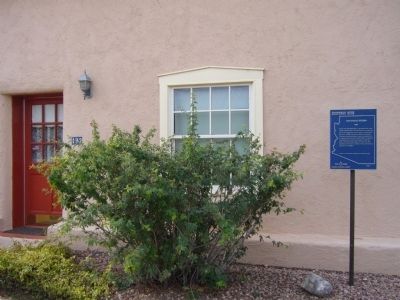
On North Baily Street, on the left when traveling north.
Called the "New Beer Hall," this single-story, mud-roofed, one-room deep, adobe Sonoran-style house was said to be "the coolest place in town" by owner John Nicholas. In 1890, the Arizona Weekly Enterprise, Florence's second newspaper, leased . . . — — Map (db m26794) HM
On East 11th Street near North Baily Street, on the right when traveling west.
Designed by prominent Arizona Architect James M. Creighton, this is the oldest standing fired-brick building in Florence. Soon after completion, French-born rancher-farmer John Nicholas moved his saloon to this building in 1889. Tradition has it . . . — — Map (db m26792) HM
On North Granite Street, on the left when traveling north.
Built in 1878 for John P. Clum, Indian agent, editor of Florence's first newspaper, the "Arizona Citizen" and founder of the "Tombstone Epitaph."
Typical of transitional architecture, the home is a Sonoran adobe with an Anglo-influenced roof. . . . — — Map (db m26744) HM
On North Willow Street, on the right when traveling north.
One of a series of Craftsman bungalows on Willow Street, this was the home of the John Zellweger family. Zellweger was a founder of the First National Bank of Florence. His father and George Push owned the large Steam Pump Ranch north of Tucson. . . . — — Map (db m68339) HM
On East 8th Street, on the right when traveling east.
This first Catholic Church in central Arizona, built in 1870 by Father Andre Echallier, was called "La Capilla del Gila". In 1883 a larger edifice commemorating the Assumption of the Blessed Virgin Mary, was constructed to the west: a convent was . . . — — Map (db m26689) HM
On North Baily Street north of East Butte Avenue, on the right.
Manuel Robles made the adobes and built this house in 1881. The single-story residence is an excellent example of a modified Sonoran-style rowhouse. Originally it was an L-shaped structure with a flat earth-filled roof, then about 1913 a flat metal . . . — — Map (db m30403) HM
On North Main Street, on the right when traveling south.
Built in 1925, this is an example of early 20th Century Commercial style. One of three structures in Florence designed by George Mauk of Phoenix. He was an architect movie house mogul, and U.S. marshal. This building was used as Arizona Edison and . . . — — Map (db m26733) HM
On East Ruggles Street, on the right when traveling west.
Frenchman Jean Baptiste Michea and his wife, Carmen Robles of Sonora built a 3-unit rowhouse/store on this site by 1878.
Typically Sonoran in style, it was built up to the property line, and had plastered adobe walls with an earthen roof over . . . — — Map (db m67495) HM
On North Baily Street, on the left when traveling north.
French-born John Nicholas built this single-story flat-roofed, Sonoran-style, adobe house along the side-street property line. Its raised foundation offered some protection from flooding. Originally rectangular, it was L-shaped in 1890 and square by . . . — — Map (db m26793) HM
On North Granite Street at 6th Street, on the right when traveling south on North Granite Street.
In 1876, Roderick Ross, one of Florence's first blacksmiths, constructed this Sonoran-style adobe house. The original flat earthen roof made of round log beams, saguaro ribs, and mud is well-preserved by a gable roof added between 1899 and 1910. . . . — — Map (db m131734) HM
On North Pinal Street near 10th Street, on the right when traveling north.
The oldest portion of this adobe was built for Sam Kee in 1882. Typical of Sonoran row houses, this home was built on the property line and was transformed to late-transitional style in 1977 by the addition of the wood-shingled, hipped roof . . . — — Map (db m26747) HM
On North Baily Street, on the right when traveling north.
This one-story, detached dwelling began as an American Victorian-style building, with walls of locally made brick and a metal-covered, timber-framed hip roof. Brick arches topped door and window openings. Bungalow-style additions included an open, . . . — — Map (db m26802) HM
On East Buttle Avenue near Orlando Street, on the right when traveling east.
This second-oldest Presbyterian Church in continuous usage in Arizona was founded in 1888. The present building was designed by architects Wallingford and Bell of Phoenix in the Spanish Colonial Revival style, with mission-type tile on the roof. . . . — — Map (db m26627) HM
On South Matilda, on the right when traveling north.
The Fulbrights moved into the home on February 14, 1934 continuing to complete the house as cash became available. The adobe patio wall was completed in 1934, the outside and inside walls were plastered in 1937 and the tile roof was installed in . . . — — Map (db m71776) HM
On South Main Street, on the right when traveling south.
A transformed early Sonoran adobe, this house is the only structure in Florence that has a full second story added to an adobe core. Built by W. C. Truman, the sheriff known for capturing lady stagecoach robber Pearl Heart in 1900, it was later . . . — — Map (db m26625) HM
On North Main Street, on the right when traveling north.
In 1901, Aquiles Arriola opened his store here with a great variety of goods lining the store walls. Arriola's son, Gustavo, grew up to be a well-known cartoonist with his own comic strip "Gordo". He wrote in his auto biography "Accidental . . . — — Map (db m71775) HM
On North Main Street near 8th Street, on the right when traveling south.
This single-story commercial building includes a partial basement, wide-open interior spaces, and a tall, carefully detailed, Main Street store front of exposed, buff-colored, pressed brick. The other walls are composed of common red brick. A metal . . . — — Map (db m26735) HM
On North Main Street near 10th Street, on the right when traveling south.
Built for Silver King mining engineer William Clark in 1884, this house is a prime example of cultural fusion in architecture.
The Sonoran mud-plastered adobe walls were combined with an elegant Victorian louvered bay window, prefabricated . . . — — Map (db m26737) HM
On Mount Lemmon Road 1 mile south of Webb Road, on the right when traveling south.
Isaac Lorraine, discoverer of the American Flag gold and silver mine, built this adobe house about 1877. It served as his residence and headquarters for nearby mining and ranching operations. On December 20, 1880, it became the first post office in . . . — — Map (db m29898) HM
On Lewis Avenue (Business Route 40) at 5th Street, on the right when traveling west on Lewis Avenue.
The hotel opened March 1, 1907, and was built of steel and concrete in the Mission Style of Spanish architecture. The hotel covered a space of 420’ X 200’. Cost was approximately $115,000.
On the ground floor of the structure was the lunch room . . . — — Map (db m33499) HM
On Montezuma Castle Road 1 mile east of Beaver Creek Estates Road.
It is no coincidence that this diorama made its debut at the same time ladders were removed and access to the cliff dwelling ended.
Before the official end of guided tours of the cliff dwelling on October 1, 1951, park rangers had . . . — — Map (db m251673) HM
On Skull Valley - Kirkland Road 0.1 miles north of Kirkland Road, on the right when traveling north.
In the late 1800's, Thomas Earnhart erected the Kirkland Store on the site of today's Kirkland Bar and Steakhouse.
In the early 1900's, Louis Haselfeld assumed ownership and opened the Haselfeld Store. The original wood frame building burned in . . . — — Map (db m33046) HM
Near Montezuma Castle Road. Reported permanently removed.
The Way Up
How in the world do you build a structure large enough to house 35 people high up on a steep canyon wall? Sound impossible? Here’s how Montezuma Castle’s ingenious Sinagua farmers managed it.
On Gurley Street (Arizona Route 89) at Washington Street., on the right on Gurley Street.
Since 1908, the area of Prescott now known as Ken Lindley Field has been used as a public park and ballfield. The land was deeded to the City of Prescott by Charles T. and Ada M. Joslin in 1922. As Mrs. Joslin requested, the City later . . . — — Map (db m21161) HM
On East Gurley Street (Route 89) near Marina Street, on the right when traveling west.
After ten years of planning, community leaders of Prescott finally raised sufficient funds to build a modern hotel which catered to the "auto tourist" in downtown Prescott -- The Hassayampa Inn. On February 28, 1927, at the site of the former Conner . . . — — Map (db m20621) HM
On South Montezuma Street, on the right when traveling south.
The cornerstone of historic "Whiskey Row", the Hotel St. Michael, represents the coming of age of Prescott's hostelries. Constructed on the site of the modest Hotel Burke, which burned in 1900, the new three-story hotel was designed by D. W. Millard . . . — — Map (db m33065) HM
On Cortez Street, on the right when traveling south.
The Hotel Vendome, referred to in a contemporary newspaper article as an "apartment house", was built on South Cortez Street in 1917 by J. B. Jones. An article in Yavapai Magazine in November 1917 refers to it as the "Hotel Vendome" and states "its . . . — — Map (db m18862) HM
On East Union Street at South Marina Street on East Union Street.
Originally a part of the Capitol Block, which was set aside in 1864 for a Territorial Capitol Building, the south half of the block was sold at auction. John Lawler, a miner, capitalist and real estate developer, bought the entire block and built a . . . — — Map (db m20618) HM
On North Marina Street., on the right when traveling south.
In the fall of 1878 the Sisters of St. Joseph came to Prescott. Money was raised in the community for a hospital to be run by the sisters and by 1881 the hospital had been completed on North Marina Street. In June of 1891 construction was started . . . — — Map (db m21603) HM
On South Cortez Street at East Union Street on South Cortez Street.
The Goldwater Brothers, Morris and Michael, arrived in Arizona from California in 1876. They opened one of the area's first general merchandising stores on the southeast corner of Cortez and Goodwin (where City Hall is now located). Three years . . . — — Map (db m20616) HM
A beautiful Victorian Cottage which faced East Sheldon Street was built on this site by W. B. Jones. On November 15, 1893, William Owen (Buckey) O'Neill and his wife Pauline moved into the house. O'Neill used a portion of the upstairs as his office . . . — — Map (db m20619) HM
On Gurley Street (Arizona Route 89) at Cortez Street, on the right when traveling east on Gurley Street.
A bank was an important asset to a new and growing community. Chartered by Solomon Lewis and M. W. Kales in 1877, the Bank of Arizona was the first business in the Arizona Territory devoted exclusively to banking. The partners built a two-story . . . — — Map (db m20295) HM
On East Gurley Street (Arizona Route 89) at Marina Street, on the left when traveling west on East Gurley Street.
Prescott's first library consisted of over 300 volumes brought to the Territory in 1864 by Secretary of State Richard C. McCormick. In 1870, a group of local women opened a reading room with 263 books collected from local citizens and out-of-town . . . — — Map (db m20814) HM
On East Gurley Street east of South Marina Street, on the right when traveling west.
The Day Octagon is the oldest known fired brick building in Arizona. Built in 1877 by Lowell and Crouch for Dr. Warren E. Day, it is significant as the first surgical hospital in Arizona Territory, where Dr. Day pulled teeth, delivered babies, . . . — — Map (db m33138) HM
On West Gurley Street at North Granite Street, on the right when traveling west on West Gurley Street.
Completed in August 1901, the Mulvenon Building was one of the first buildings constructed after the fire of 1900. It replaced a one-story wood-frame saloon building which was destroyed in the fire. Built by William J. Mulvenon, who arrived in . . . — — Map (db m20615) HM
On East Gurley Street east of South Alarcon Street, on the right when traveling west.
The first public school in Prescott was opened in 1867. In 1876 a four-room brick public school building was erected here. It was known as the "Prescott Free Academy". In 1903 that building was torn down and replaced by Washington School. Washington . . . — — Map (db m33094) HM
On South Madison Avenue, on the right when traveling south.
Construction on this adobe home on Madison Avenue began in the 1870's. Pioneer merchant E. F. Sanguinetti purchased the two-room house with its lean-to kitchen in 1890. The building, gardens, and aviaries were developed by Sanguinetti who resided . . . — — Map (db m28971) HM
On East 1st Street east of South Main Street, on the right when traveling west.
The building is an example of Moderne/Art Deco Style. It served as headquarters for Hollywood stars throughout the 1930 and 40's and was the center of Yuma's social life until 1960.
Dedicated December 1999, by the City of Yuma
for the . . . — — Map (db m29006) HM
Near Prison Hill Road 0.5 miles north of Harold C. Giss Parkway.
In 1904 an incorrigible ward, consisting of five steel cages, was constructed on this site. The total budget for the building, including steel cages, corrugated iron roofing and lumber, was five hundred dollars. Approximately 4,000 adobe bricks, . . . — — Map (db m158296) HM
Near Prison Hill Road 0.5 miles north of Harold C. Giss Parkway.
The main cellblock was built to house up to 204 prisoners, but at times the Superintendent's report stated that up to 240 prisoners were kept here. Each cell was approximately 9 foot X 12 foot and could hold six prisoners. When space became limited, . . . — — Map (db m158292) HM
On South 2nd Avenue near West 2nd Street, on the right when traveling north.
Designed in the Modernistic/Art Deco style, it retains its original design and use as a lodge. Freemasonry in Yuma began in 1900. Lodge #17 was formed in November, 1901.
Dedicated December 1999, by the City of Yuma for the preservation of . . . — — Map (db m29022) HM
On West 2nd Street east of South 1st Avenue, on the left when traveling east.
This turn of the century adobe is an example of middle-class housing in Yuma. It is also a fine example of the Anglicized Sonoran style building tradition.
Dedicated December 1999, by the City of Yuma
for the preservation of our heritage. . . . — — Map (db m29003) HM
On South Main Street south of East 3rd Street, on the right when traveling south.
United States
Post Office
has been placed on the
National Register
of Historic Places
The United States Post Office is a two-story
building of reinforced concrete faced
with native Arizona stone. The design
has strong Beaux-Arts roots, . . . — — Map (db m191672) HM
On West 2nd Street east of South 1st Avenue, on the left when traveling east.
This early commercial block was built by Jose Maria Venegas as a storehouse/dry goods outlet. The sheltered arcade is typical of southwest design of the period. The family also owned the Yuma Steam laundry in this neighborhood.
Dedicated . . . — — Map (db m29005) HM
On West 1st Street west of North Second Avenue, on the right when traveling west.
Built in classic Spanish Colonial Revival style on high ground overlooking the Colorado River, it has served as the traditional seat of municipal government.
Dedicated December 1999, by the City of Yuma for the preservation of our heritage. . . . — — Map (db m28985) HM
On South Gila Street at East 3rd Street, on the right when traveling south on South Gila Street.
Built in the Spanish Colonial Revival style to complement and capitalize on the Southern Pacific Depot site diagonally across the street. The driving force behind its construction was Yuma Mayor and entrepreneur F.S. Ming.
Dedicated . . . — — Map (db m266560) HM
On South Grand Avenue at East 7th Street, on the right when traveling north on South Grand Avenue.
[south side] The Grand Avenue United Methodist Church was organized in 1887 with seventy-four members as a congregation of the Methodist Episcopal Church and became the first Methodist congregation organized in Stuttgart. This . . . — — Map (db m262900) HM
On East 6th Street at South Baxter Street, on the right when traveling west on East 6th Street.
This commercial historic district was added to the National Register of Historic Places on June 15, 2010
as a representative collection of early to mid-20th century vernacular architecture, Centered on the Baxter County Courthouse, which was . . . — — Map (db m170753) HM
Near South Walton Boulevard (Business U.S. 71) 0.1 miles north of Southwest I Street, on the left when traveling north.
Col. Samuel W. Peel House
Built 1876
has been placed on the
National Register
of Historic Places
by the United States
Department of the Interior
— — Map (db m167937) HM
The word "Usonian" was derived from an abbreviation of "United States of North America." Frank Lloyd Wright embraced this term as the name for a distinct American and democratic style of residential architecture he developed during the Great . . . — — Map (db m108874) HM
"Everything that's ever going to be of use to you—in architecture or in life or anywhere you go or whatever you do—is going to be nature."
Frank Lloyd Wright
Frank Lloyd Wright (1867-1959) lived during a period of rapid . . . — — Map (db m108873) HM
In 1953 Gloria and Abraham Wilson wrote to Frank Lloyd Wright to commission a home.
Gloria's brother, Marvin Bachman, had been one of Wright's apprentices, and the couple hoped that using both their last names might help them secure the . . . — — Map (db m108879) HM
On Ivy Circle at McCollum Drive, on the left when traveling west on Ivy Circle.
In 1913, W.T. and Lennie Barnett Ivy moved to what is now the corner of Ivy Place and McCollum Drive. The original home, circa 1900, was destroyed by fire in 1925. The Ivy's rebuilt the existing Prairie-style Craftsman farm house in 1926, . . . — — Map (db m224952) HM
On South Walton Boulevard (U.S. 71B) 0.2 miles south of W Central Avenue, on the right when traveling south.
The Oaks
Home of Congressman Samuel W. Peel
In 1875, Samuel Peel built a two-story home on the outskirts of Bentonville that he named “The Oaks.” The house is an excellent example of the Italianate style that was popular in the South . . . — — Map (db m276707) HM
On Southeast 5th Street west of Southeast J Street, on the right when traveling west.
This property
has been placed on the
National Register
of Historic Places
by the United States
Department of the Interior
Colonel Young House
1873 — — Map (db m224903) HM
On Southeast 2nd Street at Southeast B Street, on the right when traveling east on Southeast 2nd Street.
Built in 1890 by Capt. NH Henry
Captain Henry served in the Civil War as a member of General Stonewall Jackson's artillery. After the war Henry moved to Bentonville where he helped build Bentonville's first steam railway and served as a . . . — — Map (db m225133) HM
On Jackson Street at Johnson Avenue, on the right when traveling north on Jackson Street.
John W. Looney built the IOOF/Masonic Lodge building here in 1913 after the wooden store burned. The Masonic Lodge was upstairs. The Post Office was in one end downstairs.
Looney sold groceries, feed, and general merchandise at this store. He . . . — — Map (db m224842) HM
On Jackson Street at Johnson Avenue, on the right when traveling south on Jackson Street.
This 1890's house is one of the oldest homes in Lowell. In 1881, L.P. Davis owned outlot No. 1 and 34 acres used for his plant nursery. An adjoining 40 acres is clearly defined on a 1905 map.
The 1904 photo, above, was given to the museum by . . . — — Map (db m224846) HM
On Jackson Street south of McClure Avenue (County Road 923), on the right when traveling south.
Location: West of the railroad tracks on Lincoln Street between McClure & Monroe, almost directly across from Allen Canning Company Warehouse.
It was about 12' x 12', made of native stone, cemented together. One small window on the north side was . . . — — Map (db m224840) HM
On South 1st Street south of West Walnut Street, on the right when traveling south.
114 South First Street
A.O. Clarke, Architect
Built 1905-1907
The Bank of Rogers building opened in 1907. By 1918, the building was home to the Farmers State Bank. In 1937, the American National Bank moved to this location, followed by the . . . — — Map (db m224882) HM
On Elm Street at 3rd Street, on the right when traveling west on Elm Street.
This building is a pinnacle of A.O. Clarke's interweaving use of limestone and brick, Romanesque arches, and stained glass window detail. In 1996, the historic sanctuary was renovated and is one of the highlights of the church. The trademark steeple . . . — — Map (db m93331) HM
Near South Mount Olive Street, on the right when traveling north.
Accepted by the National Register of Historic Places
February 1996
Built Circa 1932
Burt and Grace Pyeatte
Pioneer citizens coming to Siloam Springs in 1918
The house is locally significant as the finest example of English Revival . . . — — Map (db m299579) HM
On West Central Avenue east of South Hickory Street, on the right when traveling east.
It was built in 1893 by William M. Duncan in true Queen Anne architecture.
Duncan was the son of a Pennsylvania Congressman. Duncan also built the
fabulous Basin Park Hotel in Eureka Springs. This gorgeous house has had
many prominent owners . . . — — Map (db m225301) HM
On North Willow Street north of West Stepenson Avenue, on the left when traveling north.
This building, made up of two parts, has had a variety
of businesses including Capitol Café (the owners lived
upstairs), Oklahoma Tire, Bee Discount, Rowlands
Store, Fashion Lane and Unlimited Outlet. It is now
Beautiful You and Harness Boots . . . — — Map (db m225285) HM
On West Ridge Avenue at North Main Street (Business U.S. 65), on the left when traveling west on West Ridge Avenue.
One of the city's earliest gas stations, built in 1927 by W.H. Lewis, it was purchased in 1929 by Independent Oil (became Phillips 66). They remodeled it from a frame structure with rubblestone veneer to Tudor Revival Style. Independent . . . — — Map (db m141850) HM
On North Main Street (Business U.S. 65) at West Ridge Avenue, on the left when traveling north on North Main Street.
The hotel opened on October 5, 1929 and was erected at a cost of $135,000. The Spanish Moorish design is built of brick, cement & steel making it virtually fire proof. Scaracenic Arches mark the front entries The Seville served for years as . . . — — Map (db m141854) HM
On North Willow Street south of West Rush Avenue, on the right when traveling south.
HH Jackson opened the Lyric in 1913 as the first indoor theatre in Harrison.
In 1918 Ed & Lulu (Garvin) Fitton purchased the business which featured
silent films until the “New Lyric” opened on the North side of the square
in 1929. At that time . . . — — Map (db m225284) HM
On West Rush Avenue west of North Main Street, on the right when traveling west.
It was originally operated as a silent movie theater located on the West side of the square and owned by DE & Lulu Fitton. In 1929 JW Bass built a state of the art theater for talkies, leasing it back to the Fittons as the "New" Lyric. A mix of . . . — — Map (db m141840) HM
On North Willow Street south of West Rush Avenue, on the right when traveling south.
It was built in 1929 and was occupied by Ward's for 50 years. Notice the attractive facade that was added featuring the Goddess of Liberty and adopted as the corporate symbol. Fraley's Furniture and Appliances currently occupies the building. In . . . — — Map (db m225269) HM
On East Rush Avenue at North Main Street (Business U.S. 65), on the left when traveling east on East Rush Avenue.
It was completed in 1903 and served as the Post Office from 1906 - 1965. The three story (plus basement) building was constructed at an original cost of $78,000 with a floor space in excess of 20,000 sq ft. It was constructed of hard-burned, dark . . . — — Map (db m141866) HM
On South Cherry Street at West Central Avenue, on the right when traveling south on South Cherry Street.
Designed by architect Harry C. Schwebke & built by R.D. Pollard, the
Romanesque style brick building was the first free 4 year high school in
Boone County. Opening in 1912 the school served as a high school until 1952
when it became the junior . . . — — Map (db m225288) HM
On North Main Street (Business U.S. 65) at East Stephenson Avenue, on the right when traveling north on North Main Street.
It was constructed in 1912. It originally housed Walter's Dry Goods on
the ground level & Fountaine Hall located upstairs. The Hall hosted the
Masons and also a play house of questionable character. The building is
located on what is known as . . . — — Map (db m225287) HM
On East Cedar Street at North Main Street (Business U.S. 63), on the right when traveling west on East Cedar Street.
The first temporary court house in Bradley County was erected on this site in 1842, two years after the creation of the county, and continued in use until 1858, when a court house built of brick was erected. — — Map (db m121054) HM
On South Main Street (U.S. 62) just south of East Church Avenue, on the right when traveling north. Reported missing.
The first court house in Carroll County. Built about 1825, was constructed of logs and stood on the site of Carrollton. A second court house was built of brick, but burned in 1859. Another court house was built of brick on the same site after the . . . — — Map (db m170746) HM
On Main Street (State Highway 23) at Spring Street, on the right when traveling east on Main Street.
Professor KALKLOSCH’s Guidebook, published in 1880, states: “The first street of the town was surveyed down the gulch below the spring. A broad avenue connects this street with the famous EUREKA BASIN SPRING. It being the first street it . . . — — Map (db m79755) HM
On Prospect Avenue at Linwood Avenue, on the left when traveling east on Prospect Avenue.
Resort home built 1899 by William Henry Reid of Chicago. Architect Theodore C. Link of St. Louis. Design reflects simplicity favored at end of Victorian era. Upper floors are wood with verandas on four sides. Lower floor is Beaver Limestone. In . . . — — Map (db m80118) HM
On Golden Gate (Arkansas Route 187) at Parkway Street South, on the right when traveling south on Golden Gate.
This stone "Beaver Spring" house
was built circa 1912. It replaced
a log house built over the spring
purportedly by Wilson A. Beaver.
Beaver purchased the land in
1857 from John Williams who
homesteaded the land in 1852.
The Indians & . . . — — Map (db m225151) HM
22035 entries matched your criteria. Entries 401 through 500 are listed above. ⊲ Previous 100 — Next 100 ⊳