1676 entries match your criteria. Entries 401 through 500 are listed.⊲ Previous 100 — Next 100 ⊳
Immigration Topic
By Craig Doda, January 28, 2023
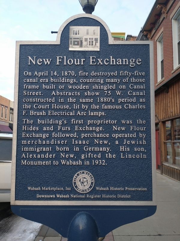
New Flour Exchange side of marker
401 ► Indiana, Wabash County, Wabash — Dr. James H. Ford / New Flour Exchange —  |
| On West Canal Street east of South Wabash Street (Indiana Route 13), on the left when traveling east. | |||
| 402 ► Indiana, Wayne County, Richmond — German Heritage — |
| On South 9th Street (U.S. 27) north of South E Street, on the left when traveling north. | |||
| 403 ► Indiana, Wayne County, Richmond — Old Richmond — |
| On South 9th Street (U.S. 27) north of South B Street, on the left when traveling north. | |||
| 404 ► Iowa, Adams County, Corning — Icarian Colony — |
| On 34th Infantry Division Highway (U.S. 34) at Mulberry Avenue, on the left when traveling east on 34th Infantry Division Highway. | |||
| 405 ► Iowa, Black Hawk County, Cedar Falls — Lawn City — Prairie Pathways - An Interpretive Journey — |
| On West 1st Street at Clay Street, on the right when traveling west on West 1st Street. | |||
| 406 ► Iowa, Boone County, Madrid — Cassel Corner Park — |
| On South State Street at West 2nd Street, on the left when traveling north on South State Street. | |||
| 407 ► Iowa, Henry County, Swedesburg — The Dala Horse — National Symbol of Sweden — |
| On James Avenue at Park Street, on the right when traveling south on James Avenue. | |||
| 408 ► Iowa, Iowa County, Ladora — 5 — Historic Amana Colonies — |
| Near Interstate 80 at milepost 208, 2.6 miles east of B Avenue (County Road V38), on the right when traveling east. | |||
| 409 ► Iowa, Linn County, Cedar Rapids, Oakhill Jackson — Oak Hill Neighborhood — History Happened Here! — |
| On 12th Avenue Southeast south of 7th Street Southeast, on the right when traveling east. | |||
| 410 ► Iowa, Linn County, Cedar Rapids, Southwest Area — Stumptown — |
| Near A Street Southwest east of C Street Southwest. | |||
| 411 ► Iowa, Marion County, Pella — Dutch Influence on Today's Pella — |
| Near Houston Avenue north of Lincoln Street, on the right when traveling south. | |||
| 412 ► Iowa, Marion County, Pella — 10 — Historic Pella — |
| On Main Street at Huber Street, on the right when traveling south on Main Street. | |||
| 413 ► Iowa, Marion County, Pella — Why the Dutch Left Their Homeland — |
| Near Lincoln Street west of Houston Avenue, on the right when traveling west. | |||
| 414 ► Iowa, Palo Alto County, Emmetsburg — Paddy Horan Solberg — 1942-2014 — |
| On Broadway Street north of 11th Street, on the right when traveling north. | |||
| 415 ► Iowa, Polk County, Ankeny — Why a Barn Style Museum? — |
| Near Southwest School Street south of Southwest 3rd Street. | |||
| 416 ► Iowa, Polk County, Des Moines, East Village — Cambodia — Robert D. Ray Asian Garden — |
| Near Robert D. Ray Drive at Maple Street, on the right when traveling south. | |||
| 417 ► Iowa, Polk County, Des Moines, East Village — Hmong — Robert D. Ray Asian Garden — |
| Near Robert D. Ray Drive south of Maple Street, on the right when traveling south. | |||
| 418 ► Iowa, Polk County, Des Moines, East Village — Laos — Robert D. Ray Asian Garden — |
| Near Robert D. Ray Drive at Maple Street, on the right when traveling south. | |||
| 419 ► Iowa, Polk County, Des Moines, East Village — Robert D. Ray Asian Garden — |
| Near Robert D. Ray Drive at E. Center Street, on the right when traveling south. | |||
| 420 ► Iowa, Polk County, Des Moines, East Village — Robert D. Ray Asian Garden — Governor Robert D. Ray, 1928-2018 — Governor of Iowa 1969-1983 — |
| Near Robert D. Ray Drive at E. Center Street, on the right when traveling south. | |||
| 421 ► Iowa, Polk County, Des Moines, East Village — Tai Dam — Robert D. Ray Asian Garden — |
| Near Robert D. Ray Drive north of E. Center Street, on the right when traveling south. | |||
| 422 ► Iowa, Polk County, Des Moines, East Village — Vietnam — Robert D. Ray Asian Garden — |
| Near Robert D. Ray Drive north of E. Center Street, on the right when traveling south. | |||
| 423 ► Iowa, Sac County, Odebolt — Iowa Rural Schools History — |
| Near West 2nd Street just west of Main Street, on the left when traveling west. | |||
| 424 ► Iowa, Winneshiek County, Decorah — Bethania Church — Heritage Park, Vesterheim Norwegian-American Museum — |
| On North Mill Street just north of West Water Street, on the left when traveling north. | |||
| 425 ► Iowa, Winneshiek County, Decorah — Blacksmith Shop — Heritage Park, Vesterheim Norwegian-American Museum — |
| Near North Mill Street just north of West Water Street, on the right when traveling north. | |||
| 426 ► Iowa, Winneshiek County, Decorah — Decorah: A Walk into the Past — Water Street Trail — |
| On West Water Street at River Street, on the right when traveling west on West Water Street. | |||
| 427 ► Iowa, Winneshiek County, Decorah — Decorah: A Walk into the Past — Water Street Trail — |
| On West Main Street at Winnebago Street, on the right when traveling east on West Main Street. | |||
| 428 ► Iowa, Winneshiek County, Decorah — Egge-Koren House — Heritage Park, Vesterheim Norwegian-American Museum — |
| Near North Mill Street just north of West Water Street, on the right when traveling north. | |||
| 429 ► Iowa, Winneshiek County, Decorah — Haugan House — Heritage Park, Vesterheim Norwegian-American Museum — |
| Near North Mill Street just north of West Water Street, on the right when traveling north. | |||
| 430 ► Iowa, Winneshiek County, Decorah — Norsvin Mill — Heritage Park, Vesterheim Norwegian-American Museum — |
| Near North Mill Street just north of West Water Street, on the right when traveling north. | |||
| 431 ► Iowa, Winneshiek County, Decorah — Painter-Bernatz Mill — Heritage Park, Vesterheim Norwegian-American Museum — |
| Near North Mill Street just south of Heivly Street, on the right when traveling north. | |||
| 432 ► Iowa, Winneshiek County, Decorah — Rovang Schoolhouse — Heritage Park, Vesterheim Norwegian-American Museum — |
| On North Mill Street just north of West Water Street, on the right when traveling north. | |||
| 433 ► Iowa, Winneshiek County, Decorah — Stabbur — Heritage Park, Vesterheim Norwegian-American Museum — |
| Near North Mill Street just north of West Water Street, on the right when traveling north. | |||
| 434 ► Iowa, Winneshiek County, Decorah — Stovewood House — Heritage Park, Vesterheim Norwegian-American Museum — |
| Near North Mill Street just north of West Water Street, on the right when traveling north. | |||
| 435 ► Iowa, Winneshiek County, Decorah — Tasa Drying Shed — Heritage Park, Vesterheim Norwegian-American Museum — |
| Near North Mechanic Street at West Day Spring Lane, on the left when traveling north. | |||
| 436 ► Iowa, Winneshiek County, Decorah — Valders House — Heritage Park, Vesterheim Norwegian-American Museum — |
| Near North Mill Street just north of West Water Street, on the right when traveling north. | |||
| 437 ► Iowa, Winneshiek County, Decorah — Vesterheim — Heritage Park, Vesterheim Norwegian-American Museum — |
| Near West Water Street just east of North Mill Street, on the left when traveling east. | |||
| 438 ► Iowa, Winneshiek County, Decorah — Welcome to Vesterheim — The National Norwegian-American Musuem and Folk Art School — |
| On West Water Street just east of North Mill Street, on the left when traveling east. | |||
| 439 ► Iowa, Winneshiek County, Decorah — Wickney House — Heritage Park, Vesterheim Norwegian-American Museum — |
| Near North Mechanic Street just north of West Day Spring Lane, on the left when traveling north. | |||
| 440 ► Kansas, Crawford County, Pittsburg — The Weir - Pittsburg Coalfield — Miners’ Memorial at Immigrant Park — |
| On 2nd Street at Walnut Street, on the right when traveling west on 2nd Street. | |||
| 441 ► Kansas, Crawford County, Pittsburg — The Weir-Pittsburg Coal Field in Cherokee County — Miners' Memorial at Immigrant Park — |
| On 2nd Street near Pine Street, on the right when traveling west. | |||
| 442 ► Kansas, Doniphan County, White Cloud — Glacial Hills Scenic Byway — |
| On Highway 7 at Main Street, on the right when traveling north on Highway 7. | |||
| 443 ► Kansas, Ellsworth County, Wilson — A Culture Lives On — Public art and traditions preserve Czech heritage — |
| On 27th Street at Avenue D, on the left when traveling west on 27th Street. | |||
| 444 ► Kansas, Ellsworth County, Wilson — Czech Capital of Kansas — Immigrants find support in a new land — |
| On 27th Street at Avenue D on 27th Street. | |||
| 445 ► Kansas, Ellsworth County, Wilson — World's Largest Czech Egg — Ed & LaVange Shiroky Park — |
| On Avenue D at 27th Street, on the right when traveling south on Avenue D. | |||
| 446 ► Kansas, Finney County, Ravanna — 12 — Beersheba — |
| On Kansas Route 156 at Route 23, on the right when traveling west on Kansas Route 156. | |||
| 447 ► Kansas, Ford County, Dodge City — Dodge City's Mexican Village — A city within a city — |
| Near East Wyatt Earp Boulevard just west of Avenue B, on the right when traveling east. | |||
| 448 ► Kansas, Harvey County, Walton — 61 — Turkey Red Wheat — |
| On U.S. 50, on the left when traveling east. | |||
| 449 ► Kansas, Johnson County, Lenexa, Sunrise Retirement — Legler Barn: A Lasting Legacy — |
| Near West 87th Street Parkway east of Lackman Road. | |||
| 450 ► Kansas, Johnson County, Prairie Village — From Farms to Suburbs: Land in Transition — |
| Near Nall Avenue. | |||
| 451 ► Kansas, Leavenworth County, Lansing — "Kansas Central Railway 1871-1890/Fallen Flags" — Spirit of the Buffalo Community Art & History Project — Artist: Everett Ward, Leavenworth — |
| On Main Street (U.S. 73) at Lansing Lane, on the right when traveling north on Main Street. | |||
| 452 ► Kansas, Leavenworth County, Leavenworth — "Sunrise to Sunset: Ad Astra per Aspera" — Spirit of the Buffalo Community Art & History Project — Artist: Becky Gordon, Lansing — |
| On 5th Avenue at Middle Street, on the right when traveling south on 5th Avenue. | |||
| 453 ► Kansas, Leavenworth County, Leavenworth — "Trails" — Spirit of the Buffalo Community Art & History Project — Artist: Alan Collins, Lansing — |
| On Cherokee Street at 6th Street, on the right when traveling west on Cherokee Street. | |||
| 454 ► Kansas, Leavenworth County, Leavenworth — Leavenworth Pioneer — Artist: Michael Young — |
| On 10th Avenue north of Marion Street, on the left when traveling north. | |||
| 455 ► Kansas, Leavenworth County, Leavenworth — Leavenworth's Union Depot — |
| On Esplanade Street at Delaware Street, on the left when traveling south on Esplanade Street. | |||
| 456 ► Kansas, Marion County, Goessel — 31 — The Mennonites in Kansas — |
| On Bison Road (State Highway 15) at 130th Street on Bison Road. | |||
| 457 ► Kansas, Marshall County, Blue Rapids — Historic Holm Cabin — |
| On Main Street at Smyth Street, on the right when traveling south on Main Street. | |||
| 458 ► Kansas, McPherson County, Moundridge — I — Swiss (Volhynian) Mennonite Memorial — |
| On Aztec Lane 0.2 miles east of 18th Avenue, on the left when traveling west. | |||
| 459 ► Kansas, McPherson County, Moundridge — II — The Swiss (Yolhynian) Mennonites — |
| On Aztec Lane 0.2 miles east of 18th Avenue, on the left when traveling west. | |||
| 460 ► Kansas, Miami County, Paola — The Potawatomi Indians Trail of Death — Indiana to Kansas — September 3, 1838 to November 4, 1838 — |
| On East Peoria Street west of S Pearl St, on the right when traveling east. | |||
| 461 ► Kansas, Republic County, Belleville — Belleville Agriculture — |
| On N Street at 18th Street, on the left when traveling south on N Street. | |||
| 462 ► Kansas, Russell County, Lucas — Post Rock Limestone and the Czechoslovakian Immigrant Experience — |
| On Main Street near 2nd Street, on the right when traveling south. | |||
| 463 ► Kansas, Sherman County, Goodland — Land and Sky Scenic Byway / Beginning Your Byway Tour — |
| On Commerce Road south of Old U.S. 24, on the right when traveling south. | |||
| 464 ► Kentucky, Clark County, Winchester — The Winchester Restaurant — |
| On North Main Street (U.S. 60) at Depot Street, on the left when traveling north on North Main Street. | |||
| 465 ► Kentucky, Garrard County, Nicholasville — The First Vineyard Established 1799 — |
| On Sugar Creek Pike, in the median. | |||
| 466 ► Kentucky, Jefferson County, Louisville, Portland — 2205 — “Bloody Monday” / American (Know-Nothing) Party — |
| On West Main Street, on the right when traveling west. | |||
| 467 ► Kentucky, Jefferson County, Louisville, Portland — 1312 — Portland / Our Lady Church — |
| On Rudd Avenue, on the right when traveling west. | |||
| 468 ► Kentucky, Laurel County, London — Swiss Colony — |
| Near Swiss Colony Lane at Hawk Creek Road, on the right when traveling west. | |||
| 469 ► Louisiana, East Baton Rouge Parish, Baton Rouge, Highlands/Perkins — 1 — Germain Bergeron House — Built Prior to 1805 — |
| Near Essen Lane south of Interstate 10. | |||
| 470 ► Louisiana, Natchitoches Parish, Natchitoches — The Great Migration — |
| On Depot Street north of Trudeau Street, on the left when traveling north. | |||
| 471 ► Louisiana, Orleans Parish, New Orleans, French Quarter — Monument to the Immigrant — |
| Near no nearby street. | |||
| 472 ► Louisiana, Orleans Parish, New Orleans, Tremé / Lafitte — Sicilian Immigration to Louisiana / 1891 Massacre and Lynching of Italians — |
| On Essence Way near St. Ann Street. | |||
| 473 ► Louisiana, Sabine Parish, Many — St. John the Baptist Catholic Church — |
| On San Antonio Avenue (Louisiana Route 6) at Church Street when traveling north on San Antonio Avenue. | |||
| 474 ► Louisiana, St. Charles Parish, Destrehan — Ad Perpetuam Rei Memoriam — 1723-1973 — |
| On River Road at Church Street, on the right when traveling west on River Road. | |||
| 475 ► Louisiana, St. John the Baptist Parish, Reserve — Graugnard House — |
| On East Jefferson Highway (State Highway 44) at West 23rd Street, on the right when traveling west on East Jefferson Highway. | |||
| 476 ► Louisiana, Webster Parish, Minden — Germantown Colony — |
| On Broadway Street (Main Street) (U.S. 79) at Homer Road (U.S. 79), in the median on Broadway Street (Main Street). | |||
| 477 ► Louisiana, West Feliciana Parish, Saint Francisville — Goldman House — 1837 — |
| On Ferdinand Street 0.2 miles west of Commerce Street, on the right when traveling west. | |||
| 478 ► Maine, Kennebec County, Waterville — 1 — Immigration / L'Immigration — The Museum in the Streets — |
| On Water Street south of Spring Street (Maine Route 137), on the right when traveling south. | |||
| 479 ► Maine, Washington County, Jonesport — Friendship Road — Jonesport, Maine through Jaffa to Jerusalem — Nellie Chapin Journey to the Holy Land, State of Israel — |
| On Main Street (Maine Route 187) at Gaelic Square, on the right when traveling east on Main Street. | |||
| 480 ► Maine, York County, Biddeford — Welcome to Shevenell Park — |
| On Main Street just west of Franklin Street, on the left when traveling west. | |||
| 481 ► Maryland, Anne Arundel County, Annapolis, St. John's College — Max and Elke Schiff — |
| Near College Avenue (Maryland Route 450) south of King George Street ( Route 450), on the right when traveling south. | |||
| 482 ► Maryland, Baltimore, Bromo Arts District — 506 Druid Hill Avenue — |
| On Druid Hill Avenue east of North Paca Street ( Route 129), on the right when traveling east. | |||
| 483 ► Maryland, Baltimore, Bromo Arts District — 510 Druid Hill Avenue — |
| On Druid Hill Avenue east of North Paca Street ( Route 129), on the right when traveling east. | |||
| 484 ► Maryland, Baltimore, Bromo Arts District — 600 Jasper Street — |
| On Jasper Street, on the right when traveling south. | |||
| 485 ► Maryland, Baltimore, Bromo Arts District — 606 Jasper Street — |
| On Jasper Street north of George Street, on the right when traveling south. | |||
| 486 ► Maryland, Baltimore, Bromo Arts District — 610 Jasper Street — |
| On Jasper Street north of George Street. | |||
| 487 ► Maryland, Baltimore, Bromo Arts District — 616 Jasper Street — |
| On Jasper Street north of George Street. | |||
| 488 ► Maryland, Baltimore, Bromo Arts District — 619 North Paca Street — |
| On North Paca Street (Maryland Route 129) south of Druid Hill Avenue, on the right when traveling north. | |||
| 489 ► Maryland, Baltimore, Bromo Arts District — 621 North Paca Street — Seton Hill Historic District — |
| On North Paca Street (Maryland Route 129) south of Druid Hill Avenue, on the right when traveling north. | |||
| 490 ► Maryland, Baltimore, Bromo Arts District — 627 North Paca Street — |
| On North Paca Street (Maryland Route 129) south of Druid Hill Avenue, on the right when traveling north. | |||
| 491 ► Maryland, Baltimore, Bromo Arts District — 637 North Paca Street — |
| On North Paca Street (Maryland Route 129) south of Druid Hill Avenue, on the right when traveling north. | |||
| 492 ► Maryland, Baltimore, Bromo Arts District — A melting pot of local business owners who call the market home — |
| On West Lexington Street west of North Eutaw Street, on the right when traveling west. | |||
| 493 ► Maryland, Baltimore, Bromo Arts District — Holy Women of Paca Street — St. Mary's Park — Dedicated 1977 — |
| On North Paca Street (Maryland Route 129) south of Druid Hill Avenue, on the left when traveling north. | |||
| 494 ► Maryland, Baltimore, Bromo Arts District — St. Mary's Seminary Chapel — |
| On North Paca Street (Maryland Route 129), on the left when traveling north. | |||
| 495 ► Maryland, Baltimore, Canton — Saint Brigid's Parish Church and School, Rectory and Convent — 🍀 🍀 — |
| On South Ellwood Avenue south of Hudson Street, on the right when traveling north. | |||
| 496 ► Maryland, Baltimore, Fells Point — St. Stanislaus Kostka Church — |
| On South Ann Street, on the right when traveling south. | |||
| 497 ► Maryland, Baltimore, Jones Falls Area — Falls Rd — Ghost Rivers — |
| On Falls Road 0.4 miles south of West 28th Street, on the left when traveling north. | |||
| 498 ► Maryland, Baltimore, Locust Point Industrial Area — Baltimore Immigration History — |
| On North Haubert Street north of Key Highway East, on the right when traveling north. | |||
| 499 ► Maryland, Baltimore, Locust Point Industrial Area — Locust Point Immigration Depot — Baltimore Immigration Memorial Site — |
| On North Haubert Street north of Key Highway East, on the right when traveling north. | |||
| 500 ► Maryland, Baltimore, Loyola University — Mary Elizabeth Lange — 1784 - 1882 — |
| Near West Cold Spring Lane west of North Charles Street ( Route 139), on the right when traveling west. | |||
1676 entries matched your criteria. Entries 401 through 500 are listed above. ⊲ Previous 100 — Next 100 ⊳