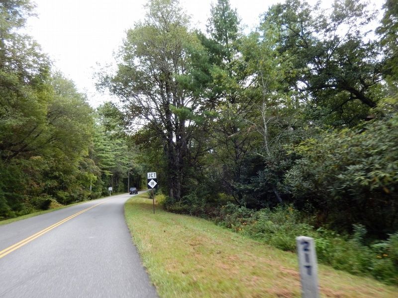
On Blue Ridge Parkway at the High Piney Spur Overlook (at milepost 218.6), 1.8 miles the Virginia state line, on the left when traveling south.
The knoll low on the ridge to the right boasts this celestial name. It is well known locally that hunters often sat about a night fire there while they followed the chase in the lowlands. They knew which hound held the lead by the . . . — — Map (db m104662) HM
On Blue Ridge Parkway 7 miles east of State Highway 18, on the right when traveling east.
You are looking into Basin Creek Cove. The log cabin 1500 feet below was the home of Martin and Janie Caudill and their 14 children. Martin's father, Harrison, who fathered 22 children, lived about a mile down the creek in the community of Basin . . . — — Map (db m306198) HM
Robert Lee Doughton, for whom Doughton Park is named, was born in Alleghany County, North Carolina, November 7, 1863. An original and leading advocate of the establishment and development of the Blue Ridge Parkway, he was a member of the United . . . — — Map (db m91786) HM
On North Main Street (U.S. 21) just north of East Whitehead Street (State Highway 18), on the right when traveling north.
[southwest side]Coast Guard • Army • Air Force • Navy • Marine Corps ☆ Dedicated to the honor and sacrifice of our Men and Women who served our Country in War and Peace ☆[northeast . . . — — Map (db m227326) WM
Near Cherry Street just east of Grayson Street, on the right when traveling east.
Crouse Park Sparta and Alleghany County have a rich heritage of music, crafts and agriculture. Crouse Park, including the Crouse House before you, was donated to the town in 1969. The Park hosts the Crouse House Pickers Monday night jam . . . — — Map (db m182942) HM
On Blue Ridge Parkway (at milepost 232.5), 3 miles west of U.S. 21, on the left when traveling south.
The massive gray rock before you is Stone Mountain, formed about 350 million years ago from intense heat and pressure deep within the earth. Centuries of erosion uncovered the rock and sculptured it into the curious shape it is today.
At one . . . — — Map (db m140553) HM
On Blue Ridge Parkway (at milepost 236.9), on the right when traveling south.
For thousands of years Native Americans cultivated the fertile valleys of the Blue Ridge region including North Carolina. Employing techniques such as “slash and burn” to clear small areas of forested land and fertilize the soil, the Cherokee raised . . . — — Map (db m123230) HM
On Healing Springs Road East 0.3 miles east of Old Highway 16, on the right when traveling east.
1883 The Spring is Discovered The Healing Spring was discovered by Willie Barker, son of Mr. and Mrs. Eli Barker, according to well-accepted tradition. As the story goes, Willie was helping his father plow corn when his father sent him to the . . . — — Map (db m228778) HM
On State Highway 16 0.1 miles north of Charles Spencer Road (County Route 1534), on the right when traveling north.
Grayson County, Virginia. Area 425 square miles. Formed in 1792 from Wythe. Named for William Grayson, one of the first two United States Senators from Virginia. Headwaters of New River are in this county.
North . . . — — Map (db m228775) HM
On Rugby Road (State Highway 194) at Joe Thomas Road, on the left when traveling north on Rugby Road.
North Carolina. Colonized, 1585-87, by first English settlers in America; permanently settled c. 1650; first to vote readiness for independence, Apr. 12, 1776
Virginia. First permanent English colony in America, 1607, one of thirteen . . . — — Map (db m95737) HM
On East Main Street (State Highway 88) at Cherry Street, on the right when traveling west on East Main Street.
American botanist and Harvard professor. In July 1841, investigated the region's flora. Headquarters was in house that stood 50 yds. N. — — Map (db m95736) HM
Near Court Street at Ashe Street, on the right when traveling east.
With European farmlands devastated and farmers called into military service
during WWI, America's European allies turned to us for food. Months before
entering WWI in 1917, the National War Garden Commission was established
to encourage Americans . . . — — Map (db m228823) HM
On Government Circle 0.1 miles south of U.S. 221, on the right when traveling south.
United States of America
Ashe County, North Carolina
“Our country called, our county answered”
American Revolution
1775-1783
Approximately 40 Ashe County pioneers fought in the Revolutionary War with General
George Washington's . . . — — Map (db m228813) HM WM
On East Main Street (Business U.S. 221) at Academy Street, on the right when traveling west on East Main Street.
A History of Jefferson
"Jefferson was a very special place at the turn of the century. The main street must have been one of the best conceived and most beautiful of its kind in the state. The pace of life was more leisurely and, in some . . . — — Map (db m269690) HM
On East Main Street (Business U.S. 221) at Academy Street, on the left when traveling east on East Main Street.
Honor Roll
In memory of those who made the supreme sacrifice while serving in wars in which the United States participated prior to World War One
Honor Roll
Ashe County World War One
Ashley, Charlie C. • Bare, Cecil • Barker, John . . . — — Map (db m228821) WM
On Government Circle south of East Main Street (U.S. 221), on the right when traveling south.
The original Charters of Freedom are on
display in The Rotunda at the National
Archives in Washington, D.C.
The Declaration of Independence was adopted July 4, 1776.
The United States Constitution was adopted . . . — — Map (db m269968) HM
On State Highway 18 S 1 mile south of Blue Ridge Parkway, on the right when traveling south.
This plaque is erected and dedicated in honor and appreciation of the forty-six years Dr. Luke has been a minister of the gospel, along with his devoted wife Mary at his side he gave so much and asked so little. In 1927 he was called to preach at . . . — — Map (db m237797) HM
On Tobaccoville Road, on the left when traveling east.
This barn was built on Old Richmond Creek in 1885 by W.W. (Billy) Doub. It was donated to the Village by Mr. W. G. (Jack) Doub on July 14, 1992 in honor of Tobaccoville's first Mayor, Henry Beck. — — Map (db m162114) HM
On Railroad Grade Road (State Road 1100) at South Fork Church Road, on the right when traveling south on Railroad Grade Road.
The early history of Todd is much like that of numerous crossroads communities
throughout northwestern North Carolina. Located where Elk Creek flows into the
South Fork of the New River, it was a logical site for trade, starting with . . . — — Map (db m228892) HM
On Blue Ridge Parkway (at milepost 266.8), on the right when traveling south.
Mount Jefferson looms high over the town of Jefferson for which it is named. It was formerly called Negro Mountain because run-away slaves supposedly hid out there while fleeing north. The summit and slopes of the mountain now make up Mount . . . — — Map (db m140555) HM
On BackStreet at State Street, on the left when traveling north on BackStreet.
Horse Creek
After crossing the border into North Carolina, the Virginia Creeper wound
along the banks of Big and Little Horse Creeks, crossing
the creeks a total of 17 times.
Tuckerdale
One of the largest for timber extraction . . . — — Map (db m269953) HM
On BackStreet at State Street, on the left when traveling north on BackStreet.
The Norfolk and Western Railroad first came to Ashe County in 1914. As the train line was established, numerous small communities began to emerge along the rails. A lone depot, placed between Paddy Mountain and Mount Jefferson, would soon blossom . . . — — Map (db m269957) HM
On Hickory Nut Gap Road (County Route 1342) west of Highway 184, on the left when traveling west.
In 1860 Banner Elk was a small community in the mountains of Watauga County (present-day Avery County). Then called Banner’s Elk, it was named for the local Banner family and the Elk River. During the last years of the Civil War, an organized system . . . — — Map (db m77533) HM
On Main Street West (State Highway 184/194) at Maple Court, on the right when traveling west on Main Street West.
Presbyterian. Founded in 1900 by Edgar Tufts. Named for teacher Elizabeth McRae & benefactor Mrs. S. P. Lees. Senior college since 1988. — — Map (db m98511) HM
On Linville Falls Highway (U.S. 221) at Sloop Mill Dam Road, on the left when traveling west on Linville Falls Highway.
Founded by Mary Martin Sloop, physician, 1913, to serve region's youth. Weaving Room, est. 1920, boosted revival of handicrafts. Campus ½ mi. W. — — Map (db m77493) HM
On Linville Falls Highway (U.S. 221) west of Sloop Mill Dam Road, on the left when traveling west.
Nowhere is The Crossnore School's mission to provide hope and healing in a
homelike residential education setting for children from families in crisis more
lovingly portrayed than through Ben Long's rendering of Mark 10:14, “Suffer the . . . — — Map (db m262974) HM
Near Elk Park Highway (North Carolina Route 194) at U.S. 19E, on the right when traveling south.
In honor of all CHS men and women who served our country in war and peace
Cranberry High School purchased March 17, 1986
Dedication 17 July 2010 to original note signees
Lila Beck C.A. & Edith Bowlick • Mary Daniels
Elbert & Georgia . . . — — Map (db m268048) WM
Near Elk Park Highway (State Highway 194) at U.S. 19E, on the right when traveling east.
During the Civil War, natural resources such as salt, lead, and iron were highly prized commodities in the Confederacy. The government relied especially on small rural ironworks to manufacture cannons, swords, and firearms. Ruben White first mined . . . — — Map (db m77479) HM
On Hospital Drive 0.5 miles south of Newland Highway ( Highway 181), on the left when traveling south.
Sarah Malinda Blalock and her husband, William McKesson “Keith” Blalock, lived in Coffey’s Gap on the Watauga and Caldwell County line in 1860. Keith Blalock was an avowed Unionist, but with the passage of the first Confederate . . . — — Map (db m77492) HM
Near Blue Ridge Parkway (at milepost 304.4), 1 mile north of Blowing Rock Highway (U.S. 221).
The first bridge of its type in the United States, the Linn Cove Viaduct is a product of design and construction techniques developed in Europe. The S-shaped structure contains 153 concrete segments, only one of which is straight. Weighing 50 tons . . . — — Map (db m134201) HM
Near Blue Ridge Parkway (at milepost 304.4), 1 mile north of Blowing Rock Highway (U.S. 221), on the right when traveling north.
He laid the foundation of the National Park Service, defining and establishing the policies under which its areas shall be developed and conserved unimpaired for future generations. There will never come an end to the good that he has done. — — Map (db m134202) HM
On Library Place at Elk Street ( Road 1342), on the right when traveling east on Library Place.
Honoring those who served
remembering those who died
Revolutionary War
Barjonah William Braswell • Martin Davenport • William Davis • William Gragg • Joseph Pyatte • Robert Sevier • John Vance • Thomas Wiseman • William Wiseman . . . — — Map (db m229167) WM
On Montezuma Street at Elk Street ( Road 1342), on the right when traveling west on Montezuma Street.
[Front]
Dedicated to
the honor and
sacrifice of
our men and
women who
served our
country in
war and peace
[Back]
Erected by Veterans
of Foreign Wars
Pat Ray Post #4286
Avery County
1775 Revolutionary War . . . — — Map (db m229247) WM
Appalachian Trail, Yellow Mountain Gap. Yellow Mountain Gap is the junction of the Appalachian Trail and Historic Bright’s Trace, route used by the “Overmountain Men” to cross the mountain enroute to the Revolutionary War battle at . . . — — Map (db m3269) HM
On Crimson Laurel Way (State Highway 226) at Hemlock Drive, on the right when traveling south on Crimson Laurel Way.
French botanist, pioneer in studying flora of western North Carolina, visited Roan Mountain, 12 miles north, August 16, 1794, & May 6, 1795. — — Map (db m84685) HM
On Crimson Laurel Way (State Highway 226) at North Mitchell Avenue (State Highway 1211), on the left when traveling south on Crimson Laurel Way.
American botanist and Harvard professor. In July, 1841, investigated flora of this region. He visited Roan Mountain, 12 miles north. — — Map (db m84684) HM
On North Mitchell Avenue at Route 226, on the right when traveling west on North Mitchell Avenue.
Mitchell County
Courthouse
This building is listed in the
National Register
of Historic Places
by the United States
Department of the Interior
Built 1907 — — Map (db m285438) HM
On State Highway 226 at State Route 261, on the right when traveling north on State Highway 226.
1868
The first Mitchell County Courthouse was constructed on this site.
1947
The first Mitchell County Public Library was located in the room over the coal shed.
1956
A brick jail was built attached to the 1907 courthouse. . . . — — Map (db m285362) HM
On North Mitchell Avenue at Route 226, on the right when traveling west on North Mitchell Avenue.
In the year of our Lord August 1, 1972 A. D. Dedicated to the memory of the brave men and women of Mitchell County, N. C.
living and dead who offered their lives in the military service of their country.
God Bless America — — Map (db m285437) WM
On State Highway 226 at Penland Road (County Route 1242), on the left when traveling north on State Highway 226.
Founded 1929 by Lucy Morgan (1889-1981) to promote traditional crafts including pottery, metal-working, and weaving. Campus 1 mile S.W. — — Map (db m79446) HM
On Crimson Laurel Way (North Carolina Route 226) south of Maple Street, on the left when traveling south.
The original Charters of Freedom are on
display in The Rotunda at the National
Archives in Washington, D.C.
The Declaration of Independence was adopted July 4, 1776.
The United States Constitution was adopted . . . — — Map (db m285443) HM
Near Parkway Maintenance Road 0.2 miles west of State Highway 226, on the left when traveling west.
Rededicated on September 29th, 1980
to commemorate the 200th anniversary of the heroic march
of the "Over the Mountain Men."
When American independence looked hopeless
a citizen army marched thru this mountain gap
to challenge British . . . — — Map (db m138466) HM WM
On Blue Ridge Parkway (at milepost 327.3), 0.2 miles east of Altapass Highway, on the left when traveling south.
The scenic mountain highway idea originated long before the Blue Ridge Parkway project began. In 1906, Joseph Hyde Pratt, North Carolina's State Geologist, proposed a toll road following the crest of the Ridge mountains from Marion, Virginia to . . . — — Map (db m140600) HM
Near Parkway Maintenance Road 0.1 miles west of State Highway 226, on the left when traveling west.
On Friday, September 29, 1780, a large part of the American Army passed this spot, under command of Colonels William Campbell, Isaac Shelby and John Sevier. On their march to the battle of King's Mountain, where the British and Tory forces, . . . — — Map (db m138478) HM WM
On Locust Street at Crystal Street, on the right when traveling east on Locust Street.
The men of Virginia, Tennessee and North Carolina on their way from Sycamore Shoals to King's Mountain encamped on the third night of their march.
September 28, 1780 — — Map (db m285448) HM
On Broadstone Road 0.1 miles west of Dewitt Barnett Road, on the left when traveling west.
The Mast Farm dates from the late 1700s, when Joseph Mast traveled from his birth place of Randolph County, North Carolina to the mountains. Joseph is said to have traded his rifle, his dog, and a pair of leggings for 1,000 acres of fertile Watauga . . . — — Map (db m210472) HM
Near Blue Ridge Parkway (at milepost 294), 2 miles west of U.S. 221, on the left when traveling south.
Moses H. Cone Memorial Park preserves the country estate of Moses Cone, a prosperous textile entrepreneur, conservationist, and philanthropist of the Gilded Age. Its centerpiece is Flat Top Manor, a gleaming white 23-room mansion of almost 14,000 . . . — — Map (db m123231) HM
The State Legislature approved our town charter in 1889, and it allowed for
regulation of the sale of beer and wine. Our first Mayor, Joe Clark (who was
known to enjoy a drink), allowed Thornton Ingle to open a tavern, and the good
times began, . . . — — Map (db m229065) HM
On Wallingford Street at Park Avenue, on the right when traveling south on Wallingford Street.
In 1952 the town granted land to American Legion Post 256 for the construction of this building and to commemorate the veterans of Blowing Rock. Members of the Legion post and town citizens provided the labor, funds, and materials. Renovations, . . . — — Map (db m210555) HM
On Wonderland Trail south of Laurel Lane, on the left when traveling south.
Originally built as a pharmacy for Mayview Park, this rustic structure would become Antlers in the 1930s. Hillis Icenhour continued his family's operation and ownership until the 1980s. Legend has it that Antlers was a provider of "spirits" before . . . — — Map (db m210566) HM
On Laurel Lane west of Main Street (Business U.S. 321), on the right when traveling west.
Opening in 1962 as Northwestern North Carolina's first ski area, Appalachian Ski Mtn. transformed Blowing Rock into a year-round vacation destination from a summer town where only one restaurant and one motel stayed open during its inaugural . . . — — Map (db m210536) HM
On Ginny Stevens Lane west of Main Street (Business U.S. 321), on the left when traveling west.
Organized in 1999 in response to a gift of Elliott Daingerfield artwork, the museum promotes the visual arts, history and rich heritage of the mountains. All of the funds to build this structure were generously donated by local citizens. — — Map (db m210544) HM
On Main Street (Business U.S. 321) at Sunset Drive, on the right when traveling north on Main Street.
Founded in 1907, the Blowing Rock Bank helped usher in the new century. Among its founders are the town's first mayor, Joseph B. Clarke and mayor George Sudderth who resigned his mayoral office to supervise construction of this building. — — Map (db m210553) HM
On Laurel Lane at Main Street (Business U.S. 321), on the right when traveling east on Laurel Lane.
In 1923 Lloyd M. Tate held the first Blowing Rock Horse Show on Green Hill Road just up the mountain behind the Green Park Hotel.
By the mid-1920's Mr. T. A. Broyhill had purchased much of what we know today as the Mayview neighborhood of Blowing . . . — — Map (db m210538) HM
On Maple Street east of Main Street (Business U.S. 321), on the right when traveling east.
Built for the purpose of storing ice harvested from nearby Chetola Lake, this building is constructed of Grandfather Mountain granite. This property has served many uses including an automobile service station, electrical repair shop and the offices . . . — — Map (db m210561) HM
On Main Street (Business U.S. 321) at Sunset Drive, on the right when traveling south on Main Street.
This public park was originally the site of the Watauga Hotel which was built in 1884 by J.G. Finley as the first hotel in Blowing Rock. Later known as the Watauga Inn, the building was destroyed by fire in the early 1900's and again in 1926. The . . . — — Map (db m210530) HM
On Main Street (Business U.S. 321) south of Globe Road, on the right when traveling south.
Built of native timber and stone, the church is the oldest religious structure on Main Street. The original 24 pews, each 11 feet long, are still in use. The exact dimensions of the structure were selected to achieve optimal interior acoustics. . . . — — Map (db m210567) HM
On Possum Hollow Road at Peacock Drive, on the right when traveling north on Possum Hollow Road.
As Blowing Rock's first African American church, this building served the religious and social activities of its members from 1949 until 1980. Funds for the purchase of the land came from a community fund drive. In 1982, First Independent Baptist . . . — — Map (db m210583) HM
On Laurel Lane at Main Street (Business U.S. 321), on the right when traveling west on Laurel Lane.
Discover Blowing Rock's rich and colorful past as you follow the History Walk
down Laurel Lane through Broyhill Park and back. On your journey, you will learn
about some of the people, places and events that have made our village the “Crown . . . — — Map (db m229051) HM
Flat Top Manor, once the home of textile magnate Moses H. Cone and his family, presides over the former Cone Estate—3,600 acres of forests, meadows and rolling farmlands.
Moses Cone, whose hobbies included road-building and cultivating apple . . . — — Map (db m20349) HM
On Bass Lake Drive 0.2 miles north of Blowing Rock Highway (U.S. 221), on the right when traveling north.
Flat Top Manor, once the home of textile magnate Moses H. Cone and his family, presides over the former Cone Estate—3,600 acres of forests, meadows and rolling farmlands.
Moses Cone, whose hobbies included road-building and cultivating . . . — — Map (db m98708) HM
On Chetola Lake Drive at Bass Lake Drive, on the left when traveling east on Chetola Lake Drive.
The 100-acre resort was purchased by Lot Estes in 1846 for five dollars. In 1892 W.W. Stringfellow transformed the original boarding house into a grand manor and named it “Chetola”, which means “haven of rest” in Cherokee. J. Luther Snyder, the . . . — — Map (db m210523) HM
Near Lakeside Drive 0.1 miles south of Clark Street.
The beautiful Chetola Resort of today started more modestly. In 1884, Lot Estes
purchased 100 acres including a horse stable and freight way station for the grand
price of a nickel per acre. He built a family home that his son expanded and used as . . . — — Map (db m229056) HM
On Galax Lane north of Green Hill Road (County Road 1534), on the right when traveling north.
Built on land donated by Lorena & R.H. Gore of Fort Lauderdale, FL, this structure is the first Catholic church in Watauga County. The Franciscan fathers from Lenoir collected funds for its construction. Originally designed for seasonal use, the . . . — — Map (db m210578) HM
On Chestnut Circle north of Chestnut Drive, on the left when traveling north.
Craig Cottage was built by D.J. Craig, the original owner of the Green Park Hotel. The foundation and five fireplaces are built of Grandfather Mountain stone. Chestnut bark siding was later replaced with cedar siding. German-style architectural . . . — — Map (db m210570) HM
On Wallingford Street at Pine Street, on the right when traveling south on Wallingford Street.
The Tudor Revival style of this house is rare in Blowing Rock. The greenstone used for the house was quarried by Paul Coffey. Coffey's brother-in-law, Ernest Banner, was the stonemason. Banner's work features keystones and youssoirs over the windows . . . — — Map (db m210556) HM
On Main Street (Business U.S. 321) near Sunset Drive, on the right when traveling south.
Donated to the Town of Blowing Rock in loving memory of two brothers and Blowing Rock's sons, Paul and Glenn
Coffey by the Coffey Family
This monument was erected two blocks north of this site on September 1, 1927. Mr. Thomas H. Coffey . . . — — Map (db m43883) HM
199 entries matched your criteria. The first 100 are listed above. Next 100 ⊳