(Preface) The Carolinas Campaign began on February 1, 1865, when Union Gen. William T. Sherman led his army north from Savannah, Georgia, after the March to the Sea. Sherman’s objective was to join Gen. Ulysses S. Grant in Virginia to crush . . . — — Map (db m222825) HM
When North Carolina passed laws in 1833 to restrict the rights of free blacks; they also limited the rights of Indians. In old Orange (later Alamance) County, many Occaneechi Indians including Dixon Corn, Jesse Jeffries, Enoch Jones, and Andrew . . . — — Map (db m168278) HM
(Preface): The Carolinas Campaign began of February 1, 1865, when Union Gen. William T. Sherman led his army north from Savannah, Georgia, after the March to the Sea. Sherman's objective was to join Gen. Ulysses S. Grant in Virginia to crush . . . — — Map (db m42335) HM
On North Carolina 62 (State Highway 62), on the left when traveling south.
(Preface): The Carolinas Campaign began of February 1, 1865, when Union Gen. William T. Sherman led his army north from Savannah, Georgia, after the March to the Sea. Sherman's objective was to join Gen. Ulysses S. Grant in Virginia to . . . — — Map (db m222726) HM
(Preface) The Carolinas Campaign began on February 1, 1865, when Union Gen. William T. Sherman led his army north from Savannah, Georgia, after the March to the Sea. Sherman’s objective was to join Gen. Ulysses S. Grant in Virginia to crush . . . — — Map (db m46022) HM
On East Main Street (State Highway 49), on the left when traveling west.
Nathaniel Polk DeShong descended from Huguenot immigrants who settled near the Haw River about a mile and a half north of here. He enlisted on June 21, 1861, at 17 years of age under Capt. James W. Lea “for the War” in the 6th North Carolina State . . . — — Map (db m222823) HM
On State Highway 119 at Jim Minor Road, on the right when traveling south on State Highway 119. Reported missing.
(Preface): The Carolinas Campaign began on February 1, 1865, when Union Gen. William T. Sherman led his army north from Savannah, Georgia, after the March to the Sea. Sherman’s objective was to join Gen. Ulysses S. Grant in Virginia to crush . . . — — Map (db m211213) HM
The Quakers (Society of Friends) were early anti-slavery supporters of the Underground Railroad. Once the war erupted and Alamance County residents chose sides, supporters of the Confederacy regarded the Friends as Unionists. Never attacked directly . . . — — Map (db m45538) HM
A mile south of here is the site of Freedom Hill Wesleyan Methodist Church, a simple frame building that measured 27 by 36 feet and was dedicated in March 1848. When local residents sent a plea for a minister to the Wesleyans in Ohio in 1847, the . . . — — Map (db m46020) HM
Micajah McPherson, a trustee of Freedom Hill Wesleyan Methodist Church and abolitionist, was lynched about a mile and a half southeast of here. Although there are different stories about his lynching, they agree that he was an innocent man lynched . . . — — Map (db m46021) HM
On Hickory Nut Gap Road (County Route 1342) west of North Carolina Highway 184, on the left when traveling west.
In 1860 Banner Elk was a small community in the mountains of Watauga County (present-day Avery County). Then called Banner’s Elk, it was named for the local Banner family and the Elk River. During the last years of the Civil War, an organized system . . . — — Map (db m77533) HM
Near Elk Park Highway (State Highway 194) at U.S. 19E, on the right when traveling east.
During the Civil War, natural resources such as salt, lead, and iron were highly prized commodities in the Confederacy. The government relied especially on small rural ironworks to manufacture cannons, swords, and firearms. Ruben White first mined . . . — — Map (db m77479) HM
On Hospital Drive, 0.5 miles south of Newland Highway (North Carolina Highway 181), on the left when traveling south.
Sarah Malinda Blalock and her husband, William McKesson “Keith” Blalock, lived in Coffey’s Gap on the Watauga and Caldwell County line in 1860. Keith Blalock was an avowed Unionist, but with the passage of the first Confederate . . . — — Map (db m77492) HM
On North Market Street (County Route 1516) at East 15th Street, on the right when traveling north on North Market Street.
After the Civil War, women’s associations throughout the South sought to gather the Confederate dead from battlefield burial sites and reinter the remains in proper cemeteries, while Confederate monuments were erected in courthouse squares and other . . . — — Map (db m76917) HM
On East Water Street at South Bonner Street, on the right when traveling east on East Water Street.
To protect Confederate supply lines and to gather much-need provisions in eastern North Carolina, Gen. Daniel H. Hill planned demonstrations against Union-occupied New Bern and Washington in March 1863. He acted under orders from Gen. James . . . — — Map (db m70502) HM
Near Pactolus Highway (U.S. 264) 0.1 miles west of Voa Road, on the left when traveling west. Reported permanently removed.
After Union Gen. Ambrose E. Burnside’s army captured Roanoke Island in February 1862, Federal troops occupied New Bern the next month and then secured the undefended town of Washington on March 20. Although several weeks passed with only a few . . . — — Map (db m211803) HM
On West Stewart Parkway near West Main Street, on the right when traveling south.
During the summer of 1862, Union
forces firmly controlled eastern
North Carolina, with garrisons
stationed at Plymouth, Washington,
New Bern and elsewhere. Federal
detachments raided the countryside
at will, while Confederate . . . — — Map (db m64899) HM
On South Queen Street south of East Water Street (U.S. 17) when traveling south. Reported missing.
To disrupt Confederate recruiting efforts here in Windsor, the Bertie County seat, three Federal transports steamed from Plymouth on the night of January 29, 1864, under U.S. Navy Lt. Cmdr. Charles W Flusser. USS Whitehead and USS . . . — — Map (db m60627) HM
On South Queen Street south of West Water Street when traveling south.
Windsor's residents slept peacefully the night of January 29-30, 1864, unaware of what the morning would bring, as U.S. Navy Lt. Cmdr. Charles W. Flusser led three gunboats their way to disrupt Confederate recruiting efforts. USS Massasoit . . . — — Map (db m226118) HM
On East Bay Street east of South Davis Street, on the left when traveling east.
Confederate Lifeline. On January 9, 1861, as secession fever swept the South, an armed body of civilians overwhelmed Fort Johnston’s lone occupant, Ordinance Sgt. James Reilly, and demanded the keys. Reilly quickly surrendered them and received . . . — — Map (db m168569) HM
In 1861–1862, Col. William Lamb and Maj. John Hedrick
constructed Fort Anderson, one of several Confederate
strongholds that protected Wilmington, a major blockade-running port. They enlarged Fort St. Philip (for St. Philip’s Anglican Church . . . — — Map (db m6515) HM
On Broadway at Mt. Clare Avenue, on the right when traveling north on Broadway.
Gen. Davis Tillson raised 1,700-man 1st U.S. Colored Heavy Artillery in Tennessee and North Carolina in 1864. The unit encamped nearby while garrisoned in Asheville in 1865. Assigned to Tillson's 2nd brigade, the men participated in operations in . . . — — Map (db m55571) HM
Near Eagle Street at Davidson Drive, on the right when traveling east.
When the war began, more than 15 percent of Buncombe County’s residents were enslaved people. James Patton housed slaves behind his Eagle Hotel (straight ahead), where they worked as waiter, maids, grooms, cooks, and trail guides. Three blocks to . . . — — Map (db m75507) HM
On O Henry Avenue at Battle Square, on the right when traveling north on O Henry Avenue. Reported missing.
Near the end of the Civil War in 1865, Confederate Battery Porter was positioned uphill to your right on Stony Hill, at that time the highest point in Asheville. The battery included four 12-pounder field pieces known as Napoleons, a model 1857 . . . — — Map (db m75505) HM
On Campus Drive at Field Drive, on the right when traveling north on Campus Drive.
On April 3, 1865, Union Col. Isaac M. Kirby left Tennessee with 900 men including his own 101st Ohio Infantry for “a scout in the direction of Asheville.” Three days later, local resident Nicholas Woodfin spotted the Federals on the Buncombe . . . — — Map (db m209953) HM
On Overlook Road south of Springside Road (County Route 3506), on the left when traveling south.
Early in 1861, Buncombe County farmer William Riley Powers joined the Rough and Ready Guards (Co. F, 14th North Carolina Infantry). The regiment was assigned to southeastern Virginia. There, Confederate Gen. Benjamin Huger discharged Pvts. Powers . . . — — Map (db m75532) HM
Near Dalton Street, 0.3 miles north of Wyoming Road, on the right when traveling north.
George Avery, a 19-year-old enslaved blacksmith, joined Co. D, 40th United States Colored Troops, in Greeneville, Tennessee, in 1865. According to local tradition, his master, Confederate Maj. William W. McDowell, sent Avery to enlist for a post-war . . . — — Map (db m75527) HM
Near Birch Street west of Pearson Drive when traveling west.
Two notable Buncombe County brothers are buried here. Zebulon B. Vance (1830-1894) was North Carolina's Civil War governor and served as a U.S. senator from 1879 to 1894. His elder brother, Robert B. Vince (1828-1899), led the 29th North Carolina . . . — — Map (db m209950) HM
Near Victoria Road, 0.1 miles south of Oakland Road, on the right when traveling south.
After John Brown’s raid on Harpers Ferry, Virginia, in 1859, new militia companies were formed in the South. Businessman William W. McDowell, whose wife acquired this house from her father’s and brother’s estates, raised a company called the . . . — — Map (db m75524) HM
Near Montford Avenue at Hill Street, on the right when traveling south.
During the war, many large buildings such as schools, warehouses, and churches became temporary prisons in Southern cities. After Asheville's jail on Pack Square overflowed with Confederate draft evaders, deserters, Union prisoners of war, and . . . — — Map (db m59170) HM
On Charlotte Highway (Alternate U.S. 74) south of Clarke Lane, on the left when traveling south.
(preface)
On March 24, 1865, Union Gen. George Stoneman led 6,000 cavalrymen from Tennessee into southwestern Virginia and western North Carolina to disrupt the Confederate supply line by destroying sections of the Virginia and Tennessee . . . — — Map (db m209727) HM
On Yates Avenue near Old U.S. 70, on the left when traveling north.
Stoneman's Raid
On March 24, 1865, Union Gen. George Stoneman led 6,000 cavalrymen from Tennessee into southwestern Virginia and western North Carolina to disrupt the Confederate supply line by destroying sections of the Virginia and Tennessee . . . — — Map (db m55971) HM
On Reems Creek Road (State Highway 1003), on the right when traveling north.
Here were born two notable Buncombe County brothers, Zebulon Baird Vance (1830-1894) and Robert Brank Vance (1828-1899).
Zebulon Vance was a Whig and supporter of the Union who opposed secession until the last moment. At the outbreak of war in . . . — — Map (db m225431) HM
(Preface): On March 24, 1865, Union Gen. George Stoneman led 6,000 cavalrymen from Tennessee into southwestern Virginia and western North Carolina to disrupt the Confederate supply line by destroying sections of the Virginia and Tennessee . . . — — Map (db m20348) HM
On St Johns Church Road at Mt Olive Road (County Route 2416), on the right when traveling north on St Johns Church Road.
During the Civil War, about two hundred members of St. John’s Lutheran Church served in at least eight Confederate army units. The units included companies in the 8th, 20th, 33rd, 52nd, and 57th North Carolina Infantry regiments, as well as a . . . — — Map (db m77374) HM
On Yadkin River Road (County Route 1560) 0.3 miles north of North Carolina Highway 268, on the right when traveling north.
(preface)
On March 24, 1865, Union Gen. George Stoneman led 6,000 cavalrymen from Tennessee into southwestern Virginia and western North Carolina to disrupt the Confederate supply line by destroying sections of the Virginia and Tennessee . . . — — Map (db m168406) HM
On Harper Avenue Northwest at Main Street Northwest, on the right when traveling east on Harper Avenue Northwest.
(preface)
On March 24, 1865, Union Gen. George Stoneman led 6,000 cavalrymen from Tennessee into southwestern Virginia and western North Carolina to disrupt the Confederate supply line by destroying sections of the Virginia and Tennessee . . . — — Map (db m208798) HM
On McPherson Road (State Highway 1231) 0.1 miles south of U.S. 17, on the right when traveling south.
North Carolina's Civil War stories are as diverse as its landscape. Northeastern North Carolina, including Camden County, the Outer Banks, and the coastal rivers, saw action early in the war as Union forces occupied it. Stories abound of naval . . . — — Map (db m165188) HM
On Canal Drive, 0.3 miles south of Main Street (U.S. 17), on the left when traveling south.
Early in 1862, Union Gen. Ambrose E. Burnside led an expedition to secure the coast of North Carolina and occupy strategically important sites such as New Bern and Elizabeth City. After Burnside learned of the March 9 clash between USS . . . — — Map (db m56761) HM
Near West Fort Macon Road at Atlantic Station Shopping Center, on the right when traveling west.
In March 1862, Union Gen. John G. Parke’s brigade of Gen. Ambrose E. Burnside’ Coastal Division advanced from New Bern to capture Beaufort Harbor and Fort Macon. During March 22-26, Parke’s forces took possession of Carolina City, Morehead City . . . — — Map (db m77046) HM
On Turner Street north of Middle Lane, on the right when traveling north.
Before the outbreak of the Civil War in 1861, local citizens formed the Beaufort Harbor Guards. These Confederate sympathizers, led by Capt. Josiah Pender, occupied Fort Mason when the sole guard, U.S. Army Ordnance Sgt. William Alexander, quietly . . . — — Map (db m77029) HM
On McCabe Road at North Carolina Highway 24, on the left when traveling north on McCabe Road.
Company K, 9th New Jersey Volunteers, built the Bogue Sound Blockhouse here in the summer of 1862 to guard the junction of the Bogue Sound Road and Newport Road. Protected by a surrounding ditch and earthworks, the log blockhouse was armed with one . . . — — Map (db m77094) HM
On Main Street at East Railroad Boulevard, on the right when traveling east on Main Street.
The 7th North Carolina Infantry built Newport Barracks here as a set of log winter quarters in 1861-1862. Union soldiers later took possession and added a hospital, headquarters, stables, storehouses, earthworks to protect the complex, and an . . . — — Map (db m31225) HM
On Cannons Ferry Road, 0.4 miles west of Dillard’s Mill Road, on the left when traveling north. Reported missing.
After Union Gen. Ambrose E. Burnside captured Roanoke Island in February 1862, U.S. Navy vessels patrolled the Chowan River from its mouth in North Carolina to Franklin, Virginia, located on the Blackwater River, a tributary. The Chowan River here . . . — — Map (db m231989) HM
On Broad Street, on the right when traveling south.
On May 5, 1864, the Confederate ironclad ram CSS Albemarle under Commander James W. Cooke, with gunboats Cotton Plant and Bombshell, steamed out of the Roanoke River into Bachelor's Bay and Albemarle Sound before you, bound for . . . — — Map (db m34832) HM
On Pollock Street east of Metcalf Street, on the left when traveling east.
Like many other North Carolinians, New Bern’s residents enjoyed close economic and family ties with the North and were reluctant to leave the Union. Once the war began, however, many North Carolinians passionately supported the Confederate cause: . . . — — Map (db m76993) HM
On South Front Street east of East Front Street (Business U.S. 17), on the left when traveling east.
On March 13, 1862, Union Gen. Ambrose E. Burnside prepared to capture New Bern after seizing Roanoke Island in February. Confederate Gen. Lawrence O’B. Branch defended the city in a line of fortifications located several miles down the Neuse . . . — — Map (db m77003) HM
On Cypress Street at Smith Street, on the right when traveling west on Cypress Street.
Greenwood Cemetery, established in 1882 on the grounds of an earlier cemetery, is New Bern’s second-oldest public cemetery and the first city-owned cemetery for African Americans. Thirteen grave markers are dated between 1816 and 1859. At least . . . — — Map (db m76972) HM
In 1861, Confederate authorities converted the New Bern Academy from a school to a hospital. The U.S. Army commandeered the structure to care for the wounded almost immediately after defeating Confederate forces in the Battle of New Bern on March . . . — — Map (db m23659) HM
On National Avenue at Court Street, on the right when traveling south on National Avenue.
On March 14, 1862, Union Gen. Ambrose E. Burnside captured New Bern after seizing Roanoke Island in February and moving his army inland. After the battle for the town, the Federals established hospitals in the New Bern Academy, the Masonic Lodge, . . . — — Map (db m76946) HM
During the Civil War, thousands of enslaved blacks freed themselves by escaping to Union lines. Craven County native William Henry Singleton (1843-1938) was one of them. According to his biography, Recollections of My Slavery Days (1922), as . . . — — Map (db m24054) HM
On Burnett Road (State Highway 82) south of West Thornton Road (State Highway 1736), on the left when traveling north.
(Preface): The Carolinas Campaign began on February 1, 1865, when Union Gen. William T. Sherman led his army north from Savannah, Georgia, after the March to the Sea. Sherman's objective was to join Gen. Ulysses S. Grant in Virginia to . . . — — Map (db m210221) HM
On Person Street at Dunn Road, on the left when traveling west on Person Street.
(preface)
The Carolinas Campaign began on February 1, 1865, when Union Gen. William T. Sherman led his army north from Savannah, Georgia, after the March to the Sea. Sherman’s objective was to join Gen. Ulysses S. Grant in Virginia to crush . . . — — Map (db m70380) HM
On Cool Spring Street, on the left when traveling south.
This is the oldest public cemetery in Fayetteville, begun in 1785. Mrs. Anne K. Kyle, who served as a nurse in the hospital here during the Civil War, established the Confederate Burial Ground soon after Union Gen. William T. Sherman and his army . . . — — Map (db m30940) HM
On Franklin Street at Hay Street, on the left when traveling south on Franklin Street.
Across the street is the Hale-Williams House, notable for the variety of architectural styles it incorporates as well as for the prominence of its builder, Edward Jones Hale. Hale bought this property in 1847 and constructed the house in the 1850s. . . . — — Map (db m70360) HM
On Arsenal Avenue, on the right when traveling west.
[Preface at top left]
The Carolinas Campaign began on February 1, 1865, when Union Gen. William T. Sherman led his army north from Savannah, Georgia, after the “March to the Sea.” Sherman's objective was to join Gen. Ulysses S. Grant in . . . — — Map (db m24355) HM
On Arsenal Avenue, on the right when traveling east.
North Carolina's Civil War stories are as diverse as its landscape. The Outer Banks and coastal rivers saw action early in the war, as Union forces occupied the region. Stories abound of naval battles, blockade running, Federal raids, and the . . . — — Map (db m24357) HM
On Cool Spring Street at Meeting Street, on the right when traveling south on Cool Spring Street.
The Fayetteville Independent Light Infantry is North Carolina's oldest military unit and the second-oldest militia organization in the U.S.
At the start of the Civil War, after North Carolina seceded, the company enrolled in active service for . . . — — Map (db m31109) HM
On Green Street at Market Square, on the right when traveling north on Green Street.
On Saturday morning, March 11, 1865, a brief skirmish took place here at the Market House as Confederate forces evacuated Fayetteville while Union Gen. William T. Sherman's army entered the town. A rear guard detachment under Gen. Wade Hampton . . . — — Map (db m24442) HM
On Dick Street south of Halliday Street, on the right when traveling north.
Duncan McLeran constructed this two-story Federal-style dwelling in 1797. In 1820, the property was sold and remodeled to accommodate the Bank of the United States, the first federal bank in North Carolina. The house is named for John Sanford, a . . . — — Map (db m70374) HM WM
On Old Bluff Church Road, 1 mile west of Sisk Culbreth Road, on the right when traveling west.
(Preface):
The Carolinas Campaign began on February 1, 1865, when Union Gen. William T. Sherman led his army north from Savannah, Georgia, after the "March to the Sea." Sherman's objective was to join Gen. Ulysses S. Grant in Virginia to . . . — — Map (db m160940) HM
Near Coinjock Canal Road, 0.2 miles east of Worth Guard Road, on the right when traveling east.
After the Battle of Elizabeth City and the destruction of the Confederate Mosquito Fleet in February 1862, the Confederates scuttled ships to block the North Carolina cut. The Federals had the same idea to stall Confederate traffic and sent five . . . — — Map (db m56979) HM
On Courthouse Road (State Highway 1242) near Caratoke Highway (State Highway 168), on the right when traveling north.
Currituck has been the county government seat since 1723. The core of the present courthouse to the right and jail in front of you were here when the Civil War began. On March 31, 1862, the “Currituck Light Cavalry” began enlisting on . . . — — Map (db m2764) HM
Near Brumley Road, 0.2 miles east of South End Road (North Carolina Highway 615), on the right when traveling east.
During the Civil War, salt—essential for the preservation of meat—was vitally important to the massive Union and Confederate armies. Currituck County's location was ideal for salt works, and Knotts Island's residents made salt both here . . . — — Map (db m76552) HM
On Caratoke Highway (State Highway 168) at Maple Road, on the right when traveling south on Caratoke Highway.
Here on June 10, 1863 twigs cracked and leaves rustled in the woods around you as escaped prisoners of war moved cautiously in the dusk. Earlier that day, the troop transport Maple Leaf had steamed away from Fort Monroe, Va., carrying 97 . . . — — Map (db m208580) HM
On Caratoke Highway (State Highway 168) at Maple Road, on the right when traveling south on Caratoke Highway. Reported missing.
Currituck County played a vital role in a prisoner-of-war escape in 1863. At 1:30 P.M. on June 10, the troop-transport steamer Maple Leaf sailed from Fort Monroe, Va., for Fort Delaware, carrying 97 captured Confederate officers bound for the . . . — — Map (db m56981) HM
On Shingle Landing Road, 0.1 miles north of Puddin Ridge Road, on the right when traveling north.
Currituck Sound and the surrounding area were under Union control by 1863. Local farmers and merchants sought permission from Federal authorities to sell their produce in Norfolk. They followed this route to the city. Union Gen. Henry M. Naglee, . . . — — Map (db m211220) HM
Near Kitty Hawk, 0.5 miles east of Caratoke Highway (U.S. 158), in the median.
For many years before the war, Currituck Sound was a busy avenue of commerce sheltered from the Atlantic Ocean by the Outer Banks. Vessels carried produce and goods between North Carolina and Virginia. After hostilities began, the sound became . . . — — Map (db m56980) HM
On South Indiantown Road, 0.4 miles north of Trotman Road, on the left when traveling south.
Indiantown, a commercial center with a shipyard, store, and mill, became a focal point for military activity during the Civil War. On June 10, 1862, U.S. Navy Lt. Charles W. Flusser led several gunboats up the North River to capture a prominent . . . — — Map (db m56814) HM
On West Center Street, on the right when traveling east.
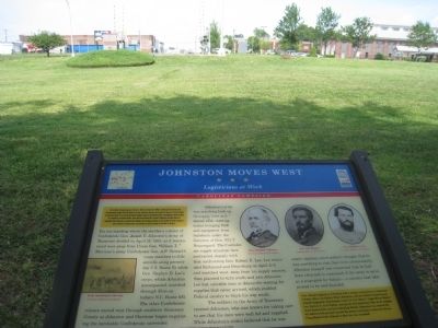
President Jefferson Davis and his entourage paused here in Lexington on April 16-17, 1865, as the Confederate government fled south after the April 3 evacuation of Richmond, Virginia. While here, Davis telegraphed Gen. Joseph E. Johnston as to the . . . — — Map (db m222581) HM
Near Yokley Road, 0.6 miles east of Ridge Road, on the left when traveling east. Reported missing.
For an hour on the evening of Easter Sunday, April 16, 1865, a pine grove outside Lexington became the de facto seat of government for the Confederate States of America and the state of North Carolina. President Jefferson Davis and his cabinet, . . . — — Map (db m222585) HM
On South Main Street, on the right when traveling south.
The Homestead was the home of Dr. William R. Holt, one of antebellum North Carolina’s most versatile and talented men, with interests in medicine, agriculture, education, religion, transportation, and manufacturing. In May 1865, when Dr. Holt . . . — — Map (db m222588) HM
On E Main Street at Memorial Park Drive, on the right when traveling north on E Main Street.
During the Civil War, Thomasville became a hospital center that treated the sick and wounded, civilian and soldier alike. From 1862 to 1865, a local doctor, D. W. Smith, operated a smallpox hospital just outside of town. In March 1865, Surgeon Simon . . . — — Map (db m34232) HM
On West Main Street at Trade Street, on the left when traveling west on West Main Street.
John W. Thomas, who represented this area in the state legislature in the mid-1800s, laid out the town of Thomasville in 1852 on the proposed route of the North Carolina Railroad. Three years later, the line was completed to the new town, and the . . . — — Map (db m208795) HM WM
Near Memorial Park Drive, on the right when traveling west.
(Preface): John W. Thomas, who represented this area in the state legislature in the mid-1800s, laid out the town of Thomasville in 1852 on the proposed route of the North Carolina Railroad. Three years later, the line was completed to the . . . — — Map (db m222596) HM
On Clement Street at Water Street, on the right when traveling south on Clement Street.
(Preface):
On March 24, 1865, Union Gen. George Stoneman led 6,000 cavalrymen from Tennessee into southwestern Virginia and western North Carolina to disrupt the Confederate supply line by destroying sections of the Virginia and Tennessee . . . — — Map (db m53207) HM
On Magnolia Extension (State Highway 11) at Mallard Street (State Highway 50), on the left when traveling south on Magnolia Extension.
Throughout the Civil War, North Carolina furnished much of the material that the Confederate armies needed to sustain field operations. Here in Kenansville, the Confederate States Army produced military supplies ranging from swords to knapsacks. . . . — — Map (db m77287) HM
On Magnolia Extension (State Highway 11) at Mallard Street (State Highway 50), on the left when traveling south on Magnolia Extension.
In April 1861, Louis Froelich, a Bavarian immigrant, began manufacturing uniform buttons in Wilmington for North Carolina soldiers. With Hungarian partner Col. Bela Estvan, Froelich operated his first arms factory for the Confederacy from November . . . — — Map (db m77289) HM
On East Hill Street at North Center Street, on the left when traveling east on East Hill Street.
During the war, the Wilmington and Weldon Railroad was part of a rail network that transported vital supplies north to Confederate forces in Virginia. Cutting that line became an important Union objective.
On July 5, 1863, Lt. Col. George W. . . . — — Map (db m77306) HM
Near Farrington Road, on the right when traveling north.
(Preface): The Carolinas Campaign began on February 1, 1865, when Union Gen. William T. Sherman led his army north from Savannah, Georgia, after the “March to the Sea.” Sherman’s objective was to join Gen. Ulysses S. Grant in Virginia to . . . — — Map (db m223114) HM
On S Miami Blvd. (State Highway 1959), on the right when traveling north.
(Preface): The Carolinas Campaign began on February 1, 1865, when Union Gen. William T. Sherman led his army north from Savannah, Georgia, after the “March to the Sea.” Sherman's objective was to join Gen. Ulysses S. Grant in . . . — — Map (db m14710) HM
On Blackwell Street, on the right when traveling north.
(Preface):The Carolinas Campaign began on February 1, 1865, when Union Gen. William T. Sherman led his army north from Savannah, Georgia, after the “March to the Sea.” Sherman's objective was to join Gen. Ulysses S. Grant in Virginia to . . . — — Map (db m219797) HM
On Blackwell Street, on the right when traveling north.
North Carolina’s Civil War stories are as diverse as its landscape. The Outer Banks and coastal rivers saw action early in the war, as Union forces occupied the region. Stories abound of naval battles, blockade running, Federal raids and the . . . — — Map (db m219798) HM
(Preface) The Carolinas Campaign began on February 1, 1865, when Union Gen. William T. Sherman led his army north from Savannah, Georgia, after the “March to the Sea.” Sherman’s objective was to join Gen. Ulysses S. Grant in Virginia to . . . — — Map (db m45346) HM
(Preface, upper left) : The Carolinas Campaign began on February 1, 1865, when Union Gen. William T. Sherman led his army north from Savannah, Georgia, after the “March to the Sea.” Sherman’s objective was to join Gen. Ulysses S. . . . — — Map (db m3635) HM
On Bennett Memorial Road, on the right when traveling east. Reported permanently removed.
North Carolina’s Civil War stories are as diverse as its landscape. The Outer Banks and coastal rivers saw action early in the war, as Union forces occupied the region. Stories abound of naval battles, blockade running, Federal raids and the . . . — — Map (db m210746) HM
When North Carolina became the last state to secede from the Union in May 1861, Washington Duke’s small farm and homestead here consisted of more than 300 acres. He grew typical crops such as corn, wheat, oats, and sweet potatoes, and had raised . . . — — Map (db m37834) HM
North Carolina’s Civil War stories are as diverse as its landscape. The Outer Banks and coastal rivers saw action early in the war, as Union forces occupied the region. Stories abound of naval battles, blockade running, Federal raids and the . . . — — Map (db m37830) HM
On East St. James Street at St. David Street, on the right when traveling east on East St. James Street.
Civil War soldiers and veterans are buried in Calvary Episcopal Churchyard and Old Town Cemetery. Among the
fifty Confederates interred in the churchyard are Gen. William Dorsey Pender and Lt. Col. John L. Bridges. In May 1863,
Pender . . . — — Map (db m45432) HM
(Preface): On July 18, 1861, Union Gen. Edward E. Potter led infantry and cavalry from New Bern to destroy the Wilmington and Weldon Railroad bridge at Rocky Mount. The Infantry feinted toward Kinston and returned to New Bern. Potter . . . — — Map (db m62211) HM
On East Wilson Street, on the left when traveling east.
(Preface): On July 18, 1863 Union Gen. Edward E. Potter led infantry and cavalry from New Bern to destroy the Wilmington and Weldon Railroad bridge at Rocky Mount. The infantry feinted toward Kinston and retreated to New Bern. Potter raided . . . — — Map (db m168410) HM
Near South Church Street just north of Race Street, on the left when traveling south.
In the opening year of the Civil War, the church behind you (now St. Philips Moravian) was constructed for enslaved and free black Moravians. Its cornerstone was laid on August 24, 1861, and it was consecrated on December 15. It replaced an . . . — — Map (db m172121) HM
Near North Main Street (County Route 1229) north of College Street, on the left when traveling north.
On May 1, 1865, five days after Confederate Gen. Joseph E. Johnston surrendered to Union Gen. William T. Sherman near Durham Station, approximately 12,000 to 15,000 troops of Sherman’s Army of the Tennessee camped in Louisburg en route to . . . — — Map (db m77880) HM
On Church Street at Court Street (North Carolina Highway 137), on the left when traveling south on Church Street.
The Gates County militia had its headquarters here in the 1836 Gates County Courthouse. When the war began, the Gates Guards were organized and were mustered into Confederate service here as Co. B, 1st North Carolina Infantry. Other Gates County . . . — — Map (db m60625) HM
On East Main Street (County Route 1106) at Court Street, on the right when traveling west on East Main Street.
During the Civil War, Graham Country (the part of Cherokee County) offered scant support to the secessionist cause, although both ardent Confederates and staunch Unionists lived here. The region was not financially dependent on slavery. Most . . . — — Map (db m75453) HM
On North Carolina Route 903, 0.2 miles east of Edwards Bridge Road (County Route 1004), on the left when traveling east.
(preface)
On July 18, 1863, Union Gen. Edward E. Potter led infantry and cavalry from New Bern to destroy the Wilmington and Weldon Railroad bridge at Rocky Mount. The infantry feinted toward Kinston and returned to New Bern. Potter . . . — — Map (db m222347) HM
On East Main Street (State Highway 123) at South William Hooker Drive, on the right when traveling east on East Main Street. Reported permanently removed.
(preface)
On July 18, 1863, Union Gen. Edward E. Potter led infantry and cavalry from New Bern to destroy the Wilmington and Weldon Railroad bridge at Rocky Mount. The infantry feinted toward Kinston and returned to New Bern. Potter raided . . . — — Map (db m232003) HM
On U.S. 13 (U.S. 258) at County Route 903, on the right when traveling north on U.S. 13.
(Preface): On July 18, 1863 Union Gen. Edward E. Potter led infantry and cavalry from New Bern to destroy the Wilmington and Weldon Railroad bridge at Rocky Mount. The infantry feinted toward Kinston and retreated to New Bern. Potter raided . . . — — Map (db m222349) HM
On Jackson Street Extended (County Road 1464) 0.1 miles west of Roanoke Avenue (State Highway 48), on the right when traveling west.
The section of canal in front of you is one of the few remnants of an engineering marvel designed to revolutionize transportation in inland North Carolina. In 1819, the Roanoke Navigation Company, representing public and private interests from . . . — — Map (db m180469) HM
On Jackson Street Extended at Roanoke Avenue (North Carolina Highway 48), on the right when traveling west on Jackson Street Extended. Reported missing.
The Roanoke Navigation Company—a collaboration among North Carolina, Virginia, and private shareholders—began building the Roanoke Canal in 1819. The company created an inland navigation system from the upper Staunton and Dan Rivers in Virginia, . . . — — Map (db m222107) HM
218 entries matched your criteria. The first 100 are listed above. Next 100 ⊳