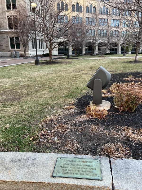
On Broadway at Columbia Street, on the right when traveling south on Broadway.
Hy Rosen (1923-2011). Born in Albany. Graduated Philip Schuyler High School. Studied at the Art Institute of Chicago and the Art Students League of NY. Enlisted in the Army in 1942 with 604th Engineers Camouflage Battalion and served in Europe. . . . — — Map (db m307524) HM
On Washington Avenue (New York State Route 5) east of Dove Street, on the right when traveling east.
116 Washington Avenue
A fine arts & crafts townhouse
Designed by Albany architects Charles Ogden & Walter Van Guysling
Built in 1908 for Doctor Joseph Ivimey Dowling
118-120 Washington Avenue
Built in 1817 for James . . . — — Map (db m303861) HM
Near Meeting House Road east of Heritage Ln (Local Route 151).
The Dwelling House or "Bell House" contained a kitchen, large community dining rooms, and retiring rooms (bedrooms). At the height of this community, 100 Shakers lived in the main building and the 'T' shaped wing. On its roof in a cupola, hung a . . . — — Map (db m115659) HM
On South Pearl Street (New York State Route 32) 0.1 miles south of Kenwood Road, on the right when traveling north.
This trail is a 9-mile pathway which follows the old Albany and Susquehanna Railroad between Albany and Voorheesville. This pathway connects visitors with landscapes and communities, including the dramatic Normanskill Gorge in the City of Albany, . . . — — Map (db m185899) HM
On Washington Avenue (New York State Route 5) east of Dove Street, on the right when traveling east.
Located at North Pearl Street and
130 Washington Avenue
Founded by
Silas S. Packard
1857
Owned and operated by the
Carnell family
1885 to 1988 — — Map (db m303857) HM
On Montgomery Street, on the right when traveling south.
The original Quackenbush pumping sta.
engines pumped water from
Hudson River to reservoirs until
Dec. 1932. In Charge of Construction:
I.C. Chesbrough. Engineer; J.H. Mars,
Engineer For Pump Engine Constr.
1874
Designated as an Albany . . . — — Map (db m4190) HM
On Meeting House Road, on the left when traveling east.
Barn (1915)
The Barn is one of the newest Shaker structures on the Church family site, built in 1915 after the previous barn was burned in an act of arson the year before. This baen features many modern design features of its time, a claw and . . . — — Map (db m249640) HM
On Broadway at Ferry Street, on the right when traveling east on Broadway.
Built as the Boardman & Gray Piano Factory in 1853, it later became the Regent Shirt Factory, then the offices of the Brandow Printing Co. — — Map (db m115701) HM
On Meeting House Road, on the right when traveling south.
Brethren's Workshop (1822)
This was the men's or "Brethren's" Workshop. The Shakers were egalitarian, and the work that men and women each contributed to the community was equally valued. While the tasks of daily life in a Shaker community . . . — — Map (db m250081) HM
On Meeting House Road, on the left when traveling north.
The Brethren's Shop was used by the men and boys for various crafts including shoe making and tinsmithing. The porches and dormers were added in 1930 and the building is now used by Albany County as offices.
A date stone in the basement is . . . — — Map (db m115662) HM
The Shakers stored milk in the creamery to keep it cool. Milk was brought from the barn in large milk cans, which were then kept cool in troughs filled by water diverted from the creek. Later the building was used as a hen house; now it is used . . . — — Map (db m115688) HM
On S Swan Street at Washington Avenue, on the right when traveling north on S Swan Street.
By his faith in God and Man he built our Nation
Erected in 1932 by the
New York State Commission
for the Celebration of the
Two Hundredth Anniversary of the Birth of
George Washington
Franklin D Roosevelt, Governor
Hon Herbert H. . . . — — Map (db m291703) HM
On Meeting House Road, on the left when traveling east.
Shakers lived a seasonal lifestyle, structured around the cycle of planting, cultivating, and harvesting crops. Today, the orchard across Heritage Lane is the only remaining sign of Shaker agriculture. However, the fields were vast, and the Shakers . . . — — Map (db m250291) HM
On Western Avenue (U.S. 20) at Glenwood Street, on the left when traveling east on Western Avenue.
McKownville-Country Club Highlands Historic District has been placed on the National Register of Historic Places in 2022 by the United States
Department of the Interior — — Map (db m292166) HM
On Meeting House Road, on the left when traveling south.
Shakers embraced song and dance as forms of spiritual expression. On Sundays they gathered here at the Meeting House to sing, dance, and pray for hours at a time. To build goodwill and attract new Believers, visitors from the "World" were invited in . . . — — Map (db m250018) HM
On Meeting House Road, on the right when traveling west.
Journals record frequent visits of the Ministry Elders, to and from
various Shaker communities. Traffic was steady between Mt. Lebanon
and Watervliet. On the second of January, 1850, Rufus Bishop recorded
that "We, the Ministry, came to . . . — — Map (db m249521) HM
This brick building was used by the ministry elders. Each member of the ministry had to perform daily manual labor such as shoe making or tailoring. Elder Chauncey Copeley a cabinet maker, worked in a wing added to the building in 1850. . . . — — Map (db m115660) HM
Near New Karner Road (New York State Route 155) at Old State Road.
In 2014, the Albany Pine Bush was designated
a National Natural Landmark by the U.S.
Department of the Interior in recognition of
outstanding geological and biological features
including the largest area of inland sand dunes
in the eastern . . . — — Map (db m191105) HM
Near Broadway at Quackenbush Square, on the left when traveling south.
No. 25 Quackenbush St. Renovated
In 1895 For Business Offices Of
The Water Dept. Rear 2 Story Brick
Bldg. Added for Stable and Work
Shops. 1897 Stable & Office Bldg.
Were Connected.
Edw. Ogden & Son, Architects
1852 . . . — — Map (db m266452) HM
By 1920, automobiles had become both necessary and fashionable. The Shakers never hesitated to adopt new technology that would make life easier and more efficient. They built this concrete garage for their Packard automobilies [sic]. — — Map (db m115671) HM
The plants in this garden are some of the herbs used and sold by The Watervliet Shaker Community during the 1800's. The community grew large "Botanical/Physic" gardens and also gathered many wild herbs for use in their business of selling dried . . . — — Map (db m115658) HM
On Meeting House Road, on the right when traveling north.
This Meeting House, or Church, was built in 1848 to replace an earlier (1791) and much smaller Meeting House. It demonstrates many typical characteristics of Shaker architecture; double doors, one for men and one for women; a large meeting room . . . — — Map (db m115663) HM
On this location was a large 3 1/2 sto[r]y stone building. Here Shaker Sisters did spinning, weaving, and sewing. Journal entries indicate that Sister Polly wove 3350 Shaker bonnets in this building.
The building was the only stone building . . . — — Map (db m115656) HM
On Commerce Avenue, on the right when traveling west.
Site Of
The New York Central
Railroad erector shop where
Engine 999 was built in 1893.
'999' was the first creation
of man in the history of time
to Travel 100 Miles per Hour
— — Map (db m32251) HM
On Quay Street, on the right when traveling north.
The Erie Canal.
This site marks the east
end of the canal, opened in
1825. It carried products
and people between the
Hudson River and Lake Erie
Albany Basin.
For nearly 100 years boats
entered the Erie Canal at
nearby Lock 1, . . . — — Map (db m5174) HM
Near Edgewood Place at Washington Park Road, on the right when traveling north.
This section of the park, just south of the original playground, was a destination for park visitors seeking refreshment. An elaborate octagonal pavilion housed a drinking fountain that catered to thirsty children from the adjacent playground. . . . — — Map (db m310888) HM
On Meeting House Road, on the left when traveling south.
While Shakers fived in separate communities, they were not completely isolated from the outside world. In fact, their economy depended on commerce with the
"World's People" and the Trustee's Office is where business was conducted.
Business . . . — — Map (db m250193) HM
On Albany-Shaker Road (New York State Route 155) at Northway - Exit 3 (Interstate 87) when traveling south on Albany-Shaker Road.
Learning through archeology
During the planning process for Interstate 87 Exit 3, archeologists conducted surveys looking for historic artifacts below ground. They uncovered remarkable evidence that these lands had been used as a seasonal . . . — — Map (db m308543) HM
On Meeting House Road, on the left when traveling east.
Shaker Creek provided water for both the canning and laundry operations. The first laundry, done on December 12, 1859, used a steam powered washing machine. Albany County used the building for laundry until the mid 1980s. Today it is a workshop. . . . — — Map (db m115674) HM
On Heritage Lane 0.2 miles west of Airline Drive, on the right when traveling west.
This orchard was planted and tended by Shakers who now rest in the nearby cemetery. It shows up on an 1838 map of the Church Family, one of four Shaker villages established within a mile. Apples were an important food in the Shakers' diet. Apples . . . — — Map (db m311795) HM
On Heritage Lane at Airline Drive, on the right when traveling west on Heritage Lane.
The orderly arrangement and simple design of the stones in this cemetery reflect the communal lifestyle and egalitarian ideals of the Shakers buried here. What the stones don't reveal is the innovation, craftsmanship. and industriousness of the . . . — — Map (db m248457) HM
On Meeting House Road east of Heritage Lane, on the left when traveling east.
What Happened to the Shakers?
At their peak in the mid-1800s, there were 4,000 to 6,000 Shakers living in nineteen US communities. Under the leadership of Mother Ann's American-born successors, Father Joseph Meacham and Mother Lucy Wright, . . . — — Map (db m249604) HM
On Meeting House Road, on the right when traveling east.
You are standing on the site of the first Shaker settlement in the United States, founded in 1776. On these lands, the Shakers eventually established four "Families" starting with the Church Family, followed by the South Family, West Family and . . . — — Map (db m250005) HM
Near Ten Broeck Place north of Ten Broeck Street, on the left when traveling east.
Abraham Ten Broeck (1734-1810) built this grand mansion in the Federal style after the destruction of his family home on Broadway in the great fire of 1797.
Descended from one of Albany's founding New Netherland families, he was a businessman, . . . — — Map (db m139507) HM
"The face had an expression of absolute content, of relief, at throwing off a burden such as few men have been called upon to bear --- a burden which few men could have borne." - Recollections of New York Secretary of State Chauncey M. Depew. . . . — — Map (db m5192) HM
On Livingston Avenue 0.1 miles east of Lark Street, on the right when traveling east.
Stephen Myers and his wife Harriet were the leaders of the Underground Railroad in Albany in the 1850s. Born enslaved in Rensselaer County, New York, in 1800, Stephen Myers was freed at age eighteen. By 1831 he and Harriet were assisting freedom . . . — — Map (db m144037) HM
On Livingston Avenue east of North Swan Street/Colonie Street, on the right when traveling east.
On this site, two generals of the Revolutionary War were interred. Major General Philip Schuyler and Brigadier General Abraham Ten Broeck, both natives of Albany.
General Philip Schuyler died in November of 1804 and was buried here following a . . . — — Map (db m139508) HM
On Northern Boulevard, on the right when traveling south.
Through this Place Passed
Gen. Henry Knox
In the Winter of 1775 - 1776
to deliver to
Gen. George Washington
at Cambridge
the train of artillery
from Fort Ticonderoga
used to force the British
Army to evacuate Boston
. . . — — Map (db m272504) HM
George L. Fox, Methodist minister
Alexander D. Goode, Jewish Rabbi
Clark V. Poling, Dutch Reformed Minister
John P. Washington, Catholic Priest
During the early morning hours of February 3, 1943 the USAT Dorchester was part of a convoy of . . . — — Map (db m64989) HM WM
On State Street just west of Henry Johnson Boulevard, on the right when traveling west.
Built for Charles Reynolds
Proprietor of a shirt factory
1891
1924-1942
home of Irving Lehman
Judge New York State
Court of Appeals — — Map (db m309191) HM
On State Street close to Sprague Street, on the left when traveling east.
Built for Harriet & Albert V. Bensen
Owner of the China Tea Co.
1880
Attributed to
Architect Albert Fuller
Historic Albany Foundation — — Map (db m309502) HM
On Willett Street 0.1 miles south of Hudson Avenue, on the right when traveling north.
Home of Isaac Waldman
Mann & Waldman Co.
Dry Goods
1878
2006
Preservation
Merit Award
78 Willett Street
Entry hood reconstruction — — Map (db m312317) HM
On Knox Street Mall/Henry Johnson Boulevard just south of Washington Park Road, in the median.
Soldiers and Sailors Memorial Commission of the City of Albany, New York Mayors Charles H. Gaus • Henry F. Snyder • James B. McEwan Commissioner of Public Works Wallace Greenalch Commissioners * John S. McEwan * John L. Newman • Peter Kinnear * . . . — — Map (db m144262) WM
On Knox Street Mall/Henry Johnson Boulevard just south of Washington Park Road, on the left when traveling south.
This straight path, sometimes known as the "Knox Street Mall", is the only portion of Washington Park that follows the pattern of the surrounding urban grid. It marks the west side of what was known as Middle or Washington Square.
This . . . — — Map (db m144256) HM
In commemoration of the three hundredth anniversary of the founding in 1624 of the first permanent settlement of Albany, then known as Fort Orange, near the site of Fort Nassau built in 1614 and abandoned in 1617. With the establishment of . . . — — Map (db m64993) HM
On Eagle Street at Corning Place, on the left when traveling south on Eagle Street.
Tablet commemorating the
Two Hundredth Anniversary
of
Albany
As a chartered city
Settled about 1624:
Charter Granted by Gov. Dongan:
July 22 1606:
State Legislature Held Here Permanently Since 1797:
Early Names Of The City: . . . — — Map (db m5560) HM
On South Swan Street, on the right when traveling east.
By his faith in God and man he built our nation
Erected in 1932 by the
New York State Commission
for the celebration of the
two hundredth anniversary of the birth of
George Washington
Hon. Franklin D. Roosevelt, Governor
Hon. . . . — — Map (db m8126) HM
On North Pearl Street (New York State Route 32) at State Street ( Route 5), on the right when traveling south on North Pearl Street.
The city of Albany is home to six National Historic Landmarks and more than 4,000 properties listed on the New York State and National Register of Historic Places.
In 2015, Albany was designated a Preserve America Community by President . . . — — Map (db m116698) HM
On Washington Avenue at Eagle Street on Washington Avenue.
Established in 1882, a hill on the site required the removal of 10,000 loads of sand and clay filling a gully on the north side of Elk Street where present houses were built.
Albany 300 - 1686-1986 - Still making History
Erected by Albany . . . — — Map (db m64997) HM
In Honor of the 200th Anniversary of the
1797 City of Albany 1997
Serving as the Capital City of the State of New York
For twenty years, after the establishment of the State of new . . . — — Map (db m5540) HM
After the English gained control of the Hudson Valley from the Dutch in 1674, they established a strong presence in the town they renamed Albany. Soldiers headquartered at Fort Frederick just above this intersection. They formed a masonic lodge in . . . — — Map (db m76382) HM
On State Street (New York State Route 5) at James Street, on the right when traveling west on State Street.
Upon this corner stood the house occupied by and wherein died Anneke Janse Bogardus 1663 The former owner of Trinity Church Property New York — — Map (db m147125) HM
Near North Pearl Street (New York State Route 32) south of Columbia Street, on the right when traveling north.
The City of Albany Salutes
B. Lodge & Co.
”Albany’s Oldest Store”
Established 1867
Presented by
Mayor Gerald D. Jennings
January 11, 1999
— — Map (db m116738) HM
On Washington Ave. (New York State Route 5) west of Eagle Street, on the right when traveling west.
Birthplace of Modern Electricity. Here discovering magnetic induction, Joseph Henry pioneered the telegraph and electric motor, 1829-31. — — Map (db m141459) HM
On Broadway just north of State Street ( Route 5), on the right when traveling north.
Early Albany, the Dutch village of Beverwijck, was filled with artisans — the people who built the community and made it livable and bustling with activity. By the late 1650s, among the thousand residents who called Beverwijck home, hard . . . — — Map (db m144029) HM
On Eagle Street at Corning Place, on the right when traveling east on Eagle Street.
Initiated by William Gorham Rice. Completed in 1927. Restored in 1986 celebrating Albany's Tricentennial of the Dongan Charter through the generous contributions of the citizens of Albany. — — Map (db m64992) HM
On Broadway (New York State Route 5) north of Hudson Avenue, on the right when traveling north.
The Declaration of Independence
Was first publicly read in
Albany by order of the
Committee of Safety
July 19, 1776 in front of this
City Hall, then on this site.
This memorial of the event
was placed here by the
citizens
. . . — — Map (db m116673) HM
Near Quay Street north of Broadway, on the right when traveling north.
While restoration progressed above the waterline, work below the waterline was delayed until such a time as the ship could be placed into drydock. The scope and cost of such a project meant that it would have to wait until the necessary funds were . . . — — Map (db m205900) HM
Albany's coomercial growth boomed after
the Erie Canal was completed
in 1825. From a small basin,
barges entered the river through a final lock.
Lining a mile of the canal above the basin was in
the Lumber District, where towering piles . . . — — Map (db m227414) HM
On State Street at Eagle Street, on the left when traveling east on State Street.
Fort Frederick Governor Edmund Andros Made an Inspection in Albany in 1676 and Found Fort Orange, Located Near the Foot of Madison Avenue in Poor Condition. He Ordered a New Fort Constructed at a Site in the Center of State Street Just West of Lodge . . . — — Map (db m5248) HM