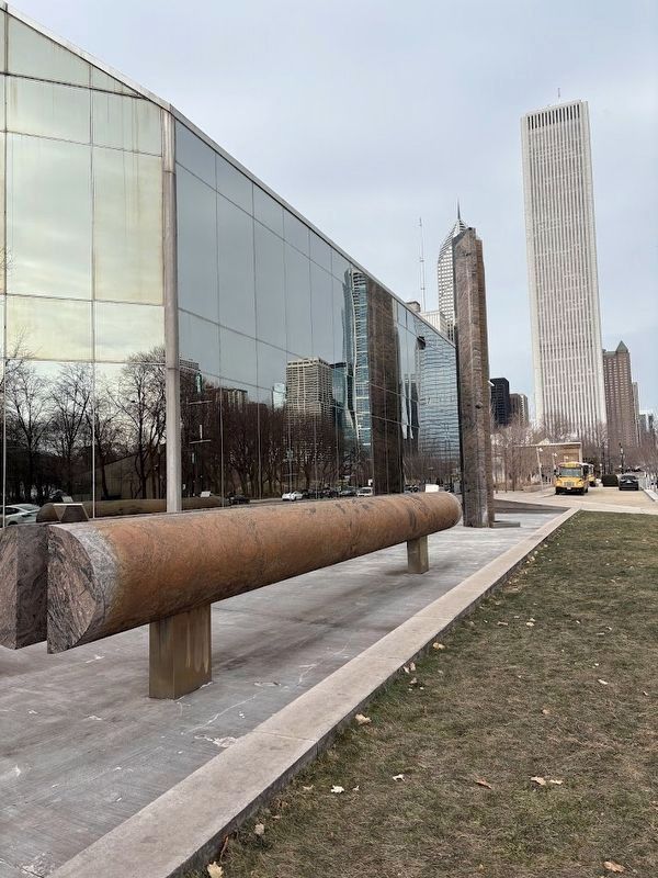
On Columbus Drive south of Monroe Street, on the right when traveling south.
Celebration of the two hundredth anniversary of the founding of the republic
By Isamu Noguchi
Commissioned by the trustees of the B.F. Ferguson Monument Fund
Dedicated November 30, 1976 — — Map (db m262822) HM
On Columbus Drive at Roosevelt Road, on the right when traveling north on Columbus Drive. Reported permanently removed.
[Inscription on the shaft holding up the statue:]
To Christopher Columbus
Discoverer of America
[Text on the pedestal's east side:]
By the grace of God and in the name of Her Majesty Queen Isabella has taken possession of this land . . . — — Map (db m310596) HM
Near North Michigan Avenue near East Madison Street, on the right when traveling north.
"We wish to plead our own cause. Too long have others spoken for us. Too long has the public been deceived by misrepresentations, in things which concern us dearly.”
-John Brown Russwurm, Founder of Freedom's Journal
. . . — — Map (db m251751) HM
Near Michigan Avenue near Madison Street, on the right when traveling north. Reported permanently removed.
Presented as part of Franz West: Millennium Park, this public art exhibition features three monumental installations by the acclaimed Austrian artist Franz West (1947-2012). Set against the iconic backdrop of Millennium Park, the largescale aluminum . . . — — Map (db m262821) HM
On Michigan Avenue near Randolph Street, on the right when traveling north.
In gratitude from the City of Chicago to
John H. Bryan, Chairman, Millennium Park, Inc.,
for his vision and leadership and to all the founders whose names are represented for all time on this Millennium Monument
Their generosity, in . . . — — Map (db m262784) HM
On Monroe Street at Columbus Drive, on the right when traveling west on Monroe Street.
In 2012, the Chicago Park District began transforming the northeastern part of Grant Park into Maggie Daley Park. For many decades, an expansive surface parking lot occupied this site with a portion of the Illinois Central's sunken rail yard . . . — — Map (db m236741) HM
On DuSable Lake Shore Drive (U.S. 41) at East Monroe Street, on the right when traveling south on DuSable Lake Shore Drive.
In 2012, the Chicago Park District began transforming the northeastern part of Grant Park into Maggie Daley Park. For many decades, an expansive surface parking lot occupied this site with a portion of the Illinois Central's sunken rail yard . . . — — Map (db m249996) HM
On East Randolph Street east of North Columbus Drive, on the right when traveling east.
In 2012, the Chicago Park District began transforming the northeastern part of Grant Park into Maggie Daley Park. For many decades, an expansive surface parking lot occupied this site with a portion of the Illinois Central's sunken rail yard . . . — — Map (db m249999) HM
Near Michigan Avenue near Randolph Street, on the right when traveling north.
Mayor Richard M. Daley dedicated Millennium Park 16 July 2004 as a gift to the people of Chicago.
This park is an enduring tribute to Chicago's long history of architectural and artistic excellence. It will stand as an inspiration to the future . . . — — Map (db m262801) HM
Near East Monroe Street west of DuSable Lake Shore Drive (U.S. 41), on the right when traveling west.
Essential funding for the creation of Maggie Daley Park has been provided by Parkways Foundation. Throughout its 18 year history, Parkways Foundation raised and strategically invested more than $30 million to support programs within the Chicago Park . . . — — Map (db m249993) HM
On South Michigan Avenue south of East Madison Street, on the right when traveling north.
How will we build differently in a circular economy? What new systems have to be invented to make efficient use of scarce resources? Made entirely of locally reclaimed timber, Re-SPLAM is a proof of concept for an optimized, lightweight structural . . . — — Map (db m291048) HM
Near Michigan Avenue south of Randolph Street, on the right when traveling north.
The Millennium Monument pays tribute to leading individuals corporations and foundations at the time of the millennium. Their generosity made possible the creation of Millennium Park, which commemorates the spirit and achievement of the great City . . . — — Map (db m262785) HM
Near Michigan Avenue east of Madison Street, on the right when traveling north.
The Lovers Dance is Yvette Mayorga's first augmented reality public work. Drawing from the stories and shapes of her intricately piped paintings and public installations, Mayorga creates an immersive, interactive experience that reflects her . . . — — Map (db m262802) HM
On Madison Street at State Street, on the left when traveling west on Madison Street.
This building epitomizes the Chicago School, a design movement that changed modern architecture. Its distinctive features include large windows, steel-frame construction, projecting bays, and ornate terra cotta cladding. Located at what was known as . . . — — Map (db m240284) HM
This building is an exceptional example of the International Style and was Chicago's first major public building to be designed in a modern, rather than historically-derived, style. Innovative for its time are the building's eight-seven foot spans . . . — — Map (db m242108) HM
Near South Michigan Avenue north of East Ida B. Wells Drive, on the right when traveling south.
Built by the Studebaker company for the assembly and display of their carriages and wagons, this building was converted into studios and theaters for artists and craftsmen in 1898. The interior public spaces, featuring murals on the tenth floor, . . . — — Map (db m237986) HM
On North Michigan Avenue north of East Washington Street, on the right when traveling north. Reported unreadable.
The Michigan Avenue "streetwall" along Grant Park is one of the most iconic images of Chicago, one known around the world. Comprised of many of Chicago's finest individual buildings, this dramatic ensemble reflects the city's development as a grand . . . — — Map (db m238007) HM
On Monroe Street east of Dearborn Street, on the left when traveling east.
This lavishly-detailed early skyscraper houses one of Chicago's oldest legitimate theatres, having featured vaudeville, drama and musicals in its long history. Designed in the French Renaissance style with tripartite Chicago-style windows, it has a . . . — — Map (db m241085) HM
On State Street at Washington Street on State Street.
Expansive windows and Gothic-ornamented terra cotta give this building a light and airy appearance befitting its international reputation as a forerunner of 20th-century glass-and-steel skyscrapers. The building was constructed in two stages: the . . . — — Map (db m240283) HM
On State Street south of Washington Street, on the right when traveling north.
[side 1]
Chicago’s Great Street
There is only one State Street. Widely celebrated in song, “That Great Street” has been known since the 1870s for its concentration of premier department stores and world-class architecture. . . . — — Map (db m240288) HM
On West Wacker Drive at North LaSalle Street on West Wacker Drive.
On this site about 1834, Gurdon S. Hubbard built Chicago’s first warehouse for storing pork and other pioneer produce. Because of its size and substantial construction early skeptics called the building "Hubbard’s Folly." — — Map (db m47692) HM
On West Adams Street at Franklin Street, on the left when traveling west on West Adams Street.
This terra-cotta-clad office building is a handsome example of the Gothic Revival architectural style. Built on the site of an earlier wholesale warehouse for the Carson, Pirie, Scott & Co. Department Store, the building exemplifies the . . . — — Map (db m236485) HM
This outstanding Art Deco-style skyscraper helps define one of the city's finest urban spaces. Its prominence is further heightened by the jog in Michigan Avenue, where it crosses the Chicago River. The base of the building is sheathed in polished . . . — — Map (db m99920) HM
On North Michigan Avenue south of East Wacker Drive, on the right when traveling north.
This outstanding Art Deco-style skyscraper helps define one of the city's finest urban spaces. Its prominence is further heightened by the jog in Michigan Avenue, where it crosses the Chicago River. The base of the building is sheathed in polished . . . — — Map (db m291058) HM
On East Wacker Drive west of North Wabash Street, on the right when traveling east.
This 40-story building was the tallest outside New York City at the time of its construction. The building's terra cotta-clad, classical design marks it as one of the most prominent high-rise statements of the City Beautiful movement. It is also the . . . — — Map (db m234661) HM
On South Michigan Avenue at East 9th Street, on the right when traveling south on South Michigan Avenue.
The Karpen Furniture Company commissioned Marshal and Fox to design a 12-story showroom and company office. The building’s simple ornament contrasted with the exuberant facades of Marshall and Fox’s other work, including the Blackstone and Drake . . . — — Map (db m47884) HM
On Chicago Riverwalk at Jean Baptiste Point du Sable (U.S. 41), on the right when traveling west on Chicago Riverwalk.
1933 A Century of Progress for Chicago's 100th Birthday. A world's fair which focused on science and industry. Buildings were prime examples of art deco and the famous Skyride which was then the tallest man-made structure west of Manhattan.
. . . — — Map (db m289563) HM
On North Michigan Avenue at Madison Street, on the right when traveling south on North Michigan Avenue.
Born in New Jersey, Ward grew up in Niles, Michigan. He left school at 14 to work as a laborer and then a clerk. In 1865 he moved to Chicago, where he clerked briefly in the dry goods emporium of Field, Palmer and Leiter. His next job, selling a St. . . . — — Map (db m237359) HM
On South Michigan Avenue at East 11th Street on South Michigan Avenue.
Aaron Montgomery Ward had a vision for Chicago’s lakefront that set him apart from most of his contemporaries. For two decades (1890-1910),he fought tirelessly to preserve Chicago’s lake shore as an open space and assure the city’s “front . . . — — Map (db m47782) HM
On South Michigan Avenue at East Congress Parkway, on the right when traveling south on South Michigan Avenue.
The extraordinary engineering talent of Dankmar Adler and the architectural genius of Louis Sullivan created this building to reflect the cultural maturity of Chicago. Combining hotel and office space with a splendid theater, the Auditorium was a . . . — — Map (db m34975) HM
On South Wabash Avenue north of East Ida B. Wells Drive, on the left when traveling south.
The Commission on Chicago Architectural Landmarks by authority of the City Council of Chicago has designated this building as an architectural landmark.
In recognition of the community spirit which here joined commercial and artistic ends, . . . — — Map (db m237448) HM
On North State Street at East Wacker Drive, on the right when traveling north on North State Street.
Dedicated
to the memory of those gallant
heroes from the Chicago area
who were members of the besieged
garrison on the Bataan peninsula
and at Corregidor, Philippine
Islands, in World War II.
May the courage and fortitude
displayed . . . — — Map (db m134843) WM
Near South Michigan Avenue north of East Ida B. Wells Drive, on the right when traveling south.
At this site on November 18, 1915, was founded the American Medical Women's Assoc., dedicated to the support of women physicians and women's health. As its founder and first president, Bertha Van Hoosen, M.D., demonstrated her dedication to the . . . — — Map (db m237431) HM
On East Balboa Avenue near South Michigan Avenue, on the right when traveling west.
An outstanding example of Modern French style of Beaux-Arts Classical architecture. As one of the city's earliest luxury hotels, it became the "Hotel of Presidents," serving as host to a dozen U.S. Presidents, including Woodrow Wilson, Franklin D. . . . — — Map (db m94409) HM
On U.S. 66 at South Franklin Street, on the right when traveling east on U.S. 66.
Holabird & Roche, architect
1909- 10
An excellent example of the Chicago School,
an architectural style of international importance
that developed between the 1880s and the
early 1900s. This building was commissioned
by Boston developers . . . — — Map (db m134414) HM
On South Wabash Avenue north of Balbo Avenue, on the right when traveling north.
For over a half century, this building housed the headquarters of the Company which has come to be known as Brunswick Corporation. Then called the Brunswick-Balke-Collender Company, it moved here in 1913 after a fire destroyed its previous home. The . . . — — Map (db m237407) HM
On East Wacker Place at North Michigan Avenue, on the right when traveling east on East Wacker Place.
According to popular legend, the architects chose this building’s dark green and gold colors based on a gold-foiled champagne bottle seen at an office holiday party. Whether true of not, the building is one of the most-distinctive features on . . . — — Map (db m51698) HM
On South Wabash Avenue north of East Monroe Street, on the right when traveling south.
The Carson Pirie Scott store ranks as one of the most important structures in early modern architecture. An example of 19th-century modular construction, it also clearly expresses the period's philosophy about an ornamental architecture.
. . . — — Map (db m244990) HM
These carved granite fragments are from the Illinois Central Station which stood at the southwest edge of Grant Park for more than 75 years. Bradford Lee Gilbert, a prolific architect of American railroad buildings, designed the massive . . . — — Map (db m99761) HM
On Chicago Riverwalk at Jean Baptiste Point du Sable Lake Shore Drive (U.S. 41), on the left when traveling east on Chicago Riverwalk.
Chicago (Chicagou in the Algonquin tongue) was named for the wild onions that grew in abundance on the river banks.
1673 Guided by Indians, Pere Jacque Marquette, a Jesuit Missionary and Louis Jolliet an explorer, arrive at the portage to . . . — — Map (db m289643) HM
On Chicago Riverwalk west of the Wells Street Bridge.
Chicago had the fastest growing population in the world during the 19th century. The river helped create a bustling economy but also required bridges. Chicago has the most moveable bridges in the U.S. and the most bridge design patents in the world. — — Map (db m270459) HM
On Chicago Riverwalk at Jean Baptiste Point du Sable Lake Shore Drive (U.S. 41), on the right when traveling west on Chicago Riverwalk.
By 1832, due to increased lake traffic, a lighthouse was built next to the fort. In 1834 the United States Army cut through a sand bar at the mouth of the Chicago River to create a better commercial harbor. By 1839 the first shipment of . . . — — Map (db m289647) HM
On East Balbo Drive east of South Wabash Avenue, on the right when traveling west.
Founded as the Goodman Children's Theatre in 1925 and recognized as a pioneer of theatre for families, Chicago Playworks welcomes more than 25,000 students and families to our highly celebrated productions each season. Today, we are dedicated to . . . — — Map (db m275673) HM
This memorial is dedicated to all veterans of the armed forces who served in Viet Nam. It replaces the former memorial and reflecting pool located on Wacker Drive that had been dedicated by Mayor Jane M. Byrne on November 11, 1982. The inscribed . . . — — Map (db m134950) WM
On North Michigan Avenue at East Wacker Drive on North Michigan Avenue.
This river originally flowing eastward from the prairie home lands of the Potawatomi and other Indian tribes into Lake Michigan, linked the waters of the Atlantic, the St. Lawrence and the Great Lakes with those of the Illinois, the Mississippi and . . . — — Map (db m99534) HM
On Chicago Riverwalk at Jean Baptiste Point du Sable Lake Shore Drive (U.S. 41), on the right when traveling west on Chicago Riverwalk.
1894 The Vertical Lift Bridge was at Halsted Street on the South Branch of the river.
The swing style bridge did not allow room for the newer, larger ships to pass in the river so several new designs were used to solve the problem.
. . . — — Map (db m289652) HM
On Chicago Riverwalk east of the Orleans Street Bridge.
Friends of the Chicago River's Fish Hotel was the first floating wetland in Chicago and demonstrated we could build habitats where there previously weren't any. — — Map (db m270457) HM
The mixture of river, marshes, prairie and forest surrounding the pre-settlement Chicago River supported a variety of wildlife species, but numbers dwindled as development and pollution changed their habitat. With the health of the river improving, . . . — — Map (db m256602) HM
On South Michigan Avenue at East Adams Street (U.S. 66), on the right when traveling south on South Michigan Avenue.
[English-language text on the west-facing side of the marker:]
“The Main Street of America”
In the 1920s, America became an automobile nation. At the start of the decade, there were 8 million cars on the road, but roughly 32,000 of the . . . — — Map (db m251544) HM
Near Chicago Riverwalk 0.1 miles east of Michigan Avenue.
This historical memorial is a representation of a WWII era submarine watertight bulkhead. Its design, construction, and placement here is a result from a challenge by a group of WWII Submarine combat veterans to "not forget Pearl Harbor." The west . . . — — Map (db m256910) HM
On North State Street south of Lake Street, on the right when traveling north.
A distinctively American building type, the motion picture palace provided a fantasy environment in which fantasies of stage and screen could be enjoyed. This Beaux-Arts style building, with its elaborate decoration and grand proportions, was one of . . . — — Map (db m236517) HM
On Chicago Riverwalk at Jean Baptiste Pointe du Sable Lake Shore Drive (U.S. 41), on the right when traveling west on Chicago Riverwalk.
1782 Jean Baptiste Point du Sable, an Afro-French Canadian fur trapper settled on the north bank of the river. He peace with the Potawatomis and married Catherine, a member of the tribe. They left in 1803 when the Louisiana Purchase opened . . . — — Map (db m289646) HM
Chicago has more movable bridges than any other city in the world. Most bridges over the Chicago River are trunnion bascule bridges known throughout the world as "Chicago Style". The French word "bascule" means teeter-totter. Through the mid-century . . . — — Map (db m256590) HM
On North Wacker Drive at West Madison Street, on the right when traveling south on North Wacker Drive.
This structure combines a 45-story, Art Deco-style office tower with a 3,650-seat opera theater. The lower part of the Wacker Drive facade was designed in an ornate French Renaissance Revival style to resemble the Paris Opera House. The dramatic . . . — — Map (db m236406) HM
During the winter of 1891, a group of Chicago sailors gathered at the home of a bridge tender to discuss the formation of a club dedicated to the sport of sailing. Their idea was to create on the lakefront, a facility where men and women could enjoy . . . — — Map (db m47651) HM
On South LaSalle Street at West Adams Street, on the right when traveling south on South LaSalle Street.
This massive block-long office building was built to house one of Chicago’s leading banks and exemplifies the large commercial buildings that define the distinctive LaSalle Street “canyon.” Architect Daniel Burnham personally . . . — — Map (db m47757) HM
Named for brothers Ira and James Couch, owners of the Tremont Hotel which stood at Lake & Dearborn streets from 1850 to 1871. Chicago's first brick building, the Tremont hosted President Abraham Lincoln when he visited Chicago. — — Map (db m245008) HM
Named for brothers Ira and James Couch, owners of the Tremont Hotel which stood at Lake & Dearborn streets from 1850 to 1871. Chicago's first brick building, the Tremont hosted President Abraham Lincoln when he visited Chicago. — — Map (db m245011) HM
On South Dearborn Street north of West Congress Parkway, on the right when traveling north. Reported missing.
[Side A]
Dearborn Street showcases some of Chicago’s best architecture, art, and urban design dating from the late 19th century. Great names in architecture include Chicago School architects William LeBaron Jenney, Burnham & Root, and . . . — — Map (db m47885) HM
On South Dearborn Street north of Van Buren Street.
[Side A]
Dearborn Street showcases some of Chicago’s best architecture, art, and urban design dating from the late 19th century. Great names in architecture include Chicago School architects William LeBaron Jenney, Burnham & Root, and Holabird & . . . — — Map (db m241136) HM
Near East Monroe Street east of South Michigan Avenue, on the right.
In the mid-198os Chicago-based artist Diane Simpson made a series of drawings, rolled them up, and wrote a note to herself: "good for future.” The drawings, which borrowed motifs from architecture and design that Simpson had recently seen in Japan, . . . — — Map (db m291012) HM
On South Wabash Avenue south of Ida B. Wells Drive, on the right when traveling south.
On the Wings of Change depicts a young adolescent girl enthralled in wonder as she opens a magical book from which the history of Chicago's women's suffrage emerges as enchanted pages that whirl all around her. The animated pages contain . . . — — Map (db m275665) HM
On Chicago Riverwalk at Jean Baptiste Pointe du Sable Lake Shore Drive (Route 41), on the right when traveling west on Chicago Riverwalk.
1857
Plat of an Industrial Subdivision built by the Chicago South Branch Canal Company to serve the fast growing need for more dock facilities.
1850
All bridges which replaced those destroyed by the Great Flood were of a . . . — — Map (db m289650) HM
On North Dearborn Street north of West Washington Street, on the left when traveling north.
Eternal flame in memory of the
men and women who have served
in our Armed Forces from the
Revolutionary War to present.
Army, Marines, Navy, Air Force
Coat Guard, National Guard
Reserves and Merchant Marines. — — Map (db m126812) WM
Fairbanks Morse & Company
Building
Has been placed on the
National Register
of Historic Places
By the United States
Department of Interior
Built 1906 — — Map (db m99883) HM
On South La Salle Street at West Adams Street (U.S. 66), on the right when traveling north on South La Salle Street.
The vertical profile and stepped silhouette of the facade, together with a sleek two-story lobby, make the Field Building one of the most distinctive Art Deco buildings in the city. Built by the estate of department store founder Marshall Field, it . . . — — Map (db m248525) HM
On Columbus Drive at South Water Street, on the right when traveling north on Columbus Drive.
On November 22, 1976, Chicago Fire Department responded to a fire at the Commonwealth Edison generating plant located at 1111 W. Cermak Road. As firefighters battled the blaze, a coal conveyor chute collapsed, trapping three firefighters beneath it . . . — — Map (db m256557) HM
On South Clark Street at West Jackson Blvd (U.S. 66), on the right when traveling north on South Clark Street.
On this site stood, in 1851, the
first Jewish house of worship
in the State of Illinois
and the middle Northwest.
Kehlath Anshe Mayriv
Congregation Men of the West
Now known as K.A.M. Temple
Established 1847
Dedicated by the
Jewish . . . — — Map (db m134416) HM
Near this site in 1833, the log store of John S.C. Hogan, was this section’s only post office, serving settler from miles around. Eastern mail was delivered once a week from Niles, Michigan.
Erected by
Chicago’s Charter Jubilee
Authenticated . . . — — Map (db m47724) HM
On South Dearborn Street north of Van Buren Street.
A remarkably light and open facade, enlivened by terra-cotta fish, eagles, salamanders, and other ornamental forms makes the Fisher Building an original and fanciful design within the tradition of
the Chicago school. The taller 1907 addition to . . . — — Map (db m241123) HM
Noah MacMillan is an illustrator, designer, and artist who has been making things for as long as he can remember. His work often mixes surreal concepts with a love for observational drawing in a visual language heavily influenced by printmaking, . . . — — Map (db m262831) HM
On East Wacker Drive at North Michigan Avenue on East Wacker Drive.
Defense
Fort Dearborn stood almost on this spot. After an heroic defense in eighteen hundred and twelve, the garrison together with women and children was forced to evacuate the fort. Led by Captain Wells, they were brutally massacred by the . . . — — Map (db m47670) HM
"FREEFORM," by the Chicago artist, Richard Hunt, is a three-ton, stainless steel, bas-relief sculpture suspended on the east exterior wall between the sixth and ninth floors, of the State Office Building at 160 North LaSalle. The 26 by 35 foot . . . — — Map (db m241092) HM
On South Columbia Drive at East Congress Parkway on South Columbia Drive.
[Decorative features listed left to right; click on marker to enlarge]
Console
Size: 7’-0” high 3’-6” wide 6’-0” deep
Material Pink Marble
The console is a decorative bracket carved as a vertical scroll and projecting from . . . — — Map (db m47659) HM
Harold Washington was elected Chicago's first African American Mayor on April 21 1983. He brought together a coalition of Chicagoans that spanned economic, social and racial lines.
Of his legacy, he said: I hope someday to be remembered by . . . — — Map (db m99684) HM
On North Dearborn Street at East Lake Street, on the left when traveling north on North Dearborn Street.
Harris and Selwyn Theaters
Crane and Franzheim, architects
1922
New York theatrical producers Sam Harris and
Archie and Edgar Selwyn constructed these
buildings for live stage shows. The "Twin Theaters"
have terra-cotta facades . . . — — Map (db m180950) HM
On East Wacker Drive at North Wabash Avenue, on the right when traveling west on East Wacker Drive.
[Text on the base on the monument:]
The government of the United States which gives to bigotry no sanction to persecution no assistance requires only that they who live under its protection should demean themselves as good citizens in giving it . . . — — Map (db m259830) HM WM
On South Michigan Avenue south of East Jackson Boulevard, on the right when traveling south.
The Michigan Avenue "streetwall" along Grant Park is one of the most iconic images of Chicago, one known around the world. Comprised of many of Chicago's finest individual buildings, this dramatic ensemble reflects the city's development as a grand . . . — — Map (db m237441) HM
On South Michigan Avenue south of East Adams Street, on the right when traveling south.
The Michigan Avenue "streetwall" along Grant Park is one of the most iconic images of Chicago, one known around the world. Comprised of many of Chicago's finest individual buildings, this dramatic ensemble reflects the city's development as a grand . . . — — Map (db m237442) HM
On South Michigan Avenue south of East Monroe Street. Reported unreadable.
The Michigan Avenue "streetwall" along Grant Park is one of the most iconic images of Chicago, one known around the world. Comprised of many of Chicago's finest individual buildings, this dramatic ensemble reflects the city's development as a grand . . . — — Map (db m237443) HM
On South Michigan Avenue south of East Madison Street, on the right when traveling south. Reported unreadable.
The Michigan Avenue "streetwall" along Grant Park is one of the most iconic images of Chicago, one known around the world. Comprised of many of Chicago's finest individual buildings, this dramatic ensemble reflects the city's development as a grand . . . — — Map (db m237446) HM
On Michigan Avenue south of Monroe Street, on the right when traveling north.
The Michigan Avenue "streetwall" along Grant Park is one of the most iconic images of Chicago, one known around the world. Comprised of many of Chicago's finest individual buildings, this dramatic ensemble reflects the city's development as a grand . . . — — Map (db m262823) HM
On Congress Plaza Drive at Michigan Avenue, on the right when traveling north on Congress Plaza Drive.
The Michigan Avenue "streetwall" along Grant Park is one of the most iconic images of Chicago, one known around the world. Comprised of many of Chicago's finest individual buildings, this dramatic ensemble reflects the city's development as a grand . . . — — Map (db m275667) HM
On Chicago Riverwalk at Jean Baptiste Point du Sable Lake Shore Drive (U.S. 41), on the right when traveling west on Chicago Riverwalk.
1836-48 Jolliet's dream to cut through the portage and thus, create a way to the Gulf via the Mississippi was finally realized with the completion of the Illinois and Michigan Canal. Many were hired to hand-dig the 60' wide and 6' deep canal. . . . — — Map (db m289649) HM
On West Randolph Street at North Franklin Street, on the left when traveling west on West Randolph Street.
Bell Post No. 242 dedicates this plaque to those employees of the Illinois Bell Telephone Company who gave their lives in the service of our country — — Map (db m268465) HM
This is one of the defining commercial high-rises of the post-World War II era. The use of stainless steel cladding is an eloquent testimony to the corporation that commissioned the building as its headquarters. The placement of all structural . . . — — Map (db m241094) HM
The Commission on Chicago Architectural Landmarks by authority of the City Council of the City of Chicago has
designated this building as an architectural landmark.
In recognition of the fine open relationship of the building elements to the . . . — — Map (db m241093) HM
186 entries matched your criteria. The first 100 are listed above. The final 86 ⊳