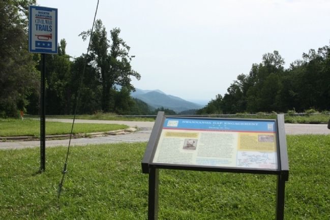
On Yates Avenue north of Old U.S. 70, on the left when traveling north. Reported permanently removed.
(preface) On March 24, 1865, Union Gen. George Stoneman led 6,000 cavalrymen from Tennessee into southwestern Virginia and western North Carolina to disrupt the Confederate supply line by destroying sections of the Virginia and . . . — — Map (db m284170) HM
On N Main Street, on the left when traveling north.
Stoneman’s U.S. Cavalry occupied the town of Salisbury, Apr. 12, 1865, and destroyed the Confederate warehouses, supplies, and prison. — — Map (db m33918) HM
On West Main Street (State Highway 20), on the left when traveling south.
On May 1, 1865, cadets from the Arsenal Academy at Columbia, under Capt. John Peyre Thomas, who were en route from Greenville to Newberry to be disbanded, met a band of Stoneman's raiders near here in one of the last engagements of the war, which . . . — — Map (db m8395) HM
On North Main Street (U.S. 11) at Medical Park Drive, on the right when traveling north on North Main Street.
Union Maj. Gen. George Stoneman, seeking to destroy crucial Confederate infrastructure, led more than 5,000 cavalrymen into Southwest Virginia in Dec. 1864. Here at Marion, Stoneman’s main column encountered about 1,000 Confederate cavalry and . . . — — Map (db m300296) HM
Near Shepherd Mill Road, on the right when traveling east.
During the Civil War, the Confederacy relied on small rural ironworks for the metals needed to manufacture cannons, swords, and firearms. The furnace here, owned by the Moratock Mining and Manufacturing Company, was typical of the charcoal blast . . . — — Map (db m34156) HM
On Old U.S. 70 E, on the right when traveling west.
Southern troops turned back Stoneman's U.S. cavalry, raiding through western North Carolina, at Swannanoa Gap, near here, April 20, 1865. — — Map (db m55830) HM
Near Millard Farmer Road 0.4 miles east of Old Corinth Road, on the right when traveling east.
The Battle of Brown's Mill killed or wounded about 100 of McCook's men. Wheeler's casualties probably numbered fewer than 50. "The dead lay around us on every side, singly and in groups and piles; men and horses, - in some cases, apparently . . . — — Map (db m94668) HM
On North Main Street (U.S. 221) south of Trade Street, on the right when traveling north.
On March 24, 1865, Union Gen. George Stoneman led 6,000 cavalrymen from Tennessee into southwestern Virginia and western North Carolina to disrupt the Confederate supply line by destroying sections of the Virginia and Tennessee Railroad, . . . — — Map (db m253441) HM
On U.S. 29 at Old Salisbury Road, on the right when traveling north on U.S. 29.
Southern troops turned back Stoneman's U. S. Cavalry, raiding through western North Carolina, at the Yadkin River Bridge, April 12, 1865. — — Map (db m33927) HM
On West Innes Street, on the right when traveling north. Reported permanently removed.
On a raid through western North Carolina Gen. Stoneman’s U. S. Cavalry fought a skirmish with Southern troops near here, April 12, 1865. — — Map (db m33921) HM
On Courthouse Circle at Main Street (North Carolina Highway 8/89), on the left when traveling north on Courthouse Circle.
Early in April 1865, Union Gen. George Stoneman’s cavalry moved from Tennessee into Virginia and then south through Danbury to destroy railroad track, warehouses, and supplies that supported Gen. Robert E. Lee’s Army of Northern Virginia. Stoneman . . . — — Map (db m77678) HM
On North Locust Street (Virginia Route 8) south of Penn Avenue NW, on the right when traveling north.
On March 24, 1865, Union Gen. George Stoneman led 6,00 cavalrymen from Tennesse into southwestern Virginia and western North Carolina to disrupt the Confederate supply line by destroying sections of the Virginia and Tennessee Railroad, the . . . — — Map (db m299100) HM
On Whitetop Road (Virginia Route 107) at Exit 35 (Interstate 81), on the left when traveling north on Whitetop Road.
On December 1, 1864, Union Gen. George Stoneman led 5,700 cavalrymen east from Knoxville, Tennessee, to destroy iron-, lead-, and saltworks in Virginia that were essential to the Confederate war effort. After actions at Kingsport and . . . — — Map (db m261967) HM
On Montrobles Place east of Los Robles Avenue, on the left when traveling east.
This was the site of ‘Los Robles’, the 400 acre estate of Governor George Stoneman. Here in 1880 President Rutherford B. Hayes was entertained. The first schoolhouse in the San Gabriel Valley, California's first tennis club, and the first municipal . . . — — Map (db m127644) HM
On Monticello Highway (State Highway 11) south of Jackson Road, on the right when traveling north.
Sunshine Church II, built in 1880 and dedicated in 1883 by Rev. Sam Jones, replaced old Sunshine Church, two miles south of here, which General Sherman’s troops burned in 1864. A wounded northern prisoner, B.F. Morris, Shelby, Ohio, cared for by . . . — — Map (db m8897) HM
On Yadkin River Road (County Route 1560) 0.3 miles north of North Carolina Highway 268, on the right when traveling north.
(preface)
On March 24, 1865, Union Gen. George Stoneman led 6,000 cavalrymen from Tennessee into southwestern Virginia and western North Carolina to disrupt the Confederate supply line by destroying sections of the Virginia and Tennessee . . . — — Map (db m168406) HM
On State Highway 16 at W A Street, on the right when traveling south on State Highway 16.
On a Civil War raid through Western North Carolina by Gen. George Stoneman's U.S. Cavalry troops commanded by Col. William J. Palmer passed through Newton on April 17, 1865, burned the Confederate Commissary depot and the county jail, and shot and . . . — — Map (db m152421) HM
Near U.S. 70 0.2 miles east of Lake Tahoma Road (North Carolina Highway 80), on the right when traveling east.
(preface)
On March 24, 1865, Union Gen. George Stoneman led 6,000 cavalrymen from Tennessee into southwestern Virginia and western North Carolina to disrupt the Confederate supply line by destroying sections of the Virginia and Tennessee . . . — — Map (db m208799) HM
On Washington Highway (U.S. 1) 0.2 miles north of England Street ( Route 54).
In 1838, the Richmond, Fredericksburg & Potomac Railroad bought 462 acres bordering its tracks twelve miles north of Richmond in Hanover County. The company created a small summer retreat and passenger rest stop there. In 1858, the area was . . . — — Map (db m1991) HM
On N Main Street (U.S. 29) at W Council Street, on the left when traveling north on N Main Street.
The Old Rowan County Courthouse, a visible reminder of Salisbury’s antebellum prosperity, was erected in 1855 and is one of North Carolina’s finest Greek Revival-style public buildings. It served as Rowan’s third courthouse until 1914. Salisbury . . . — — Map (db m34278) HM
On March 24, 1865, Union Gen. George Stoneman led 6,000 cavalrymen from Tennessee into southwestern Virginia and western North Carolina to disrupt the Confederate supply line by destroying sections of the Virginia and Tennessee Railroad, . . . — — Map (db m20348) HM
On Harper Avenue Northwest at Main Street Northwest, on the right when traveling east on Harper Avenue Northwest. Reported permanently removed.
On March 24, 1865, Union Gen. George Stoneman led 6,000 cavalrymen from Tennessee into southwestern Virginia and western North Carolina to disrupt the Confederate supply line by destroying sections of the Virginia and Tennessee Railroad, . . . — — Map (db m301373) HM
On March 24, 1865, Union Gen. George Stoneman led 6,000 cavalrymen from Tennessee into southwestern Virginia and western North Carolina to disrupt the Confederate supply line by destroying sections of the Virginia and Tennessee Railroad, the . . . — — Map (db m12890) HM
On March 24, 1865, Union Gen. George Stoneman led 6,000 cavalrymen from Tennessee into southwestern Virginia and western North Carolina to disrupt the Confederate supply line by destroying sections of the Virginia and Tennessee Railroad, . . . — — Map (db m54615) HM
Near Quarterpath Road, on the left when traveling south.
On the other side of the parapet is Quarterpath Road, a historic roadbed that for centuries linked Williamsburg to Allen’s Wharf on the James River. It runs behind the Confederate fortifications here, gaining additional importance during the Battle . . . — — Map (db m184202) HM
On this site between 1849 and 1957 stood the Union Hotel and Hall. Built by three veterans of the Mexican War, the hotel was a one-story adobe and the hall a one-story frame building. These were destroyed by fire in 1866 and replaced by two-story . . . — — Map (db m80731) HM
On Yates Avenue north of Old U.S. 70, on the left when traveling north.
(Preface) On March 24, 1865, Union Gen. George Stoneman led 6,000 cavalrymen from Tennessee into southwestern Virginia and western North Carolina to disrupt the Confederate supply line by destroying sections of the Virginia and . . . — — Map (db m284171) HM
On Sterling Street at Union Street on Sterling Street.
On March 24, 1865, Union Gen. George Stoneman led 6,000 cavalrymen from Tennessee into southwestern Virginia and western North Carolina to disrupt the Confederate supply line by destroying sections of the Virginia and Tennessee Railroad, the . . . — — Map (db m99609) HM
On Harper Avenue Southwest at Main Street Southwest, on the right when traveling east on Harper Avenue Southwest.
The church that stood here in 1865 became a prison for three days when Union Gen. George Stoneman, with two brigades of raiders under Gen. Alvan C. Gillem, occupied Lenoir over Easter weekend, April 15-17, 1865. The prisoners were 900 old men, boys, . . . — — Map (db m301374) HM
On South Center Street (North Carolina Route 115) south of Court Street, on the right when traveling south. Reported permanently removed.
(Preface):
On March 24, 1865, Union Gen. George Stoneman led 6,000 cavalrymen from Tennessee into southwestern Virginia and western North Carolina to disrupt the Confederate supply line by destroying sections of the Virginia and Tennessee . . . — — Map (db m262946) HM
On Main Street at Front Street, on the left when traveling east on Main Street.
(Preface):
On March 24, 1865, Union Gen. George Stoneman led 6,000 cavalrymen from Tennessee into southwestern Virginia and western North Carolina to disrupt the Confederate supply line by destroying sections of the Virginia and Tennessee . . . — — Map (db m56794) HM
On Courtney-Huntsville Road at Farmington Road, on the left on Courtney-Huntsville Road. Reported permanently removed.
On March 24, 1865, Union Gen. George Stoneman led 6,000 cavalrymen from Tennessee into southwestern Virginia and western North Carolina to disrupt the Confederate supply line by destroying sections of the Virginia and Tennessee Railroad, . . . — — Map (db m270440) HM
On Jones Street (Virginia Route 457) at East Main Street, on the left when traveling north on Jones Street.
On March 24, 1865, Union Gen. George Stoneman led 6,000 cavalrymen from Tennessee into southwestern Virginia and western North Carolina to disrupt the Confederate supply line by destroying sections of the Virginia and Tennessee Railroad, . . . — — Map (db m66013) HM
On West Main Street (U.S. 11) at Cummings Street SW (Alternate U.S. 58), on the right when traveling east on West Main Street.
On December 1, 1864, Union Gen. George Stoneman led 5,700 cavalrymen east from Knoxville, Tennessee, to destroy iron-, lead-, and saltworks in Virginia that were essential to the Confederate war effort. After actions at Kingsport and . . . — — Map (db m67298) HM
On Charlotte Highway (Alternate U.S. 74) south of Clarke Lane, on the left when traveling south.
(preface)
On March 24, 1865, Union Gen. George Stoneman led 6,000 cavalrymen from Tennessee into southwestern Virginia and western North Carolina to disrupt the Confederate supply line by destroying sections of the Virginia and Tennessee . . . — — Map (db m209727) HM
On Clement Street at Water Street, on the right when traveling south on Clement Street.
On March 24, 1865, Union Gen. George Stoneman led 6,000 cavalrymen from Tennessee into southwestern Virginia and western North Carolina to disrupt the Confederate supply line by destroying sections of the Virginia and Tennessee Railroad, . . . — — Map (db m53207) HM
On South Center Street (North Carolina Route 115) south of Court Street, on the left when traveling north.
After destroying the Confederate supply depot and prison at Salisbury, Union Gen.
George Stoneman led his raiders west toward Tennessee, arriving in Statesville
on the night of April 13, 1865. Here his men burned supplies, the railroad depot,
and . . . — — Map (db m262947) HM
On Mill Creek Road (State Road 1407 at milepost 0.4), 0.4 miles south of Graphite Road, on the right when traveling south.
(preface) On March 24, 1865, Union Gen. George Stoneman led 6,000 cavalrymen from Tennessee into southwestern Virginia and western North Carolina to disrupt the Confederate supply line by destroying sections of the Virginia and . . . — — Map (db m284209) HM
On Rockford Road, on the right when traveling south.
(Preface):
On March 24, 1865, Union Gen. George Stoneman led 6,000 cavalrymen from Tennessee into southwestern Virginia and western North Carolina to disrupt the Confederate supply line by destroying sections of the Virginia and Tennessee . . . — — Map (db m54626) HM
On Pulaski Street 0.1 miles west of Washington Street, on the right when traveling east.
In July, 1864, Maj. Gen. W. T. Sherman’s army [US] closed in on Atlanta. Finding its fortifications “too strong to assault and too extensive to invest,” he sought to force its fall by sending Maj. Gen. George Stoneman, with three cavalry . . . — — Map (db m25207) HM
Near Monticello Highway (Georgia Route 11) south of Jackson Road.
As part of a two-pronged Cavalry raid, on Wednesday, July 27 1864, Union Major General George Stoneman with over 2,100 troopers left the main Federal army then located near Atlanta. Stoneman's orders from Major General William T. Sherman, were to . . . — — Map (db m103205) HM
On South Main Street (U.S. 278) at Foster Street, on the right when traveling east on South Main Street.
Closing in on Atlanta in July 1864, Maj. Gen. W.T. Sherman, USA, found its vast fortifications “too strong to assault and too extensive to invest.” To force an evacuation, he sent Maj. Gen. George Stoneman’s cavalry [US] (2112 men and 2 . . . — — Map (db m16165) HM
Near Martinsburg Road, on the right when traveling south.
During the Civil War, White's Ford on the Potomac River was employed by Confederate troops on three separate occasions. Lee's troops crossed here in their invasion of Maryland, September 4-7, 1862. General Jubal A. Early's II Corps, after an . . . — — Map (db m10145) HM
On E Bank Street, on the right when traveling north.
On November 2, 1861, the Confederate government purchased about 16 acres here for a prison. The tract included an abandoned three-story cotton mill, a boiler house, six tenements, a superintendent’s house, and several smaller buildings. A stockade . . . — — Map (db m34202) HM
On East Kerr Street at Depot Street, on the right when traveling south on East Kerr Street.
In 1856 Nathaniel Boyden and other investors established the North Carolina Foundry and Agricultural Machine Works. It was located on East Kerr Street on an acre lot lying between the railroad and Long Street. The property, with its three large . . . — — Map (db m238692) HM
On Recreation Road, on the right when traveling east.
The site of Fort Hamby is located about half a mile south of here. The two-story log house was not a military fortification. It got its name after 20 to 30 Union and Confederate deserters occupied it at the end of the war. Their leader, who gave his . . . — — Map (db m55373) HM
On Windsor Road at Buck Shoals Road, on the right on Windsor Road.
(Preface):
On March 24, 1865, Union Gen. George Stoneman led 6,000 cavalrymen from Tennessee into southwestern Virginia and western North Carolina to disrupt the Confederate supply line by destroying sections of the Virginia and Tennessee . . . — — Map (db m55343) HM
On Winston Road (State Highway 67) north of Fall Creek Church Road, on the right when traveling west.
(Preface):
On March 24, 1865, Union Gen. George Stoneman led 6,000 cavalrymen from Tennessee into southwestern Virginia and western North Carolina to disrupt the Confederate supply line by destroying sections of the Virginia and Tennessee . . . — — Map (db m56801) HM
On Newbys Shop Road (Virginia Route 673), on the right when traveling north.
On January 25, 1863, Union general Joseph "Fighting Joe" Hooker replaced Gen. Ambrose E. Burnside as the fifth commander of the demoralized eastern armies in less than two years. On taking charge of the Army of the Potomac, Hooker implemented . . . — — Map (db m154485) HM
On North Main Street (U.S. 11), on the right when traveling north. Reported permanently removed.
Throughout 1864, Federal raids against the Confederate infrastructure in East Tennessee and Southwest Virginia attempted to destroy iron and lead mines, salt works and railroads. The Virginia & Tennessee Railroad, the Confederate lifeline to the . . . — — Map (db m196007) HM
On Ocmulgee National Park Road 0.2 miles south of Emery Highway (U.S. 23/80), on the left when traveling south.
During the Civil War, Macon, Georgia was a thriving city, serving as a major transportation, medical, and manufacturing center. In 1864, Federal officers were being held at Camp Oglethorpe, a prisoner of war camp. Two battles were fought in Macon; . . . — — Map (db m98657) HM
On Georgia Route 11 at Perimeter Road ( Route 380), on the left when traveling north on Georgia Route 11.
In July, 1864, Maj. Gen. W.T. Sherman’s army [US] closed in on Atlanta. Finding its fortifications “too strong to assault and too extensive to invest,” he sought to force its fall by sending Maj. Gen George Stoneman, with three cavalry . . . — — Map (db m24478) HM
On Monticello Highway (Georgia Route 11) 1 mile north of Otis Redding Drive, on the right when traveling south.
In July, 1864, Maj. Gen. W. T. Sherman’s army [US] closed in on Atlanta. Finding its fortifications “too strong to assault and too extensive to invest,” he sought to force its fall by sending Maj. Gen. George Stoneman, with three cavalry . . . — — Map (db m25645) HM
On West Marion Street (Georgia Route 16) 0.1 miles west of South Jefferson Avenue (Business U.S. 441), on the right when traveling east.
Closing in on Atlanta in July, 1864, Maj. Gen. W. T. Sherman, USA, found its vast fortifications “too strong to assault and too extensive to invest.” To force an evacuation, he sent Maj. Gen. George Stoneman’s cavalry [US] (2112 men and . . . — — Map (db m106731) HM
On Macon Road at Jackson Street, on the left when traveling north on Macon Road.
In July, 1864, Maj. Gen. W.T. Sherman’s army [US] closed in on Atlanta. Finding its fortifications “too strong to assault and too extensive to invest,” he sought to force its fall by sending Maj. Gen George Stoneman, with three cavalry . . . — — Map (db m41745) HM
On Greenup Street north of 6th Street, on the right when traveling north.
From 1859 to 1873 this was the home of Jesse Root and Hannah (Simpson) Grant, parents of General Ulysses S. Grant, 18th President of the United States. Jesse served as the Postmaster of Covington from 1866 to 1872. Gen. Grant's sister, Mary, . . . — — Map (db m174671) HM
On Centre Avenue (Pennsylvania Route 61) just north of North 4th Street, on the right when traveling north. Reported damaged.
Gregg and the 8th Pennsylvania fought in the Peninsula Campaign, where he distinguished himself in the Seven Days Battles, expertly screening retreating Union Infantry. The Battle of Antietam was his next engagement, but cavalry played little . . . — — Map (db m203742) HM
On Indian Ridge Road at Old Rutledge Pike, on the left when traveling north on Indian Ridge Road.
This single-room cabin was constructed about six miles east of here, the home of John Janeway and his wife, Gertrude. It is typical of such dwellings in Appalachian Tennessee. During the Civil War, Janeway join the fighting late, in June 1864, . . . — — Map (db m100480) HM
[Inset]
On December 10, 1864, Union Gen. George Stoneman led 5,700 horse artillerists and cavalrymen east from Knoxville, Tennessee, to destroy iron-, lead-, and saltworks in Virginia that were essential to the Confederate war effort. . . . — — Map (db m108218) HM
Near Timothy Place west of Macon Highway, on the left when traveling north.
On July 19, 1864, Union Major General William Tecumseh Sherman was closing in on Atlanta, Georgia. Part of his Attack Strategy was to have the supply line destroyed that might re-supply the city of Atlanta. Sherman sent a message to Union General . . . — — Map (db m313272) HM
(Preface): On March 24, 1865, Union Gen. George Stoneman led 6,000 cavalrymen from Tennessee into southwestern Virginia and western North Carolina to disrupt the Confederate supply line by destroying sections of the Virginia and Tennessee . . . — — Map (db m53199) HM
Near Berkley Williams Drive 0.7 miles Charlie Coles Drive. Reported permanently removed.
On May 10, 1864, the day after defeating Confederate forces in the bloody battle of Cloyd's Mountain, Union Gen. George Crook's Army of the Kanawha attacked and burned this railroad bridge over the New River. During the Civil War, the railroad was . . . — — Map (db m9514) HM
On Berkley Williams Drive west of New River Drive, on the right when traveling west.
On May 10, 1864, the day after defeating Confederate forces in the bloody battle of Cloyd's Mountain, Union Gen. George Crook's Army of the Kanawha attacked and burned this railroad bridge over the New River. During the Civil War, the railroad . . . — — Map (db m304960) HM
Near East Broad Street east of First Street, on the right when traveling east.
The Cook brothers came to Athens to manufacture guns for the Confederate Army. Weapons produced in the water-powered Armory were heralded as some of the finest in the South.
Francis and Ferdinand Cook bought William Carr's grist and sawmill . . . — — Map (db m206375) HM
On Willow Street at Hickory Street, on the right when traveling north on Willow Street.
The wooded hill on the horizon to your right is the site of the Cook & Brother Gun Emplacement - one of Athens' last lines of defense against invading forces.
The only attempt to invade Athens during the Civil War was by the Union forces of . . . — — Map (db m296514) HM
Near Pulaski Street 0.2 miles east of Greene Settlement Road, on the right when traveling east.
Founded in 1808 Clinton was a commercial and educational center and the early seat of Jones County. It was planned with streets in a New England styled gridiron pattern and a central square. In 1820 Clinton was the fourth -largest town in Georgia. . . . — — Map (db m103208) HM
On Monticello Street SW south of Clark Street SW, on the left when traveling south.
On Friday, July 22, 1864, while the Battle of Atlanta raged about 25 miles to the west, Union Brigadier General Kenner Garrard and about 3,500 cavalrymen were in Covington. They had been ordered by Major General William T. Sherman to disrupt the . . . — — Map (db m103344) HM
Near Eagle Street at Davidson Drive, on the right when traveling east.
When the war began, more than 15 percent of Buncombe County’s residents were enslaved people. James Patton housed slaves behind his Eagle Hotel (straight ahead), where they worked as waiter, maids, grooms, cooks, and trail guides. Three blocks to . . . — — Map (db m75507) HM
On Broadway near Mt. Clare Avenue, on the right when traveling north. Reported missing.
Gen. Davis Tillson raised 1,700-man 1st U.S. Colored Heavy Artillery in Tennessee and North Carolina in 1864. The unit encamped nearby while garrisoned in Asheville in 1865. Assigned to Tillson's 2nd brigade, the men participated in operations in . . . — — Map (db m294918) HM
On Outer Drive at Michigan Avenue, on the right when traveling south on Outer Drive.
Across the road lies the grave of Elijah Wood, who served in the United States Colored Troops during the Civil War and became a community leader after the guns fell silent.
Born into slavery in 1834 in Robertsville (now Oak Ridge), Tennessee, . . . — — Map (db m293575) HM
On Homestead Lane 0.5 miles north of Abram Penn Highway (Virginia Route 626), on the right when traveling north.
In 1843, brick-making and construction of the stately home of Hardin and Nancy Jane Reynolds began and continued into the next decade. The bricks were likely made on the property by skilled enslaved workers. The house was built in two sections, . . . — — Map (db m304986) HM
Near Millard Farmer Road 0.4 miles east of Old Corinth Road, on the right when traveling east.
You are standing on an old farm road where, on July 30, 1864, Union cavalrymen sweltering on tired horses were hurrying toward the Chattahoochee River. Confederate cavalrymen were hiding near the end of the road waiting for them. As the Yankees . . . — — Map (db m94659) HM
Born in Clinton, Jones County, Georgia
February 14, 1829
Died Atlanta, Georgia
March 31, 1911
He was the son of
Alfred Iverson, Sr.
United States Senator for Georgia
and
Caroline Goode Holt . . . — — Map (db m64825) HM WM
Near Dalton Street 0.3 miles north of Wyoming Road, on the right when traveling north.
George Avery, a 19-year-old enslaved blacksmith, joined Co. D, 40th United States Colored Troops, in Greeneville, Tennessee, in 1865. According to local tradition, his master, Confederate Maj. William W. McDowell, sent Avery to enlist for a post-war . . . — — Map (db m75527) HM
On Coxe Road (County Route 1005) 0.4 miles east of River Crest Parkway, on the left when traveling east. Reported missing.
On March 24, 1865, Union Gen. George Stoneman led 6,000 cavalrymen from Tennessee into southwestern Virginia and western North Carolina to disrupt the Confederate supply line by destroying sections of the Virginia and Tennessee Railroad, . . . — — Map (db m266614) HM
Near North Broadway (U.S. 441) at Emory Place, on the right when traveling south.
Since the Civil War, the thirteen-acre Old Gray Cemetery has been the final resting place for Union and Confederate
veterans. During the conflict, control of Knoxville shifted from Confederate to Union forces, so it is appropriate that both sides . . . — — Map (db m82211) HM
On West Main Street (Virginia Route 91) north of Court Street.
Saltville is named for the vast salt deposits
that exist under this valley. The commercial
salt industry began developing here in the
1780s. During the Civil War, Saltville played
a vital role in providing salt for the Confederacy, On 2 Oct. . . . — — Map (db m91056) HM
On Palmer Avenue at West Main Street ( Route 91), on the right when traveling south on Palmer Avenue.
During the Civil War, most Confederate states operated furnaces or contracted with operators in Saltville to supply salt for the people of their states. Salt was vital as a preservative for food.
The Federal army's first attempt to destroy the . . . — — Map (db m258209) HM
On Lynn Road (State Highway 108) at Old Howard Gap Road and Story Road, on the right when traveling south on Lynn Road.
On a raid through western North Carolina Gen. Stoneman's U.S Cavalry fought Southern Troops at Howard's Gap. 4 Mi. North, April 22, 1865. — — Map (db m11210) HM
Dedicated to the intrepid and patriotic men: the Civil War Balloonists, Union and Confederate, known and unknown who against ridicule and skepticism laid the foundation for this nation’s future in the sky.
Inscribed hereon are the names of . . . — — Map (db m24824) HM
On Fairplay Street at West Main Street, on the right when traveling south on Fairplay Street.
In the early 1860s Rutledge was a community of about 200 citizens. It was named for a local family that had owned property through which the Georgia Railroad was built. Farms and plantations dotted the area around the railroad station and small . . . — — Map (db m103336) HM
On Baker Road 0.6 miles east of Old Griswoldville Road, on the left when traveling east.
Samuel Griswold (1790-1867) and his wife Louisa moved from Burlington, Connecticut, to Clinton, Georgia, in 1815. By 1825, he had advanced from store clerk to tinsmith to building cotton gins. By 1830, he owned and operated a foundry and gin . . . — — Map (db m142871) HM
Near West Court Square south of West Ponce de Leon Avenue.
Five DeKalb County courthouses have been
erected here in the center of Decatur since 1823.
The third courthouse structure, between 1847
and 1898, was where DeKalb County's two
anti-secession delegates were selected to attend
Georgia's secession . . . — — Map (db m142543) HM
Thin black lines indicate changes in relevance. Between each pair of lines entries are ordered geographically but all have the same relevance.
* Inflectional forms of words are their plurals, singulars, and possessives as well as gramatical tenses and similar variations.