By Cosmos Mariner, September 14, 2016
Blue Ridge Parkway Marker
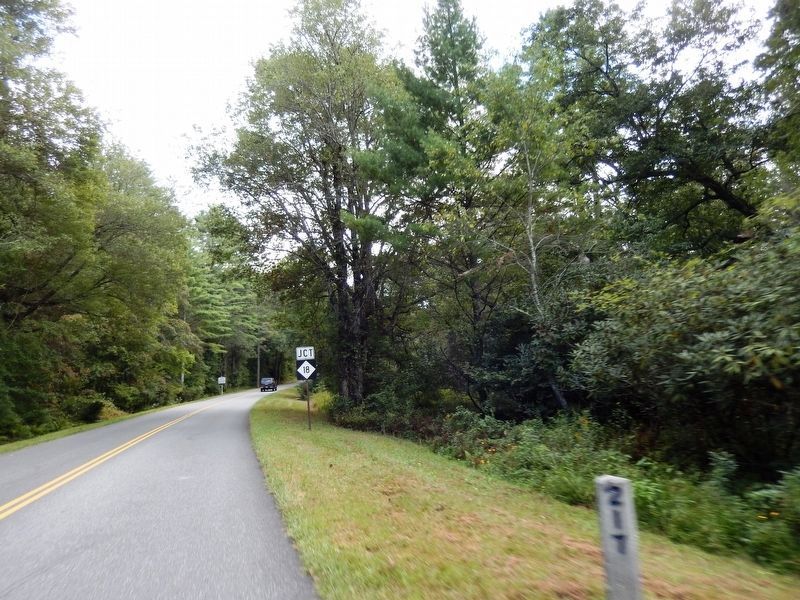
| On Blue Ridge Parkway (at milepost 217), 0.3 miles north of North Carolina Route 18, on the right when traveling north. |
| On Saddle Mountain Church Road east of Mountain Lake Road, on the left when traveling east. |
| On Blue Ridge Parkway at the High Piney Spur Overlook (at milepost 218.6), 1.8 miles the Virginia state line, on the left when traveling south. |
| On Blue Ridge Parkway 7 miles east of State Highway 18, on the right when traveling east. |
| On State Highway 18 at State Highway 88, on the right when traveling south on State Highway 18. |
| On Blue Ridge Parkway (at milepost 241). |
| On North Main Street (U.S. 21) just north of East Whitehead Street (State Highway 18), on the right when traveling north. |
| On North Main Street (U.S. 21) just north of East Whitehead Street (State Highway 18), on the right when traveling north. |
| On North Main Street (U.S. 21) at East Whitehead Street (State Highway 18), on the right when traveling north on North Main Street. |
| On North Main Street (U.S. 21) just north of Whitehead Street (State Highway 18), on the right when traveling north. |
| Near Cherry Street just east of Grayson Street, on the right when traveling east. |
| On Blue Ridge Parkway (at milepost 232.5), 3 miles west of U.S. 21, on the left when traveling south. |
| On Blue Ridge Parkway (at milepost 236.9), on the right when traveling south. |
| On Healing Springs Road East 0.3 miles east of Old Highway 16, on the right when traveling east. |
| On State Highway 16 at Trading Post Road, on the right when traveling south on State Highway 16. |
| On State Highway 16 0.1 miles north of Charles Spencer Road (County Route 1534), on the right when traveling north. |
| On Rugby Road (State Highway 194) at Joe Thomas Road, on the left when traveling north on Rugby Road. |
| On East Main Street (State Highway 88) at Cherry Street, on the right when traveling west on East Main Street. |
| Near Court Street at Ashe Street, on the right when traveling east. |
| On Government Circle 0.1 miles south of U.S. 221, on the right when traveling south. |
| On East Main Street (Business U.S. 221) at Academy Street, on the right when traveling west on East Main Street. |
| On East Main Street (Business U.S. 221) at Academy Street, on the left when traveling east on East Main Street. |
| On Government Circle south of East Main Street (U.S. 221), on the right when traveling south. |
| On North Carolina Route 194 at Piney Creek Road, on the right when traveling north on North Carolina Route 194. |
| On State Highway 18 S 1 mile south of Blue Ridge Parkway, on the right when traveling south. |
| On State Highway 88 at Little Peak Creek Road (Local Road 1595) on State Highway 88. |
| On Tobaccoville Road, on the left when traveling east. |
| On Todd Railroad Grade Road (State Road 1100) near Carter Miller Road, on the right when traveling south. |
| On Todd Railroad Grade Road (State Road 1100) west of Carter Miller Road, on the right when traveling west. |
| On Todd Railroad Grade Road (State Road 1100) 0.2 miles south of State Highway 194, on the right when traveling south. |
| On Todd Railroad Grade Road (State Road 1100) at Carter Miller Road, on the right when traveling west on Todd Railroad Grade Road. |
| On Carter Miller Road north of Railroad Grade Road ( Road 1100), on the left when traveling north. |
| On Railroad Grade Road at Cranberry Springs Road (State Road 1100) on Railroad Grade Road. |
| On Railroad Grade Road (State Road 1100) at South Fork Church Road, on the right when traveling south on Railroad Grade Road. |
| On Todd Railroad Grade Road (State Road 1100) north of South Fork Church Road, on the left when traveling north. |
| On Blue Ridge Parkway (at milepost 266.8), on the right when traveling south. |
| On BackStreet at State Street, on the left when traveling north on BackStreet. |
| On BackStreet at State Street, on the left when traveling north on BackStreet. |
| On Hickory Nut Gap Road (County Route 1342) west of Highway 184, on the left when traveling west. |
| On Main Street West (State Highway 184/194) at Maple Court, on the right when traveling west on Main Street West. |
| On Main Street West (State Highway 184/194) at Maple Court, on the right when traveling west on Main Street West. |
| On Linville Falls Highway (U.S. 221) at Sloop Mill Dam Road, on the left when traveling west on Linville Falls Highway. |
| On Miracle in the Hills Drive at North Drive, on the left when traveling north on Miracle in the Hills Drive. |
| On Linville Falls Highway (U.S. 221) west of Sloop Mill Dam Road, on the left when traveling west. |
| On Johnson Lane, on the left when traveling north. |
| Near Elk Park Highway (North Carolina Route 194) at U.S. 19E, on the right when traveling south. |
| Near Elk Park Highway (State Highway 194) at U.S. 19E, on the right when traveling east. |
| On U.S. 19E at Elk Park Highway ( Highway 194) on U.S. 19E. |
| On Hospital Drive 0.5 miles south of Newland Highway ( Highway 181), on the left when traveling south. |
| Near Blue Ridge Parkway (at milepost 304.4), 1 mile north of Blowing Rock Highway (U.S. 221). |
| Near Blue Ridge Parkway (at milepost 304.4), 1 mile north of Blowing Rock Highway (U.S. 221), on the right when traveling north. |
| On Blowing Rock Highway (U.S. 221) at Blowing Rock Highway on Blowing Rock Highway. |
| On Blowing Rock Highway (U.S. 221). |
| Near Grandfather Mountain Drive (Route 105) at Route 184, on the right when traveling north. |
| On Library Place at Elk Street ( Road 1342), on the right when traveling east on Library Place. |
| On Montezuma Street at Elk Street ( Road 1342), on the right when traveling west on Montezuma Street. |
| On Schultz Circle at Elk Street ( Road 1342), on the right when traveling east on Schultz Circle. |
| On U.S. 19E at Roaring Creek Road, on the right when traveling south on U.S. 19E. |
| On Crimson Laurel Way (State Highway 226) at Hemlock Drive, on the right when traveling south on Crimson Laurel Way. |
| On Crimson Laurel Way (State Highway 226) at North Mitchell Avenue (State Highway 1211), on the left when traveling south on Crimson Laurel Way. |
| On North Mitchell Avenue (State Highway 1211) at Crimson Laurel Way (State Highway 226), on the left when traveling north on North Mitchell Avenue. |
| Near Long View Drive 0.2 miles west of Route 261, on the right when traveling west. |
| On North Mitchell Avenue at Route 226, on the right when traveling west on North Mitchell Avenue. |
| On State Highway 226 at State Route 261, on the right when traveling north on State Highway 226. |
| On North Mitchell Avenue at Route 226, on the right when traveling west on North Mitchell Avenue. |
| On State Highway 226 at Penland Road (County Route 1242), on the left when traveling north on State Highway 226. |
| On North Carolina Route 226 at Mine Creek Road ( Route 226A) on North Carolina Route 226. |
| On Crimson Laurel Way (North Carolina Route 226) south of Maple Street, on the left when traveling south. |
| On Long View Drive 0.4 miles west of Route 261, on the right when traveling west. |
| Near Parkway Maintenance Road 0.2 miles west of State Highway 226, on the left when traveling west. |
| On Crystal Street north of Locust Street, on the right when traveling north. |
| On Blue Ridge Parkway (at milepost 327.3), 0.2 miles east of Altapass Highway, on the left when traveling south. |
| Near Parkway Maintenance Road 0.1 miles west of State Highway 226, on the left when traveling west. |
| On Locust Street at Crystal Street, on the right when traveling east on Locust Street. |
| On State Highway 226 at Blue Ridge Parkway, on the right when traveling east on State Highway 226. |
| On Locust Street at Crystal Street, on the left when traveling east on Locust Street. |
| On Broadstone Road 0.1 miles west of Dewitt Barnett Road, on the left when traveling west. |
| Near Blue Ridge Parkway (at milepost 294), 2 miles west of U.S. 221, on the left when traveling south. |
| Near Laurel Lane at Wallingford Street. |
| On Wallingford Street at Park Avenue, on the right when traveling south on Wallingford Street. |
| On Wonderland Trail south of Laurel Lane, on the left when traveling south. |
| On Laurel Lane west of Main Street (Business U.S. 321), on the right when traveling west. |
| On Ginny Stevens Lane west of Main Street (Business U.S. 321), on the left when traveling west. |
| On Main Street (Business U.S. 321) at Sunset Drive, on the right when traveling north on Main Street. |
| On Laurel Lane at Main Street (Business U.S. 321), on the right when traveling east on Laurel Lane. |
| On Maple Street east of Main Street (Business U.S. 321), on the right when traveling east. |
| On Main Street (Business U.S. 321) at Sunset Drive, on the right when traveling south on Main Street. |
| On Main Street (Business U.S. 321) south of Globe Road, on the right when traveling south. |
| On Possum Hollow Road at Peacock Drive, on the right when traveling north on Possum Hollow Road. |
| On Laurel Lane at Main Street (Business U.S. 321), on the right when traveling west on Laurel Lane. |
| Near Blue Ridge Parkway (at milepost 294). |
| On Bass Lake Drive 0.2 miles north of Blowing Rock Highway (U.S. 221), on the right when traveling north. |
| On Chetola Lake Drive at Bass Lake Drive, on the left when traveling east on Chetola Lake Drive. |
| Near Lakeside Drive 0.1 miles south of Clark Street. |
| On Galax Lane north of Green Hill Road (County Road 1534), on the right when traveling north. |
| On Chestnut Circle north of Chestnut Drive, on the left when traveling north. |
| On Wallingford Street at Pine Street, on the right when traveling south on Wallingford Street. |
| On Main Street (Business U.S. 321) near Sunset Drive, on the right when traveling south. |
199 entries matched your criteria. The first 100 are listed above.
Next 100 ⊳
