1364 entries match your criteria. Entries 201 through 300 are listed.⊲ Previous 100 — Next 100 ⊳
Historical Markers and War Memorials in Wyoming
By Barry Swackhamer, June 6, 2016
Coal Production Marker
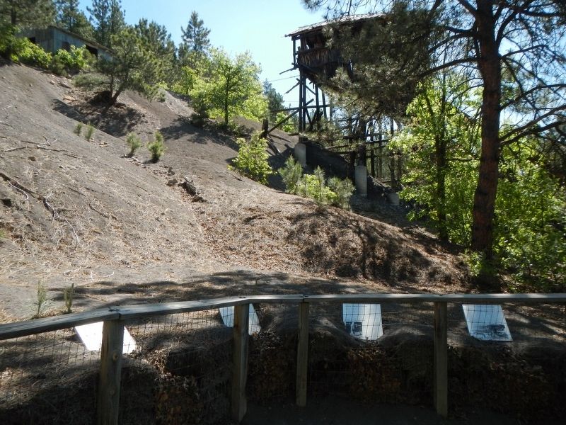
| 201 ► Wyoming, Crook County, Aladdin — Coal Production — The Coal Miner — |
| Near State Highway 24 near Owl Creek Road, on the left when traveling east. | |||
| 202 ► Wyoming, Crook County, Aladdin — Custer's 1874 Expedition — |
| On State Highway 24, 0.2 miles west of Oak Creek Road, on the left when traveling west. | |||
| 203 ► Wyoming, Crook County, Aladdin — Later Years of Operation — |
| Near State Highway 24 near Owl Creek Road, on the left when traveling east. | |||
| 204 ► Wyoming, Crook County, Aladdin — The Hoist House — |
| Near State Highway 24 near Owl Creek Road, on the left when traveling east. | |||
| 205 ► Wyoming, Crook County, Aladdin — Tipple Operation — |
| Near Wyoming Route 24 near Owl Creek Road, on the left when traveling east. | |||
| 206 ► Wyoming, Crook County, Aladdin — Tipple Stabilazation (sic) — |
| Near State Highway 24 near Owl Creek Road, on the left when traveling east. | |||
| 207 ► Wyoming, Crook County, Aladdin — Vore Buffalo Jump — |
| On Old U.S. 14, 2.8 miles east of Wyoming Highway 111. | |||
| 208 ► Wyoming, Crook County, Beulah — A Community Processing Plant — |
| On Old Hwy 14, 3 miles State Highway 86. | |||
| 209 ► Wyoming, Crook County, Beulah — Discovering the Vore Archaeological Site — |
| On Old Hwy 14, 3 miles east of State Highway 86. | |||
| 210 ► Wyoming, Crook County, Beulah — Preparing for Impending Blizzards — |
| On Old U.S. 14 near Wyoming Highway 111, on the right when traveling east. | |||
| 211 ► Wyoming, Crook County, Beulah — The Ideal Hunting Ground — |
| Near Old U.S. 14 near Wyoming Highway 111, on the right when traveling east. | |||
| 212 ► Wyoming, Crook County, Beulah — Trapping Buffalo — |
| On Old Hwy 14, 3 miles east of State Highway 86. | |||
| 213 ► Wyoming, Crook County, Beulah — Understanding Bison Behavior Brought Success — |
| Near Old U.S. 14 near Wyoming Highway 111, on the right when traveling east. | |||
| 214 ► Wyoming, Crook County, Devils Tower — Bountiful Land — |
| Near Devils Tower National Monument Road (State Highway 110) 3.5 miles west of State Highway 24. | |||
| 215 ► Wyoming, Crook County, Devils Tower — Daredevil Stunt — |
| Near Devils Tower National Monument Road (State Highway 110) 3.5 miles west of State Highway 24. | |||
| 216 ► Wyoming, Crook County, Devils Tower — Devils Tower — |
| On State Highway 24, 1.7 miles south of Devils Tower National Monument Road (State Highway 110), on the right when traveling north. | |||
| 217 ► Wyoming, Crook County, Devils Tower — Devils Tower — |
| On State Highway 24 near State Highway 110, on the right when traveling north. | |||
| 218 ► Wyoming, Crook County, Devils Tower — Devils Tower ... the first National Monument — |
| On Devils Tower National Monument Road, on the right when traveling south. | |||
| 219 ► Wyoming, Crook County, Devils Tower — Friends, Family, and Fun — The Old Settler's Picnic - A Devils Tower Tradition — |
| On Devils Tower National Monument Road. | |||
| 220 ► Wyoming, Crook County, Devils Tower — Many Meanings for Many People — |
| Near Devils Tower National Monument Road (State Highway 110) 3.5 miles west of State Highway 24. | |||
| 221 ► Wyoming, Crook County, Devils Tower — Reach for the Top — |
| Near Devils Tower National Monument Road (State Highway 110) 3.5 miles west of State Highway 24. | |||
| 222 ► Wyoming, Crook County, Devils Tower — What Are Those Big Concrete Pyramids Down by the River? — |
| On State Highway 110. | |||
| 223 ► Wyoming, Crook County, Hulett — Buried Tower — Devils Tower National Monument — |
| Near State Highway 110. | |||
| 224 ► Wyoming, Crook County, Hulett — Camp Devin — |
| On WY-112 N, on the right when traveling north. | |||
| 225 ► Wyoming, Crook County, Hulett — Devils Tower — |
| On State Highway 24, 1 mile west of Mona Belle Road, on the right when traveling west. | |||
| 226 ► Wyoming, Crook County, Hulett — How Did the Tower Form? — Devils Tower National Monument — |
| Near State Highway 110. | |||
| 227 ► Wyoming, Crook County, Hulett — Life Above and Below Ground — Devils Tower National Monument — |
| On State Highway 110, 0.4 miles east of NPS Administration Building Driveway, on the right when traveling east. | |||
| 228 ► Wyoming, Crook County, Hulett — People of the Land — Devils Tower National Monument — |
| Near State Highway 110. | |||
| 229 ► Wyoming, Crook County, Moorcroft — Inyan Kara — |
| On Interstate 90 at milepost 171, on the right when traveling west. | |||
| 230 ► Wyoming, Crook County, Moorcroft — Lifeline — |
| On Interstate 90 near U.S. 14. | |||
| 231 ► Wyoming, Crook County, Moorcroft — Texas Trail — 1866-1897 — |
| Near Interstate 90 near U.S. 14, on the right when traveling west. | |||
| 232 ► Wyoming, Crook County, Sundance — Paha Sapa, Black Hills — Geologic History of the Lakotas' Sacred Hills — |
| On Interstate 90. | |||
| 233 ► Wyoming, Crook County, Sundance — Bird of the Black Hills — The Black Hills are Home to more than 200 Species of Glorious Birds — |
| On Interstate 90. | |||
| 234 ► Wyoming, Crook County, Sundance — Black Hills — |
| On Industrial Avenue near Interstate 90, on the left when traveling south. | |||
| 235 ► Wyoming, Crook County, Sundance — Crook County — |
| On Industrial Avenue near Interstate 90. | |||
| 236 ► Wyoming, Crook County, Sundance — Custer Expedition — |
| On Industrial Avenue (at milepost 190) near Interstate 90. | |||
| 237 ► Wyoming, Crook County, Sundance — Custer Expedition |
| On State Highway 585 near Cold Springs Road, on the left when traveling south. Reported missing. | |||
| 238 ► Wyoming, Crook County, Sundance — Inyan Kara Methodist Episcopal Church — |
| On State Highway 585 near County Route 62, on the right when traveling south. | |||
| 239 ► Wyoming, Crook County, Sundance — Matthew S. Driskill — |
| On Old U.S. 14 when traveling north. | |||
| 240 ► Wyoming, Crook County, Sundance — Petrified Trees — Fossils Give Clues to Wyoming's Paleo-Past — |
| On Interstate 90. | |||
| 241 ► Wyoming, Crook County, Sundance — Rich Colors, Rich Lands — Gold Metal, Green Grass, Black Coal & Crude — |
| On Interstate 90. | |||
| 242 ► Wyoming, Crook County, Sundance — Sundance Nature Area — |
| On Fairground Loop Rd. | |||
| 243 ► Wyoming, Crook County, Sundance — The "Sundance Kid" — |
| On E Cleveland St at S 3rd St on E Cleveland St. | |||
| 244 ► Wyoming, Crook County, Sundance — The Custer Trail — Site of Sacred Lands and Historic Battles — |
| On Interstate 90. | |||
| 245 ► Wyoming, Crook County, Sundance — The Vore Buffalo Jump — Hunting Large Bison Took Teamwork and Ingenuity — |
| On Interstate 90. | |||
| 246 ► Wyoming, Crook County, Sundance — Watching the Heavens and Earth — |
| On Warren Peak Rd. | |||
| 247 ► Wyoming, Fremont County, Atlantic City — Atlantic City: Surviving the Bust — |
| On East Main Street at North Geissler Avenue, on the right when traveling west on East Main Street. | |||
| 248 ► Wyoming, Fremont County, Atlantic City — Fort Stambaugh, 1870-1878 — |
| On South Pass Road (Dickinson Avenue) near Atlantic City Road, on the left when traveling south. | |||
| 249 ► Wyoming, Fremont County, Atlantic City — Local Colour — |
| Near Fort Stambaugh Loop. | |||
| 250 ► Wyoming, Fremont County, Atlantic City — Miner’s Delight — Is not abandoned! — |
| Near Fort Stambough Loop. | |||
| 251 ► Wyoming, Fremont County, Atlantic City — Miners Delight: The Boom’s Broken Promises — The Boom’s Broken Promises — |
| On Atlantic City Road at Fort Stambaugh Loop, on the left when traveling south on Atlantic City Road. | |||
| 252 ► Wyoming, Fremont County, Crowheart — Crowheart Butte — |
| On U.S. 287 near Sand Draw Road, on the left. | |||
| 253 ► Wyoming, Fremont County, Crowheart — The Riverton Project — |
| On U.S. 287 near U.S. 26, on the left when traveling west. | |||
| 254 ► Wyoming, Fremont County, Crowheart — Wyoming Winds — |
| On U.S. 287 near U.S. 26, on the left when traveling west. | |||
| 255 ► Wyoming, Fremont County, Dubois — Cultural Heritage — |
| Near Union Pass Road (Forest Road 600) near Forest Road 534. | |||
| 256 ► Wyoming, Fremont County, Dubois — Fauna of Union Pass — |
| Near Union Pass Road (Forest Road 600) near Forest Road 534, on the right when traveling south. | |||
| 257 ► Wyoming, Fremont County, Dubois — Flora at Union Pass — |
| Near Union Pass Road (Forest Road 600) near Forest Road 534, on the right when traveling south. | |||
| 258 ► Wyoming, Fremont County, Dubois — Resources — Ownership - Exploration - Administration — |
| Near Union Pass Road (Forest Road 600) near Forest Road 534, on the right when traveling south. | |||
| 259 ► Wyoming, Fremont County, Dubois — Road through a Pass — |
| Near Union Pass Road (Forest Road 600) near Forest Road 534, on the right when traveling south. | |||
| 260 ► Wyoming, Fremont County, Dubois — The Ramshorn — |
| Near Union Pass Road (Forest Road 600) near Forest Road 534, on the right when traveling south. | |||
| 261 ► Wyoming, Fremont County, Dubois — The Rendezvous — |
| Near Union Pass Road (Forest Road 600) near Forest Road 534. | |||
| 262 ► Wyoming, Fremont County, Dubois — Three Waters Mountain — |
| On Union Pass Road (Forest Road 600) near Forest Road 534, on the right when traveling south. | |||
| 263 ► Wyoming, Fremont County, Dubois — Tie Hack Memorial — Railroads and the West — |
| On U.S. 287 near Warm Springs Creek Road, on the left when traveling west. | |||
| 264 ► Wyoming, Fremont County, Dubois — Union Pass — |
| On U.S. 287 at Union Pass Road on U.S. 287. | |||
| 265 ► Wyoming, Fremont County, Dubois — Union Pass — |
| On U.S. 287 at Union Pass Road, on the left when traveling west on U.S. 287. | |||
| 266 ► Wyoming, Fremont County, Dubois — Union Pass — |
| On Union Pass Road (Forest Road 600) near Road 534, on the right when traveling south. | |||
| 267 ► Wyoming, Fremont County, Dubois — Wind River Range — |
| Near Union Pass Road (Forest Road 600) near Forest Road 534, on the right when traveling south. | |||
| 268 ► Wyoming, Fremont County, Fort Washakie — Block House — |
| Near Old Wind River Highway near Trout Creek Road, on the right when traveling south. | |||
| 269 ► Wyoming, Fremont County, Fort Washakie — Fort Washakie World War II Veterans Memorial — |
| On 2nd Street at Washakie Street, on the left when traveling west on 2nd Street. | |||
| 270 ► Wyoming, Fremont County, Fort Washakie — Mrs. Maggie Richards and Mrs. Hall — |
| On Cemetery Lane near Trout Creek Road, on the left when traveling north. | |||
| 271 ► Wyoming, Fremont County, Fort Washakie — Sacajawea — |
| On U.S. 287 at Ethete Road, on the right when traveling north on U.S. 287. | |||
| 272 ► Wyoming, Fremont County, Fort Washakie — Sacajawea — Baptiste Charbonneau — Bazil — |
| On Cemetery Lane, 0.5 miles north of Trout Creek Road, on the left when traveling north. | |||
| 273 ► Wyoming, Fremont County, Fort Washakie — Sacajawea — |
| Near Cemetery Lane near Trout Creek Road, on the left when traveling north. | |||
| 274 ► Wyoming, Fremont County, Fort Washakie — Sacajawea Cemetery — |
| Near Cemetery Lane near Trout Creek Road, on the left when traveling north. | |||
| 275 ► Wyoming, Fremont County, Fort Washakie — The Right Rev. George Maxwell Randall, D.D. — |
| On Cemetery Lane near Trout Creek Road, on the left when traveling north. | |||
| 276 ► Wyoming, Fremont County, Fort Washakie — The Shoshone-Episcopal Mission Boarding School — |
| On Trout Creek Road near Cemetery Lane, on the left when traveling west. | |||
| 277 ► Wyoming, Fremont County, Fort Washakie — Washakie — |
| On North Fork Road near Black Coal Drive, on the right when traveling west. | |||
| 278 ► Wyoming, Fremont County, Hudson — Bonneville Cabins — |
| On State Highway 789 near West 6th Street, on the left when traveling west. | |||
| 279 ► Wyoming, Fremont County, Hudson — World War II — |
| On South Main Street (State Highway 789) near East 2nd Street, on the left when traveling south. | |||
| 280 ► Wyoming, Fremont County, Jeffrey City — Gold Flakes to Yellowcake Historic Mine Trail — |
| On Sweetwater Boulevard at Bob Adams Avenue, on the right when traveling west on Sweetwater Boulevard. | |||
| 281 ► Wyoming, Fremont County, Jeffrey City — Ice Slough — |
| On U.S. 287, 1.7 miles west of Happy Springs Rd, on the right when traveling west. | |||
| 282 ► Wyoming, Fremont County, Jeffrey City — Jeffrey City — Biggest Bust of Them All — |
| On Sweetwater Boulevard at Bob Adams Avenue, on the right when traveling west on Sweetwater Boulevard. | |||
| 283 ► Wyoming, Fremont County, Jeffrey City — Pony Express — |
| Near U.S. 287, 1 mile west of California Emigrant Road, on the right when traveling west. | |||
| 284 ► Wyoming, Fremont County, Jeffrey City — Split Rock — |
| Near U.S. 287, 1 mile west of California Emigrant Rd, on the right when traveling west. | |||
| 285 ► Wyoming, Fremont County, Jeffrey City — Split Rock — |
| On U.S. 287, 2.5 miles west of California Emigrant Road, on the right when traveling west. | |||
| 286 ► Wyoming, Fremont County, Jeffrey City — Split Rock — |
| Near U.S. 287, 1 mile west of California Emigrant Road, on the right when traveling west. | |||
| 287 ► Wyoming, Fremont County, Jeffrey City — Split Rock Meadows — |
| Near U.S. 287, 1 mile west of California Emigrant Road, on the right when traveling west. | |||
| 288 ► Wyoming, Fremont County, Jeffrey City — Trails to Opportunity — |
| Near Wyoming 789 near Wyoming Highway 220, on the right when traveling west. | |||
| 289 ► Wyoming, Fremont County, Jeffrey City — Wild Horses — A Western Legacy — |
| Near Wyoming 789 (U.S. 287) near Wyoming Highway 220, on the right when traveling west. | |||
| 290 ► Wyoming, Fremont County, Lander — "The Sinks" — |
| Near Sinks Canyon Road (State Highway 131), on the left. | |||
| 291 ► Wyoming, Fremont County, Lander — Beaver Rim and the Wind River Range — |
| Near U.S. 287, 12 miles east of Wyoming Highway 28. | |||
| 292 ► Wyoming, Fremont County, Lander — Borner's Garden Schoolhouse — Circa 1881 — |
| Near Main Street (U.S. 287) near Clinched Street, on the left when traveling west. | |||
| 293 ► Wyoming, Fremont County, Lander — Bossert Building — 1893 — Lander Bake Shop — |
| On Main Street (U.S. 287) near South 3rd Street, on the left when traveling west. | |||
| 294 ► Wyoming, Fremont County, Lander — Dallas Dome Oil Field — |
| On U.S. 287 at Dallas Dome Road, on the right when traveling west on U.S. 287. | |||
| 295 ► Wyoming, Fremont County, Lander — Fremont Hotel — 1891 — Central Bank & Trust — |
| On Main Street (Route 287) near South 3rd Street, on the left. | |||
| 296 ► Wyoming, Fremont County, Lander — Gold Flakes to Yellowcake Historic Mine Trail — |
| Near U.S. 287, 12 miles east of Wyoming Highway 28. | |||
| 297 ► Wyoming, Fremont County, Lander — Gold Flakes to Yellowcake Historic Mine Trail — |
| On State Highway 28, 1.1 miles north of Louis Lake Road, on the right when traveling south. | |||
| 298 ► Wyoming, Fremont County, Lander — I.O.O.F. Building — |
| On North 2nd Street at Main Street, on the right when traveling south on North 2nd Street. | |||
| 299 ► Wyoming, Fremont County, Lander — IOOF Building - Golden Rule Store — 1886 — Forge Bar & Grill — |
| On Main Street (U.S. 287) near North 2nd Street, on the right when traveling west. | |||
| 300 ► Wyoming, Fremont County, Lander — Killed Here By Indians — |
| On Wyoming 789 (U.S. 287) at Surveyor Road, on the right when traveling north on Wyoming 789. | |||
1364 entries matched your criteria. Entries 201 through 300 are listed above. ⊲ Previous 100 — Next 100 ⊳