THE HISTORICAL
MARKER DATABASE
“Bite-Size Bits of Local, National, and Global History”


754 entries match your criteria. The first 100 are listed.                                               Next 100 ⊳


Historical Markers and War Memorials
in Gold West Country

 
By Barry Swackhamer, May 12, 2018
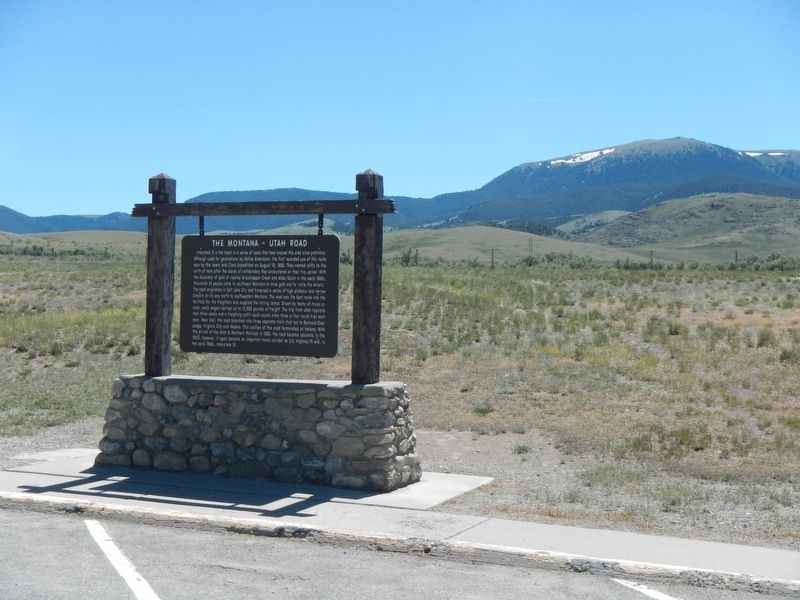
The Montana-Utah Road Marker
1 ► Montana, Beaverhead County, Dell — The Montana-Utah Road —
On Interstate 15 at milepost 35 near Red Rock Road.
2 ► Montana, Beaverhead County, Dillon — "it was mutually advantageous..." — Lewis and Clark at Camp Fortunate —
On State Highway 324 near Interstate 15, on the left when traveling east.
3 ► Montana, Beaverhead County, Dillon — it has a singular appearence — Meriwether Lewis, August 10, 1895 —
On State Highway 324 near Lake View Road, on the right when traveling east.
4 ► Montana, Beaverhead County, Dillon — "…we called them the rattle snake clifts" — Lewis & Clark to the Headwaters —
On Interstate 15 Frontage Road near Old Stage Road, on the right when traveling north.
5 ► Montana, Beaverhead County, Dillon — …the End of the Northwest Passage? — Change in Topography Across the Great Divide —
Near State Highway 324 near Lake View Road when traveling east.
6 ► Montana, Beaverhead County, Dillon — A Tribute to Sidney Edgerton — Montana's Unsung Hero —
On Bannack Road near State Highway 278, on the left when traveling east.
7 ► Montana, Beaverhead County, Dillon — Bannack —
On Bannack Road.
8 ► Montana, Beaverhead County, Dillon — Bannack —
On Interstate 15 at milepost 55 near Rebich Lane, on the right when traveling south.
9 ► Montana, Beaverhead County, Dillon — Bannack —
On MT 278 West, on the right when traveling north.
10 ► Montana, Beaverhead County, Dillon — Bannack Historical District —
Near Bannack Road (State Highway 278), on the left when traveling east.
11 ► Montana, Beaverhead County, Dillon — Beaverhead Canyon Gateway — (Ryan’s Canyon) —
On I-15.
12 ► Montana, Beaverhead County, Dillon — Beaverhead County World War II Memorial —
On North Montana Street (Business Interstate 15) at State Highway 91, on the left when traveling north on North Montana Street.
13 ► Montana, Beaverhead County, Dillon — Beaverhead Rock —
On 41 near Diamond O Drive, on the right when traveling south.
14 ► Montana, Beaverhead County, Dillon — Beaver's Head Rock: Native Road Sign — Lewis & Clark Seek the Shoshone —
On State Highway 41 near Diamond O Drive, on the right when traveling south.
15 ► Montana, Beaverhead County, Dillon — Camp Fortunate — To The Headwaters —
Near Montana Route 324 near Lake View Road, on the right when traveling east.
Paid Advertisement
16 ► Montana, Beaverhead County, Dillon — City of Dillon City Hall —
On East Center Street at North Idaho Street, on the right when traveling north on East Center Street.
17 ► Montana, Beaverhead County, Dillon — Clark Pocket Compass Monument —
Near Clarks Lookout Road west of State Highway 91.
18 ► Montana, Beaverhead County, Dillon — Dillon City Hall Historic District —
On East Center Street near North Idaho Street, on the left when traveling south.
19 ► Montana, Beaverhead County, Dillon — Dillon Implement Company —
On North Idaho Street at East Center Street, on the right when traveling north on North Idaho Street.
20 ► Montana, Beaverhead County, Dillon — Dillon's Founding — 1880-1930 —
On E. Glendale Street at South Washington Street, on the right when traveling north on E. Glendale Street.
21 ► Montana, Beaverhead County, Dillon — Distant Features —
On Clarks Lookout Road west of State Highway 91, on the right when traveling south.
22 ► Montana, Beaverhead County, Dillon — Entering the Beaverhead River Canyon — "the river entered the mountain…"
Near Interstate 15 Frontage Road near Old Stage Road, on the right when traveling north. Reported unreadable.
23 ► Montana, Beaverhead County, Dillon — Fortunate Camp —
On State Highway 324 near Interstate 15, on the left when traveling east.
24 ► Montana, Beaverhead County, Dillon — Grasshopper Creek —
Near Bannack Road near State Highway 278, on the left when traveling east.
25 ► Montana, Beaverhead County, Dillon — Hotel Andrus — 1917 —
On South Idaho Street at East Glendale Street, on the right when traveling west on South Idaho Street.
26 ► Montana, Beaverhead County, Dillon — Hotel Metlen — National Register of Historic Places —
On South Railroad Avenue at West Bannack Street, on the left when traveling north on South Railroad Avenue.
27 ► Montana, Beaverhead County, Dillon — Lewis and Clark Pathfinder Tribute —
On South Montana Street, on the right when traveling south.
28 ► Montana, Beaverhead County, Dillon — Mapping the Way —
On Clarks Lookout Road west of State Highway 91, on the right when traveling south.
29 ► Montana, Beaverhead County, Dillon — Martin Barrett House —
On South Pacific Street at East Clark Street, on the right when traveling west on South Pacific Street.
30 ► Montana, Beaverhead County, Dillon — Medicine Tree — This is a Sheepeater Shoshoni Medicine Tree —
Near South Montana Street near East Glendale Street, on the right when traveling east.
31 ► Montana, Beaverhead County, Dillon — Nez Perce Camp —
Near Bannack Road.
Paid Advertisement
32 ► Montana, Beaverhead County, Dillon — Old Trail to the Gold Diggin's —
On Interstate 15 at milepost 55 near Rebich Lane when traveling south.
33 ► Montana, Beaverhead County, Dillon — Red Rock Stage —
On Lemhi Pass Road (State Highway 324), on the left when traveling south.
34 ► Montana, Beaverhead County, Dillon — Reliable Landmarks —
On Clarks Lookout Road west of State Highway 91, on the right when traveling south.
35 ► Montana, Beaverhead County, Dillon — Reunion at Camp Fortunate —
On State Highway 324 near Lake View Road, on the right when traveling east.
36 ► Montana, Beaverhead County, Dillon — Sacajawea —
Near State Highway 324 near State Highway 15, on the left when traveling west.
37 ► Montana, Beaverhead County, Dillon — The First Electric Gold Dredge —
Near Bannack Road near State Highway 278, on the left when traveling east.
38 ► Montana, Beaverhead County, Dillon — The Lewis and Clark Expedition —
Near State Highway 324 near Interstate 15, on the left when traveling east.
39 ► Montana, Beaverhead County, Dillon — The Route and Campsites of Lewis and Clark in Montana: A Geologic Perpective — by Robert N. Bergantino and Kenneth L Sandau —
Near State Highway 324 near Lake View Road, on the right when traveling east.
40 ► Montana, Beaverhead County, Dillon — U.S. Post Office — Dillon Main — National Register of Historic Places —
On South Idaho Street just north of East Sebree Street, on the right when traveling south.
41 ► Montana, Beaverhead County, Dillon — William Clark — Map Maker —
On Clarks Lookout Road west of State Highway 91, on the right when traveling south.
42 ► Montana, Beaverhead County, Grant — "Most Distant Fountain" of the Mighty Missouri —
Near Lemhi Pass Road near Forest Road 158, on the left when traveling south.
43 ► Montana, Beaverhead County, Grant — The Beginning of the "Endless Missouri" —
Near Lemhi Pass Road near Forest Road 158, on the left when traveling south.
44 ► Montana, Beaverhead County, Jackson — "Hot Spring Valley" — Land of 10,000 Haystacks —
Near State Highway 278 near Bull Creek Road, on the right when traveling south.
45 ► Montana, Beaverhead County, Jackson — "I now take my leave..." — Clark Heads Toward the Yellowstone
On State Highway 278 near County Road 7482, on the right when traveling east. Reported damaged.
46 ► Montana, Beaverhead County, Jackson — "The Carroll Ranch" — Stopping point for travelers & cattle drives —
On State Highway 278 near Bull Creek Road, on the right when traveling south.
47 ► Montana, Beaverhead County, Jackson — A Soul-Searching Birthday — Questions about meaning, fulfillment & purpose —
Near State Highway 287 near Big Lake Creek Road, on the right when traveling south.
Paid Advertisement
48 ► Montana, Beaverhead County, Jackson — Naturally Sustained Productivity — Past, Present & Future —
Near State Highway 278 near Bull Creek Road, on the right when traveling south.
49 ► Montana, Beaverhead County, Jackson — Undaunted Stewardship — Serving History and Enhancing the Environment & Economy —
Near State Highway 278 near Bull Creek Road, on the right when traveling south.
50 ► Montana, Beaverhead County, Jackson — Welcome to Hamilton Ranch — Historic Landscapes Endure —
On State Highway 278 near Bull Creek Road, on the right when traveling south.
51 ► Montana, Beaverhead County, Lima — Howdy Everyone! Glad to See You —
Near Bailey Street at Old US Highway 91 (Harrison Street), on the right when traveling east.
52 ► Montana, Beaverhead County, Lima — The Montana Road —
Near Bailey Street at Old US Highway 91 (Harrison Street), on the right when traveling east.
53 ► Montana, Beaverhead County, Lima — The Tendoy Mountains —
Near Bailey Street at Old US Highway 91 (Harrison Street).
54 ► Montana, Beaverhead County, Polaris — The Way It Used To Be... Way Back —
On Pioneer Mountains National Forest Scenic Bywayt (Forest Road 73) near State Highway 278, on the right when traveling north.
55 ► Montana, Beaverhead County, Wisdom — "this spring...blubbers with heat" — Clark in the Big Hole Valley —
On State Highway 278 near Founier Street, on the right when traveling north.
56 ► Montana, Beaverhead County, Wisdom — A Perfect Place to Rest —
Near Park Entrance Road near State Highway 43, on the left when traveling east.
57 ► Montana, Beaverhead County, Wisdom — A Story of Fires… to be continued —
On State Highway 43 at May Creek Campground Road, on the right when traveling east on State Highway 43.
58 ► Montana, Beaverhead County, Wisdom — Battlefield Landscape —
Near Park Entrance Road near State Highway 43, on the left when traveling east.
59 ► Montana, Beaverhead County, Wisdom — Big Hole National Battlefield Monument —
On Park Entrance Road near State Highway 43, on the left when traveling north.
60 ► Montana, Beaverhead County, Wisdom — Big Hole Valley — Land of 10,000 Haystacks —
On State Highway 278 near Big Lake Creek Road, on the right when traveling south.
61 ► Montana, Beaverhead County, Wisdom — Brave Warriors —
Near Park Entrance Road near State Highway 43, on the left when traveling north.
62 ► Montana, Beaverhead County, Wisdom — Natural Travel Corridor — On the Eve of Tragedy — Trail Creek —
On State Highway 43 at Bitterroot-Big Hole Road, on the left when traveling east on State Highway 43.
63 ► Montana, Beaverhead County, Wisdom — Siege Site —
Near Park Entrance Road near State Highway 43, on the left when traveling east.
Paid Advertisement
64 ► Montana, Broadwater County, Toston — Lewis and Clark Trail —
On Toston Dam Road.
65 ► Montana, Broadwater County, Toston — Lorentz Homestead —
Near 285 near 287, on the left when traveling east.
66 ► Montana, Broadwater County, Toston — Toston Bridge —
On Bypass U.S. 287 near Slifka Lane, on the right when traveling west.
67 ► Montana, Broadwater County, Toston — Toston Smelter —
On Lombard Road at Bypass State Highway 287, on the right when traveling north on Lombard Road.
68 ► Montana, Broadwater County, Townsend — Canyon Ferry —
On U.S. 287 near Springville Lane, on the right when traveling north.
69 ► Montana, Broadwater County, Townsend — Crimson Bluffs — "...a remarkable bluff of a crimson coloured earth...." —
On River Road near Deer Path, on the right when traveling north.
70 ► Montana, Broadwater County, Townsend — State Bank of Townsend —
On Broadway (U.S. 12) near South Cedar Street, on the right when traveling north.
71 ► Montana, Broadwater County, Townsend — Thar's Gold in Them Thar Hills —
On State Highway 287 near Springville Lane, on the right when traveling north.
72 ► Montana, Broadwater County, Townsend — Valley Masonic Lodge No. 21 —
On South Spruce Street at B Street, on the right when traveling north on South Spruce Street.
73 ► Montana, Broadwater County, Townsend — Yorks Islands — Lewis and Clark in Montana —
Near State Highway 287 at milepost 81 near Shelly Road, on the left when traveling north.
74 ► Montana, Broadwater County, Winston — Winston —
On Main Street near U.S. 12, on the right when traveling west.
75 ► Montana, Deer Lodge County, Anaconda — 119-125 East Park Avenue — Anaconda Commercial Historic District —
On East Park Avenue (State Highway 1) near Oak Street, on the right when traveling east.
76 ► Montana, Deer Lodge County, Anaconda — 219 East Commercial Avenue — Anaconda Commercial Historic District —
On East Commercial Avenue near Cherry Street, on the left when traveling west.
77 ► Montana, Deer Lodge County, Anaconda — 219 West Third Street — West Side Historic District —
On West Third Street near Locust Street, on the left when traveling west.
78 ► Montana, Deer Lodge County, Anaconda — 321 East Third Street — Butte-Anaconda Historic District —
On East 3rd Street at Cedar Street, on the left when traveling west on East 3rd Street.
79 ► Montana, Deer Lodge County, Anaconda — 408 East Park Avenue — Anaconda Commercial Historic District —
On East Park Avenue (State Highway 1) near Cedar Street, on the right when traveling east.
Paid Advertisement
80 ► Montana, Deer Lodge County, Anaconda — 504 Main Street — West Side Historic District —
On Main Street at West 5th Street, on the left when traveling north on Main Street.
81 ► Montana, Deer Lodge County, Anaconda — 509 Chestnut — Goosetown Historic District —
On Chestnut Street near East 5th Street, on the right when traveling north.
82 ► Montana, Deer Lodge County, Anaconda — 801 East Third Street — Goosetown Historic District —
On East Third Street at Ash Street, on the left when traveling west on East Third Street.
83 ► Montana, Deer Lodge County, Anaconda — Anaconda —
Near Pintler Vetrans Memorial Scenic Highway (State Highway 1) near Interstate 90 Frontage Road, on the right when traveling east.
84 ► Montana, Deer Lodge County, Anaconda — Anaconda City Hall —
On 401 East Commercial Avenue at Cedar Street, on the left when traveling west on 401 East Commercial Avenue.
85 ► Montana, Deer Lodge County, Anaconda — Atlantic Cable Quartz Lode —
On Pintler Veterans Memorial Scenic Highway (at milepost 20) near Old Highway 10, aka Spring Hill Road, on the left when traveling west.
86 ► Montana, Deer Lodge County, Anaconda — Barich Block — Anaconda Commercial Historic District —
On East Park Avenue (State Highway 1) near Chestnut Street, on the right when traveling east.
87 ► Montana, Deer Lodge County, Anaconda — Butte, Anaconda and Pacific Railway Historic District —
On West Commercial Avenue near Locust Street, on the right when traveling west.
88 ► Montana, Deer Lodge County, Anaconda — Butte-Anaconda Historic District —
On Main Street at West 8th Street when traveling south on Main Street.
89 ► Montana, Deer Lodge County, Anaconda — Carpenters Union Hall — Anaconda Commercial Historic District —
On East Commercial Avenue near Cherry Street, on the left when traveling west.
90 ► Montana, Deer Lodge County, Anaconda — Cohen Block/Park Motors — Anaconda Commercial Historic District —
On East Commercial Avenue at Cherry Street on East Commercial Avenue.
91 ► Montana, Deer Lodge County, Anaconda — Commercial Historic District —
On East Park Avenue (State Highway 1) near Cherry Street, on the left when traveling east.
92 ► Montana, Deer Lodge County, Anaconda — Contributions of the Washoe Smelter —
On Anaconda Smelter Road (East 4th Street) 0.2 miles south of Park Avenue (Pintler Veterans Memorial Scenic Hwy) (State Highway 1), on the right when traveling east.
93 ► Montana, Deer Lodge County, Anaconda — Deer Lodge County Courthouse —
On Main Street at West 8th Street when traveling south on Main Street.
94 ► Montana, Deer Lodge County, Anaconda — Electric Light Building — Anaconda Commercial Historic District —
On Main Street at West Commercial Avenue, on the right when traveling north on Main Street.
95 ► Montana, Deer Lodge County, Anaconda — Fred Clark Residence — West Side Historic District —
On Locust Street at West 6th Street, on the left on Locust Street.
Paid Advertisement
96 ► Montana, Deer Lodge County, Anaconda — Furst Block — Anaconda Commercial Historic District —
On East Park Avenue (State Highway 1) near Main Street, on the right when traveling east.
97 ► Montana, Deer Lodge County, Anaconda — Furst Residence —
On West 3rd Street near Poplar Street, on the left when traveling west.
98 ► Montana, Deer Lodge County, Anaconda — Goosetown Historic District —
On Anaconda Smelter Road (East 4th Street) 0.2 miles south of Park Avenue (Pintler Veterans Memorial Scenic Hwy) (State Highway 1), on the right when traveling east.
99 ► Montana, Deer Lodge County, Anaconda — Hearst Free Library — West Side Historic District —
On Main Street at East 4th Street, on the left when traveling south on Main Street.
100 ► Montana, Deer Lodge County, Anaconda — Ida Block — Anaconda Commercial Historic District —
On Main Street at East Commercial Avenue, on the right when traveling east on Main Street.

754 entries matched your criteria. The first 100 are listed above. Next 100 ⊳
 
 
CeraNet Cloud Computing sponsors the Historical Marker Database.
This website earns income from purchases you make after using our links to Amazon.com. We appreciate your support.
Paid Advertisement
Nov. 10, 2026
