178 entries match your criteria. The first 100 are listed. ⊳
Vexillology Historical Markers
This series is about flags, their origins and uses. It is not for flag dedications, unless the dedications indicates the history of the flag's development.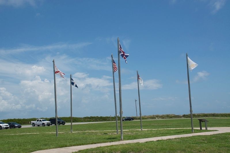
By Sandra Hughes, June 1, 2018
Colors of Significance Historic Flags of Mobile Point Marker
1 ► Alabama, Baldwin County, Fort Morgan — Colors of Significance: Historic Flags of Mobile Point —  |
| Near Fort Morgan Road (Alabama Route 180) 2 miles west of Dune Drive, on the left when traveling west. | |||
| 2 ► Alabama, Baldwin County, Fort Morgan — The Pride of Seven Flags — |
| On Dixie Graves Parkway near Route 180 W. | |||
| 3 ► Alabama, Henry County, Abbeville — Abbeville / Seven Flags and an Arrow Over Abbeville — |
| On East Washington Street, on the right when traveling east. | |||
| 4 ► Alabama, Montgomery County, Montgomery — First National Confederate Flag — ("Stars and Bars") — |
| Near Monroe Street east of North Bainbridge Street, on the right when traveling east. | |||
| 5 ► Alabama, Montgomery County, Montgomery — Great Seal of the Confederacy — |
| On Bibb Street just west of Commerce Street, on the right when traveling west. | |||
| 6 ► Alabama, Montgomery County, Montgomery — Second National Confederate Flag — ("Stainless Banner") — |
| Near Monroe Street east of North Bainbridge Street, on the right when traveling east. | |||
| 7 ► Alabama, Montgomery County, Montgomery — United States Flag Raised Over Alabama Capitol — Apr. 12, 1865 — |
| On South Bainbridge Street at Dexter Avenue, on the right when traveling north on South Bainbridge Street. | |||
| 8 ► Alabama, Montgomery County, Montgomery, Centennial Hill — "Battle Flag of the Confederacy" — |
| Near Monroe Street east of North Bainbridge Street when traveling east. | |||
| 9 ► Alabama, Montgomery County, Montgomery, Centennial Hill — "Third National Confederate Flag" — |
| Near Monroe Street east of North Bainbridge Street, on the right when traveling east. | |||
| 10 ► Alaska, Sitka Borough, Sitka, Mount Edgecumbe — American Flag Raising Site — |
| Near Lincoln Street. | |||
| 11 ► Arkansas, Jefferson County, Wabbaseka — The Arkansas Flag/Wabbaseka Memorial — |
| On U.S. 63/79 0.1 miles north of Myrtle Street, on the right when traveling north. | |||
| 12 ► California, Los Angeles County, Glendale, Montrose — National Flag Week — "It All Started In Montrose" — Montrose, California, Birthplace of National Flag Week — |
| On Honolulu Avenue at Ocean Boulevard, on the right when traveling west on Honolulu Avenue. | |||
| 13 ► California, Monterey County, Monterey — 6 — Bouchard Monument |
| Near Corporal Ewing Road. Reported permanently removed. | |||
| 14 ► California, Monterey County, Monterey — Hippolyte Bouchard Monument / Monumento a Hipólito Bouchard — When the Argentine Flag Flew Over Monterey / Cuando la bandera argentina voló sobre Monterey — |
| On Corporal Ewing Road north of Artillery Street, on the right when traveling north. | |||
| 15 ► California, Napa County, Yountville — Flags over California in 1870 — |
| Near Washington Street near Yount Street, on the left when traveling north. | |||
| 16 ► California, San Francisco City and County, San Francisco, The Castro — The Rainbow Flag — |
| Near Market Street at Castro Street. | |||
| 17 ► California, Sonoma County, Sonoma — 7 — Raising of the Bear Flag — |
| On First Street East at East Spain Street, on the right when traveling south on First Street East. | |||
| 18 ► Colorado, Kiowa County, Chivington — Why A 33 Star Flag — Sand Creek Massacre National Historic Site — |
| Near County Road W east of Chief White Antelope Way. | |||
| 19 ► Connecticut, Western Region, New Milford — In Memory of Peter Joseph Orenski — "The Flag Man" — April 21, 1940 to August 13, 2006 — |
| On Main Street just south of Church Street, on the right when traveling north. | |||
| 20 ► District of Columbia, Washington, Northwest Washington, Bloomingdale — DC and the Development of the International Bear Brotherhood Flag — |
| Near Thomas Street Northwest just east of 2nd Street Northwest, on the right when traveling east. | |||
| 21 ► District of Columbia, Washington, Northwest Washington, Federal Triangle — Flags of the World — |
| Near Pennsylvania Avenue Northwest west of 12th Street Northwest. | |||
| 22 ► Florida, Marion County, Ocala — Confederate States of America — Flags of Florida,1861-1865 — Marion County Museum — |
| On SE 26th Terrace 0.1 miles south of East Fort King Street, on the right when traveling north. | |||
| 23 ► Florida, Marion County, Ocala — Florida’s Past Flags — Ocala - Marion County Veterans Memorial Park — |
| Near East Fort King Street 0.1 miles south of East Silver Springs Boulevard. | |||
| 24 ► Florida, Marion County, Ocala — France — Flags of Florida,1564-1565 — Marion County Museum — |
| On SE 26th Terrace 0.1 miles south of East Fort King Street, on the right when traveling north. | |||
| 25 ► Florida, Marion County, Ocala — Great Britain — Flags of Florida,1763-1784 — Marion County Museum — |
| On SE 26th Terrace 0.1 miles south of East Fort King Street, on the right when traveling north. | |||
| 26 ► Florida, Marion County, Ocala — Spain — Flags of Florida,1513-1564 — Marion County Museum — |
| On SE 26th Terrace 0.1 miles south of East Fort King Street, on the right when traveling north. | |||
| 27 ► Florida, Marion County, Ocala — United States of America — Flags of Florida,1821-1845 — Marion County Museum — |
| On SE 26th Terrace 0.1 miles south of E Fort King St., on the right when traveling north. | |||
| 28 ► Florida, Monroe County, Key West — Union Jack — |
| On Weech Way at Southard Street on Weech Way. | |||
| 29 ► Florida, St. Johns County, St. Augustine — Four Centuries----Five Flags — |
| On St. Francis Street just west of Marine Street, on the right when traveling west. | |||
| 30 ► Georgia, Crawford County, Knoxville — Joanna Troutman — |
| On East Crusselle Street (U.S. 80) at Fair Play Hill Road, on the right when traveling east on East Crusselle Street. | |||
| 31 ► Georgia, Fulton County, Fairburn — Here the First Confedereate Flag Was Unfurled in Georgia — |
| On Southwest Broad Street (U.S. 29) at East Campbellton Street (Georgia Route 92), on the right when traveling north on Southwest Broad Street. | |||
| 32 ► Georgia, Gordon County, Resaca — Did You Know That Both Sides Used Red, White and Blue Flags? — |
| Near Resaca Lafayette Road Northwest (Georgia Route 136). | |||
| 33 ► Georgia, Warren County, Warrenton — National Flags of the Confederate States of America 1861-1865 — |
| On Main Street (Jefferson Davis Memorial Highway) at Norwood Street on Main Street (Jefferson Davis Memorial Highway). | |||
| 34 ► Idaho, Lemhi County, Tendoy — Lewis and Clark: Unfurling the Flag — Lewis and Clark in Lemhi County — |
| On Warm Springs Road (Forest Road 185), on the right when traveling east. | |||
| 35 ► Illinois, Cook County, Midlothian — Can We Wave the Flag Too Much? — |
| On Pulaski Road 0.1 miles south of 147th Street (Illinois Route 83), on the right when traveling north. | |||
| 36 ► Illinois, Massac County, Metropolis — Four Flags Over Fort Massac — |
| Near 7th Street east of U.S. 45. | |||
| 37 ► Illinois, Sangamon County, Springfield, Old Aristocracy Hill — The 21-Star Flag — |
| On South 5th Street at East Jackson Street, on the left when traveling south on South 5th Street. | |||
| 38 ► Indiana, Harrison County, Corydon — Flags Over Corydon — |
| On South Capitol Avenue west of West Poplar Street, on the right when traveling south. | |||
| 39 ► Indiana, Johnson County, Franklin — The Hopewell Flag — |
| On State Road 144 west of North Centerline Road, on the right when traveling west. | |||
| 40 ► Indiana, Marion County, Indianapolis, Downtown — An Uneasy Peace — 1959-present — Medal of Honor Memorial — |
| Near North West Street at Downtown Canal Walk, on the right when traveling south. | |||
| 41 ► Indiana, Morgan County, Mooresville — 55.2016.1 — Indiana State Flag — |
| On E. Main Street at N. Indiana Street, on the right when traveling west on E. Main Street. | |||
| 42 ► Kansas, Sedgwick County, Wichita — Columbus Standard — Bicentennial Flag Memorial — |
| Near North Waco Avenue. | |||
| 43 ► Kansas, Sedgwick County, Wichita — Commander In Chief's Personal Flag — Bicentennial Flag Memorial — |
| Near North Waco Avenue. | |||
| 44 ► Kansas, Sedgwick County, Wichita — Confederate Flag — Bicentennial Flag Memorial |
| Near North Waco Avenue. Reported permanently removed. | |||
| 45 ► Kansas, Sedgwick County, Wichita — Fifty Star Flag — Bicentennial Flag Memorial — |
| Near North Waco Avenue. | |||
| 46 ► Kansas, Sedgwick County, Wichita — Flag of Fifteen Stripes — Bicentennial Flag Memorial — |
| Near North Waco Avenue. | |||
| 47 ► Kansas, Sedgwick County, Wichita — Forty-Eight Star Flag — Bicentennial Flag Memorial — |
| Near North Waco Avenue. | |||
| 48 ► Kansas, Sedgwick County, Wichita — Forty-Five Star Flag — Bicentennial Flag Memorial — |
| Near North Waco Avenue. | |||
| 49 ► Kansas, Sedgwick County, Wichita — French Tricolor — Bicentennial Flag Memorial — |
| Near North Waco Avenue. | |||
| 50 ► Kansas, Sedgwick County, Wichita — Grand Union Flag — Bicentennial Flag Memorial — |
| Near North Waco Avenue. | |||
| 51 ► Kansas, Sedgwick County, Wichita — Thirteen Star Flag (Bennington Flag) — Bicentennial Flag Memorial — |
| Near North Waco Avenue. | |||
| 52 ► Kansas, Sedgwick County, Wichita — Thirty-Four Star Flag (1861) — Bicentennial Flag Memorial — |
| Near North Waco Avenue. | |||
| 53 ► Kansas, Sedgwick County, Wichita — Union Flag — Bicentennial Flag Memorial — |
| Near North Waco Avenue. | |||
| 54 ► Kentucky, Ballard County, Wickliffe, Ohio Township — Flags! Flags! Flags! — |
| On Fort Jefferson Hill Road (U.S. 51/62) 0.2 miles south of Patterson Road, on the right when traveling south. | |||
| 55 ► Kentucky, McCracken County, Paducah — 1175 — Confederate Flag of Welcome / Rescue of Flag — |
| On Farley Place 0.1 miles south of South 3rd Street (Business U.S. 60), on the left when traveling south. | |||
| 56 ► Louisiana, East Baton Rouge Parish, Baton Rouge — Flag of the Confederate States of America — March 21, 1861 - May 9, 1862 — |
| Near St. Louis Street 0.1 miles North Boulevard, on the right when traveling south. | |||
| 57 ► Louisiana, East Baton Rouge Parish, Baton Rouge — Flag of the State of Louisiana — Adopted 1912 — |
| Near St. Louis Street 0.1 miles North Boulevard, on the right when traveling south. | |||
| 58 ► Maryland, Anne Arundel County, Annapolis — History of Our Maryland Flag — |
| On Maryland Avenue south of Prince George Street, on the right when traveling north. | |||
| 59 ► Maryland, Baltimore, Inner Harbor — Baltimore Riot Trail — Flag Waving at Fawn Street — Baltimore – A House Divided |
| On President Street at Fawn Street, on the left when traveling north on President Street. Reported permanently removed. | |||
| 60 ► Maryland, Baltimore, Inner Harbor — Baltimore Riot Trail — Flag Waving at Fawn Street — Baltimore - A Divided City — |
| On President Street at Fawn Street, on the right when traveling south on President Street. | |||
| 61 ► Maryland, Baltimore, Jonestown — The Flag House and Star-Spangled Banner Museum — |
| On East Pratt Street, on the left when traveling east. | |||
| 62 ► Maryland, Baltimore, Jonestown — The Star Spangled Banner Flag was Born Here — |
| On South President Street. | |||
| 63 ► Maryland, Baltimore, Jonestown — Welcome To The Star-Spangled Banner Flag House — |
| Near Albemarle Street just north of East Pratt Street, on the right when traveling south. | |||
| 64 ► Maryland, Baltimore, Locust Point Industrial Area — O'er the Ramparts We Watch! — Which Flag Flies Today? — |
| Near East Fort Avenue. | |||
| 65 ► Maryland, Baltimore, Locust Point Industrial Area — Star-Spangled Banner |
| Near East Fort Avenue. Reported permanently removed. | |||
| 66 ► Maryland, Caroline County, Ridgely — Town of Ridgely Flag — |
| On Central Avenue (Maryland Route 312) just south of East Railroad Street, on the left when traveling south. | |||
| 67 ► Maryland, Carroll County, Westminster — Divided Loyalties — A U.S. Flag Goes South |
| Near North Court Street. Reported permanently removed. | |||
| 68 ► Maryland, Frederick County, Frederick, Downtown — Barbara Fritchie House — "Shoot if you must this old gray head, but spare your country’s flag." — Antietam Campaign 1862 |
| On West Patrick Street (State Highway 144), on the left when traveling west. Reported permanently removed. | |||
| 69 ► Maryland, Frederick County, Frederick, Downtown — Barbara Fritchie House — "Spare your country's flag" — Antietam Campaign 1862 — |
| On West Patrick Street (Maryland Route 144) east of South Bentz Street, on the right when traveling east. | |||
| 70 ► Maryland, Montgomery County, Beallsville — Beallsville — Squabble at the cemetery: Whose flag flies today? — Antietam Campaign 1862 — |
| On Beallsville Road (Maryland Route 109) at Darnestown Road ( Route 28), on the right when traveling south on Beallsville Road. | |||
| 71 ► Massachusetts, Suffolk County, Boston, Charlestown — Flags at Sea — |
| Near 1st Avenue south of 5th Srteet, on the left when traveling south. | |||
| 72 ► Michigan, Emmet County, Mackinaw City — Flags of Michilimackinac — |
| On North Huron Avenue. | |||
| 73 ► Michigan, Mackinac County, Mackinac Island — Flags at Fort Mackinac — |
| Near Huron Road, on the left when traveling west. | |||
| 74 ► Mississippi, Harrison County, Pass Christian — The Flag of the United States of America — |
| Near East Scenic Drive 0.1 miles west of Fleitas Avenue. | |||
| 75 ► Mississippi, Jackson County, Ocean Springs — The Nine Flags of Mississippi — |
| On Front Beach Drive. | |||
| 76 ► Missouri, Lafayette County, Higginsville — Confederate States of America - Battle Flags — |
| On 1st Street 0.4 miles north of Business Missouri Route 13, on the left when traveling north. | |||
| 77 ► Missouri, Lafayette County, Higginsville — Confederate States of America - National Flags — |
| On 1st Street 0.4 miles Business Missouri Route 13, on the left when traveling north. | |||
| 78 ► New Jersey, Burlington County, Bordentown — 50 Star Flag — |
| On Farnsworth Avenue (County Road 545) at Railroad Street, on the right when traveling south on Farnsworth Avenue. | |||
| 79 ► New Jersey, Gloucester County, National Park — Flag of Fort Mercer — |
| Near Hessian Road, on the right when traveling west. | |||
| 80 ► New Jersey, Somerset County, Bound Brook — Thirteen Star Flag |
| On Middlebrook Road, on the left when traveling east. Reported missing. | |||
| 81 ► New Mexico, Doña Ana County, Las Cruces — The History of the New Mexico State Flag — |
| On Dripping Springs Road. | |||
| 82 ► New York, Essex County, Crown Point — The White Flag — |
| Near Bridge Road. | |||
| 83 ► New York, Greene County, Athens — Pride Flag — |
| On North Water Street at 2nd Street, on the right when traveling north on North Water Street. | |||
| 84 ► New York, New York County, Manhattan, World Trade Center — Flag of Honor — |
| On Church Street close to Fullton Street. | |||
| 85 ► New York, Orange County, Harriman — First MIA Flag — |
| On South Main Street at Grove Street when traveling north on South Main Street. | |||
| 86 ► New York, Tioga County, Newark Valley — ‘Rollie’ Noble Flag — |
| On Rock Street east of N Main Street (New York State Route 38), on the left when traveling east. | |||
| 87 ► North Carolina, Guilford County, Kernersville, Colfax — 20 Star Flag - 1818 — |
| On Pleasant View Trail 0.8 miles north of Park Céntre Drive, on the left when traveling north. | |||
| 88 ► North Carolina, Guilford County, Kernersville, Colfax — 38 Star Flag - 1877 — |
| On Pleasant View Trail 0.8 miles north of Park Céntre Drive, on the left when traveling north. | |||
| 89 ► North Carolina, Guilford County, Kernersville, Colfax — 48 Star Flag - 1912 — |
| On Pleasant View Trail 0.8 miles north of Park Céntre Drive, on the left when traveling north. | |||
| 90 ► North Carolina, Guilford County, Kernersville, Colfax — 50 Star Flag - 1960 — |
| On Pleasant View Trail 0.8 miles north of Park Céntre Drive, on the left when traveling north. | |||
| 91 ► North Carolina, Guilford County, Kernersville, Colfax — Betsy Ross Flag - Circa 1790 — |
| On Pleasant View Trail 0.8 miles north of Park Céntre Drive, on the left when traveling north. | |||
| 92 ► North Carolina, Guilford County, Kernersville, Colfax — Fort Sumter Flag - 1861 — |
| On Pleasant View Trail 0.8 miles north of Park Céntre Drive, on the left when traveling north. | |||
| 93 ► North Carolina, Guilford County, Kernersville, Colfax — Gadsden Flag - 1775 — |
| On Pleasant View Trail just east of Willow Creek Road, on the right when traveling east. | |||
| 94 ► North Carolina, Guilford County, Kernersville, Colfax — Grand Union Flag - 1775 — |
| On Pleasant View Trail 0.8 miles north of Park Centre Drive, on the left when traveling north. | |||
| 95 ► North Carolina, Guilford County, Kernersville, Colfax — Great Star Flag - 1837 — |
| On Pleasant View Trail 0.8 miles north of Park Céntre Drive, on the left when traveling north. | |||
| 96 ► North Carolina, Guilford County, Kernersville, Colfax — Guilford Courthouse Flag - 1781 — |
| On Pleasant View Trail 0.8 miles Park Céntre Drive, on the left when traveling north. | |||
| 97 ► North Carolina, Guilford County, Kernersville, Colfax — National Flag - 1777 — |
| On Pleasant View Trail 0.8 miles north of Park Céntre Drive, on the left when traveling north. | |||
| 98 ► North Carolina, Guilford County, Kernersville, Colfax — Sons of Liberty Flag - 1775 — |
| On Pleasant View Trail 0.7 miles north of Park Centre Drive, on the left when traveling north. | |||
| 99 ► North Carolina, Guilford County, Kernersville, Colfax — The U.S. Army Flag — |
| Near Pleasant View Trail 0.8 miles north of Park Céntre Drive, on the left when traveling north. | |||
| 100 ► North Carolina, Polk County, Columbus — 1765 - Sons of Liberty Flag — |
| On Gibson Street north of Ward Street, on the right when traveling north. | |||
178 entries matched your criteria. The first 100 are listed above. The final 78 ⊳