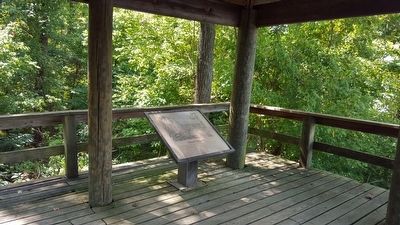
Mt. Malady, the first hospital in the American colonies, was built in Coxendale near Henricus in 1612. It had 40 beds for 80 patients! Many colonists arrived in poor health from their long sea voyage. Others acquired diseases, such as . . . — — Map (db m288106) HM
Olin Miller Dantzler (1826-1824) was a native of South Carolina. He graduated from Randolph-Macon College in Virginia in 1846. He married Caroline Clover on July 10, 1850, and they had five children. Prior to the war Dantzler served as a South . . . — — Map (db m16060) HM
In 1607, Opposunoquonuske, sister of the Appamattuck Indian chief Coquonasum, headed an Appamattuck town on the James River at the mouth of the Appomattox. On 24 May 1607, Opposunoquonuske received a party of Englishmen in a stately fashion, greatly . . . — — Map (db m54254) HM
The town of Osbornes was named for Captain Thomas Osborne who settled nearby at Coxendale in 1616. During the 17th and 18th centuries, Osborne's plantation wharf was a tobacco inspection station and local shipping center. Thomas Jefferson, . . . — — Map (db m16019) HM
(left panel)
Parker’s Battery
A one-quarter-mile walking trail through the site offers a window into the existence of a typical Civil War artillery company on the front lines during the final year of the war. The men depended on the . . . — — Map (db m173570) HM
Parker’s men improved this earthen redoubt, referred to as a battery, so as to better protect their guns stationed behind its walls. Supporting infantry, from the 15th and 17th Virginia regiments, filled the adjacent trenches and manned the forward . . . — — Map (db m16086) HM
Parker’s men improved this earthen redoubt, referred to as a battery, so as to better protect their guns stationed behind its walls. Supporting infantry, from the 15th and 17th Virginia regiments, filled the adjacent trenches and manned the forward . . . — — Map (db m66326) HM
To the west of the road here at Proctor's Creek Maj. Gen. Benjamin F. Butler's Union Army of the James attacked the outer line of the Confederates' Drewry Bluff defenses on 13-14 May 1864. On the first day, Union Maj. Gen. Quincy A. Gillmore struck . . . — — Map (db m16044) HM
Many of the men, like Major Parker and Lieutenant J. Thompson Brown, returned to their homes in Richmond after the war. Brown became a successful local businessman, and in 1888 purchased the ground here in order to preserve the area where the . . . — — Map (db m164550) HM
Many of the men, like Major Parker and Lieutenant J. Thompson Brown, returned to their homes in and around Richmond after the war. In 1888, Lieutenant Brown, then a successful local businessman, purchased the ground here in order to preserve the . . . — — Map (db m164551) HM
McClellan’s Federals attacked in 1862, then Grant in ’64, while Joseph E. Johnston and then Robert E. Lee defended. The two major assaults on the Confederate capital fanned out in a series of battles, skirmishers and marches. Tour the . . . — — Map (db m16076) HM
On 16 May 1864, Confederate forces under Gen. P.G.T. Beauregard attacked southward across a three-mile front. They struck the Union Army of the James under Maj. Gen. Benjamin F. Butler and pushed it across Proctor's Creek, away from Richmond and . . . — — Map (db m205502) HM
(Preface) Early 1864, Gen. Ulysses S. Grant, commander of all Federal armies, ordered advances throughout the Confederacy in the spring. On May 5, General Benjamin F. Butler's Army of the James landed Bermuda Hundred to begin . . . — — Map (db m184714) HM
Here in 1864 on the Bermuda Hundred peninsula between the James and Appomattox Rivers, the Union Army of the James, commanded by Maj. Gen. Benjamin F. Butler, was "bottled up" by Confederate Gen. P. G. T. Beauregard, defender of Petersburg. The . . . — — Map (db m17118) HM
On Jan. 23, 1865, the ironclads Virginia II, Richmond, and Fredericksburg, with five smaller vessels, descended the James River in an effort to attack the Union supply depot at City Point. A reliable report indicated that recent . . . — — Map (db m164327) HM
On the evening of May 16, 1864 the Army of the James completed its retreat from The Second Battle of Drewry's Bluff and returned to its earthworks in Bermuda Hundred. Too disorganized to effectively pursue the retreating Federals, the Confederates . . . — — Map (db m164336) HM
This is a fragment from the breech of a 5.8 inch “Sawyer Gun”. This gun was located at Battery Sawyer, a Federal gun position across the river to your front where the River’s Bend community is today. This gun burst on August 5, 1864 . . . — — Map (db m87592) HM
After the Battle of Cold Harbor in June 1864, Lt. Gen. Ulysses S. Grant made plans to shift the Army of the Potomac to the south side of the James River with the objective of capturing Petersburg. On June 15th, the 18th Corps of the Army of the . . . — — Map (db m184370) HM
Just beyond this field stood the Cobb's Hill Signal Tower, also known as Butler's Signal Tower. The tower stood 110 feet tall and was located next to Fort Zabriskie. It was used to communicate with troops along the James River and Appomattox River. . . . — — Map (db m271148) HM
Photograph of the ironclad ram Atlanta. The Atlanta was built by the Confederacy and was captured at Savannah Ga. by Federal forces in 1863. It saw service on the James River in the US Navy. The ship was decommissioned in 1865 and was . . . — — Map (db m87876) HM
This photograph of the Dutch Gap Canal was taken from near this location in 1865. It shows the canal with a dredge boat in the background. The canal was dug in an attempt to bypass Confederate gun positions at Battery Dantzler approximately one . . . — — Map (db m164325) HM
Photograph of the Union ironclad Saugus taken from near this location in March 1865. The log boom on the bow of the Saugus is a field adaptation to protect it from Confederate mines in the river.
This sign was sponsored by Edwin . . . — — Map (db m87877) HM
This site seems remote from Richmond, but Confederate defenses extended well beyond the city. From mid-June 1864 a unit of artillerymen called Parker’s Battery manned these earthworks.
Despite the proximity of a large enemy force, this line was . . . — — Map (db m164339) HM
Near this spot was built
Anno Domini 1611
The Church of Henricopolis
Under the auspices of
Sir Thomas Dale
High Marshall of Virginia
The Reverend Alexander Whitaker, M.A,
Minister
This cross is erected to
Commemorate the . . . — — Map (db m16147) HM
The house that stood here, midway between Richmond and Petersburg, was a landmark in the campaign of 1864. East and Southeast were Batteries Brooks, Semmes, Wood and Dantzler which defended the South side of James river from Drewry’s Bluff to the . . . — — Map (db m14277) HM
Just east of this point running from the James River to the Appomattox River, was the Confederate defense line known as the Howlett line, named for the Howlett House that stood at the north end of the line. Established in May, 1864, by General . . . — — Map (db m17116) HM
Native Americans 1500's
These boats were used by the Powhatan Indians to carry furs, food, and other trading items.
First Settlers 1600's
Shallops were wider and sometimes longer than canoes. They were propelled by oars or by . . . — — Map (db m288107) HM
Civilization has dramatically transformed the landscape. Before 1930s, the land around you was probably swamp and bottomland forest. From the 1930s to around the 1960s, companies mined the area for sand and gravel. During this time, the large open . . . — — Map (db m87881) HM
The foundation is all that remains of the lightkeeper’s house. The lightkeeper had to live on site to maintain the gas-powered lights which were once located on the bluff. Lights were constructed after the first Dutch Gap channel was completed in . . . — — Map (db m16153) HM
The Battle of Trent's Reach
On the night of Jan. 23, 1865, the ironclads Virginia II, Richmond, and Fredericksburg, with five smaller vessels, descended the James River in an effort to attack the Union supply depot at . . . — — Map (db m288110) HM
One of the most dramatic changes along the James River is the daily tide. The tides originating in the Atlantic Ocean influence the river all the way to the City of Richmond. Constant sources of freshwater from replenishing rainfalls and streams . . . — — Map (db m288109)
The Union Army of the James under General Benjamin Butler came to "Dutch Gap" in the summer of 1864 to begin digging a military canal. The first regiment, the 169th NY Infantry and the 1st NY Engineers immediately took casualties from Confederate . . . — — Map (db m278809) HM
(preface) Early in 1864, Union Gen. Ulysses S. Grant, commander of all Federal armies, ordered advances throughout the Confederacy in the spring. On May 5, Union Gen. Benjamin F. Butler landed his Army of the James on Bermuda Hundred . . . — — Map (db m164324) HM
Dedicated to those who served in the Armed Forces of the United States
This memorial obtained from Dutch Gap at the site where on May 16, 1619 the Virginia Company of London decreed that a college or university should be . . . — — Map (db m133676) WM
The 1917 Courthouse stands on the footprint of the first Chesterfield County courthouse built in 1749 and demolished in 1917, against the will of local citizenry. This early preservation case was the subject of heated debate between concerned . . . — — Map (db m133671) HM
On this spot were imprisoned 1770-1774
John Tanner
William Weber
Augustine Eastin
David Tinsley
Joseph Anthony
Jeremiah Walker
John Weatherford
Apostles of
Religious Liberty
“Whether it be right . . . — — Map (db m19527) HM
This is the site of the former camp of two Civilian Conservation Corps (CCC) companies and a Works Progress Administration (WPA) work force of 300 men who constructed the recreation area along Swift Creek from the spring of 1935 to the summer of . . . — — Map (db m28861) HM
This area, known originally as "Cold Water Run," is the site of the first Chesterfield County courthouse, erected in 1750. In 1917 it was demolished and replaced by a larger Georgian Revival brick building that served the county until the 1960s. . . . — — Map (db m19523) HM
Late on the morning of Monday, April 3, 1865, part of Confederate General Robert E. Lee’s Army of Northern Virginia briefly halted here at the Chesterfield County seat. The day before, a series of Federal attacks had broken through Lee’s lines at . . . — — Map (db m19518) HM
On the morning of Monday, April 3, 1865, part of Confederate General Robert E. Lee's Army of Northern Virginia briefly halted here. The day before, a series of Federal attacks had broken through Lee's lines at Petersburg and ended the siege there. . . . — — Map (db m311949) HM
Located north of this marker is the site of the camp of CCC Company 2386, Beach, Virginia. The camp was organized in 1935 and disbanded in 1942. The company consisted of 2 to 3 military officers, a civilian technical service staff, and approximately . . . — — Map (db m28858) HM
Coal mines, including Brighthope, Raccoon, Cox, Hill, Vaden, and others, were located a mile west of here. As early as 1822 coal was sold for local use. By 1845 the Clover Hill Railroad was constructed to transport the coal to the Appomattox River . . . — — Map (db m28873) HM
Virginia troops pivotal in Maj. Gen. Greene's Carolina Campaign trained here, 1780-1781, in harsh conditions similar to Valley Forge. — — Map (db m313482) HM
I propose to create a civilian conservation corps…confining itself to forestry, the prevention of soil erosion, flood control, and similar projects. I call your attention to the fact that this type of work is of definite, practical . . . — — Map (db m28863) HM
Chesterfield County recognizes employees who have dedicated 25-plus years of service to the county. Since 2007, engraved bricks have been placed on the walkway outside the Historic 1917 Courthouse to commemorate the longstanding commitments and . . . — — Map (db m308886) HM
Built on the location of an earlier, smaller structure, the dwelling measured 18' x 29' and was divided into two rooms. No evidence of a brick chimney or hearth was found. Most likely, the chimney and hearth were made of sticks covered with mud or . . . — — Map (db m308903) HM
Two and one-third miles south stands Eppington, built in the late 1760s by Francis Eppes and his wife Elizabeth Wayles Eppes, half-sister to Martha Wayles Jefferson. Thomas Jefferson frequently visited Eppington. Lucy Jefferson, his daughter, died . . . — — Map (db m28911) HM
The kitchen building measured 16' x 58'. Other rooms such as laundries, woodsheds, living quarters for the cook and family could have been added. This would explain the long length of the building. — — Map (db m308902) HM
Built in 1822 by William Winfree, this Federal-style house was named for the large stand of magnolia trees in the front yard. It was originally surrounded by a 600-acre farm. A nearby tavern provided lodging for persons with business at the . . . — — Map (db m19487) HM
Late in the 18th century, the Methodist Episcopal Church confronted the possibility of schism. James O'Kelly, a Methodist minister, began challenging Bishop Francis Asbury regarding his appointive powers, his management of church affairs, and other . . . — — Map (db m26013) HM
This park of 7604 acres was originally known as the Swift Creek Recreational Area. Its purchase in 1934 and subsequent development by the federal government were with the understanding that eventually the State would accept and maintain the . . . — — Map (db m28856) HM
The smoke house measured 18' x 8', though most smoke houses were usually smaller in size. It contained a brick smoke box which was filled with hickory wood to smoke the meat. — — Map (db m308901) HM
Before the start of the American Revolution, free Black men were enrolled in local county militias across Virginia. When the war began, these men often volunteered to enlist in Virginia's Continental battalions. Hundreds of Black patriots, including . . . — — Map (db m289579) HM
Women played an important role in the Continental Army barracks at Chesterfield Courthouse during 1780-1781. Local women were often contracted to make shirts for the sick and wounded at the military hospital and to serve as laundresses. Other . . . — — Map (db m289586) HM
In the wake of two successive Continental Army defeats - first General Lincoln's surrender of his Continental army at the Siege of Charleston, SC on May 12, 1780 and then the defeat of General Gates' Continental army at Camden, SC on August 16, . . . — — Map (db m289587) HM
Dedicated to all
Chesterfield County
veterans who served
their country
[On the other side of the wall is a series of plaques:]
Afghanistan
2001
Chesterfield County
Remembers
Brandon T. Islip, . . . — — Map (db m133672) WM
William Ransom Johnson lived near here at Oakland. Called the “Napoleon of the Turf,” he dominated American horseracing early in the 19th century. He trained more than 20 champions and achieved national fame from the 30 North-South match races held . . . — — Map (db m28915) HM
World War I began to impact Chesterfield County on April 6, 1917 when the National Selective Service Act was enacted. Lacking a home guard and with no pre-war military organization, Chesterfield County's initial efforts to form an infantry unit . . . — — Map (db m133674) HM
Group Camp 7, built for the use of African Americans, opened 1.25 miles south of here in 1939. The site was part of Swift Creek Recreational Demonstration Area, a project of the National Park Service that later became Pocahontas State Park. The . . . — — Map (db m308882) HM
Elements of the Union Army of the James, led by Maj. Gen. Benjamin F. Butler, landed at Bermuda Hundred on 5 May 1864 to cut the Confederate rail and supply lines between Richmond and Petersburg. On 9 May, Butler sent divisions to Port Walthall . . . — — Map (db m17121) HM
You are standing in the middle of the Union line that faced the Confederate route of attack up the Richmond Turnpike on May 9, 1864, during Union Gen. Benjamin F. Butler's Bermuda Hundred Campaign. Here, along Swift Creek, elements of Butler's . . . — — Map (db m272902) HM
Following the Battle of Ware Bottom Church on May 20, 1864, Confederate forces began digging the earthworks that would become known as the Howlett Line. Named after the Howlett house, which stood at the northernmost point, the line stretched . . . — — Map (db m16096) HM
While Union Maj. Gen. Benjamin F. Butler's Army of the James entrenched at Bermuda Hundred on 11 May 1864, Confederate Maj. Gen. Robert F. Hoke led parts of two divisions north from Petersburg to unite with Maj. Gen. Robert Ransom's division near . . . — — Map (db m17123) HM
On 5 May 1864, leading elements of Union Maj. Gen. Benjamin F. Butler's Army of the James disembarked off transports at Bermuda Hundred, located to the north of here. The next day this army began severing telegraph lines and nearby portions of the . . . — — Map (db m17120) HM
In March of 1865 Abraham Lincoln left behind the pressures of Washington and traveled to visit Lt. Gen. Grant at City Point. He spent two weeks at City Point, touring the front and reviewing troops.
On March 27, 1865, Abraham Lincoln, his wife . . . — — Map (db m109395) HM
Ending the war by a direct attack on Richmond was a key component of the Federal war effort in the east. Federal naval forces also blockaded the Confederate coast while the Federal army fought to capture key coastal cities and ports along the . . . — — Map (db m73966) HM
Like its pre-war economy, much of the southern war effort relied on slave labor. When Richmond became the capital for the newly formed Confederacy, both freedmen and slaves were used to maintain railroads, build fortifications, and perform other . . . — — Map (db m109390) HM
This is a composite of two photographs taken of the Appomattox River from this location. The signal tower in the background was near present day R. Garland Dodd Park at Point of Rocks.
This sign was sponsored by Stewart O'Bannon III . . . — — Map (db m109396) HM
Broadway Landing was located three miles up the Appomattox River from City Point. It was the main supply depot for Federal artillery during the siege of Petersburg. Artillery pieces and ammunition were transported by ship or barge and offloaded . . . — — Map (db m109393) HM
Around this Stone Lie the Remains of
Col. Jno. Bolling of "Cobbs."
Great-Grand-Son of
Rolfe and Pocahontas.
B. 1676 — D. 1729
He was prominent in his day. Represented his County (Chesterfield) in the House of Burgesses and . . . — — Map (db m271182) HM
When the Bermuda Hundred Campaign began, Confederate forces south of the James River were widely scattered across southern Virginia and eastern North Carolina. Confederate eyes were focused on events to the north where the Battle of the Wilderness . . . — — Map (db m271154) HM
The wooded area in front of you contains rare examples of a radiant heat system called a Crimean Oven. This system was used to heat hospital tents at Point of Rocks during the Civil War. The concept behind Crimean Ovens dates back to the days of the . . . — — Map (db m109398) HM
In May of 1864, the Federal 18th Corps occupied the position along the bluff behind you. In late May of 1864, the southern end of the Confederate Howlett Line was under construction approximately 1.5 miles to your front (west). That section of the . . . — — Map (db m271161) HM
In March of 1864 Ulysses S. Grant was placed in command of all Federal forces. Grant's plan to end the war envisioned a multi-front invasion across the entire Confederacy to negate the South's ability to shift forces from one front to another. . . . — — Map (db m73965) HM
Lt. Gen. Grant’s strategy was to attack the Confederate armies on multiple fronts simultaneously so that they could not reinforce each other. In the early days of May 1864, Maj. Gen. George G. Meade moved the Army of the Potomac across the Rapidan . . . — — Map (db m73970) HM
From May 1864 until the end of the Civil War in April 1865, this land was the site of a large hospital for Federal troops who fought in the Bermuda Hundred Campaign and the Siege of Petersburg. Historic Point of Rocks is within the historic boundary . . . — — Map (db m73972) HM
Point of Rocks takes its name from a 60-foot high sandstone cliff located here along the Appomattox River. The site was used by Native Americans as a camp and observation point, and was mentioned by Captain John Smith in his notes on Virginia. A . . . — — Map (db m109399) HM
In 1608, when exploring the Appomattox River, the James River's largest tributary, Smith found verdant marshes the likes of which can still be seen along Ashton Creek. Referred to as bread-basked marshes, these creek-fed wetlands yielded many . . . — — Map (db m271158) HM
Patients at Point of Rocks Hospital were under the care of two pioneer women in the field of medicine, Clara Barton and Harriet Dame. At a time when most women were not allowed to be near the fighting, these women saw the war close up at field . . . — — Map (db m109378) HM
Battles at Port Walthall Junction
At about 4:00 PM on May 6, 1864 Brig. Gen. Charles Heckman's brigade moved down Ruffin Mill Road toward Port Walthall Junction where 600 soldiers from Brig. Gen. Johnson Hagood's South Carolina brigade . . . — — Map (db m73971) HM
(preface) Early in 1864, Union Gen. Ulysses S. Grant, commander of all Federal armies, ordered advances throughout the Confederacy in the spring. On May 5, Union Gen. Benjamin F. Butler landed his Army of the James on Bermuda . . . — — Map (db m271152) HM
Shortly after the Army of the James landed in Bermuda Hundred, a field hospital was established here at Point of Rocks. The hospital originally consisted of tents set up in the orchard around the Strachan House. The tents were 50 feet long and . . . — — Map (db m109377) HM
This photograph was taken from across the Appomattox River behind you.
The large hospital ward in the photograph once stood in this field in front of you.
This sign was sponsored by Douglas Waters, Carrollton, TX — — Map (db m109392) HM
This photograph was taken from this spot in 1865. The flat area in front of you is where the hut in the photograph once stood. In June of 1864 a pontoon bridge was built across the marshy ground in the photograph. The first attacks on . . . — — Map (db m109374) HM
”On June 26,...just as we were having roll call and the men were about to retire for the night, the boom of a cannon a little way down the river, and the whizzing of a shell as it sped us by, aroused us to the fact that the enemy was . . . — — Map (db m109376) HM
On May 4, 1864, Maj. Gen. Benjamin F. Butler began to load 38,000 men of the Army of the James on transport ships at Newport News and Yorktown, Virginia. Their goal was a neck of land in Chesterfield County known as Bermuda Hundred. Butler was to . . . — — Map (db m271157) HM
In April of 1864, Lt. Gen. Ulysses S. Grant met with Maj. Gen. Benjamin F. Butler and approved his plan for attacking Richmond by moving an army up the James River. Grant decided that while the Army of the Potomac moved against Robert E. Lee and the . . . — — Map (db m271156) HM
"Petersburg at that hour was clearly at the mercy of the Federal Commander who had all but captured it"
Confederate General P.G.T. Beauregard on the June 15th attack at Petersburg.
On June 9, 1864, as Grant prepared to shift his army . . . — — Map (db m180819) HM
After taking heavy losses at Cold Harbor, Lt. Gen. Grant made the decision to move his army across the James River and attack Petersburg. The capture of that city and its key rail links would cut off Richmond from the rest of the Confederacy. . . . — — Map (db m109386) HM
This house was constructed in 1841 by Rev. John Alexander Strachan, founder of Enon Baptist Church. Rev. Strachan also preached at several other congregations in the area. Family stories describe him rowing a boat across the Appomattox River to . . . — — Map (db m74662) HM
The United States Submarine Propeller Alligator
The green, 47-foot-long Alligator was the U.S. Navy's first submarine—a technological wonder of the Civil War era.
French engineer Brutus de Villeroi designed the . . . — — Map (db m109375) HM
Thousands of African-American troops served in the Army of the James under the official designation of United States Colored Troops (USCT).
Maj. Gen. Benjamin F. Butler was a strong proponent of the use of African-American troops and had more . . . — — Map (db m180820) HM
Gabriel Archer wrote about a high rock cliff that projected into the channel of the Appomattox River upstream of its confluence with the James. When exploring the river in 1608, Smith found verdant marshes the likes of which can still be seen here . . . — — Map (db m271153) HM
"The Rocks" became a popular place for students to meet down on the Appomattox River. The group seen here is from the "Normal Class" of 1913. The term "normal" referred to teacher training programs. The "collegiate institute" included training in . . . — — Map (db m149617) HM
Lynchburg native Amaza Lee Meredith was one of the nation's few African American female architects during the mid-20th century. Her self-designed residence, Azurest South (1939), is a rare Virginia example of a mature International Style building. . . . — — Map (db m130078) HM
The site of an Appomattox Indian village burned in 1676 in Bacon's Rebellion, the present town of Ettrick stands on land that belonged to "Ettrick Banks" and "Matoax," the boyhood plantation of John Randolph of Roanoke. In 1810 Campbell's Bridge . . . — — Map (db m287247) HM
In honor of those of Ettrick
who served in the Armed Forces
and
in memory of these who made
the Supreme Sacrifice in World War II
C. Leslie Clarke • William E. Laffoon • Robert E. Marable • Charlie L. Nichols • Charles C. . . . — — Map (db m149623) WM
1689 entries matched your criteria. Entries 101 through 200 are listed above. ⊲ Previous 100 — Next 100 ⊳