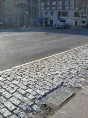
On Eagle Street at Eagle Street and State Street, on the right on Eagle Street.
Facing The River on an eminence in this broad street. opposite St Peters Church stood, Fort Frederick. Built about 1676. Removed 1789. Gallows Hill to the South. Fort burial ground, to the North. — — Map (db m5405) HM
On Broadway (New York State Route 5) at Frontage Road, on the left when traveling south on Broadway.
Mere yards ahead of you once stood Fort Orange, the first permanent Dutch settlement in North America.
The Dutch West India Company built Fort Orange at the most strategic crossroads in the region — at the head of the trail into Mohawk . . . — — Map (db m144034) HM
On Empire State Trail at Quay Street, on the right when traveling south on Empire State Trail.
Through this place passed
Gen. Henry Knox
in the winter of 1775-1776
to deliver to
Gen. George Washington
at Cambridge
the train of artillery
from Fort Ticonderoga
used to force the British
Army to evacuate Boston . . . — — Map (db m227122) HM
Philip Henry Sheridan, General United States Army. Born Albany NY. March 6th 1831, Died Nonquitt Mass. August 5th, 1888.
Erected by the citizens of Albany and the state of New York under chapter 100 of the laws of 1914. Commissioners: Governors . . . — — Map (db m95584) WM
On Washington Avenue (New York State Route 5) west of Eagle Street, on the right when traveling west.
The monument and panels are a tribute to and honors families who have lost one or more loved ones serving in the Armed Forces of the United States of America.
Homeland
The first panel depicts our homeland, the majestic mountains and . . . — — Map (db m303854) WM
On Empire State Trail at Quay Street, on the right when traveling south on Empire State Trail.
In charge of artillery for the Continental Army, Colonel Henry Knox was given the task to bring cannon captured from the forts in Crown Point and Ticonderoga to Boston. With ice barely able to support the weight of the sleds and cannons, Colonel . . . — — Map (db m227011) HM
On State Street (New York State Route 5) east of Eagle Street, on the right when traveling east.
This section of State Street is arguably the oldest continuously operating commercial avenue in the United States.
What began as a path in the woods cut by Native peoples and Dutch beaver trappers and traders became the main east-west . . . — — Map (db m116688) HM
On Broadway at Hudson Avenue, on the right when traveling north on Broadway.
Early in Colonial days, the Dutch military oversaw a lucrative system of trade between Europeans and Native Americans at Fort Orange. Archaeologists discovered the remains of the fort, built in 1624, just beyond the bend in Broadway to your left. . . . — — Map (db m272855) HM
Joseph Henry
Pathfinder in Science
Born in Albany
1797
Died in Washington
1878
[Left Panel]:
I arranged around one of the upper rooms in the Albany Academy a wire of more than a mile in length throvgh which I was enabled . . . — — Map (db m11749) HM
On Eagle Street at Corning Place, on the left when traveling north on Eagle Street.
Kilian Van Rensselaer the Progenitorof the Van Rensselaer family in America, a merchant of Amsterdam Holland, the original proprietor and first patroon of the Manor of Rensselaerwyck, under a grant from the Dutch government in 1629. In following . . . — — Map (db m116749) HM
Named in honor of the Marquis de LaFayette who commanded troops at Albany in 1778. Returned here in 1784 on his way to Fort Schuyler was entertained by the State of New York and the City of Albany during his visits in 1824-1825. — — Map (db m64999) HM
"I hold myself without mock modesty, the humblest of all individuals that have ever been elevated to the Presidency....You have generously tendered me the united support of the great Empire State." - Abraham Lincoln speaking to the New York . . . — — Map (db m5191) HM
On Empire State Trail at NY Bike Routes 9 & 5 on Empire State Trail.
In memory of Lou Rossi
1945-2020
NYSDOT Planner, lead founder of NYBC
Everyone in New York who loves bicycling
owes much to Lou Rossi. Smart and energetic,
he was the principal shaper of the state's
cycling infrastructure.
Two thousand . . . — — Map (db m227417) HM
On Eagle Street north of State Street ( Route 5), on the right when traveling north.
In 1885, American Architect and Building News named "The Best Ten Buildings in the United States."
Two of those selected were the New York State Capitol and Albany City Hall, before you and to your right. The Capitol was chosen . . . — — Map (db m116699) HM
On Broadway at State Street, on the right on Broadway.
Opposite
at the intersection of these streets.
stood the
Old Dutch Church
built 1656 rebuilt 1715. removed 1806.
Burial ground around it. — — Map (db m272856) HM
Near Broadway at Hudson Avenue, on the right when traveling north.
On the North-East corner of
Broadway, then Court Street, and Hudson, then Spanish
Street, stood the second city hall, erected 1705, in
which the famous Congress of 1754 "met and prepared
a union of the several colonies for mutual defense
and . . . — — Map (db m290537) HM
When the USS Slater returned from Greece to dock at the Intrepid Sea, Air & Space Museum in New York City on August 27, 1993, the state of the ship was appalling.
The first goal was to survey the condition of the ship and develop a plan of action. . . . — — Map (db m49646) HM
In 1997, the management at the Intrepid Sea, Air & Space Museum made the decision to downsize and the SLATER was asked to find a new home. The ship was towed to Albany and arrived on October 27, 1997 to a crowd of well wishers. Here, a new . . . — — Map (db m49645) HM
The whole painstaking process of restoring the ship, acquiring the parts and installing the refurbished gear, has been driven by volunteers and would have never been possible without these dedicated individuals. The SLATER's wooden whale boat has . . . — — Map (db m49644) HM
On Broadway north of Steuben Street, on the left when traveling north.
In the dawn of American Railroads, the Mohawk and Hudson Line (1831), running between Albany and Schenectady, was one of the first built.
Juggling funding, inventions, public relations and sheer determination, this railroad evolved from a . . . — — Map (db m116703) HM
On Washington Avenue just north of Eagle Street, on the left when traveling south.
The New York State Organization National Society Daughters of the American Revolution honors the courage and valor of more than 41,000 patriot troops in the line. The levies and the militia from New York Colony and State who left their homes and . . . — — Map (db m64998) WM
On Broadway (New York State Route 5) north of Hudson Avenue, on the right when traveling north.
On the North-east Corner of Broadway then Court Street, and Hudson, then Spanish Street, stood the second City Hall, erected 1705, in which the famous Congress of 1754 “met and prepared a Union of the Several Colonies for Mutual Defense and . . . — — Map (db m116676) HM
On Broadway at Beaver Street, on the right when traveling south on Broadway.
On this site once stood the first Poor House in the United States.
Community care for the poor was an important feature of Dutch society, and it took root here in Albany as the city was settled in the first half of the 1600s.
. . . — — Map (db m116696) HM
Gen. Lafayette was received here 1824
The remains of President Lincoln and many other prominent men, lay in state here. The State Library was adjoining and with Capitol, demolished 1883. Fronting on this park stood Congress Hall, famous for its . . . — — Map (db m64990) HM
On State Street at South Pearl Street, on the right when traveling east on State Street.
Martin Van Buren
1782 - 1862
resided at 92 State Street
on this site
while serving as 9th Governor of
the State of New York 1828 - 1829
He is famed for his distinguished career as boy-lawyer, surrogate, judge, state senator, Attorney . . . — — Map (db m5439) HM
In the middle of State, formerly Yonkers Street, one block below, stood the First English Church, built A.D. 1715, upon ground granted by letters patent from King George the First. It bore the name of St. Peter's Church. The parish was incorporated . . . — — Map (db m76381) HM
On Broadway (New York State Route 5) north of Hudson Avenue, on the right when traveling north.
The grand building before you is home to the headquarters of The State University of New York (SUNY).
Founded in 1948, SUNY is the largest comprehensive system of public higher education in the United States. Among the system's 64 . . . — — Map (db m116667) HM
On Lodge Street at State Street ( Route 5), on the right when traveling north on Lodge Street.
Chartered
March 4, 1813
Held its first classes
in a frame building which
formerly stood upon this site
This tablet erected
June 3, 1938
during the Celebration of the
125th Anniversary of the
founding . . . — — Map (db m116745) HM
On Broadway at Maiden Lane, on the right when traveling north on Broadway.
Why is Albany Here?
Mohawk and Mahican peoples inhabited this region for thousands of years when the Dutch ship the Half Moon dropped anchor near this spot in 1609.
At that time, the world was in the midst of a "Little Ice . . . — — Map (db m116700) HM
On State Street (State Highway 5) just east of South Pearl Street (State Highway 32), on the right when traveling east.
Birth place of General Philip Schuyler and Elizabeth, his daughter, wife of Alexander Hamilton. Adjoining on the west was the famous “Lewis Tavern.” South Pearl St. formerly Washington St. was but twelve feet wide, having a gate at this . . . — — Map (db m147000) HM
Time: The Second World War, 1942
During the “dark days” of 1940, after the German conquest of France and prior to the U.S. involvement in World War II, England stood alone against the threat of Nazi world domination. An island nation, . . . — — Map (db m18188) HM
On Broadway just north of Steuben Street, on the right when traveling north.
Formerly Union Station Listed on The National Register of Historic Places Constructed 1898-1900 for New York Central & Hudson River Railroad Restored and renovated 1984-1986 by Norstar Bankcorp — — Map (db m149334) HM
Near Quay Street north of Broadway, on the right when traveling north.
USS Slater DE-766
Has been Designated a National Historic Landmark
This site possesses national significance in commemorating the history of the United States of America
Destroyer escorts defended vital - convoys during World War II. . . . — — Map (db m193737) HM
On Elk Street east of North Hawk Street, on the left when traveling west.
This tribute in memory of our citizens who were killed in action in the Viet Nam War & of who died as a consequence of wounds sustained there or who remain missing & to this day
May 27, 1979
Arthur F. Cooper •• Peter B. Miller •• . . . — — Map (db m305747) WM
On Washington Avenue (New York State Route 5) east of North Hawk Street.
Washington first took command of the American Army under the grandparent of this elm at Cambridge, Mass.
July 3. 1775.
Raised and presented by Maryland D.A.R., marked by New York State D.A.R., this tree is planted as part of the . . . — — Map (db m303852) HM
On Rapp Road at Stringsteen Road, on the left when traveling east on Rapp Road.
Rapp Road Community Historic District has been placed on the National Register of Historic Places in 2002 by the United States Department of the Interior. — — Map (db m152904) HM
On Eagle Street at Madison Avenue, on the right when traveling east on Eagle Street.
In 1835 the City appropriated $1,000 and citizens raised a fund to enclose it within an iron fence. A fountain, the first in the city, dedicated in 1863. — — Map (db m306894) HM
On Mill Road just west of Normanside Drive, on the left when traveling west.
In 1630, an early settler called "the Norman", leased the water privileges of what was then called by the native Americans, "Ta-wal-sen-tha". The "Val of Tawasentha", in Longfellow's poem Hiawatha, is the Normanskill Valley. The Norman erected a . . . — — Map (db m306951) HM
On Western Avenue near Madison Avenue (U.S. 20), on the left when traveling west.
In 1831 the Mohawk & Hudson
Railroad established the
first steam passenger train
service in NYS between this
junction and Schenectady — — Map (db m256461) HM
On Orange Street at Clinton Square, on the left when traveling east on Orange Street.
Albany 300
– 1686 – 1986 –
Still Making History
Named For Governor Dewitt
Clinton Who Died in His Home
Near Here in 1828. Formally
Established as a Park in 1921. — — Map (db m192003) HM
On Orange Street near North Pearl Street, on the left when traveling east.
Author of "Moby Dick"
Studied and Worked During
Formative Years in Albany
1830 - 1838. Family Home at
3 Clinton Square 1834-1838
— — Map (db m32335) HM
Residence for NYS Governors Enos Throop - 1830-2, Washington Hunt - 1850-2, Horatio Seymour - 1852-4 and Mayor J. Stevenson - 1826-8
New York State Bar Association — — Map (db m64996) HM
On South Pearl Street (New York State Route 32) at Rensselaer St., on the right when traveling north on South Pearl Street.
Free Black Revolutionay War Soldier served 1776-1779. Local Business & Landowner. Trustee "Albany School for Educating People of Color." — — Map (db m297222) HM
In 1886 the site was unimproved: “wild and rugged in every respect.” Formerly known as Delaware Square, Delaware Park, Beaver Park — — Map (db m131656) HM
On Clinton Street at Schuyler Street, on the right when traveling south on Clinton Street.
The
Schuyler Mansion
1762
Acquired By The
State Of New York
1911
Restored and Dedicated
As An Historic Monument
October 17, 1917
Governor
Charles S. Whitman
Trustees
Mary Margaretta Manning President
James F. Tracey . . . — — Map (db m58881) HM
On Clinton Street near Schuyler Street, on the right when traveling south.
The
Schuyler Mansion
Erected 1762
The Home of
Major General Philip Schuyler
of the American Revolution
Patriot * Soldier * Statesman
* 1733 1804*
Acquired by the State of New York 1911
Restored and Dedicated
October . . . — — Map (db m58882) HM
Major General Philip Schuyler commanded the Northern Department of the Continental Army until August 1777. After the Battles of Saratoga, British General Burgoyne stayed here as a prisoner-guest.
Revolutionary Heritage Trail — — Map (db m58883) HM
On Ten Broeck Street just north of Ten Broeck Place, on the left when traveling north.
Erected by General Abraham and Elizabeth Van Rensselaer Ten Broeck Erected 1798 Occupied by the Thomas Olcott Family 1848-1948 Given to the Albany County Historical Association in 1948 — — Map (db m139505) HM
On Lancaster Street, on the left when traveling north.
Originally part of the 1806 "Middle Square," this
was the first area of the park to be reopened
as Washington Park in 1871. It was not until
1878 that 25,000 plants were brought here
to create a large "tropical" garden. In the late
1950s, the . . . — — Map (db m312922) HM
On Washington Park Road at Thurlow Terrace on Washington Park Road.
Nine Pin Ciderworks presents Albany's Urban Orchard in partnership with Samascott Orchards, the City of Albany and the Washington Park Conservancy.
The orchard aims to educate the community about New York's remarkable and historically coveted . . . — — Map (db m250356) HM
Near Madison Avenue (U.S. 20) at New Scotland Avenue.
The Lakehouse that appears in these images is very different than the building that stands in front of you. The existing Lakehouse, designed by J. Russell White, was built of brick and terra cotta in 1929. It replaced the original 1875 wood . . . — — Map (db m144255) HM
On Willett Street 0 miles north of State Street, on the right when traveling north.
United States Congressman, State Comptroller, Lieutenant Governor, first Roman Catholic governor,
famed journalist, orator and statesman who helped establish the Irish Free State and the only resident of the City of Albany to serve as Governor . . . — — Map (db m307345) HM
On Willett Street at State Street, on the left when traveling north on Willett Street.
1740 -- 1830
For his gallant and patriotic services in
defense of Albany and the people of the
Mohawk Valley against Tory and Indian
foes during the years of the War for
Independence, this stone brought from the
scenes of conflict and . . . — — Map (db m307335) HM
Near Washington Park Road 0.1 miles east of New Scotland Avenue, on the left when traveling east.
In 1947, residents of Albany collected 300 tons of donated food, clothing, medical supplies, household goods and building materials to help rebuild Nijmegen, The Netherlands, which had been devastated by bombing and fighting during World War II. . . . — — Map (db m144257) HM
On Washington Park Road a.k.a. Henry Johnson Blvd., on the right when traveling west.
[Top Panel]
The Battle of Henry Johnson
First American Awarded
Croix De Guerre
with
Gold Palm
For
Valor
[Center Panel]
In Memory of Sergeant Henry Lincoln Johnson Albany, New York for uncommon valor in combat . . . — — Map (db m42675) HM
On New Scotland Avenue (Washington Park Road) at Madison Avenue (U.S. 20), on the right when traveling north on New Scotland Avenue (Washington Park Road).
Attained its present form in the years 1869-1884 Design attributed to the concepts of renowned Landscape Architect Frederick Law Olmsted — — Map (db m138130) HM
On Second Street west of Oak Street, on the right when traveling west.
247 Second Street
built in 1870 and home of
Arabella Chapman, 1914-1927.
First African-American
student and graduate of
Albany Free Academy, 1873-77. — — Map (db m274086) HM
On Clinton Avenue at Manning Boulevard, on the left when traveling south on Clinton Avenue.
Named in memory of Hon. John Swinburne, M.D., Mayor of Albany 1882-84. One of four surgeons to found Albany Medical College. Member of Congress. — — Map (db m115735) HM
On New York State Route 143 at County Route 111, on the left when traveling west on New York State Route 143.
1818 Ephraim Andrews acquires cloth dressing and wool carding mills. By 1850 John E. Andrews establishes a straw paper making mill — — Map (db m131759) HM
On County Route 111 0.1 miles south of Route 143, on the right when traveling north.
1790 Settled in 1790 as Stephenville, the Alcove community harnessed the power of water from the Hannacroix Creek in the early industrial era of this region of the state.
1844
Here in 1844 Ephraim Andres built a cloth and wool . . . — — Map (db m285369) HM
On Grand Street 0.2 miles east of Fairview Avenue, on the right when traveling east.
Altamont Fairgrounds
The Albany Agricultural Society sponsored the first fair in Albany County in 1819. For the next 70 years fairs were held in Albany and in the surrounding towns and villages. In August 1892, local businessmen . . . — — Map (db m283615) HM
The Village's First Freight and passenger train station was built in 1864, only months after the first train passed through Knowersville. In 1896 the old station was moved south along the tracks. In 1897, it was replaced by the . . . — — Map (db m283535) HM
On Grand Street 0.1 miles north of Fairview Avenue, on the right when traveling north.
Altamont High School
The Altamont Union Free School was constructed in 1901 - 1902. It was designed by Altamont resident Wheeler D. Wright and built by James W. Packer, a contractor from Oneonta, NY. The building was the fourth . . . — — Map (db m283736) HM
On Lincoln Avenue at Jay Street, on the right when traveling south on Lincoln Avenue.
Altamont Reformed Church
The Altamont Reformed Church was constructed by contractor Hiram Schoonmaker on land donated by Melvin Beebe. Construction started in September 1887. The building was dedicated on October 3, 1888, as the . . . — — Map (db m283719) HM
On Park Street at Main Street, on the right when traveling south on Park Street.
Welcome to Altamont
The Village of Altamont and its immediate surroundings were once part of a tract of land deeded in 1630 by the Dutch West India Company to Killian Van Rensselaer (c. 1586-1643),a wealthy 17th century Dutch . . . — — Map (db m308938) HM
On Main Street (New York State Route 146) at Gun Club Road, on the right when traveling west on Main Street.
Welcome to Altamont
The Village of Altamont and its immediate surroundings were once part of a tract of land deeded in 1630 by the Dutch West India Company to Killian Van Rensselaer (c. 1586-1643),a wealthy 17th century Dutch . . . — — Map (db m283534) HM
In 1887, Charles V. Beebe received a patent for an easy riding, swing attachment for farm equipment seats. In 1891,he moved to Altamont and opened a harness shop in the Ostrander Building, in what is now 125 Maple Avenue. In 1895, . . . — — Map (db m131475) HM
This 225-acre Bond Road property was added to T Mohawk Hudson Land Conservaney's Bozen Kill Preserve in 2024. MHLC is grateful to neighboring landowners Bryan Swift and Lauren Lyons-Swift, along with Marti and Kevin McLoughlin, who initiated the . . . — — Map (db m268190) HM
On Main Street (New York State Route 156) at Altamont Blvd ( Route 146), on the right when traveling east on Main Street.
In 1867, George Severson, a great-grandson of early settler Jurrian Severson, built the Severson House hotel, the first hotel in the growing hamlet of Knowersville. Only a few steps away from the new train station, the hotel provided lodging . . . — — Map (db m246180) HM
Dedicated to those who served
in the armed forces
to maintain America's freedom.
August 1, 1991
( Both benches on either side are inscribed )
In honor of all who have served
with profound gratitude
for the men and women who . . . — — Map (db m308940) WM
On Maple Avenue (New York State Route 146), on the left when traveling north.
In 1879, James Ostrander bought a large lot on Church Street, and built a thriving shoe business. In 1882, he sold a portion of the lot to Charles Taber, who opened a tin shop on the site. Both businesses were lost in the 1886 fire, . . . — — Map (db m131455) HM
On Maple Avenue (New York State Route 146) when traveling west.
The Altamont Hose Company No. 1 was organized in May 1893, with 25 citizens appointed as members by the Village Trustees. The Company's first location was rented space at the Temperance Hall on Lincoln Avenue. In 1926, the Company . . . — — Map (db m131453) HM
On Park Street 0.1 miles Main Street ( Route 156), on the right when traveling east.
First National Bank of Altamont
In early 1910, several Altamont businessmen petitioned the Comptroller of the Currency for permission to open a bank in Altamont. The First National Bank of Altamont opened its doors on December 5, . . . — — Map (db m283411) HM
2003 entries matched your criteria. Entries 101 through 200 are listed above. ⊲ Previous 100 — Next 100 ⊳