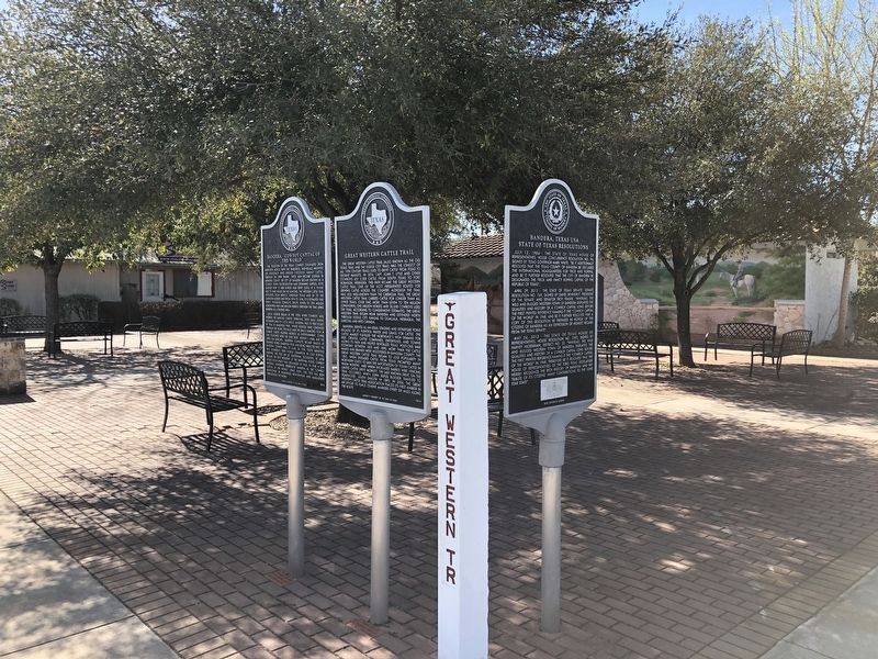
On Main Street (State Highway 173/16) at Hackberry Street, on the right when traveling south on Main Street.
The Great Western Cattle Trail (also known as the Old Texas Trail and the Dodge City Trail) was the longest of all 19th century trails used to drive cattle from Texas to distant markets. In 1874, Capt. John T. Lytle and other cowboys led 3,500 . . . — — Map (db m130351) HM
On Old Medina Highway 0.1 miles west of Houston Street, on the right when traveling west.
Freedman and soldier Hendrick Arnold (1804-1849) was awarded land following the Texas Revolution for his participation in the Siege of Bexar and the Battle of San Jacinto. He received six surveys in what was then Bexar county, including this . . . — — Map (db m201897) HM
Near Old San Antonio Road 0.1 miles north of State Highway 16.
Size: 40 feet long
Weight: 44,000 pounds
Diet: Herbivore
Habitat: China, India, Kazakhstan and Pakistan
Period: 33-23 million years ago (Ice Age) — — Map (db m189443) HM
Near Old San Antonio Road 0.1 miles north of State Highway 16.
Size: 8 to 10 feet tall
Weight: 8,000 to 12,000 pounds
Diet: Herbivore
Habitat: North and Central America
Period: 33.9 Million years to 11,000 years ago — — Map (db m189436) HM
On Main Street (State Highway 16), on the right when traveling west.
Entered the year-old town of Bandera in March, 1854. Leader was Lyman Wight, church elder who had separated from followers of Brigham Young and taken a colony of 250 to Texas in 1846.
Settling first in Austin, then Fredericksburg (where they . . . — — Map (db m130135) HM
On Main Street (State Highway 173) at Cypress Street, on the right when traveling south on Main Street.
Built 1873 for E. Huffmeyer & brother, by B.F. Langford, Sr., contractor; of native stone.
Bandera's oldest building. Used over 30 years by W.J. Davenport, Sr., as general store. Damaged by fire, 1936.
Restored and remodeled by Thomas . . . — — Map (db m111521) HM
Built 1881. Local stone, cypress floors used. Housed county offices until 1890. Used 57 years. Recorded Texas Historic Landmark - 1965 — — Map (db m130354) HM
On Main Street (State Highway 16) at Pecan Street, on the right when traveling south on Main Street.
This winding, 100-mile trail from San Antonio to Kerrville was, during the 19th century, a strategic patrol road traveled by Texas Rangers to protect the surrounding area from hostile Indian attacks.
During uneasy pioneer days roads such as . . . — — Map (db m117711) HM
On Airport Road 0.1 miles south of Bottle Springs Road, on the right when traveling south.
Colonel John Henry "Jack" Lapham (1885-1956) was a son of a co-founder of the Texas Company (later Texaco). He was living in San Antonio by 1920 and had many business interests, Jack, his wife, Julie Edna (Capen), and their four children all had . . . — — Map (db m304488) HM
On Polly's Cemetery Road at Old School Road, on the right when traveling west on Polly's Cemetery Road.
In the late 1850's, Jose Policarpio" Polly" Rodriguez (1829-1914), a noted US Army scout with 2nd Calvary, became one of the first settlers of Bandera County. His first purchase of 600 acres included this property. Ultimately, he acquired over . . . — — Map (db m189491) HM
On Polly's Chapel Road 0.1 miles north of Old School Road, on the left when traveling north.
Named for Policarpo Rodriguez (1829-1914), Texas Ranger, Army Scout and Guide; 1858 Privilege Creek settler. Converted here to Methodist faith, built with his own hands, in 1882, chapel of native stone, where he and others have preached. . . . — — Map (db m155675) HM
On Polly's Chapel Road 0.1 miles north of Old School Road, on the left when traveling north.
An official Texas Historical Landmark
In 1880, the Rev. Jose Policarpio "Polly" Rodriguez (1829-1914) completed this chapel on his ranch. Plans began when he selected this gentle rise west of nearby Privilege Creek. Then, he faced the building . . . — — Map (db m189489) HM
On Main Street (State Highway 16) at Hackberry Street, on the left when traveling north on Main Street.
The State of Texas Governor
To all to whom these presents shall come, greeting know ye that this official certificate is presented in recognition of:
Bandera, "Cowboy Capital of the World" receiving a Texas historical commission . . . — — Map (db m177189) HM
This home was constructed in the 1870s by Georgia stonemason James Henry White for Charles F. Schmidtke (1839-1884). A native of Germany, Schmidtke was an early Bandera merchant, grist miller, and lumber mill operator. White's grandson J. Calvin . . . — — Map (db m307866) HM
Near Old San Antonio Road 0.1 miles north of State Highway 16.
Size: 79 in - 98 in
Weight: 660 pounds
Diet: Carnivore
Habitat: Every continent, except Australia and Antarctica
Period: 1,600,000 to 11,000 years ago (Ice Age) — — Map (db m189434) HM
Polish settlers, who came to Bandera in 1855, built this convent and Catholic school in 1874. All classes, except religion and music, were moved in 1882 to a nearby frame school building. In 1922 a second story was added to the native limestone . . . — — Map (db m130357) HM
Near Old San Antonio Road 0.1 miles north of State Highway 16.
Size: Up to 30 feet long
Weight: 4,400 pounds
Diet: Herbivore
Habitat: Colorado, Oklahoma and Utah
Period: 154 to 144 million years ago (Jurassic) — — Map (db m189435) HM
Communities in the 19th century relied on mills to provide lumber, shingles, flour and cloth. Local millers and blacksmiths were integral community members, providing the necessary materials for early development. Stephen F. Austin reported in 1833 . . . — — Map (db m130356) HM
On Main Street (State Highway 16) at Hackberry Street, on the right when traveling north on Main Street.
With deserving respect for all men and women of every Military Department of the United States Armed Forces, the membership of faithful veteran comrades, in Bandera County, unite in the formal dedication of this monument to those whose . . . — — Map (db m162841) WM
On 13th Street at Pecan Street, on the right when traveling north on 13th Street.
Artist John Warren Hunter (1903-93), son of J. Marvin Hunter, was born in Kimble County and known for his scenic depictions of Texas. A 1923 graduate of Bandera High School, he soon began printing the Harper Herald with his wife Lora. After . . . — — Map (db m162319) HM
Near Highway 16 0.1 miles north of Orchard Park Boulevard.
Joe H. Newcomer (Jan. 19, 1910 - Dec. 23, 1967) Special Texas Ranger, Deputy Sheriff, Justice of Bandera County, World War II Shipboard Security Officer for Chemical Company, Also Uvalde Alderman, County Clerk, Chief of Police. Member . . . — — Map (db m155439) HM
On Broadway Street (State Highway 16) at Cherry Lane, on the left when traveling north on Broadway Street.
All Gave Some - Some Gave All
A.E. McClendon 1 •
Ad Flowers 4 •
Albert Duke 13 •
Albert Faris 6 •
Allen Keese 4 •
Allen Keese 7 •
Alva Swinney 4 •
Alvin Allen 11 •
Amos Weed 4 •
Andrew Reed 5 •
Andrew Slinsky 1 •
Andy Reed 1 . . . — — Map (db m304549) WM
On State Highway 16 north of Post Oak Road, on the left when traveling north.
In a desire to help the town grow, Medina businessman Brown H. Stokes (1897-1940) established Stokes Tourist Courts at his 11-acre riverfront property and family homestead. By 1939, the courts comprised 10 cottages, built by local masons the . . . — — Map (db m270495) HM
On Bear Creek Road at Privilege Creek Road, on the right when traveling north on Bear Creek Road.
125 Years of Bandera history!
Polly Texas Pioneer Association, a local 501.c.3 non-profit, is proud to announce its acquisition of Polly's Schoolhouse. The schoolhouse was built in 1892 by J.P. "Polly" Rodriguez. The schoolhouse served as . . . — — Map (db m189492) HM
On Privilege Creek Road at Old School Road, on the left when traveling north on Privilege Creek Road.
Polly, Texas was founded by Jose Policarpio "Polly" Rodriguez (1829-1914) in 1858. Polly was a noted frontieraman, surveyor and US Army scout with the 2nd Calvary who became one of the first settlers of Bandera County. His purchase of acreage and . . . — — Map (db m189485) HM
On Farm to Market Road 462 2 miles south of County Highway 211, on the left when traveling south.
During the mid-1800s the Texas Hill Country was the site of many hostile encounters, some deadly, between pioneer immigrants whose permanent settlements ran counter to area Native Americans accustomed to unrestrained hunting and gathering. One . . . — — Map (db m155608) HM
On Farm to Market Road 187 0.3 miles north of West Sabinal Road, on the left when traveling north.
Founded 1883, named for Henry Taylor. He, Gid Thompson and other early settlers gave land and founded school. First trustees were D. Harper, H. Kennedy, H. Taylor. First one-room frame building had homemade desks and recitation benches. . . . — — Map (db m111332) HM
On River Road 0.1 miles east of Trainer Street, on the right when traveling east.
Constructed of native stone quarried near the site, this home was built in 1882-83 in Pittsburg (later annexed by Blanco) by Irish craftsman Laurence H. Wall. The total construction cost was $1,000. John Wilson Baines and his wife Ruth Ament Huffman . . . — — Map (db m233938) HM
On 11th Street at Mesquite Street, on the right when traveling west on 11th Street.
Chartered in 1883, Blanco High School began as a combination private and public school. A white limestone schoolhouse was constructed at this site and opened for classes in October 1884. During its early years, Blanco High School offered a six-month . . . — — Map (db m194073) HM
On Pecan Street at 1sr Street, on the right when traveling south on Pecan Street.
Organized, 1854, by Rev. Daniel Rawls, Methodist circuit rider. Six charter members. Worship was held in log cabin and frame building until 1882.
Present structure erected, dedicated, 1883. Still serves as church sanctuary. Native limestone . . . — — Map (db m194114) HM
On Park Road 23 0.3 miles south of U.S. 281, on the right when traveling south.
In 1933, the Texas Legislature
established Blanco State Park on
more than 100 acres along the
Blanco River. Eighteen property
owners donated or sold land for
the public recreational area. The
Civilian Conservation Corps (CCC)
made initial . . . — — Map (db m233939) HM
On Terri Lane at 4th Street (Farm to Market Road 1623), on the left when traveling north on Terri Lane.
Led by Mr. and Mrs. Robert Silliman and the Rev. Joseph Bird (1821-1909), this congregation was organized on November 6, 1859, with five charter members. Worship services were held in a Union church shared with the local Methodist and Church of . . . — — Map (db m194103) HM
On Pecan Street south of 5th Street, on the right when traveling north.
Born in Louisiana; in 1850 came to Texas, where his father, Rev. Geo. W. Baines, founded a church newspaper and was president of Baylor University. Served in the Williamson Cadets, in Civil War.
Lived in Collin County, 1867-1882. Married . . . — — Map (db m305380) HM
Born in Kentucky. Moved to Texas in 1833. In Texas Revolution he fought in Siege of Bexar (1835) and Battle of San Jacinto (1836). In 1842 took part in Somervell expedition against Mexico.
Resided at Washington-on-the-Brazos; present Kendall . . . — — Map (db m194072) HM
On Peyton Colony Road (County Highway 409) 0.2 miles Farm to Market Road 165, on the left when traveling north.
Born a slave in Virginia, Peyton Roberts became a freedman in Caldwell County, Texas, at the close of the Civil War. He soon moved west to this area and the settlement that developed around his farm became known as Peyton Colony. In 1874, under the . . . — — Map (db m194059) HM
On Main Street (U.S. 281), on the left when traveling south.
Designed in Victorian style by architect F. E. Ruffini. Erected in 1886 as first permanent county courthouse, building served only four years - until 1890. County seat then moved to Johnson City.
Purchased by Chas. E. Crist, the structure . . . — — Map (db m31565) HM
On Peyton Colony Road 0.2 miles north of Farm to Market Road 165, on the left when traveling north.
In 1865, a group of freed persons, led by Peyton Roberts, established a community they named Peyton Colony. Roberts was born into slavery in Virginia. In the 1820s, he came to Texas with his owner, Jeremiah Roberts, settling in the Bastrop and . . . — — Map (db m194063) HM
On Farm to Market Road 473 1 mile east of U.S. 281, on the right when traveling east.
In 1850's when first Catholic families came to Blanco County, worship was in homes and halls. Land was purchased in 1887. By efforts of Father Virgilius Draessel and people of Twin Sisters, this church was built and dedicated in 1889.
Stone for . . . — — Map (db m183635) HM
On Hye-Albert Road (County Road 206) 0.1 miles south of U.S. 290, on the left when traveling south.
The community of Hye, first known as Rocky Creek, was settled by mostly German and Anglo American families in the 1860s. Mississippi native Hiram G. “Hye” Brown became the first postmaster in 1886 and the namesake for the new post office. . . . — — Map (db m307901) HM
On State Highway 290 near Hye Albert Road, on the right.
Named for Hiram ("Hye") Brown, founder of store, in 1880. Post office established 1886. Present store with Bavarian metalwork built in 1904. Owned by Deike family since 1923. At age four, Lyndon B. Johnson, future U.S. President, mailed a letter . . . — — Map (db m212042) HM
On North Avenue G at Pecan Avenue, on the right when traveling south on North Avenue G.
Noting the unhealthy dampness of the basement where prisoners were first kept after the Blanco County seat was moved to Johnson City, the Commissioners Court ordered the construction of this jail facility in 1893. Completed the following year, the . . . — — Map (db m126810) HM
On Settlement Road 0.2 miles west of South Lady Bird Lane.
Abundant timber, "stirrup-high" grass, and seemingly adequate water lured the hill country's first settlers to this land. But the land deceived. Only a thin layer of poor soil sustained this lush landscape.
The virgin grasses that attracted . . . — — Map (db m236531) HM
Designed by San Antonio architect Henry T. Phelps, the 1916 Blanco County Courthouse was the first permanent courthouse built after the seat of government moved from Blanco to Johnson City in 1890. Serving as contractor for the project was . . . — — Map (db m31499) HM
From this headquarters site in the 1870s, the brothers J. T. and Sam Ealy Johnson started thousands of cattle up trails to Kansas and other shipping or market points. To the west, at Williamson's Creek, and at Deer Creek (southeast) the Johnsons had . . . — — Map (db m35352) HM
On Nugent Avenue at Pecan Avenue, on the right when traveling north on Nugent Avenue.
Dedicated to the military veterans of
Blanco County and their families.
With sincere appreciation for
their service, sacrifice, and commitment to
our country and all it stands for,
represented by the colors flying proudly above.
Lest . . . — — Map (db m31486) HM
On North Avenue G south of East Cypress Stret, on the right when traveling north.
James Franklin Barnwell was born on October 23, 1874 in Bowdon, Georgia. His family had a tradition of doctors, including his grandfather and three uncles. Following completion of his medical education at the University of Tennessee in 1896, . . . — — Map (db m126759) HM
On North Nugent Avenue (State Highway 356 Spur) at East Cypress Street, on the right when traveling south on North Nugent Avenue.
Prominent pioneer physician, civic leader. Practiced medicine in Illinois and Kentucky before settling in Texas in 1857; moved to Blanco County in 1860. He was Civil War surgeon at Fort Mason, Tex. Served as commissioner and chief justice of . . . — — Map (db m126761) HM
On Avenue F at Elm Street, on the left when traveling south on Avenue F.
E. Babe Smith was instrumental in the founding of Pedernales Electric Cooperative in the late 1930s. His vision, along with that of Congressman Lyndon B. Johnson and others, brought electric power to the farms and ranches of the Texas Hill Country. . . . — — Map (db m31095) HM
On Avenue F at Main Street (U.S. 290), on the right when traveling north on Avenue F.
In 1879, on July 19-20 or August 16-17, seven members formed the Missionary Baptist Church of Christ, present First Baptist Church. The Rev. James E. Bell (b.1843) held services in the schoolhouse. Lumber for the original church building, erected . . . — — Map (db m31532) HM
On Avenue E at Cypress Street, on the right when traveling north on Avenue E.
>This congregation was organized in 1903 by the Rev. Tom Smith, an evangelist with the Texas Christian Missionary Society, and twenty-six charter members. Land for a church building was given by Judge N. T. Stubbs and a sanctuary was completed in . . . — — Map (db m31533) HM
On Main Street (U.S. 290) at Plum Short on Main Street.
Because of his love for this land, respect for his ancestors who settled here, and his devotion to both, Lyndon Johnson has been called the "last of the frontier presidents."
Confederate veteran Samuel Ealy Johnson, Sr., and his wife Eliza . . . — — Map (db m236532) HM
On West Pecan Drive east of Avenue L, on the right when traveling west.
A native of Georgia, James Polk Johnson came to Texas with his family and grew up in DeWitt County. Following his service in the Confederate army during the Civil War, he moved to Blanco County to join his uncles in the cattle business. He bought . . . — — Map (db m126760) HM
On Nugent Avenue (State Highway 356) at Pecan Avenue, on the left when traveling south on Nugent Avenue.
Built by Johnson City founder James Polk Johnson (1845-1885), this structure has housed a variety of businesses and served as a community gathering place. In addition to serving as a community hall, opera house, and meeting place for churches and . . . — — Map (db m31126) HM
“It was just a big family town. Nobody was rich, and everybody had plenty to eat and plenty to wear, and Lyndon was no different from the rest of us. I miss that little town, that feeling that everybody would do anything for anybody else. . . . — — Map (db m31098) HM
On North Nugent Avenue at Cemetery Road, on the left when traveling north on North Nugent Avenue.
In 1892, local Masons Joseph Bird, W.H. Withers and G.M. Nash, on behalf of Johnson City Masonic Lodge No. 561, purchased land at this site from Julia Ann Moore Johnson, widow of town founder James Polk Johnson. Early marked graves date from the . . . — — Map (db m279796) HM
The landscape around you reflects more than 100 years of agricultural use.
The Bruckner Barn The stone barn to your right was built in 1884 by John Bruckner, patriarch of the family that lived on this site for more than 80 years. . . . — — Map (db m236512) HM
On Ladybird Lane at Avenue G, on the left when traveling west on Ladybird Lane.
The sidewalk ahead leads to the Johnson Settlement, frontier home of President Johnson's paternal grandparents, Samuel Ealy Johnson, Sr., and Eliza Bunton Johnson.
Between 1867 and 1872 Sam Ealy Johnson, Sr., and his brother Tom drove huge herds . . . — — Map (db m31097) HM
On Elm Street at Avenue G, on the right when traveling east on Elm Street.
Sam Ealy Johnson Jr. (1877-1937) and his wife Rebekah Baines Johnson (1881-1958) bought this residence in 1913. Sam, an educator and six-term Texas legislator, and Rebekah, an educator and journalist, raised five children here. The frame house was . . . — — Map (db m30926) HM
On Avenue G at Ladybird Lane, on the right when traveling north on Avenue G.
Lyndon Johnson spent most of ten years living in this home - a decade that profoundly affected the future president's view of the world.
A neat landscape in front of you bears little resemblance to the backyard Lyndon Johnson knew. In Johnson's . . . — — Map (db m31036) HM
On South Avenue F south of East Elm Street, on the right when traveling north.
By the 1930s, many residents of cities across the U.S. were benefiting from the common use of electricity. However, a vast majority of rural areas lacked electric service, which compounded depression-era problems for farmers whose crop returns were . . . — — Map (db m126764) HM
On East Elm Street at South Avenue F, on the left when traveling west on East Elm Street.
"Of all the things I have ever done, nothing has given me as much satisfaction as bringing power to the Hill Country of Texas." - Lyndon B. Johnson
In the 1930s, investor-owned utilities didn't consider it profitable to extend miles of . . . — — Map (db m236546) HM
On Avenue F at Elm Street, on the left when traveling south on Avenue F.
These plaques were first
installed on the original
Pedernales Electric
Cooperative, Inc.
headquarters building in 1939.
Pedernales Electric Co-operative
- Incorporated -
Erected 1939
Dedicated to the extension of
electric . . . — — Map (db m31093) HM
On West Pecan Drive east of Avenue L, on the right when traveling west.
Born in Alabama on August 24, 1845, James Polk Johnson was still a child when his family moved to Texas in search of a better life. As a teenager he served in the Civil War and then joined his uncles Tom and Sam Ealy Johnson in their cattle droving . . . — — Map (db m127310) HM
On West Main Street at Plum Short, on the left when traveling west on West Main Street.
As a child, President Lyndon B. Johnson never tired of his grandparents’ stories of 1860s life on the Texas frontier. He loved the tales of long, dusty cattle drives and bravery in the face of Comanche Indian raids. By walking less than a mile, . . . — — Map (db m295511) HM
On Settlement Road 0.2 miles west of South Lady Bird Lane.
After the Civil War, Lyndon B. Johnson's grandfather, Sam Ealy Johnson, Sr., brought his bride Eliza to this place to live in a "Dog-trot" cabin. Sam and his brother, Tom, bought cattle on speculation to drive in great herds over the Chisholm Trail . . . — — Map (db m236527) HM
On East Pecan Drive at North Nugent Avenue, on the right when traveling west on East Pecan Drive.
On February 11, 1858 the state legislature created Blanco county and mandated that the "county seat thereof shall also be called Blanco and should be within five miles of the center of the county. By 1862, however, boundary changes meant that the . . . — — Map (db m236549) HM
On Main Street (U.S. 290) at Plum Shorts on Main Street.
For five years (1867-1872) this cabin was the home of Samuel Ealy Johnson and his wife Eliza. While Sam ran the family's cattle business, Eliza attended by hand to virtually every detail of running the ranch. She hauled water, spun wool, made . . . — — Map (db m236513) HM
Just as Johnson City helped shape Lyndon Johnson, Lyndon Johnson helped shape the modern face of Johnson City. Throughout the town are buildings that reflect Johnson's quest to ease the hardships he knew here in his youth. The former LBJ Hospital - . . . — — Map (db m31128) HM
Born in Tennessee in 1836, Thomas C. Felps came to Texas in 1850 and to this area in 1856. He earned a living by freighting and joined the Blanco County Rangers during the Civil War. In 1863 he married Eliza V. White (b. 1846), a native of Ohio. . . . — — Map (db m131395) HM
On South Lady Bird Lane at East Main Street (U.S. 280), on the left when traveling south on South Lady Bird Lane.
This building served as a dry goods store; general merchandise emporium; cotton, wool, and mohair warehouse; and youth recreation center. It has been restored to its appearance about 1915-1920. President Johnson gave it to the American people in . . . — — Map (db m248547) HM
On Round Mountain Cemetery Road 0.1 miles north of Ranch to Market Road 962.
Gideon Cowan Thorp was born in Tennessee in 1844 and had settled in Texas with his family by 1850. The Thorps later moved to Llano County. Gideon served in the Confederate Army during the Civil War and returned to the area after the war, relocating . . . — — Map (db m244565) HM
On Bird Lane 0.1 miles south of U.S. 281, on the left when traveling south.
For more than 50 years after becoming a pioneer settler of this area, North Carolina native Joseph Bird greatly contributed to the development of Blanco County as a distinguished frontier Baptist minister, postmaster, Civil War soldier, county . . . — — Map (db m248539) HM
The town of Bertram was founded in 1882 when the Austin and Northwestern Railroad established a route through the area. The community was named for Rudolph Bertram, an Austin merchant who was instrumental in the development of the rail line. Many . . . — — Map (db m27426) HM
On State Highway 29 at Farm to Market Road 1174, on the right when traveling west on State Highway 29.
When the Austin & Northwestern Railroad first laid rails through Bertram in 1882, the original Bertram depot was constructed on this site and served railroad passengers until the end of passenger service in 1937.
The depot was demolished in . . . — — Map (db m203266) HM
When Bertram was founded in 1882 along the Austin & Northwestern Railroad, one of the first structures erected was a combination school, Sunday School, and Masonic Lodge hall. Rudolph Bertram, Austin Railroad executive for whom the town was named, . . . — — Map (db m27427) HM
Built as a defense against the Indians in 1855 by William Black (1815-1907) on land owned by him. In the stockade, constructed of cedar logs, sentries were kept on guard on moonlight nights. Guns and ammunition for public use were kept here. . . . — — Map (db m27429) HM
On State Highway 29 at Farm to Market Road 1174, on the right when traveling west on State Highway 29.
Pinky Wilson is the author of the Aggie War Hymn, the most famous fight song in the world. Pinky was born in 1897 in Florence, TX. He ranched there through 1950, when he purchased a ranch near Bertram, Burnet County TX, where he, wife Erma, and son . . . — — Map (db m203265) HM
Some of the first settlers in this farming and ranching community were the William Alexander Faires family in 1874 and the Martin Luther Ater family the next year. The settlement was called "Pool Branch" for a nearby pool formed by a waterfall. In . . . — — Map (db m27539) HM
On County Road 200 at County Road 210 on County Road 200.
The small community of Joppa was established for a church and school in the 1880s. With the growing population in Burnet County and business generated from railroad. The county decided to construct several bridges over waterways throughout the . . . — — Map (db m150410) HM
This cemetery, with interments dating back to the 1850s, became a community graveyard for the Sycamore Springs and Mahomet rural communities. In 1909 J. W. Williams and J. W. and Nellie Greer deeded the cemetery property to the community of . . . — — Map (db m27596) HM
On FM-243 0.1 miles west of CR-284, on the right when traveling east.
Settlement in this part of Burnet County began in the 1850s. Two early communities were Mahomet and Sycamore Springs, originally located 8 miles from each other. Pioneers of Mahomet were George Ater, William G. Hall, and Mr. Sanford, while . . . — — Map (db m27597) HM
On FM-243 0.2 miles west of CR-284, on the right when traveling west.
Chartered Jan. 21, 1854; met in log schoolhouse.
Erected own lodge hall 1856 on land given by Grand Master Sam Mather and B. K. Stewart. First floor used as church and school. A fire in 1915 razed hall. Lodge rebuilt here 1916 on land given by G. . . . — — Map (db m27637) HM
Near CR-330A 0.2 miles west of FM-243, on the right.
John Jennings (1802-1867), his wife Sarah C. (Sally) (1806-1879), and their family came to this area in 1851. The settlement which grew up around their farm became known as Jennings Creek community. After Burnet County was created in 1852, John . . . — — Map (db m27638) HM
Two miles south of the Joppa Community Church and Center, and six miles northeast of Bertram, stands an iron truss Pratt bridge over the Russell Fork of the North San Gabriel River. On September 5, 1910, the Burnet County Commissioners Court . . . — — Map (db m150408) HM
On CR-200 0.1 miles west of FM-1174, on the right when traveling east.
In the 1850s and 60s families settled on this farm and ranch land along the Middle Gabriel river. The Old Austin-Lampasas and Burnet-Belton roads intersected here. Six acres deeded by Alexander M. Barton in 1877 later became the site of a . . . — — Map (db m27701) HM
On CR-274 at CR-280, on the right when traveling north on CR-274.
Anglo settlement of this part of Burnet County began in the 1850s. By the 1870s settlers had established cattle and sheep ranches as well as a number of family farms. A community school opened in 1882 and remained in operation until 1921. The . . . — — Map (db m27694) HM
On County Road 326A 0.2 miles west of Farm to Market Road 1174.
After Emancipation, local formerly enslaved African American founded the community of Stringtown. It is believed that Stringtown's intentional design—placement of all homes in a line or string—encouraged community engagement, allowing residents to . . . — — Map (db m313511) HM
John H. Bryson (1850-1930) and his wife Milda (Barton) (1852-1952) had this home constructed on their land in 1906 by local builder Marcus Langford. It is located on a site purchased in 1855 by Milda's uncle Welborn Barton and later owned by her . . . — — Map (db m27433) HM
On State Highway 29 at Farm to Market Road 1174, on the right when traveling west on State Highway 29.
In 1882 the Austin & Northwestern RR built a rail line through this site to haul granite, quarried at Granite Mountain in Marble Falls to build the State Capital in Austin. The town of South Gabriel was moved here, surrounding the tracks, and . . . — — Map (db m203267) HM
On CR-322 0.1 miles east of FM-1174, on the right when traveling west.
The South Gabriel Post Office opened in Postmaster Thomas Lewiston's mercantile store on Sept. 29, 1871. The village, named for the South San Gabriel River, was also called Lewiston.
Located on the Austin-Burnet Road, the hamlet soon had two . . . — — Map (db m27727) HM
On State Spur 308, on the right when traveling south.
The Briggs State Bank was chartered on May 27, 1909. Constructed that spring, this limestone and brick building is typical of a commercial architecture style once popular in Texas. It features a three-bay front with central entry and transoms, and . . . — — Map (db m27432) HM
This cemetery is the oldest of three graveyards associated with the Briggs community. The site was originally called Briggs Cemetery, but came to be known by the name of DeWolf when in 1900 Homer and Martha Hill DeWolf deeded the land to three . . . — — Map (db m150418) HM
2081 entries matched your criteria. Entries 101 through 200 are listed above. ⊲ Previous 100 — Next 100 ⊳