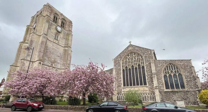
Welcome to the church and its surrounding area. You are on the south side of the building. On your immediate left is the priest's door, above which is what may be a rare exterior pulpit. Further left is the main entrance through the large projecting . . . — — Map (db m305206) HM
The earliest recorded reference to this Wetherspoon free house is a lease granted to George Cocke dated 1668. This Grade II listed building is described as "17th and 18th centuries, with alterations". The 18th century, Georgian style parts flank the . . . — — Map (db m305207) HM
This entrance to the church is called the priest's door. Such doors are usually on the south side of a church, as is this one, and allowed the priest to enter the sanctuary or chancel. The inner doorway was restored in 1859, but its 13th century . . . — — Map (db m312662) HM
Designed by Thomas Fulcher in 1785 as an assembly room and used for Balls, Corporation Feasts and as a Theatre. Restored in 1903, it is now the Town's Public Hall. — — Map (db m312664) HM
In grateful Memory of those men from the parishes of Botesdale-Redgrave-Rickinghall– Superior and Inferior, who fell in The Great War
1914-1918
Also in affectionate memory of those who gave their lives in the . . . — — Map (db m52451) HM
This magnificent building has stood here since at least 1220. Step inside to discover the part it has played in the history of Bury St Edmunds and of England. — — Map (db m251123) HM
In memory of Captain Bartholomew Gosnold explorer and 'prime mover' behind the first permanent English settlement North America at Jamestown, Virginia, where he died 22 August 1607.
Also of his family buried in this churchyard: his wife Mary . . . — — Map (db m251131) HM
Over one thousand years ago, building began on the abbey's first stone church.
By the early 10th century St Edmund's body was moved to Beodricsworth, which became known as Bury St Edmunds. A large wooden church was built here, probably . . . — — Map (db m246126) HM
St Edmund was originally buried in a simple chapel near to where he was killed. His body was moved to Bury in the early 900s, and around 100 years later building began on a new stone church. The abbey grew into one of the largest churches in Europe. . . . — — Map (db m251126) HM
The Abbey of St Edmund was one of the largest and most powerful abbeys in the country. This imposing yet beautiful gateway was the impressive main entrance to the abbey's Great Court.
All kinds of people came through this gate to access the . . . — — Map (db m246123) HM
Bury St Edmunds Abbey was one of the largest and grandest monasteries in England. Today, it mostly lies in ruins.
The abbey was a large community, with clear roles to make everything ran smoothly - just like any organization. The abbot was in . . . — — Map (db m251119) HM
The abbot was a powerful and influential man. To reflect his importance he had a large and luxurious residence, and this ruined building known as the Queen's Chamber is all that remains.
In 1044, King Edward the Confessor gave the monks the . . . — — Map (db m246128) HM
As the abbey grew, its organisation became more elaborate. The abbot was in charge, with support from the prior and sub-prior, and the chapter house was the centre of their management.
The monks' communal lives were highly regulated by a book . . . — — Map (db m250972) HM
This gateway led directly to the Abbey Church. The abbey's many visitors would all pass through here, from kings and queens to humble pilgrims in search of a miracle.
Like the Abbey Gate to the north, this gateway provided an elaborate and . . . — — Map (db m246732) HM
This large, square area was the cloister, the heart of the main monastic buildings. From here the monks could access everything they needed for their daily lives and stay separate from the outside world.
In this corner you would have been . . . — — Map (db m250973) HM
You are looking into the crypt. Now exposed, it was originally a low, dark, vaulted interior.
This eastern end of the Abbey Church was the oldest part built around 1080-95 during the rule of Abbot Baldwin. Above the crypt was the presbytery or . . . — — Map (db m250971) HM
In the Middle Ages, this area was a huge open courtyard with access to all of the working areas of the abbey. People, horses and carts would have been coming and going all day.
Ahead of you were the courtroom, the guest house, and the . . . — — Map (db m246124) HM
The heart of any monastic church was the choir the space where the monks sat in individual seats called choir stalls.
At Bury, the choir occupied the area below the central tower and into the nave to the left. Monks gathered here eight times . . . — — Map (db m253102) HM
Near this spot
on the 20th November A.D. 1214,
Cardinal Langton & the barons
swore at St Edmund's altar
that they would obtain from
King John
the ratification of
Magna Charta.
Where the rude buttress totters to its fall,
And . . . — — Map (db m250976) HM
The magnificent west front provided the first impression of the Abbey Church to its many visitors.
Its unusually wide design and looming central tower would have been an imposing sight. It was richly decorated in a similar style to the Norman . . . — — Map (db m250974) HM
Built by the East Suffolk Railway to a design by Francis Thompson, the station was opened on 1st June 1859. The company amalgamated with the Great Eastern Railway in 1862.
The station once served the junction for the branch to Framlingham, . . . — — Map (db m304820) HM
You are in Hamilton Gardens
This area of the gardens was conveyed to the Council from Tollemache Breweries for recreational use in 1921. It was formally associated with the South Beach Mansion which can still be seen to the south-west along . . . — — Map (db m305204) HM
The Elizabethan privateer, Thomas Cavendish from Trimley, near Felixstowe, set sail with three galleons: "Desire" "Content" and "Hugh Gallant" and 223 man, in July 1580.
This fleet undertook a journey lasting over two years and covered more . . . — — Map (db m305202) HM
Discover what was near by Over the Centuries The Angel Hotel
The Angel Hotel dates from the 16th century and was originally a posting house for coaches between London, Ipswich and Norwich. The Angel has served many purposes to the . . . — — Map (db m305023) HM
The Old Rectory
Walk left down Rectory Street, with our modern Library opposite you, and you come to Rectory Lane. Hidden behind a wall is one of Halesworth's most complete ancient houses. The Old Rectory has at its core a 16th century . . . — — Map (db m305022) HM
Ipswich Borough Council welcomes you to Christchurch Park.
The Park extends over 33 hectares of picturesque grounds and its history dates from the 12th century.
The Park is designated County Wildlife Site and is on the English Heritage . . . — — Map (db m314386) HM
Austrian born, Jewish, British Military Volunteer,
MI6 Secret Agent, WW2.
King's Commendation for Brave Conduct, 1944/1945.
while investigating and reporting on factories
where Nazis were thought to be developing
nuclear weapons, he . . . — — Map (db m232664) HM
Welcome to Ipswich, founded over 1,000 years ago by the Kings of East Anglia.
Modern Ipswich was built over the top of an Anglo-Saxon town called Gipeswic, making it one of the oldest continuously inhabited towns in England.
In the 7th . . . — — Map (db m304815) HM
Welcome to Suffolk's county town, a superb starting place to explore the Suffolk Coast & Heaths Area of Outstanding Natural Beauty (AONB).
Hop on a bus or stroll to the town centre. You can shop, visit historic alleyways and enjoy the . . . — — Map (db m305210) HM
Henry Tooley portman of Ipswich by his will dated Nov. 15 1550 left several estates for the purpose of erecting Alms
houses and for the main finance of poor persons therein
In peaceful silence lett great Toolie rest
Whose charitable deeds . . . — — Map (db m225912) HM
The Dominicans - The Order of Preachers - mendicants and evangelists with a mission to towns, formed by Dominic of Osma in Spain in 1216, first arrived in England during the middle part of the 13th century. Known as the Black Friars from the colour . . . — — Map (db m305021) HM
A church on this site was recorded in the Domesday Survey of 1086, making this the oldest building in Saxmundham.
Although St John's is much altered since ancient times, it remains a central part of the surrounding community.
The church is . . . — — Map (db m304822) HM
History
Stowmarket is an ancient town; although its origins are impossible to date, its name has pre-Saxon roots and evidence of Roman settlement has been found close to the present town centre. The root of Stowmarket's name is the Old . . . — — Map (db m305291) HM
Sudbury is set in the heart of the beautiful Stour Valley. the famous landscape which inspired pointers Thomas Gainsborough and John Constable. Much of the valley from Dedham to Sudbury is designated as an Area of Outstanding Natural Beauty. . . . — — Map (db m304808) HM
This plaque is dedicated to Dodie Smith (1896-1990)
Author of "The Hundred and One Dalmations"
Just before midnight they came to the market town of Sudbury. Pongo paused as they crossed the bridge over the River Stour. "Here we enter . . . — — Map (db m304813) HM
Silk making began in China but by the late Middle Ages the same skills were being used in France and Italy.
The wearing of silk became a mark of a person's position in society and silk products commanded high prices. In 1609 King James hade an . . . — — Map (db m305258) HM
Sudbury is an ancient market town with a long history By the early 14th century it was one of only three towns in the county (with Bury and Ipswich to appear in a list of England's wealthiest towns. The woollen cloth industry was a major contributor . . . — — Map (db m305249) HM
When the railway came to Sudbury in 1849 it was built on the edge of the floodplain and gradually superseded the Stour as a more efficient method of transporting goods. For centuries Sudbury's diverse industries thrived on river and then rail . . . — — Map (db m304807) HM
The Lady Elizabeth pub is named after Lady Elizabeth de Burgh (1295-1360), who in the 14th century invested in creating the Market Hill in Sudbury, where the pub is located today.
The pub's name was chosen in February 2021 by the Sudbury . . . — — Map (db m305246) HM
Welcome to the Deben valley, the heart of East Anglian royal power 1,500 years ago.
In the 7th century, south-east Suffolk was the power centre of the East Anglian kingdom, which covered modem day Suffolk and Norfolk.
Here archaeologists . . . — — Map (db m304816) HM
This ancient market town with over 1000 years history has something for everyone. It offers a feast of fine buildings in its winding streets. As well as the magnificent St. Mary's Church, a Tide Mill and Windmill, the Museum gives a fascinating and . . . — — Map (db m304818) HM