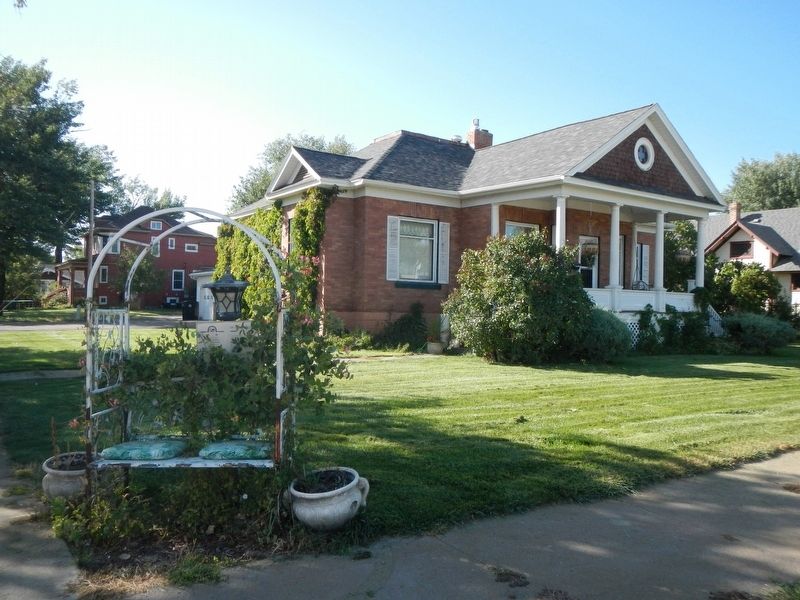
On Main Street (State Highway 59) at North Merriam Avenue, on the left when traveling east on Main Street.
A sophisticated blend of Classical elements characterizes this intimately elegant residence that, despite its modest size, easily rivals the district’s grander “high style” homes. Built in 1907, the residence was then “out in the country,” its . . . — — Map (db m164168) HM
On Main Street (Business Interstate 94) near South 5th Street, on the right when traveling east.
Dr. Robert G. Redd served as an army surgeon at Fort Keogh in the 1870s. Redd resigned in 1881 to assume a private practice. He served as county physician, coroner, and surgeon for the Northern Pacific Railroad as well as mayor from 1889 to 1900. He . . . — — Map (db m163878) HM
On Main Street near South 5th Street, on the right when traveling east.
By late 1880s breeders in the Miles City area produced cow ponies, saddle horses, cavalry mounts, carriage horses, draft animals for farming and freighting, some polo ponies, and race horses.
In 1883, the Custer County Assessor estimated . . . — — Map (db m163879) HM
On Main Street (State Highway 59) near North Winchester Avenue, on the left when traveling east.
Wealthy Miles City residents looked to the undeveloped area east of the Northern Pacific tracks to build their homes in the early twentieth century. Among them were Ed and Doris Love who had this Prairie Style home constructed in 1916. Its bands of . . . — — Map (db m164149) HM
On North 11th Street at Palmer Street, on the right when traveling north on North 11th Street.
An eclectic blend of Romanesque, Gothic, and Queen Anne architectural styles, this 1886 church survives as designer Byron Vreeland’s most significant building in Montana. Vreeland blended these styles as his architectural signature in many of his . . . — — Map (db m164049) HM
On Main Street (Business Interstate 94) at North Montana Avenue, on the left when traveling east on Main Street.
Charter members George and Helen Miles bestowed this land on the church in 1882. Since that time the First Presbyterian Church has occupied this space. Church trustees met in 1911 to discuss the construction of a larger $30,000-$40,000 church. . . . — — Map (db m164116) HM
Following the defeat of General Custer and the Seventh Cavalry at Little High Horn on June 25, 1876, Congress appropriated $200,000 to establish two forts in Montana Territory. The U.S. Army selected one site along the Tongue River, a mile and a . . . — — Map (db m164231) HM
On Main Street (Highway 59) near South Custer Avenue, on the right when traveling east.
This American foursquare style home appears to have been designed by prominent architect Brynjulf Rivenes. Built between 1910 and 1914 for businessman George Foster, its compact simplicity is an elegant, individual statement of the prosperity Miles . . . — — Map (db m164119) HM
Born in Wisconsin, Al Furstnow settled permanently in Miles City in 1894 and became the major saddler in the northwest. In 1895, Furstnow commissioned Byron Vreeland to build this Queen Anne style home, unusual because the architect usually designed . . . — — Map (db m164091) HM
On Main Street (State Highway 59) at South Lake Avenue, on the right when traveling east on Main Street.
Cabinet and furniture makers also made caskets, and so the two businesses often went hand in hand. Furniture dealer James E. Graves purchased H. C. Plimpton’s long-established furniture and undertaking business in the 1920s. In 1929, Graves moved . . . — — Map (db m164118) HM
On Main Street (State Highway 59) near South Jordan Avenue, on the right when traveling east.
The stylistic versatility of architect Brynjulf Rivenes is well demonstrated in this distinguished home built for Miles City businessman Harry J. Horton. The simple foursquare plan combines wide eaves, a low hipped roof, and massive brick pillars, . . . — — Map (db m164121) HM
In the 1880, railroad company promotional campaigns lured farmers to Eastern Montana. They arrived with the idea of transforming the planes into rich fields of grain. However big wheat yields did not last long. The drought and dust storms of 1919 . . . — — Map (db m164404) HM
You stand about 500 miles from where the Yellowstone's 670-mile journey begins from its headwater in Yellowstone National Park to the confluence with the Missouri River. The last of America's free flowing rivers, the Yellowstone drains 70,100 square . . . — — Map (db m164403) HM
On North Jordan Avenue near Clark Street, on the right when traveling north.
A converted two-story house served as the county hospital in 1907, a year before the Chicago, Milwaukee, St. Paul and Pacific Railroad arrived in Miles City. With encouragement from the railroad, which needed a place to treat injured workers, the . . . — — Map (db m164171) HM
The New Deal’s National Recovery Administration provided funds for the construction of several significant buildings at the fort in the 1930s. These included a dairy barn, milk house, cattle sheds, and this large horse barn. Designed and built in . . . — — Map (db m164265) HM
On Main Street (Business Interstate 94) near South 8th Street, on the right when traveling east.
The Jackson Block’s spare façade bears witness to those watchwords of modern architecture, “form follows function.” The two-story building suggests ways that urban architectural trends were translated and adapted in small communities. Its main . . . — — Map (db m164044) HM
On Pleasant Street at North 9th Street, on the left when traveling east on Pleasant Street.
Complex rooflines and decorative details define this wood-frame residence. Particularly noteworthy are the ornamental bargeboards fastened to the roofline and the unique bull’s-eye pattern decorating the front gable. Other details include windows . . . — — Map (db m164095) HM
On North Cottage Grove Avenue near Main Street, on the left when traveling north.
Sometimes called “labor’s aristocracy,” locomotive engineers were the highest paid workers on the railroad. That fact gave William Kelly, an engineer for the Milwaukee Road, the means to purchase this one-story home. In 1920 he lived here with his . . . — — Map (db m164172) HM
On Main Street (Business Highway 94) near South 6th Street, on the right when traveling east.
This popular gathering place, one of Miles City’s oldest established businesses, has been proclaimed by connoisseurs the perfect bar. Originally a saloon (1893), then a fine saddlery (1900-1907), businessman James Kenney purchased the property in . . . — — Map (db m163980) HM
On North 11th Street near Palmer Street, on the right when traveling north.
The end of the 1880s witnessed development of Miles City’s north side, with expensive homes being built on generous tracts of land. As land became scarce, parcels were carved from spacious lawns and working families became the neighbors of prominent . . . — — Map (db m164090) HM
On Main Street (State Highway 59) at South Stacy Avenue, on the right when traveling east on Main Street.
Built for C. N. and Louise E. Lukes in 1911, the home is also known as the Ed Love House. Lukes was cashier of the Commercial State Bank and after the deaths of C. N. and Louise in 1929, ownership passed to their daughter, Doris Lukes Love, and her . . . — — Map (db m164148) HM
On Palmer Street near North 11th Street, on the left when traveling east.
Nestled amidst grand Queen Anne style houses is this early folk residence. The wooden home, constructed for Scottish immigrant John McAusland, appears on an 1883 bird’s-eye map of Miles City. A steeply pitched side-gable roof and a small dormer . . . — — Map (db m164046) HM
On North 11th Street at Pleasant Street, on the right when traveling north on North 11th Street.
In 1910, the Methodists hired a New York fundraising firm to raise funds for a new, larger church to replace the 1883 building. The growing congregation raised $14,000 and neighbor C. J. Wagenbreth donated the needed capital to complete the project, . . . — — Map (db m164092) HM
On Main Street (State Highway 59) near South Jordan Avenue, on the right when traveling east.
The development of this elegant residential neighborhood reflects Miles City's second growth spurt in the early twentieth century. Although the population of this "cowtown" waned between 1890 and 1905, the advent of the Chicago, Milwaukee and St. . . . — — Map (db m164120) HM
On Main Street (Business Interstate 94) near South 6th Street, on the right when traveling east.
The Main Street historic district reveals Miles City’s major growth periods of 1882-1887, 1905-1920, and 1935- 1940. The first of these began with the arrival of the Northern Pacific in 1881, when imposing brick business blocks began to replace the . . . — — Map (db m163979) HM
On Main Street near South 5th Street, on the right when traveling east.
In 1889 Evelyn Cameron (1886-1928) and husband, Ewen came from England and a privileged life to settle on various ranches near Terry, Montana. Evelyn documented life in eastern Montana both in her diaries and in her photographs. She . . . — — Map (db m163969) HM
On Main Street (State Highway 59) near South Custer Avenue, on the right when traveling east.
A low-pitched hipped roof, an asymmetrical open front porch with massive square porch supports, clean lines, and wide overhanging eaves mark the two-story Pope residence as a classic example of the Prairie style. Builder Thomas Burton clad the . . . — — Map (db m164117) HM
On U.S. 12 24 miles east of U.S. I-94, on the left when traveling east. Reported permanently removed.
This is the river that exuberant parties claim is a mile wide, an inch deep, and runs up hill. The statement is exaggerated. Captain Clark, of the Lewis and Clark Expedition, named it the Redstone in 1806 and afterwards found out that the Indians . . . — — Map (db m155578) HM
Breaking and training thousands of horses at Fort Keogh for the U.S. military and Allied French and British forces was crucial during World War I because of the military’s reliance on horse-drawn transportation. This two-story mess hall served . . . — — Map (db m164233) HM
On Main Street (State Highway 59) at North Jordan Avenue, on the left when traveling east on Main Street.
Nature, comfort, simplicity, honesty, and integrity were ideals incorporated into early-twentieth-century architecture. This Craftsman style bungalow is an exceptional expression of those ideals. Its compact floorplan and modestly adorned exterior . . . — — Map (db m164169) HM
Near Main Street near South 5th Street, on the right when traveling east.
Before there was a Miles City, before there were railroads or even crude trails, there were the rivers. And the mighty Yellowstone would, for a few years, serve as the highway that brought people and their necessities to Miles City. Perhaps the best . . . — — Map (db m163971) HM
On Main Street (State Highway 59) at South Strevell Avenue, on the right when traveling east on Main Street.
Determined to bring the Chicago, Milwaukee, and St. Paul Railroad to Miles City, land developer, cattleman, and banker Lorenzo Stacy organized his fellow businessmen to secure and donate property for the railroad’s right-of- way. In 1908, the . . . — — Map (db m164147) HM
On Main Street near South 5th Street, on the right when traveling east.
By the 1920s the horse industry was thriving in eastern Montana. "There were horses on every knoll and hill in sight." In the 1930s the Great Depression combined with drought drove people to abandon their farms and ranches, turning lose . . . — — Map (db m163880) HM
On Main Street near South 5th Street, on the right when traveling east.
The modern day horse found its way to the Americas on Spanish ships around 1680, landing on Mexican shores. Some horses escaped the Conquistadors, and Native Americans quickly discovered the utility of the horse. The Plains Indians became experts at . . . — — Map (db m163882) HM
On Main Street at North 5th Street, on the left when traveling east on Main Street.
Since the 1880s, Miles City has been the trade, service, and social center for Eastern Montana ranchers. After its famed McQueen House burned down, town booster Joseph Leighton built the Leighton, 1898-1899, which became an area landmark. Within a . . . — — Map (db m163974) HM
On Business Interstate 94 near Garryowen Road, on the right when traveling south.
Captain Wm. Clark and ten others camped near the mouth of the Tongue River on July 29, 1806. Clark noted the great number of buffalo in the area and reported that the river was so muddy and warm that it was "very disagreeable to drink." Clark . . . — — Map (db m163877) HM
On South Strevell Avenue at Stower Street, on the right when traveling north on South Strevell Avenue.
Armed with a degree from the Ontario Business College, Canadian-born Thomas Shore arrived in Miles City in 1896. He and former cowboy Wirt Newcom formed a partnership and opened a department store on Main Street in 1900. The store flourished, . . . — — Map (db m164174) HM
On Pleasant Street at North 10th Street, on the left when traveling east on Pleasant Street.
The elegance of this magnificent Neoclassical style mansion belies the humble roots of its first owner, George H. Ulmer, the Pennsylvania-born son of a German immigrant. Ulmer came to Miles City in 1883, and by 1889 partners George Miles and Charles . . . — — Map (db m164094) HM
On South Lake Street (Avenue) at Dickinson Street, on the right when traveling north on South Lake Street (Avenue).
Log cabins and canvas tents lined Miles City’s Main Street when Walrond Snell and William Ladd opened their crockery business in the late 1870s. Snell sold his interests in 1883, returning to his native England to marry his sweetheart, Elizabeth . . . — — Map (db m164173) HM
Hundreds of military and civilian residents at Fort Keogh made the fort’s water supply a primary concern. By 1879, two thousand feet of pipe had been laid and seven cisterns installed. A converted boiler pumped water from the Yellowstone River for . . . — — Map (db m164264) HM
D. J. O’Malley grew up living at frontier forts because his step-father served in the 19th Infantry. He lived at Fort Keogh, near Miles City, for five years before going to work in 1882 at age 16 for the Home Land and Cattle Co. (N-Bar-N) for $45 a . . . — — Map (db m155046) HM
On South Main Street near West Lincoln Avenue, on the left when traveling north.
The completion of the Chicago, Milwaukee, St. Paul, and Pacific Railroad line through this area in 1908 brought an influx of homesteaders, increasing the demand for county services. Simultaneously, the Progressive Movement in Montana sparked a . . . — — Map (db m164216) HM
On Holt Street (U.S. 212) at Courthouse Square, on the left when traveling east on Holt Street.
1900Broadus post office established, named after the Broaddus family. 1919Powder River County formed. Frank Kelsey, Moorhead rancher and Custer County state senator, introduced the bill drawn up by A.W. Heidel, Helena . . . — — Map (db m203084) HM
On U.S. 212 near Big Powder River East, on the left when traveling north.
Don't fence me in,
Gimme land, lots'land
Stretching miles across the West.
Don't fence me in,
Let me ride where it's wide
And that's how I like it best.
I want to see the stars,
I want to feel the breeze,
I want . . . — — Map (db m189209) HM
On Holt Street (U.S. 212) near Jensen Avenue, on the left when traveling west.
Fur trappers came upriver in the wake of the Lewis and Clark Expedition in 1806. These visitors left behind them tall tales of their adventures and a few trading posts scattered along the Yellowstone River. Southeastern Montana was Indian and . . . — — Map (db m189174) HM
On U.S. 212 south of Big Powder River East, on the left when traveling north.
Fur trappers came upriver in the wake of the Lewis and Clark Expedition in 1806. These visitors left behind them tall tales of their adventures and a few trading posts scattered along the Yellowstone River. Southeastern Montana was Indian and . . . — — Map (db m189212) HM
On U.S. 212 south of Big Powder River East, on the left when traveling north.
About 65 million years ago, the Western Interior Seaway receded as the Rocky Mountains rose, pushing the shoreline further east. Great rivers meandered through the coastal plain in a warm and humid climate, depositing sediment which would later . . . — — Map (db m189211)
On U.S. 212 near Big Powder River East, on the left when traveling north.
From its source in central Wyoming to its union with the Yellowstone River, the Powder River is 250 miles long, "a mile wide and an inch deep; to thick to drink and to thin to plow." During World War I, Montana's 91st Division gained national . . . — — Map (db m189210) HM
On Old Highway 10 near Powder River Road, on the right when traveling west.
These graves hold more than the remains of six men-they hold the power of symbol and stereotype. Like other remote graves overlooking prime waterways in the rural West, they have been kept well marked. Yet the identities of their occupants can no . . . — — Map (db m253717) HM
On Old Highway 10 near Powder River Road, on the right when traveling west.
Father DeSmet, accompanied by Trader Galpin and his wife traveled overland from thenMissouri River to meet the Hunkpapa Sioux at the Sitting Bull Council on June 20, 1868 for a peace conference.
Runners from Father DeSmet's were sent ahead to to . . . — — Map (db m253651) HM
Near Old Highway 10 near Powder River Road, on the right when traveling west.
Over the span of untold generations, rivers marked the primary travel routes used by nomadic tribes and the earliest explorers. The first steamboat to venture up the Yellowstone River to its confluence with the Powder River was the famed Far West, . . . — — Map (db m253720) HM
On Old Highway 10 near Powder River Road, on the right when traveling west.
The military paved the way for the settlement of the West-and the lands in front of you played a central role. The first military encampment here occurred on July 30, 1805, when Captain William Clark and other members of the Corps of Discovery . . . — — Map (db m253655) HM
On West Old Highgway 19 at Milwaukee Road, on the right when traveling south on West Old Highgway 19.
Work on the 225 mile Eastern Mountain scion of the Milwaukee Railroad took place 1907-1908
The Milwaukee ran through a region of river and creek valleys making for the building of many bridges. The Yellowstone was crossed three times between . . . — — Map (db m282915) HM
On Ten Mile Road just north of Park Street, on the left when traveling north.
In 1970, Congress enacted a Wilderness Act and designated 43,000 acres north of Terry in the badlands as a Wilderness Study Area. The Calypso Trail and Scenic View offer a grand look at the badlands area. Father DeSmet met with the Hunkpapa Sioux . . . — — Map (db m203104) HM
On Old Highway 10, on the right when traveling west.
This is the river that exuberant parties claim is a mile wide, an inch deep, and runs up hill. The statement is exaggerated. Captain Clark, of the Lewis and Clark Expedition, named it the Redstone in 1806 and afterwards found out that the Indians . . . — — Map (db m253645) HM
On Old Highway 10 near Powder River Road, on the right when traveling west.
Surrounding you is northern mixed-grass prairie stretching further than the eye can see in all directions. This is a place where exceptionally clean air mixes freely with the lilting serenades of sparrows and western meadowlarks. Where people and . . . — — Map (db m253719) HM
On Ten Mile Road at Park Street, on the right when traveling north on Ten Mile Road.
• A conference of businessmen from South Dakota in 1912 met to build a better road between Ipswich and Aberdeen, SD. This led to the development of the Yellowstone Trail which stretched from "Plymouth Rock to Puget Sound". • The Yellowstone Trail . . . — — Map (db m202882) HM
On Montana 39 (Route 39) 1.4 miles south of MT 39 and Rosebud Creek Road, on the right when traveling south.
Custer Campsite - June 23, 1876
Lieutenant Colonel George Armstrong Custer and the Seventh Cavalry, having marched approximately 33 miles up Rosebud Creek, set up camp at this location in the late afternoon of June 23, 1876.
In . . . — — Map (db m312863) HM
On North 11th Avenue near River Street, on the right when traveling north.
By 1897, a single-story home stood on this site. Owners had added a wing and two porches by 1910, but by 1920 that house had been replaced with this one-story bungalow. The full-length front porch tucked beneath the roof, exposed rafter tails, and . . . — — Map (db m165044) HM
On North 11th Avenue near River Street, on the left when traveling north.
At the turn of the twentieth century, inviting porches fronted many houses in Forsyth. Built before 1910 on a prominent corner lot, this hipped-roof home retains its full-length porch, supported by Doric columns. As with many early-twentieth-century . . . — — Map (db m165048) HM
On North 12th Avenue at Park Street, on the right when traveling north on North 12th Avenue.
Early pioneers Thomas and Mary Alexander owned large swaths of land in and around Forsyth, including most of this block, which they subdivided into lots. They sold this tract to Edward Jones in 1903, who likely built this asymmetrical two-story . . . — — Map (db m164911) HM
On North 13th Avenue near Oak Street, on the left when traveling north.
A single-story octagonal cutaway bay with prominent wooden brackets and a multi-sided screen porch mark the street façade of this T-shaped, two-story home. An excellent example of vernacular Queen Anne style architecture, the home displays much . . . — — Map (db m164833) HM
On North 12th Avenue near Oak Street, on the left when traveling north.
Northern Pacific conductor Frank Runyan and his wife, Nellie, built this one-story bungalow in 1914. County jailor Dick Wright and his wife, Edith, lived here from 1919 to 1923. A. J. and Ina Freeman owned the home in 1940. A. J. was justice of the . . . — — Map (db m164850) HM
On Willow Street at North 12th Avenue, on the right when traveling west on Willow Street.
Standing just outside the original town site, this two-story home is believed to be one of the first residences constructed so close to the Yellowstone River. It was a dangerous place to build since despite early dikes, the river was still prone to . . . — — Map (db m164854) HM
On Main Street near North 9th Street, on the right when traveling west.
In 1882, pioneer Thomas Alexander traded a parcel of land to the Northern Pacific in exchange for other property nearby. Alexander’s farm became the town of Forsyth and Alexander became an important local merchant and real estate developer. Among . . . — — Map (db m164780) HM
On North 13th Avenue near Oak Street, on the right when traveling north.
A large central dormer and an inset front porch distinguish this Craftsman style residence. Businessman and real estate developer Winnie Dowlin likely had the home constructed circa 1910 along with the two houses immediately to the south for rental . . . — — Map (db m164832) HM
On North 13th Avenue near River Street, on the left when traveling north.
Arrival of the Milwaukee railroad and the masses of homesteaders who followed in its wake meant land-office business for Forsyth. As Rosebud County seat, Forsyth provided plenty of work for lawyers like Henry Beeman, who opened a title abstract . . . — — Map (db m165229) HM
On North 13th Avenue near River Street, on the right when traveling north.
“The three Longley cottages in the eastern part of the city have been completed and are ready for occupancy,” announced the Forsyth Times in November 1901. Two of those cottages were almost certainly this hipped-roof residence and its . . . — — Map (db m165150) HM
On Main Street near 12th Avenue, on the right when traveling west.
The Northern Pacific Railroad was the lifeblood of many small Montana towns like Forsyth, which was founded in 1882 to serve as an operations base for rail crews. Since unmarried men filled most railroad positions, towns like Forsyth had need of . . . — — Map (db m164666) HM
On South 7th Avenue at Front Street, on the left when traveling south on South 7th Avenue.
On May 8, 1882, the first train rumbled through Forsyth, and the growing town soon became home to many Northern Pacific Railway workers. Among them were locomotive engineers, whose skills were in high demand, particularly in the West during the . . . — — Map (db m164787) HM
On North 9th Avenue near Cedar Street, on the right when traveling north.
Sunrays filtering through a window apparently ignited straw packing in the basement of the J. E. Choisser Wholesale Liquor Company in July 1917. Bottles of liquor burst in the flames, fueling a fire that ultimately gutted the two-story building. . . . — — Map (db m164764) HM
On South 7th Avenue at Vne Street, on the left when traveling south on South 7th Avenue.
Five brick houses, all built by early Forsyth merchant Hiram Marcyes, lined this block in 1903. Marcyes arrived in Forsyth in 1882 when it was just a tent town. In 1888, he built the first brick business block in Forsyth; fifteen years later he . . . — — Map (db m164788) HM
On Main Street at North 8th Avenue, on the right when traveling west on Main Street.
Decorative brickwork marks this impressive hotel designed by Montana architects Link and Haire. A vivid diamond pattern of light and dark brick provides a decorative band below the cornice, while raised brickwork divides the building vertically. A . . . — — Map (db m164770) HM
On North 12th Avenue at Park Street, on the right when traveling north on North 12th Avenue.
“E. A. Cornwell, the popular Forsyth merchant and banker, will move this week into the first cement block house ever built in Forsyth,” reported the Forsyth Times on October 3, 1907. “It is fitted with steam throughout, electric . . . — — Map (db m164917) HM
On North 12th Avenue at River Street, on the left when traveling north on North 12th Avenue.
Cast concrete block was an exciting new technology in the 1900s. While critics labeled it “cheap and vulgar,” builders and homeowners embraced it as a “substantial and beautiful substitute for stone.” Durable, affordable, and . . . — — Map (db m164922) HM
On North 11th Avenue near Park Street, on the right when traveling north.
Distinctive pointed-arched, Gothic style windows and a decorative three-story square tower, tucked in the L of the cross-gable, originally distinguished this unique residence, constructed between 1896 and 1903. In March 1903, John and Julia Edwards . . . — — Map (db m165050) HM
On North 11th Avenue at Park Street, on the right when traveling north on North 11th Avenue.
In 1901, prosperous rancher Thomas Hammond built “a fine residence in Forsyth ... one of the architectural adornments of the city.” He and his wife, Adelaide, and their four children used the home as a town house until 1905. That year . . . — — Map (db m165052) HM
On Cedar Street at North 12th Avenue, on the right when traveling east on Cedar Street.
When an overheated furnace set fire to the First Presbyterian Church in December 1919, the congregation lost everything but the Prairie style manse built next door in 1910. While church members temporarily held services in the Masonic Hall, news of . . . — — Map (db m164923) HM
On 3rd Avenue North at Oak Street, on the left when traveling north on 3rd Avenue North.
Although heavy rain disrupted the celebrations, it couldn’t dampen the enthusiasm Forsyth residents felt for their new bridge, dedicated on July 4, 1905. Prior to the bridge’s construction, Rosebud County residents had to ford the Yellowstone River . . . — — Map (db m164782) HM
On Main Street at North 10th Avenue, on the right when traveling west on Main Street.
Captain William Clark trekked through this area on his journey down the Yellowstone River in 1806. By the time General George Armstrong Custer passed by en route to the Little Bighorn in 1876, homesteads dotted the area. As the Northern Pacific . . . — — Map (db m164670) HM
On Main Street near 13th Avenue, on the right when traveling west.
Founded for the railroad, Forsyth’s residential neighborhoods were platted in 1882 but much of the land lay undeveloped until the 1900s. Forsyth’s first-generation homes were simple dwellings rapidly constructed of wood or log to serve the immediate . . . — — Map (db m164627) HM
On 3rd Avenue North at Oak Street, on the left when traveling north on 3rd Avenue North.
Recognizing that successful communities require infrastructure, Forsyth’s civic leaders proposed construction of a waterworks and sewerage system in 1906. As the town council asserted when it posted the bond issue, “We desire to improve the town.... . . . — — Map (db m164783) HM
On Main Street at 12th Avenue, on the right when traveling west on Main Street.
(Three panels make up this marker:) (panel 1)
In 1918, rising flood waters on the Yellowstone River threatened the City of Forsyth, the Forsyth Times-Journal reported "Over 500 men worked for 36 hours to keep . . . — — Map (db m164762) HM
On Main Street at 9th Avenue, on the right when traveling west on Main Street.
In 1918, the city of Forsyth was threatened by rising flood waters of the Yellowstone River.
Only a two block section of Main Street between 8th and 10th avenues remained relatively dry because temporary berms were quickly constructed to hold . . . — — Map (db m164763) HM
On Main Street near North 8th Avenue, on the right when traveling west.
In 1918, the city of Forsyth was threatened by rising flood waters of the Yellowstone River. Only two blocks of Main Street between 8th and 10th Avenues remained dry. Temporary berms had been constructed to hold the flood waters at bay to protect . . . — — Map (db m164773) HM
On 3rd Avenue North at Oak Street, on the left when traveling north on 3rd Avenue North.
In 1918, a rising Yellowstone River threatened the City of Forsyth. According to the Forsyth Times Journal, "Over 500 men worked for 36 hours to keep the flood water out of the city as much as possible." On this day in the early morning hours, the . . . — — Map (db m164785) HM
On North 14th Avenue at River Street, on the left when traveling north on North 14th Avenue.
In 1918 the city of Forsyth was flooded for 2 1/2 weeks by the rising waters of the Yellowstone River.
The waters rushed into the west end of Forsyth, flooding the entire town north of the Northern Pacific Railroad tracks. As the flood . . . — — Map (db m165144) HM
On Main Street near 6th Avenue North, on the right when traveling west.
In 1918, water from the Yellowstone River rushed into the west end of Forsyth and flooded the entire town north of the Northern Pacific Railroad tracks. Every basement was flooded to the floor joists. Homes in the residential district had 2 to 3 . . . — — Map (db m165234) HM
On North 13th Avenue at River Street, on the left when traveling north on North 13th Avenue.
Decorative half-timbering and an intricate roofline distinguish this elegant one-and-one-half-story home. Mary Philbrick had the residence built as a wedding present for her daughter Mary Frances and son-in-law Harry Cornwell, a hardware merchant. . . . — — Map (db m165146) HM
On Front Street near South 5th Avenue, on the right when traveling north.
Hiram Marcyes was born September 11, 1844 in Newberg, Maine. He served in the Civil War as a bugler in the Fourth Minnesota Volunteer Infantry Company with the the Union army. His service took him in battles from Vicksburg to Sherman's March to the . . . — — Map (db m188746) HM
On North 15th Avenue at Potty Path on North 15th Avenue.
One the morning of May 23, 1876, two cavalrymen and a citizen teamster, attached to Colonel John Gibbon's Montana Column, were ambushed by a war party of Lakota in the bluffs on the north side of the Yellowstone a few miles downriver from this . . . — — Map (db m164801) HM
On North 9th Avenue near Cedar Street, on the left when traveling north.
A pressed metal cornice, door surrounds made of cast iron, and an exposed steel I-beam distinguish the façade of the 1907 Kennedy-Fletcher block. Geo. L. Mesker and Co. of Bedford, Indiana, the largest architectural ironworks in the country, . . . — — Map (db m164766) HM
On North 12th Avenue near River Street, on the right when traveling north.
Cattleman Lafayette H. Parker and his wife, Lida, purchased a small home on this lot in 1910. Lafayette died two years later of tuberculosis, but Lida continued to live here, and in 1917, she obtained a mortgage to replace her home with a two-story . . . — — Map (db m164921) HM
On Main Street near 10th Avenue, on the right when traveling west.
Terra-cotta medallions sporting the Masonic emblem of square and compass and the words “Masonic Temple” centered beneath the cornice proudly announce this building’s primary purpose. Chartered in 1898, the Forsyth Masonic Lodge met in borrowed . . . — — Map (db m164686) HM
On North 13th Avenue near Park Street when traveling north.
When the Milwaukee road arrived in 1907, Forsyth boomed, and carpenter Maurice S. Lord decided to open his own business. “It won’t cost you anything to talk to me,” he advertised, “and if I can’t suit you as to price and quality, . . . — — Map (db m165145) HM
On North 13th Avenue near Cedar Street, on the left when traveling north.
The deep eaves and flared rooflines of this two-story home were meant to evoke the Far East, while its octagonal tower, ornamental brackets, decorative beveled glass, and corbelled chimneys reveal the attention to detail that accompanied the home’s . . . — — Map (db m165230) HM
On Main Street near 10th Avenue, on the right when traveling west.
Pioneer businessman Thomas Alexander founded Forsyth’s first bank in 1892. In 1898, he built this ashlar stone bank building with material quarried within a mile of Forsyth. Three small panels on the cornice commemorate the year of construction and . . . — — Map (db m164760) HM