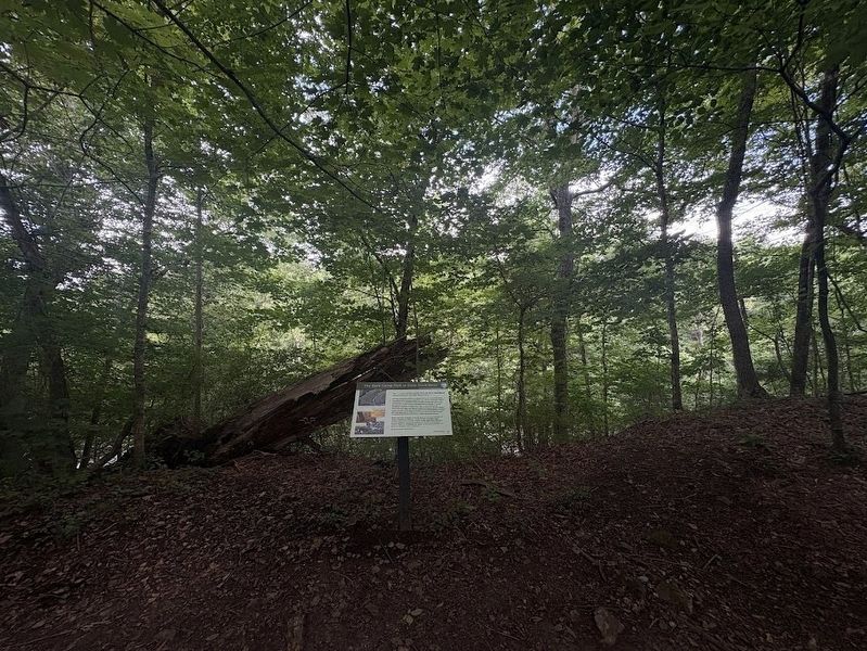
Near Stone Fort Drive north of U.S. 41, on the left when traveling south.
The "...most spectacularly sited of these Woodland sacred places is the Old Stone Fort." ¹
Flowing along this section of mound wall is the Little Duck River. The ceremonial enclosure intensifies the natural landscape; taking advantage . . . — — Map (db m277784) HM
The Civilian Conservation Corps was launched by President Franklin D. Roosevelt April 5, 1933 as a lifeline for undernourished sons of the Great Depression. Each company consisted of about 200 men who were housed in Tennessee barracks under the . . . — — Map (db m81376) HM
Near Stone Fort Drive near U.S. 41, in the median.
The first feature seen of the Old Stone Fort is "the only...gateway...evident in the walls," ¹ on this end of the enclosure.
The mound walls forming the outer perimeter of the enclosure approach each other here and swell into terminal . . . — — Map (db m277791) HM
Near Stone Fort Drive south of U.S. 41, in the median.
The mound walls of the Old Stone Fort enclose the 50-acre area in front of you.
Archaeologists find few signs of housing, food storage, or artifacts. This appears to be typical of the use of hilltop enclosures in the period and supports the . . . — — Map (db m277788) HM
Near Stone Fort Dr south of U.S. 41, on the left when traveling south.
The cliffs represent the escarpment of the Highland Rim and its transition to the Central Basin elevation at their foot.
The rock outcroppings are primarily limestone underlain by shale. The shale erodes more quickly and leaves overhangs and . . . — — Map (db m277781) HM
Near Stone Fort Dr south of U.S. 41, on the right when traveling south.
The wall in front of you begins the longest continuous segment of mound wall at the Old Stone Fort.
Stretching for nearly two thousand feet, this section spans the distance between the Big and Little Duck Rivers. As elsewhere, the wall is . . . — — Map (db m277780) HM
Near Stone Fort Dr south of U.S. 41, on the left when traveling south.
Hilltop enclosures are constructed to conform to the natural setting.
The east section of the mound wall ends here. Replacing the mounds are steep cliffs, allowing the landscape to define the site. Once again, this fits the pattern of hilltop . . . — — Map (db m277782) HM
Near Stone Fort Drive near U.S. 41, on the right when traveling south.
The Old Stone Fort is a type of prehistoric Native American mound site.
American Indians built numerous types of mounds. These included burial mounds, ceremonial platform mounds, animal effigy mounds and mounds creating enclosures. The long . . . — — Map (db m277842) HM
Near Stone Fort Dr south of U.S. 41, on the right when traveling west.
The Main Mill, The Pulp Mill, and the Wrapping Mill
W.S. Whitman's paper mill was built prior to the Civil War. Whitman also built the gunpowder mill used by Confederate forces during the war. After the Civil War, Whitman left the area and . . . — — Map (db m277764) HM
Near Stone Fort Dr south of U.S. 41, on the right when traveling west.
"Big Falls," the largest single drop on the Big Duck River, would have been of particular significance to the builders of the Old Stone Fort.
While water was sacred to prehistoric Native Americans, by the 1800s it was the primary power source . . . — — Map (db m277765) HM
Near Stone Fort Dr south of U.S. 41, on the left when traveling west.
Antiquarians exchanged letters and maps concerning the "wonders" on the frontier such as the Old Stone Fort.
The earliest surviving letter referencing the Old Stone Fort was written by Sam Mitchell in 1810. The earliest map seems to be about . . . — — Map (db m277762) HM
On West Main Street at North Irwin Street, on the right when traveling west on West Main Street.
In late June of 1863, Union Major General William S. Rosecrans launched a massive offensive from his base in Murfreesboro in an attempt to drive Confederate General Braxton Bragg’s 43,000-man Army of Tennessee from its entrenchments at . . . — — Map (db m75354) HM
On West Main Street at North Irwin Street, on the right when traveling west on West Main Street.
When Manchester was founded in the late 18th century, local lore has it that the town, named for Manchester, England, was destined to become an American version of this powerful industrial city. The Duck River falls, it was noted, would provide an . . . — — Map (db m75355) HM
On North Spring Street just south of West Fort Street, on the right when traveling south.
In everlasting and honored memory of the young sons of Coffee County who gave their lives in America's most unpopular war, they died not in vein because all served honorably and faithfully and our surviving veterans carry the torch of freedom to . . . — — Map (db m158573) WM
On North Spring Street at West Main Street, on the left when traveling north on North Spring Street.
After the Battle of Stones River on January 2, 1863, Union Gen. William S. Rosecrans occupied Murfreesboro. Confederate Gen. Braxton Bragg withdrew south to the Highland Rim to protect the rail junction at Tullahoma, Bragg's headquarters, . . . — — Map (db m156117) HM
Near Stone Fort Dr south of U.S. 41, on the right when traveling south.
As with most mills during the Civil War, the Manchester Powder Mill was powered by water. Water mills were used in the production of many types of material goods, like paper, flour, lumber, and textiles. Water mills use the flow of water to turn a . . . — — Map (db m277776) HM
On West Main Street just west of North Spring Street, on the right when traveling west.
Dedicated to the everlasting memory of the men and women of Coffee County who served their country in World Wars I and II
In memoriam and reverent honor to the brave veterans of Coffee County who made the supreme sacrifice and gave their lives . . . — — Map (db m158632) WM
On Hillsboro Highway (U.S. 41) at Tyree Cove Road, on the right when traveling south on Hillsboro Highway.
Coffee County
Established 1836; named in honor of
Major General John Coffee
soldier, surveyor, and close friend of Andrew Jackson. Tennessee troops under his command took a decisive part in the New Orleans Campaign, December 23, 1814 to . . . — — Map (db m150467) HM
Near NE Atlantic Street north of East Lincoln Street, on the left when traveling north.
Tullahoma, chartered in 1852, was laid out by a Town Company along the Nashville and Chattanooga Railroad line being built at the time. The street along the railroad was named “Atlantic” perhaps because the railroad made possible an . . . — — Map (db m172367) HM
On South Jackson Street (U.S. 41A) at West Volney Street, on the right when traveling south on South Jackson Street.
Withdrawing to this area after the Battle of Murfreesboro, Gen. Braxton Bragg established his command post near here. Other units went into defensive winter quarters at Bell Buckle, Shelbyville & Wartrace. Here they remained until late June, 1863, . . . — — Map (db m81378) HM
On West Decherd Street at South Jackson Street (Alternate U.S. 41), on the right when traveling east on West Decherd Street.
Now the city s regional Fine Arts Center, sisters Jennie and Affa Baillet and their parents lived and worked here beginning in the 1870's. Jennie was an artist [illegible] and the family operated a millinery store downtown. They watched much . . . — — Map (db m172400) HM
On Jackson Street (U.S. 41) at Decherd Street, on the right when traveling north on Jackson Street.
Jane (Jennie) Baillet
1834 - 1918
Emma Adell Baillet
1838 - 1926
Affa Ann Baillet
1850 - 1934
This house was the home of Jane, Emma, and Affa Baillet whose family purchased the property . . . — — Map (db m81379) HM
On South Jackson Street (Alternate U.S. 41) at West Decherd Street, on the right when traveling south on South Jackson Street.
Braxton Bragg's Headquarters – Public Square (now S. Jackson Civic Center grounds)
After the Battle of Stone's River, the Confederate Army of Tennessee moved to the Duck River Line extending from Spring Hill through Shelbyville, Tullahoma, . . . — — Map (db m172402) HM
On South Jackson Street (U.S. 41A) at West Volney Street, on the right when traveling south on South Jackson Street.
Originally established in 1926 for training the Tennessee National Guard, this became a Federal training area, Jan. 10, 1941. It was named for Lt. Gen. N.B. Forrest, CSA. Units training here included the 8th, 33rd, 79th & 80th Inf. Divs., 17th . . . — — Map (db m24446) HM
On Arnold Center Road, on the right when traveling south.
Camp Peay 1926 - 1940
Camp Forrest 1940-1946
Arnold Center 1949
Tullahoma, Tenn
A tribute to the men and women who trained and worked at Camp Forrest and contributed significantly to victory in World War II. — — Map (db m24430) HM
On South Jackson Street (State Highway 41-a) at Vocational Lane, on the left when traveling south on South Jackson Street.
Coffee County
Established 1836; named in honor of
Major General John Coffee
Soldier, surveyor and close friend of Andrew Jackson. Tennessee troops under his command took a decisive part in the New Orleans Campaign, December 23, 1814 to . . . — — Map (db m81380) HM
On Maplewood Avenue 0.1 miles north of West Waggoner Street, on the right when traveling south.
The cemetery holds the graves of over 500 Confederate soldiers who died from wounds, illness, or accidents while in Tullahoma. 404 soldiers have been identified from records located many years after the Civil War. Col. Matt Martin, CSA deeded the . . . — — Map (db m172408) HM
On South Jackson Street (U.S. 41A) at West Volney Street, on the right when traveling south on South Jackson Street.
1 mile SW are buried 407 unknown Confederates. Many of these died in one of the hospitals established here when Tullahoma was headquarters for the Army of Tennessee during the first six months of 1863, following the Battle of Murfreesboro and . . . — — Map (db m24296) HM
On Maplewood Avenue 0.3 miles south of West Coffee Street, on the right when traveling south.
On this ground are buried 407 unknown Confederates. Many of these died in one of the hospitals established here when Tullahoma was headquarter for the Army of Tennessee during the first six months of 1863. Following the Battle of Murfreesboro and . . . — — Map (db m75311) HM WM
On East Fort Street near Ovoca Road, on the right when traveling east.
Fort Rains, a bastioned fort, was built by the Confederates during their six-months stay the early part of 1863 on the slight eminence along Fort Street between Ovoca Road and Forrest Drive, as they awaited a move by the Union Army. The fort was . . . — — Map (db m172355) HM
On NE Atlantic Street at East Grundy Street, on the right when traveling south on NE Atlantic Street.
(preface)
After the Battle of Stones River ended on January 2, 1863, Union Gen. William S. Rosecrans occupied Murfreesboro. Confederate Gen. Braxton Bragg withdrew south to the Highland Rim to protect the rail junction at Tullahoma, Bragg’s . . . — — Map (db m81382) HM
On South Jackson Street (U.S. 41A) at West Volney Street, on the right when traveling south on South Jackson Street.
Born near here, 1818. Was the only governor of Confederate State of Tennessee. In Congress 1849-51; elected governor, 1857-59-61. When U.S. forces captured Nashville, joined staff of Army of Tennessee for remainder of War. Fled to Mexico, 1865; . . . — — Map (db m61914) HM
On Tennessee Route 55, on the right when traveling east.
South of here, at Bobo's Crossroads, Col. Starnes, 4th Tennessee Cavalry, CSA, then commanding Forrest's Old Brigade, was killed in a skirmish while his brigade was screening the withdrawal of the Army of Tennessee from Tullahoma to the Chattanooga . . . — — Map (db m24188) HM
Near North Franklin Street south of West Lincoln Street, on the left when traveling south.
This is the site of the antebellum summer home of United States Supreme Court Justice John Catron (1786-1865) and his wife, Mathilda Childress Catron. Born in Virginia, Catron moved as a youth to Kentucky and served in the War of 1812. He read law, . . . — — Map (db m268800) HM
On South Jackson Street (Alternate U.S. 41) south of West Lincoln Street, on the right when traveling south.
The Field and Reynolds Livery Stable was located here in the 1800's. During the time from 1863 to 1867 when Tullahoma was occupied by soldiers and under martial law, troops were often gathered at this site by their commanders for instructions and . . . — — Map (db m172396) HM
Near Maplewood Avenue 0.3 miles south of West Coffee Street, on the right when traveling south.
Tullahoma was the headquarters and logistics center of the Confederate Army of Tennessee for the first six months of 1863 after the Battle of Murfreesboro. At least three hospitals here treated soldiers wounded during Gen. Braxton Bragg’s 1862 and . . . — — Map (db m75310) HM
On Wilson Avenue (Tennessee Route 130) at North Jackson Street (Alternate U.S. 41), on the right when traveling west on Wilson Avenue.
This land was donated to the city for use as a cemetery in 1875 by J.E. Hogain, a son-in-law of one of Tullahoma's five founders, Dr. T.A. Anderson, a physician whose home was at Belmont. It is the burial site for many of Tullahoma's leading . . . — — Map (db m172351) HM
On South Jackson Street (Alternate U.S. 41) south of West Lincoln Street, on the right when traveling south.
Provost Marshall's Headquarters — On S. Jackson St., about middle of United Methodist Church parking lot. At the conclusion of the Tullahoma Campaign, the Federal government stationed troops to guard the city. Tullahoma was especially vital . . . — — Map (db m172394) HM
On South Jackson Street (Alternate U.S. 41) south of West Decherd Street, on the right when traveling south.
This 13 acre site was laid out as the Public Square in the 1851 Town Plat of
Tullahoma, intended as a park and town meeting area. Instead, the center of town followed the depot built by the railroad. Tullahoma's first public school was built here . . . — — Map (db m172404) HM
On Arnold Center Road, on the right when traveling south.
On January 8, 1943 2nd Army commenced an intensive training course to train Rangers at Camp Forrest. Tennessee.
The 2nd Ranger Battalion was formed on April 1, 1943 by Lt. Col. W. C. Saffrans. Later these Rangers were trained and led by Major J. . . . — — Map (db m24433) HM
The car displayed here is a side bay window model caboose built in 1964 by the Louisville & Nashville Railroad at the company’s South Louisville yards. The exterior is restored to the original L & N red.
The purpose of a caboose was to provide . . . — — Map (db m75318) HM
On South Jackson Street (U.S. 41A) at West Volney Street, on the right when traveling south on South Jackson Street.
No sooner did the North begin its invasion than slaves fled to Union lines seeking freedom. This presented problems for military commanders and President Lincoln. The political aims of the war did not initially include emancipation. Before Lincoln’s . . . — — Map (db m75324) HM
On South Jackson Street (U.S. 41A) at West Volney Street, on the right when traveling south on South Jackson Street.
In late June of 1863, Union Major General William S. Rosecrans launched a massive offensive from his base in Murfreesboro in an attempt to drive Confederate General Braxton Bragg’s 43,000-man Army of Tennessee from its entrenchments at . . . — — Map (db m75325) HM
On South Jackson Street (U.S. 41A) at West Volney Street, on the right when traveling south on South Jackson Street.
When the Union Army of the Cumberland captured Manchester on June 27th, Braxton Bragg’s Confederate forces retreated here to Tullahoma - a supply base and Army of Tennessee headquarters since January, 1863. Tullahoma, however, was tactically a . . . — — Map (db m81383) HM
Near NE Atlantic Street north of East Lincoln Street.
(Monument)
[Front]: In grateful tribute to our men and women who served their country in the armed forces of the United States of America
[Side]: All gave some Some gave all We will never forget
[Side]: We live in the . . . — — Map (db m172392) WM
On NE Atlantic Street at East Lincoln Street, on the right when traveling north on NE Atlantic Street.
Here stood the Verandah Hotel, one of several buildings, taken over as a hospital for troops during the Civil War. Opposite it was Tullahoma's first depot built by the Nashville and Chattanooga Railroad in 1852. Ammunition stored in the brick . . . — — Map (db m172365) HM
Near North Jackson Street at Wilson Ave, on the right when traveling south.
Thomas was involved with the sale of much of the land in the Tullahoma area. Pierce planned, surveyed and drew maps of original plot of Tullahoma and was instrumental in moving the Coffee/Franklin Co. line in order that all of the town would lie in . . . — — Map (db m278218) HM
On Nashville Highway (U.S. 70) 0.1 miles east of Hillwood Acres, on the right when traveling east.
North ½ mile, the first fair was held October 15-17, 1856, on the south bank of Hickman Creek. The buildings were destroyed by Federal troops in 1863 and rebuilt across the creek 9 years later. There, despite fire and flood, the fair has been . . . — — Map (db m150175) HM
On West Main Street west of High Street ( Route 53), on the left when traveling west.
Side 1-Gen. John H. Morgan CSA
Side 2-Gen. Morgan left here Dec. 21, 1862, with 2,500 horsemen on his Kentucky Christmas Raid. The raid concluded in Smithville Jan. 5, 1863, after the raiders captured 1887 enemy soldiers and destroyed $2,000,000 in . . . — — Map (db m74323) WM
On West Main Street west of High Street ( Route 53), on the left when traveling west.
From late in 1862 to mid-1863, Confederate Gen. Braxton Bragg fortified his defenses in Middle Tennessee while Union Gen. William S. Rosecrans reinforced his army. To disrupt the extended Federal communication and supply lines, late in 1862 Bragg . . . — — Map (db m74322) HM
On Nashville Highway (U.S. 70) at Foutch Road, on the right when traveling north on Nashville Highway.
The raid by Brig. Gen John H. Morgan's Cavalry Division into Indiana and Ohio began here. Units were the 2nd, 3rd, 5th, 6th, 8th, 9th, 10th, and 11th Kentucky Cavalry, and the 9th Tennessee Calvary, with attached artillery. Brig. Gen. Basil Duke and . . . — — Map (db m110553) HM
On Nashville Highway (U.S. 70) at Goose Creek Road, on the right when traveling east on Nashville Highway.
Wheeler School for Blacks was established during the Reconstruction period in Wilson County on land donated by Captain J.D. Wheeler, formerly of the 5th Tennessee Cavalry, C. S. A. Renowned Black educator W. E. B. DuBois taught at the school during . . . — — Map (db m150174) HM
On Nashville Highway (U.S. 70) at Old Dry Creek Road, on the right when traveling east on Nashville Highway.
On April 3, 1863, two Union brigades under Gen. Stanley advanced to this position to battle a Confederate Division commanded by Col. Gano of Morgan's Cavalry ½ mile east on Snow Hill. Union wounded were taken to the Williams house 300 yards to . . . — — Map (db m74306) WM
On Lancaster Road (State Highway 96/141), on the right when traveling west.
Center Hill Dam
Designed by the U.S. Army Corps of Engineers and built by private contractors, Center Hill Dam, 240 feet high and 2,160 feet long, impounds 64 miles of the Caney Fork River. Congress authorized the dam in 1938 to reduce flood . . . — — Map (db m157775) HM
On Nashville Highway (State Highway 70) 0.2 miles east of Dismal Road, on the right when traveling east.
The first settler (1797) in what later became DeKalb County, Dale built a water-powered log mill to grind corn for the settlers who followed him here in 1800. Traces of the dam remain on Smith's Fork, about 200 yards upstream. — — Map (db m224819) HM
On Dunham Cemetery Trail, on the right when traveling south.
0.1-mile trail meanders gently up the ridge, This easy leading you to the historic Dunham Cemetery. Nestled in a serene setting, this peaceful location offers a glimpse into the past, overlooking what was once the Laurel Hill Community. The trail . . . — — Map (db m278225) HM
On Tennessee Route 26 at Route 83, on the right when traveling east on Tennessee Route 26.
The Beckwith Inn was located just south of here on the Old Turnpike. Originally built by James Cannady in 1816, it was one of the best-known landmarks in DeKalb County. James B. and Rachel Roulstone Beckwith operated the inn from 1843 until the late . . . — — Map (db m84976) HM
On Short Mountain Road (Tennessee Route 146) at Half Acre Road, on the right when traveling east on Short Mountain Road.
Hiram T. "Pomp” Kersey was a celebrated leader of Confederate irregulars that protected
Confederate families in the Short Mountain area. Before leading the partisans, he served
in Co. A, 16th Tenn. Vol. Inf., C.S.A. On 24 July 1864, in . . . — — Map (db m150453) HM
On South Public Square at East Market Street, on the left when traveling east on South Public Square.
Darrin Vincent, with Jamie Dailey, leads one of the most popular bands in contemporary American music, embracing bluegrass, country and gospel. Steeped in tradition, they bring versatility, comedy and a broad selection of newly composed songs to . . . — — Map (db m224769) HM
On Public Square at East Main Street, on the left when traveling north on Public Square.
Established 1837; named in honor of Baron Johann De Kalb, the Bavarian officer who accompanied Lafayette to America in 1777. Appointed a Major General in the Continental Army, he was killed at the Battle of Camden in 1780 while commanding Delaware . . . — — Map (db m129993) HM WM
On South Public Square at South 3rd Street, on the left when traveling east on South Public Square.
(south face)
Atlanta • Chickamauga • Murfreesboro
This monument is dedicated to the memory of all DeKalb Countians who served the Confederacy. They sacrificed much for the cause of an independent South. Their courage and patriotism . . . — — Map (db m75792) WM
On South Public Square near East Public Square, on the left when traveling east.
DeKalb County differed from surrounding counties. A sizeable minority of its citizens opposed secession and voted against it in the June 8, 1861 referendum. Their champion was a slave owner, Congressman William B. Stokes. The majority followed . . . — — Map (db m81483) HM
On Tennessee Route 26 at Evins Mill Road, on the right when traveling east on Tennessee Route 26.
1/2 Mi. south on Fall Creek stood a watermill built in 1837 by Daniel Smith, an early Tennessee pioneer. The original mill was destroyed by flood in 1905, and a new one 1000 ft. distant was built by J.E. Evins near Carmack Falls, where the river . . . — — Map (db m84322) HM
May the sun of righteousness shining on the American Flag glorify the sacrifice and hold in grateful remembrance the Thousands of our sons and daughters who suffered for our freedom. — — Map (db m75791) WM
On State Highway 96 east of Mathis Street, on the right when traveling east.
Built on the banks of Beaverdam Creek c. 1819-1820, “Lonesome” is a pioneer log cabin thought to be one of the oldest residences in Dickson County. It was built for William Austin (1790-1876), a veteran of the War of 1812, and his wife . . . — — Map (db m151413) HM
This monument was erected by the Tenn. synod May 30, 1942
The Cumberland Presbyterian Church was organized Feb. 4, 1810 by Samuel King, Finis Ewing, Samuel McAdow — — Map (db m151472) HM
Reclaiming Nature
In 1934, agents from the Resettlement Administration and the National Park Service visited Dickson County under petition by local business leaders to evaluate the area’s submarginal farmland and natural resources for a . . . — — Map (db m151473) HM
Tennessee State Parks
The Civilian Conservation Corps (CCC) played an important role in shaping the establishment and early growth of Tennessee's state parks. Fifteen of the first 25 parks received significant levels of design and construction . . . — — Map (db m151474) HM
On Jackson Hill Road at Camp II Road, on the right when traveling south on Jackson Hill Road.
CCC companies 4497-SP-5 and 3464-NP-16 were among the many companies organized by the U.S.A. during the Great Depression to provide useful employment for thousands of people and at the same time to develop and save our natural resources.
In . . . — — Map (db m151469) HM
Replica of the home of Rev. Samuel McAdow where he, together with Rev. Finis Ewing and Rev. Samuel King, founded the Cumberland Presbyterian Church Feb. 4, 1810. Outgrowth of “The Great Revival of 1800,” the new denomination arose to . . . — — Map (db m151470) HM
On Court Square east of Clark Street, on the left when traveling east.
In 1860, 300 people lived in Charlotte, the Dickson County seat. During the war, the residents witnessed considerable military activity, beginning February 17, 1862, when Confederate Col. Nathan Bedford Forrest, arrived here to reequip his men and . . . — — Map (db m68958) HM
On Promise Land Road north of Reddon Crossing Road, on the left when traveling north.
The Emancipation Proclamation, issued January 1, 1863, authorized the recruiting of African Americans as United States soldiers. It inspired men, like brothers John and Arch Nesbitt, to join the U.S. Colored Troops and fight for their freedom. John . . . — — Map (db m81504) HM
On Dozier Boat Dock Road 1.1 miles north of Ashland City Highway ( Route 49), on the right when traveling north.
After the fall of Fort Donelson in February 1862, Federal forces gained control of Nashville and transported most of their supplies to the city via the Cumberland River. Extending for five miles along the river here, the Harpeth Shoals made . . . — — Map (db m68962) HM
On Promise Land Road 0.1 miles north of Reddon Crossing Road, on the left when traveling north.
In this locality shortly after the Civil War, freed slaves established Promise Land, the first African-American community of Dickson County. Early settlers were Nathan Bowen, Washington Vanleer, and two brothers, John and Arch Nesbitt. In time, the . . . — — Map (db m68961) HM
On Van Leer Highway (State Highway 49) 0.1 miles west of Fagen Chapel Road, on the right when traveling west.
The former home of this pioneer is 0.2 miles north. Here, March 18, 1804, the first County Court of Dickson County met with Lemuel Harvey presiding. Other members were Montgomery Bell, Richard Napier, Jesse Craft. William Doak, William Teas, Gabriel . . . — — Map (db m151438) HM
On Promise Land Road 0.1 miles north of Reddon Crossing Road, on the right when traveling north.
Born in the Promise Land community of Charlotte
Tennessee, Theodore and Lizzie Vanleer Edmondson
formed The Promise Land Singers who traveled
throughout Tennessee and Kentucky. In 1953, a
year before the beginning of the modern civil
rights . . . — — Map (db m274724) HM
On Court Square at Clark Street, on the left when traveling east on Court Square.
In memory of the
Confederate Soldiers
of Dickson County, TN.
11th Tennessee Infantry, Co. C. E. H. K
49th Tennessee Infantry, Co. B, D
50th Tennessee Infantry, Co. A
10th Tennessee Cavalry
24th Tennessee Sharpshooters
Baxter’s . . . — — Map (db m81508) WM
On State Highway 48 0.1 miles south of New Dry Hollow Road, on the right when traveling north.
One mile west, James Robertson purchased land in 1793 to build the first iron works west of the Cumberlands. In 1804, Montgomery Bell bought it and during the War of 1812 supplied Gen. Jackson's army with cannon shot. From 1825 to 1863, A. W. . . . — — Map (db m151422) HM
Near Leach Road at Hunt Road, on the right when traveling south. Reported unreadable.
On the above hill overlooking the village sits the Drouillard Mansion. Built in 1868-1870 by James Pierre and Mary Florence Drouillard, it was Victorian designed in the pre-Civil War Italianate stvle like the summer homes Mary saw on her visits . . . — — Map (db m151430) HM
On Old State Highway 48 south of Hunt Road, on the left when traveling south.
The Hand House is a two-story brick I-house. It was built in the late 1820s and is one of the oldest buildings in Cumberland Furnace. The bricks in the three brick thick walls are handmade. It has served not only as a residence but a tavern as . . . — — Map (db m151426) HM
On Cinder Road west of Leach Road, on the right when traveling west.
The Stark's cabin is a single pen, one and one half story log cabin, approximately 18 ft. x 18 ft. It has dove tail notching and a cut stone chimney. The date of construction is unknown but believed to be during the first phase of Cumberland . . . — — Map (db m151425) HM
On Leach Road at Hunt Road, on the left when traveling south on Leach Road.
The Thompson House is a double pen log cabin. The basic log construction probably
predates the Civil War.
In the 20th century a wraparound porch, rear framed extension weatherboard and central
shed dormer were added. All but the dormer were . . . — — Map (db m151429) HM
On Center Avenue, on the left when traveling east.
War Memorial Building Korean & Vietnam
Dedicated to the memory
of the men of
Dickson County Tennessee
Who gave their lives that
freedom might live
1950 Korean Conflict 1955
Bennie E. Bellar
Mack Cavender
Jesse R. Cooksey . . . — — Map (db m125869) WM
On Ferbee Road east of Garners Creek Road, on the right when traveling east.
In 1864, just to your left, the Federal army established Camp Gillem to protect the locomotive yard here at Gillem Station. Both were named for Gen. Alvan C. Gillem, commander of the troops guarding and constructing the Nashville and Northwestern . . . — — Map (db m203665) HM
On Yellow Creek Road (Tennessee Route 46) south of Old Number 1 Road, on the right when traveling south.
During the Civil War, Yellow Creek's rough terrain and the widespread Confederate sentiment of its inhabitants provided a safe refuge for guerrillas operating in Dickson County and the surrounding area. Regular Confederate cavalry also came through . . . — — Map (db m151419) HM
On Frank Clement Place west of Center Avenue ( Route 48), on the right when traveling west.
Continued attacks by Confederate guerrillas destroying Union supply ships on the Cumberland River at Yellow Creek and Harpeth Shoals, as they attempted to supply Nashville, necessitated General U.S. Grant to authorize the construction of a safe . . . — — Map (db m81510) HM
On Wade Avenue at East Walnut Street, on the right when traveling north on Wade Avenue.
It is believed that this steam engine began its life of use in Dickson County here on this property by The Cowan Lumber Company. The company was established in June of 1923 and built many residential and commercial buildings (Dickson’s War Memorial . . . — — Map (db m124550)
On Frank Clement Place at Center Avenue, on the left when traveling west on Frank Clement Place.
Country music star Craig Morgan is a Grand Ole Opry member who scored his first No. 1 hit in 2005 with "That's What I Love About Sunday." An Army veteran, he has played many overseas shows for service members and their families and has consistently . . . — — Map (db m221757) HM
On North Main Street north of West College Street (U.S. 70E), on the right when traveling south.
November 30, 1915 - Mr. and Mrs. L. W. Little and Mr. and Mrs. T. C. Helberg deeded a 46' x 125' vacant lot (Lot 2) to the First National Bank in consideration of the bank surrendering a $2,000 note. The bank then sold the lot to S. H. Bryan and W. . . . — — Map (db m304361) HM
On Center Avenue, on the left when traveling east.
1899-Town grants railroad permission to build overpass/underground on Charlotte Street, the western edge of the city limits.
1900-Ordinance passed requiring all business to have board sidewalks * Population is 1363 residents
1901-Citizens . . . — — Map (db m124558) HM
On Frank Clement Place at Center Avenue, on the left when traveling west on Frank Clement Place.
The first hit song recorded in Nashville was Francis Craig's "Near You." It became one of the most successful pop records of the pre-rock 'n' roll era. Craig, the Hermitage Hotel's house orchestra leader for 20 years, recorded "Near You" for . . . — — Map (db m221853) HM
On Frank Clement Place east of South Main Street, on the right when traveling east.
Born on this site, June 1920, Clement spent his childhood in Dickson. Famous as an orator, he was three times elected Governor of Tennessee, for a two-year term in 1952 and for four-year terms in 1954 and 1962. Among the programs inaugurated during . . . — — Map (db m68933) HM
On North Main Street at West College Street (U.S. 70E), on the right when traveling west on North Main Street.
June 23, 1905 - W. E. Cullum and wife, Katie, sold this 25'x125' lot to John M. Gossett and wife, Mattie for $950. Once the existing small frame residence was removed, Mr. Gossett erected the current building. The October 19, 1905, edition of the . . . — — Map (db m304364) HM
1386 entries matched your criteria. Entries 101 through 200 are listed above. ⊲ Previous 100 — Next 100 ⊳