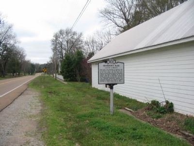
From here, Col. Benjamin H. Grierson's task force (6th Ill., 7th Ill., 2nd Ind. Cav., Btry "K", 1st Ill. Art.) raided into the deep south. Using as advanced guard Federals in Confederate uniform and other stratagems, he cut the Mobile & Ohio RR at . . . — — Map (db m19303) HM
The "Queen of the Confederacy" was born here January 11, 1832. In 1858 she married Francis Pickens, United States Ambassador to Russia and later Governor of South Carolina. During the Civil War, Lucy was the only woman honored by having her portrait . . . — — Map (db m37274) HM
This Protestant Episcopal Church was first established as a mission in 1832, consecrated in 1843. Rev. Samuel George Litton was its missionary and first rector. It was established by the efforts of Mrs. Mary Hayes Gloster a widow from Warrenton, . . . — — Map (db m62006) HM
Settled in 1819 on the site of an Indian trading post, it was named for General La Fayette's ancestral home in France. He visited La Grange in 1824 and called it the "Beautiful Village." Its location on a bluff made it a natural military post; . . . — — Map (db m62007) HM
Federal forces occupied LaGrange during the war, 1862-1865, and made it an important supply base. Gen. William T. Sherman established his headquarters here when the occupation began in 1862. In April 1863, Union Col. Benjamin H. Grierson left here . . . — — Map (db m51816) HM
This house was the birthplace of Lucy P. Holcombe Pickens (June 11, 1832 - Aug. 8, 1899), a noted beauty of ante-bellum days and the most famous person born in La Grange. Mrs. Pickens is the only woman whose likeness has appeared on American . . . — — Map (db m37276) HM
About a mile south was the burial site in 1854 of Mrs. Mary Hayes Willis Gloster, founder of Immanuel, the first Episcopal church to be consecrated in West TN; her daughter Elizabeth Willis Gloster Anderson in 1873; her son-in-law John Anderson in . . . — — Map (db m19300) HM
This house was built in 1828 by Major Charles Michie, a veteran of the War of 1812. During the War between the States it was for a time headquarters for Maj. Gen. William Tecumseh Sherman of the Federal Army. It was also several times occupied by . . . — — Map (db m19299) HM
Named for Cypress Creek and at other times called Davis for the pioneer Davis family, ancestors of the Emerson family of Somerville, this church stood in the Center Point community on land owned now (1996) by James H. Shelton, great-great-grandson . . . — — Map (db m55399) HM
By late in 1863, the Union army occupying West Tennessee strongly defended the Memphis and Charleston Railroad, which ran eastward from Memphis through Moscow. Federal infantry, including the U.S. Colored Troops of the 2nd West Tennessee . . . — — Map (db m37273) HM
Battle of Moscow December 4, 1863Three thousand Confederate cavalry with artillery, led by Gen. James Chalmers, attacked the Memphis & Charleston Railroad bridge over Wolf River and ambushed Col. Edward Hatch's brigade of Union cavalry crossing . . . — — Map (db m81524) HM
Oakland
Presbyterian Church
has been placed on the
National Register
of Historic Places
by the United States
Department of the Interior
Organized 1888 — — Map (db m179105) HM
Born in Rossville on January 12, 1904, Fred McDowell was one of America's eminent blues artists. His work, rooted in the Delta blues tradition, won him international fame. Of his unique bottleneck guitar style he said: "I make the guitar say what I . . . — — Map (db m19310) HM
(side 1)
On December 27, 1863 Lafayette Station (now known as Rossville) saw the culmination of an incredible month in West Tennessee history. It began with a Presidential order giving General Bedford Forrest an independent command. The . . . — — Map (db m148502) HM
Fayette County was organized the first Monday in December, 1824, in the home of Robert G. Thornton, ten miles S. East on North fork of Wolf River. It was made a part of the district which David Crockett then represented in the state legislature. — — Map (db m33856) HM
A number of black Fayette County sharecroppers who participated in a voter registration drive were evicted from their lands in 1959-60. Many of them moved to "Tent City", also called "Freedom Village", where they lived in military surplus tents . . . — — Map (db m122255) HM
The Arlington Cemetery Company, formed in 1909, bought 4.7 acres of land on this site. Owners were: R.D. Cole, S.Y. Wilson, H.S. Griffin, W.A. Taylor, F.S. Bragg, and A.H. Murray. In time, this company ceased to function. the Arlington Cemetery . . . — — Map (db m76903) HM
The Town's first post office building was located in the row of businesses facing the railroad tracks in the area of town currently known as Depot Square. The first Postmaster, Danial Kerman,was appointed in 1866. Even though the Town was called . . . — — Map (db m85897) HM
Early pioneers settled in the Arlington area around 1830. A depot, called Withe Station, was established in 1856. The land was given by General Samuel Jackson Hays. In 1872 his land holdings were sold at public auction and the community became . . . — — Map (db m148512) HM
Dedicated
to the
sons and daughters
of Arlington
who gave their lives
in service of their
country
and all those
who served in defense
of this country
for our
liberty and freedom
World War II
Sam Wells
Logan . . . — — Map (db m148515) WM
The blacksmith shop played an integral role in the community in it's early days. He made and repaired farming tools and equipment, wagons and their parts, horseshoes, and household items. The community's first blacksmith was Perkins White, who . . . — — Map (db m85676) HM
The Harrell Farm Log Cabin is estimated to date back to the mid-1800's and served as the cook's residence at the Harrell Farm. The Harrell farm was located along Harrell Road, in both Shelby and Fayette Counties, and the log cabin was located near . . . — — Map (db m85812) HM
The land currently known as Arlington originally belonged to the Chickasaw Indians. In 1818, a Treaty with the Chickasaw ceded this land, along with other land in West Tennessee, to the United States. On November 24, 1819, Shelby County was . . . — — Map (db m179116) HM
In January of 1884, the Memphis District High School opened its doors on this site. Built by the Memphis Conference of Methodist Church, the school was acquired by the Shelby County Schools in 1895. In 1912, a new school replaced the original during . . . — — Map (db m76902) HM
In April 1862, Union victories at Shiloh and on the Mississippi River made Confederate control of the river in Tennessee more difficult. Southern soldiers evacuated posts that they could not defend easily, such as Memphis. Capt. James E. . . . — — Map (db m88230) HM
Orion Hill's story began in 1830 when Alexander Donelson arrived with a new wave of settlers and their slaves. Alexander, grandson of John Donelson, co-founder of Nashboro, now Nashville, and a nephew of the 7th president, Andrew Jackson and Rachel . . . — — Map (db m179108) HM
This cemetery, founded in 1853, grew up around the Brunswick Cumberland Presbyterian Church, which has since moved. During the Confederate War, the church building was used as a hospital, and 17 unknown Confederate soldiers who died there are buried . . . — — Map (db m88314) HM
Early pioneers settled in the Arlington area around 1830. A depot, called Withe Station, was established in 1856. The land was given by General Samuel Jackson Hays. In 1872 his land holdings were sold at public auction and the community became . . . — — Map (db m76898) HM
This building was erected around 1890 by the Carnes family, who owned a large farm north of Arlington. Hal Carnes established a grocery.
In 1917 it was sold to Clarence Brockwell & while still running the grocery, he operated it as a skating rink . . . — — Map (db m179118) HM
Wade Bolton and Bolton College
On this site in 1887 upon the Hoboken Plantation was erected the first building of Bolton College, established under the provisions of the will of Wade H. Bolton, prominent landowner, killed in 1869 by a former . . . — — Map (db m148523) HM
Gray's Creek Baptist Church. This church is Shelby County's oldest African American congregation. It was founded by two free men of color, preachers Simon Price and Joseph "Free Joe" Harris, and numerous slaves, right after its former . . . — — Map (db m148239) HM
Just to the north is the site of an old inn used by stagecoach and other travelers between Memphis and eastern settlements from 1829 until stagecoach travel ceased. It was dismantled in 1926. — — Map (db m74842) HM
The Town of Arlington welcomes you to Mary Alice Park, formerly the home of Arlington Blending & Packaging Company, a pesticide formulating and packaging facility which operated from 1971 to 1978. In 2005, the Town purchased the land, to be . . . — — Map (db m148517) HM
Davies Manor provides a stunning example of wartime survival. Located just north of the stage route between Memphis and Nashville, the house and surrounding plantation were visited by soldiers from both sides during the Civil War.
When the war . . . — — Map (db m179119) HM
Built near Old Stage Road about 1807, occupied by Logan Early Davies, James Baxter Davies & their descendants for over a century. Named for Zachariah Davies, soldier of the American Revolution. In the path of both armies, 1861-65, it was the scene . . . — — Map (db m148287) HM
Born Frances Ellen Davies, Mrs. Davies-Rodgers was teacher, school administrator, Shelby County Historian for 30 years, genealogist, author of 10 books (focusing mainly on the Brunswick area and Episcopal Church history), philanthropist. church . . . — — Map (db m179133) HM
Born on November 27, 1821 in Robertson County, TN. Gabriel Bartlett grew up on the family farm near Cedar Hill. He came to Shelby County in the mid-1840s as a young man and married Elizabeth Glasgow of Fayette County in 1846. He bought a tract of . . . — — Map (db m179134) HM
Born in Memphis and graduated from Bartlett High School, Singleton was posthumously awarded the Medal of Honor by Congress for heroism during combat in Vietnam. Serving in the 3rd Marine Division, on March 24, 1967, he charged through heavy enemy . . . — — Map (db m179137) HM WM
The former site of Warren's Methodist Chapel and cemetery was sold in 1851 by Joseph and Matilda Warren Locke for $20 to the Methodist Episcopal Church, South. At this time it became known as Pisgah. The earliest known burial was Sarah C. Bond, . . . — — Map (db m85584) HM
Front
On Christmas Eve 1949, parishioner John Maher buried a statue of the Infant Jesus of Prague on this site and hopeful Catholics from the area began fund-raising efforts to build the first Catholic church in Bartlett. Within one year . . . — — Map (db m88647) HM
A toll road of 1829 became Stage Road, Bartlett's main street. In 1856 the town was called Union Depot. Incorporated in 1866 and named Bartlett for Major Gabriel Matson Bartlett. Shelby County Courts were held here from 1870-1885. In 1885 Bartlett . . . — — Map (db m7543) HM
Nicholas Gotten a native of Spangdahlen, Germany, immigrated to America at the age of 22: worked in the north before coming to Tennessee: established himself as a blacksmith in Union Depot (Bartlett) in 1860: enlisted in the Confederate Army (Co. C. . . . — — Map (db m6943) HM
Collierville's location on the Memphis and Charleston Railroad made it strategically important throughout the Civil War. Frequently occupied by Union forces, the town found itself in the gun sights of Confederate cavalrymen intent on severing . . . — — Map (db m37267) HM
(Side one):
On Oct. 11, 1863, Gen. James R. Chalmers, with a force of about 3000 Confederate cavalrymen, consisting of the 7th TN, 13th TN, 18th MS, 2nd MO, 2nd AR, and 3rd MS, approached Collierville from the south along Mt. Pleasant Road. . . . — — Map (db m63137) HM
Early in November 1863, Union Gen. William T. Sherman was moving east to relieve the Union army at Chattanooga. Confederate Gen. Joseph E. Johnston ordered Gen. James R. Chalmers to "harass [Sherman's] rear and break the railroad behind him." . . . — — Map (db m37269) HM
For the citizens of the State of Tennessee during the early 1860's, the violence and bloodshed of combat were not faraway abstractions, nor were they empty statistics in a textbook. The soldiers who fought and died were not anonymous heroes, . . . — — Map (db m200760) HM
The Collierville Christian Church (Disciples of Christ) was originally founded in Fayette County near the close of the Civil War. Construction began at the present location in 1873. Renovations to the building were made in 1906, and again in the . . . — — Map (db m63135) HM
This land, which was actually in Mississippi until 1838, originally belonged to the Chickasaws. This area has served as a central hub for education in Collierville since 1873, when Bellevue Female College constructed a two story wooden building . . . — — Map (db m76812) HM
One of two sanctuaries of Collierville United Methodist Church, the Sanctuary on the Square was built in 1900 by the Methodist Episcopal Church South congregation. The Methodists were the first to erect a church in the community and from . . . — — Map (db m82673)
Collierville, first known as Oak Grove, was founded in about 1835 and was named for Jesse R. Collier. The county’s second oldest town was near Mt. Pleasant Rd. and Hwy. 57 on land of Adams, Floyd, Hodge, Collier and the Tharp Grant. In 1837, the . . . — — Map (db m63134) HM
In Honor of
Collierville Area Veterans
Dedicated by
Collierville VFW Post 5066
Mickey Locke - Commander
Jim Inman - Quartermaster
— — Map (db m149076) WM
To those who gave so much to their cause during the great conflict. Brave men lie beneath this ground; some in mass graves near the battlefields where they fell, some in lonely unmarked graves, and some in untended cemeteries across the south. The . . . — — Map (db m200769) WM
The home of Cecil and Laura Davis Elliott was designed in 1913 by architect Bayard Snowden Cairnes of the Memphis firm Hanker and Cairnes. Cairnes, who was trained at the Ecole des Beaux Arts in Paris, used a unique hexagonal plan that provided a . . . — — Map (db m37266) HM
By August 1836, before Jesse Collier and Horace Barbee had advertised “Collier Town for Sale” in the Memphis Enquirer, the Baptists had located in the Collierville area. Shiloh Church was established on the north side of State Line Road . . . — — Map (db m76816) HM
*Referenced from The War of the Rebellion: A Compilation of the Official Records of the Union and Confederate Armies, Chapter XLII. Chalmers' Raid Series 1, Volume 30, Part II, page 783.
The following is a quote provided by Colonel R. V. . . . — — Map (db m149072) HM
Herman W. Cox, Jr., life long resident of Collierville, was a 1939 graduate of Collierville High School. He served as an elected leader of Collierville, first as alderman in 1959 and Mayor in 1975, retiring in 1999 after serving for 40 years. . . . — — Map (db m149082) HM
In July of 1866, Collierville, like much of the South, was beginning to recover from the ravages of war. Three years earlier, "Mister Collier's Village" consisting of several homes and a general store a few hundred yards east of the square on Mt. . . . — — Map (db m149075) HM
McGinnis Park is dedicated to the memory of Wiley Washington McGinnis (1875 1959), who
first landscaped Collierville Square. The park and streets of the 443 acre Schilling Farms development are named for individuals who contributed to the rich . . . — — Map (db m149054) HM
The Federal troops quickly understood the importance of taking control of railroads and by May 1862 the US Government held the Memphis & Charleston Railroad with few exceptions until the end of the Civil War. Note that there were up to 15,000 Union . . . — — Map (db m149079) HM
In 1844 Salem Presbyterian Church was established in southeast Shelby County. It remained there until 1871 and then relocated to Collierville. The name was changed to the Presbyterian Church of Collierville. The Presbyterians met at the Methodist . . . — — Map (db m63131) HM
This is a portion of the ridge where the Confederates faced the occupying Union Forces and General W. T. Sherman in the Battle of Collierville. When you look north toward the railroad and the town square you are standing in the shadows of the . . . — — Map (db m119227) HM WM
The corner stone for Saint Andrew’s Episcopal Church was laid on April 22, 1890. The church was consecrated on May 27, 1891. Anna Holden, the guiding force in the founding of St. Andrew’s, led a group that raised $3,000 to build the church. The . . . — — Map (db m63132) HM
On Sunday October 11, 1863, the Confederate forces of Brigadier General James R. Chalmers, consisting of the 7th, 12th, 13th, and 14th Tennessee Cavalry, the 1st, 3rd, 5th, 12th and 18th Mississippi Cavalry and the 2nd Missouri Cavalry, along . . . — — Map (db m149140) HM
Collierville Railroad Depot
The first railroad depot in Collierville was located in this vicinity adjacent to the Memphis and Charleston Railroad. A letter was discovered in the Mississippi Library Department of Archives and Special . . . — — Map (db m149077) HM
The Original Town Site of Collierville/Colliersville
In this area and to the east, lies the original town site of Collierville. The lands that were destined to become Collierville traveled through many periods of history before a village . . . — — Map (db m149071) HM
(side 1)
On April 15, 1861, eighty men from Collierville organized the Wigfall Grays to oppose President Lincoln’s call for volunteers to invade the South. The company was named in honor of Senator Louis T. Wigfall who was well known for . . . — — Map (db m82843) HM
Herbert Thomas Brooks served in community leadership roles for over 50 years. His leadership and vision affected almost every facet of the community and can be seen in the physical beauty of Collierville's landscape as well as the design of the . . . — — Map (db m37271) HM
"The expression of American personality through this war is not to be looked for in the great campaign and the battle-fights. It is to be looked for… in the hospitals, among the wounded.” ~ Walt Whitman notebook entry
During the Civil War . . . — — Map (db m149073) HM
Dr. Greene Fort Pinkston, who practiced medicine for more than 58 years in the Cordova area, was born in Scott County, Mississippi, in 1875. His parents were Ritton and Fannie Gresham Pinkston. At age 24 he left home to attend Meharry Medical School . . . — — Map (db m118383) HM
The land that is now Bedford Plantation subdivision was once part of 640 acres owned by Julian Bedford (1825-1879), and Virginia R. Kenney
Bedford (1830-1916), who settled in 1851 at what was
to be known as the Bailey Station community.
They . . . — — Map (db m149053) HM
Although in 1860, Germantown numbered fewer than 300 people, almost every able-bodied man—85 of them—enlisted in the Confederate Army in 1861. They formed the Shelby Grays and were designated Co. A, 4th Tennessee Infantry. The regiment, . . . — — Map (db m162731) HM
This is the only Germantown church to survive the war, while the town suffered because of its strategic location on the Memphis & Charlestown Railroad. Many male members of the congregation joined the 4th Tennessee Infantry (CSA), while others . . . — — Map (db m121840) HM
In 1825, Scottish-born Frances Wright purchased 1,940 acres of land on this site to establish a utopian colony called Nashoba, an experiment to end slavery. General Lafayette, the French Revolutionary War hero, her host on her voyage to America and . . . — — Map (db m200775) HM
Organized circa 1836 as New Hope Baptist Church. Ground given in 1841 by Wilks Brooks, whose family was active in life of the Church for many years. Original building was burned in 1862 when Federal forces had command of community. Present building . . . — — Map (db m162738) HM
Founded by Germantown Methodist Episcopal Church on land bought in 1840 from George P. and Nicey B. Shepherd, early subdividers of the village, this cemetery served the whole community for 125 years. A stone fragment dated 1843 marks the earliest . . . — — Map (db m84552) HM
The Germantown Depot, shown in 1927, was constructed in 1858. It served as a passenger station between Memphis and Williston, Tennessee. The depot was also a shipping center and a floral distribution point. The depot burned in 1947 and was rebuilt . . . — — Map (db m200824) HM
New Hope Church was first organized in 1838 by Martin Hodges, licensed preacher. Wilks Brooks, a neighbor and church member, donated this land December 11, 1841, so the church could erect its first sanctuary.
On the 30th of that month, when the . . . — — Map (db m289150) HM
The City began in 1833 as the hamlet of Pea Ridge, was renamed Germantown in 1836 and incorporated in 1841. The City of Germantown now includes the site of historic Nashoba Plantation. Union troops occupied the town during the Civil War. Yellow . . . — — Map (db m74837) HM
The office of Dr. John Grundy Seay and Glenn's Grocery were side by side, prior to this site becoming the Germantown Commissary.
Visit www.ghpatn.org to learn more about Germantown history. — — Map (db m200830) HM
One of the oldest surviving brick residences in Shelby County, the John Gray House, built prior to 1851, is a rare example of a Federal Period hall and parlor plan, middle-class farmhouse. Originally located in Morning Sun, near Eads, it was moved . . . — — Map (db m83728) HM
Land near the present church site was provided to New Bethel Missionary Baptist Church by Mrs. Florida Thompson, a member of a prominent white family of Germantown. The land was made available for a church structure, known then as a brush arbor, . . . — — Map (db m143164) HM
During the Civil War, the railroad in front of you was the Memphis & Charleston Railroad. Union forces occupied the area soon after the April 1862 Battle of Shiloh and the capture of Memphis on June 6. they used the railroad to transport troops and . . . — — Map (db m107968) HM
S.A. Oakley established his mercantile and grocery store at the intersection of Germantown Road and Dogwood Road in 1938. Oakley sold hardware, canned goods, feed, kerosene and candy. After Oakley's death in 1941, his son Minor Oakley operated the . . . — — Map (db m200826) HM
A Southern Railway engine making a stop at the Germantown Depot in 1915. Southern Railway operated along these tracks between 1894 and 1990. This Depot served as an office for the Railway Express Agency (REA). It was destroyed by fire in the late . . . — — Map (db m200834) HM
In 1861, Germantown was divided between secessionists and unionists until the news of Fort Sumter and President Abraham Lincoln’s call for volunteers tilted the balance in favor of secession. Germantown women announced on April 26, “We…offer . . . — — Map (db m82844) HM
This was the site of a Civil War earthwork redoubt built by the Union Army as part of a series of forts guarding the Memphis & Charleston Railroad. The fort is thought to have been built in June 1863 by the 49th Illinois Infantry Regiment and used . . . — — Map (db m74839) HM
Dedicated
to those men of the
First Marine Division, FMF
who gave their lives
in the service of
their country
World War II • Korea • Vietnam
Southwest Asia — — Map (db m200770) WM
The house was built in 1854 on Wm. Carter's land. Its 493 acres were subdivided in 1872. In 1918 Fritz Hussy and Mamie Cloyes owned and named 20 acres Oaklawn Garden. Harry and Becky Cloyes established a botanical garden and museum of historic . . . — — Map (db m76905) HM
Chambers Chapel United Methodist Church
Martha Ann Vaughan Chambers donated an acre of land near Chambers Mineral Springs as a site for a Methodist Episcopal Church South on Nov. 6, 1869. Three wooden frame buildings have stood on this . . . — — Map (db m88696) HM
A) American Cutoff Mile
Mile 526.5 AHP
In the flood of 1858, the Mississippi cut through the neck of American Bend, and the abandoned river bed was renamed Lake Lee. The first steamboat to try to navigate the American Cutoff was the . . . — — Map (db m115525) HM
The Mississippi’s southernmost major tributary, the Arkansas, is born from melting snow on the eastern slopes of the Continental Divide near Leadville, Colorado. Its 1,450-mile course drains 160,500 square miles in five states.
Despite . . . — — Map (db m115008) HM
The Mississippi’s southernmost major tributary, the Arkansas, is born from melting snow on the eastern slopes of the Continental Divide near Leadville, Colorado. Its 1,450-mile course drains 160,500 square miles in five states.
Despite dramatic . . . — — Map (db m255067) HM
This was the site of one of the earliest airports in the Memphis area. Named for Lt. Guion Armstrong, a Memphis pilot killed in World War I, it was dedicated Nov. 11, 1926. Charles A. Lindbergh landed here on Oct. 3, 1927 (four months after his . . . — — Map (db m221425) HM
A) Ashbrook Cutoff
Mile 549.0 AHP
Rowdy Bend was the first of four consecutive loops, in this stretch of the river that pilots called the “Greenville Bends.” Rowdy Bend kept getting longer despite efforts to stabilize it, and Ashbrook . . . — — Map (db m115526) HM
692 entries matched your criteria. Entries 101 through 200 are listed above. ⊲ Previous 100 — Next 100 ⊳