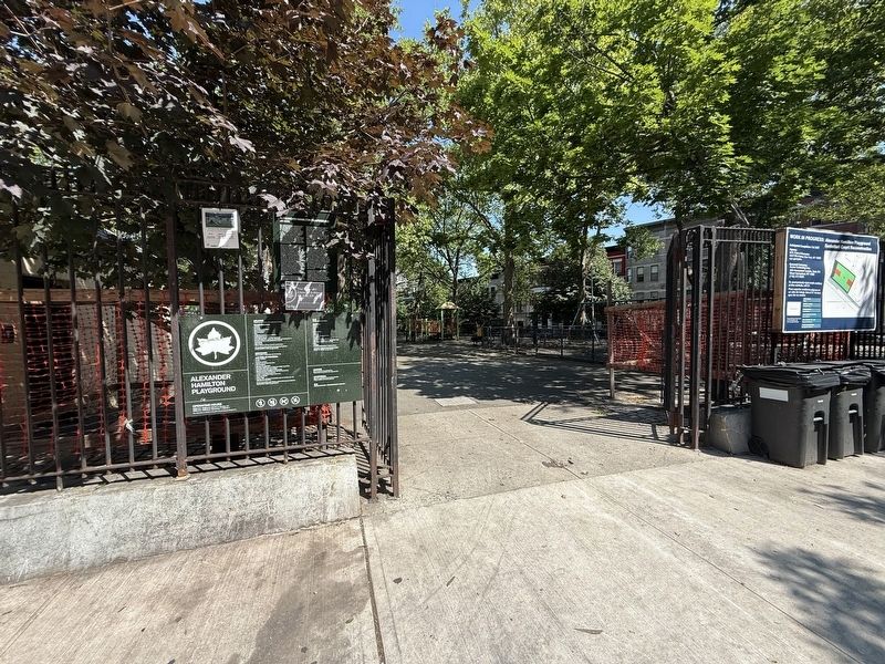
On Hamilton Place south of West 141 Street, on the right when traveling south.
One of the most eminent statesmen of the Colonial Days, Alexander Hamilton (1757-1804) was also the most distinguished resident of the neighborhood that has become known as Harlem Heights. Born in the British West Indies, Hamilton moved to New . . . — — Map (db m310446) HM
On K Street at 19th Street, on the right when traveling east on K Street.
A bisexual poet, journalist, and political activist. Among the first generation born free in the South after the Civil War and a daughter of a slave, she was one of the prominent African Americans involved in the artistic flourishing of the Harlem . . . — — Map (db m171821) HM
Near E Street Southeast at Potomac Avenue Southeast, on the right when traveling east.
Born in Pennsylvania, Alain LeRoy Locke developed a deep passion for education and the literary arts due to the influence of his teacher and mother. At 16, he adopted the first name Alain and graduated from Central High School in Philadelphia. In . . . — — Map (db m266040) HM
Althea Gibson overcame unbelievable odds to achieve international acclaim and success. Her journey from the violent streets of Harlem to the royal courts of Wimbledon reveals strength of character and her remarkable composure in the face of racial . . . — — Map (db m191573) HM
On Willis Avenue Bridge Path north of Dr. Martin Luther King Jr. Boulevard, on the left when traveling north. Reported unreadable.
A swing bridge is a movable bridge that opens for navigation by rotating horizontally about a center pivot pier located in the middle of the waterway. The top section, known as the superstructure, is usually locked in position so that traffic and . . . — — Map (db m209714) HM
On West 155th Street near Frederick Douglass Boulevard, on the left when traveling west. Reported permanently removed.
This basketball court is named in honor of Gregory Marius (1958-2017), founder of the popular Entertainers Basketball Classic at Rucker Park. Born in Harlem on March 18, 1958, Gregory Alexander Marius was a lifelong Harlem resident.
Marius . . . — — Map (db m136578) HM
On Randolph Street, on the right when traveling north.
Historian, activist, and playwright, Beatrice M. Buck made it her life's work to preserve the history and culture of the great Paradise Valley in Detroit, Michigan.
In Detroit's Paradise Valley, individuals, families, businesses, the arts, . . . — — Map (db m209229) HM
On Martin Luther King Jr. Boulevard just east of Belle Avenue, on the right when traveling east.
Here stood the childhood home of Augusta Savage (1892-1962), a gifted sculptor who fought poverty and racism to become a leading figure of the Harlem Renaissance. The seventh of 14 children born to Edward and Cornelia Fells, Augusta taught herself . . . — — Map (db m211859) HM
On Northwest Old Pike Road at Northwest 51st Street, on the right when traveling south on Northwest Old Pike Road.
Old Pike Road is the oldest, most westerly, north-south road in Clay County. Starting at Kawsmouth on the north bank of the Missouri River in Harlem it ran north, skirting on the east an old river scar the settlers called “the slough bank,” until it . . . — — Map (db m252107) HM
On Morningside Avenue just north of West 114th Street, on the right when traveling south.
What was here before?
This area of Morningside Heights was formerly known as Muscoota ("flat place" or "plain") to the Lenape in the Harlem Plain, Vrendendal ("Peaceful Dale") to 17th century Dutch settlers, and Vandewater . . . — — Map (db m242834) HM
On Morningside Avenue south of West 123rd Street, on the right when traveling south.
What was here before?
This area of Morningside Heights was formerly known as Muscoota ("flat place" or "plain") to the Lenape in the Harlem Plain, Vrendendal ("Peaceful Dale") to 17th century Dutch settlers, and Vandewater . . . — — Map (db m241517) HM
On Southeast Main Street at Marigold Street, on the right when traveling north on Southeast Main Street.
In the early 1930s Thelonious Monk's family moved from NC into a small apartment in Manhattan, the city where Monk spent most of the remainder of his life. Largely self-taught, Monk started his musical activities by age six, and at age ten he began . . . — — Map (db m244720) HM
On South Chrisman Avenue near Collins Street, on the left when traveling north.
Side 1
During the segregation era many towns in Mississippi had a particular street that served as the center of African American business and social life, catering not only to townsfolk but to farm hands and sharecroppers from the countryside . . . — — Map (db m170498) HM
On University Avenue south of West 170th Street when traveling north.
What was here before?
In 1671, Governor Francis Lovelace (1621-1675) granted 1,250 acres, including this site, which extended from the Bronx River to the Harlem River, to John Archer (1630-1684). The land was farmed by early settlers such . . . — — Map (db m283182) HM
On Edgecombe Avenue at West 136th Street, on the left when traveling north on Edgecombe Avenue.
Dorrance Brooks (d. 1918) was an African American soldier who died in France shortly before the end of World War I. A native of Harlem and the son of a Civil War veteran, Brooks was a Private First Class in the 15th Infantry. In World War I, . . . — — Map (db m210008) HM
On West 128th Street just east of Malcolm X Boulevard/Lenox Avenue when traveling west.
A revolutionary, nationwide movement in the history of urban open-space design of parks and recreational areas began in 1965 in an unlikely location: an empty lot at 65 West 128th Street in Central Harlem. The urban unrest of the early 1960s led . . . — — Map (db m210044) HM
On Edgecombe Avenue at 155th Street, on the right when traveling south on Edgecombe Avenue.
What was here before?
The neighborhood of Sugar Hill is a part of Harlem that became home to many leading members of African American society during the first half of the 20th century. In 2009, NYC Parks named this triangular lawn at the . . . — — Map (db m278421) HM
On Morningside Avenue at Dr. Martin Luther King Jr. Boulevard, on the right when traveling south on Morningside Avenue.
Acquired and dedicated in 1941, this park is named for Franklin Delano Roosevelt (1882-1945), the 32nd President of the United States, who led the country through the Great Depression and World War II. Like his distant cousin Theodore Roosevelt . . . — — Map (db m241510) HM
On Willis Avenue Bridge Path north of East 126th Street, on the left when traveling north. Reported unreadable.
The Harlem River separates the Bronx from Manhattan, and crossing it has always presented a challenge. By 1667 small boats were ferrying people and goods across the river near here, but it was to the north and west near [unreadable] Street . . . — — Map (db m209697) HM
On Harden Street, on the right when traveling south.
Carver Theatre, built about 1941, was one of Columbia’s two exclusively African-American theatres during the segregation era of the mid-20th century. It was run by black operators but owned by the white-owned Dixie Amusement Company for most of its . . . — — Map (db m53952) HM
On "S" Street Northwest at 14th Street Northwest when traveling west on "S" Street Northwest.
Dedicated to the Whitman-Walker Clinic and the many health care workers who served the LGBT community in this building from 1987 - 2008, the early days of the HIV/AIDS pandemic. — — Map (db m202432) HM
The Civil War
Dred Scott (1795-1858) was born into slavery in Virginia and relocated with the family when it moved to St. Louis in 1830. In 1846, he sued to gain his freedom. After 11 years, in a landmark decision, he was denied his freedom . . . — — Map (db m261475) HM
On U.S. 6 at South Lake Boulevard, on the right when traveling west on U.S. 6.
The railroad came to Mahopac in 1871 and the first station was built in 1880. By 1930 Route 6 construction moved it to Bucks Hollow Road, used until 1969.
Mahopac American Legion Post 1080 2001 — — Map (db m22590) HM
On Central Avenue at 42nd Street, on the right when traveling south on Central Avenue.
The Down Beat was part of what was known during the War years as “Little Harlem”. It was a popular destination for Hollywood celebrities and the upper-class residents of Beverly Hills. Buddy Collete created his Stars of Swing in 1946 at the Down . . . — — Map (db m51234) HM
On R Street Northwest west of 13th Street Northwest, on the left when traveling west.
Alain Locke (1886-1954), a leading 20th-century intellectual and the nation's first black Rhodes Scholar, was a central figure in the New Negro (sometimes called the Harlem) Renaissance. Locke edited The New Negro (1925), an anthology of . . . — — Map (db m110915) HM
On R Street Northwest just east of 14th Street Northwest, on the right when traveling west.
James Lesesne Wells (1902-1993) was an influential artist known for his innovative Linocuts, Wood Engravins, and Color Aquatints. He was active in the Harlem Renaissance before moving to Washington in 1929, and to this house soon after. Wells was a . . . — — Map (db m187425) HM
On North Copeland Street at West Carolina Street, on the left when traveling north on North Copeland Street.
Copeland Street had its share of homes and businesses in the Frenchtown enclave. The most frequented business was Mitchell's Funeral Home, which later became Strong and Jones Funeral Home. The most infamous spot was Malones Bar and Grill, where . . . — — Map (db m229440) HM
On Hine Street west of Limestone Street, on the right when traveling east.
William "Bill" Garrett (1929-1974) was on the Shelbyville, IN High School basketball team when they won the 1947 state championship and was named Indiana's Mr. Basketball. He attended IUB 1947-1951; was the first African-American basketball player . . . — — Map (db m132728) HM
A major figure in the Harlem Renaissance, artist Aaron Douglas was called the "Father of African-American art." Douglas founded the art department at Fisk University in Nashville, Tennessee. Known for his two-dimensional, black and white abstract . . . — — Map (db m200412) HM
Alto saxophonist Charles "Yardbird" Parker was born August 29, 1920 in Kansas City, Kansas. He started playing the saxophone at age 11. From 1935 to 1939 he played in competitive Kansas City bands developing his own expressive style. In Harlem, he . . . — — Map (db m201580) HM
At age eight, Frank Marshall Davis discovered the blues. The music affirmed and sustained him, and helped him translate his experience. After attending Kansas State University, Davis wrote major collections of poetry including I Am the American . . . — — Map (db m200524) HM
As a youngster, she played basketball on neighborhood courts. In college she played for the University of Kansas Jayhawks, and was a four time All American. During the 1984 Olympics in Los Angeles, Woodard helped the team bring home the Gold Medal. . . . — — Map (db m202122) HM
Clarence and Parren Mitchell grew up in Harlem Park, and fought for equality well beyond their West Baltimore neighborhood. In 1933, Clarence reported on an Eastern Shore lynching for The Afro-American newspaper. He came home transformed into an . . . — — Map (db m101456) HM
Tomb of William Richardson Patriot Col. of the Flying Camp of the Maryland Line Hero of battles of Long Island and Harlem Heights 1776 — — Map (db m79312) HM
On West 137th Street at St. Nicholas Avenue, on the left when traveling west on West 137th Street.
What was here before?
After being home to the Lenape for thousands of years, Harlem was settled by Dutch farmers in the late 1600s. The neighborhood's agricultural yield began to wane after the American Revolution and many residents moved . . . — — Map (db m210007) HM
On West 136th Street at St. Nicholas Avenue, on the left when traveling east on West 136th Street.
The Dorrance Brooks Square Historic District, designated in 2021, is significant for its association with notable and pioneering African American individuals, institutions, and organizations during the Harlem Renaissance in the fields of politics, . . . — — Map (db m210009) HM
On 5th Avenue south of West 135th Street, on the right when traveling south.
In 1932, Dr. Godfrey Nurse was selected to be the first Black Presidential elector by the Democratic Party. The founder of Harlem's Godfrey Nurse Research Laboratory, Dr. Nurse was a generous philanthropist, community activist and one of the driving . . . — — Map (db m210028) HM
On West 135th Street at Lenox Terrace Place, on the right when traveling west on West 135th Street.
What was here before?
This property was part of farmer John Meyer's 108-acre estate. He purchased the property in 1825 and built his home at present-day Eighth Avenue and West 133rd Street in 1835, which remained until 1897. The property . . . — — Map (db m241557) HM
This path marks the route of the Kingsbridge Road, also known as the Eastern Post Road. This was the main road through Manhattan in the 1700s and early 1800s, before the current street grid was implemented, and was key to transportation in the . . . — — Map (db m96070) HM
On East 105th Street west of 3rd Avenue, on the right when traveling west.
What was here before?
The area, which became known as East Harlem, was rural for most of the 19th century. The construction of the elevated transit line to Harlem in 1879-1880, and the extension of the Interborough Rapid Transit line in . . . — — Map (db m242861) HM
Willi Smith was inspired, he said, not by Paris but by Sunday church in Harlem. His WilliWear line, founded in 1976, was characterized by loose silhouettes in brightly colored fabrics. Exuberant and witty, his clothes were sophisticated, yet . . . — — Map (db m148101) HM
Near Broadway at West 204th Street, on the right when traveling west.
After the Battle of Harlem Heights in 1776, this farm was used by the British as a Hessian camp. A Hessian hut has been constructed at this site. — — Map (db m278370) HM
Near Broadway (U.S. 9) at 204th Street, on the left when traveling north.
The Dyckman Farm and the War By the late 18th century, the Dyckman family owned approximately 250 acres, one of the largest farms in northern Manhattan. Their original home was located at the Harlem River, north of present day 207th Street. . . . — — Map (db m237088) HM
On Zene Street at East Winder Street, on the right when traveling north on Zene Street.
Born: September 28, 1938, Henderson, NC
Died: April 30, 2015, Hackensack, NJ
Ben E. King left North Carolina with his family for Harlem in 1947 and started work in his father's restaurants as a teenager. His remarkable ability to sing . . . — — Map (db m250914) HM
A prominent African American journalist, as editor at Billboard magazine, Jackson promoted black theater during the 1920s Harlem Renaissance. He later fostered African American business activities for the US Dept. of Commerce. He was born and raised . . . — — Map (db m91073) HM
On North Broad Street just south of Callowhill Street.
The South Philadelphia Hebrew Association was a dominant professional team from 1918 to 1959, winning 12 league championships. During its heyday in the 1930s, the team was all Jewish. Owner/coach Eddie Gottlieb was a seminal figure in the . . . — — Map (db m83489) HM
On North 59th Street at West Oxford Street on North 59th Street.
A legendary basketball player, born in Philadelphia. Earned national attention at Overbrook High School and at the University of Kansas. Played professionally for the Harlem Globetrotters, Philadelphia Warriors and 76ers, and Los Angeles Lakers, . . . — — Map (db m82077) HM
This neo-Gothic structure first served as the Erastus M. Cravath Memorial Library. Named for Cravath, the university's first president (1875-1900), it was designed by Nashville architect Henry Hibbs and built in 1929-30. The interior walls depict . . . — — Map (db m4502) HM
On Dr DB Todd Jr Blvd at Morena Street, on the left when traveling north on Dr DB Todd Jr Blvd.
At this site lived Arna W. Bontemps, one of the most prolific contributors to the Harlem or Negro Renaissance. From 1943 to 1965, Bontemps, an award-winning poet, playwright, novelist, biographer, historian, editor, and author of children's books, . . . — — Map (db m4959) HM
On M. L. King Boulevard (Tennessee Route 2) near Lindsey Street, on the left when traveling west.
For sixty-one years the Martin Hotel was located at this site. Established in 1924 by Robert Martin with 50 rooms it became the largest African-American hotel in the South. Many celebrities and entertainers such as: Ella Fitzgerald, The Ink Spots, . . . — — Map (db m15648) HM
Near Pierce Street just south of 13th Street, on the right when traveling south.
Virginia's premier Black lyric poet who was a central figure in the cultural movement known as the Harlem Renaissance, Anne Spencer gained national respect through her dedication to her writing and to the cause of cultural enlightenment for Black . . . — — Map (db m179851) HM
On Pierce Street south of 13th Street, on the right when traveling south.
This was the home of Edward Alexander and Anne Bannister Spencer from 1903 until her death on July 25, 1975. Born on February 6, 1882, in Henry County, Va. Anne Spencer was to receive national and international recognition as a poet. Published . . . — — Map (db m74009) HM
Near Atlantic Avenue just south of 14th Street, on the right when traveling south.
The First Lady of Jazz possessed superlative musicianship and skill in scat singing (improvisational vocals). After being discovered at age 16 in a Harlem talent show, Fitzgerald performed throughout America, Europe and Asia and on milestone . . . — — Map (db m165911) HM
Near Spottswood Poles Drive west of Bridgeforth Drive when traveling west.
A standout on both the baseball field and the battlefield, Spottswood ‘Spots’ Poles was born in Winchester, Virginia in December 1887 (per his grave marker). He was an accomplished outfielder in the American Negro League during the period of . . . — — Map (db m144545) HM
On Castro Street near Market Street, on the left when traveling north.
Eloquent novelist, essayist, poet, social critic, civil rights leader and passionate advocate for racial equality and human rights for gays. — — Map (db m99818) HM
On Lake Street at Maple Avenue, on the right when traveling east on Lake Street.
On this site in 1835, Joseph Kettlestrings and his
wife, Betty, first settlers of Oak Park, built their
cabin amid the oaks on "the only dry land between
Chicago and the Aux Plaines.” It later became an inn
called The Oak Ridge House, and was . . . — — Map (db m188769) HM
On Dr DB Todd Jr Boulevard near Hermosa Street, on the right when traveling south.
This Dutch Colonial house was built in 1931 for James Weldon Johnson. He served as U.S. Consul to Venezuela and Nicaragua, editor of the New York Age, and field secretary of the NAACP. Johnson's poem, "Lift Every Voice and Sing," set to music by his . . . — — Map (db m4520) HM
On Pierce Street at 15th Street, on the right when traveling north on Pierce Street.
During the 1940's through early 1960's Dr. R. Walter Johnson trained aspiring, black, tennis hopefuls on this site. Among these were Althea Gibson & Arthur Ashe. — — Map (db m74035) HM
On Dorothy West Avenue at Myrtle Avenue, on the right when traveling west on Dorothy West Avenue.
African American Heritage Trail of Martha's Vineyard The Powell House "Keep the faith, baby" Adam Clayton Powell, Jr.
1908 - 1972 This, the summer home of Adam Clayton Powell, Jr. from 1937 to 1944, and of Isabel Washington Powell from . . . — — Map (db m177813) HM
On East 4th Street north of Show Park Road, on the left when traveling north.
Revolutionary War (1775-1783)
Over 5,000 African Americans served in the Continental Army during the Revolutionary War. About half of the Rhode Island regiment consisted of free blacks and escaped slaves. In February 1783, . . . — — Map (db m86080) HM
On East 55th Street near Harlem Avenue, on the right when traveling south. Reported missing.
Garrett Augustus Morgan was an African American businessman and prolific inventor of devices that made people's lives safer and more convenient. Born on March 4, 1877 in Claysville, the Black segregated section of Paris, Kentucky, Morgan migrated . . . — — Map (db m17895) HM
On Rue Notre-Dame Ouest east of Atwater Avenue, on the left when traveling east.
L’Universal Negro Improvement Association (UNIA)
Fondée en 1914 par le Jamaïcain Marcus Garvey, cette association fait partie d'un mouvement mondial visant à unir les gens d'ascendance africaine et à leur donner des moyens . . . — — Map (db m294739) HM
On Elm Street Northwest at 4th Street Northwest, on the right when traveling west on Elm Street Northwest.
Poet May Miller once remarked that unlike New York's Harlem, LeDroit Park “didn't have to have a renaissance.” In fact, before they joined the cultural movement of the 1920s and '30s, most Harlem Renaissance intellectuals spent time at Howard . . . — — Map (db m130838) HM
On Mount Desert Street (Maine Route 3) at Ledgelawn Avenue, on the right when traveling east on Mount Desert Street.
The Holy Redeemer Catholic Church was built in 1907 at a cost of $44,000 contributed almost entirely by the maids and workmen of the town. The church has its own patron, Saint Katharine Mary Drexel, canonized in 2000 during a . . . — — Map (db m184669) HM
Near Exterior Street north of East 150th Street, on the left when traveling north.
The Bronx Terminal Market's road, rail, and water links brought vast amounts of food into New York City.
Delivery Trucks at the Market
Trucks were a constant fixture at the Bronx Terminal Market. The long rows of narrow stores . . . — — Map (db m241555) HM
In 1845, Lemuel Pomeroy II, a prominent gun manufacturer from Pittsfield, Massachusetts, and his sons, established the Copake Iron Works here at the western edge of the Litchfield Iron District. The site offered all the resources essential for iron . . . — — Map (db m135768) HM
On Harlem Valley Rail Trail south of New York State Route 344, on the right when traveling south.
A train depot appears on maps as early
as 1858. It was likely built when the
New York and Harlem Railroad built its
tracks through here in 1852. The building
stands today adjacent to the Harlem Valley
Rail Trail. In this c. 1900 image, the . . . — — Map (db m230386) HM
On Main Street at Church Street, on the right when traveling west on Main Street.
The Old Croton Aqueduct is a brick and stone conduit, built between 1837 and 1842, to carry water from the Croton River into New York City. Since it is a gravity flow system, a gradual decline had to be maintained throughout the Aqueduct's . . . — — Map (db m193184) HM
On East Swamp Road (Route 313) just east of N. Main Street, on the right when traveling east.
Preeminent 20th century photographer. Siskind’s influential images of Bucks County architecture from 1939 to 1945 brought about a change from documentary style to a radical abstract style, setting a new standard in American art photography. — — Map (db m49809) HM
On 13th Street Northwest north of S Street Northwest, on the right when traveling north.
Edward Kennedy “Duke” Ellington (1899—1974), the internationally renowned composer and musician born in Washington, DC, spend part of his youth here at 1805 13th Street, NW (1910—1914). During those formative years he studied classical piano as well . . . — — Map (db m79980) HM
On Hancock Street at East Jefferson Street, in the median on Hancock Street.
Oliver Norvell Hardy, of the comedy team Laurel and Hardy, lived in the Turnell-Butler Hotel which once stood on this corner. He was born in Harlem, Georgia, on January 18, 1892. The family was in Madison by that February, and may have moved here . . . — — Map (db m15372) HM
On Laney Walker Boulevard west of 10th Street, on the right when traveling west.
Rev. Charles T. Walker was born into slavery in 1858 near Hepzibah, later moving to Augusta to study divinity at The Augusta Institute (now Morehouse College). Walker received his ordination at Franklin Covenant Baptist Church and established . . . — — Map (db m200124) HM
Near Roosevelt Road (Illinois Route 38) west of East Avenue, on the right when traveling east.
Special thanks to The Berwyn Public Library, Berwyn Historical Society, and our FitzGerald's fam for helping pull this together!
1919 • Sanborn Fire Insurance Map
First KNOWN appearance of the clubs. Still searching for the original . . . — — Map (db m272029) HM
On South Michigan Avenue at Cullerton Aveue on South Michigan Avenue.
The seeds of the Second Presbyterian Church originated on the banks of the Chicago River under the pastoral guidance of Rev. Jeremiah Porter, in 1833. In 1835, the church was formally incorporated as the First Presbyterian Church and Society of . . . — — Map (db m267801) HM
On Oscar Cross Avenue east of South 8th Street, on the right when traveling east.
This hotel and the nearby Purple Room were popular stops for leading African American performers and musicians touring the South during the mid-20th cen. on what was called the "Chitlin' Circuit." Other notable guests included civil rights . . . — — Map (db m303098) HM
On Harmony Road (Maryland Route 16) at Wilkins Branch Road, on the left when traveling north on Harmony Road.
Member Maryland Assembly 1773–76. Introduced bill forming Caroline County 1774 of which he was one of the Commissioners. Colonel of the “Flying Camp” of the Eastern Shore 1776. Fought at Harlem Heights. First Colonel 5th Maryland Regiment. Moved . . . — — Map (db m107815) HM
On West Wiygul Street at South Gaither Street, on the left when traveling west on West Wiygul Street.
Front
Jazz bandleader and saxophonist James Melvin “Jimmie” Lunceford was born just outside Fulton on June 6, 1902. He formed his first band, the Chickasaw Syncopators, while teaching at Manassas High School in Memphis in 1927, and by . . . — — Map (db m96781) HM
On Delmar Boulevard east of Westgate Avenue, on the right when traveling east.
Robert Gibson, once a Harlem Globetrotter, pitched for the St. Louis Cardinals from 1959 until he retired in 1975. Known for his fastball, he struck out 3,117 batters. In his 1968 MVP season, Bob Gibson pitched 28 complete games and 13 shutouts . . . — — Map (db m124693) HM
On Delmar Boulevard east of Westgate Avenue, on the right when traveling west.
Redd Foxx starred in "Sanford and Son," one of television's most popular comedy series in the 1970s. Born John Elroy Sanford in St. Louis, he left home at age 16 to join a New York street band. Called red for his complexion, he adopted a baseball . . . — — Map (db m124762) HM
Near North Higgins Avenue at West Front Street, on the right when traveling south.
In autumn 1909, Industrial Workers of the World (IWW) organizers Elizabeth Gurley Flynn and Jack Jones arrived in Missoula, soon followed by there comrade Frank Little. After renting space for a union hall, they took to the streets, determined to . . . — — Map (db m123336) HM
On Arctic Avenue at North Kentucky Avenue, on the right when traveling west on Arctic Avenue.
Soundra E. Usry-Hollingsworth worked diligently in many capacities to promote Atlantic City. In the 1960's, she was a dancer with Larry Steele's Smart Affairs at the famed Club Harlem's first Mistress of Ceremonies. She worked in Special Events for . . . — — Map (db m153451) HM
On North Ohio Avenue just west of Gramercy Avenue, on the right when traveling west.
Born in Clinton, North Carolina, Wilbert Royal made Atlantic City his home after receiving his Master's Degree at North Carolina A&T University. Affectionately known as "Huff", he spent many summers in Atlantic City working as a bellhop at Lombardy . . . — — Map (db m190941) HM
Near Exterior Street north of East 150th Street, on the right when traveling south.
The lower Hudson Valley and the Bronx Terminal Market share a rich and colorful past.
Macomb's Dam Across the Harlem River
In 1814, Robert Macomb built a dam and toll bridge across the Harlem River in the vicinity of . . . — — Map (db m241545) HM
On Alexander Avenue at East 138th Street, on the left when traveling north on Alexander Avenue.
This Historic District is named after Jordan L. Mott, owner of the famed iron works on the Harlem River. The four blocks of Alexander Avenue between 137th and 141st Streets were among the earliest sections of The Bronx to be transformed from . . . — — Map (db m271398) HM
On New York Avenue just south of Prospect Place, on the right when traveling south.
Born in Chester, Pennsylvania, and married at the age of 13, Ethel Waters overcame a childhood of abuse and poverty to become a jazz and gospel singer and actress, with a career spanning five decades. Waters toured on the black vaudeville circuit . . . — — Map (db m183119) HM
On Carlton Avenue 0.1 miles north of Willoughby Avenue, on the right when traveling north.
Grandson of slaves and son of a sharecropper who abandoned him, Mississippi-born Wright moved to Chicago n 1927, and ten years later to New York. Here he befriended Ralph Ellison (Invisible Man), and became Harlem editor of the Daily . . . — — Map (db m181661) HM
On West 131st Street just west of Malcolm X Boulevard/Lenox Avenue, on the left when traveling west.
Born in Alabama and raised in Eatonville, Florida, (one of the first self-governing all-Black municipalities in the United States), Zora Neale Hurston was a prolific novelist, playwright, educator, and ethnographer who earned unprecedented acclaim . . . — — Map (db m210014) HM
This blockhouse was part of a line of fortifications extending from the Hudson to the Harlem River built for the defense of New York by it's (sic) patriotic citizens during the War of 1812-1815.
This tablet is erected by the Woman's Auxiliary to . . . — — Map (db m156889) HM WM
On Saint Nicholas Place at West 150th Street, on the right when traveling north on Saint Nicholas Place.
This handsome granite residence was built in 1886-88 by architect Samuel B. Reed, for James A. Bailey. In 1881, Bailey and Phineas T. Barnum founded the famed Barnum and Bailey Circus. This house is a fine example of the Romanesque revival style . . . — — Map (db m302453) HM
On Edgecombe Avenue near West 150th Street, on the right when traveling south.
The Benzinger House was constructed in 1890-91 in a section of Harlem that still resembled a country village. The house was the residence of Agnes Benzinger and her husband Nicholas, a successful publisher, manufacturer and importer of religious . . . — — Map (db m302456) HM
On Saint Nicholas Avenue south of 155th Street, on the right when traveling north.
I've known rivers:
Ancient, dusky rivers.
My soul has grown deep like the rivers.
from The Negro Speaks of Rivers by Langston Hughes (1902-1967), Sugar Hill Resident 1937-41
You are standing on the path . . . — — Map (db m302398) HM
Near Amsterdam Avenue at West 173rd Street, on the right when traveling north.
High Bridge, Manhattan
The Old Croton Aqueduct brought water across the Harlem River via the High Bridge, the most spectacular and technically advanced feature of New York City's first public water supply system. The original bridge, . . . — — Map (db m283178) HM
On Lamont Avenue 0.1 miles east of East 97th Street, on the left when traveling east. Reported missing.
Charles Waddell Chesnutt was born in Cleveland on June 30, 1858 and died November 15, 1932. He has been called "The pioneer of the color line" and was an author, crusader for racial and social justice, humanitarian, and forerunner of the Harlem . . . — — Map (db m255740) HM
On Fancher Road at Schleppi Road, on the right when traveling east on Fancher Road.
Established on land owned by R.J. Kern. Earliest burial appears to be 1900. North and South sections; currently active cemetery. Burial location of many veterans from the Civil War to the present. Cemetery and records maintained by Harlem . . . — — Map (db m297987) HM
On De La Rosa Street at Plaza Avanue, on the right when traveling east on De La Rosa Street.
San Felipe ISD operated a school for African American students for a short time in the 1930s and again from 1945-56. Langston School on de la Rosa street was named for Langston Hughes, notable writer of the Harlem Renaissance. San Felipe ISD . . . — — Map (db m185131) HM
On Lee Street north of Cumberland Street (Virginia Route 113), on the left when traveling north.
Charles S. Johnson, sociologist, author, and civil rights leader, was born in Bristol, son of a 42-year pastor of Lee Street Baptist Church. He attended Virginia Union University and the University of Chicago and served in combat during World War I. . . . — — Map (db m210163) HM
On Perry Street just north of Farmer Street, on the right when traveling north.
Wyatt Tee Walker, pastor of Gillfield Baptist Church from 1953 to 1960, served as the president of the Petersburg branch of the NAACP and as Virginia director of the Congress of Racial Equality. He worked closely with Dr. Martin Luther King Jr. and . . . — — Map (db m180107) HM
On Widewater State Park Road 0.2 miles west of Brent Point Road (County Route 658), on the left when traveling west.
Palmer Hayden, artist, was born Peyton Cole Hedgeman nearby in Widewater. He served in the U.S. Army during World War I and later studied art at Columbia University and Boothbay Harbor, Maine. He achieved prominence as a painter during the Harlem . . . — — Map (db m156487) HM
431 entries matched your criteria. Entries 101 through 200 are listed above. ⊲ Previous 100 — Next 100 ⊳
Thin black lines indicate changes in relevance. Between each pair of lines entries are ordered geographically but all have the same relevance.
* Inflectional forms of words are their plurals, singulars, and possessives as well as gramatical tenses and similar variations.