3684 entries match your criteria. Entries 101 through 200 are listed.⊲ Previous 100 — Next 100 ⊳
Daughters of the American Revolution (DAR) Historical Markers
Markers erected by any chapter of the Daughters of the American Revolution (DAR). DAR is dedicated to historical preservation, accomplished by the efforts of its chapters at the local level. One of the ways they accomplish this is by placing monuments around the world to memorialize people and events throughout American history.
The series also includes other markers that mention DAR where DAR is not the erecting organization, where a DAR marker is nearby, or where an additional photo of a DAR tablet or plaque is included in the page but it does not include enough information to be considered a marker in its own right.
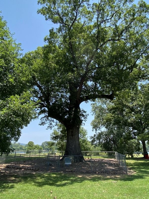
Upon this spot, under the Council Oak, acting Governor Robert Crittenden and Chief Black Fox, tribe spokesman, met in council April, 1820 and made the treaty, which gave to Arkansas all the Cherokee land south of the Arkansas River. — — Map (db m233690) HM
During the 1850s Moses Stinnett and his wife Patsy operated a Stage Coach Station beside the Little Rock Fort Smith Military Road which was located 300 feet East of this
spot. They catered to travelers and in 1858 contracted with Butterfield . . . — — Map (db m198418) HM
One thousand feet due west was a prehistoric mound, 400 feet long, 150 feet wide, and 14 feet high. The remains of 450 Indians with stone implements and shell ornaments were found when the mound was remove in 1908. — — Map (db m79861) HM
This marker designates the area where on March 27, 1772 a scientific team under the auspices of the Empire of Spain stopped on Strawberry Creek to include an observation of is now known as Golden Gate. According to Juan Crespi, diarist, the first . . . — — Map (db m42034) HM
Capt. Don Pedro, Father Fray Juan Crespi, fourteen soldiers, and a Christian Indian, camped here and took a latitude sighting of the Golden Gate.
Agalanes • John Rutledge • Ann Loucks • Mount Diablo • Berkeley Hills • Oakland Campanile • . . . — — Map (db m72138) HM
First brick house built in Alameda County. Constructed 1860 by W. R. Toler for Ignacio Peralta, early San Leandro Spanish settler, whose father, Don Luis Maria Peralta, received land grant from Spanish Governor Don Pablo Vicente de Sola, October 20, . . . — — Map (db m100550) HM
The Oregon School District was formed in 1856 and the schoolhouse stood near Dry Creek behind the old Pence Hotel. In 1872 the schoolhouse was relocated and rebuilt behind the existing corrals south of present day Durhan-Pentz Road. Following the . . . — — Map (db m65869) HM
This marker commemorates the men and women who achieved American independence. These Patriots, believing in the noble cause of liberty, fought valiantly to found a new nation.
1775 - 1783
Presented by Acalanes Chapter Daughters of . . . — — Map (db m246658) WM
This Unit of 500 Acres in the
National Tribute Grove
is preserved through the
National Society
Daughters of the American Revolution
to honor those who served in the armed forces
of the United States in World War II
and to . . . — — Map (db m241927) WM
This historic Carnegie Library was built to serve the small, rural population of the surrounding area. It was dedicated on July 14, 1917, and has been in continuous use as a free public library since that date.
The Willows Chapter . . . — — Map (db m91797) HM
This Memorial Erected
in Honor of Those Who
Served Their Country
in Time of War
By Veteran's Memorial Housing Committee - May 30, 1941 • Representing County Board of Supervisors - Hugh T. Osborne • Representing veterans of the war with . . . — — Map (db m81827) WM
Daughters of the American Revolution commemorate the significant role the
Reyes Adobe historical site played in the development of California and its
history. The property was a stop along the state's famous El Camino Real. — — Map (db m154344) HM
To the memory of Benjamin Davis Wilson, Don Benito, 1811 – 1878, pioneer trapper and settler who came to California in 1841, and in 1864 blazed the trail up this mountain which bears his name. — — Map (db m123037) HM
This grove presented by the
California State Society of the
Daughters of the American Revolution
in honor of
Mrs. John Whittier Howe Hodge,
State Regent 1938-1940,
commemorating the
D.A.R. Society's Fiftieth Anniversary. — — Map (db m291772) HM
This tablet marks the site of a battle between the Indians and the early Californians.
Placed by the Beverly Hills Chapter Daughters of the American Revolution, 1930. — — Map (db m292810) HM
This tablet
commemorates the site of
the oldest Protestant
Evangelical Church
in Southern California;
the erection of the first
school house; and the end
of the Santa Fe Trail. — — Map (db m211471) HM
The Oak of Peace played an important role in the history of California.
It was at this site on January 11, 1847, that the surrender of the
Californios to the United States Army was arranged. Jésus Pico,
emissary of U.S. Lt. Colonel John C. . . . — — Map (db m234878) HM
First historical landmark — Historical Society Museum, original site of 1913 city hall, jail, and fire house — Dedicated May 8, 1990. Bob Kuhn, Mayor, City of Glendora. John Gordon, President, Glendora Historical Society.
Marker . . . — — Map (db m242573) HM
Site of ancient Indian villages.
It was built in 1928 by H.A. Edwards.
It was purchased and enlarged, 1938-1941, by Grace Oliver.
The museum opened in 1941. — — Map (db m152544) HM
Honoring the Indians of Puvungna
who fished these shores long before the reign of the Dons.
U.S.A. Bicentennial year 1975
Susan B. Anthony Chapter NSDAR — — Map (db m132708) HM
Founded in 1797 by Father Fermin Francisco Lasuen.
We honor those men of faith, courage and vision who guided the founding of the mission and also those who have preserved it for posterity. — — Map (db m169607) HM
El Alisal, built by Charles F. Lummis, writer, editor, founder Southwest Museum.
Declared Historic Cultural Monument No. 68 by the Cultural Heritage Board, Municipal Arts Department, City of Los Angeles.
second marker: . . . — — Map (db m163698) HM
Point Fermin Light House, dedicated by Stephen M. White and Rudecinda Parlors Native Sons and Native Daughters of the Golden West, San Pedro, California, May 2, 1940. Built 1874.
Point Fermin Lighthouse, erected 1874. Honored as a . . . — — Map (db m51006) HM
This tablet presented February 9, 1979, to the Veterans Memorial Park, in loving memory of the many veterans, nurses, and aides of the San Fernando Valley Veterans Hospital, whose lives were lost during the earthquake of February 9, 1971. — — Map (db m150941) HM
This marks the oldest building in Southern California of brick, stone and mortar. Built 1791-1805, completed and dedicated.
Mission San Gabriel Archangel, Queen of the Missions, which brought Christianity and civilization to California . . . — — Map (db m50947) HM
In commemoration of the two-hundredth birthday of George Washington, first President of the United States, whose wisdom, foresight, and patriotism are an inspiration to all true Americans. — — Map (db m119721) HM
panel 1:
Under this oak — the legend runs — the first Easter Services in California
were held by Father Crespi in 1770.
panel 2:
Near this spot the Cathedral Oak stood. Time destroyed its roots. This monument is . . . — — Map (db m134912) HM
Paradox Hybrid Walnut Tree
Planted in 1907 as an experiment for the
University of California.
California Registered Historical
Landmark No. 681.
Dedicated 1963
By Whittier area community beautiful
Grand Parlor Native . . . — — Map (db m241036) HM
Indian Warrior
Baptized by Franciscan Fathers.
A Ferryman on the San Francisco Bay,
He Became Known as
El Marinero
(The Sailor)
Died about 1835 — — Map (db m102758) HM
Honoring
Four Early Americans in California
They came to this coast as seamen and remained as settlers
Baptized in this Mission
George Mayo, of Plymouth, Mass., on 3 August, 1816
Thomas W. Doak, of Boston, Mass., on 22 November, 1816 . . . — — Map (db m63684) HM
Forty-eight men of diverse education and cultural backgrounds from throughout California converged upon Monterey in September in 1849 to frame a constitutional government for California. Working together as Californians, they created this . . . — — Map (db m63348) HM
This Circle Commemorates
Commodore John Drake Sloat, U.S.N.
In this City of Monterey
on 7 July 1846
he proclaimed California annexed to the United States
Tablet presented by the Commodore Sloat Chapter
Daughters of the American Revolution
7 . . . — — Map (db m226259) HM
This house was built in 1857 by Mr. Geo. Hansen the promoter of that little colony of Germans who founded what is now the City of Anaheim, and originally stood on N. Los Angeles St. between Chartres & Cypress Sts.
The building was a gift . . . — — Map (db m241957) HM
This boulder marks the site of one of the first public schools in this county.
Built 1867.
First teacher - Jennie Swift.
William M. McFadden taught here 1869 to 1879. — — Map (db m189683) HM
Typical of one room schoolhouse of the 1800's is this one from Beloit, Kansas. Built in 1879, it housed 8 classes at a time from the first through the eighth grades. Schools rarely had more than two rooms in those days, due not only to the limited . . . — — Map (db m103383) HM
This plaque commemorates the 150th anniversary of the visit to this anchoring cove by author Richard Henry Dana. He arrived in 1835 aboard the brig "Pilgrim" which traded New England goods to Mission San Juan Capistrano and area ranchos for cow . . . — — Map (db m267208) HM
The building and artifacts on this site are significant remnants of the history of Saddleback Valley. They serve as reminders that the efforts and accomplishments of those who lived here before us, are the basis of our communities today. — — Map (db m299253) HM
The Atchison, Topeka & Santa Fe Railroad reached Orange in 1887, offering passenger and freight service. This building was their second depot on this site, built in 1938. To the south is the original depot park, laid out in 1891. The railroad . . . — — Map (db m308908) HM
California State Society Daughters of the American Revolution commemorates the birthplace and honors the patriotic service of Richard Nixon Statesman 37th President of the United States of America born January 9, 1913 Mrs. . . . — — Map (db m170610) HM
Erected in 1891 by the volunteer firemen of Auburn Hook and Ladder Company No.2 with funds raised by public subscription. Dedicated May 21, 1892. In continuous use until 1954 — — Map (db m11920) HM
The oldest section of this church, built in 1882-1883, was
Roseville's first ecclesiastical structure.
Dedication ceremonies for the church were held
March 4, 1883. — — Map (db m143585) HM
Pochea was one of cluster of Indian villages forming the very large settlement of Pahsitna which extended along the ridge east and west of Ramona Bowl. Pahsitnah was thriving when the Spanish first passed by in 1774. A tragic story tells of the . . . — — Map (db m50668) HM
Built 1923. Luiseño Chapter, NSDAR.
Dedicated October 14, 2017.
Riverside County Historical Landmark.
Approved by the County of Riverside Board of Supervisors, October 4, 2011.
Presented to the City of Lake Elsinore. . . . — — Map (db m178932) HM
In honor of those who have served in the armed services of the United States from the American Revolution to present and to those who gave their lives in service to protect our freedoms in all military conflicts.
We also pay special tribute . . . — — Map (db m206394) WM
To Commemorate the introduction of the first Marsh Grapefruit Trees into California, brought to Riverside from Lakeland, Florida in 1890 by Twogood and Cutter, pioneer nurserymen, and to honor J.E. Cutter who planted here one of those first . . . — — Map (db m82144) HM
Founded June 24, 1797 by Father Laseun
15th of the 21 Missions largest and only church with 3 aisles. Dedicated in 1812
Monastery wing consisted of 36 rooms
This Mission has never been abandoned. It is now the parish church of San Juan . . . — — Map (db m82242) HM
This marker commemorates the World War II Army Air Corps Pilots who were trained between 1940 and 1944, at this airfield that was the home of the Cal-Aero Flight Academy. — — Map (db m242382) HM WM
"Guachama Rancheria, lying along this road, was named San Bernardino May 20, 1810, by Francisco Dumetz. In 1819 it became the San Bernardino Rancho of Mission San Gabriel. The adobe administration building stood about 70 yds. north of this spot, . . . — — Map (db m51015) HM
In 1895 the Junior Order of American
Mechanics erected the first
Redlands “Liberty Pole” a term
derived from the American
Revolution. Made from a century
old douglas fir, the pole was moved
in 1963 from the intersection of
Orange, Cajon, . . . — — Map (db m269718) HM
N.S.D.A.R. Memorial
to the
Pioneer Mothers
of the
Covered Wagon Days.
This trail, trod by the Padres in Spanish Days,
became, under Mexican rule, the road connecting
Los Angeles, later the American Post Road.
Over this trail, . . . — — Map (db m149065) HM
In 1910, on the unoccupied brushland of North Coronado Island, inventor and entrepreneur Glenn Hammond Curtiss opened his winter flying school for prospective "aeroplane pilots."Among his first class of students was Navy Lieutenant Theodore G. . . . — — Map (db m116835) HM
Founded June 12, 1798 by Father Lasuen, then president of the California missions, and administered by Father Peyri. Notable for its impressive architecture — a composite of Spanish, Moorish, and Mexican. — — Map (db m401) HM
To commemorate the discovery of California by Juan Rodriquez Cabrillo who landed on the shores of San Diego Bay September 28, 1542. — — Map (db m126875) HM
Santa Fe Depot - 1915.
In tribute to the Atcheson, Topeka & Santa Fe Railroad,
Pioneers of The Western Movement.
Placed by
Dist. XIV California State Society
Daughters of the American Revolution,
November 16, 1985. — — Map (db m241972) HM
Mission Founded - July 16, 1769, Mission San Diego de Alcalá was established at the Presidio of San Diego. Services were held outdoors and in available rooms
-Founding Missionary: Father Junipero Serra, O.F.M
1774 Church - The Mission . . . — — Map (db m254265) HM
Dedicated to Juan Bandini
1800 – 1859
Patriot and Friend of the United States
This structure has been recorded by the
Historic American Buildings Survey of the United States Department of the Interior for its archives at the . . . — — Map (db m143529) HM
Dedicated to Lt. George H. Derby U.S.A
1823 — 1861
Humorist, Engineer, and Builder of the first dike to safeguard San Diego Bay as a navigable harbor.
San Diego Chapter D.A.R.
San Diego Chapter S.A.R.
Nov. 3, 1962 — — Map (db m84359) HM
On this spot the American flag was first raised in San Francisco by Commander John B. Montgomery of the U.S.S. Portsmouth, July 9, 1846. — — Map (db m81722) HM
Trees from historic spots
in the thirteen
original states of the Union
Planted by Sequoia Chapter
Daughters of the American Revolution
October 19, 1896.
Boulder placed April 19, 1920.
— — Map (db m285031) HM
The first ship to enter San Francisco Bay, the San Carlos (Captain Ayala), dropped anchor off this point August 5, 1775. Lieutenant-Colonel Don Juan Bautista de Anza planted the cross on Cantil Blanco (White Cliff) March 28, 1776. The first . . . — — Map (db m10742) HM
General
John C. Fremont
camped on this site
March 26, 1844.
Marked
by El Toyon chapter
Daughters of the
American Revolution, 1923.
Christopher “Kit” Carson,
Fremont expedition
scout, camped on this site
March 26, 1844. . . . — — Map (db m241329) HM
On November 4, 1769, the expedition of Captain Gaspar de Portola, after crossing Sweeny Ridge, beheld the Bay of San Francisco for the first time. That night they camped at a small lagoon, now covered by San Andreas Lake. Finding the bay too large . . . — — Map (db m70737) HM
The Gaspar de Portolá expedition camped twice near this marker. During Spain’s initial colonial thrust into Alta California, the exploration party headed northward from San Diego searching for Monterey Bay. At first, they did not recognize the bay . . . — — Map (db m199135) HM
Chief Scout for Gaspar de Portolá. Ortega assisted with the founding of Mission San Buenaventura and established the presidio at Santa Barbara where he served as commandant from 1781-1784. Husband of Doña María Carrillo. — — Map (db m131602) HM
His officers and soldiers and Fray Juan Crespi (diarist) the first white men to march through the wilderness of California. Arrived at Santa Barbara Aug. 18-20, 1769, and camped in this vicinity. — — Map (db m178191) HM
Indian woman abandoned on San Nicolas Island eighteen years. Found and brought to Santa Barbara by Capt. George Nidever in 1853. — — Map (db m157886) HM
This tablet marks the southeasterly boundary of the Santa Barbara Presidio founded in 1782 by Gov. Felipe de Neve and Capt. Jose Francisco Ortega in command of fifty soldiers accompanied by Fray Junipero Serra who dedicated the site. — — Map (db m128224) HM
This base is a two-sided monument commemorating both Rancho San Ysidro (side 1) and San Ysidro School (side 2)
Rancho San Ysidro
In the early 1800's Rancho San Ysidro was granted to Ygnacio Ortega. After his
death the lands were . . . — — Map (db m18484) HM
“Mountain Charley” McKiernan, one of the earliest residents of the Santa Crux Mountains, settled near here in 1850. John Martin Schultheis and his wife homesteaded land about a mile from here in 1852. Their home still standing (1950). The Patchen . . . — — Map (db m53475) HM
Members of the Juan Bautista de Anza Expedition camped in this vicinity near Llagas Creek, March 24, 1776. The Anza Expedition led to the establishment of the Pueblo of San José de Guadalupe, Mission Santa Clara de Asis, Mission San Francisco de . . . — — Map (db m296845) HM
This plaque marks the 250th Anniversary of the founding of the United States of America
1776-2026
May these trees stand as a living testament to our nation’s history and as a foundation for the next 250 years
Dedicated September 12, . . . — — Map (db m310913) HM
The El Palo Alto Chapter
Daughters of the American Revolution
Bicentennial Mini-Grove of
El Palo Alto Redwood Progeny
Dedicated September 26, 1974 — — Map (db m310950)
A significant problem in mining is groundwater removal. Water limited the depth of early miners until the Cornish pump was introduced in the 18th Century. Cornish pumps originated in the tin and copper mining region of Cornwall, England, and evolved . . . — — Map (db m49855) HM
The D retort, line the rotary furnace, was used to recover mercury from cinnabar ore. Whereas the rotary furnace was a continuously-operating system, the D retort was loaded with ore, fired for a period of time (usually 8 to 24 hours), then allowed . . . — — Map (db m49862) HM
The rotary furnace was used to recover mercury from cinnabar ore. Finely crushed ore fro the fine ore bin entered the furnace by means of a feeder known as a shotgun or bump feeder. The feeder periodically injected a measured amount of ore into the . . . — — Map (db m52818) HM
Preserved here is equipment used in quicksilver mining. A few examples are from New Almaden, but most are from the Guadalupe Mine and were used in the last fifty years of mining, until the mines closed in the 1970s.
The equipment is organized . . . — — Map (db m49854) HM
Hoeing tables and cleaning tanks were used to purify mercury as the final step in the process of converting cinnabar to mercury. Mercury collected in the condensers of a furnace or retort was contaminated with soot, water, dust, sublimed sulphur . . . — — Map (db m49857) HM
The Mancha “Little Trammer” is one of the smallest mining locomotives manufactured by the Mancha Storage Battery Locomotive Company. It is powered by batteries, allowing it to be used deep within the mines without emitting toxic fumes. . . . — — Map (db m52823) HM
After cleaned mercury is collected, it was placed in iron flasks for transportation to market. A flask of mercury weighs about 76 pounds when filled and a flask needs to be strong because of the density of the liquid metal.
Filled containers of . . . — — Map (db m49858) HM
These two air compressors are typical of those used in hard-rock mining. The Gardner-Denver air compressor, powered by a gasoline engine, is a mobile type that was moved to wherever it was needed. The Ingersoll-Rand air compressor, powered by an . . . — — Map (db m52821) HM
Ventilation fans provided fresh air for miners deep within the mines. Ventilation pipe connected to fans carried air wherever it was needed in the mine to provide miners with breathable air by diluting and displacing dust and noxious gases. Fans . . . — — Map (db m202802) HM
3684 entries matched your criteria. Entries 101 through 200 are listed above. ⊲ Previous 100 — Next 100 ⊳