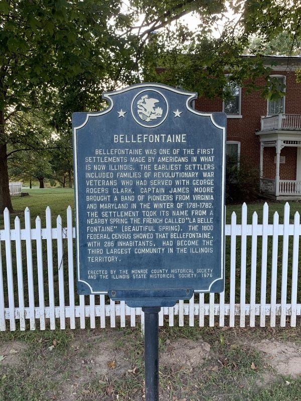
Bellefontaine was one of the first settlements made by Americans in what is now Illinois. The earliest settlers included families of Revolutionary War veterans who had served with George Rogers Clark. Captain James Moore brought a band of pioneers . . . — — Map (db m140335) HM
Hillsboro was founded in 1823. Abundant natural resources shaped its economic landscape, such as the eight-foot vein of coal underlying the town. Coal from Hillsboro and nearby Taylor Springs and Kortkamp was primarily used locally rather than . . . — — Map (db m281209) HM
Mary Harris was born in Cork, Ireland in 1837. Her family fled to Toronto during the famine. She moved to Memphis in 1860, married George Jones, an iron molder and proud union man. They had four children together.
Mary Jones moved to Chicago, . . . — — Map (db m156812) HM
Beneath us lies one of the nation's richest coal seams, formed 300 million years ago and covering two-thirds of Illinois. Coal made this state an industrial and economic powerhouse by the 1880s - it drove the machinery, heated the homes, smelted . . . — — Map (db m149886) HM
A leading figure of the 19th-century "Stone-Campbell" Restoration movement, Barton Warren Stone owned and lived on this farm from 1838 to 1844. Stone advocated the unity of all Christians, served as an educator and church planter, and published . . . — — Map (db m149893) HM
"I have discovered the machine I want to design and build, a portable 'Ferris Wheel'", W. E. Sullivan, 1893.
A young man's dream became reality when W. E. Sullivan of Roodhouse, Illinois, designed and built a small, portable, revolving wheel, . . . — — Map (db m57658) HM
Miss Dorothea Dix in her "memorial to the Senate and House of the Representatives of Illinois" urged their serious consideration of the afflicted condition of an increasing class of insane sufferers, whose healthful exercise of their intellectual . . . — — Map (db m149907) HM
G.V. Black, father of modern dentistry, was born in 1836 on a farm near Winchester, Illinois. He studied medicine and dentistry and in 1857 began his practice of dentistry in Winchester. After serving in the Civil War, he resumed dental practice in . . . — — Map (db m57631) HM
MacMurray College was founded as Illinois Conference Female Academy in
1846 by Methodist preachers. It became Illinois Woman's College in 1899 before
acquiring its final name in 1930. MacMurray College was a major presence in
Jacksonville for 174 . . . — — Map (db m229609) HM
New Method Book Bindery (Bound to Stay Bound Books since 1970) was established at 220 S. Main, Jacksonville, Illinois, in January 1920 by Lawrence D. Sibert and William Suhy. The bindery quickly became one of the nation's leading library binders, . . . — — Map (db m181714) HM
Stephen A. Douglas was born in Brandon, Vermont, in 1813. He attended schools there and in New York state. In 1833, he settled in Winchester, Illinois, five miles southwest, where he taught school. In 1834 he moved to Jacksonville, eight miles . . . — — Map (db m182098) HM
The site of the Farmers State Bank and Trust Company Building, formerly known as the Ayers National Bank Building, has been associated with banking longer than any other site in the State of Illinois and possibly the entire Old Northwest.
By . . . — — Map (db m149896) HM
Jacksonville's first courthouse on the Square was a primitive structure built in 1826. It burned down on December 6, 1827. The second Morgan County courthouse played a significant role and was located on the southwest corner of the town square. . . . — — Map (db m287396) HM
In the 1830's and 1840's an organized criminal gang known as the Banditti of the Prairie was active on the Midwestern frontier. In 1841 six members were arrested and held for trial in Oregon, Illinois. On March 21, the day before the trial, the . . . — — Map (db m308296) HM
In the spring of 1825, Oliver W. Kellogg blazed a trail north through the prairie, passing near the future West Grove settlement, then a few miles east of Forreston, and up through Crane's Grove.
A year later, John Boles opened a shorter . . . — — Map (db m208640) HM
Early French traders who traveled the Rock River named the large bend southwest of this point, Grand Detour. Winnebago and Potawatomi villages in the area made it a prominent location for fur trading posts, and during the 1820's the United States . . . — — Map (db m131290) HM
Rock River Seminary, the first institution of higher education in Northern Illinois, was established by the Methodist Church in 1839. Because of financial difficulties it was forced to close in 1879. The Church of the Brethren then purchased the . . . — — Map (db m308295) HM
The Indians called this area Nanusha (buffalo). The first settlers arrived here in 1829 and six years later a village, St. Marion, was laid out. About 1840 the name was changed to Buffalo Grove and the village prospered until 1855 when the railroad . . . — — Map (db m208581) HM
This free-standing, perpetual-burning lime kiln was used to produce lime mortar, a product widely utilized by the building industry. The area was known as Buffalo Grove after a thriving early settlement along the Galena Trail. The region retained . . . — — Map (db m208638) HM
Early in the Black Hawk War Indians concealed near this spot in Buffalo Grove, May 19, 1832, killed William Durley, a member of a six man detail carrying dispatches from Colonel James M. Strode at Galena to General Henry Atkinson at Dixon's Ferry. . . . — — Map (db m208585) HM
Abraham Lincoln was a guest in this house, August 15-17, 1856. His host was Zenas Aplington, founder of Polo. On Saturday, August 16, John D. Campbell and James W. Carpenter, who were law partners in Polo, joined Lincoln and Aplington in a drive by . . . — — Map (db m55803) HM
In 1825 Oliver W. Kellogg blazed a trail from Peoria to Galena which passed east of this site. On a spring day in the following year John Boles marked a shorter route near this point. The news of the Boles Trail spread and it became a heavily . . . — — Map (db m208467) HM
In the early 1830’s pioneer traffic moving north from Peoria crowded primitive trails and forced a direct route to Galena. In 1833, Levi Warner’s state survey marked the Galena Road. It cut through this schoolyard. Private Abraham Lincoln passed . . . — — Map (db m55795) HM
Here, on May 14, 1832, the first engagement of the Black Hawk War took place when 275 Illinois Militiamen under Maj. Isaiah Stillman were put to flight by Black Hawk and his warriors. So thoroughly demoralized were the volunteers that a new army had . . . — — Map (db m59710) HM
Founded by the Rt. Rev. Philander Chase, first bishop of Illinois, 1845. Restored and rededicated by the Rt. Rev. William L. Essex, Bishop of Quincy Nov. 4, 1945. — — Map (db m150540) HM
Gomo or Masemo (Resting Fish) (b. ca. 1750- d. 1815), a Potawatomi leader, respected by members of many tribes, the residents of French Peoria, governor of the Illinois Territory Ninian Edwards, and William Clark, then U.S. agent for Indian . . . — — Map (db m308005) HM
Robert Gilmore LeTourneau (usually referred to as R.G.) was known as the
“dean of earthmoving” and “God's businessman.” At the urging of Caterpillar
Tractor Company, he moved his manufacturing business from California . . . — — Map (db m150578) HM
Jubilee College, two miles to the north, was established by Philander Chase, first Protestant Episcopal bishop of Illinois, as one of the state's early institutions of higher learning. First students were received in 1840, and the school . . . — — Map (db m309336) HM
George Washington Carver Community Center fulfills the legacy of black women who believed in the motto "lifting as we climb."
The Colored Women's Aid Club was part of a rich network of women active in the social reform and social welfare . . . — — Map (db m267235) HM
This plaque dedicated by
Colonel John C. Bryner, Camp 67
Sons of the Union Veterans of the Civil War
in memory of veterans interred in Moffatt Cemetery
Veteran • Rank • Co. • Regiment
Amsler, Henry Pvt G 14 IL Inf Cons • Anderson, . . . — — Map (db m239257) WM
Nance Legins-Costley is known to history as the first enslaved person
Abraham Lincoln helped free. She was born in 1813 into indentured
servitude in Kaskaskia, Illinois Territory, to slaves Randol and Annachy
Legins. In 1827 in Springfield, . . . — — Map (db m239256) HM
The city of Peoria was named for the Peoria tribe of the Iliniwek Indian confederacy who once lived here. It was in 1673 that Jacques Marquette and the explorer Louis Jolliet traveled through the widened portion of the Illinois river known as Lake . . . — — Map (db m150580) HM
Aquilla Moffatt arrived here in 1822 and began mining and milling ventures.
On return from the Black Hawk War, he built his home on South Adams
Street and set aside a small burying ground for family and friends. After
the Civil War he named an . . . — — Map (db m239258) HM
Meaning "fat lake," Illinois Indian name for Peoria Lake. Here passed Jolliet and Marquette in 1673. Established near the lake were Ft. Crévecoeur, 1680; Ft. St. Louis, 1691-92; Old Peorias Fort and village, 1730; Peorias, 1778; Ft. Clark, 1813; . . . — — Map (db m309742) HM
Susan Goodman Komen wanted to make the world a better place. The active civic leader, daughter, sister, wife and young mother of two from Peoria, Illinois, left a legacy she never imagined — her life changed the way the world talks about and . . . — — Map (db m306508) HM
Kenneth Leon “Tug” Wilson was a collegiate athlete, Olympian, educator, Rotarian and amateur sports administrator who promoted physical fitness, sportsmanship and humanitarian service around the world.
Born March 27, 1896 in Atwood, Wilson grew . . . — — Map (db m226052) HM
The fertile prairies in Illinois attracted the attention of French trader Louis Jolliet and Father Jacques Marquette as they explored the Mississippi and Illinois Rivers in 1673. France claimed this region until 1763 when it was surrendered to Great . . . — — Map (db m136729) HM
In 1673 the areas of the Mississippi and Illinois Rivers were explored by Frenchmen Louis Joliet and Father Jacques Marquette. Their voyages resulted in French claims on the area until 1763 when, by the Treaty of Paris, France ceded the land to . . . — — Map (db m78655) HM
This was the home of distinguished agricultural leader, Earl Clemmons Smith, born in Pike County February 19, 1881. In 1907, Smith began farming his grandmother Clemmons' land at this site. Smith became active in the early national farm bureau . . . — — Map (db m78648) HM
On February 22, 1839, members of The Church of Jesus Christ of Latter-day Saints, refugees driven from Missouri under the “Extermination Order” of Governor Lilburn Boggs, settled on this site. The property was owned by Thomas Edwards, who later . . . — — Map (db m78649) HM
During the Civil War the naval depot of the western river fleet was located at Mound City. Here the keels of three of the famous Eads ironclad gunboats were laid, and a large force of workmen were employed to keep the fleet in fighting trim. The . . . — — Map (db m144869) HM
The southern portion of the brick building at the Ohio levee, 150 yards east of here, was part of a large warehouse which was converted into a Military Hospital in 1861 and staffed during the Civil War by the Sisters of the Holy Cross. Following the . . . — — Map (db m144868) HM
On the Ohio River three miles south of here Cantonment Wilkinson-ville, named for Gen. James Wilkinson, was established by Lt. Col. David Strong in 1797 as a post of the United States Army. It was garrisoned until 1804. Here are buried Colonel . . . — — Map (db m207779) HM
Shadrach Bond, first Governor of Illinois (1818-1822), is buried in Evergreen Cemetery in Chester. The first recorded settler in the area was John McFerron who purchased land in 1817 but Samuel Smith, who settled here in 1830, is considered the . . . — — Map (db m316215) HM
Elias Kent Kane, architect of the state's first constitution was born in New York in 1794. Kane studied law and began his practice in Tennessee. In 1814 he moved to Kaskaskia, where he was appointed a judge of the Illinois Territory. Active in . . . — — Map (db m161382) HM
In the third year of the American Revolutionary War, Lt. Col. George Rogers Clark and his army of 170 Virginians set out from Fort Massac (Metropolis) on their way to liberate the town of Kaskaskia from British control. On July 3, 1778, Clark's army . . . — — Map (db m161445) HM
Shadrach Bond, first Governor of Illinois, was born November 24, 1773, in Fredericktown, Maryland. He came to Illinois in 1794 and farmed at New Design. In 1805 he was elected to the Indiana Territorial Assembly, where he was instrumental in . . . — — Map (db m161381) HM
Thomas Mather was born in Simsbury, Connecticut, in 1795. His father, William Mather, fought in the Revolutionary War and was a direct descendant of Cotton Mather. The New England minister associated with the Salem Witch Trials. Thomas Mather . . . — — Map (db m161322) HM
From 1703 until it was washed away by the Mississippi two centuries later, the ancient town of Kaskaskia - the second settlement in Illinois, the territorial capital, and the first state capital stood two miles southwest of here. Fort Kaskaskia . . . — — Map (db m161321) HM
The American Bottom is that sixty mile long strip of lowland lying between the bluffs and the east bank of the Mississippi River. Its earliest recorded history is written in the annals of France, England, and Spain. In the wars, these nations fought . . . — — Map (db m161859) HM
George Rogers Clark's capture of Kaskaskia in July, 1778, doomed British control of the Illinois country. The occupation of Kaskaskia was the first step in Clark's plan to capture the western headquarters of the British at Detroit. Under . . . — — Map (db m143482) HM
George Fisher, early Illinois physician, served as sheriff of Randolph County, member of the first House of Representatives of Indiana Territory, Speaker of the House in the first and third Illinois Territorial Assemblies, (1812-1814, 1816-1818), . . . — — Map (db m161312) HM
As early as 8000 B.C. prehistoric Indians were camping in the shelter of this great sandstone bluff. These nomadic people, who lived by hunting animals and gathering plants for food and fibers, came here regularly for more than 6000 years. Later . . . — — Map (db m161319) HM
The layered sediments at the base of this bluff preserve a record of repeated use of two rock shelters by Native Americans groups from 9000 to 4000 years ago. The earliest groups camped here for short periods of time. By 8,000 years ago, some . . . — — Map (db m283757) HM
Dr. George Fisher, Kaskaskia physician, lived on a farm eight miles west of here from 1806 until his death in 1820. 1801 First Sheriff of Randolph County, 1805-1808 Member of the first and second General Assemblies of Indiana Territory, 1812-1816 . . . — — Map (db m161315) HM
Charter Oak School is said to be the only octagonal one-story brick schoolhouse in Illinois. It was built in 1873, in accordance with a design suggested by Daniel Ling, a teacher of the Charter Oak School district. It served as a school until . . . — — Map (db m161316) HM
During the Presidential Campaign of 1856 Abraham Lincoln and Stephen A. Douglas spoke in Olney at separate political rallies held the same day - Saturday, September 20. In the morning Douglas spoke in a grove near town at a Democratic rally for . . . — — Map (db m178242) HM
Robert Ridgway, leading American ornithologist, was born at Mount Carmel, Illinois, on July 2, 1850. As a youth he became interested in birds and sketched many specimens around his home. At the age of seventeen, he was appointed zoologist on a . . . — — Map (db m99118) HM
In 1902, the first experimental solar power plant was built in Olney, Illinois by H.E. Willsie and John Boyle Jr., two American engineers. Their solar power plant was based on an 1885 design developed by the French engineer Tellier. Between 1892 and . . . — — Map (db m178244) HM
In 1832 when Black Hawk and his Sauk and Fox followers returned to Illinois, 1500 mounted volunteers advanced along the banks of the Rock River to capture them. 505 men under Colonel Zachary Taylor followed in supply boats and late at night on May . . . — — Map (db m78266) HM
On May 8, 1832, while encamped approximately one mile west of this point, Abraham Lincoln was mustered into the military service of the United States. Captain Lincoln's company was mustered into state service at Beardstown April 28, the day before . . . — — Map (db m32972) HM
Fort Armstrong was built in 1816-1817. Its riverside was protected by limestone bluffs and its other sides were formed in part by the rear walls of barracks and storehouses. Blockhouses, like the replica, stood at three corners. The pyramid of . . . — — Map (db m33225) HM
The Sauk Indian village on the Rock River marks the site of the westernmost conflict of the Revolutionary War. In the summer of 1780, an American force under John Montgomery, with French and Spanish allies, destroyed the village of Saukenuk. Colonel . . . — — Map (db m202047) HM
Hero Street, U.S.A. received its name in 1968 to honor the fifty-seven servicemen from thirty-three families on this block-and-a-half who served in defense of America between 1941 and 1968. Six men died in World War II and two in the Korean . . . — — Map (db m33236) HM
This area of some 143 acres located approximately two miles south of Carrier Mills was inhabited by prehistoric people throughout three different archaeological periods. Until the turn of the century, the South Fork of the Saline River was a . . . — — Map (db m146461) HM
Here was located the home of Samuel Elder, cofounder of Elder-Redo now called Eldorado. Judge of the county court 1849-1856, school commissioner, collector, Internal Revenue, Justice of the Peace, and farmer. He and his son, William, together with . . . — — Map (db m146459) HM
On September 28, 1963, America got its first taste of English rock 'n' roll. Five months before the beginning of "Beatlemania," before the Beatles played on the "Ed Sullivan Show," George Harrison, lead guitarist for the British band, became the . . . — — Map (db m192053) HM
From the creation of Saline County in 1847 to the end of the century the production of tobacco was the principal industry. In 1870 Saline County had the highest tobacco production in the state.
The Webber brothers of Galatia and Raleigh were . . . — — Map (db m192045) HM
Pioneering black physician James Henry Lewis (1888-1963) was born in North Carolina. Because of limited educational opportunities available to black students at that time and place, he moved to Illinois, where he worked to put himself through . . . — — Map (db m192052) HM
Actress Virginia Gregg was born at 325 East Locust Street in Harrisburg on March 6, 1916. In an acting career spanning 40-plus years, she appeared in no less than 1,200 radio and television dramas, and more than 40 motion pictures, usually in . . . — — Map (db m192050) HM
Two hundred feet east of here was the Ingersoll law office. Ebon Clark Ingersoll and Robert Green Ingersoll, his younger brother, before they moved to Peoria, had a successful law practice in the Saline County Circuit Court which met in Raleigh, the . . . — — Map (db m192047) HM
This building, one of the first brick buildings in Sangamon County, was built in the spring of 1834 by John Broadwell. His father, Moses Broadwell, a native of Elizabethtown, New Jersey, came to Illinois in 1820. He and his son John built a brick . . . — — Map (db m129230) HM
Abraham Lincoln was born in Hardin County, Kentucky, February 12, 1809. He moved with his family to Indiana in 1816 and to Illinois in 1830. His first home in Illinois was 8 miles southwest of Decatur. In 1831 he later moved along to New Salem, . . . — — Map (db m157150) HM
Prior to the coming of the railroads, Springfield was handicapped by inadequate transportation facilities. Early in 1832, Vincent A. Bogue, Springfield businessman and promoter, planned to supply the Sangamon River region with steamboat service. He . . . — — Map (db m54765) HM
Camp Butler was established in 1861as a Civil War training camp and mobilization center for Illinois recruits. Selected by State officials and Brigadier General William T. Sherman and named for Illinois State Treasurer William Butler (1859-1863), . . . — — Map (db m51876) HM
Camp Butler, Civil War concentration camp for Illinois volunteers, occupied a large area in this vicinity from 1861 to 1866. It was also a prison camp for captured Confederates. Now a National Cemetery, it contains the graves of 1642 Union and . . . — — Map (db m310925) HM
On February 10, 2007, United States Senator Barack Obama of Illinois announced his candidacy for President of the United States from the southeast lawn of the Old State Capitol. More than 15,000 people attended the event.
Obama, who had . . . — — Map (db m312846) HM
This portion of the Tinsley Building, a merchant block constructed in 1840-1841, is the only surviving structure in which Abraham Lincoln maintained a law office. Intended originally for commercial use, much of the building was rented for other . . . — — Map (db m4656) HM
The Old State Capitol was the fifth Statehouse in Illinois history. The building served as Capitol from 1839 to 1876. Its cornerstone was laid during ceremonies held July 4, 1837. During the 1840s and 1850s the building dominated Springfield's . . . — — Map (db m312816) HM
From this building on February 11, 1861 Abraham Lincoln departed Springfield, Illinois to assume the Presidency of the United States. After bidding farewell to a number of friends, he delivered a brief, spontaneous and moving farewell address to . . . — — Map (db m308274) HM
On this site stood the residence of John A. McClernand. He was born in Breckenridge County, Kentucky, but moved with his family to Shawneetown, Illinois, in 1816. He studied law and in 1832 was admitted to the bar. He served in the Illinois General . . . — — Map (db m162032) HM
Lithuanians arrived en masse during Sangamon County's coal boom, numbering several thousand with their families by 1920, they fled political and religious repression, conscription, poverty, and a total ban on their language in the Czarist Russian . . . — — Map (db m162036) HM
The site where Lanphier High School now stands was once known as Reservoir Park. Constructed in the late 1870s, Reservoir Park was a popular recreation spot that integrated a lagoon and huge reservoir, which served as the City of Springfield's water . . . — — Map (db m162041) HM
Poet, translator, writer, educator, Robert Stuart Fitzgerald (1910-1985) lived in his family's home on this site (215 E. Jackson) for 20 years. While a student at Springfield High School, his talent for poetry came to the attention of poet Vachel . . . — — Map (db m184684) HM
Founded on February 12, 1863, the 54th birthday of President Abraham Lincoln, the Springfield Home for the Friendless was established as a temporary shelter for children, widows, and the destitute displaced by Civil War and economic hardship. The . . . — — Map (db m156779) HM
In 1852 the family of Pascal Enos donated this ground for an institution of higher learning. Rev. Francis Springer, an educator and Springfield's first Lutheran Minister, led efforts to establish Illinois State University, a college preparatory . . . — — Map (db m162046) HM
Near this site in 1917, union miner Henry Stephens walked a long route home "with headlamp and dinner bucket" at dusk in support of the streetcar workers' strike and boycott. He vowed to trek long miles in solidarity: "I'd live in the fields on . . . — — Map (db m281233) HM
An important trail in the history of Illinois ran atop this ridge. Called the Edwards Trace, an early word for trail, its use reaches back to antiquity when herds of bison and other large mammals traveled along its path. For millennia, prehistoric . . . — — Map (db m156781) HM
On this site in 1843, John Hutchinson, undertaker, cabinetmaker, and businessman, established the first private burial ground in Springfield. Located on the western edge of the then-newly-incorporated city. Hutchinson Cemetery operated for several . . . — — Map (db m162028) HM
Azel Waters Dorsey, 1784-1858, teacher of Abraham Lincoln, is buried on the King farm one mile south of Huntsville. Dorsey taught a "blab school" in Spencer County, Indiana which young Lincoln attended for six months in 1824.
He moved to Schuyler . . . — — Map (db m181413) HM
Nearby is one of two sites in Illinois that serve as the basis for all land surveys in the state. It is the point just northwest of Beardstown, where the 4th principal meridian intersects its base line.
Originally, land was measured by . . . — — Map (db m24943) HM
This site was the homestead of the Scripps family – pioneer journalists and philanthropists. John Scripps (1785-1868), a Methodist circuit-rider, settled here
in 1831. In 1849 he began publishing the Prairie Telegraph, now the Rushville . . . — — Map (db m229613) HM
Abraham Lincoln first publicly challenged U.S. Senator Stephen A. Douglas's "Nebraska Bill" during a Whig county convention August 26, 1854, in the Scott County courtroom located at this site. Because the bill allowed for the expansion of slavery, . . . — — Map (db m182043) HM
The road on which this bridge is located was once an important route between Springfield and Effingham. The bridge was completed in the autumn of 1868 at a cost of $2,500 and named for the owner of the first mill near here. It is the narrowest of . . . — — Map (db m188395) HM
This is the site of the Moweaqua Coal Mine Disaster which on December 24, 1932, took the lives of all 54 miners entering the mine that day. The Moweaqua Coal Mine was Shelby County's largest. An unprecedented drop in barometric pressure allowed . . . — — Map (db m55619) HM
Gustavus Koerner came to Belleville from Germany in 1833. He took a law degree from the University of Heidleberg in 1832. Shortly after, he was arrested during a political demonstration. He escaped and joined a party of emigrants. In Illinois his . . . — — Map (db m140531) HM
John Messinger received a formal education in New England before settling on the Illinois frontier in 1802. After serving as St. Clair County Surveyor, he was appointed Deputy United States Surveyor and platted much of the government land between . . . — — Map (db m140532) HM
With this marker we honor Captain Jean Baptiste Hamelin and the citizens of Cahokia for their sacrifice, and the role they played in the American Revolutionary War. In the latter days of the Revolutionary War, both American and British had ambitions . . . — — Map (db m132349) HM
George Rogers Clark captured Kaskaskia on the night of July 4-5, 1778, and then sent a small company under Captain Joseph Bowman northward to Cahokia. Bowman met no resistance from the French settlers along the way, and took possession of Cahokia on . . . — — Map (db m140497) HM
John Jacob Hays was born in New York circa 1770. His family emigrated to North America from the Netherlands in 1720. The Hays family belongs to Congregation Shearith Israel, the oldest Jewish Congregation in the United States.
John Jacob Hays . . . — — Map (db m140422) HM