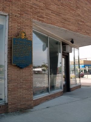
On this site the Town proprietors erected the original Lincoln House in 1854.
Leonard Volk met Abraham Lincoln on the sidewalk in front of the hotel on July 16, 1858, and arranged to make Lincoln's life mask later. — — Map (db m12349) HM
The Niebuhr family, called “The Trapp Family of Theology” by Time magazine, produced four distinguished professors of Christian studies. In 1902, the Rev. Gustav and Lydia Niebuhr came to Lincoln, where he became pastor of St. John’s . . . — — Map (db m105975) HM
William Maxwell (1908-2000), author and editor, lived in this home from 1910-1920. He often returned to this home and Lincoln in his novels and short stories. His Midwestern childhood, particularly his mother's death in the Spanish influenza . . . — — Map (db m106025) HM
Mt. Pulaski served as the seat of Logan County from 1848 to 1853. The First County Court was at Postville, now part of Lincoln, Illinois.
In 1848 Logan County voters approved the removal of the Court from Postville to Mt. Pulaski. Local citizens . . . — — Map (db m12327) HM
From the site of the Lincoln cabin on the Sangamon three miles south of here, to the Wabash River opposite Vincennes, the Lincoln National Memorial Highway follows substantially the route taken by the Lincoln family in their migration from Indiana . . . — — Map (db m55617) HM
On an eminence overlooking the Sangamon River three miles south of here stood the first home of Lincoln in Illinois. To this site came the Lincoln family in March, 1830. Here they lived until 1831, when the parents removed to Coles County and . . . — — Map (db m55618) HM
During the historical period, the earliest inhabitants of the present-day community of Bunker Hill were the Peoria, Kickapoo, and Winnebago Indians who established an encampment near North Washington and West Morgan Streets. Another Native American . . . — — Map (db m143178) HM
Coal miners were the vanguard of the American Labor Movement and Illinois played a major role. In the 1890s tens of thousands of Illinois miners joined the United Mine Workers Union. But in succeeding decades the leadership of UMW President John L. . . . — — Map (db m184782) HM
The Union Miners Cemetery in Mt. Olive, Illinois, is the only labor union-established and union-owned cemetery in the United States. It is the result of the Battle of Virden fought in Virden on October 12, 1898, when the Chicago-Virden Coal Company . . . — — Map (db m184803) HM
Elijah Parish Lovejoy was the first pastor of Upper Alton Presbyterian Church, now College Avenue Presbyterian Church. A minister, teacher, newspaper editor, and martyr to free speech and the abolition of slavery, he was fatally shot on Nov. 7, . . . — — Map (db m142159) HM
Bitten by gold rush fever in 1849, Dr. Benjamin F. Edwards, brother to former Illinois governor Ninian Edwards and the Honorable Cyrus Edwards, left Alton and traveled to San Francisco to try to capitalize on the economic opportunity. Days before he . . . — — Map (db m140668) HM
This unique Queen Anne style playhouse was built in 1885 for five year old Lucy J. Haskell, daughter of Dr. William A. and Florence Hayner Haskell. It is believed Lucy's grandfather, John E. Hayner, commissioned prominent local architect, Lucas J. . . . — — Map (db m133293) HM
On this site in 1831, John Mason Peck (1789-1858), pioneer Baptist preacher, author, and educator, established the school which became Shurtleff College. In 1817, Peck had left his home in New England with a vision "to bring the lamp of learning and . . . — — Map (db m139658) HM
The seventh and last debate between Abraham Lincoln and Stephen A. Douglas in the 1858 U.S. Senatorial Campaign was held at this site on October 15. Approximately five thousand people gathered in front of the old City Hall to hear the two . . . — — Map (db m154153) HM
Ruins of first state prison in Illinois. Built in 1830-31. Unsanitary conditions aroused persistent criticism from Dorothea Dix, pioneer in prison reform. All inmates were transferred to Joliet prior to 1860. During the Civil War many Confederate . . . — — Map (db m144762) HM
Scott Bibb (1855-1909) was the plaintiff in the Alton School Case, a series of lawsuits that sought to retain Alton's desegregated schools, which had existed in Alton from 1872 to 1897, a short-lived outcome of the Reconstruction era. When Alton . . . — — Map (db m133294) HM
In 1673 Jacques Marquette reported that he and fellow French explorer Louis Jolliet discovered a Painting of what was probably two "Water Monsters" on the bluffs of the Mississippi River near present day Alton. By 1700 those pictographic creatures . . . — — Map (db m89339) HM
On April 5, 1918, German immigrant Robert Prager was hanged by a mob at this site. Prager's lynching was the high-water mark of the anti-immigrant and anti-German hysteria that gripped the nation during World War I. Persecution in the guise of . . . — — Map (db m151267) HM
Built circa 1845 by Daniel Dove Collins (1814-1892) for his bride Elizabeth M. Anderson (1826-1902), the Collins House is an example of Greek revival architecture. As the first president of the Collinsville village board, Collins held board meetings . . . — — Map (db m144010) HM
The Wann Disaster of January 21, 1893, is Madison County’s most horrific railroad tragedy. It caused the greatest loss of life and cases of personal injury in a single incident. The accident occurred at the Wann Junction on the Big Four Railroad, . . . — — Map (db m139657) HM
More than 250,000 horses were brought in from mid and western United States and shipped out of the East Alton stockyards during World War I. The horses of various breeds were shipped overseas to the British, French, and Belgian governments for the . . . — — Map (db m211576) HM
One quarter-mile to the west stood Fort Russell, a wooden stockade which served as a base of supplies and operations for the Illinois Militia during the War of 1812. From here, for months at a time, Governor Ninian Edwards administered the affairs . . . — — Map (db m202080) HM
The Goshen Road was one of the main arteries of travel in the early 1800's, when Illinois was frontier country. The road ran in a northwesterly direction from Shawneetown to Edwardsville -- a distance of more than 150 miles. Shawneetown and . . . — — Map (db m138859) HM
Site of the courthouse where, in 1824, political enemies convicted Governor Edward Coles of illegally freeing his slaves. "To preserve to a continuous line of generations that liberty obtained by the valor of our forefathers, we must make . . . — — Map (db m143182) HM
Social visionary N.O. Nelson founded the village of LeClaire in 1890, naming it after Edme Jean LeClaire, who inaugurated profit sharing in France. In contrast to unsanitary urban tenement districts, LeClaire was a model cooperative village offering . . . — — Map (db m143190) HM
In 1869, the abandoned Madison County Circuit Clerk's office at 1210 N. Main Street was designated as Edwardsville's "colored" school. It later became known as "Lincoln School." Though segregated, it was the first state-funded free public school . . . — — Map (db m173664) HM
In 1844, Madison County began a program of caring for the poor. Ten years later the county purchased this property and the first permanent buildings were constructed during the Civil War. The purpose of the facility was to provide care for the . . . — — Map (db m163349) HM
The once world-renowned concert venue Mississippi River Festival ("MRF") began as a pioneering experiment in regional cooperation between Southern Illinois University Edwardsville and the St. Louis Symphony. The Symphony was invited to establish . . . — — Map (db m144301) HM
The remnants of Pogue Store, seen here, mark the center of Edwardsville's business district more than two centuries ago. In 1818, when Robert Pogue built his store, it was located directly across the street from courthouse square.
Pogue's was a . . . — — Map (db m160042) HM
This Federal-style home was built in 1836 for Dr. John Weir (1809-1878) and his first wife, Hepzibah Damon (1810-1838). His first patients entered the house through a side entrance on the north face of the building. Weir, both a surgeon and . . . — — Map (db m187506) HM
Six Mile Prairie, located in the American Bottom six miles from St. Louis, was first settled in the 1830's by American farm families who migrated from the Upland south. With their crude farm implements, these pioneers broke through the tough prairie . . . — — Map (db m138844) HM
Meriwether Lewis and William Clark originally planned to camp west of the Mississippi River during the winter of 1803-04. Carlos Dehault Delassus, the Spanish commandant at St. Louis, however, had not received formal notification from his government . . . — — Map (db m141787) HM
At the point where U.S. Highway 51 and the Jefferson-Marion County road meet, the Third Principal Meridian intersects its east-west base line. This cardinal point was established by a Federal surveyor on February 1, 1815. At least 60 percent of the . . . — — Map (db m167467) HM
In 1779 George Rogers Clark led his army from Kaskaskia through this area to Vincennes where they captured Fort Sackville from the British. In 1818 there were several taverns on this section of the Vincennes-St. Louis Trail. Traditionally, the log . . . — — Map (db m178084) HM
Salem is locally known as the “Gateway to Little Egypt”. Egypt refers to southern Illinois. In the early days of statehood, crop failures threatened the existence of the isolated settlements in northern and central Illinois, and trips . . . — — Map (db m99120) HM
Lived in Salem, Illinois, from his birth, March 19, 1860, until 1875. A national figure after his “Cross of Gold” speech in 1896, Bryan was the unsuccessful Democratic candidate for President in 1896, 1900, 1908, and served as Secretary . . . — — Map (db m99119) HM
On March 25, 1947 a violent explosion struck Centralia Coal Company Mine No. 5 located in Wamac, Illinois. By March 29, it was confirmed that the explosion, combined with the subsequent release of poisonous gas, had taken the lives of 111 of the 142 . . . — — Map (db m167468) HM
In 1893 the Sante Fe Railroad authorized
Charles Devlin, their manager of mining
properties, to purchase the mineral rights
here to 11,000 acres. The Devlin Coal Company
sank two shafts and began producing coal
using the longwall method, . . . — — Map (db m33669) HM
Lt. Col. George Rogers Clark and his troop of 170 volunteers, principally Virginians, camped near this site, called Indian Point, on June 30, 1778. They were marching from Fort Massac to attack the British post at Kaskaskia. This was the first of . . . — — Map (db m146332) HM
In 1673 the areas of the Mississippi and Illinois Rivers were explored by Frenchmen Louis Jolliet and Father Jacques Marquette. Their voyages resulted in French claims on the area until 1763 when, by the Treaty of Paris, France ceded the land to . . . — — Map (db m146313) HM
Annie Turnbo Malone, the daughter of a Kentucky refugee slave and the 10th or 11 children was born on a farm in Massac County, and attended school in Metropolis. Annie Turnbo Malone is acknowledged as the true founder of African-American . . . — — Map (db m233641) HM
George Rogers Clark arrived at Fort Massac on June 30, 1778, with about 175 men, under orders from Virginia to capture the British outposts in Illinois. British failure to regarrison the old French fort here enabled Clark to enter the Illinois . . . — — Map (db m60313) HM
Oscar Micheaux was an author, film director, and independent producer of more than 40 motion pictures between 1919 and 1948. As America’s first major African-American filmmaker, Micheaux is considered by many as the forerunner of Tyler Perry and . . . — — Map (db m233640) HM
Oakwood Cemetery was developed by William H. Randolph in 1857, on land settled by his wife's family, the Brookings, in 1834. It was laid out by surveyor Charles Gilchrist - later a Civil War colonel and brevet brigadier general. A former sheriff and . . . — — Map (db m181706) HM
Civil rights activist Rev. Dr. C.T. Vivian (1924-2020) was raised in a home on this property from 1930 to 1945. He graduated from Macomb High School and Western Illinois State Teachers College (now WIU). His civil rights activism - helping black . . . — — Map (db m181704) HM
This former school, now a residence, and cemetery were named for the David Haeger family, from Germany, who settled in this part of McHenry County. This area was the boyhood home of David Henry Haeger, the eldest son of the Haeger children, who . . . — — Map (db m65892) HM
In 1843 Ira C. Goodrich purchased this land from the United States Government. As an early settler to McHenry County, Goodrich founded the local school system, served as director and was road master. Farmsteads like this established by the early . . . — — Map (db m65532) HM
In 1673 Louis Jolliet and Father Jacques Marquette explored the Illinois Country for France. By the 1763 treaty ending the French and Indian War, this area passed to England. During the American Revolution, George Rogers Clark's men captured it for . . . — — Map (db m76530) HM
McHenry County's first commissioners met in this building on August 5th, 1840. The original structure was built on the Court Street side of the public square, now Veterans Memorial Park, as McHenry County's first courthouse.
McHenry County . . . — — Map (db m76532) HM
Benjaminville was founded in the 1850's by Quaker farmers looking for rich prairie soil on which to grow their wheat. The Friends Meeting House, built in 1874, has changed little since then. The adjacent burial ground is divided into two sections: . . . — — Map (db m157153) HM
This Victorian Mansion was the home of Judge David Davis, an associate of Abraham Lincoln's.
Construction began in 1870 and was completed in 1872. The house is built of yellow hard-burned face brick with stone quoins in the corners. It is 64 . . . — — Map (db m12249) HM
The first woman elected to the Illinois Senate, Florence Fifer Bohrer served two terms from 1925 to 1933. She chaired the Senate committee to visit charitable institutions, led efforts to revamp Illinois' child welfare laws, and sponsored . . . — — Map (db m55616) HM
Franklin Square contains the homes of former Vice President Adlai Stevenson I and Governor Joseph Fifer. Franklin Park, the centerpiece of the district, was the starting point for partisan torchlight parades in the late nineteenth century. The park, . . . — — Map (db m156963) HM
This was the home of Adlai E. Stevenson I, Vice-President of the United States, 1893-1897. Stevenson was born in Kentucky in 1835 and came to Bloomington in 1852. He attended Illinois Wesleyan University in Bloomington and Centre College in . . . — — Map (db m55614) HM
This was the home of Joseph W. Fifer, Republican Governor of Illinois, 1889-1893. Fifer was born in Virginia in 1840 and came to Illinois in 1857. During the Civil War he served in the 33rd Illinois Infantry Regiment. He graduated from Illinois . . . — — Map (db m55615) HM
In 1908, the park board established racially segregated beaches and bathing facilities at Miller Park. Whites had exclusive use of the lake's larger beach and cleaner waters, while the "colored" beach was located in the park's smaller lagoon - a . . . — — Map (db m156962) HM
Matthew T. Scott made his fortune on the Grand Prairie in the 19th century by developing thousands of acres of farmland. He founded the town of Chenoa in 1855 as a center for his business activities. Although Scott bought and sold over 45,000 acres . . . — — Map (db m160064) HM
By the late 1700’s, the Kickapoo people had established a major settlement here, close to fertile fields, abundant game and timber, and important trade routes. Opposed to American expansion, these Native Americans allied with the British during the . . . — — Map (db m157154) HM
The first settlement in this area in 1822 was called Keg Grove. By the time a post office was established in 1829 the settlement was known as Blooming Grove. McLean County was organized the following year and Bloomington, which was laid out in 1831 . . . — — Map (db m157176) HM
In 1926, construction began on a 2,448-mile highway from Chicago to Santa Monica, California. Route 66 reflected the increased use of motorized vehicles. The road, which cut diagonally across Illinois, passed through Lexington. Sleek restaurants, . . . — — Map (db m157028) HM
The John Patton Cabin, originally situated 3½ miles southeast of this site, is a structure intimately linked with the relations of whites and Indians on the Illinois frontier. Built with the assistance of Kickapoo Indians from a nearby village, . . . — — Map (db m160059) HM
The Illinois Soldiers' and Sailors' Children's School (ISSCS) opened in 1865 as the Illinois Soldiers' Orphans' Home. Dedicated in 1869, it provided a home for children of Civil War veterans who had been killed and wounded. In 1899, the state . . . — — Map (db m160048) HM
In this structure, built about 1832, residents of the Athens area held a banquet on August 3, 1837, for the 'Long Nine' - Abraham Lincoln and the other State legislators from Sangamon County. The men, whose height totaled fifty-four feet, were . . . — — Map (db m78608) HM
Founder of the Grand Army of the Republic, Menard County resident, Rush Medical College graduate 1850, Surgeon 14th Illinois Volunteers 1861-1864. He originated the G.A.R. name, ritual and constitution of Post No. 1, Decatur April 6, 1866, called . . . — — Map (db m12315) HM
William F. Berry, 1811 - 1835, is buried two miles west in the cemetery of Rock Creek Cumberland Presbyterian Church. His father, the Rev. John M. Berry, founded the church in 1822. Abraham Lincoln and Berry were partners in a store at New Salem in . . . — — Map (db m78614) HM
"I think I may say that he was my scholar and I was his teacher." At New Salem, Lincoln read Graham's books and in 1833 studied grammar and surveying. Teacher in Kentucky and Illinois more than fifty years, Graham died in South Dakota. In 1933 his . . . — — Map (db m124185) HM
Abraham Lincoln visited Mercer County on at least two occasions. On May
7 and 8, 1832, at the onset of the Black Hawk War, Captain Lincoln led his
company of Illinois militia northeast from Oquawka to the Rock River at
Milan through Mercer . . . — — Map (db m230129) HM
Maeystown, where three streams descend down the bluff, was founded by Jacob Maeys in 1852. The original settlers were German members of the forty-eighter movement. The village is unique in manner with structures integrated into the landscape. The . . . — — Map (db m140382) HM
The church was organized in 1841 by pastor G. A. Schieferdecker and settlers from Saxony, Thuringia, and Westfalia, Germany. The site was donated in 1849 by Johann Christian and Katherine Just. The present church was erected in 1863, and the tower . . . — — Map (db m140384) HM
Bellefontaine was one of the first settlements made by Americans in what is now Illinois. The earliest settlers included families of Revolutionary War veterans who had served with George Rogers Clark. Captain James Moore brought a band of pioneers . . . — — Map (db m140335) HM
Mary Harris was born in Cork, Ireland in 1837. Her family fled to Toronto during the famine. She moved to Memphis in 1860, married George Jones, an iron molder and proud union man. They had four children together.
Mary Jones moved to Chicago, . . . — — Map (db m156812) HM
Beneath us lies one of the nation's richest coal seams, formed 300 million years ago and covering two-thirds of Illinois. Coal made this state an industrial and economic powerhouse by the 1880s - it drove the machinery, heated the homes, smelted . . . — — Map (db m149886) HM
A leading figure of the 19th-century "Stone-Campbell" Restoration movement, Barton Warren Stone owned and lived on this farm from 1838 to 1844. Stone advocated the unity of all Christians, served as an educator and church planter, and published . . . — — Map (db m149893) HM
"I have discovered the machine I want to design and build, a portable 'Ferris Wheel'", W. E. Sullivan, 1893.
A young man's dream became reality when W. E. Sullivan of Roodhouse, Illinois, designed and built a small, portable, revolving wheel, . . . — — Map (db m57658) HM
Miss Dorothea Dix in her "memorial to the Senate and House of the Representatives of Illinois" urged their serious consideration of the afflicted condition of an increasing class of insane sufferers, whose healthful exercise of their intellectual . . . — — Map (db m149907) HM
G.V. Black, father of modern dentistry, was born in 1836 on a farm near Winchester, Illinois. He studied medicine and dentistry and in 1857 began his practice of dentistry in Winchester. After serving in the Civil War, he resumed dental practice in . . . — — Map (db m57631) HM
MacMurray College was founded as Illinois Conference Female Academy in
1846 by Methodist preachers. It became Illinois Woman's College in 1899 before
acquiring its final name in 1930. MacMurray College was a major presence in
Jacksonville for 174 . . . — — Map (db m229609) HM
New Method Book Bindery (Bound to Stay Bound Books since 1970) was established at 220 S. Main, Jacksonville, Illinois, in January 1920 by Lawrence D. Sibert and William Suhy. The bindery quickly became one of the nation's leading library binders, . . . — — Map (db m181714) HM
Stephen A. Douglas was born in Brandon, Vermont, in 1813. He attended schools there and in New York state. In 1833, he settled in Winchester, Illinois, five miles southwest, where he taught school. In 1834 he moved to Jacksonville, eight miles . . . — — Map (db m182098) HM
The site of the Farmers State Bank and Trust Company Building, formerly known as the Ayers National Bank Building, has been associated with banking longer than any other site in the State of Illinois and possibly the entire Old Northwest.
By . . . — — Map (db m149896) HM
In the 1830's and 1840's an organized criminal gang known as the Banditti of the Prairie was active on the Midwestern frontier. In 1841 six members were arrested and held for trial in Oregon, Illinois. On March 21, the day before the trial, the . . . — — Map (db m208331) HM
In the spring of 1825, Oliver W. Kellogg blazed a trail north through the prairie, passing near the future West Grove settlement, then a few miles east of Forreston, and up through Crane's Grove.
A year later, John Boles opened a shorter . . . — — Map (db m208640) HM
Rock River Seminary, the first institution of higher education in Northern Illinois, was established by the Methodist Church in 1839. Because of financial difficulties it was forced to close in 1879. The Church of the Brethren then purchased the . . . — — Map (db m208351) HM
The Indians called this area Nanusha (buffalo). The first settlers arrived here in 1829 and six years later a village, St. Marion, was laid out. About 1840 the name was changed to Buffalo Grove and the village prospered until 1855 when the railroad . . . — — Map (db m208581) HM
This free-standing, perpetual-burning lime kiln was used to produce lime mortar, a product widely utilized by the building industry. The area was known as Buffalo Grove after a thriving early settlement along the Galena Trail. The region retained . . . — — Map (db m208638) HM
Early in the Black Hawk War Indians concealed near this spot in Buffalo Grove, May 19, 1832, killed William Durley, a member of a six man detail carrying dispatches from Colonel James M. Strode at Galena to General Henry Atkinson at Dixon's Ferry. . . . — — Map (db m208585) HM
Abraham Lincoln was a guest in this house, August 15-17, 1856. His host was Zenas Aplington, founder of Polo. On Saturday, August 16, John D. Campbell and James W. Carpenter, who were law partners in Polo, joined Lincoln and Aplington in a drive by . . . — — Map (db m55803) HM
In 1825 Oliver W. Kellogg blazed a trail from Peoria to Galena which passed east of this site. On a spring day in the following year John Boles marked a shorter route near this point. The news of the Boles Trail spread and it became a heavily . . . — — Map (db m208467) HM
In the early 1830’s pioneer traffic moving north from Peoria crowded primitive trails and forced a direct route to Galena. In 1833, Levi Warner’s state survey marked the Galena Road. It cut through this schoolyard. Private Abraham Lincoln passed . . . — — Map (db m55795) HM
Here, on May 14, 1832, the first engagement of the Black Hawk War took place when 275 Illinois Militiamen under Maj. Isaiah Stillman were put to flight by Black Hawk and his warriors. So thoroughly demoralized were the volunteers that a new army had . . . — — Map (db m59710) HM
Founded by the Rt. Rev. Philander Chase, first bishop of Illinois, 1845. Restored and rededicated by the Rt. Rev. William L. Essex, Bishop of Quincy Nov. 4, 1945. — — Map (db m150540) HM
Robert Gilmore LeTourneau (usually referred to as R.G.) was known as the
“dean of earthmoving” and “God's businessman.” At the urging of Caterpillar
Tractor Company, he moved his manufacturing business from California . . . — — Map (db m150578) HM
This plaque dedicated by
Colonel John C. Bryner, Camp 67
Sons of the Union Veterans of the Civil War
in memory of veterans interred in Moffatt Cemetery
Veteran • Rank • Co. • Regiment
Amsler, Henry Pvt G 14 IL Inf Cons • Anderson, . . . — — Map (db m239257) WM
Nance Legins-Costley is known to history as the first enslaved person
Abraham Lincoln helped free. She was born in 1813 into indentured
servitude in Kaskaskia, Illinois Territory, to slaves Randol and Annachy
Legins. In 1827 in Springfield, . . . — — Map (db m239256) HM
The city of Peoria was named for the Peoria tribe of the Iliniwek Indian confederacy who once lived here. It was in 1673 that Jacques Marquette and the explorer Louis Jolliet traveled through the widened portion of the Illinois river known as Lake . . . — — Map (db m150580) HM
Aquilla Moffatt arrived here in 1822 and began mining and milling ventures.
On return from the Black Hawk War, he built his home on South Adams
Street and set aside a small burying ground for family and friends. After
the Civil War he named an . . . — — Map (db m239258) HM
Meaning “fat lake,” Illinois Indian name for Peoria Lake. Here passed Jolliet and Marquette in 1673. Established near the lake were Ft. Crévecoeur, 1680; Ft. St. Louis, 1691-92; Old Peorias Fort and village, 1730; Peorias, 1778; Ft. . . . — — Map (db m150584) HM
Kenneth Leon “Tug” Wilson was a collegiate athlete, Olympian, educator, Rotarian and amateur sports administrator who promoted physical fitness, sportsmanship and humanitarian service around the world.
Born March 27, 1896 in Atwood, Wilson grew . . . — — Map (db m226052) HM
The fertile prairies in Illinois attracted the attention of French trader Louis Jolliet and Father Jacques Marquette as they explored the Mississippi and Illinois Rivers in 1673. France claimed this region until 1763 when it was surrendered to Great . . . — — Map (db m136729) HM
399 entries matched your criteria. Entries 201 through 300 are listed above. ⊲ Previous 100 — Next 100 ⊳