494 entries match your criteria. Entries 301 through 400 are listed.⊲ Previous 100 — The final 94 ⊳
NYC Parks Historical Markers
The purpose of this NYC Parks & Recreation program is to place historical identification markers which describe the history of the site, park improvements, and the biography of the person for whom the park is named.
These historical signs also offer virtual and physical context to parks, playgrounds, monuments, and landmarks across New York City.
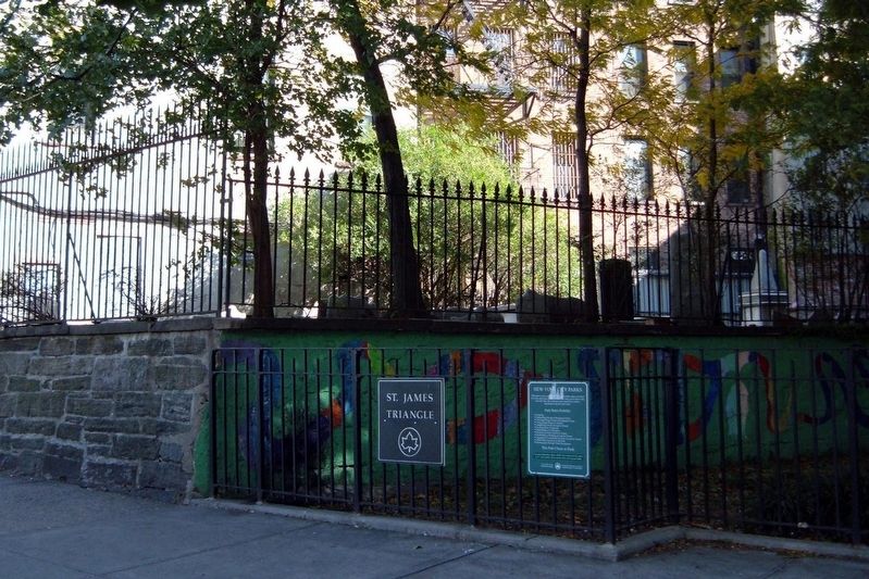
On St. James Place near James Street, on the right when traveling north.
This park, located at the intersection of St. James Place, Oliver, Madison, and James Streets bordering the Civic Center, Chinatown, and Lower East Side neighborhoods of Manhattan, takes its name from nearby St. James Roman Catholic Church. The . . . — — Map (db m131955) HM
On Lafayette Street near Leonard Street, on the right when traveling south.
After Collect Pond was buried, various legends arose.
Legend 1: The pond supplied the city’s drinking water.
It did not. However, the city’s subterranean springs, which were the source of the pond’s water, fed two other water supply systems. . . . — — Map (db m131784) HM
On Centre Street near Worth Street, on the left when traveling north.
This park in the heart of New York City’s civic center is named for patriot, author, humanitarian, and political visionary Thomas Paine (1737-1809). The land that is now Thomas Paine Park was once part of a freshwater swamp surrounded, . . . — — Map (db m129041) HM
On 5th Avenue at West 142nd Street on 5th Avenue. Reported permanently removed.
This monument honors the legendary 369th Infantry Regiment known as the Harlem Hellfighters. The black granite obelisk is a replica of a 1997 memorial that stands in Sechault in Northern France, where the 369th soldiers distinguished themselves . . . — — Map (db m18993) HM
On East 128th Street at Lexington Avenue, on the left when traveling east on East 128th Street.
Alice Wragg Kornegay (1952 - 1996) was a pioneering community advocate in East Harlem for more than thirty five years. Born in Georgetown, South Carolina, she came to East Harlem to live with cousins at the age of ten, after her parents died. She . . . — — Map (db m183129) HM
On Lexington Avenue south of East 118th Street, on the right when traveling north.
This site is a public garden which is maintained by neighborhood volunteers through GreenThumb. Founded in 1978, GreenThumb helps local residents transform vacant properties into attractive green spaces. If you want to join this garden, call (212) . . . — — Map (db m241319) HM
On Pleasant Avenue just north of East 118th Street, on the left when traveling south.
This site is a public garden which is maintained by neighborhood volunteers through GreenThumb. Founded in 1978, GreenThumb helps local residents transform vacant properties into attractive green spaces. If you want to join this garden, call (212) . . . — — Map (db m242851) HM
On East 120th Street east of Lexington Avenue, on the left when traveling east.
Harlem Art Park is located at the corner of East 120th Street and Sylvan Place, a small road between Lexington and 3rd Avenues that was closed off for use as parkland. The City of New York originally acquired the first part of this property, a . . . — — Map (db m241321) HM
On Pleasant Avenue just south of East 119th Street, on the left when traveling south.
This garden takes its name from the Community of Pleasant Village, the area from 114th to 120th Streets on Pleasant Avenue and west to First Avenue. The neighborhood in turn takes its name from Pleasant Avenue, aptly dubbed for its idyllic . . . — — Map (db m242847) HM
On 1st Avenue at East 112th Street, on the right when traveling north on 1st Avenue.
What was here before?
This park in which this pool is located was planned and named by the Board of Aldermen in 1894, though the land for it was not purchased until 1897. The park opened on October 7, 1905 to provide organized play to the . . . — — Map (db m242852) HM
On East 106th Street west of 3rd Avenue, on the right when traveling east.
Bounded by Lexington Avenue, East 105th Street, and East 106th Street, this park honors renowned civil rights activist and author Walter White (1893-1955). White was born in Atlanta, Georgia, a few decades after the Civil War. Considering his . . . — — Map (db m242858) HM
On East 105th Street west of 3rd Avenue, on the right when traveling west.
What was here before?
The area, which became known as East Harlem, was rural for most of the 19th century. The construction of the elevated transit line to Harlem in 1879-1880, and the extension of the Interborough Rapid Transit line in . . . — — Map (db m242861) HM
On Greenwich Street at Edgar Street, on the left when traveling south on Greenwich Street. Reported permanently removed.
Elizabeth H. Berger (1960-2013) was a community leader in Lower Manhattan whose passion for New York City and the neighborhood in which she made a home with her family animated a career in government, the arts and community service. As the President . . . — — Map (db m278468) HM
Near State Street, on the right when traveling south.
This 1903 statue by Jonathan Scott Hartley (1845-1912) depicts the esteemed Swedish-American engineer and inventor John Ericsson (1803-1889), who helped to revolutionize military-maritime technology with his ironclad warship, the Monitor. Ericsson . . . — — Map (db m13850) HM
Near State Street at Battery Place, on the left when traveling north.
This monumental flagstaff commemorates the Dutch establishment of New Amsterdam and the seventeenth century European settlement that launched the modern metropolis of New York City. Designed by Dutch sculptor H.A. van den Eijnde (1869-1939), the . . . — — Map (db m13927) HM
On Wall Street at Water Street, on the right when traveling west on Wall Street.
On Wall Street, between Pearl and Water Streets, a market that auctioned enslaved people of African ancestry was established by a Common Council law on November 30, 1711. This slave market was in use until 1762. Slave owners wanting to hire out . . . — — Map (db m84899) HM
On Riverside Drive at Broadway (U.S. 9), on the left when traveling west on Riverside Drive.
What was here before?
Early Dutch settlers referred to this forested, high ground as "Lang Bergh" or Long Hill. The Weckquaesgeek lived in the area until 1715, when they surrendered their last holdings in exchange for goods delivered by . . . — — Map (db m278418) HM
On Amsterdam Avenue north of West 190th Street, on the right when traveling north.
Juan Bosch (1909-2001) is the Dominican Republic's best known writer. He is most famous for his short stories, though his work also includes novels and historical analyses. His courageous opposition to the brutal dictatorships in his . . . — — Map (db m278413) HM
On Christopher Street east of 7th Avenue South, on the right when traveling east. Reported permanently removed.
This expressive bronze portrait of General Philip Henry Sheridan (1831-1888), created by Joseph Pollia (1893-1954), was unveiled in Christopher Park in 1936. The sculpture honors the distinguished Civil War cavalry commander for whom the . . . — — Map (db m275891) HM
On Mercer Street just north of Bleecker Street, on the right when traveling south.
This playground is named for physician and soldier Hugh Mercer (1726-1777) whose military service has included fighting in the Seven Years' War and being appointed Brigadier-General during the Revolutionary War.
Mercer immigrated to America . . . — — Map (db m264986) HM
On Mercer Street near West 3rd Street, on the right when traveling south. Reported permanently removed.
Mercer Playground is one of New York’s youngest parks, located in one of its oldest areas, Greenwich Village. Mercer Street, directly to the east of the park, was laid out prior to 1797 and called First Street and Clermont Street. By 1799 it was . . . — — Map (db m140768) HM
On LaGuardia Place at West Houston Street, on the right when traveling north on LaGuardia Place. Reported permanently removed.
Landscape artist Alan Sonfist (1946-) created Time Landscape as a living monument to the forest that once blanketed Manhattan Island. He proposed the project in 1965. After extensive research on New York’s botany, geology, and history Sonfist and . . . — — Map (db m140865) HM
On West Houston Street east of LaGuardia Place, on the right when traveling west.
Alan Sonfist, an environmental artist born in 1946, envisioned Time Landscape as a homage to the lost forests of Manhattan, first conceptualized in 1965. Collaborating closely with local communities, Sonfist meticulously delved into New York's . . . — — Map (db m265435) HM
On Hamilton Place south of West 141 Street, on the right when traveling south.
One of the most eminent statesmen of the Colonial Days, Alexander Hamilton (1757-1804) was also the most distinguished resident of the neighborhood that has become known as Harlem Heights. Born in the British West Indies, Hamilton moved to New . . . — — Map (db m310446) HM
On West 143rd Street at Amsterdam Avenue, on the right when traveling west on West 143rd Street.
This park is named for Johnny Hartman (1923-1983), a distinguished vocalist who is best remembered for his recordings of romantic ballads. This parcel of land was acquired by condemnation by the City of New York in 1876 and includes a portion of . . . — — Map (db m278424) HM
On 11th Avenue at West 52nd Street, on the right when traveling south on 11th Avenue.
Who is this monument dedicated to?
This memorial honors the young men from the neighborhood who died in World War I. The monument features a pensive infantryman known as a "doughboy" holding poppies in his right hand and a rifle slung over . . . — — Map (db m283348) HM
On 11th Avenue at West 52nd Street, on the right when traveling south on 11th Avenue.
DeWitt Clinton Park is one of the few New York City parks which gave its name to a neighborhood. This area, roughly bounded by 59th Street, Eighth Avenue, 34th Street, and the Hudson River, is known as Clinton, or Hell's Kitchen. The park and its . . . — — Map (db m283332) HM
On West 49th Street west of 9th Avenue, on the right when traveling west.
This playground is named in honor of Johann Gutenberg (c. 1397-1468), the German pioneer in the field of printing who is widely regarded as the European inventor of movable type. The Chinese are credited with the invention of printing type—a . . . — — Map (db m283327) HM
On Cabrini Boulevard near Pinehurst Avenue and West 187th Street, in the median.
This trivium (Latin for a place where three roads meet), at the juncture of Cabrini Boulevard, Pinehurst Avenue, and West 187th Street, is named for Dr. Charles V. Paterno (1877-1946) who was largely responsible for the residential development of . . . — — Map (db m299110) HM
On West 34th Street east of 12th Avenue (New York State Route 9A), on the right when traveling east.
Freight Rail on Manhattan's West Side
The 19th century brought a population boom and rapid growth in manufacturing to New York City. To serve the growing metropolis, freight . . . — — Map (db m228843) HM
On Bruce Reynolds Way west of West 215th Street, on the right when traveling west.
This garden honors the memory of Bruce Reynolds (1960-2001), a Port Authority Police Officer who sacrificed his life to save others on Sept. 11, 2001.
Bruce Reynolds was the son of J.A. and Geri Reynolds. When he was 5 years old, the family . . . — — Map (db m278415) HM
On Broadway (U.S. 9) at West 204th Street, on the right when traveling west on Broadway.
About the Farmhouse
Built around 1784 by William Dyckman (1725-1787), the Dyckman Farmhouse Museum (DFM) remains the last Dutch Colonial farmhouse in Manhattan. It was a prosperous farm of over 250 acres until the 1860s. DFM recognizes and . . . — — Map (db m278368) HM
On Broadway (U.S. 9) at 204th Street, on the left when traveling north on Broadway. Reported permanently removed.
Built by William Dyckman in approximately 1784, this house was once the center of a thriving farm more than 250 acres in size. Dyckman Farmhouse, along with the smokehouse and reconstructed “Hessian Hut,” has been a public museum since 1916. Jan . . . — — Map (db m41567) HM
On 10th Avenue south of West 204th Street, on the right when traveling south.
What was here before?
Through the 17th century, the Inwood area of Manhattan was inhabited by the Lenape, who relied on both the Hudson and Harlem Rivers as food sources. The area was later colonized by Dutch settlers, including the Dyckman . . . — — Map (db m278375) HM
Located at the intersection of Oliver Street, East Broadway, the Bowery, and Park Row, Kimlau Square stands at the center of Chatham Square. In 1961, a local law named this island within Chatham Square in recognition of the contributions of Lt. . . . — — Map (db m125913) HM
On Broadway north of West 63rd Street, on the right when traveling north.
Located opposite the Lincoln Center for the Performing Arts, this larger-than-life-sized bronze sculpture depicts Italian Renaissance author and poet Dante Alighieri (1265–1321). Artist Ettore Ximenes (1855–1926) sculpted the bronze . . . — — Map (db m166274) HM
On Broadway north of West 63rd Street, on the right when traveling south.
Sources conflict as to how this triangular parcel at Broadway, Columbus Avenue, and West 63rd Street became parkland. It may have been acquired from John A. Bunting in 1852, or it may have been acquired as a public place by condemnation in 1868. . . . — — Map (db m166211) HM
On Broadway north of West 63rd Street, on the right when traveling south.
Dante Park is maned after Italy's great poet, Dante Alighieri (1265-1321). Born to a noble Florentine family, Dante immersed himself in the study of philosophy and Provençal poetry. In 1302 Dante was banished from Florence for his political views . . . — — Map (db m166338) HM
On Columbus Avenue at West 65th Street, on the right when traveling south on Columbus Avenue.
Lincoln Center for the Performing Arts
212.875.5000 / www.lincolncenter.org
Lincoln Center for the Performing Arts, the largest and most ambition performing arts complex in the world, grew out of an unprecedented public, private . . . — — Map (db m203771) HM
On Empire State Trail, on the right when traveling north. Reported permanently removed.
Linda Stone Davidoff (1941-2003) devoted herself tirelessly to the city and its people as a planner, advocate and public servant. In her lifetime, she headed several non-profit organizations, including The Parks Council, the New York League of . . . — — Map (db m283354) HM
On West 70th Street west of Amsterdam Avenue, on the right when traveling east.
What was here before?
Owned by the Dyckman family since 1701, this land was purchased by Jacob Harsen and Catherine Cosine in 1763 and farmed for tobacco. They took over the homestead that was located at today's West 70th Street and . . . — — Map (db m283376) HM
On Columbus Avenue at West 65th Street, on the right when traveling south on Columbus Avenue.
Richard Tucker Park is named after the renowned tenor, Richard Tucker (1913-1975). Born and raised in Brooklyn, NY, Richard Tucker worked as a cantor before making his debut with the Metropolitan Opera in 1945, where he enjoyed a 30-year career, . . . — — Map (db m203770) HM
On Empire State Trail at West 59th Street, on the left when traveling north on Empire State Trail.
Located between West 59th Street and West 71st Street, Riverside Park South is nestled between historic Riverside Park and Hudson River Park along the Hudson River. Riverside Park South is a blend of recreational space and thriving native . . . — — Map (db m283350) HM
On West 68th Street west of Riverside Boulevard, on the left when traveling west.
Located between West 59th Street and West 71st Street, Riverside Park South is nestled between historic Riverside Park and Hudson River Park along the Hudson River. Riverside Park South is a blend of recreational space and thriving native . . . — — Map (db m283355) HM
On West 64th Street east of West End Avenue, on the right when traveling east.
This park honors Samuel N. Bennerson (1923-1970), a local leader active in the Amsterdam-Phipps community. Born to parents from the Virgin Islands, Bennerson was a second generation resident of the former Phipps Houses, a complex of model . . . — — Map (db m278503) HM
On West 108th Street west of Columbus Avenue, on the left when traveling east.
This playground honors the memory of Anibal Aviles (1947-1966), a gifted athlete who attended nearby J.H.S. 54, where he captained both the basketball and track teams. Raised on West 109th Street, Aviles belonged to a local Catholic Youth . . . — — Map (db m242813) HM
On Amsterdam Avenue north of West 104th Street, on the right when traveling north.
Formerly known as P.S. 145 Playground, this parkland was renamed in 1997 to reflect the rich history of the area. The Upper West Side was named Bloomingdale by 17th century Dutch and Fleming settlers after a town near Haarlem in the Netherlands. . . . — — Map (db m242787) HM
On Amsterdam Avenue at West 101st Street, on the right when traveling north on Amsterdam Avenue.
This playground is named for Frederick Douglass (1818-1895), celebrated African American abolitionist, orator, author, and statesman. Frederick Douglass Playground is located on Amsterdam Avenue between 100th and 102nd Streets. In 1954, the City . . . — — Map (db m242778) HM
On Amsterdam Avenue south of West 99th Street, on the right when traveling north.
Located at West 96th Street and Amsterdam Avenue, this playground and the adjoining school honor four-term New York Governor Alfred Emanuel Smith (1873-1944). The son of Irish immigrants, Smith dropped out of school to help support his family. . . . — — Map (db m242774) HM
On Morningside Drive at West 116th Street, on the left when traveling south on Morningside Drive.
Carl Schurz (1829-1906) was born in Liblar, Prussia (near what is now Cologne, Germany). In 1848, while a doctoral candidate at the University of Bonn, he joined the democratic revolt opposing the autocratic German government. After participating in . . . — — Map (db m98463) HM
Near Seminary Row near Claremont Avenue, on the left when traveling east.
Daniel Butterfield (1831-1901) was born October 31, 1831. His father John was a leader in the express mail business, and helped found the American Express Company. Butterfield graduated from Union College in 1849, and became a merchant in New York . . . — — Map (db m19627) HM
On Morningside Avenue south of West 123rd Street, on the right when traveling south.
What was here before?
This area of Morningside Heights was formerly known as Muscoota ("flat place" or "plain") to the Lenape in the Harlem Plain, Vrendendal ("Peaceful Dale") to 17th century Dutch settlers, and Vandewater . . . — — Map (db m241517) HM
On Morningside Avenue just north of West 114th Street, on the right when traveling south.
What was here before?
This area of Morningside Heights was formerly known as Muscoota ("flat place" or "plain") to the Lenape in the Harlem Plain, Vrendendal ("Peaceful Dale") to 17th century Dutch settlers, and Vandewater . . . — — Map (db m242834) HM
On East 4th Street west of Cooper Square, on the right when traveling west.
About the House
This late-Federal and Greek Revival rowhouse is a lone survivor of Old New York, the only family home preserved intact – inside and out – from the 19th century. Built in 1832, it was home to a prosperous merchant-class . . . — — Map (db m226109) HM
On Wards Meadow Loop 0.1 miles south of Hell Gate Circle, on the left when traveling north.
Perched on a knoll overlooking the East River, and framed by the monumental RFK (Triboro) and Hell Gate bridges, this little municipal comfort station is an echo of the first efforts to transform the island-landscape into a park. Its slate roof . . . — — Map (db m274919) HM
On Central Road south of K Road, on the right when traveling north.
About the Freshwater Wetland
Travel along the pathway to view the Randall's Island Freshwater Wetland. This area was once part of the Little Hell Gate Channel, which divided Randall's Island Park into two separate islands: Wards Island and . . . — — Map (db m209747) HM
On Little Hell Gate Bridge near Harlem River Pathway, on the right when traveling north.
About the Little Hell Gate Salt Marsh — Bringing Habitat Back
originally the Little Hell Gate Inlet was a more extensive channel separating Randall's Island to the north from Wards Island to the south. By the 1960's, the two islands and a . . . — — Map (db m274912) HM
On Little Hell Gate Bridge at Harlem River Pathway, on the left when traveling south on Little Hell Gate Bridge.
About the Little Hell Gate Salt Marsh — Bringing Habitat Back
originally the Little Hell Gate Inlet was a more extensive channel separating Randall's Island to the north from Wards Island to the south. By the 1960's, the two islands and a . . . — — Map (db m274914) HM
On Harlem River Pathway east of Little Hell Gate Bridge, on the right when traveling south.
About the Little Hell Gate Salt Marsh — Bringing Habitat Back
originally the Little Hell Gate Inlet was a more extensive channel separating Randall's Island to the north from Wards Island to the south. By the 1960's, the two islands and a . . . — — Map (db m274916) HM
On Harlem River Pathway north of Sunken Meadow Loop, on the left when traveling north.
The Randall's Island Park Alliance invites you to explore one of the longest perennial gardens in New York City. Composed as an urban oasis, it features large drifts of ecologically-compatible plants, habitats promoting biodiversity, and plants . . . — — Map (db m274909) HM
On Harlem River Pathway west of Little Hell Gate Bridge, on the left when traveling north.
The Randall's Island Park Alliance invites you to explore one of the longest perennial gardens in New York City. Composed as an urban oasis, it features large drifts of ecologically-compatible plants, habitats promoting biodiversity, and plants . . . — — Map (db m274911) HM
On West Houston Street at Avenue of the Americas, on the right when traveling east on West Houston Street.
The City of New York acquired this property in 1925, and transferred it to the Department of Transportation as part of a Sixth Avenue renovation. The Board of Estimate later placed the parcel under NYC Parks jurisdiction in May 1934. The . . . — — Map (db m182949) HM
On Avenue of the Americas (6th Avenue) north of West Houston Street, on the right when traveling north.
What was here before?
Long ago the area was home to the Lenape people. In the 19th century the central Greenwich Village precinct immediately to the north was known as Little Africa and was home to an early settlement of freed Blacks. Later . . . — — Map (db m284865) HM
On First Avenue at East 41st Street, on the left when traveling north on First Avenue.
Trygve Lie Plaza honors the memory of Norwegian statesman Trygve Lie (1896-1968), the first Secretary-General of the United Nations. The park was acquired by the City of New York in 1948 in connection with the widening of First Avenue and named for . . . — — Map (db m271903) HM
On Catherine Street just south of Monroe Street, on the right when traveling south.
This park honors Governor Alfred Emanuel Smith (1873-1944), who rose from the Lower East Side as the son of Irish immigrants to become a New York State and City legislator, governor, and the first Catholic candidate for President of the United . . . — — Map (db m241574) HM
On Cherry Street at Catherine Slip, on the right when traveling east on Cherry Street.
On this site in 1786, Henry Rutgers (1745-1830) built the Catherine Market which was named for his mother Catherine Rutgers (1711-1799). The market, whose vendors sold meats and fish, was near to the Catherine ferry and was popular among the . . . — — Map (db m241577) HM
Alfred E. Smith (1873-1944) served as Governor of New York from 1919 to 1920 and from 1923 to 1928.
He was the Democratic presidential candidate in 1928. As a result of his dedication to housing and social issues, Al Smith led the state’s . . . — — Map (db m132067) HM
Near Union Square W near E 17th Street, on the left when traveling south. Reported permanently removed.
One of three sculptural renditions of Abraham Lincoln (1809-1865) in New York City’s parks, this larger-than-life bronze by Henry Kirke Brown (1814-1886) stands vigil on a busy crossroads at the north end of Union Square Park. Abraham Lincoln was . . . — — Map (db m41271) HM
On Union Square West at East 16th Street, on the right when traveling north on Union Square West.
One of three sculptural renditions of Abraham Lincoln (1809-1865) in New York City's parks, this bronze larger-than-life sized statue by Henry Kirke Brown (1814-1886) today stands vigil on a busy crossroad at the north side of Union Square Park. . . . — — Map (db m242889) HM
On East 14th Street east of Union Square East, on the right when traveling west. Reported permanently removed.
This impressive bronze equestrian portrait of George Washington (1732-1799), the first president of the United States, is the oldest sculpture in the New York City Parks collection. It was modeled by Henry Kirka Brown (1814-1886) and dedicated in . . . — — Map (db m242871) HM
On East 14th Street near between Union Square East & West, on the right when traveling south. Reported permanently removed.
This impressive bronze equestrian portrait of George Washington (1732-1799), the first President of the United States, is the oldest sculpture in the New York City parks collection. It was modeled by Henry Kirke Brown (1814-1886) and dedicated in . . . — — Map (db m138392) HM
On Riverside Drive north of West 72nd Street, on the right when traveling south.
This monument by sculptor Penelope Jencks honors humanitarian and First Lady Anna Eleanor Roosevelt (1884-1962). Dedicated under the oak trees at 72nd Street on October 5, 1996 in the presence of then First Lady of the United States Hillary . . . — — Map (db m283361) HM
On Riverside Drive at West 76th Street, on the left when traveling north on Riverside Drive. Reported permanently removed.
This ornate, baroque-styled marble fountain is named for Robert Ray Hamilton (1851-1890) a prominent businessman, land owner and politician who bequeathed $9,000 to the City for its creation and installation. It is one of the finest and last . . . — — Map (db m98458) HM
On Riverside Drive at West 76th Street, on the right when traveling south on Riverside Drive.
This ornate, baroque-styled marble fountain is named for Robert Ray Hamilton (1851-1890) a prominent businessman, land owner and politician who bequeathed $9,000 to the City for its creation and installation. It is one of the finest and last . . . — — Map (db m283363) HM
On Riverside Drive at W 93rd Street, on the right when traveling north on Riverside Drive.
This impressive bronze equestrian sculpture of 15th century French patriot and martyr Joan of Arc (1411-1431) is one of the finest works of art in the Parks collection. Created by the eminent artist and art patron Anna Vaughn Hyatt Huntington . . . — — Map (db m53978) HM
On Riverside Drive at West 72nd Street, on the left when traveling north on Riverside Drive. Reported permanently removed.
Riverside Park is one of only eight officially designated scenic landmarks in the City of New York. Rugged bluffs and rocky outcroppings created through prehistoric glacial deposits once descended directly to the Hudson River shore. They were . . . — — Map (db m170420) HM
On Empire State Trail north of Hudson River Greenway, on the right when traveling north.
Located between West 59th Street and West 71st Street, Riverside Park South is nestled between historic Riverside Park and Hudson River Park along the Hudson River. Riverside Park South is a blend of recreational space and thriving native . . . — — Map (db m283357) HM
On West 77th Street at Amsterdam Avenue, on the right when traveling west on West 77th Street. Reported permanently removed.
One of the Civil War’s best-known generals, William Tecumseh Sherman (1820-1891) was born in Lancaster, Ohio in 1820. He graduated from the United States Military Academy at West Point in 1840 and served in California and the Mexican War. . . . — — Map (db m31062) HM
On West 77th Street east of Amsterdam Avenue, on the right when traveling west. Reported permanently removed.
What was here before?
This was once the site of Public School 87, a four-story, non-fireproof building that dated to 1889. It was slated for demolition in 1952 to construct a new school to accommodate a growing neighborhood.
How did . . . — — Map (db m283374) HM
Near Edgecombe Avenue south of West 158th Street, on the right when traveling north.
Dedicated to John T. Brush (1845-1912), the long-time owner of the New York Giants baseball franchise, this steel-and-concrete stairway with 80 steps was presented to the City of New York by the New York Giants on July 9, 1913. Brush previously . . . — — Map (db m242815) HM
On Jumel Terrace at Sylvan Terrace, on the right when traveling north on Jumel Terrace. Reported permanently removed.
Manhattan’s oldest surviving house, Morris-Jumel Mansion, is a monument to colonial grandeur. Built in 1765 as a summer retreat for British colonel Roger Morris and his American wife Mary Philipse, this house is the only survivor of a number of . . . — — Map (db m19682) HM
On Edgecombe Avenue at East 158th Street, on the right when traveling east on Edgecombe Avenue.
Aqueduct History
Built between 1837 and 1842, the Croton Aqueduct profoundly changed New York City by providing abundant clean water from the Croton River in northern Westchester County. Local wells, springs and ponds had gradually become . . . — — Map (db m272759) HM
Near Amsterdam Avenue at West 173rd Street, on the right when traveling north.
High Bridge, Manhattan
The Old Croton Aqueduct brought water across the Harlem River via the High Bridge, the most spectacular and technically advanced feature of New York City's first public water supply system. The original bridge, . . . — — Map (db m283178) HM
On Edgecombe Avenue near West 155th Street, on the left when traveling north. Reported permanently removed.
The rock escarpment overlooking Harlem Valley forms the spine of northern Manhattan. Perched on this rise is the neighborhood of Sugar Hill, a part of Harlem which became home to many leading members of African-American society during the first . . . — — Map (db m135278) HM
On Edgecombe Avenue at 155th Street, on the right when traveling south on Edgecombe Avenue.
What was here before?
The neighborhood of Sugar Hill is a part of Harlem that became home to many leading members of African American society during the first half of the 20th century. In 2009, NYC Parks named this triangular lawn at the . . . — — Map (db m278421) HM
On West 126th Street at Frederick Douglass Boulevard, on the right when traveling west on West 126th Street.
This site is a public garden which is maintained by neighborhood volunteers though GreenThumb. Founded in 1978, GreenThumb helps local residents transform vacant properties into attractive green spaces. If you want to join this garden, call (212) . . . — — Map (db m283654) HM
On Morningside Avenue at Dr. Martin Luther King Jr. Boulevard, on the right when traveling south on Morningside Avenue.
Acquired and dedicated in 1941, this park is named for Franklin Delano Roosevelt (1882-1945), the 32nd President of the United States, who led the country through the Great Depression and World War II. Like his distant cousin Theodore Roosevelt . . . — — Map (db m241510) HM
Near East End Avenue at East 87th Street, on the right when traveling north.
Carl Schurz Park, named by the Board of Aldermen in 1910 for the soldier, statesman, and journalist Carl Schurz (1829-1906), overlooks the turbulent waters of Hell Gate. The first known Dutch owner of the land was Sybout Claessen who was granted . . . — — Map (db m283590) HM
On 19th Street south of 23rd Drive, on the right when traveling south.
What was here before?
At one time local children swam in the Hell Gate tidal strait at the base the natural hillside embankment in the turbulent waters. The endangerment to citizens in Astoria and to coastal waters throughout the city led . . . — — Map (db m241590) HM
Near Shore Boulevard south of Ditmars Boulevard, on the left when traveling south.
The pin oak and serviceberry trees planted in this grove are a living memorial to the fathers and mothers, sisters and brothers, sons and daughters, family and friends lost to us far to soon, on Flight 587. May their spirit live on in the beauty . . . — — Map (db m241386) HM
On Shore Boulevard 0.4 miles south of Ditmars Boulevard, on the right when traveling south.
On the morning of June 15, 1904, the steamboat General Slocum caught fire in the East River with approximately 1,300 people on board, including many children. In the course of 20 minutes an estimated 1,021 people died. Prior to September 11, . . . — — Map (db m268683) HM
On 48th Street south of 20th Avenue, on the left when traveling north.
Paul Raimonda (1922-1988), an outspoken community leader in Long Island City, Queens, was born on July 5, 1922. He attended P.S. 126 and Bryant High School, and served for four years in the Army Air Corps during World War II. Both during his . . . — — Map (db m278501) HM
Near Poppenhusen Avenue west of College Place, on the right when traveling west.
Pollution and over-harvesting have decimated the once-thriving oyster population along New York City's coast. Using solar energy, Coastal Preservation Network is restoring oysters, mussels, and marsh grasses at MacNeil Park through its Electric . . . — — Map (db m294897) HM
Near Poppenhusen Avenue east of 119th Street, on the right when traveling west.
This park is named for Hermon A. MacNeil (1866 - 1947), an American sculptor who is known for designing the Standing Liberty quarter and sculpting the east pediment on the United States Supreme Court Building.
In 1835 Reverend William . . . — — Map (db m294898) HM
King Hussain of the Hachamite Kingdom of Jordan presented this 30 foot-high marble column to the New York World’s Fair Corporation and City of New York on the occasion of Jordan’s participation in the New York World’s Fair of 1964-65, held in . . . — — Map (db m108561) HM
On New York Avenue at Avenue of the Americas, on the right when traveling west on New York Avenue.
Flushing Meadows Corona Park, today New York City’s second largest park, has risen like a phoenix from the ashes. The 1,255-acre open space was indeed an ash disposal heap in the early 20th Century, noted by F. Scott Fitzgerald in The Great . . . — — Map (db m148250) HM
On 111th Street at United Nations Avenue North, on the right when traveling north on 111th Street.
Flushing Meadows-Corona Park, today New York City's second largest park, has risen like a phoenix from the ashes. The 1,255-acre open space was indeed an ash disposal heap in the early 20th Century, noted by F. Scott Fitzgerald in The Great . . . — — Map (db m239583) HM
On Zoo Path at Zoo Bridge, on the right when traveling north on Zoo Path. Reported unreadable.
The animal motifs for these fanciful bronze grillwork gates were designed by architects Clarke and Rapuana, and dating to 1960, were crafted by the Italian-born sculptor Albino Manca (1898-1976).
Following the New York World's Fair of . . . — — Map (db m193539) HM