1217 entries match your criteria. Entries 301 through 400 are listed.⊲ Previous 100 — Next 100 ⊳
Historical Markers and War Memorials in New Mexico
By Bill Kirchner, July 23, 2011
back of Cimarron Canyon Marker
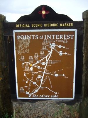
| 301 ► New Mexico, Colfax County, Cimarron — Cimarron Canyon — |
| On U.S. 64 at milepost 305,, 0.6 miles west of Turkey Creek Trail, on the right when traveling east. | |||
| 302 ► New Mexico, Colfax County, Cimarron — Cimarron Canyon State Park — |
| On U.S. 64 at milepost 295.9,, 0.8 miles west of Hummingbird Lane, on the left when traveling east. | |||
| 303 ► New Mexico, Colfax County, Cimarron — Palisades Sill — |
| On U.S. 64 at milepost 293.9,, 2.8 miles west of Hummingbird Lane, on the left when traveling east. | |||
| 304 ► New Mexico, Colfax County, Cimarron — Santa Fe Trail — |
| On Kit Carson Highway (U.S. 64) east of South Euclid Avenue, on the right when traveling east. | |||
| 305 ► New Mexico, Colfax County, Cimarron — The Saint James Hotel — |
| On State Road 21, 0.4 miles south of U.S. 64, on the left when traveling south. | |||
| 306 ► New Mexico, Colfax County, Eagle Nest — Eagle Nest Lake State Park — |
| On U.S. 64 at milepost 287.5,, 0.3 miles west of Green Mountain Summit Road, on the left when traveling east. | |||
| 307 ► New Mexico, Colfax County, Eagle Nest — Elizabethtown — |
| On Therma Way (U.S. 64) at State Road 38, on the left when traveling east on Therma Way. | |||
| 308 ► New Mexico, Colfax County, Eagle Nest — Wheeler Peak — |
| On U.S. 64 at milepost 282 at County Road B-9, on the left when traveling north on U.S. 64. | |||
| 309 ► New Mexico, Colfax County, Maxwell — Santa Fe Trail — |
| On Interstate 25 south of A-9, on the left when traveling south. | |||
| 310 ► New Mexico, Colfax County, Maxwell — Women of the Santa Fe Trail / New Mexico Historic Women Marker Initiative — |
| Near Interstate 25 at milepost 434, on the right when traveling south. | |||
| 311 ► New Mexico, Colfax County, Raton — Clifton House Site — |
| Near Interstate 25 at milepost 434, on the right when traveling south. | |||
| 312 ► New Mexico, Colfax County, Raton — First Automobile in New Mexico — |
| On Clayton Road at Whittier Street, on the right when traveling west on Clayton Road. | |||
| 313 ► New Mexico, Colfax County, Raton — Palace Hotel — |
| On South 1st Street at Cook Avenue, on the right when traveling south on South 1st Street. | |||
| 314 ► New Mexico, Colfax County, Raton — Raton — Population 8,225 – Elevation 6,379 — |
| On U.S. 64 at milepost 350, on the right when traveling west. | |||
| 315 ► New Mexico, Colfax County, Raton — Santa Fe Trail — |
| On U.S. 64 at Ranchway Road, on the right when traveling south on U.S. 64. | |||
| 316 ► New Mexico, Colfax County, Raton — The Mountain Route — |
| Near Clayton Road at Whittier Street. | |||
| 317 ► New Mexico, Colfax County, Springer — Old Colfax County Courthouse — |
| On Maxwell Avenue, 0.2 miles north of 4th Street, on the right when traveling north. | |||
| 318 ► New Mexico, Colfax County, Springer — Point of Rocks / The Dorsey Mansion — |
| On U.S. 412 at milepost 23.6, on the left when traveling east. | |||
| 319 ► New Mexico, Colfax County, Springer — Springer — Population 1,696 - Elevation 5,857 — |
| On Railroad Avenue, 0.1 miles north of State Road 468, on the right when traveling south. | |||
| 320 ► New Mexico, Colfax County, Springer — The Santa Fe Trail — Santa Fe Trail National Scenic Byway — |
| On U.S. 412 at milepost 23.6 at County Road 52, on the left when traveling east on U.S. 412. | |||
| 321 ► New Mexico, Colfax County, Springer — The Santa Fe Trail — Santa Fe Trail National Scenic Byway — |
| On Maxwell Avenue (Business Interstate 25) north of 6th Street, on the right when traveling north. | |||
| 322 ► New Mexico, Colfax County, Springer — View of the Rockies — |
| On U.S. 412 at milepost 23.6, on the left when traveling east. | |||
| 323 ► New Mexico, Curry County, Clovis — Ida O. Jackson — Educator — (1890-1960) — |
| On West Grand Avenue at Alphon Street, on the right when traveling east on West Grand Avenue. | |||
| 324 ► New Mexico, Curry County, Clovis — Norman Petty Studios — |
| On West 7th Street east of West Street, on the right when traveling east. | |||
| 325 ► New Mexico, Curry County, Melrose — Estella García/Fabric Artists: Women of the WPA — |
| On U.S. 60 at milepost 366, on the right when traveling west. | |||
| 326 ► New Mexico, Curry County, Melrose — Llano Estacado — |
| On U.S. 60 at milepost 357, on the right when traveling west. | |||
| 327 ► New Mexico, Curry County, Texico — Clovis — Population 31,194 -- Elevation 4,260 |
| On U.S. 60, on the right when traveling west. Reported missing. | |||
| 328 ► New Mexico, De Baca County, Fort Sumner — Bosque Redondo Indian Reservation — (Old Fort Sumner, 1862 – 1869) — |
| On U.S. 60 at milepost 331, on the right when traveling west. | |||
| 329 ► New Mexico, De Baca County, Fort Sumner — Bosque Redondo Indian Reservation — Fort Sumner 1862 - 1868 — |
| On State Road 272 south of State Road 212, on the right when traveling south. | |||
| 330 ► New Mexico, De Baca County, Fort Sumner — Fort Sumner — |
| On State Road 60 at milepost 329.5, on the left when traveling east. | |||
| 331 ► New Mexico, De Baca County, Fort Sumner — Fort Sumner — |
| On U.S. 60 at State Road 20, on the right when traveling east on U.S. 60. | |||
| 332 ► New Mexico, De Baca County, Fort Sumner — Lucien Bonaparte Maxwell — |
| Near Billy the Kid Road (State Road 272) 0.1 miles south of State Road 212. | |||
| 333 ► New Mexico, De Baca County, Fort Sumner — 368 — Old Fort Sumner and “Billy the Kid’s” Grave — |
| On Billy the Kid Road (State Road 272) south of State Road 212, on the right when traveling south. | |||
| 334 ► New Mexico, De Baca County, Sumner Lake — Sumner Lake State Park — |
| On U.S. 84 at State Road 203, on the right when traveling south on U.S. 84. | |||
| 335 ► New Mexico, Doña Ana County, Anthony — Brazito Battlefield — |
| Near Interstate 10 when traveling north. | |||
| 336 ► New Mexico, Doña Ana County, Anthony — Butterfield Trail/Espejo's Expedition — /On the Camino Real — |
| Near Interstate 10. | |||
| 337 ► New Mexico, Doña Ana County, Anthony — Oñate’s Route — On the Camino Real — |
| Near northbound I-10 (Interstate 10) when traveling north. | |||
| 338 ► New Mexico, Doña Ana County, Doña Ana — Bartlett Garcia — Continental Survey Point — |
| On Dona Ana Road at State Road 320, on the right when traveling north on Dona Ana Road. | |||
| 339 ► New Mexico, Doña Ana County, Doña Ana — Doña Ana — (On the Camino Real) — |
| On Dona Ana Road at State Road 320, on the right when traveling north on Dona Ana Road. | |||
| 340 ► New Mexico, Doña Ana County, Doña Ana — Doña Ana (1604–1680) — |
| On State Road 320 at milepost 2,, 0.1 miles west of Interstate 25, on the right when traveling west. | |||
| 341 ► New Mexico, Doña Ana County, Doña Ana — Shalam Colony — 1884-1901 — |
| On State Road 185 at milepost 5.5 at Shalam Colony Trail, on the right when traveling south on State Road 185. | |||
| 342 ► New Mexico, Doña Ana County, Hatch — Hatch — Population 1,028 - Elevation 4,055 — |
| 343 ► New Mexico, Doña Ana County, Las Cruces — America's First Battle of World War II: The Philippines — |
| Near North Roadrunner Parkway, 1.8 miles south of U.S. 70. | |||
| 344 ► New Mexico, Doña Ana County, Las Cruces — Civil War Battle of Mesilla & Major Lynde's Retreat — July 24-27, 1861 — |
| On Calle De Parian, on the left when traveling east. | |||
| 345 ► New Mexico, Doña Ana County, Las Cruces — Doña Ana County Courthouse — |
| On West Lohman Avenue, on the left when traveling east. | |||
| 346 ► New Mexico, Doña Ana County, Las Cruces — Fort Selden State Monument — 1865-1891 — |
| On Interstate 25 at milepost 22.8, on the right when traveling south. | |||
| 347 ► New Mexico, Doña Ana County, Las Cruces — Heroes of Bataan — The New Mexico Story — |
| Near North Roadrunner Parkway, 1.8 miles south of U.S. 70. | |||
| 348 ► New Mexico, Doña Ana County, Las Cruces — Jornada del Muerto — On the Camino Real — |
| On Interstate 25 at milepost 22.8, on the right when traveling south. | |||
| 349 ► New Mexico, Doña Ana County, Las Cruces — La Mesilla — |
| On State Road 28 at State Road 292, on the right when traveling south on State Road 28. | |||
| 350 ► New Mexico, Doña Ana County, Las Cruces — Las Cruces on the Camino Real — Population 74,267 -- Elevation 3,909 — |
| Near Interstate 10 at milepost 136. | |||
| 351 ► New Mexico, Doña Ana County, Las Cruces — Las Cruces Railroad Depot — |
| Near North Mesilla Street at West Las Cruces Avenue, on the right when traveling south. | |||
| 352 ► New Mexico, Doña Ana County, Las Cruces — María Gutiérrez Spencer — Advocate for Social Justice — (1919 - 1992) — |
| On Espina Street at Espina Street and Horseshoe Street, on the right when traveling south on Espina Street. | |||
| 353 ► New Mexico, Doña Ana County, Las Cruces — Miller Field Gates — |
| On Espina Street at Horseshoe Street on Espina Street. | |||
| 354 ► New Mexico, Doña Ana County, Las Cruces — Nike Hercules Missile — |
| On U.S. 70 at milepost 178, on the right when traveling east. | |||
| 355 ► New Mexico, Doña Ana County, Las Cruces — Paraje San Diego — |
| On Interstate 25 at milepost 22.8, on the right when traveling south. | |||
| 356 ► New Mexico, Doña Ana County, Las Cruces — Pat Garrett Murder Site — |
| On U.S. 70 at milepost 153.6 at South Jornada Road, on the right when traveling east on U.S. 70. | |||
| 357 ► New Mexico, Doña Ana County, Las Cruces — Rio Grande — |
| On West Picacho Avenue (U.S. 70) at Hoskins Lane, on the right when traveling east on West Picacho Avenue. | |||
| 358 ► New Mexico, Doña Ana County, Las Cruces — Rio Grande Theatre — 1926 — City of Las Cruces — |
| On North Downtown Mall, on the left when traveling north. | |||
| 359 ► New Mexico, Doña Ana County, Las Cruces — San Augustín Pass — |
| On U.S. 70 at milepost 178, on the right when traveling east. | |||
| 360 ► New Mexico, Doña Ana County, Las Cruces — Site of San Agustín Springs — |
| On U.S. 70 at milepost 177, on the right when traveling west. | |||
| 361 ► New Mexico, Doña Ana County, Las Cruces — The Branigan Building — 1935 — |
| Near North Main Street south of North Water Street, on the right when traveling south. | |||
| 362 ► New Mexico, Doña Ana County, Las Cruces — The Historic Green Bridge — |
| 363 ► New Mexico, Doña Ana County, Las Cruces — The Santa Fe Railroad Depot — 1910 — |
| Near North Mesilla Street at West Las Cruces Avenue, on the right when traveling south. | |||
| 364 ► New Mexico, Doña Ana County, Mesilla — All Servicemen and Women — |
| On Calle de Parian, on the left when traveling east. | |||
| 365 ► New Mexico, Doña Ana County, Mesilla — Billy the Kid — |
| On Calle De Guadalupe at Calle De Parian, on the right when traveling north on Calle De Guadalupe. | |||
| 366 ► New Mexico, Doña Ana County, Mesilla — Butterfield Overland Trail — South Central Region — |
| On Calle de Guadalupe, on the left when traveling north. | |||
| 367 ► New Mexico, Doña Ana County, Mesilla — Doña Ana County Courthouse and Jail |
| On Calle de Parian at Calle de Guadalupe, on the left when traveling east on Calle de Parian. Reported missing. | |||
| 368 ► New Mexico, Doña Ana County, Mesilla — El Mariachi dba Thunderbird de la Mesilla — Gallery Gifts Indian Jewelry — |
| On Calle Principal at Calle De Parian, on the right when traveling south on Calle Principal. | |||
| 369 ► New Mexico, Doña Ana County, Mesilla — Head Quarters, Dept. of New Mexico — Fort Fillmore, Nov. 15th, 1854 — |
| On Calle de Parian, on the left when traveling east. | |||
| 370 ► New Mexico, Doña Ana County, Mesilla — 693 — La Mesilla — |
| On Calle de Principal at Calle de Parian, on the right when traveling north on Calle de Principal. | |||
| 371 ► New Mexico, Doña Ana County, Mesilla — La Posta de Mesilla — |
| On Calle De San Albino south of Calle de Parian, on the right when traveling south. | |||
| 372 ► New Mexico, Doña Ana County, Mesilla — 14 — Mesilla Plaza — |
| On Calle De Parian at Calle De Guadalupe, on the left when traveling east on Calle De Parian. | |||
| 373 ► New Mexico, Doña Ana County, Mesilla — Plaza de Mesilla — |
| On Calle de Parian, on the left when traveling east. | |||
| 374 ► New Mexico, Doña Ana County, Mesilla — The Gadsden Purchase Celebration — |
| On Calle de Parian, on the left when traveling east. | |||
| 375 ► New Mexico, Doña Ana County, Radium Springs — A Diversion Dam for the Valley — Una presa de desviación para el valle — |
| Near Dona Ana Road, 0.9 miles north of Fort Selden Road, on the right when traveling north. | |||
| 376 ► New Mexico, Doña Ana County, Radium Springs — Changing Upland Plants — Cambiando las plantas de tierras altas — |
| Near Dona Ana Road, 0.9 miles north of Fort Selden Road, on the right when traveling north. | |||
| 377 ► New Mexico, Doña Ana County, Radium Springs — Fort Selden Cemetery — |
| On Leasburg Park Road, 0.3 miles north of State Road 157, on the right when traveling north. | |||
| 378 ► New Mexico, Doña Ana County, Radium Springs — History in Your Imagination — Historia en su imaginación — |
| Near Dona Ana Road, 0.7 miles north of Fort Selden Road, on the right when traveling north. | |||
| 379 ► New Mexico, Doña Ana County, Radium Springs — Jornada del Muerto — On the Camino Real — |
| Near Interstate 25 at milepost 22.8. | |||
| 380 ► New Mexico, Doña Ana County, Radium Springs — Jornada del Muerto — |
| Near Interstate 25 at milepost 27. | |||
| 381 ► New Mexico, Doña Ana County, Radium Springs — Paraje de Robledo — |
| On Fort Selden Road, 1.4 miles west of Interstate 25, on the right when traveling west. | |||
| 382 ► New Mexico, Doña Ana County, Radium Springs — Paraje San Diego — |
| Near Interstate 25 at milepost 22.8, on the right when traveling north. | |||
| 383 ► New Mexico, Doña Ana County, Radium Springs — Rio Grande Bosque — Bosque del Río Grande — |
| Near Dona Ana Road, 0.9 miles north of Fort Selden Road, on the right when traveling north. | |||
| 384 ► New Mexico, Doña Ana County, Radium Springs — Rio Grandé Bridge at Radium Springs — |
| On State Road 185 at milepost 15, on the right when traveling south. | |||
| 385 ► New Mexico, Doña Ana County, Radium Springs — Rio Grande Means Life — El Río Grande significa vida — |
| Near Dona Ana Road, 0.7 miles north of Fort Selden Road, on the right when traveling north. | |||
| 386 ► New Mexico, Doña Ana County, Rincon — Rincón — |
| On Rincon Road (State Road 140) 0.3 miles west of Interstate 25, on the right when traveling west. | |||
| 387 ► New Mexico, Doña Ana County, Santa Teresa — MIM-23 Surface-to-Air Missile System — War Eagles Museum — |
| On Airport Road, on the right when traveling west. | |||
| 388 ► New Mexico, Doña Ana County, Sunland Park — El Paso Del Rio Del Norte — |
| On McNutt Road, 2.2 miles south of Racetrack Drive, on the left when traveling south. | |||
| 389 ► New Mexico, Doña Ana County, Sunland Park — International Boundary and Water Commission — International Boundary Marker #1 — |
| On McNutt Road, 2.6 miles south of Racetrack Drive, on the right when traveling south. | |||
| 390 ► New Mexico, Doña Ana County, Valdo — Paraje de los Brazitos — |
| On State Road 478 at State Road 227, on the left when traveling north on State Road 478. | |||
| 391 ► New Mexico, Doña Ana County, White Sands — White Sands Missile Range — AIAA Historic Aerospace Site — |
| On State Road 213. | |||
| 392 ► New Mexico, Eddy County, Artesia — 1781 — Abo Elementary School and Fallout Shelter — |
| On West Centre Avenue west of South 17th Street, on the right when traveling west. | |||
| 393 ► New Mexico, Eddy County, Artesia — Artesia — Population 10,385 – Elevation 3,350 — |
| On U.S. 285 at milepost 61, on the right when traveling south. | |||
| 394 ► New Mexico, Eddy County, Artesia — 394 — Artesia — Population 10,385 – Elevation 3,350 — |
| On Roswell Highway (U.S. 285), on the right when traveling south. | |||
| 395 ► New Mexico, Eddy County, Artesia — Castaño de Sosa’s Route — |
| On U.S. 285 at milepost 67, on the right when traveling north. | |||
| 396 ► New Mexico, Eddy County, Artesia — First Lady of Artesia — |
| On West Main Street at South 3rd Street, on the right when traveling east on West Main Street. | |||
| 397 ► New Mexico, Eddy County, Artesia — Independent Spirit — |
| On U.S. 82 at U.S. 285, on the right when traveling west on U.S. 82. | |||
| 398 ► New Mexico, Eddy County, Artesia — John R. Gray — 1930-2001 — |
| On West Main Street (U.S. 82) east of South 6th Street, on the right when traveling east. | |||
| 399 ► New Mexico, Eddy County, Artesia — Mack C. Chase — |
| On West Main Street (U.S. 82) east of South 6th Street, on the right when traveling east. | |||
| 400 ► New Mexico, Eddy County, Artesia — Martin Yates, Jr. — 1882-1949 — |
| On West Main Street (U.S. 82) at South 6th Street, on the right when traveling east on West Main Street. | |||
1217 entries matched your criteria. Entries 301 through 400 are listed above. ⊲ Previous 100 — Next 100 ⊳