You are now at the Great Plains-Rocky Mountain boundary. The Cimarron Range, one of the eastern-most ranges of the Sangre de Cristo Mountains in this part of New Mexico. Elevation 6,800 feet. — — Map (db m45764) HM
This high mountain park is part of a state wildlife area and is managed by the New Mexico State Park Division in cooperation with the New Mexico Department of Game and Fish. Trout fishing is excellent in the Cimarron River, and the park offers fine . . . — — Map (db m45755) HM
These spectacular cliffs are cut by the Cimarron River through igneous rock known as a sill and composed of the rock type monzonite which was emplaced some 40 million years ago as these Southern Rocky Mountains were being uplifted. Elevation 8,000 . . . — — Map (db m45753) HM
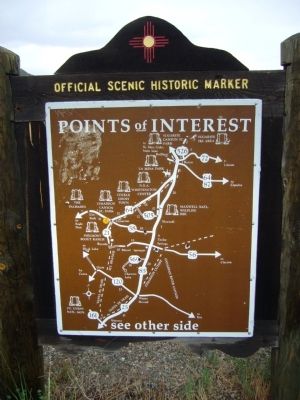
Side A:
The difficulty of bringing caravans over rocky and mountainous Raton Pass kept most wagon traffic on the Cimarron Cutoff of the Santa Fe Trail until the 1840's. Afterwards, the Mountain Branch, which here approaches Raton Pass, . . . — — Map (db m45821) HM
The Saint James Hotel
Has been placed on the
National Register
Of Historic Places
By the United States
Department of the Interior
1872 — — Map (db m45779) HM
Eagle Nest was a place where members of several Indian tribes were said to have come to collect ceremonial feathers. Before 1919, Charles Springer acquired the land and built a dam for irrigation. It now has a capacity of 78,000 acre feet and . . . — — Map (db m45752) HM
The discovery of gold on Baldy Mountain in 1866 brought such a rush of fortune-seekers to the Moreno Valley that “E-town” became a roaring mining camp almost overnight. Because of water and transportation problems, and a decline in ore . . . — — Map (db m45751) HM
Across Moreno Valley stands Wheeler Peak, 13,161 feet, highest peak in New Mexico. Rocks of Wheeler Peak and the Taos Range are highly resistant granites and gneisses of Precambrian age. Moreno Valley is underlain by soft sandstones and shales which . . . — — Map (db m45750) HM
Santa Fe Trail
(Via Bent's Fort) 1822-1879 Marked by the Daughters of the American Revolution and the Territory of New Mexico 1910 — — Map (db m227255) HM
Women of the Santa Fe Trail
The Women of the Santa Fe Trail endured untold hardships traveling across the Great Plains. In 1829, six Hispanic women were the first known female travelers going east on the trail. In 1832, Mary Donoho was . . . — — Map (db m107280) HM
Three-quarters of a mile west of here at the Canadian River crossing was the popular overnight stage stop on the Old Santa Fe Trail. Clifton House Site was built in 1867 by rancher Tom Stockton, with materials brought overland from Dodge City. For . . . — — Map (db m107281) HM
Robert L. Dodson bought a steam-powered Locomobile in Denver with plans to drive it to Albuquerque. Accompanied by a Locomobile representative, on November 30, 1900, the pair became the first motorists to traverse treacherous Raton Pass into New . . . — — Map (db m77850) HM
Built in 1896 by the Smith brothers, Scottish immigrant coal miners, the Palace Hotel became the crowning jewel of the many holdings acquired by the frugal Smiths. Nearly lost by fire in 1932, the Palace was purchased and restored by the Tinnie . . . — — Map (db m196359) HM
Once the Willow Springs freight stop on the Santa Fe Trail, the town of Raton developed from A.T. & S.F. repair shops established when the railroad crossed Raton Pass in 1879. Valuable coal deposits attracted early settlers. Nearby Clifton House was . . . — — Map (db m77849) HM
Opened by William Becknell in 1812, the Santa Fe Trail became the major trade route to Santa Fe from Missouri River towns. The two main branches, the Cimarron Cutoff and the Mountain Branch, joined at Watrous. Travel over the Trail ceased with . . . — — Map (db m202790) HM
To the north is Raton Pass, a treacherous connection through the rough mountain terrain between Colorado and New Mexico. Wagon trains traveling on the Santa Fe Trail camped here, at a trail stop called Willow Springs, to either prepare for or . . . — — Map (db m77851) HM
Built in 1879 at a cost of $9,800, this building served as the Colfax County Courthouse from 1882 through 1897, when the county seat was moved to Raton. This building housed the New Mexico reform school for boys from 1910 to 1917 and has been a . . . — — Map (db m55206) HM
Point of Rocks
Point of Rocks was a major landmark along the Santa Fe Trail. Located in Jicarilla Apache country, it was near here that the party of Santa Fe merchant J.W. White was attacked in 1849. Kit Carson was a member of the military . . . — — Map (db m55207) HM
Located in the old Maxwell Land Grant and near the Cimarron Cutoff of the Santa Fe Trail, Springer served as Colfax County seat from 1882 to 1897. Several men were killed here in one of the late flare-ups of the Colfax County War, a dispute between . . . — — Map (db m45823) HM
Point of Rocks was a convenient camping spot for Santa Fe Trail travelers going in both directions. When the caravans camped here going west they knew they were two weeks from the end of their 900-mile journey. Here they would have their first . . . — — Map (db m156696) HM
Traveling on the Santa Fe Trail, the commercial road which ran 900 miles between Franklin, Missouri, and Santa Fe, New Mexico, could be long, hard, and dangerous. Obtaining water was sometimes a problem and, along with breakdowns and bad weather, . . . — — Map (db m156697) HM
Reaching altitudes more than 13,000 feet, well watered, and forested, the Rocky Mountains are host to numerous recreational activities including skiing, fishing, hunting, and camping. To the north can be seen numerous volcanic peaks that lie . . . — — Map (db m55208) HM
Clovis schools were segregated when Ida O. Jackson arrived from Texas in 1926 to teach African-American youth. Starting with two students in Bethlehem Baptist Church, she encouraged early education and by 1935 taught 35 students in a one-room . . . — — Map (db m246804) HM
At thirteen, Norman began cutting records in
his fathers filling station. With money earned
from the Norman Petty Trio's "mood Indigo",
Petty converted a family grocery store next
door into a modern recording studio where
he experimented with . . . — — Map (db m160369) HM
This is a two sided markerSide A:
Estella García
Estella García taught colcha embroidery at Melrose, New Mexico, for the Federal Arts Program in the 1930s. Anglo and Hispana women in Garcia's class collaborated to . . . — — Map (db m73703) HM
Nomadic Indians and countless buffalo herds dominated this vast plain when the Vásquez de Coronado expedition explored it in 1541. Later it was the focus of Comanchero activity, and in the 19th century it became a center for cattle ranching. The . . . — — Map (db m73716) HM
During the 1700s and early 1800s, Comanche Indian buffalo hunters used trails that passed near here. In 1907 the Santa Fe Railroad established Clovis to serve as the eastern terminal of the Belen Cutoff, which would connect with the transcontinental . . . — — Map (db m145061) HM
The U.S. Army established Fort Sumner in 1862 as a supply and control point for the Bosque Redondo Indian Reservation. About 10,000 Navajo were forcibly relocated from the Four-Corners Region during the tragic march known as the Long Walk. About 500 . . . — — Map (db m73718) HM
You are entering the grounds of historic Fort Sumner, headquarters of the Bosque Redondo Indian Reservation.
Over 400 Mescalero Apache and 7,000 Navajo were held here as prisoners of war. The museum tells their stories. — — Map (db m145060) HM
Population 1,250 – Elevation 4,028 ft.
Named for the fort built in 1862 to guard the Bosque Redondo Indian Reservation, the town of Fort Sumner grew out of settlements clustering around the Maxwell family properties. It moved to its . . . — — Map (db m73721) HM
Population 1,250 – Elevation 4,028 ft.
Named for the fort built in 1862 to guard the Bosque Redondo Indian Reservation, the town of Fort Sumner grew out of settlements clustering around the Maxwell family properties. It moved to its . . . — — Map (db m73722) HM
A native of Kaskaskia, Ill, a fur trader and trapper who by industry, good fortune and trading became sole owner in 1864 of the largest single tract of land owned by any one individual in the United States.
Maxwell founded the First National Bank . . . — — Map (db m73719) HM
Fort Sumner was established in 1862 to guard the Navajo and Apaches on the Bosque Redondo reservation. It was discontinued as a military post in 1868 and the buildings and site sold to Lucien B. Maxwell. William "Billy the Kid" Bonney was killed . . . — — Map (db m73713) HM
Lake Sumner was originally named Alamogordo Lake after Alamogordo Creek. The lake and surrounding land became a state park in 1960. In 1974, the lake and state park were renamed Sumner in honor of Colonial Edmond Vose Sumner who in the mid 19th . . . — — Map (db m245417) HM
One of the few battles of the Mexican War to be fought in New Mexico occured near here on Christmas Day, 1846. U.S. troops under Colonel Alexander W. Doniphan defeated a Mexican army commanded by General Antonio Ponce de León. Two days later, . . . — — Map (db m6552) HM
Stagecoaches of the Butterfield Overland Mail Co. began carrying passengers and mail from St. Louis to San Francisco, across southern New Mexico, in 1858. The 2,795-mile journey took 21-22 days. In 1861 the service was re-routed through Salt Lake . . . — — Map (db m6553) HM
Juan de Oñate, first governor of New Mexico, passed near here with his colonizing expedition in May, 1598. Traveling north, he designated official campsites (called parajes) on the Camino Real, used by expeditions that followed. In Oñate's . . . — — Map (db m6549) HM
On April 24, 1851, John Russell Bartlett for the United States and Pedro Garcia-Conde for the Republic of Mexico, erected near here a monument designating 32° 22’ north latitude on the Rio Grande as the initial point for the official survey of the . . . — — Map (db m38177) HM
This site, named after the legendary woman, Doña Ana, is first mentioned as a paraje along the Camino Real. Spanish rested near here as they retreated from New Mexico following the Pueblo Revolt of 1680. The community was founded in 1843 as the Doña . . . — — Map (db m38178) HM
The name of the county Doña Ana originates from Doña Ana Robledo, who died near here while fleeing south with other settlers during the 1680 Pueblo Revolt. She was buried below the peak that now bears her surname in the Robledo Mountains, so named . . . — — Map (db m38176) HM
In 1884, Shalam Colony was established on the banks of the Rio Grande near the village of Doña Ana by John Ballou Newbrough and a group of Utopian followers called Faithists. Newbrough’s “Book of Shalam" set forth a plan for gathering the . . . — — Map (db m38199) HM
Originally established as Santa Barbara in 1851, Apache raids drove the settlers away until 1853 when nearby Fort Thorn was established. Abandoned again in 1860 after the fort closed, it was reoccupied in 1875 and re-named for General Edward Hatch, . . . — — Map (db m24745) HM
For America, WWII began of December 7, 1941, with the attack on Pearl Harbor, the first of Japan's day-long assault on locations throughout the Pacific. Major American installations on Luzon, the largest island of the Philippines, were also . . . — — Map (db m38286) HM
On July 24, 1861, Lt. Col. John Robert Baylor led 300 men consisting of two companies of the Second Texas Mounted Rifles, a Texas light-artillery company without its howitzers, an El Paso County scout company, and some civilians from Fort Bliss to . . . — — Map (db m38266) HM
Fort Selden was established to protect settlers and railroad construction crews in the Mesilla Valley and the Jornada del Muerto from Apaches. The first regular army troops to garrison it were four companies of the black 125th Infantry. General . . . — — Map (db m45085) HM
More than fourteen hundred New Mexicans fought with the 200th Coast Artillery (CAC) Regiment defending the Philippines and the Bataan Peninsula at the beginning of World War II. The regiment received the Presidential Distinguished Unit Citation with . . . — — Map (db m38293) HM
This stretch of the Camino Real leaves the Ríó Grande and cuts across 90 miles of desert with little water or shelter. Despite its difficulty, the dreaded “Journey of the Deadman” was heavily used by Spanish, Mexican, and Anglo travelers . . . — — Map (db m45083) HM
On November 16, 1854, a detachment from nearby Fort Fillmore raised the U.S. flag here confirming the Gadsden Purchase; thus the Gadsden territory was officially recognized as part of the United States. In 1858, the Butterfield stage began its run . . . — — Map (db m38149) HM
In 1849, following the Mexican War, fields were first broken in Las Cruces. The town became a flourishing stop on the Camino Real, deriving its name, "The Crosses", from the marking of graves of victims of an Apache attack. Las Cruces since 1881 has . . . — — Map (db m60679) HM
The Las Cruces Depot, built in 1910, is a county seat style Atchison, Topeka and Santa Fe (ATSF) building. Characteristics of this style of building consist of standard brick, symmetrical-gable roofed passenger areas, parapets on the edges of the . . . — — Map (db m196744) HM
Punished for not speaking English in school, María Gutiérrez Spencer devoted her life to validating the Indo-Hispano experience. A graduate of University of California, Berkeley and New Mexico State University, she pioneered bilingual and bicultural . . . — — Map (db m89687) HM
There are three markers mounted on The GatesMarker A:
Miller Field Gates
The New Mexico A&M senior class built these gates to Miller Field in 1924. The athletic field, stretching north and west from the gates was said to be . . . — — Map (db m89686) HM
Anti-aircraft missiles like this Nike Hercules once stood guard around many major U.S. cities and facilities during the Cold War. They were capable of knocking down high-flying, fast-moving bombers with high-explosive warheads or, equipped with a . . . — — Map (db m38295) HM
This paraje, or stopping place, provided travelers along the Camino Real with a final opportunity to water their stock and prepare their caravans before leaving the Rio Grande Valley and entering the desolate Jornada del Muerto. Caravans on . . . — — Map (db m45084) HM
Pat Garrett, the Lincoln County Sheriff who shot and killed William “Billy the Kid” Bonney at Fort Sumner in 1881, was himself murdered at a remote site nearby on February 29, 1908. Wayne Brazel, a local cowboy, confessed to shooting . . . — — Map (db m149330) HM
Marker Front: The Rio Grande (big river) has been an integral part of the history of New Mexico for thousands of years. Running through the entire state, it is both its backbone and lifeblood. It originates in the southern Rocky Mountains of . . . — — Map (db m67023) HM
Divide between the Tularosa Basin to the east and Jornada del Muerto to the west, cut between the Organ Mountains to the south and the San Augustín-San Andrés Mountains to the north. White gypsum sands glisten to the northeast. Roadcuts in Tertiary . . . — — Map (db m126930) HM
Here on July 27, 1861, less than 300 Confederate troops intercepted 500 Union soldiers retreating from Fort Fillmore to Fort Stanton. Exhausted from the heat and famished for water, the Union troops straggled across the desert in a five-mile . . . — — Map (db m38154) HM
This structure is the oldest steel highway bridge in New Mexico, built in 1902 by Chaves County as part of the three-span Pecos River Bridge east of Roswell. There it connected the growing town with the smaller communities and ranches of the Eastern . . . — — Map (db m89690) HM
In memory of:
all Servicemen and Women
of the Armed Forces
who served their God and Country
Dedicated July 4, 1957
by Ray McCorkle Post No. 3242
Veterans of Foreign Wars — — Map (db m6989) HM
This building, which dates from 1850, once housed the Capitol of Arizona and New Mexico. Later it was the Courthouse in which Billy The Kid was tried and sentenced to hang. — — Map (db m126893) HM
This is the oldest documented brick building in New Mexico.
Augustin Maurin (of French descent) initiated construction in 1860 using burned brick from his own kiln. He was murdered by robbers in his adjoining apartment in 1866.
The heir, Cesar . . . — — Map (db m196768) HM
I. The laws of the United States having been extended by proclamation over the Mesilla Valley and the territory recently acquired from the Republic of Mexico, the undersigned as military Commander of the same directs that Lt. Colonel Miles 3rd . . . — — Map (db m6991) HM
The 1848 Treaty of Guadalupe Hidalgo ended the Mexican-American War, establishing Mesilla as a Mexican holding. Cura Ramon Ortiz settled families from El Paso del Norte and pre-territorial New Mexico here. Disputes over the border just north of town . . . — — Map (db m119926) HM
This is the original La Posta. The only station that remains standing on the Butterfield Trail. For more than a century and three quarters, these old adobe walls have withstood the attack of elements and men and have sheltered such personalities as . . . — — Map (db m126894) HM
Established in
Mexican Territory, 1850.
U.S. Flag Raised July 4, 1854.
Seat of Confederate Government
in New Mexico, 1861-1862.
Site No. 14
A Registered Cultural Property
State of New Mexico — — Map (db m196766) HM
Conservation made possible by grants from
United States Department of Commerce
Economic Development Administration
New Mexico
American Revolution Bicentennial Commission
and by matching funds from the
Town of Mesilla
and individual . . . — — Map (db m6988) HM
English: In the early 1900s, after the construction of the Elephant Butte storage dam, planning began for a project to divert water from the Rio Grande to irrigate crops for 50 miles through the Mesilla Valley. In late winter of . . . — — Map (db m157900) HM
English: In the past, miles of Chihuahuan desert grassland cloaked the flats above the Rio Grande. Bunch grasses such as alkali sacaton, muhlies, dropseeds and three-awns were widespread. Scattered among the grasses were shrubs like . . . — — Map (db m158037) HM
Fort Selden was established nearby in 1865 to help protect the settlements of the Mesilla Valley and travelers along the Jornada del Muerto from Apache raids. The post cemetery was located in this field until the fort was abandoned in 1891. Military . . . — — Map (db m38201) HM
English: As you look across this landscape, use your imagination to "see" how people lived and passed by this spot throughout history. Ancient village — 1,000 years ago Look along the ridge and imagine a village built by . . . — — Map (db m158085) HM
This stretch of the Camino Real leaves the Río Grande and cuts across 90 miles of desert with little water or shelter. Despite its difficulty, the dreaded “Journey of the Deadman” was heavily used by Spanish, Mexican, and Anglo travelers . . . — — Map (db m38205) HM
High plains of the Jornada del Muerto, elevation 4,340 feet, lie 400 feet above the Rio Grande Valley. It is a transitional area from the Basin and Range region to the west into tilted mountain ranges, such as the San Andres Mountains to the east, . . . — — Map (db m38206) HM
This paraje or resting place was named for Pedro Robledo, a member of the Juan de Oñate expedition, who was buried nearby on May 21, 1598. This camping place was a welcome sight for caravans entering or exiting the dreaded Jornada del . . . — — Map (db m38200) HM
This paraje, or stopping place, provided travelers along the Camino Real with a final opportunity to water their stock and prepare their caravans before leaving the Rio Grande Valley and entering the desolate Jornada del Muerto. Caravans on their . . . — — Map (db m38204) HM
English: The cottonwood forests that border the Rio Grande in central New Mexico are a remnant of a unique and diminishing habitat. Known locally by the Spanish word bosque, these riverside forests provide valuable resources . . . — — Map (db m158081) HM
This structure – one of the best surviving examples of timber and beam bridge construction in the state – was erected in 1933. The superstructure consists of 19 spans, each 25 feet in length. The roadway is 475 feet long. During the . . . — — Map (db m38202) HM
English: Early people in this area found much of what they needed in the Rio Grande valley. They moved throughout these grasslands and foothills in search of food and resources. Later, settlements concentrated along the river, using . . . — — Map (db m158095) HM
Rincón was originally named El Rincón de Fray Diego in honor of a 17th century Franciscan who died here. Established as a settlement called Thorne in 1881, it became Rincón in 1883. With the establishment of the Santa Fe Railroad, Rincón . . . — — Map (db m45082) HM
In the early 1950s, the Cold War was in full swing. The United States and the
Soviet Union faced each other with bristling arrays of weapons. While all-out nuclear war between the two superpowers was unlikely, the possibility of a shooting war . . . — — Map (db m162264) HM
This canyon cut here by the Rio Grande marks the crossing of the historic Camino Real, or Royal Road, to La Tierra Adentra. Trackers and traders crossed the river here to begin the arduous journey north to Santa Fe. Permanent settlement of this area . . . — — Map (db m38103) HM
[English Translation Marker:]
The first international monument of the 276 monuments installed to the west along the international land boundary which marks the international boundary between the United States and Mexico. This monument . . . — — Map (db m38105) HM
Here the Camino Real between Santa Fe and El Paso passed along the eastern bank of the Rio Grande near a brazito, or small branch of the river that created a small island. At this paraje, or stopping place, American troops defeated a . . . — — Map (db m38148) HM
White Sands Proving Ground, as it was first called, is home to America’s first large-scale rocket and missile launch facilities. Established in 1945, the launching here of 67 V-2 rockets and many other vehicles propelled the United States into the . . . — — Map (db m140621) HM WM
Built 1962. The only Cold-War era fallout shelter/school building in the United States.
Site no. 1781
A Registered Cultural Property
State of New Mexico — — Map (db m235316) HM
Artesia, named for the area's many artesian wells, lies on the route of the Pecos Valley cattle trails used by Charles Goodnight, Oliver Loving, and John S. Chisum. The town, established in 1903, is located in what was once part of Chisum's vast . . . — — Map (db m61456) HM
Artesia, named for the area's many artesian wells, lies on the route of the Pecos Valley cattle trails used by Charles Goodnight, Oliver Loving, and John S. Chisum. The town, established in 1903, is located in what was once part of Chisum's vast . . . — — Map (db m119811) HM
In 1590-91 Gaspar Castaño de Sosa, a Portuguese by birth, took an expedition up the Pecos River in an attempt to establish a colony in New Mexico. His venture was a failure, but it led to a permanent settlement under Don Juan de Oñate in 1598. . . . — — Map (db m61454) HM
Dedicated
to the
Spirit of the Pioneer Woman
Sculptor: Robert Summers
Foundry: Eagle Bronze
First Lady of Artesia is approximately 12 feet tall and 6 feet in diameter. The artist designed Sallie Chisum from several photographs . . . — — Map (db m73436) HM
The men who drove cattle from Texas up along the Pecos River during the mid-1860s until the barbed-wire era of the early 1900s were tough, independent and courageous. Those who chose to settle down and ranch in the surrounding plains or rugged . . . — — Map (db m61443) HM
"He was born with compassion" is the way John R. Gray was described by his daughter, Terry Gray Chandler, and is remembered by those who knew him. His outward appearances portrayed him as a gruff cowboy, but he was known as a benefactor in his town, . . . — — Map (db m235349) HM
Mack Chase got his start in the oilfield in 1945 at the young age of 14. After graduating from Artesia High School, he went straight to the field full time on a pulling unit, then into two years of service in the United States Army in the early . . . — — Map (db m235351) HM
“It is my boiled-down, concentrated, solidified and undiluted opinion that the oil development in this Valley so far is only a preliminary skirmish compared with the artillery that will soon follow.” – Martin Yates, Jr., 1924
The brochures . . . — — Map (db m235362) HM
1217 entries matched your criteria. Entries 301 through 400 are listed above. ⊲ Previous 100 — Next 100 ⊳