By Bradley Owen, July 31, 2024
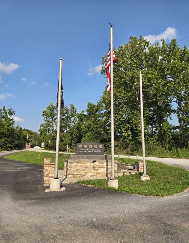
Post 1669 Catholic War Veterans Memorial
| Near National Pike (Business U.S. 40) north of Nell Street, on the left when traveling north. |
| On Jumonville Road (County Route 2021) 0.3 miles north of Old Braddock Road, on the left when traveling north. |
| On Buttermilk Lane south of Walnut Avenue, on the right when traveling south. |
| Near Old Braddock Road 0.2 miles east of Jumonville Road (County Route 2021), on the left when traveling east. |
| Near Jumonville Road (Pennsylvania Route 2021) 0.2 miles north of Old Braddock Road, on the right when traveling north. |
| Near Jumonville Road (County Road 2021), on the right when traveling north. |
| Near Old Braddock Road 0.2 miles east of Jumonville Road (County Route 2021), on the left when traveling east. |
| On Finley Street 0.2 miles east of National Pike (Business U.S. 40), on the right when traveling east. |
| Near Jumonville Road (Parish Route 2021) 0.2 miles north of Old Braddock Road, on the right when traveling north. |
| On National Pike (U.S. 40) 2.1 miles west of Jumonville Road (County Route 2021), on the right when traveling east. |
| On National Pike (Business U.S. 40) at Hopwood Fairchance Road, on the left when traveling north on National Pike. |
| Near Jumonville Road (County Route 2021) 0.2 miles north of Old Braddock Road, on the right when traveling north. |
| On Buttermilk Lane south of Walnut Avenue, on the right when traveling south. |
| On Jumonville Road (Pennsylvania Route 2021) 1.2 miles north of National Pike (U.S. 40). Reported unreadable. |
| On Jumonville Road (County Route 2021) 1.2 miles north of National Pike (U.S. 40), on the right when traveling north. Reported unreadable. |
| On Jumonville Road (Pennsylvania Route 2021) 0.2 miles north of Old Braddock Road, on the left when traveling north. |
| On Jumonville Road (County Route 2021) 1 mile north of National Pike (U.S. 40), on the left when traveling north. Reported missing. |
| Near Jumonville Road (County Road 2021), on the right when traveling north. |
| Near Old Braddock Road 0.2 miles east of Jumonville Road (County Route 2021), on the left when traveling east. |
| On National Pike (U.S. 40) 2.1 miles west of Jumonville Road (County Route 2021), on the right when traveling east. |
| On Jumonville Road (Pennsylvania Route 2021) 3 miles north of National Pike (U.S. 40), on the right when traveling north. |
| Near West Crawford Avenue east of Arch Bridge Road, on the left when traveling east. |
| Near West Crawford Avenue east of Arch Bridge Road, on the left when traveling east. |
| On Main Street 0.2 miles north of Pine Ridge Road, on the left when traveling north. |
| On National Pike (U.S. 40) west of Pike School Road, on the right when traveling west. |
| On National Pike (U.S. 40) 1.2 miles east of Dark Hollow Road (Local Route T876), on the right when traveling east. |
| On Main Street (Pennsylvania Route 281) at Church Street, on the right when traveling south on Main Street. |
| On Main Street (Pennsylvania Route 281) at Church Street, on the left when traveling north on Main Street. |
| On Main Street (Pennsylvania Route 166) at Middle Avenue (now closed), on the left when traveling north on Main Street. |
| On Main Street (Pennsylvania Route 166) at Middle Avenue (now closed), on the right when traveling north on Main Street. |
| On Main Street (Pennsylvania Route 166) at Cross Avenue, on the left when traveling north on Main Street. |
| On River Avenue west of South Liberty Street, on the right when traveling east. |
| On Main Street (Pennsylvania Route 166) at Cross Avenue, on the left when traveling north on Main Street. |
| On Edenborn Road (Pennsylvania Route 166) south of Long Street, on the right when traveling north. |
| On Mill Run Road (Pennsylvania Route 381) 1.5 miles north of Maple Summit Road ( Route 2017), on the right when traveling north. |
| On Mount Braddock Road (Pennsylvania Route 1055) north of Ferguson Road, on the left when traveling north. |
| On Mudd School Road 0.2 miles east of Gimlet Hill Road, on the right when traveling east. |
| On New Geneva Road (Pennsylvania Route 166), on the right when traveling south. |
| On South Mill Street at Church Street, on the left when traveling south on South Mill Street. |
| On Springfield Pike (Pennsylvania Route 711) west of Indian Creek Valley Road ( Route 381), on the left when traveling west. |
| Near Sheridan Street east of Main Street ( Route 381), on the left when traveling east. |
| Near Sheridan Street east of Main Street ( Route 381), on the left when traveling east. |
| On Sheridan Street east of Main Street ( Route 381), on the left when traveling east. |
| Near Sheridan Street east of Main Street ( Route 381), on the left when traveling east. |
| On Sheridan Street east of Main Street ( Route 381), on the left when traveling east. |
| Near Sheridan Street east of Main Street ( Route 381), on the left when traveling east. |
| On Sherman Street at Lincoln Street, on the left when traveling north on Sherman Street. |
| Near Mountain Road (Pennsylvania Route 3027) 0.2 miles south of Willey Road, on the left when traveling north. |
| On Oliver Road west of South Gun Club Road, on the left when traveling west. |
| On Banning Road at Layton Road, on the right when traveling west on Banning Road. |
| On DeLafayette Street at Union Street, on the right when traveling south on DeLafayette Street. |
| On Pittsburgh Road (Pennsylvania Route 51) 1.1 miles south of West Independence Street, on the right when traveling south. Reported missing. |
| On Independence Street at Circle Street, on the right when traveling west on Independence Street. |
| On Layton Road east of Knox Street, on the right when traveling east. |
| On Independence Street east of Circle Street, on the right when traveling east. |
| On Pennsylvania Route 4038 north of Church Street, on the left when traveling north. |
| On Hancock Street at Independence Street, on the left when traveling north on Hancock Street. |
| On Hancock Street south of Randolph Street, on the left when traveling north. |
| On Independence Street west of Federal Street, on the right when traveling west. |
| On Liberty Street north of Railroad Street, on the right when traveling north. |
| Near Galley Street 0.2 miles east of Navy Street, on the right when traveling east. |
| Near Galley Street 0.1 miles east of Adams Street, on the right when traveling east. |
| On Layton Road east of Knox Street, on the left when traveling east. |
| On Independence Street at Circle Street, on the right when traveling east on Independence Street. |
| On DeLafayette Street at Vfw Street, on the left when traveling east on DeLafayette Street. |
| On Liberty Street south of Independence Street, on the left when traveling south. |
| On Railroad Street near Penn Street (U.S. 119), on the right when traveling north. |
| On South Eighty Eight Road (Pennsylvania Route 88) at South Main Street, on the right when traveling north on South Eighty Eight Road. |
| Near New Geneva Road near County Route 166. |
| Near New Geneva Road (Pennsylvania Route 166) south of Pekar Road. |
| Near New Geneva Road (Pennsylvania Route 166) south of Pekar Road, on the left when traveling north. |
| Near New Geneva Road (Pennsylvania Route 166) south of Pekar Road, on the left when traveling north. |
| Near New Geneva Road (Pennsylvania Route 166) south of Pekar Road, on the left when traveling north. |
| Near New Geneva Road (Pennsylvania Route 166) south of Pekar Road, on the left when traveling north. |
| On Penn Street (U.S. 119) at Railroad Street, on the left when traveling west on Penn Street. |
| On Morgantown Road (U.S. 119) west of Honor Roll Road, on the left when traveling south. |
| Near New Geneva Road (Pennsylvania Route 166) south of Pekar Road, on the left when traveling north. |
| Near New Geneva Road (Pennsylvania Route 166) south of Pekar Road, on the left when traveling north. |
| On North Main Street (U.S. 119) at Penn Street (U.S. 119), on the right when traveling north on North Main Street. |
| Near New Geneva Road (Pennsylvania Route 166) south of Pekar Road, on the left when traveling north. |
| On New Geneva Rd. Reported permanently removed. |
| On South Main Street 0.1 miles north of 5th Avenue, on the right when traveling north. |
| On Morgantown Street (U.S. 119) just north of Broadway Street, on the left when traveling north. |
| Near Morgantown Road (U.S. 119) north of Pennsylvania State Line, on the right when traveling north. |
| On Morgantown Road (U.S. 119) north of Pennsylvania State Line, on the right when traveling north. |
| On Railroad Street north of Broadway Street, on the right when traveling north. |
| On North Main Street (U.S. 119) 0.1 miles north of Penn Street (U.S. 119), on the left when traveling north. |
| On Penncraft Road at Penncraft Circle 2, on the right when traveling east on Penncraft Road. |
| On Legion Street (Pennsylvania Route 166) at Legion Street, on the right when traveling north on Legion Street. |
| On Republic Road (Pennsylvania Route 166) at Legion Street, on the right when traveling north on Republic Road. |
| On Springhill Furnace Road (Pennsylvania Route 857) south of Wymps Gap Road, on the right when traveling south. |
| On Main Street (U.S. 119) at Liberty Street, on the right when traveling north on Main Street. |
| On Pittsburgh Road (Pennsylvania Route 51) at Laurel Hill Road, on the right when traveling north on Pittsburgh Road. |
| On Main Street (Pennsylvania Route 4016) at Hurst Road ( Route 4026), on the left when traveling north on Main Street. |
| On Memorial Drive north of Main Street (Local Route 699), on the right when traveling north. |
1329 entries matched your criteria. Entries 401 through 500 are listed above.
⊲ Previous 100 —
Next 100 ⊳
