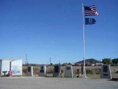
Camp Bouse
September 1943 to March 1944
"The Kid Battalion"
From Normandy to the Elbe:
•Normandy
•Northern France
•Ardennes
•Rhineland
•Central Europe — — Map (db m78563) HM
Dedicated to the men who gave time in their lives to serve honorably and courageously for our country. We take this moment in time to recognize their achievements which were done with pride and dignity.
* * *
Campaigns
Ardennes - Alsace - . . . — — Map (db m29160) HM
Campaigns
Ardennes, Rhineland and Central Europe
The 739th Tank Battalion was activated in March 1943 at Fort Lewis, Washington. The officers were from various states, the enlisted personnel from Oklahoma, Texas and Louisiana.
The . . . — — Map (db m78558) HM
The 740th tank battalion was activated at Fort Knox, Ky. on March 1, 1943. It trained at Fort Knox and at Camp Bouse, Az. as a canal defense light (CDL) unit and as a standard medium tank battalion from October 15, 1943 to April 24, 1944 then sailed . . . — — Map (db m78562) HM
The 748th Tank Battalion, Medium was activated on 20 August 1942 at Camp Rucker, Alabama. The Rhinos headed for Fort Knox on the 15th of April 1943 for training and on 20 April 1943 were reorganized as a special battalion equipped with CDL . . . — — Map (db m92814) HM
This building was built prior to 1912. The mercantile was known to do business with the A & C and Swansea railroads in 1916. It has been open continuously since that time. Bouse postmaster Cora L. Johnston moved the US Post Office to the store in . . . — — Map (db m39504) HM
Thomas Bouse was born in Mendecino County, California and came here about 1889 as a prospector and built the first two rooms of his home. He ran a small store here. He brought his wife, Katherine, and infant daughter here in 1892. Three more . . . — — Map (db m29070) HM
General George Patton established Camp Bouse in 1943 in the Butler Valley as the site for training over 5,500 carefully screened and qualified volunteers. These soldiers were trained to use a highly secret weapon called the Canal Defense Light. . . . — — Map (db m29165) HM
Camp Bouse was established in Butler Valley 30 miles behind this monument in Sept. of 1943. It was one of twelve such camps built in the southwestern deserts to harden and train United States troops for service on the battlefields of World War II. . . . — — Map (db m78566) HM
Campaigns
Central Europe Northern France Rhineland
The 701st tank battalion was activated 3/28/43 at Camp Campbell, KY. Here 553 young men and officers began their journey into history. These men began their basic training and for many saw . . . — — Map (db m78564) HM
Activated 1 April, 1943 at Camp Perry, OH. Completed basic training and then sent to Ft. Knox, KY. Unit then assigned to Camp Bouse, AZ arriving there 9 November, 1943. Maintaining operation of special tanks named "Leaflets" was specific assignment. . . . — — Map (db m78557) HM
United States Army
World War II
1924 – 2002
Whose dedication to the memory of his brothers in
arms, who fell in the Battle of the Ardennes, made this
historical park possible. — — Map (db m78542) HM
He was our drinking buddy
While on duty
He drank our beer
He was
Full of good cheer
And went to the nurses' quarters around the bend
And came to an untimely end,
Of the Colonel, he was unaware
That it would be the crime of all time . . . — — Map (db m78536) HM
We bring to a close
We tried to find
We must now impose
Units not found
748th Tank Battalion
150th Station Hospital
538th Ordnance Company
166th Quartermaster
629th Quartermaster — — Map (db m29161) HM
In honored memory of those soldiers of the battalion who trained here at Camp Bouse and gave their lives in combat to preserve the freedom of the United States and to set the Peoples of Europe free.
Headquarters Company
Donald D. . . . — — Map (db m78537) HM
Gold and silver strikes in the 1860's created growth in the area. It is said Wyatt Earp served as sheriff of Cibola for one year in the 1890's. The town of Cibola formed in 1898 and construction began on a 16 mile canal to bring water from the river . . . — — Map (db m78552) HM
Ferries of various size and design once provided transportation across the lower Colorado River linking Arizona with California, Nevada and Utah.
Ferrymen plied their trade from Yuma to Pearce Ferry. The first ferry on the river was started . . . — — Map (db m78553) HM
This monument built to
perpetuate the memory of
the pioneers, trailblazers,
and adventurers that rest
in these unmarked graves.
(Arizona Highway Department, 1934)
Rededicated: April 27, 2003 (CY 6008)
By the Ancient and . . . — — Map (db m31188) HM
We honor our ancestors who died violent deaths at the hands of their captors and at this concentration camp. We greet the spirits of our ancestors and embrace their strength and above all else, their will to survive this holocaust: the Hualapai . . . — — Map (db m36012) HM
First used sometime after June 16, 1862. Some of Arizona's earliest pioneers, people of every race and moral persuasion, lie here in eternal peace. The last burial was on April 22, 1988. — — Map (db m31827) HM
In the 1860's, Prospector Pauline Weaver discovered gold on the eastside of the Colorado River, setting off a mining rush in the area. Ore from nearby mines in the Buckskin Hills was transported by wagon down the washes to the Colorado River which . . . — — Map (db m145826) HM
[ The single 30 foot concrete pillar of the monument symbolizes "unity of spirit". The hexagonal base represents a Japanese stone lantern. The 12 small pillars situated around the monument make it a working sundial. Mounted on the 30 foot pillar . . . — — Map (db m32258) HM
McDonnell Douglas F-4 Phantom was a multi-service aircraft, served as primary fighter with Air Force, Navy and Marine Corps during Vietnam era. Carrying a crew of two, Pilot and Weapon Systems Officer, it was capable of speeds in excess of Mach . . . — — Map (db m118796) HM
The famous camel herd with which the name of Hi Jolly is linked constitutes an interesting sidelight of Arizona history.
Jefferson Davis (afterward president of the Southern Confederacy), as Secretary of War, approved a plan to experiment . . . — — Map (db m70566) HM
Established between 1899 & 1904. Existed until 1924. Overall dimensions 12' x 40', consisting of station and sleeping rooms. A breezeway separated rooms from main building. — — Map (db m7005) HM
Thomas P. Quinn, born in 1869 in New Jersey, had a mine near here and dug a cistern to catch water. He built a house just north of this sign and lived there until old age forced him to move to Bouse.
The remains of his cistern survive and . . . — — Map (db m29068) HM
Dug by hand around 1864 by a miner named Tyson. This 40-foot-deep well marked the spot around which grew the town of Quartzsite. Originally known as "Tyson's Well," "Tyson Wells," or "Tyson's Wells," the small community served as an important . . . — — Map (db m39416) HM
This was a stage stop between Ehrenberg and Wickenburg and points east. Travelers in the 1870's and 80's made their first stop here on eastward journeys from the Colorado River. "No grass, but good water," an early desert guide indicated . . . — — Map (db m7004) HM
Harrisburg was established on this site in 1886 by Captain Charles Harris, and his partner Governor Fredrick Tritle, as a mill town to process ore from the Socorro and other mines in the area. By 1887 two mills were operating here.
The post . . . — — Map (db m31821) HM
This desert town was made famous by the humor of Dick Wick Hall, healthseeker and operator of the laughing gas station. Hall's publication the Salome Sun was filled with extravagant tales of the desert's adaptation of species. He told of his frog . . . — — Map (db m31824) HM
On the morning of March 23, 1950, an Air Force B-50 Bomber on a routine training mission, exploded and crashed north of the communities of Dateland and Hyder AZ. Two of the 14 crewman on board, Capt. John H. Lee and 1st. Lt. William T. Gentry, . . . — — Map (db m28936) HM
Datelan Army Air Field was established here January 1, 1943. The site was chosen due to the availability of water and the adjacent location of the Yuma Gunnery Range. Construction was completed June 1, 1943. Datelan AAF was a sub-base of Yuma Army . . . — — Map (db m78545) HM
Camps Hyder & Horn were established 10 miles north of Dateland in the fall of 1943. They were 2 of 15 desert camps built to harden and train United States Troops for service in World War II. The Desert Training Center was a simulated theater of . . . — — Map (db m78546) HM
Here trained
For Victory
Under
Desert Skies
The
81st Infantry
Division
The Wildcats
1943
In Memoriam
Privates
Robert J Vilella
Paul M. West
Earl S. Smith
James J. DeCarlo
Lynn Ramsey
Clyde B. Slayton
Arden . . . — — Map (db m28937) HM
In memorium June 28, 1944 a B-17 Training Bomber crashed South of this Point.
Crew Members
2nd. Lt. William A. Richell, 22, Pilot
2nd. Lt. Sheridan B. Marek, 20, Co-Pilot
2nd. Lt. Angus W. MacArthur, 21, Co-Pilot
Sgt. Manteu P. Jones, . . . — — Map (db m248850) HM WM
who carved this farm out of the desert. We, the Wellton-Mohawk Valley Kiwanis Club, dedicate this spot. Here on May 1, 1952 Michael W. Straus, United States Commissioner of Reclamation turned the first water on to lands of the Wellton-Mohawk . . . — — Map (db m28967) HM
Across the Colorado River is "Indian Hill," the site of La Purisima Concepcion mission. Built in 1780 by Spanish explorers, it was destroyed in 1781 when native Quechans revolted, killing all European males. Nothing is left of that structure. . . . — — Map (db m158369) HM
The gray bridge, finished in 1915, is the "Ocean to Ocean" Highway Bridge. This was the final link in a highway stretching from the Atlantic to the Pacific coast. Its presence meant travelers no longer had to wait for the ferry to cross the . . . — — Map (db m158287) HM
In memory of
the inmates, who lost their life
while serving their sentence, at the
Arizona Territorial Prison at Yuma
Aldrete, Simon • Alejandra • Alveres, Thomas • Armbula, Tomas • Arnett, William • Arvizu, Gregorio • Baca, Antonio • . . . — — Map (db m51636) HM
In 1877, the Southern. Pacific Railroad (SPRR) was the first railroad to arrive in the Arizona Territory, crossing the Colorado River from California and arriving in Yuma. Traveling through the scorching desert, the locomotives arrived in Yuma . . . — — Map (db m266543) HM
Recordando a Brian O'Dwyer In 1994 Brian came to Gowan to build a business in Mexico that would provide growth and opportunity for the company and his employees. Walking the fields with farmers, Brian and his Tribe were men with muddy boots. They . . . — — Map (db m191696) HM
Camp Laguna operated from April 1942 to April 1944. It was one of twelve such camps built in the southwestern deserts to train United States troops during World War II.
The Desert Training Center, a simulated theater of operations, included . . . — — Map (db m29061) HM
In 1863 Jacob Snively, founder of Gila City, and right hand to Sam Houston, avenger of the Alamo, following blazes left on the saguaros by Mexican and Conquistador predecessors, came to Castle Dome, and within 15 years, Castle Dome City’s population . . . — — Map (db m48924) HM
In 1859, steamboat entrepreneur George Alonzo Johnson built a riverside home for his bride, Estefana Alvarado. Now known as the Commanding Officer's Quarters, the home is believed to be Arizona's oldest Anglo-built adobe building. In the . . . — — Map (db m28999) HM
Eager to expand it's New World empire, Spain authorized a 1775-1776 expedition to settle the port of San Francisco. The expedition, lead by Juan Bautista de Anza, commander of the Royal Presidio of Tubac, traversed 1000 miles on foot, horseback, . . . — — Map (db m191836) HM
All water for the prison came from the river. Inmates dug a network of tunnels at the base of the hill which would fill with river water. From there water was pumped up into the 85,000 gallon granite-walled tank, also of inmate construction. In . . . — — Map (db m185955) HM
Construction on this adobe home on Madison Avenue began in the 1870's. Pioneer merchant E. F. Sanguinetti purchased the two-room house with its lean-to kitchen in 1890. The building, gardens, and aviaries were developed by Sanguinetti who resided . . . — — Map (db m28971) HM
Early day route from Sonora to California over the path taken by Father Eusebio Kino in 1700 when he sought to discover if California was part of the American mainland. The parched desert along this route has claimed hundreds of lives, particularly . . . — — Map (db m83418) HM
This is the point of discovery for the Flora Temple Mine. In the early 1870’s, a Colorado River steamboat captain named Isaac Polthamus purchased the Flora Temple Mine. This mine was the 2nd patented claim in Arizona (1871). Polthamus and his . . . — — Map (db m91925) HM
Built by John Gandolfo, this brick landmark served as a 635 seat theater and vaudeville house, a WW II USO canteen and was a center of community activity from 1917 to 1950. The third floor ballroom was destroyed by fire in 1925.
Dedicated . . . — — Map (db m28987) HM
John Ghiotto, native of Genoa, came to Yuma in 1890 to work in the Gandolfo store. He went into business for himself and had a chain of four small groceries. His brick home is typical of middle class housing of this period.
Dedicated December . . . — — Map (db m29004) HM
The building is an example of Moderne/Art Deco Style. It served as headquarters for Hollywood stars throughout the 1930 and 40's and was the center of Yuma's social life until 1960.
Dedicated December 1999, by the City of Yuma
for the . . . — — Map (db m29006) HM
In Commemoration
Of the
125th Anniversary of the Founding
of
Immaculate Conception Parish
1866 – 1991
Celebrated on the Feast of the Immaculate Conception
December 8, 1991
Most Rev. Manuel D. Moreno, D.D.
Bishop of the . . . — — Map (db m29024) HM
Senator Giss was born February, 1906, in Minneapolis, Minn. and moved to Arizona in 1937. Being a concerned individual for Arizona's future, Senator Giss entered politics. He served as a member of the Arizona House of Representatives for two years . . . — — Map (db m28986) HM
In 1904 an incorrigible ward, consisting of five steel cages, was constructed on this site. The total budget for the building, including steel cages, corrugated iron roofing and lumber, was five hundred dollars. Approximately 4,000 adobe bricks, . . . — — Map (db m158296) HM
During World War II, the Yuma proving ground of the United States Army Corps of Engineers was known as the Yuma Test Branch, which was used as a floating-bridge test facility. By 1944, more allied troop support was needed to conduct the bridge tests . . . — — Map (db m29059) HM
While the American Revolution brewed on the Atlantic Coast, Spain expanded its New World empire to protect California against the British and Russians. In 1774, Juan Bautista de Anza, commander of the Royal Presidio of Tubac, successfully explored . . . — — Map (db m158299) HM
The main cellblock was built to house up to 204 prisoners, but at times the Superintendent's report stated that up to 240 prisoners were kept here. Each cell was approximately 9 foot X 12 foot and could hold six prisoners. When space became limited, . . . — — Map (db m158292) HM
Designed in the Modernistic/Art Deco style, it retains its original design and use as a lodge. Freemasonry in Yuma began in 1900. Lodge #17 was formed in November, 1901.
Dedicated December 1999, by the City of Yuma for the preservation of . . . — — Map (db m29022) HM
Mormon Battalion Crossing
This monument marks the approximate site of the crossing of the Colorado River by the Mormon Battalion on 10 and 11 January 1847.
The Mormon Battalion consisted of 500 volunteer soldiers from among the . . . — — Map (db m62011) HM
This turn of the century adobe is an example of middle-class housing in Yuma. It is also a fine example of the Anglicized Sonoran style building tradition.
Dedicated December 1999, by the City of Yuma
for the preservation of our heritage. . . . — — Map (db m29003) HM
The "New Yard" was constructed in 1900 to help relieve overcrowding. The entrance to the library was closed and the first four cells were made from the library excavation in the south bank. Eight more cells were dug into the east side of the same . . . — — Map (db m185959) HM
In 1913 after strong campaigning from the citizens of Yuma, Representative Carl Hayden secured funding for this bridge. When completed, it was the only highway bridge across the Colorado River for 1,200 miles. It was partially funded by the Office . . . — — Map (db m46786) HM
This adobe building was constructed in 1872 as an office for the Fort Yuma Quartermaster Depot. It replaced a room in a corner of the depot storehouses where, according to Captain J. G. C. Lee, Quartermaster, ". . .the noise of the arrivals and . . . — — Map (db m29000) HM
Anything a prisoner could not make himself or barter for, he had to do without. As an inmate, forty-eight hours a week were spent working in the fields, quarry, adobe yard, or on assignment in a shop. Whether you needed a tin cup or a new . . . — — Map (db m158293) HM
A steam pump located at the edge of the river propelled muddy Colorado River water through pipes to an elevated holding tank constructed of local rock and mortar with a wood shingle roof to decrease evaporation. Sediment fell to the bottom of the . . . — — Map (db m29001) HM
Boomtown In 1877, the Southern Pacific Railroad brought the first train into Arizona by building a bridge across the Colorado River along Madison Avenue. The bridge design included a section that pivoted open, like a gate, to allow steamboats . . . — — Map (db m266545) HM
On October 25, 1911, pioneer aviator Robert Grant Fowler touched down on this site, becoming the first person to land an airplane in Arizona under its own power. A native Californian, he had departed Los Angles October 19, and completed aviation . . . — — Map (db m29018) HM
The main office and store for E. F. Sanguinetti's extensive business interests. Build of brick, it is the one of the few structures on Main Street to survive the 1916 flood.
Dedicated December 1999, by the City of Yuma
for the . . . — — Map (db m191786) HM
The concrete slabs in front of you were the floors of the shop buildings constructed in 1895. The shops housed the electric generating plant, shoe/ tailor shops and the laundry/bathhouse. The 33 foot x 100 foot adobe building had a corrugated iron . . . — — Map (db m191835) HM
Below the junction of the Gila and the Colorado rivers was the only natural ford on the southern trail to the Pacific. Though often menacing, Indians helped early travelers across on crude rafts. Several ferries operated from 1850 on. Best known . . . — — Map (db m158300) HM
Southern Pacific No. 2521 was built by the Baldwin Locomotive Works in Schenectady, New York, and deliver to the Southern Pacific Railroad in 1907.
In its lifetime, this historic engine logged an estimated 2.5 million miles hauling . . . — — Map (db m266548) HM
The Southern Pacific Hotel was constructed on the immediate east side of the existing 1877 track alignment on the banks of the Colorado River. Construction was started on March 26, 1881.
"The first floor of the hotel is divided into eleven . . . — — Map (db m266546) HM
Wooden coaches were built around 1875 by Southern Pacific Railroad shops in Sacramento, California, and were used for passenger service in the railroad's southern division.
In 1913, this car was converted for railroad maintenance and was then . . . — — Map (db m29002) HM
The best preserved 19th century brick building in Yuma. One of the few structures to survive the flood of 1916. Across the street from the Southern Pacific Roundhouse, it offered groceries, sundries, and a saloon for railroad employees. . . . — — Map (db m29019) HM
During his 1774 exploratory trip, Anza made friends with Chief Olleyquotequiebe (Anza called him “Palma”) of the Quechan Indians, who controlled the river crossing. The Quechans welcomed the 1775 colonizing expedition and supplied beans, . . . — — Map (db m158365) HM
• Cast in 1875
• Stands approximately 3 feet high
• Weighs approximately 800 lbs. with carriage
This bell was cast by W.T. Garratt's Brass and Bell Foundry in San Francisco, California in 1875. A sailing ship brought the bell up the . . . — — Map (db m185957) HM
Between 1846 and 1848, the United States and Mexico went to war. One of the major directives of the United States during this war was to secure its western border and to occupy California and the territory of New Mexico. The government asked for . . . — — Map (db m22686) HM
United States
Post Office
has been placed on the
National Register
of Historic Places
The United States Post Office is a two-story
building of reinforced concrete faced
with native Arizona stone. The design
has strong Beaux-Arts roots, . . . — — Map (db m191672) HM
This early commercial block was built by Jose Maria Venegas as a storehouse/dry goods outlet. The sheltered arcade is typical of southwest design of the period. The family also owned the Yuma Steam laundry in this neighborhood.
Dedicated . . . — — Map (db m29005) HM
Yuma of the 1870's had limited marketplaces. Goods were brought in by steamships or many days' journey through hostile country. Calamities along the journey claimed belongings and supplies more than once. The government compensated by stocking as . . . — — Map (db m158298) HM
In January 1943 the Yuma Test Branch of the Engineer Board of the Corps of Engineers commenced test operations on fixed and floating bridges at Imperial Dam. Tests were conducted in both sluiceways as well as above and below the dam. Transportation . . . — — Map (db m29058) HM
Built in classic Spanish Colonial Revival style on high ground overlooking the Colorado River, it has served as the traditional seat of municipal government.
Dedicated December 1999, by the City of Yuma for the preservation of our heritage. . . . — — Map (db m28985) HM
Dedicated to the memory of the Yuma County, Arizona Veterans who gave their lives for their country in the World War 1917-18 Lt. Col. H. H. Donkersley • Sidney D. Carter • Fermin Coz • Worley Doby • Joaquin Dominguez • Frank Espinoza • Jesse R. . . . — — Map (db m166001) WM
From 1850 to 1877 all travelers crossing the Colorado River used the ferry. Several operated between the mouth of the Gila River and Pilot Knob. Steamboats arrived on the river in 1850 and the first railroad bridge was built in 1877. — — Map (db m29015) HM
Yuma Crossing, used since prehistoric times, played a significant part in the development of the West and continues to influence the affairs of the state and the nation. The Yuma City-County Bicentennial Commission in the spring of 1974 conceived . . . — — Map (db m28984) HM
The Natural Setting The river supported pristine cottonwood / willow gallery forests, mesquite bosques, wetlands, inter-tidal salt flats, and lakes dependent on annual floods for existence. The area yielded a rich harvest of seasonal wild . . . — — Map (db m158377) HM
A Positive Impact Starting in 1905, dams were constructed along the Colorado River that brought positive change to the Southwest. Dams and canals brought a safe and secure source of water and power and enhanced the ability of people to live in . . . — — Map (db m158380) HM
Restoration in Progress The Yuma East Wetlands (YEW) is an innovative restoration project pioneered by the Quechan Indian Tribe and the City of Yuma. The 1,418 acres of the YEW are comprised of native riparian wetland, and aquatic habitats . . . — — Map (db m158390) HM
The concrete slabs before you are all that remain of an early adobe structure. Originally, this building was where prisoners were processed, ate meals, and received medical attention. Later it housed offices, storerooms, barbershop and the two cells . . . — — Map (db m158297) HM
Built in the Spanish Colonial Revival style to complement and capitalize on the Southern Pacific Depot site diagonally across the street. The driving force behind its construction was Yuma Mayor and entrepreneur F.S. Ming.
Dedicated . . . — — Map (db m266560) HM