On Nov. 15, 1864, after destroying Atlanta and cutting his communications with the North, Maj. Gen. W. T. Sherman, USA, began his destructive Campaign for Savannah -- the March to the Sea. He divided his army [US] into two wings. The Left Wing (14th . . . — — Map (db m11957) HM
The highway northward is the Old River Road, one of the earliest routes west of the Ogeechee and a leading way from Savannah to Georgia's western frontier. It followed an old Indian trial [sic] along the Ogeechee to a point west of Bartow, . . . — — Map (db m12474) HM
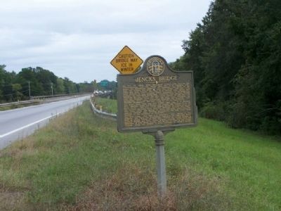
On Dec. 6, 1864, the 15th Corps (US), the extreme right of Gen. Sherman's army on its destructive March to the Sea, camped near Jenk's Bridge on Great Ogeechee River, east of Blitchton. On the 7th, Oliver's brigade was sent in advance of Hazen's . . . — — Map (db m11939) HM
This church, the oldest congregation in lower Bryan County, was certified by the Presbytery of Georgia in 1830. Its founders included rice planters on Bryan Neck, among them Thomas Savage Clay, Richard James Arnold and George Washington McAllister. . . . — — Map (db m18648) HM
This County created by Act of the Legislature Dec. 19, 1793, is named for Jonathan Bryan, Revolutionary patriot and member of the Executive Council in 1777. The "lost town" of Hardwick on the Ogeechee River was the first temporary County Site. Laid . . . — — Map (db m14952) HM
Built in 1912, this structure was originally
a simple one-room brick cube with barred
windows and an armored door. It was used
to house offenders for short periods for
fighting, public drunkenness and similar
minor offenses.
In 1928, the . . . — — Map (db m15816) HM
On May 10, 1754 GEORGE TOWN was established at the "Elbow" of Great Ogeechee River, eight miles east. In February, 1755, Gov. Reynolds, dissatisfied with Savannah as a capital and as a port, chose this new site because it has a . . . — — Map (db m8364) HM
In memory of
Antonio J. Waring, Jr. M.D.
1915 - 1964
This plaque erected by his admirers
in recognition of his memorable work
in Archaeology
and the field of Indian Civilization
and in appreciation of his devoted . . . — — Map (db m250488) HM
Organized in 1869, this is the oldest African-American church congregation in lower Bryan County. The first structure for the church, a Prayer House, was built in 1870 on this site near the white Presbyterian Church (Burnt Church). London Harris, a . . . — — Map (db m54193) HM
Near this site in 1830 the Bryan Neck Presbyterian Church was established, being the oldest organized congregation in Bryan County. The church served the numerous planter families of lower Bryan, which had become one of the most productive . . . — — Map (db m54354) HM
Built by William Collyer in New York City. She was
ordered by New York merchants and launched September
22, 1853. Her maiden voyage was from New York to
Charleston, South Carolina, under the name United States
Mail Steamship . . . — — Map (db m12868) HM
The congregation of the Canaan Baptist Church, primarily African-American, was organized in 1913 by Rev. David Boles, Sr., who was pastor, and Brother Fred Gilbert, Deacon. It was the only organized denominational church in what is now Richmond Hill . . . — — Map (db m59957) HM
Charlestonian, a student of Agassiz at Harvard, then professor of mathematics at the College of Charleston, he resigned his position at the outbreak of the war and became an officer in the Confederate engineers. Transferred to Savannah he spent his . . . — — Map (db m12711) HM
When called upon by a Union officer to surrender during Sherman's assault, December 13, 1864, Clinch responded with a blow of his sword. After three sabre, six bayonet, and two gunshot wounds, he was taken. — — Map (db m13075) HM
From the roof of Cheves' rice mill (2 1/2 miles across the Ogeechee in the direction of the arrow) General Sherman and his staff watched the reduction of Fort McAllister, sunset, December 13, 1864. — — Map (db m12914) HM
This replica of a coast defence cannon known as the columbiad was manufactured, 1964, by Savannah Machine and Foundry Company as a public service. A similar cannon was positioned here during Union naval attacks, 1863. The columbiad fired 87-lb. . . . — — Map (db m12776) HM
Outside of their expansive home on the Ogeechee River, this is the single most imposing structure built by Henry and Clara Ford during their sojourn in Richmond Hill from 1926 to 1951. Built by local labor in 1936 near the Ways Station School, the . . . — — Map (db m228173) HM
Land mines or torpedoes buried along the western approaches to the fort caused most of the casualties to the Union troops in the assault on December 13, 1864. After the taking of the fort, General Sherman personally gave orders that the captured . . . — — Map (db m13071) HM
This wood-frame structure, situated on a site known since the creation of Bryan County in 1793 as “the Crossroads”, was built in 1939 with funding provided by Henry Ford. The building came to be familiarly called “the . . . — — Map (db m54142) HM
The largest naval guns used against land fortifications were fired on Fort McAllister in 1863 from monitor-type Union ironclads. 15 in. shells penetrated 17 ft. of sand, digging craters 8 ft. in diameter and 7 ft. deep on exploding, but all damage . . . — — Map (db m13037) HM
The swift Confederate blockade runner Nashville
(renamed Rattlesnake) was destroyed
by the monitor Montauk, February 28, 1863,
after she went aground on a sandbar in a hairpin bend
of the Ogeechee River. The engagement was . . . — — Map (db m11474) HM
Henry Ford implemented the construction of the Bakery building in 1941 to provide fresh baked goods for the employees of his Richmond Hill Plantation. The Bakery was operated in tandem with the adjacent Commissary and Post Office buildings, thus . . . — — Map (db m148754) HM
The Commissary building and complex was built by Henry Ford in 1941 to serve the local community and the employees of Ford's Richmond Hill Plantation. It sold groceries, dry goods and general merchandise at reasonable prices and specialized in fresh . . . — — Map (db m148753) HM
Near here, on the West bank of the Ogeechee River, Fort Argyle was built in 1733, to command one of the main passes by which enemy Indians had recently invaded South Carolina, and to give protection to the settlers of Savannah from anticipated raids . . . — — Map (db m29523) HM
East 4.5 miles, on Great Ogeechee River, Fort McAllister was built 1861-62 to guard the "back door" to Savannah. During 1862-63, it repulsed 7 attacks by armored vessels, some mounting 15-inch guns. Dec. 13, 1864, its small garrison of 230 . . . — — Map (db m29452) HM
Fort McAllister was built on the Ogeechee River 4.5 miles east of here, to guard the "back door" to
Savannah. During 1862-63, it repulsed seven attacks by armored vessels, some mounting 15-inch guns. On December 13, 1864, its small garrison of . . . — — Map (db m279180) HM
Situated at Genesis Point, 10 miles east on the right bank of the Great Ogeechee River below the "lost town" of Hardwick, this fort was the right of the exterior line designed for the defense of Savannah. It denied the use of the river to Union . . . — — Map (db m8387) HM
Dec. 1864. Fort McAllister, built 1861-62 to close the Great Ogeechee River to enemy ships, mounted 11 siege guns, 12 field pieces and 1 10-inch mortar. Below it, piles and torpedoes obstructed the channel. As the Union forces neared Savannah, the . . . — — Map (db m16103) HM
On July 1st and 29th, 1862, the fort was shelled by Union gunboats and on Nov. 19th by the ironclad "Wissahickon" and two escort craft. Hit below the waterline, "Wissahickon" withdrew after firing 17 11-inch and 25 other shells. The escorts withdrew . . . — — Map (db m16102) HM
Buried here is George Washington McAllister (1781-1850), a prominent planter of Bryan County. In 1817, McAllister acquired Strathy Hall Plantation on the Ogeechee River where he cultivated rice and was one of the largest slave owners on Bryan Neck. . . . — — Map (db m59985) HM
On these grounds in 1939, Henry Ford built a school to serve the educational needs of the African-American children of lower Bryan County. Professor Herman Cooper was appointed as the Principal when the school opened later that year, originally with . . . — — Map (db m54321) HM
Across the Ogeechee River from this point was the northernmost town of the Province of Guale, the village of Satuache. Spanish records place Satuache about 10 miles northeast of Guale’s provincial capital at Mission Santa Catalina (St. Catherines . . . — — Map (db m60008) HM
This site on the Great Ogeechee, 14 miles from the Atlantic, was selected in 1755 by Governor John Reynolds for the capital of Georgia. He named it for his kinsman, Lord High Chancellor of England, Phillip Yorke Hardwicke. Reynolds said: "Hardwicke . . . — — Map (db m11225) HM
On Dec. 6, 1864, the 15th Corps (US), Maj. Gen. P. J. Osterhaus, USA the extreme right of Gen. Sherman's army on its destructive March to the Sea, camped near Jenk's Bridge, on Great Ogeechee River east of Blichton. On the 7th, Oliver's brigade of . . . — — Map (db m15812) HM
In 1925, Henry Ford of Detroit, Mich., a leading American automobile pioneer who perfected the assembly line concept of auto manufacturing, began acquiring large tracts of land on both sides of the nearby Ogeechee River. He sponsored extensive . . . — — Map (db m54170) HM
For nearly 20 years, J. F. (Jack) Gregory was the general manager and superintendent for all of Henry Ford’s various operations in and around Ways Station, later Richmond Hill. Serving for Ford from the 1920s until 1946, Gregory oversaw the . . . — — Map (db m59669) HM
Superintendent of the Henry Ford Plantation at Richmond Hill, Georgia 1929 until the death of Henry Ford in 1947, under his supervision, the dreams Henry Ford envisioned for this community were accomplished.
This plaque is placed here in . . . — — Map (db m112148) HM
On Dec. 12, 1864, the 3rd Cavalry Division [US], Brig. Gen. J. L. Kilpatrick, USA, covering the right rear of Gen. Sherman's army which was then closing in on Savannah, crossed the Great Ogeechee River near Fort Argyle and the Canoochee River . . . — — Map (db m279185) HM
The 3rd Cavalry Division (US), Brigadier General H.J. Kilpatrick (US), covered the right rear of General Sherman's army as it closed in on Savannah. On December 12, 1864, Kilpatrick's army crossed the Ogeechee River near Fort Argyle and the . . . — — Map (db m279186) HM
This structure was built in 1940 by Henry Ford to serve as a kindergarten for the children of Ways Station-Richmond Hill during the Ford era. The building included a kitchen and two large classrooms to accommodate children aged three years to six. . . . — — Map (db m54435) HM
These portions of rotating machinery were
removed, in 1960, from the wreck of the
Confederate blockade runner Nashville,
sunk in the Ogeechee River by shell fire from
the U.S.S. Montauk in Feb., 1863.
These relics give some conception . . . — — Map (db m16105) HM
Killed in action while commanding the fort during the second attack of the monitor MONTAUK, February 1, 1863. The 32-pounder beside which he was standing was struck while Gallie was going from gun to gun, encouraging his men to calmness of aim. — — Map (db m13072) HM
Henry and Clara Ford had this chapel built in 1937 near the Community House and the Ways Station School. The chapel was named for the mothers of Henry Ford (Mary) and Clara Ford (Martha). Students from the nearby school utilized the Martha-Mary . . . — — Map (db m54319) HM
The monitors took positions against the far marsh in the direction of the arrow, between 900 and 1200 yards from the fort during the following series of attacks: by the MONTAUK, January 27, February 1, and February 28, 1863; and by the PASSAIC, the . . . — — Map (db m12777) HM
The production of rice on Bryan Neck utilized upstream fresh water and the tidal influences of the Ogeechee River. Heavy wooden trunks, or tidegates, along the levees and embankments in the rice fields allowed the inflow and outflow of fresh water . . . — — Map (db m59995) HM
Richard James Arnold (1796-1873) acquired nearby White Hall Plantation through his marriage in 1823 to Louisa Gindrat. A Rhode Island native, Arnold invested heavily in White Hall for the cultivation of cotton and in his Cherry Hill and Mulberry . . . — — Map (db m59997) HM
The Richmond Hill Veterans Monument is dedicated to the men and women of the U.S. Armed Forces who have served our great nation throughout the 20th and 21st centuries, but the history of sacrifice and duty to our nation weaves a patriotic tapestry . . . — — Map (db m128029) WM
In July, 1862, the CSS "Nashville", Capt. Baker, ran the Union blockade and entered Savannah via Wilmington River with a cargo of arms. Loaded with cotton for Europe, she attempted to escape via Ossabaw Sound. Thwarted by the vigilance of the . . . — — Map (db m164870) HM
The “Bottom” residential village, built in the mid-1930s, was the first housing project developed by Henry Ford for his employees in the Ways Station (later Richmond Hill) area. The name originated from the fact that the area had been a . . . — — Map (db m59965) HM
In this cemetery are interred members of the Clay family, among the most prominent of Bryan Neck and coastal Georgia from the colonial era of Georgia through the 19th century. Prominent among these are Thomas Savage Clay (1801-1849) and his wife . . . — — Map (db m59986) HM
The sole Confederate fatality after seven hours of intensive bombardment on March 3, 1863, by the monitors PASSAIC (Capt. Percival Drayton), NAHANT, and PATAPSCO, supported by the MONTAUK, the WISSAHICKON, the SENECA, the DAWN, the FLAMBEAU, the . . . — — Map (db m13038) HM
In 1856, the Savannah, Albany & Gulf R.R. was built across the nearby Ogeechee River into Bryan County. Near this site a train depot was built, which came to be known as “Ways No. 1 ½” for William J. Way, the first station master . . . — — Map (db m54398) HM
Ways Station (now Richmond Hill), Station No. 1-1/2 on the Savannah, Albany and Gulf Railroad, was built on land belonging to William J. Way. He was the first station master and co-owner of Silk Hope rice plantation. Construction of the rail line . . . — — Map (db m127220) HM
Chartered in 1824, the Savannah-Ogeechee Canal was constructed between 1826 and 1830 by African and Irish laborers who moved thousands of cubic yards of earth. A boon to Georgia’s economy, the canal moved cotton, rice, bricks, and natural . . . — — Map (db m47921) HM
On Dec. 6 1864, the 15th Corps [US], Maj. Gen. P. J. Osterhaus, USA, the extreme right of Gen. Sherman's army on its destructive March to the Sea, forced a crossing of Great Ogeechee River at Jenk's Bridge (US 80 east of Blitchton) and drove the . . . — — Map (db m12080) HM
In 1736, Noble Jones, John Fallowfield and Henry Parker settled this important outpost on the colony's inland waterway to the south and named it Isle of Hope. Jones' Wormsloe plantation was fortified and armed against Spanish attack until
1742. . . . — — Map (db m9151) HM
In 1736, Noble Jones, John Fallowfield and Henry Parker settled this important outpost on the colony's inland waterway to the south and named it Isle of Hope. Jones' Wormsloe plantation was fortified and armed against Spanish attack until 1742. The . . . — — Map (db m16387) HM
The Isle of Hope Methodist Church was organized in 1851. The first Trustees were George W. Wylly, Simeon F. Murphy, John B. Hogg, William Waite, Theodore Goodwin, Thomas J. Barnsley and the Rev. William S. Baker.
The church building that stands . . . — — Map (db m15947) HM
Built by Federal troops during the Civil War, in February 1862, Battery Hamilton prevented Confederate gunboats and reinforcements from moving down the Savannah River to aid the besieged Fort Pulaski. Its presence also allowed the Federals to . . . — — Map (db m55178) HM
Mulberry Grove which is located approximately 2 miles northeast from this marker is one of the most historic of the old Savannah River plantations.
In early Colonial days mulberry trees were cultivated at Mulberry Grove for use in Georgia's . . . — — Map (db m8064) HM
Near here stood Mulberry Grove, plantation home of General Nathanael Greene and Catherine Littlefield Greene. President George Washington twice visited the widowed Mrs. Greene at Mulberry Grove during the Southern tour of 1791. Traveling downriver . . . — — Map (db m18640) HM
Approximately 300 yards northeast of this marker there was located in colonial days a shipyard where at least one vessel capable of engaging in overseas trade was built. The creek on which it stood is known as Shipyard Creek. The site of the . . . — — Map (db m9399) HM
Nicholsonboro Community grew out of the turmoil of the last year of the Civil War and the first years of Reconstruction. General W. T. Sherman's Special Field Order No. 15 reserved the sea islands
from Charleston southward, plus abandoned rice . . . — — Map (db m9389) HM
389th
Bomb Group
565th
Squadron
In Memory of
"P T's Pirates"
Lt Paul T Wilkerson, Pilot
Lt Clyde S Sewell, Copilot
Lt Leroy S Campbell, Navigator
Lt Richard Sullivan, . . . — — Map (db m70229) WM
401st 612th
Bomb Group (H) Squadron
Crew of the
"Stubborn Jean"
1st Combat Related Aircraft Loss Of The 401st
T Neag Pilot POW
J P England Co Pilot KIA
Okey . . . — — Map (db m68466) WM
385th Bomb Group (H) 551st Bomb Squadron
Great Ashfield "The Mighty Eighth"
1st Lt. Harlan Leroy Cook
August 27, 1920 - May 2, 2006
Enlisted Army Air Corps April 1942
Pilot Training California and Arizona
April 22, . . . — — Map (db m68090) WM
Lest We Forget
20th Fighter Gp
Dedicated
By The
20th Fighter Group
Association
King's Cliffe, England
Aug. 1943-Oct. 1945
55th Ftr Sqdn KI
77th Ftr Sqdn LC
79th Ftr Sqdn MC
97th Serv Gp
In honor of our 85 . . . — — Map (db m64716) WM
Presented In His Memory
By The Family And Friends Of
2nd Lt Louis Howard
Bourgeault
"Our Hero"
1921-1997
427th Sq 303rd BG
Shot down by anti-aircraft guns over
Berlin Germany - June 21, 1944 . . . — — Map (db m69924) WM
In Memory Of Those Who Served
2nd Strategic Air Depot
Little Staughton Abbots Ripton
World War II 1942 1945
Soldiers Together -- Brothers Forever — — Map (db m64890) WM
The Can Do Group
Chelveston, England
March 1942 - September 1945
480 Combat Missions
2 Medals of Honor 2 Presidential Citations
In honor of all who served with the 305th, we proudly
dedicate this memorial to the 787 valiant . . . — — Map (db m65035) WM
In Memory Of
The
351st Bombardment
Group (Heavy)
Eighth United States Army
Air Force
311 Group combat bombing missions
were flown from this airfield over
occupied Europe between 1943-1945
175 B-17 Flying Fortresses and . . . — — Map (db m64457) HM WM
355th Fighter Group
And
Support Units
US 8th Air Force
Activated Orlando FL 12 Nov 42
Arrived UK 6 Jul 43
First Combat Mission 14 Sep 43
Last Combat Mission 25 Apr 45
Over 1500 E/A Damaged - Destroyed
Distinguished Unit . . . — — Map (db m65650) HM WM
359th, 360th, 361st
Hqtrs & Support Sqdns
413 Missions Flown - 278 Enemy Aircraft
Destroyed With Loss of 72 Personnel...
Operated From Martlesham Heath,
Ipswich, England From October 1943
To May 1945. This Memorial is a . . . — — Map (db m64881) WM
(North face)
In Honored Memory
To the gallant men of the 364th Fighter Group
who gave their lives for the freedom of our country
Greater Love Hath No Man
342 Missions
455 Enemy Aircraft Destroyed
Honington, England, 8th . . . — — Map (db m64792) WM
Alconbury, England
1945
Crew Of 1st Lt James Young
2nd Lt James Pearigen P
2nd Lt Leon Hammer N
S/Sgt Joseph O'Loughlin E
S/Sgt Paul Schuchardt R
S/Sgt Everett Miller NG
S/Sgt . . . — — Map (db m66641) WM
(West face)
The 384th Bombardment
Group (H) - 8th Air Force
of the
United States of America
flew from this airfield
1943 - 1945
(North side)
This Memorial is
a replica of the
Memorial presently
standing at . . . — — Map (db m66816) HM WM
(West Face)
392nd Bomb Group
8th Air Force
U.S. Army Air Forces
Station 118
Wendling
In Honor Of
825 Airmen
Who Gave Their Lives
And All Who Served
With Them At This Base
July 1943 - June 1945
(South Face) . . . — — Map (db m64145) WM
This Memorial Is Dedicated To The Everlasting Memory Of Those Air Crews And Support Units Who
Served So Gallantly In World War II
Station 131
Nuthampstead Hertfordshire, England — — Map (db m64250) WM
Flying bombing missions out of their base at Tibenham,England, during World War II, the 445th Bombardment Group (H), 2nd Air Division, flew B-24 Liberators deep into Nazi-held Europe. The 700th, 701st, 702nd and 703rd Bombardment Squadrons(H) . . . — — Map (db m66395) HM WM
8th Air Force World War II
The D-Day Leaders
B-24 Liberator
Heavy Bomber
Dedicated To The 447
Who Gave Their Lives
In The Cause Of Freedom
"Bungay Buckaroos"
704th 705th
Bomb . . . — — Map (db m65457) HM WM
Dedicated to those who served
in the 447th Bomb Group
during World War II
Rattlesden England
November 1943 to May 1945
Squadrons
708
709
710
711
447th Bomb Group — — Map (db m66560) WM
We came from all states of the
United States of America.
Some were so young, just out of high school,
But most in their late teens or young twenties.
Eager to do what they could to Preserve Freedom
We quickly learned our skills . . . — — Map (db m65700) WM
In Rememberence
Of Those Who Served In The
452nd Bombardment Group
Activated 1 June 1943
Deactivated 27 August 1945
728th, 729th,
730th, 731st Squadrons
Base of Operations-
Deopham Green, England
250 Combat Missions . . . — — Map (db m64756) WM
Dedicated in Reverent Remembrance of those gallant airmen of the 457th Bombardment Group (H), United States Eighth Army Air Force, Station 130 Glatton, England, who in the service of their country gave their lives that Freedom might prevail. — — Map (db m65955) WM
United States Army Air Force Station 120
Attlebridge Airfield
March 1944 - July 1945
Flew 231 Combat Missions
In B-24 "Liberator" Aircraft
In an air offense over the continent:
Normandy, Northern France, Rhineland . . . — — Map (db m65100) WM
434th 435th
Fighter Squadron Fighter Squadron
436th
Fighter Squadron 8th Air Force Wattisham, England 1944-1945
Lest We Forget "All The Young Men" Dedicated 17 Oct 1997 — — Map (db m66382) WM
To The Men Of The 487th Bomb Group (H)
Lost In Action 1943 -- 1945
487th Bomb Group (H) U.S. Army Air Force
836th Squadron 8th Air Force
837th Squadron Station . . . — — Map (db m66147) WM
Commander: Col. Ezekiel W. Napier
Dep Commander: Lt. Col. Leon R. Vance
Medal Of Honor
Dedicated to all who served with the
489th and a memorial to those of the
group who gave their lives in the cause
of freedom and human dignity . . . — — Map (db m65499) WM
724 entries matched your criteria. The first 100 are listed above. Next 100 ⊳