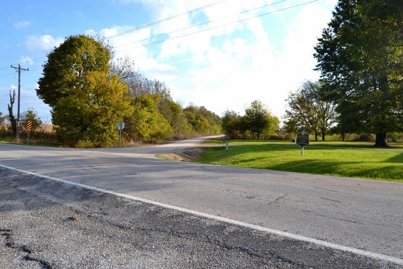
The John I. Smith Relay Station was 172 ½ miles from the Tipton Terminus and stood in northeast Barry County, about 7 miles west of Crane. — — Map (db m99688) HM
Cassville, the last town
on the route of
the Butterfield Mail in Missouri,
was not a relay station
but the coaches stopped
for mail and passengers — — Map (db m80212) HM
Between 1855 and 1884, there stood on this square, a two-story brick courthouse that was known as Missouri's "second Confederate capitol." It was here that members of the state legislature gathered between Oct. 29 and Nov. 7, 1861 to complete a . . . — — Map (db m44605) HM
Dedicated to men and women who serve in the Armed Forces of the United States, during war and peace. We sincerely appreciate your sacrifice and dedication to preserve the freedom of this great nation. God will one day judge our actions. Until then . . . — — Map (db m62885)
This valleys bountiful resources, particularly its abundant water, attracted settlers beginning in the 1820s. The constant rapid flowing of spring-fed Roaring River appealed to millwrights, who saw the opportunities such a reliable source of power . . . — — Map (db m68553) HM
Monett, as well as Neosho and Joplin, was an early aviation hotbed in
the United States. Monett had investors from the area named L.B.
Durnil and U.S. Barnsley who wanted to build an airplane. They had
two projects in Monett including the . . . — — Map (db m251422) HM
At this location, the Central School was
built around 1892 and serviced 1st through
12th grades. As Monett continued to grow
in size, Central School became the main
grade school.
Written by: Jasmine Rodriguez and Genesis
Guerra
. . . — — Map (db m251468) HM
Dedicated to a fallen hero and all Armed Forces Serving and Protecting the United States of America.
Greater love hath no man than this, that a man lay down his life for his friends. John 15:13.
Under a picture of Specialist . . . — — Map (db m62712) WM
Originally built in 1904, Eugene Field School
was a feeder school. It was located on
Benton Street at Sixth Street. It was built by
L.A. Mason, a major contractor in Monett at
the time. Other feeder schools during that
time were Plymouth and . . . — — Map (db m251471) HM
Monett High School was built in 1905.
Monett's student population later outgrew
the building and they had to build a bigger
building for grades 9-12. The second high
school building was built in 1922-23 by
M.E. Gillioz and a junior college was . . . — — Map (db m251473) HM
Logan David McKee, born on the 27th of February in 1877, is known
as a remarkable man in Monett Missouri. Logan grew up in
Hutchinson, Kansas. He came to Monett in 1891 to be a pharmacist
and worked for many drug stores in the area until he had . . . — — Map (db m251425) HM
Christopher Glenn Stark was a veteran of Monett. Christopher graduated
Monett High School in 2007, joined the Army in 2008, and was part of the
705th Explosive Ordnance Disposal company. Christopher was killed in
action on February 28, 2011 . . . — — Map (db m251412)
In the early 1900s, it was well known that there was a
cave underneath the current Monett City Park Casino. In
1918, it was reported in the Monett Weekly Times that
they were referring to the cave as a quarry. Logan McKee
was studying the cave . . . — — Map (db m251438) HM
Kelly Creek in downtown Monett has been flooding since about
1907 and there have been at least 40 floods that have been
documented. The 1927 flood arose so quickly that waitresses at
the Frisco Hotel stood on tables until firefighters came along . . . — — Map (db m251460) HM
In 1921, Monett was known for having a legendary football
team as well as having an undefeated season of eleven games.
Finis Engleman was the coach of this legendary team. Monett
had a great season that year going against Arkansas 57 to . . . — — Map (db m251475) HM
The founder of the Harvey Houses was Frederick Henry Harvey.
After he married, he and his wife opened up their first Harvey
House in 1878 in Florence, Kansas. In 1881 he replaced his male
waiters with the famous “Harvey Girls.” Harvey gained a . . . — — Map (db m251449) HM
Monett has always been known as a nice, peaceful railroad town. However, in 1894,
that was disrupted. There were five lynchings in twelve years near the turn of the
century in this area, however, only one of these was in Monett. On June 28, 1894 . . . — — Map (db m251447) HM
At Sixth and Front Streets in 1898 the Monett
Railroad YMCA was built. The YMCA was a very
active unit in Monett under the direction of Mr.
George J.C. Wilhelm. The YMCA housed railroad
workers with clean rooms, hot baths, and even gave
people . . . — — Map (db m251453) HM
Native Americans have a long history in the Monett area. Artifacts from the
bottomland of the Monett golf course and the Long farm east of town
reflect centuries of occupation dating back to the Archaic Period 2,800 to
9,000 years ago, which is . . . — — Map (db m251440) HM
Strawberries were a huge start to the Monett economy. Strawberries were
one of the first crops introduced to Southwest Missouri in the 1800s.
Southwest Missouri produced the finest strawberries in the United States
and Monett became one of the . . . — — Map (db m251444) HM
Downtown Monett Missouri is home to one of the
most famous landmarks in Monett Missouri, the
Freedom Silo located by the train tracks. The
Freedom Silo has stood for 130 years and is believed
to have been built around 1890. It is called . . . — — Map (db m251452) HM
In 1887, Plymouth Junction or Plymouth Crossing, now known
as Monett, served as a trading post and main shipping center
for the Frisco Railroad. The Frisco Railroad was originally
known as the Louis-San Francisco Railway. The railroad . . . — — Map (db m251455) HM
The Gardner home on 713 Central was built
shortly after the Sizer house by Solon Wright,
owner of Wright Dry Goods, in an attempt to
show up Callumura. Wright wanted the grandest
home in Monett. However, after the construction
of the home, . . . — — Map (db m251469) HM
The Gillioz Theater was built in 1931 and was operated by
Commonwealth Amusement by 1941. Johnson and Maack of St.
Louis were the architects of the Gillioz. This theater was very
popular amongst the local community. During the prom season
the . . . — — Map (db m251465) HM
Monett has been home to four hospitals since its founding. Dr. West's
hospital was first established in 1914 and was the first hospital in
Monett. It housed 18 beds by the time it closed around WWI. After
WWI, Dr. West later reopened his . . . — — Map (db m251396) HM
The Sizer home on 800 Central was built for the
family of Fielding Sizer, an attorney, in 1916. The
current occupants are only the second set of
people to live in the house. The house still
retains most of its original features including . . . — — Map (db m251470) HM
On the Trail of Tears there were 3 paths that
removed the Native Americans from their land to
Indian Territory due to the Indian Removal Act.
One of the paths from the Trail of Tears went just
southeast of Monett near Star City and Madry.
We . . . — — Map (db m251439) HM
Viga Burns Hall was born on 17th of June, 1892 in Hancock Missouri. Raised
by a prominent Monett businessman, Francis Marion Hall, V.B. Hall followed
in his father's footsteps founding V.B. Hall Company in 1919. A leader in the
transition from a . . . — — Map (db m251443) HM
Monett had four other names before it was called Monett. Monett was first
named Kings Prairie Depot. Monett began as a Frisco Railroad town because
of its location. By 1875, Plymouth had become a new name for Kings Prairie
Depot. The name . . . — — Map (db m251457) HM
Railroad was a prominent mode of transportation in the first half of
the 20th Century. Presidential nominees would come and stop in
towns to give speeches and try to convince people to vote for them.
These stops were known as “whistle stops.” . . . — — Map (db m251445) HM
The Waldensian church originated in Europe with the preaching of
the merchant Valdo in 1140-1217. The official symbol of the
Waldensian church is a candle positioned over an open Bible. The
original homeland of the Waldenses was in Northern . . . — — Map (db m251428) HM
This monument is dedicated to those who served our country by the people of Purdy, Missouri. We must always remember that by the sacrifices we enjoy our freedom today. Dedicated 2012. — — Map (db m62800) WM
This Douglas A-4 Skyhawk was generously donated to the City of Purdy by the Department of Navy, Naval Air Systems, in response to the joint acquisitions efforts of the late Norman “Gabby” Gibbons and U.S. Navy Commander Edward Estes. The City of . . . — — Map (db m229667) HM
Air Force ☆ Army ☆ Coast Guard Marines ☆ Navy In honored memory of those who served in defense of their country so that all may enjoy freedom. Let us show them that we do care, Let us gather with them and share, Their . . . — — Map (db m229649) WM
Born Lamar, Missouri May 8, 1884
Died Kansas City, Missouri December 26, 1972
Patriot - Statesman - Legionnaire
First Legionnaire President
of the United States
This memorial was erected in May 1984 by
Legionnaires and Friends of the . . . — — Map (db m37140) HM
This shrine is dedicated to
Harry S. Truman
Thirty second President
of the United States of America
who was born at this location
May 8, 1884
[died] Dec. 26, 1972
"I ask only to be a good and faithful
servant of . . . — — Map (db m37113) HM
Side A
Lamar is distinguished as the birthplace of Harry S. Truman, the 33rd President of the United States. The son of John Anderson Truman and Martha Ellen (Young) Truman, he was born May 8, 1884. The family moved to Harrisonville in Cass . . . — — Map (db m42286) HM
On October 1st, 1910, this cannon and original memorial presented to Barton County, Missouri by the members of McCook Post No. 34 G.A.R. Department of Missouri. It was dedicated to the memory of the soldiers and sailors of the Civil War 1861-1865. . . . — — Map (db m42302) WM
In memory of
Veterans
World War I
and
Veterans
World War II
The Perimeter
The Perimeter is a place warriors will always seek- even for eternity. Just gaze out at our National Cemeteries, for out there, on the outer edge, . . . — — Map (db m81538) WM
The 1st Kansas Colored Volunteer Infantry fought and won the Battle of Island Mound, also known as The Battle at Fort Toothman on October 28 & 29, 1862 in Charlotte Township approx. 7.5 miles southwest of Butler. It is said to have been the only . . . — — Map (db m54126) HM WM
[Main monument, front] To honor all veterans past, present and future
This tribute is dedicated to all the men and women of Bates County who have served our country in times of war and peace, active and reserve
Honor, Courage and Commitment
. . . — — Map (db m251701) WM
Bates County was formed in 1841. Many early settlers came from Kentucky, Virginia and Tennessee. The 1860 census listed a population of 6,765 with a slave population of 442. In 1862, the slave population had dropped greatly.
Most Bates . . . — — Map (db m60614) HM
Here, on October 29, 1862 was the first crucible to test the mettle of formerly enslaved black men during the Civil War.
Here, a group of volunteers faced battle with the certainty of only two outcomes - victory or death - for there would be . . . — — Map (db m60581) HM
1806 15 Ms. South of Butler
Explorer Zebulon Pike Parley
With Osage Chief
1863 Burning of Butler by Order No. 11
During the Civil War
Where the Civil War Began
Brother Against Brother
Post Civil War Reconstruction
[Mural . . . — — Map (db m39898) HM
First Road Dragger in Bates County
He lived for others. He tried to live a humble Christian. The Lord blessed his life and will continue to bless all who trust fully in Him. — — Map (db m46088) HM
Most of the men of the First Kansas Colored Volunteer Infantry were escaped slaves. Many fled to Kansas from farms and towns in Missouri or Arkansas to find freedom. Some may have been "stolen" in Jayhawk raids. Others in the regiment were . . . — — Map (db m65049) HM
Webster School was erected on this site in 1900. It was one of 3 schools to serve the East, West, & North neighborhoods. Known as North School, it was razed when the 3 grade schools were consolidated into Butler Elementary. — — Map (db m39907) HM
By 1863 the Union Army’s inability to control Confederate Guerrilla activity in western Missouri exploded. On August 25, 1863, Union General Thomas Ewing issued Order No. 11 four days after Quantrill’s Raid on Lawrence, Kansas. Residents in Bates . . . — — Map (db m74091) HM
The Palace Hotel Building was built in 1879 as part of the rebuilding of Butler after it was burned during the Civil War. It is a good example of high style Italianate architecture with elaborate bracketed cornice. It originally had an exterior . . . — — Map (db m39874) HM
In the 1860s, the vast, rolling tallgrass prairies of the Osage Plains stretched for miles. Maintained by periodic fires for approximately 5,000 years before European settlement, prairie once covered approximately 78 percent of Bates County, Mo. . . . — — Map (db m60613) HM
With the faith and courage of
their forefathers who made
possible the freedom of these
United States
The Boy Scouts of America
dedicate this copy of the
Statue of Liberty as a pledge
of everlasting fidelity and
and loyalty
The . . . — — Map (db m93626) HM
During the fall of 1862, Bates County had become a haven for guerrillas and Confederate recruiters. One of their favorite haunts was a marshy tract on the Marais-des-Cygnes River, southwest of Butler, known to locals as "Hog Island." On Oct. . . . — — Map (db m65050) HM
African Americans saw the Civil War as a fight for their freedom. Early in the war, freed black men who tried to enlist in the Union Army were turned away. A 1792 Federal law still barred blacks from bearing arms for the U.S. Army. The U.S. . . . — — Map (db m60617) HM
After the 1854 Kansas-Nebraska Act was passed, pro-slavery Missourians and free-state Kansans fought over whether Kansas should enter the Union as a slave or free state. The fighting was so intense that the conflict was called "Bleeding . . . — — Map (db m60584) HM
Erected Aug. 1, 1921
in memory of those
who served in the
Worlds War
Rededicated
August 1, 2001
in memory of all
American veterans — — Map (db m84539) WM
Historic Harmony Mission, a school for the Indians of Missouri, once stood east of Rich Hill, on the north bank of the Osage River, near the centuries-old camping sites of the Great and Little Osage tribes.
The mission was founded in 1821 by . . . — — Map (db m121349) HM
El Dorado Springs was founded around this spring in 1881 due to the waters medicinal value. The stone above marked its first site 75 ft. to the SE until 1890 when routed to this basin. During repairs in Sept. 1992, this sandstone slab was found . . . — — Map (db m57372) HM
This bell has been donated by the Rock School District of Cedar County Missouri in commemoration of the former Common School Districts which presently comprise the El Dorado Springs R-2 School District.
Cedar County
Barnes • Cedar Springs . . . — — Map (db m57417) HM
Before El Dorado Springs was founded, this stone wash basin sat before the Spring on rock supports. It was used by travelers along the trail. Some pioneer artisan cut it from a stone taken from Grindstone Quarry, located East of the Park Hotel. . . . — — Map (db m57377) HM
This wagon represented the State of Missouri in the 1976 Bicentennial Wagon Train Pilgrimage to Valley Forge, Pennsylvania
Wagon Master, Raymond Williams
Asst. Wagon Master, Jack Nolan
Outriders, Georgia Williams
Dixie Nolan-Peak and . . . — — Map (db m57421) HM
Realizing it was believed by the general public that the spring water had some medicinal value and that people were coming great distances to drink the water for whatever ailments they had, Nathaniel H. and Waldo P. Cruce, brothers, had the . . . — — Map (db m57380) HM
A sea of grasses and wildflowers - the tallgrass prairie - once covered America's heartland. It is now one of the most endangered ecosystems in the world, and many of its inhabitants are struggling to survive.
Thousands of acres of rolling . . . — — Map (db m57202) HM
This monument is dedicated to Roy Bandy and Eddy Wilson for their efforts in providing career and work opportunities for young people in the field of cadastral (land) surveying with the General Land Office and its successor, the Bureau of Land . . . — — Map (db m57381) HM
Here where the Ozark Highland borders on the Western Prairie region of Missouri, Cedar County was organized in 1845. The name is for the trees along Cedar Creek. Stockton, the county seat, was platted in 1846 on land given by Zimri and Marian . . . — — Map (db m72914) HM
In honored memory of those from Cedar County who lost their lives in World War One, World War Two, the Korean and Vietnam Conflicts. These Heroes live beyond the tomb.
[Roll of Honored Dead]
And to all those who fought valiantly for . . . — — Map (db m79791) WM
The John C. Ashmore Relay Station in northwest Christian County stood in Polk Township, 152 ½ miles from the Tipton Terminus. It was the only station in the county. — — Map (db m99690) HM
McCullock assigned Brig. Gen. James S. Rains and his six mounted companies of the 8th Division of the Missouri State Guard along with a company of Arkansans, about 400 men, to take the lead in the southern advance. Rains was given the task . . . — — Map (db m258752) HM
On this approximate spot on May 10, 1889 three members of the Baldknobbers were hanged for murder.
The name came from the Bald Knob hilltops on which the Taney County group met.
After the Civil War justice on the area was minimal. In the . . . — — Map (db m59918) HM
Deep in the Missouri Ozarks, Christian County, organized 1859, was one of last 3 of the State’s 114 counties to be formed. At the request of pioneer “Mrs. Thomas Neaves” it was named for her native Ky. county honoring Rev. War Col. . . . — — Map (db m99716) HM
Dedicated to all veterans
of Christian County
November 11 1992
In Memory of
All American Veterans
This memorial honors all American veterans who, although separated by generations, shared a common, undeniable goal - to valiantly . . . — — Map (db m59920) WM
Encompassing 504 sq. miles of the west slope of Missouri's Ozarks, Dade County was organized in 1841 and named for Maj. Francis L. Dade killed in Florida War with Seminoles in 1835. In territory ceded by Osage tribes in 1808, the county was early . . . — — Map (db m79788) HM
These flags are dedicated June 14, 2002 to all Freemasons that have served in the Armed Forces. We enjoy our freedoms today because of their sacrifices.
Greater love hath no man than this, that a man lay down his life for his . . . — — Map (db m79768) WM
This monument is dedicated to those who served our country by the people of Dade County. We must always remember that by their sacrifices we enjoy our freedom today.
Air Force • Army • Marines • Navy — — Map (db m79772) WM
Dedicated in honor and memory of all veterans of Dade County, past and present, especially to those who gave their lives in the service of this great country.
To those who have fought and died. We pray that your sacrifice will not have been in . . . — — Map (db m79787) WM
Built in 1949, the last of the original six drive-ins that were named after the famous "Mother Road'.
Recognized by Hampton Hotels Save-A-Landmark program as a site worth seeing — — Map (db m189152) HM
In memory of the men in blue and gray who fought here on July 5, 1861.
Dedicated by the United Veterans of Carthage, who fought side by side in four foreign wars, on July 4, 1961. — — Map (db m52063) HM
In memory of
The Brave Men
who fell July 5, 1861,
in the Battle of Carthage.
C. S. M. A.
Mrs. Cindarilla F. Mealy, Pres.
Mrs. Lucinda Hampton, [?] — — Map (db m37145) HM
Arthur Boots built this Streamline Moderne style motor court in 1939,
featuring a “Radio in Every Room,” at the intersection of Route 66
and the Jefferson Highway, known as the “Crossroads of America.”
The motel was expanded in 1946 and restored . . . — — Map (db m251588) HM
The beautiful city of Carthage was laid out, 1842, as the seat of Jasper County, organized, 1841, and named for Sgt. William Jasper, Revolutionary hero. Centered in a county of great mineral wealth and good farm land, Carthage grew into a . . . — — Map (db m24311) HM
In memory of Charles Pollard Wood, who died July 11, 1898 while training at Camp George H. Thomas, Chickamauga, Georgia. A Sergeant in Company A, 2nd Missiouri Infantry (Carthage). Only person to "lay in state" in the Jasper County Courthouse. . . . — — Map (db m52065) HM
Editor and Publisher
The Carthage Press
1944 - 1969
Because of his vision and desires Carthage
will always be a better place for all.
Bust dedicated 11/96
Sculptor Bill R. Snow — — Map (db m61174) HM
321 entries matched your criteria. The first 100 are listed above. Next 100 ⊳