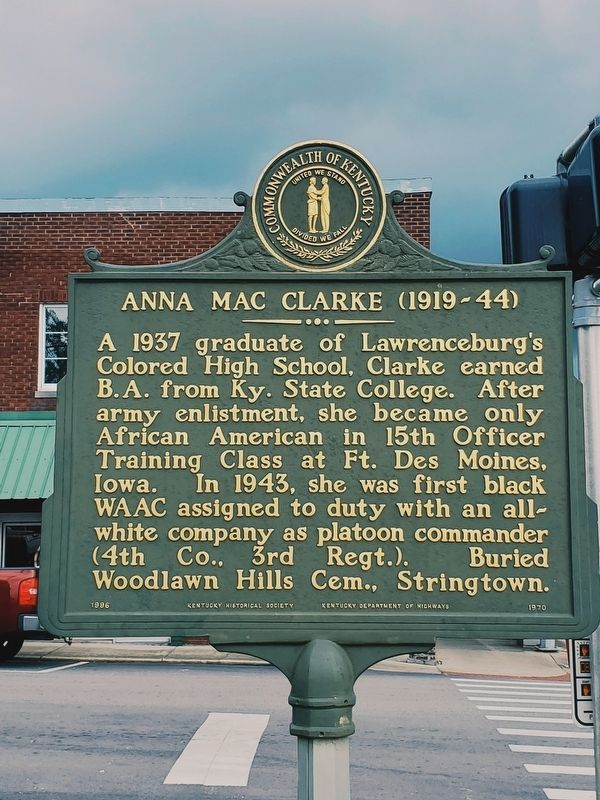
This Lawrenceburg native was one of the first black women in Ky. to enlist during World War II. She joined Women's Army Auxiliary Corps in 1942, and was commissioned a 1st Lieutenant the next year in newly named Women's Army Corps. While . . . — — Map (db m229583) HM
For Richard Clough Anderson, Jr., 1788-1826. Served in Ky. Legts. three terms. Elected Congress, 1817, for two terms. Returned Ky. Legis., 1822, chosen speaker. Appointed Minister to Colombia by Pres. Monroe, 1823, where he negotiated first treaty . . . — — Map (db m244638) HM
Oct. 8, 1862, during Battle of Perryville, Gen. Jones Withers' troops of Gen. Kirby Smith's CSA army attacked USA force of Gen. J.W. Sill near Fox Creek while Smith skirmished with Sill's rear guard. Many Union prisoners and 20 wagons captured. A . . . — — Map (db m162489) HM
Kavanaugh School.
Rhoda C. Kavanaugh founded school on Woodford Street which became known as "Little Annapolis." First boarding student came to prepare for Naval Academy in 1914. From then until 1945, Mrs. Kavanaugh launched 150 future Navy . . . — — Map (db m236572) HM
A Cumberland Presbyterian church organized by Rev. Laban Jones in 1827 in log cabin on Thomas McCall farm, overlooking McCall Spring. the itinerant pastor traveled his circuit on horseback visiting his "preaching places twice a year". This church . . . — — Map (db m105465) HM
Kavanaugh Academy 1904-09; Anderson Co. High School 1909-20; Kavanaugh High School 1920-49. Rhoda C. Kavanaugh, A.B., founder and principal 41 years. Under her direction it ranked among the nation's foremost preparatory schools for Annapolis and . . . — — Map (db m236573) HM
The McAfee bros., James McCoun, Jr. and Samuel Adams, first white men to explore this area, 1773. Cove Spring and Cove Spring Branch in Franklin Co. boundary line, 1794. Maj. Gen. Kirby Smith, CSA, and troops camped here on their way to join General . . . — — Map (db m105464) HM
James Beauchamp (Champ) Clark born near here, 1850. Attended U. of K. Taught school in county, 1870-71. Pres. Marshall College, 1873-74. Congressman from Missouri 24 yrs. Led defeat of Cannonism, control of House by Speaker. Then Speaker, 1911-19. . . . — — Map (db m313) HM
Mother church of Baptist witness in area. Constituted Feb. 3, 1798, by William Taylor and John Penney with seven charter members. John Penney, first pastor, served until his death, 1833. Great-grandfather of J.C. Penney, founder of Penney Stores. In . . . — — Map (db m244605) HM
This renowned scholar, raconteur, and lawyer was born in Anderson Co. Educated first in a one-room school at Glensboro, he graduated from U.K. Law School in 1912. Among his books was Lincoln and the Bluegrass (1955). His talk on Cassius Clay, . . . — — Map (db m34786) HM
Edward Boone was killed by Indians here on the banks of Boone Creek on Oct. 4, 1780, while hunting with his brother Daniel. He was buried here the next day by Daniel and a party from Boone’s Station, near Athens, Ky, where Edward, Daniel and their . . . — — Map (db m172021) HM
Death site of Edward Boone, a brother of renowned Kentucky pioneer Daniel Boone. Edward was killed by Indians here Oct 1780 at age 40 while hunting with Daniel. Boone Creek named for Edward. Daniel and Edward wed sisters, Rebecca and Martha Bryan, . . . — — Map (db m171825) HM
Established in 1867 under Rev. Thomas Gant after members left the fellowship of First Baptist Church, Paris, Rev. Elisha Green, pastor. Current church structure of wood mold brick built in 1904. Membership includes descendants of the original . . . — — Map (db m170051) HM
Born in Millersburg, Kidd devoted much of her life to civil rights causes. Served as representative in Ky. state legislature, 1968-85, earning her nickname, “Lady of the House.” Kidd led Ky.'s ratification of 13th, 14th, and 15th amendments to . . . — — Map (db m123690) HM
Although it was a military academy,
its goal was to educate young men &
women in a structured, disciplined,
and challenging environment to
prepare them for leadership roles
in military or civilian life. Army
Cadet Corps purchased property in . . . — — Map (db m217853) HM
Alexander House
The federal style house was built for William W. Alexander, a state representative 1848-52. His father, William Alexander, owned a hemp factory until 1856, which was operated by 100 enslaved people. At 600 feet, it had one of . . . — — Map (db m170055) HM
Soldiers of the American Revolution Who Died Citizens of Bourbon County
Samuel Brice • Isaac Darnell • James Duncan • James Hughes • James Hutchinson • John Luckie • Alexander Mitchell • John Moore • Robert Purdy • William Turner • Benjamin . . . — — Map (db m231274) WM
Dedicated May 25, 1986
In memory of those who gave their lives
• Walter K. Morris SSgt Air Force Apr. 18, 1927 – Oct. 24, 1963
• Donald I. Rankin SP4 Army Apr. 14, 1940 – Nov. 24, 1966
• Benjamin M. Brothers III PFC Marines Sept. 25, 1947 . . . — — Map (db m218140) WM
This building is dedicated to
the men of Bourbon County who served their country
during the World War.
1917 – 1918
Sacred to the memory of those who died for
Liberty, Justice and Peace.
Charles Adair * Joseph H. Holt * . . . — — Map (db m123689) WM
Named for the royal French family who aided the colonies in the War of Independence. Bourbon was one of nine Virginia counties formed before Kentucky became a state in 1792. From its original area all of twenty-four counties and parts of ten other . . . — — Map (db m43621) HM
Bourbon Whiskey
Named after Bourbon Co. because of quantity and quality of whiskey produced within its borders. Made from a fermented mash of at least 51% corn, with less wheat, rye, or barley, yeast and limestone water. Distilled at no more . . . — — Map (db m35597) HM
Built by Presbyterians, 1791. Here Barton W. Stone began his ministry, 1796. Famous revival attended by pioneers of many faiths, 1801. Springfield Presbytery dissolved and "Christian Church" launched, June 28, 1804. — — Map (db m9724) HM
Colville Covered Bridge Built in 1877, this bridge spans Hinkston Creek. It is of Burr truss construction, which is the multiple king post type. The single span is 124 feet long and 18 feet wide. It was restored by Louis Bower in 1913 and by . . . — — Map (db m171786) HM
(obverse)
July 18, on its first Ky. raid Gen. John Hunt Morgan's cavalry rode to Paris from victory at Cynthiana. After holding out for days citizen groups surrendered. Warned of Union force nearby, CSA escaped pursuit, returned to Tenn. . . . — — Map (db m97145) HM
Dedicated in honor of
Mary Desha
of Kentucky
one of the four founders of the
National Society, Daughters of the American Revolution
restoration commenced 1940 the Golden Jubilee Year, N.S.D.A.R.
by the
Kentucky Society, . . . — — Map (db m245039) HM
This log building lined with adz-hewn cherry was built as a tavern. In 1795 it became first post office in Paris. Thomas Eades then served as tavern owner and postmaster. Robert Trimble had home and law office here before becoming U.S. Supreme Court . . . — — Map (db m43626) HM
Sites of birthplace of Garrett A. Morgan, and Branch School, which he attended, are ¼ mile south. He invented the tri-color traffic signal, forerunner of the present type, and a gas mask worn in rescue work at Cleveland, Ohio, 1916. His mask was the . . . — — Map (db m170056) HM
First Christian Church organized 1827 by Thomas Allen, John Gano, and six "brave and forthright" women. Part of movement led by Barton W. Stone out of 1801 Cane Ridge Revival promoting Christian unity on New Testament authority. Prominent from its . . . — — Map (db m170054) HM
Frankfort & Cincinnati Railroad
Built 1888-90 as the Kentucky Midland Railroad, it spanned 40 miles from Frankfort to Paris. Had connections on both ends to the L&N. Name changed to Frankfort & Cincinnati in 1899, but it had no connections . . . — — Map (db m170050) HM
This lawyer, state legislator, and congressman, who played leading role in preventing 1861 secession of Kentucky, lived 1 block north. Davis represented Bourbon Co. in legislature. In Congress, 1839-47, 1861-72; Ky. Const. Conv., 1849. A Whig ally . . . — — Map (db m170079) HM
Hopewell, one of the oldest Presbyterian churches in Bourbon County, has held worship services since 1785. The first congregation included Dutch settlers. It was recognized by the Transylvania Presbytery in 1787. Original church was located near . . . — — Map (db m218204) HM
John Edwards 1748-1837
As early legislator, Edwards was member of the Virginia House of Delegates in 1781-83, 1785, 1786. He was a delegate to the convention to ratify Federal Constitution, June 1788, and to conventions that separated . . . — — Map (db m43623) HM
Robert Johnston, a Revolutionary War captain, was born in Virginia in 1749. He and his wife operated a tavern in their house here from 1796-1812. Located on what was the main road between Maysville and Lexington, this inn served stage and horseback . . . — — Map (db m67703) HM
Site of birthplace and early home of John Fox, Jr., famous Kentucky author, born 1862, graduated from Harvard in 1883. Died, 1919. Focusing on life in the Appalachian area, he wrote 12 novels and 45 short stories, including The Little Shepherd of . . . — — Map (db m170082) HM
The Paris Cemetery Gatehouse is a rare surviving example of Gothic architecture in Kentucky. John McMurtry was the Lexington builder/architect who had worked with Alexander Jackson Davis, New York architect, as the builder of Loudoun House (ca. . . . — — Map (db m218183) HM
Near his home Isaac Ruddell built a gristmill in 1788 on the north side of Hinkson bridge, and a sawmill in 1795 to be operated by his son, Abram. A 720-spindle cotton mill erected 500 feet west by Thomas and Hugh Brent in 1828, burned 1836. Soon . . . — — Map (db m171782) HM
Organized by 20 members of the Cooper's Run Church in 1800, with the help of Ambrose Dudley, George Eve and Augustine Eastin. They built at this site on land given, 1798, by Charles Smith, Sr. The log structure was replaced by a brick house of . . . — — Map (db m35860) HM
Built of two-foot blue ash logs as home by Daniel Matheny, 1790. With Jacob Leer as class leader Mt. Gilead Methodist Society was organized here by Reverend Caleb Jarvis Taylor, author of revival hymns. Members were not allowed to buy slaves except . . . — — Map (db m218137) HM
Here stood Mt. Gilead Methodist Church
on land given by Daniel Matheny in 1790,
a gift confirmed by Thomas Jones, Sr.,
the eventual owner.
The word “Gilead” is defined in Genesis
as “hill of witness” and the adoption of
this name was a . . . — — Map (db m218138) HM
Originally a 1,400 acre land warrant, Townsend Springs was settled by John Townsend in 1775-1776. With Capt. John Hinkston Townsend traveled Ohio River exploring Shawnee territory. Named Townsend Creek in 1776. Townsend raised corn, sold to . . . — — Map (db m170052) HM
Born September 23, 1800-Died May 4, 1873 Famous for his eclectic readers which introduced thousands of children to the treasures of literature. At this site he taught from 1823 to 1826 before joining the faculty of Miami University. — — Map (db m50653) HM
Colorful college football coach and National Baseball League umpire. Coached Praying Colonels of Centre College into national football spotlight, 1916-23. See other side. First coached, 1898-99, at Bethel College, Russellville, Ky. Then held four . . . — — Map (db m121575) HM
In this block a thriving African American business district stood for over 100 years. Restaurants, barber and beauty shops, medical and dental offices, and retail shops drew patrons from Boyle and nearby counties. Until razed by urban renewal in . . . — — Map (db m49741) HM
Native of Delaware. Trained in medicine and surgery under E. McDowell, lived in this house 1825-30. He performed the 3rd ovariotomy in the U.S. (1823), was the first to perform laminectomy (1829), and was an innovative contributor to urologic . . . — — Map (db m121537) HM
To honor and commemorate the men who fought in the American Revolution and sleep in Boyle County Kentucky.
John Spears • Michael Harmon • Hugh Shiell •
John Pipes • John Gray • William Warren •
Samuel McDowell • Thomas . . . — — Map (db m121869) WM
Dedicated to those men and women of this community who served our country in times of peace and war and especially to those who gave their lives in that service.
World War I
Ball, Basil • Jesse, Frank H. •
Bramer, George S. • Maples, . . . — — Map (db m121870) WM
This one-story brick building, originally only two rooms, was the first brick schoolhouse in Danville. The schoolhouse, circa 1820, was renovated in 1975. — — Map (db m121729) HM
(North Face)
Erected by the U.D.C. and veterans of Boyle Co. The Confederate Dead
(South Face)
"What They Were The Whole World Knows" — — Map (db m265928) WM
Homesite and grave 1 mile west. B., Orange Co., Va., 1740. D., 1825. 40 years service to his country. Lt. at Fort Pitt, Dunmore's War, 1774. Captain, Botetourt County militia, 1776. Northwest Campaign of George Rogers Clark, 1778. Came to Ky., 1781. . . . — — Map (db m120112) HM
Founded on this campus in 1819 by pioneer Kentuckians who held that heart and mind must be trained together, and dedicated to the inculcation of ideals of culture and character in the hearts of American youth. Veritas Lux Mentis. — — Map (db m121562) HM
Early pioneer settlement erected before 1779. Developed by George Clark, brother-in-law of William Whitley, whose party came to Ky. about 1775. Located on Clark's Run Creek, named for George Clark, it was one of the first stations built in the . . . — — Map (db m105411) HM
For Judge John Boyle, 1774-1834. State representative, 1800; U.S. Congress, 1803-9; Kentucky Court of Appeals, Chief Justice, 1810-26; U.S. District Judge for Kentucky, 1826-34. The Judge "lived for his country," setting many important legal . . . — — Map (db m121555) HM
The original log courthouse, which was built on this site in 1784-1785, housed the Supreme Court of Kentucky and the Constitutional Conventions which led to Kentucky's statehood on June 1, 1792. This replica was erected in 1942. — — Map (db m121535) HM
Boyle County's first courthouse erected here, 1842, destroyed by great fire of 1860. This building completed 1862. First occupied by Union forces as hospital after battle of Perryville, October 8, 1862.
On 11th a Union force drove CSA from . . . — — Map (db m121556) HM
McDowell House And Apothecary Shop
The pioneering spirit of Dr. Ephraim McDowell-father of abdominal surgery and most prominent surgeon west of the Alleghenies in the early 19th century-is celebrated today at McDowell House.
On Christmas . . . — — Map (db m71041) HM
Burial site of Ephraim McDowell, the “father of modern surgery.” His family moved here from Va. in 1784. He studied medicine in Va. and Scotland before practicing in Danville. In 1802, he married Sarah Shelby, dau. of Ky.’s first gov. . . . — — Map (db m50814) HM
Physician & teacher spoke here at 1887 State Assoc. of Colored Teachers Meeting advocating women's suffrage. Speech in national newspaper. — — Map (db m132656) HM
Obverse
Home of Ephraim McDowell, the “father of modern surgery.” Here on December 25, 1809, McDowell performed the first successful abdominal operation when he took a 22-pound ovarian cyst from Jane Todd Crawford of Green . . . — — Map (db m71047) HM
On June 1, 1916, representatives of local churches, civic clubs and Centre College, inspired by Hull House and the Progressive Era, founded the Community Work Board (CWB), which made social work scientific, opposed begging; gave coal, meals, and . . . — — Map (db m170098) HM
Kentucky's first recorded hemp crop, 1775, was on Clark's Run Creek, near Danville. Grown by Archibald McNeill, who brought the first seed with him when he located here. Hemp production spread slowly throughout the area, but Boyle County later . . . — — Map (db m121560) HM
This building is the original First Post Office west of the Allegheny Mountains. General Thomas Barbee commissioned first Post Master, August 20, 1792. Logs moved from Walnut Street to Constitution Square. Dedicated to the State of Kentucky by the . . . — — Map (db m121725) HM
May 23, 1864, nearly 250 black men, most of them slaves, left Boyle Co. to march to Camp Nelson in Jessamine Co. to enlist in the Union army. On the way, some Danville citizens threw stones and shot pistols at the recruits. When they reached . . . — — Map (db m70996) HM
Fisher’s Row, circa 1816-1817, was built by Jeremiah Fisher as the first rental property in Danville. Fisher’s row consists of two, two-story houses with a common wall. The brick is laid in the Flemish Bond Pattern. — — Map (db m121727) HM
Stephen Albert Fisher, Rev. War soldier from Va., assigned in 1775 to active duty and wounded while serving with Colonel John Bowman's militia. Returned to Ky. in 1779 with wife Mary Magdalene Garr. He established garrison of military significance . . . — — Map (db m70981) HM
Mansion built by William Owsley at close of term as Governor of Kentucky, 1844-48. Tract on which house stands part of land claimed by James Harrod prior to 1785. Owsley (1782-1862) served as Judge on the Court of Appeals, State Senator, and . . . — — Map (db m153067) HM
Grayson’s Tavern, circa 1785, was owned and operated by Benjamin Grayson as the first tavern in Danville. The political club of Danville, formed in 1786, met here frequently to discuss issues which formed the framework of the Kentucky Constitution. — — Map (db m121730) HM
Danville's first tavern, operated in this building before 1800 by Benjamin Grayson. Often within these walls the burning political issues of the day were discussed. The Danville Political Society, organized in 1786 and the first of its kind in the . . . — — Map (db m49742) HM
In honor of
The Pioneer Founders
of Kentucky
and to commemorate
Kentucky's First
Constitutional Convention
of which
Samuel McDowell
was president and
Thomas Todd
was clerk
and which in April 1792 met in Danville
and . . . — — Map (db m262363) HM
First governor of Kentucky
1792-1796
Fifth governor of Kentucky
1812-1816
One of Shelby’s first acts as Governor was to call for and help design the Great Seal of the Commonwealth of Kentucky. The figures of a pioneer and statesman in this . . . — — Map (db m121734) HM
Kentucky School for the Deaf first opened 1823 in Danville, at 4th and Main Sts. In 1826, it moved to this campus. Jacobs Hall is oldest surviving building, constructed 1855-57, of Italianate design by architect Thomas Lewinski. Its interior is . . . — — Map (db m121561) HM
In 1785, the District of Kentucky ordered the construction of a jail, “to be constructed of 9-inch logs”. This replica of the jail was built in 1942. — — Map (db m121731) HM
Obverse
John Gill Weisiger Memorial Park
The land embraced within this park, bounded by Main Street, First Street, Walnut Street and alleyway, was conveyed to the commonwealth of Kentucky as a gift by Miss Emma Weisiger, and . . . — — Map (db m71338) HM
Born in Boyle Co. and a graduate of Centre College, 1850, Harlan practiced law in central Ky. after 1853. Although against Lincoln and abolition in 1860, he was a strong Unionist during Civil War; recruited 10th Ky. Infantry. Elected Attorney . . . — — Map (db m121559) HM
Abraham Lincoln’s friend and 1st law partner was born on Nov. 10, 1807, in Fayette Co. The son of a Presbyterian minister & Mary Todd Lincoln’s aunt, Stuart graduated from Centre College in 1826. Two years later he became a lawyer in Springfield, . . . — — Map (db m49746) HM
Side 1 Original site of Bate High School, built 1912 and named in honor of its founder, John William Bate. Born a slave in Louisville, Bate received an AB from Berea College in 1881 and and AM in 1891. He moved to Danville to teach in 1881 . . . — — Map (db m105414) HM
In December 1806, William Clark, coleader of the Lewis and Clark Expedition to the Pacific Ocean, visited his nephews in school in Danville. Clark was en route to Washington to report to President Jefferson and other government officials about the . . . — — Map (db m49744) HM
This dynamic Southern Baptist missionary spent almost forty years (1873-1912) teaching and ministering in China. She was a member of First Baptist Church, Danville, 1868-71, and taught at Caldwell Female Institute, later a part of Centre College. . . . — — Map (db m153068) HM
The original log meeting house, erected on this site in 1784 under the direction of reverend David Rice, housed the newly formed Concord Presbyterian Congregation, the first Presbyterians in Kentucky. This replica was erected in 1942. — — Map (db m121733) HM
Old Crow Inn
The oldest existing stone house in Kentucky, built 1784, is part of this building. The house has been enlarged and Doric pillars added. Land purchased from John Crow by James Wright, 1781. Next owner, Colonel Joshua Barbee, who . . . — — Map (db m105413) HM
Reverend Francis Clark organized first Methodist Soc. in Ky., 1783; such groups formed Methodist Episcopal Church, established 1784. Clark, from Virginia, settled near here. A local preacher, he was assisted by John Durham, lay leader. Society, led . . . — — Map (db m170100) HM
(side 1)
Poet, Lawyer and Soldier
Theodore O'Hara was born in this city, Feb. 11, 1820. He read law with Judge Wm. Owsley. Newspaper work included editing Frankfort Yeoman and Louisville Times. He served in Mexican War, . . . — — Map (db m121558) HM
This original building built pre-1792, served as the first office west of the Alleghenies. On August 20, 1792, Thomas Barbee was commissioned postmaster. The first mail was received on November 3, 1792. The post office was moved here from its . . . — — Map (db m121726) HM
One of three founded, 1784, by Reverend David Rice; earliest of this denomination west of Alleghenies. Here worshipped: James G. Birney, whose presidential candidacy in 1844 caused defeat of Henry Clay; John C. Breckinridge, whose 1860 candidacy . . . — — Map (db m121839) HM
On this corner, in 1823, Kentucky founded the first state-supported school in the United States for the instruction of deaf children. Classes met in an old inn that was known as the Yellow House. Reverend and Mrs. John R. Kerr served as first . . . — — Map (db m121541) HM
Referred to by geologists as a “karst window”, sinking springs form when bedrock has collapsed to reveal groundwater moving through an aquifer. Water flows from the spring, creates a surface-flowing stream, and returns underground. This . . . — — Map (db m121572) HM
Kentucky District Court sessions held here March 14, 1785, until Court of Appeals set up in 1792. Created by Virginia statute on May 6, 1782, the court first met in Harrodsburg on March 3, 1783. Later meetings at Low Dutch Station and John Crow's . . . — — Map (db m121534) HM
One of the oldest church buildings in Danville. Erected in 1830 after Trinity parish founded in 1829. Rebuilt on the original walls following fire which swept central part of town, 1860. James Birney and Ephraim McDowell members of first vestry. In . . . — — Map (db m121539) HM
Founded Danville, 1781. First Atty. Gen. of Ky. District, 1783. As a member of Commission went to Falls of Ohio to allot lands in Clark's grant to members of Ill. Regt. Daniel was killed by Indians, Aug. 1784, on way to visit brother at Bullitt's . . . — — Map (db m49743) HM
The Watts-Bell House circa 1816-1817, was built by William Watts for leading Danville merchant David Bell. Joshua Fry Bell, grandson of David Bell, grew up in this house. He became a distinguished lawyer and statesman, serving as a member of the . . . — — Map (db m121728) HM
Willis Russell, a well-educated & emancipated slave of Rev. War captain Robert Craddock, relocated from Warren Co., Ky. to Danville around April 1838. He taught black children in this pre-1795 log home that he inherited when Capt. Craddock died in . . . — — Map (db m121564) HM
Isaac Shelby, 1st & 5th governor, came to Ky. as a surveyor in 1775. He claimed 1400 acres in 1776 by raising a crop of corn. In 1779 he received 1st land settlement & premption deed granted by Va. Land Commission. His home, Traveler's Rest, . . . — — Map (db m120115) HM
1029 entries matched your criteria. The first 100 are listed above. Next 100 ⊳