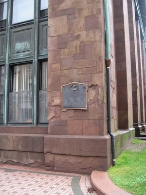
On State Street at Markle Court, on the left when traveling east on State Street.
Abraham Lincoln visited this city Saturday evening March 10, 1860, and delivered a political address before a large audience of citizens in Washington Hall, which was then a portion of this building. — — Map (db m170212) HM
On Broad Street at State Street, on the right when traveling south on Broad Street.
Bridgeport
"The Park City"
The area that is now Bridgeport was settled in the mid-17th century by farmers from the older towns of Stratford and Fairfield. Centers of settlement were Stratfield, present North Avenue; Pembroke, now Old Mill Green; . . . — — Map (db m91834) HM
On Broad Street at State Street, on the right when traveling north on Broad Street.
Korea Memorial
Freedom is not free
I will never leave you or forsake you
Hebrews 13 5
In my generation this was not the first occasion
when the strong attacked the
weak. Communism was acting in Korea just as
Hitler, Mussolini and . . . — — Map (db m170213) WM
On Broad Street at State Street, on the right when traveling north on Broad Street.
This Tablet Is Dedicated To Bridgeports Sons And Daughters Who Gave Up Their Lives That The World Might Re A Better Place In Which To Live
Agnew, James • Altman, Walter G. • Anderson, Martin A. • Armstrong, Thomas • Baltonsaita, Ignatz • Banks, . . . — — Map (db m91929) WM
On Broad Street at State Street, on the right when traveling north on Broad Street.
Vietnam
This Memorial Is Dedicated To
Those Who Have Given The Supreme
Sacrifice To Their Country
“If Ye Break Faith
We Shall Have Died In Vain”
Donated By Concerned Citizens
Dedicated - May 29, 1983
( left panel . . . — — Map (db m91928) WM
On Broad Street at State Street, on the right when traveling north on Broad Street.
World War II Memorial
To those who made the ultimate sacrifice so that others would live
Aaron, William • Adams, Thomas • Adelman, Harold • Aitkin, Richard W. • Akalis, Anthony J. • Alderucci, Salvatore • Aleksiewicz, Stephen N. • Anagnos, . . . — — Map (db m91973) WM
On Broad Street at State Street, on the right when traveling north on Broad Street.
In Recognition
Of The Patriotism Of Our Employees
Who Entered The Service Of Our Country
During The Great War
1914 – 1918
The Bryant Electric Company — — Map (db m91931) WM
On Broad Street at State Street, on the right when traveling north on Broad Street.
In Commemoration
Of Those Employees Who Served
In the Armed Forces of the United States
During World War II
1941 – 1945
The Bryant Electric Company — — Map (db m91927) WM
On Lyon Terrace at Golden Hill Street, on the right when traveling south on Lyon Terrace.
This Marker Commemorates The
150th Anniversary
Of The City Of Bridgeport
During This 150th Year
The People Of Bridgeport Reflected On Their Past
Celebrated Their Present Life Together,
And Planned For A Future Full Of Hope And . . . — — Map (db m91975) HM
On Congress Street at Lyon Terrace, on the right when traveling west on Congress Street.
Date of Hire July 19, 1967
Date of Retirement - April 2, 2014
Original Badge Number: 86
Promoted to Detective: June 17, 1986
Date Died: May 28, 2015
On March 16, 2013, Detective Domkowski was involved in a
motor vehicle accident while . . . — — Map (db m297817) HM
On Broad Street at South Frontage Road, on the right when traveling north on Broad Street.
James Henry O'Rourke
September 1, 1850 - January 8, 1919
‘Orator Jim' O'Rourke, son of Irish immigrants, was a professional baseball player, scholar, and civil rights activist. The Bridgeport native had the first base hit in National League . . . — — Map (db m91832) HM
On Golden Hill Street at Lafayette Square, on the right when traveling south on Golden Hill Street.
In memory of the construction workers who died at L'Ambiance Plaza April 23, 1987
Michael Addona • Augustus Allman • Glenn Canning • Mario Colello • Francesco D’Adonna • William Daddona • Donald Emanuel • Vincent Figliomeni • Herbert Goeldner, . . . — — Map (db m91977) HM
On Broad Street at State Street, on the right when traveling south on Broad Street.
Considered one of the 10 most important Black inventors in US history. Lewis Latimer was renowned for his work with the Edison Pioneers. Of his many inventions and patents, his most famous discovery was the incandescent light bulb carbon filament . . . — — Map (db m91836) HM
On Congress Street at Lyon Terrace, on the right when traveling west on Congress Street.
Date of Hire - July 19, 1967
Date of Retirement May 10, 1978
Badge Number: 276
Date Died: May 26, 2016
On October 10, 1973 Officer Terrence Flood was dispatched to 1780-1794
Stratford Avenue on a report of a fire with trapped occupants. . . . — — Map (db m297815) HM
On Broad Street at Bank Street, on the right when traveling south on Broad Street.
Formerly known as
the Bridgeport Society for Mental Hygiene
commemorates the opening of
Bridgeport's first mental health clinic
at this original location
991 Broad Street
September 1, 1925
Presented on
September 1, 2010
by . . . — — Map (db m297825) HM
On East Washington Avenue at Noble Avenue on East Washington Avenue.
In 1851, P.T. Barnum and William Noble took the land that we now stand on and developed it. Lots were planned and streets were named after their own family members such as Caroline, Hallet, and of course Barnum. A firm was hired to design an English . . . — — Map (db m227305) HM
On Barnum Avenue at Kossuth Street, on the left when traveling west on Barnum Avenue.
In 1851, P.T. Barnum and William Noble took the land that we now stand on and developed it. Lots were planned and streets were named after their own family members such as Caroline, Hallet, and of course Barnum. A firm was hired to design an English . . . — — Map (db m227306) HM
Near Noble Avenue north of Crown Street, on the left when traveling north.
Status: Threatened
Formerly an endangered species due to poaching, their population has increased thanks to environmental awareness programs at zoos like Connecticut's Beardsley Zoo.
Near Noble Avenue north of Crown Street, on the left when traveling north.
Size: up to 12.5 feet in length[;] up to 6.5 feet at the shoulders
Weight: up to 2,500 lbs[;] males larger than females
Lifespan: 15-20 years in the wild[;] up to 40 years in captivity
Habitat: grasslands . . . — — Map (db m230894) HM
Near Noble Avenue north of Crown Street, on the left when traveling north.
Size: 18 - 30 inches at the shoulder
Weight: males weigh between 80-200 pounds, females weigh between 62-132 pounds
Lifespan: 10 - 15 years average, up to 20 years
Habitat: temperate forest, with a wide range of . . . — — Map (db m230906) HM
Near Noble Avenue north of Crown Street, on the left when traveling north.
It is estimated that between 1970 - 1983, the Amur leopard lost 80% of its former territory. Indiscriminate logging, forest fires and land conversion for farming are the main causes. There is still hope. Large tracts of forest, which are ideal . . . — — Map (db m230916) HM
Near Noble Avenue north of Crown Street, on the left when traveling north.
AZA Tiger Conservation Campaign
Connecticut's Beardsley Zoo supports the Amur Tiger Conservation projects sponsored by the AZA Tiger Species Survival Plan. The first survey of Amur tigers in the 1930's estimated that only 20 - 30 remained . . . — — Map (db m230926) HM
Near Noble Avenue north of Crown Street, on the left when traveling north.
Height: 4 feet
Weight: up to 33 lbs
Wingspan: 10 to 12 feet
Males: brown eyes,
Females: red eyes and lack the head crest Or carbuncle.
Lifespan: 50 years in the wild. Over 75 years in human . . . — — Map (db m230842) HM
Near Noble Avenue north of Crown Street, on the left when traveling north.
The eagle's drastic decline in the mid-20th century has been attributed to the widespread use of the pesticide DDT. In a process called biological magnification (brought brought forth to the general public by Rachel Carson in her book Silent . . . — — Map (db m230922) HM
Near Noble Avenue north of Crown Street, on the left when traveling north.
Size: 34-43 inches in length
Weight: males 8-9 lbs, females 10-14 lbs
Wingspan: 6-7.5 feet
Lifespan: 25 to 30 in the wild[;] up to 60 years in captivity
Habitat: lakes, rivers and seacoasts
Diet: fish, . . . — — Map (db m230923) HM
Near Noble Avenue north of Crown Street, on the left when traveling north.
Size: 17-20 inches[;] wingspan of 39-43 inches
Weight: 2.5 lbs
Lifespan: 18 years in the wild[;] over 20 years in captivity
Habitat: coniferous forests, swamp and riparian forests
Diet: small mammals, birds, . . . — — Map (db m230893) HM
Near Noble Avenue north of Crown Street, on the left when traveling north.
Size: 19-20 inches
Wingspan: 38-42 inches
Weight: 1.6 pounds
Females are larger than males
Lifespan: 23 years in human care and 10 years or more in the wild
Habitat: Mature forests are their preferred . . . — — Map (db m230934) HM
Near Noble Avenue near Crown Street, on the left when traveling north.
Bears have fascinated and inspired humans since our ancient ancestors first explored the wild world around them and gazed at the skies above.
They connect us deeply with the natural world around us.
Inspired by the rising sun, Sun bears . . . — — Map (db m230880) HM
On Noble Avenue north of Crown Street, on the left when traveling north.
For thousands of years, tribal people around the world have relied on certain animals to provide them with meat, milk, shelter, tools and transportation. Middle-Eastern tribes have relied on Dromedary camels, northern Eurasian tribes have relied . . . — — Map (db m230898) HM
Near Noble Avenue north of Crown Street, on the left when traveling north.
Size: up to 16 inches
Weight: up to 3.5 lbs
Lifespan: 5-8 years in the wild[;] 8-12 years in captivity
Habitat: open, level, arid, short and medium-grass plains
Diet: grasses, weeds, forbs, roots, a small . . . — — Map (db m230882) HM
Near Noble Avenue north of Crown Street, on the left when traveling north.
Size: 1.5-2.5 feet at shoulder
Weight: 66-88 pounds
Lifespan: Up to 9 years
Habitat: Dry thorn forests, plains and marshes of South America
Diet: Cacti, tubers, fruits, flowers
Near Noble Avenue north of Crown Street, on the left when traveling north.
Our Big Cow was originally displayed at the Danbury Fair, one of the largest agriculture fairs in the country for many years.
Thank you to our Big Cow sponsor, Wade's Dairy.
The Big Cow has also become a Time Capsule to be opened in . . . — — Map (db m230931) HM
On Noble Avenue north of Crown Street, on the left when traveling north.
Dexter cattle are the smallest North American breed of cattle. Dexter cattle were originally brought to the U.S. in 1912 from Ireland and quickly became popular due to their ideal size for the small family farms of the time. . . . — — Map (db m230943) HM
Near Noble Avenue north of Crown Street, on the left when traveling north.
Wild cattle originated in North Africa, Europe and Southern Asia. Domestic cattle are found worldwide.
Cattle are large, hoofed mammals. They graze on rangelands throughout the world.
Cattle breeds vary in color, shape and size. The . . . — — Map (db m230940) HM
Near Noble Avenue north of Crown Street, on the left when traveling north.
People have kept goat herds for more than 10,000 years.
They originated in Central Asia and are now found worldwide.
The many breeds of domestic goats vary in color, shape and size. The largest breeds can weigh up to 250 pounds, while . . . — — Map (db m230937) HM
On East Main Street (Connecticut Route 127) at Beverly Place, on the right when traveling south on East Main Street.
Frederick Law Olmsted
Beardsley Park was originally designed by Frederick Law Olmsted during the 1880's, and the design completed by his sons in the early 20th century. Known as the father of American landscape architecture, Olmsted . . . — — Map (db m230835) HM
Near Noble Avenue north of Crown Street, on the left when traveling north.
Height at shoulder: 21 - 24 inches
Weight: 150 to 300 lbs
Habitat: Farms across Europe, Africa and the United States
Diet: Shrubs, weeds, bird eggs, mice grasshoppers, roots, tubers, even manure
Status: This . . . — — Map (db m230939) HM
Near Noble Avenue north of Crown Street, on the left when traveling north.
One of the two Amur leopards at Connecticut's Beardsley Zoo is melanistic, causing her to appear all black, while the male has the usual coat pattern. At first, a melanistic cat might look solid black, but even melanistic leopards are spotted. If . . . — — Map (db m230917) HM
Near Noble Avenue north of Crown Street, on the left when traveling north.
Size: 18-30 inches at the shoulder
Weight: 70 to 90 lbs
Lifespan: up to 15 years
Habitat: mountain forests, grasslands and shrublands
Diet: elk, white-tailed deer, mule deer, also known to eat smaller . . . — — Map (db m230875) HM
Near Noble Avenue north of Crown Street, on the left when traveling north.
Size: no taller than 34 inches, measured at the top of the shoulders
Weight: between 150 and 350 pounds
Lifespan: from 25 to 35 years
Found in many nations, particularly in Europe and the Americas
Near Noble Avenue north of Crown Street, on the left when traveling north.
Our myths and legends about wolves vary from reverence to fear.
753 B.C.
Mother to mythic heroes
According to Roman mythology. Romulus and Remus were nurtured as infants by a "she-wolf." Romulus founded the city of Rome on the Tiber . . . — — Map (db m230843) HM
Near Noble Avenue north of Crown Street, on the left when traveling north.
Named for Narragansett Bay in Rhode Island, this is the oldest turkey variety developed in the United States. They originate from the breeding of native wild turkeys in New England to domesticated species brought here by European settlers. . . . — — Map (db m230944) HM
Near Noble Avenue north of Crown Street, on the left when traveling north.
Beardsley Park Zoo was founded as a menagerie featuring animals donated by the P.T. Barnum Circus and area residents. With the historic Greenhouse as a central feature of the park, the Zoo became a beautiful recreation site where visitors could . . . — — Map (db m230840) HM
Near Noble Avenue north of Crown Street, on the left when traveling north.
Wolves have been brought to near extinction, mainly due to conflicts with humans.
1630 - Present
Bounty Hunting for Wolves
In 1630, Massachusetts colonists passed the first wolf bounty law in America. They sought to eliminate wolves . . . — — Map (db m230845) HM
Near Noble Avenue north of Crown Street, on the left when traveling north.
Bearly Recognizable:
While bears come in a wide variety of sizes and colors, all bears have some things in common. Large, powerful, well-furred bodies, long snouts with super-sensitive noses, broad paws with sharp claws and tiny tails are . . . — — Map (db m230878) HM
Near Noble Avenue near Crown Street when traveling north.
Description: Short reddish brown to tawny gray fur, long legs and large ears.
Size: 18"-26" at the shoulder
Weight: 40-90 lbs
Lifespan: 6-7 years in the wild, up to 15 years in captivity
Near Noble Avenue north of Crown Street, on the left when traveling north.
Peafowl are native to India. The males, known as peacocks, are brightly-colored to attract females (peahens).
Guineafowl are native to Africa. Their keen eyesight enables them to prey on invertebrates.
Wild Turkeys are true "American . . . — — Map (db m230945) HM
Near Noble Avenue north of Crown Street, on the left when traveling north.
Size: about 3' tall at the shoulder, length of 6'-7'
Weight: 90 - 130 lbs for females, 130 - 220 lbs for males
Lifespan: up to 10 years in the wild, and up to 20 years in captivity
Diet: a wide variety of . . . — — Map (db m230895) HM
Near Noble Avenue north of Crown Street, on the left when traveling north.
White tigers are not a separate species. All white tigers in North America are the descendants of a single tiger captured in 1951. Generations of inbreeding have increased the frequency of the white coat. Because of this inbreeding and the . . . — — Map (db m230928) HM
On Howe Drive north of Soundview Drive, on the left when traveling south.
In memory of all the young men who participated on these baseball diamonds in the city of Bridgeport who made the supreme sacrifice in the service of their country
Samuel J. Tedesco
Mayor of the city of Bridgeport
The . . . — — Map (db m298087) WM
Near Waldemere Avenue near Park Avenue, on the left when traveling west.
[ south plaque ] Dedicated To The Memory Of The Heroic Men Of Bridgeport, Who Fell In The Late War For The Preservation Of The Union. July, 1876 "It is for us the living to be here dedicated to the great task remaining before us, that from . . . — — Map (db m27137) HM
On Waldemere Avenue at Park Avenue, on the left when traveling west on Waldemere Avenue.
[Inscription on the street (east) side]
This Memorial Arch was erected
AD MCMXVIII to the memory of
William Hunt Perry
of Bridgeport Conn by his wife
Harriet Adelaide Perry
[Inscription on the park side]
This Memorial . . . — — Map (db m27166) HM
Near Waldemere Avenue west of Iranistan Avenue, on the left when traveling west.
The test of mankind's progress is not whether we add more to the abundance of those who have much; it is whether we provide enough for those who have too little. — — Map (db m306191) HM
On Soundview Drive at Monument Drive, on the left when traveling west on Soundview Drive.
In Memoriam
U.S.S. Maine
Destroyed in Havana Harbor
February 15th 1898
This tablet is cast from metal recovered from the U.S.S. Maine — — Map (db m27128) HM
Near Dewey Street near Maplewood Avenue, on the left when traveling north.
[ battle names on the banner at the top ]
Fort Sumter • Vicksburg • Mobile Bay • Antietam • Gettysburg • Appomattox
First Conn Cavalry
Richard R Crawford Lt D d Oct 30 1863 In Hospital Va
Eugene W Starkweather Corp L d . . . — — Map (db m27213) HM
Near Dewey Street at Maplewood Avenue, on the left when traveling north.
This monument is a memorial to Charles S. Stratton, a native of Bridgeport, who gained worldwide fame as Tom Thumb in the exhibitions of P.T. Barnum. The lifesize statue was erected before Tom Thumb's death on July 15, 1883. In 1959 vandals smashed . . . — — Map (db m27168) HM
On Shore Road 0.1 miles east of Elm Street, on the right when traveling east.
Traditional Landing Place of Stratford’s First Settlers in the spring of 1639 under leadership of the Rev. Adam Blakeman
On the right, at the inner end of the harbor stood the First Meeting House and burial ground, and across the harbor at . . . — — Map (db m48426) HM
On Academy Hill at Elm Street, on the left when traveling east on Academy Hill.
Academy Hill
Historic District
Established April 14, 1988
First known as Watch House Hill, where the first settlers manned a blockhouse and a palisade to guard the town from threats of Dutch and Indian attack.
Renamed Meeting House . . . — — Map (db m25814) HM
Near Main Street (Connecticut Route 110) at Manor Hill Road, on the right when traveling north.
In competition with Henry Ford’s Blacksmith Shop which had 4 sides and 4 corners, David Boothe designed this Blacksmith Shop with 44 sides and 44 corners. He offered $5.00 to anyone who found something missing and he never had to pay up. It houses . . . — — Map (db m25910) HM
Near Main Street (Connecticut Route 110) at Manor Hill Road, on the right when traveling north.
Listed on the National Register of Historic Places
By the United States
Department of the Interior
May 1, 1985
This Estate Owned by the Boothe Family
For Many Generations Was Willed
To the Town of Stratford by
David Beach . . . — — Map (db m25907) HM
Near Main Street (Connecticut Route 110) at Manor Hill Road, on the right when traveling north.
This 1820’s home was built over the original foundation of the 1683 house and has been altered four times since then. David and Stephen Boothe’s renovations of 1913 added stained glass windows, four safes in the walls, and several . . . — — Map (db m25911) HM
On Academy Hill 0.1 miles east of Main Street ( Route 113), on the left when traveling east.
In Memory Of
Captain John Carpenter
Born in London, England, 1628
Settled In
Stratford, Connecticut
Before 1646
He commanded the Jamaica Fusiliers
In the Defense of Fort James, New
York, When the Dutch Fleet Of
William of Orange . . . — — Map (db m25766) HM
On Broad Street at Monument Place, on the right when traveling east on Broad Street.
This Gate Is the Gift of Columbia University In the City of New York In Grateful Memory of Samuel Johnson the First President of King’s College In the Province of New York 1754 – 1763 A.D. And of His Son William Samuel Johnson the First . . . — — Map (db m25815) HM
Near Main Street (Connecticut Route 110) at Manor Hill Road, on the right when traveling north.
In 1913, this 1830’s haybarn was topped with a clocktower which was acquired in Massachusetts by the Boothes in exchange for a carpet sweeper. They installed Westminster Chimes, and inscribed the five massive bells with their genealogy. The . . . — — Map (db m25908) HM
Near Main Street (Connecticut Route 110) 0.1 miles Manor Hill Road, on the right when traveling north.
Merritt Parkway Toll Booth Plaza
Built in the late 1930s, the Merritt Parkway was designed for beauty as well as efficiency in traveling through southern Connecticut. The intent of the road was to bring the weary city driver into a restful . . . — — Map (db m25903) HM
[Left Plaque]
In honor of
the men and women
who planted in the wilderness
the early homes of Stratford,
who fought bravely and suffered patiently
in the War of the American Revolution,
and who left to their descendents
a . . . — — Map (db m26099) HM
On Academy Hill 0.1 miles east of Main Street (Route 113), on the left when traveling east.
Planted in Memory Of
Theodore Roosevelt
On the 100th Anniversary Of
His Birth October 27, 1958
Capt. David Hawley Society C.A.R. — — Map (db m53238) HM
On Academy Hill 0.1 miles east of Main Street ( Route 113), on the left when traveling east.
American
Revolutionary War
1775 –– 1783
Dedicated to the brave Patriots
from Stratford who participated
in the struggle to achieve our
Independence
Killed in battle
Zachariah Blakeman
William Thompson
David Wooster . . . — — Map (db m25773) HM
On Academy Hill 0.1 miles Main Street ( Route 113), on the left when traveling east.
[ West Face ]
1776 Dedicated To The
Memory Of
Those Who Fought
For Liberty
And Saved The Union
-------
“Yet Loved Ones Have Fallen
And still where they sleep
A sorrowing nation shall
Silently weep,
and . . . — — Map (db m25782) HM
On Academy Hill 0.1 miles east of Main Street ( Route 113), on the left when traveling east.
In memory
to all disabled
American Veterans who
served in all wars
and conflicts of the
United States of America
Dedicated by
Charles K. Merritt Chapter No. 20
Disabled American Veterans
Stratford, Connecticut. . . . — — Map (db m25785) HM
On Academy Hill 0.1 miles east of Main Street ( Route 113), on the left when traveling east.
In Honor Of
Those Who Served
In the Korean War
Cpl. Carmen F. Caruso Army
Capt. Raymond S. Davis Army
Cpl. Virgil R. Julian Army
PFC. William A. Mastroianni Army
Pvt. John F. Miner Army
PFC. John P. Quinlan Marines
Pvt. . . . — — Map (db m25772) WM
On Academy Hill 0.1 miles east of Main Street ( Route 113), on the left when traveling east.
In recognition and appreciation
for the service given by
members of the Armed Forces
from Stratford during times of
national crisis
[ Front face ]
Libya • Grenada • Lebanon • Iraq • Bosnia • Saudi Arabia • Afghanistan • . . . — — Map (db m25783) HM
On Academy Hill 0.1 miles east of Main Street ( Route 113), on the left when traveling east.
Vietnam
“That these dead shall not have died in vain, that this nation, under God shall have a new birth of freedom and that this government of the people, by the people, for the people shall not perish from the earth.” . . . — — Map (db m25771) HM
On Academy Hill 0.1 miles Main Street ( Route 113), on the left when traveling east.
World War I
Apr. 6, 1917 – Nov. 11, 1918
Dedicated to the Soldiers From Stratford Who Served Our Country During World War I
Killed In Action
George C Anderson
Martin Cunningham
George Desario
Charles Dunn . . . — — Map (db m25784) HM
On West Broad Street at Main Street ( Route 113), on the left when traveling west on West Broad Street.
In grateful recognition of all those who served our country in time of war the Town of Stratford dedicates this memorial A.D. 1931 — — Map (db m25898) WM
On Academy Hill 0.1 miles east of Main Street ( Route 113), on the left when traveling east.
World War II
1941 – 1945
[ Inside right cloumn ]
Dedicated to all the
Brave men and
women from the
town of stratford
Who served with
Honor in
World War II
[ Inside left cloumn ]
“I pray that our . . . — — Map (db m25769) HM
Near Main Street (Connecticut Route 110) near Manor Hill Road, on the right when traveling north.
This building, designed and built by the Boothes, was made of redwood shipped through the Panama Canal. All the 4x6 timbers lie flat and are secured with galvanized dowels. Other features are glass block windows, a fireplace, and a cathedral . . . — — Map (db m25909) HM
On Ferry Road (U.S. 148), on the right when traveling east.
For over two hundred years the Chester-Hadlyme Ferry has provided public transportation at this site. The first crossing was initiated by Johnathan Warner of Chester in 1769. Known as Warner's Ferry, it was privately operated until 1877 when it . . . — — Map (db m61345) HM
On Ferry Road, on the left when traveling west on Ferry Road.
(Upper middle photo)
At one time, the town of Chester had three train stations: (from south to north) Chester, North Chester, and Hadlyme-all of which would have been within sight of this location looking south.
This location is the . . . — — Map (db m266484) HM
On Main Street at Water Street ( Route 148), on the left when traveling west on Main Street.
Chester
Chester is located on land known as Pattaconk or Pattyquounck in Indian deeds of the 1660's. Settled largely by families from Saybrook, it became the Fourth Ecclesiastical Society of the Saybrook Congregational Church in 1740 and was . . . — — Map (db m100313) HM
On Middlesex Turnpike (Connecticut Route 154) at Railroad Avenue, on the right when traveling north on Middlesex Turnpike.
There Was A Time
When The World Asked
Ordinary People
To Do
Extraordinary Things
To The Man and Women of Chester
Who Served Our Country
Dedicated
May 2004
( left panel )
World War II
Kern, Frederick A. • Walden, Francis . . . — — Map (db m65998) WM
On Middlesex Turnpike (Connecticut Route 154) near Railroad Avenue, on the right when traveling north.
In honor of the men of Chester
who served in the World War
1917 - 1918
Abbey Raymond C. • Bailey Charles F. • Beckwith Willis A. • Berg Albert • Bergonzi Joseph • Bickerton Charles W. • Bocksruth John H. • Bole John J. • Brooks Malcolm G. • . . . — — Map (db m66000) WM
On Middlesex Turnpike (Connecticut Route 154) at Railroad Avenue, on the right when traveling north on Middlesex Turnpike.
Honoring All Who Served
World War II 1941 1946
These Gave Their Lives
George A. Butler • Allen W. Burton • Theodore P. Dreher • Arthur Going • Philip H. Kern • Anthony P. Narducci • Harold M. Perry • Richard L. Turner • George E. Watrous • . . . — — Map (db m65999) WM
Near East Main Street (U.S. 1) at Cemetery Road, on the right when traveling east.
You are standing beside the Indian River in the heart of the 1663 settlement of Killingworth, sited on its protective harbor. In 1838, the shoreline portion parted from northern Killingworth and became Clinton.
Shipbuilding
The first . . . — — Map (db m100187) HM
On East Main Street (U.S. 1) just west of Cemetery Road, on the right when traveling west.
1. Congregational Church
This Classic Rivival sanctuary dates from 1837 and is the fourth church building to have been located on Meeting House Hill. In front of the church stands in the monument honoring Abraham Pierson and the . . . — — Map (db m227288) HM
On East Main Street (U.S. 1) just east of Cemetery Road, on the right when traveling east.
1. Indian River
At the center of the Colonial settlement, this stream winds south through salt marshes to the harbor. Shipyards stood on its banks in the 18th and 19th centuries. The bridge dates from the 1876, replacing an an earlier . . . — — Map (db m227290) HM
On West Main Street (U.S. 1) at Hull Street ( Route 81), on the right when traveling west on West Main Street.
On this approximate location
Abel Buell
had his goldsmith shop from
1763 - 1769
Inventor, artist, engraver,
cartographer, engineer, pattern maker, lapidary,
silversmith, die cutter, type founder,
and master of many trades. . . . — — Map (db m269315) HM
On East Main Street (U.S. 1) at Morgan Park, on the left when traveling east on East Main Street.
In Honor of
The Good and Learned
Abraham Pierson
First President
of
Yale College 1701-1707
Pastor of Killingworth Church
Now Clinton 1694-1707
The Time of His Death
Beloved and Regretted
By All.
( east side )
Erected By . . . — — Map (db m100188) HM
On E Main St (U.S. 1) at Commerce St, on the right when traveling north on E Main St.
U.S. Army Staff Sgt. Ryan C. Knauss, 23, Corryton, Tennessee
U.S. Navy, Hospital Corpsman Maxton W. Soviak, 22, Berlin Heights, Ohio
U.S. Marine Staff Sgt. Darin T Hoover, 31, Salt Lake City, Utah
U.S. Marine Sgt. Nicole L. Gee, 23, . . . — — Map (db m260539) WM