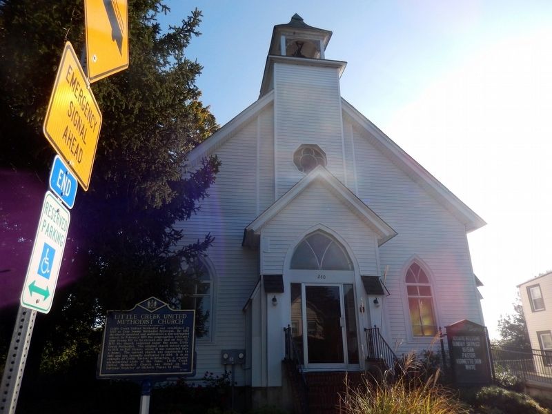
Little Creek United Methodist was established in 1820 as Gum Swamp Methodist Episcopal. By 1832 the church operated and maintained a non-segregated school. In February 1875 the congregation relocated Gum Swamp ME to its current site and on May 30, . . . — — Map (db m141374) HM
On 11th Street at Wilson Street, on the right when traveling east on 11th Street.
In 1875 the Delaware General Assembly enacted legislation requiring the racial segregation of public places such as train stations, hotels, and restaurants. For most of the next century this practice was strictly enforced. Established at this . . . — — Map (db m10920) HM
On 2nd Street at Walnut Street, on the left when traveling west on 2nd Street.
On May 2, 1914, the Delaware Congressional Union and Delaware Equal Suffrage Association held a parade in Wilmington. Approximately 400 suffragists marched from the Pennsylvania Railroad Station to the New Castle County Court House at 10th and . . . — — Map (db m184921) HM
Named after William C. Jason, the second President of State College for Colored Students (now Delaware State University), Jason Beach was a recreational destination for people of color from the 1930s through the early 1970s. Along with use as a . . . — — Map (db m200985) HM
On T Street Northwest west of 16th Street Northwest, on the right when traveling east.
Internationally renowned baritone Todd Duncan (1903-1998) lived here from about 1935 until about 1960. Duncan originated the role of Porgy in George Gershwin's opera Porgy and Bess on Broadway. He later refused to perform the role at DC's . . . — — Map (db m97801) HM
On 23rd Street Northwest south of E Street Northwest, on the right.
Segregated by rank, the Washington Naval Hospital's patients occupied either wards, if enlisted, or this building, if officers. The first floor of the Sick Officer's Quarters featured an office, reception room, medical library, a nurses' dressing . . . — — Map (db m129348) HM
Near Freedom Avenue, 0.3 miles south of Parker Street, on the left when traveling south.
The 1954 case of Brown v. Board of Education ended with a Supreme Court decision that helped lead to the desegregation of schools throughout America. Prior to the ruling, African-American children in Topeka, Kansas were denied access to all-white . . . — — Map (db m179773) HM
On State Road 21 at Treat Road, on the right when traveling south on State Road 21.
Situated on the site of Camp Blanding, between Sandhill and Brooklyn lakes, are the remnants of Magnolia Lake State Park. A relic from the time of segregation, Magnolia Lake was built to provide separate facilities to serve African American . . . — — Map (db m135964) HM
Near Seminole Road, 0.1 miles east of Campground Road.
Manhattan Beach was Florida’s first African American beach resort. In 1900, Henry Flagler reserved Manhattan Beach for black employees of his Florida East Coast Railway and Florida East Coast Hotel companies. African Americans, who comprised a . . . — — Map (db m173936) HM
On Kings Road (U.S. 23) at North Davis Street, on the right when traveling east on Kings Road.
The founders of Second Missionary Baptist Church worshipped at Bethel Baptist Church with their slaves masters in the 1830s. They built their first separate wooden sanctuary in 1848 in the African American neighborhood of LaVilla. The first . . . — — Map (db m101663) HM
On South Palafox Street at West Garden Street (Business U.S. 98), on the right when traveling south on South Palafox Street.
This building, once occupied by a Woolworth’s five and dime store, played a role in the struggle for civil rights in Florida. In the 1950s and 1960s, African Americans in segregated communities began sit-ins to protest against “whites . . . — — Map (db m110472) HM
Near East Fort King Street, 0.1 miles south of East Silver Springs Boulevard.
The 65th Infantry Regiment, an all volunteer unit from Puerto Rico was segregated by race, united by honor. With a long and honored tradition since its inception in 1899. The regiment has participated gallantly in WWI, WWII, Korea, Vietnam, and all . . . — — Map (db m198482) WM
On North 9th Street just south of Alachua Street, on the left when traveling north.
In May 1887, the original wood frame building of St. Peter's Episcopal Church in Fernandina was given to the black congregation and called Good Shepherd Episcopal Church. The structure was moved to face east on Ninth Street. The rectors of St. . . . — — Map (db m92955) HM
On Church Street, 0.2 miles east of Limestone Creek Road, on the left when traveling east.
Mount Carmel Missionary Baptist Church, a cornerstone of Jupiter’s African American community, was organized in 1902 by the Reverend J. A. Wannamaker and the pioneer families of Simmons, Campbell, Ford, Bush, and Davis. These early settlers arrived . . . — — Map (db m95675) HM
On Holt Avenue, 0.1 miles south of Russell Street, on the left when traveling north.
Side 1
Acknowledging the needs of Clearwater’s growing Black community, the city commission created North Greenwood Cemetery, also known as the ‘Clearwater Colored Cemetery.” On January 2, 1940, the city adopted a resolution that established a . . . — — Map (db m212590) HM
On West Main Street at 1st Street, on the right when traveling east on West Main Street.
The Dundee Passenger Depot, built ca. 1912, was the first depot on the Haines City to Sebring Line of The Atlantic Coast Line Railroad. Most of Dundee’s early growth can be attributed to the railroad. With the advent of the railroad, the . . . — — Map (db m93192) HM
On Shurling Drive, 0 miles west of Gray Highway (U.S. 129), on the right when traveling west.
Founded in October 1899 by the Reverend E. K. Love under the auspices of the Missionary Baptist Convention of Georgia, Central City College served as a co-educational institution of learning for African-American students at both the high school and . . . — — Map (db m23065) HM
On Willow Hill Road (County Route 6110) 0.5 miles south of U.S. 80, on the right when traveling south.
Willow Hill School was established in 1874 during Reconstruction as one of the first schools for African Americans in Bulloch County. It was privately supported until being sold to the local Board of Education in 1920. In 1954 the county built a new . . . — — Map (db m107702) HM
On East 45th Street at West Atlantic Avenue, on the left when traveling east on East 45th Street.
Malcolm R. Maclean served in the U.S. Navy during World War II and the Korean War, rising to the rank of commander. After Harvard Law, Maclean entered Savannah politics. His fellow aldermen selected Maclean as mayor in 1960 to fill an unexpired . . . — — Map (db m235251) HM
On Florance St near W 35th St, on the right when traveling west.
Florance Street School was designed by the firm Levy and Clarke and built in 1929 as one of the early public schools in Savannah built specifically for African-American students. It contributed greatly to Savannah’s Cuyler-Brownville community by . . . — — Map (db m12088) HM
Established in 1959, Vienna High and Industrial School was a consolidated school for African Americans during segregation. As part of Georgia's massive resistance to federally mandated school integration, politicians and school officials sought to . . . — — Map (db m127159) HM
On Old Chapel Lane, 0 miles east of West Lanier Avenue (Georgia Route 54), on the right when traveling east.
Today’s Flat Rock AME Church originated in 1854 as a place of worship for slaves on nearby Spears Plantation, and it is believed to be the oldest African-American congregation in Fayette County. Originally known as Rocky Mount, the church moved . . . — — Map (db m22973) HM
On Westview Drive SW, 0.1 miles east of Welborn Street SW, on the right when traveling east.
Social activist Lugenia Burns Hope was born in St. Louis, Missouri. Following her father’s death, her family moved to Chicago, Illinois, where she became involved in social work. In 1897, she married Dr. John Hope and the couple moved to Atlanta, . . . — — Map (db m235239) HM
On Auburn Avenue NE east of Courtland St NE, on the left when traveling east.
Alonzo Herndon was born into slavery in Walton County, Georgia, in 1858. After moving to segregated Atlanta, Herndon opened several barbershops including the upscale Crystal Palace in 1902. In 1905, he purchased a small mutual aid association that . . . — — Map (db m185910) HM
On Helena Road SE west of Jonesboro Road SE (Georgia Route 54), on the left when traveling east.
South-View Cemetery was founded in 1886 by formerly enslaved African Americans who objected to the conditions and the treatment they received at Atlanta's segregated burial grounds. South-View's landscape reflects the influence of 19th century . . . — — Map (db m186568) HM
Former slave, Principal of Tuskegee Institute and author of Up From Slavery, Washington delivered the Atlanta Exposition Address on September 18, 1895 at this site, the former auditorium of the Cotton States and International Exposition. . . . — — Map (db m73369) HM
Near Beach View Drive, 0.1 miles north of South Riverview Drive.
Mr. Lincoln says we are free. We can live our own lives. God bless Mr. Lincoln. In 1863, as a strategy to end the Civil War, President Abraham Lincoln signed the Emancipation Proclamation declaring that "all persons held as slaves, . . . — — Map (db m168805) HM
On Veterans Parkway (U.S. 27) 0 miles north of 6th Street, on the right when traveling north.
The first public library for African Americans in segregated Columbus, the Colored/Fourth Avenue Library, opened on January 5, 1953. The existence of
this facility resulted from covenants and restrictions barring the use of the city’s new public . . . — — Map (db m22410) HM
On Colham Ferry Road at Morrison Street, on the right when traveling south on Colham Ferry Road.
E.D. Stroud School was established in 1956 as part of a statewide “equalization” effort for Georgia’s African-American public schools. As part of Georgia’s massive resistance to federally mandated school integration, politicians and . . . — — Map (db m108666) HM
On East 5th Street at Central Avenue, on the left when traveling east on East 5th Street.
Scott Bibb (1855-1909) was the plaintiff in the Alton School Case, a series of lawsuits that sought to retain Alton's desegregated schools, which had existed in Alton from 1872 to 1897, a short-lived outcome of the Reconstruction era. When Alton . . . — — Map (db m133294) HM
On East Walnut Street east of North Mill Street, on the right when traveling east.
Pioneering black physician James Henry Lewis (1888-1963) was born in North Carolina. Because of limited educational opportunities available to black students at that time and place, he moved to Illinois, where he worked to put himself through both . . . — — Map (db m192052) HM
On SE Monroe Street south of SE 15th Street, on the left when traveling south.
When Monroe Elementary School opened in 1927, it was a key part of Topeka's grand, million-dollar school construction program. Topeka wanted a first-class educational system that would promote pride in the city's schools. The new Monroe School . . . — — Map (db m81392) HM
On Paris Pike (U.S. 27) west of Kingston Road, on the right when traveling west.
Home of the Wildcat rollercoaster, Joyland Railroad, a midway, Fayette Co.'s first public swimming pool & a dance casino featuring jazz and big bands like Duke Ellington & Artie Shaw, as well as local & regional entertainers. The segregated park . . . — — Map (db m202879) HM
On E South Street north of Main Street (U.S. 31W), on the left when traveling north.
(Side A)
In 1945, Hart County had 67 One-Room Schools scattered throughout the county. These 67 schools served students in grades first through eighth.
Not quite a decade later, all One-Room Schools in Hart County had been closed. At . . . — — Map (db m174340) HM
On June 7, 1892, Homer Adolph Plessy defied a Louisiana law that segregated railroad trains on the basis of race. He was arrested and became the defendant in the May 18, 1896 United States Supreme Court decision of Plessy v. Ferguson, which condoned . . . — — Map (db m13036) HM
On Redemption Way east of Northwest 3rd Street, on the right when traveling east.
Formerly, Our Lady of Grace Catholic Church, this sanctuary represents an important historical phenomenon in the history of the Catholic Church in southern Louisiana, the formation of separate churches for black parishioners. Prior to its founding, . . . — — Map (db m85247) HM
On West Street (Maryland Route 450) at West Washington Street, on the right when traveling east on West Street.
Site of the oldest and most prominent African American congregation in Annapolis, MD. In 1803, seven free African Americans bought the land and established the First African Methodist Episcopal Church. It was closed in 1832 in a local reaction to . . . — — Map (db m6191) HM
Dr. Lillie May Carroll Jackson, born in Baltimore on May 25, 1889, was a tireless freedom fighter. As an “American of African descent, “she endured the humiliation of Jim Crow segregation, but did not take this plight sitting down. . . . — — Map (db m101626) HM
On West Hamburg Street, on the right when traveling east.
Slavery, segregation, discrimination, and the struggle for equality have defined the African American experience in Baltimore. At the start of the Civil War, Baltimore had 25,680 free blacks-more than any other U.S. city-and only 2,218 slaves. Over . . . — — Map (db m6355) HM
On Mendota Avenue at Cloverdale Avenue, on the left when traveling south on Mendota Avenue.
During the early twentieth century, many African Americans migrated north to work in Detroit's automobile factories. Increased migration during World War II prompted Royal Oak Township's Clinton School District to split into two racially segregated . . . — — Map (db m95364) HM
On Rivard Street, 0.1 miles north of Larned Street, on the right when traveling north.
Fannie Richards, Detroit’s first black public school teacher, lived on this site. Born in Virginia about 1840, she moved to Detroit as a young woman. In 1863, she opened a private school for black children, and two years later was appointed to teach . . . — — Map (db m172548) HM
On East Broadway, 0.1 miles west of North 1st Street, on the left when traveling west.
Gravesites for blacks were initially segregated in the south-central end of Columbia Cemetery near its intersection of Boone Road and Todd Drive. Blacks buried in this section include famed ragtime pianist and composer J.W. "Blind" Boone and . . . — — Map (db m169446) HM
On South 4th Street at Cherry Street, on the right when traveling south on South 4th Street.
The African-American Heritage Trail commemorates Columbia's blacks, their enterprises and churches from the city's first 200 years. The Trail honors people who overcame enormous odds to achieve outstanding legacies, some receiving national and . . . — — Map (db m169420) HM
On Delmar Boulevard west of Melville Avenue, on the right when traveling west.
Born in St. Louis, Dick Gregory grew up at 1803 N. Taylor Ave. shining shoes to help feed his family. At Sumner High School, he led a march against conditions at segregated schools and set a state record in track. As a star comedian in the early . . . — — Map (db m124777) HM
On Delmar Boulevard at Westgate Avenue, on the right when traveling west on Delmar Boulevard.
Maya Angelou, born Marguerite Johnson in St. Louis, was raised in segregated rural Arkansas. Her bestselling account of that upbringing, "I Know Why the Caged Bird Sings," won critical acclaim in 1970. A leading literary voice of the . . . — — Map (db m124764) HM
On Michigan Avenue south of Broadway, on the right when traveling south.
In 1934 Ann Montgomery converted her ice cream parlor and Oriental Billiard Parlor on this site into the Little Harlem Hotel. Cab Calloway, Billy Eckstine, Della Reese, Sarah Vaughn and many others performed and stayed here when downtown hotels were . . . — — Map (db m75351) HM
On Huguenot Street, 0.5 miles north of Mulberry Street, on the right when traveling north.
Site of African-American burial ground French Huguenots who founded New Paltz in 1677 had used enslaved Africans for construction and farm work as early as 1673. By 1790, 179 enslaved African-Americans and 9 free persons of color lived in New . . . — — Map (db m145962) HM
On South Elm Street at East February 1 Place, on the right when traveling north on South Elm Street.
Albion Winegar Tourgee, a native of Ohio and veteran of the Union Army, moved to Greensboro in 1865 and led a campaign to secure justice for African—Americans. He was an organizer of the Republican Party in NC, a delegate to the convention that . . . — — Map (db m219410) HM
On Oakes Place, 0.2 miles Flat Rock Road, on the right when traveling south.
This cemetery stands as evidence of a once thriving African American farming community established in the 1820s. With the aid of community leader, Alexander "Sandy" Harper (c.1804-1889), Captina, originally called Guinea, became a stop on the . . . — — Map (db m79263) HM
On Harriott Road (County Route 131) at Frabell Drive (County Route 309), on the right when traveling east on Harriott Road.
Lucy Depp Park was a 102-acre development named for Lucinda Depp (1844-1929). She had inherited the land from her father, Abraham (1791-1858), an emancipated African American man and central Ohio pioneer from Powhattan County, Virginia. Known . . . — — Map (db m108066) HM
On South Nelson Road at Gault Street, on the right when traveling north on South Nelson Road.
Hanford Village was founded in the early 1900s just east of Columbus proper with its own mayor, police force, fire department, businesses, and park. After World War II, a subdivision of Hanford became a segregated community for returning African . . . — — Map (db m94618) HM
On Delaiane Street at Hill Street, on the left when traveling west on Delaiane Street.
(Side 1)
Briggs Family House
On November 11, 1949, local African American families came to this house to sign a petition demanding equal resources in Summerton's racially segregated schools. Believing the homes isolated location . . . — — Map (db m199859) HM
This large spring-fed swimming pool was once a watering hole on Tollunteeskee's Trail, later Emery Road, first road cut and cleared through this area In 1787. In 1944, the Manhattan Project improved and opened the new swimming pool on July 29, . . . — — Map (db m215322) HM
On Jefferson Street, on the right when traveling east.
Beginning in late 1959, a group of Nashville college students from Fisk University, Tennessee A&I, Meharry Medical College and American Baptist Theological Seminary, along with local religious leaders, began to discuss a mass collective action . . . — — Map (db m207833) HM
On Montgomery Way south of Barnhill Street, on the right when traveling north.
Preceded by Lexington Colored School, which operated at Pilgrim Rest Baptist Church, Montgomery School was established in 1923 for the education of Negro boys and girls of Lexington and Henderson County, a Rosenwald facility, it was organized as . . . — — Map (db m153432) HM
Near J L Seehorn Junior Road west of Gilbreath Drive, on the right when traveling west.
Dedicated in 2013, this fountain tells a story of hope, inspiration, and courage. It pays tribute to the first African American students to enroll at what was then East Tennessee State College. These pioneering students integrated the campus in an . . . — — Map (db m173436) HM
On Center Street west of North Hoefgen Avenue, on the left when traveling west.
230 N. Center Street, commonly referred to as "The Spire" today, was built in 1884 and was the first home of St. Paul Colored Methodist Church, as it was called during the Reconstruction era after the Civil War. It is the oldest African American . . . — — Map (db m245209) HM
On East Prairie Street, on the right when traveling east.
The new community of Cuero was surveyed for the Cuero Land & Immigration Co. in 1873. That same year, the city incorporated, and the GWT&P Railroad extended its track to it from Indianola. The land company conveyed 12 acres at this site for use as . . . — — Map (db m207817) HM
On West Alamo Street at Joseph Street, on the left when traveling east on West Alamo Street.
In 1914, noted Texas educator Columbus H. Hogan became a founding partner in the Washington County Undertaking Co. on South Park Street in Brenham. It was then the only funeral home in the county for African Americans. Hogan later became sole . . . — — Map (db m165377) HM
On Montgomery Street just east of Richmond Highway (U.S. 1), on the left when traveling west.
Earl Lloyd, a Naismith Memorial Basketball Hall of Famer, grew up on this block, attended the segregated Parker-Gray High School, and graduated from West Virginia State College. On 31 Oct. 1950, as a member of the Washington Capitols, he became the . . . — — Map (db m195657) HM
On Gordons Fairgrounds Road (Virginia Route 777) 0.1 miles south of Richmond Highway (U.S. 60), on the left when traveling south.
Amherst County opened Central High School here in 1956 to serve African American students. The school, established at the same time as the all-white Amherst County High School, was built in an effort to create "separate but equal" facilities despite . . . — — Map (db m179501) HM
On North Vacation Lane east of 23rd Street North, on the left when traveling north.
On February 2, 1959, Stratford Jr. High became the first racially integrated school in Virginia. The long battle to integrate Virginia's public schools followed the U.S. Supreme Court's 1954 decision in Brown v. Board of Education, which held that . . . — — Map (db m55729) HM
On Preston Avenue just south of Rosser Avenue, on the right when traveling south.
After the abolition of slavery, African Americans still confronted racial prejudice. Schools, churches, transportation, parks, and other public spaces became segregated by practice and by law. In 1919 Paul Goodloe McIntire (1860-1952), a merchant . . . — — Map (db m170149) HM
On Beulah Street, 0.1 miles south of Walker Lane, on the right when traveling south.
In the early 1880s, former slaves organized a congregation and held church services near a grove of laurel on Beulah Road. The trustees, including Middleton Braxton, George Carroll, Thornton Gray, and William Jasper, were focused on educating the . . . — — Map (db m86181) HM
On Accotink Park Road near Southern Drive, on the left when traveling west.
During the Depression, in 1933, President Franklin D. Roosevelt’s administration established the Civilian Conservation Corps (CCC) to help unemployed men, ages 18 to 25. CCC men created state parks, improved soil conservation, conducted . . . — — Map (db m190932) HM
On South Maple Avenue, on the right when traveling east. Reported missing.
This Colonial Revival bungalow (part of 1724 1,279-acre Pearson Grant) bought by Dr. Edwin B. Henderson in 1913. Henderson's ancestors include Powhattan Chief Mimetou. In 1904 he was first African-American certified to teach physical education; . . . — — Map (db m4202) HM
On Tinner Hill Road south of Lee Highway (U.S. 29), on the right when traveling south.
An early rural branch of the National Association for the Advancement of Colored People (NAACP) was founded here on Tinner Hill. In 1915, the Town of Falls Church proposed an ordinance to segregate black and white residential sections. Local African . . . — — Map (db m55735) HM
On Wolfe Street at Princess Anne Street (Business U.S. 17), on the right when traveling west on Wolfe Street.
Automobiles opened up exciting opportunities for travel, but a racially segregated nation was fraught with risk for African American motorists. In the Jim Crow era, travelers were met with intimidation and outright discrimination. Many carried their . . . — — Map (db m182644) HM
On Settlers Landing Road (U.S. 60) at South King Street, on the right when traveling east on Settlers Landing Road.
Katherine Johnson, mathematician, graduated from West Virginia State College and was a member of Alpha Kappa Alpha Sorority, Inc. She was a teacher before the National Advisory Committee for Aeronautics (later NASA) hired her in 1953 to work in the . . . — — Map (db m199789) HM
On Settlers Landing Road (U.S. 60) at South King Street, on the right when traveling east on Settlers Landing Road.
Mary Jackson, aerospace engineer, was born in Hampton and graduated from Hampton Institute in 1942. The National Advisory Committee for Aeronautics (later NASA), hired her in 1951 to be a "human computer" in the segregated West Area Computing Unit . . . — — Map (db m199792) HM
On James Madison Parkway (U.S. 301) at Hanover Church Road (Virginia Route 611), on the right when traveling north on James Madison Parkway.
Ralph Bunche High School was built as a direct result of the Federal District Court case Margaret Smith et al. v. School Board of King George County, Virginia, which was filed in 1947. The judge ruled that jurisdictions should ensure the . . . — — Map (db m76409) HM
On Kirby Street at 13th Street when traveling north on Kirby Street.
African Americans held worship services in a nearby railroad toolshed during the Civil War. Jesse Dungee, later a member of the Virginia House of Delegates, organized the congregation (now known as Mt. Nebo) in 1866. The Gothic-Revival style . . . — — Map (db m167830) HM
On North Street, on the right when traveling west.
Mt. Zion, recognized as the oldest continuing African American Methodist congregation in Virginia, traces its origins to the Old Stone Church, established in Leesburg in 1766. Black members of the Old Stone Church, desiring their own church after . . . — — Map (db m126606) HM
On Fifth Street (Virginia Route 163) at Clay Street, on the left when traveling east on Fifth Street.
Abram Frederick Biggers (1838 - 1879), a lawyer by profession, was appointed the first superintendent of the Lynchburg and Campbell County schools in 1870. As a part of his effort to build a strong system, Biggers toured northern states to study . . . — — Map (db m54467) HM
On Concord Turnpike at Spinoza Circle, on the right when traveling north on Concord Turnpike.
The Megginson School was built here ca. 1923 for the African American students in the Pleasant Valley community, then part of Campbell County. Albert Megginson (1831-1923), formerly enslaved, purchased land in this area after the Civil War and later . . . — — Map (db m179861) HM
On Liberty Street south of Prince William Street, on the left when traveling south.
In the post-Civil War years, African-Americans who were bound by a strong sense of community settled near the Brown School and the Manassas Industrial School on what was then known as Liberty Avenue. As early as 1895, African-Americans began buying . . . — — Map (db m168231) HM
On Montpelier Road, on the right when traveling south.
"The Negro habitations are separate from the dwelling house both here and all over Virginia, and they form a kind of village." - Journal of Sir Augustus John Foster, 1807 The Quarters, a cluster of wooden buildings segregated from the main . . . — — Map (db m24047) HM
On Griffin Boulevard, 0.1 miles north of South Main Street (Business U.S. 15), on the right when traveling north.
Barbara Johns, civil rights pioneer, was born in New York and moved to her parents' native Prince Edward County as a child. In April 1951, at age 16, she led a student walkout to protest conditions at the segregated Robert Russa Moton High School, . . . — — Map (db m171732) HM
On North 3rd Street at East Marshall Street, on the right when traveling north on North 3rd Street.
Born enslaved near Richmond in 1863, John Mitchell, Jr. came of age in the tumultuous post–Civil War era. In 1883, he launched a daring journalism career, becoming editor and publisher of the black-owned Richmond Planet once located . . . — — Map (db m57530) HM
On East Broad Street east of North 6th Street, on the right when traveling east.
On 22 Feb. 1960, 34 Virginia Union University students, 11 women and 23 men, refused to leave the segregated dining facilities here at Thalhimers department store and were arrested. Charged with trespassing, they were later convicted and fined. This . . . — — Map (db m95568) HM
On St. James Street just north of West Baker Street, on the left when traveling north.
Maggie Walker, an African American entrepreneur and civil rights activist, promoted economic empowerment for the Black community. In 1899 she was elected head of the Independent Order of Saint Luke, a mutual aid society and insurance company facing . . . — — Map (db m180213) HM
On Sunset Street, 0.1 miles west of Capon Street, on the right when traveling west.
The Queen Street School, one of the first schools in Shenandoah County for African Americans, had opened in Strasburg by 1875. After a fire in 1929, a new school known as Sunset Hill was built here ca. 1930 to serve grades 1-7. Because the county . . . — — Map (db m171234) HM
On North Church Street at E. Locust Street, on the right when traveling north on North Church Street.
Inspired by visits from traveling preachers, African Americans organized what would become Mt. Zion United Methodist Church ca. 1867. The congregation acquired the framework of a former German Reformed Church in 1869, moved it to this site, and used . . . — — Map (db m127778) HM
Near James Monroe Highway (Virginia Route 205) 0.2 miles south of Ferry Landing (Virginia Route 638), on the left when traveling south.
Born in Westmoreland County, Charles Bernard Smith (1917-1991) is one of more than 140,000 African Americans who served in the racially segregated U.S. Army Air Force during World War II. Trained at Chanute Field, Illinois, in aircraft ground . . . — — Map (db m22255) HM
On Center Avenue north of East 3rd Street (U.S. 119), on the left when traveling north.
According to law then in place for the education of children of color, it was not until 1880 that Weston had a sufficient number of African-American children to support the requisite segregated classrooms. The third such building constructed in . . . — — Map (db m197829) HM
Near Foreman Bottom Road west of Tams Highway (West Virginia Route 16).
In the 1910s, the East Gulf Coal Company opened what came to be known as the Helen Mine and Coal Camp. Realizing their need to attract a more reliable and family-oriented workforce, the coal operators began constructing "model towns.” Here in the . . . — — Map (db m186950) HM
On North Hogan Street at West Duval Street, on the left when traveling north on North Hogan Street.
The Seminole Club was organized in 1887 with F.R. Osborne, J.M. Barrs, A.C. Cowan and W.R. Hunter as the organizing officers. Named in honor of Florida's Native American Seminole tribe, the club was Jacksonville's oldest social club for men and the . . . — — Map (db m221308) HM
On Dr. Martin Luther King Drive at East 35th Street, in the median on Dr. Martin Luther King Drive.
Victory
St. Mihiel, Argonne Forest, Mont de Signes, Oise-Aisne Offensive.
In memory of the heroes of the old 8th Infantry, Illinois National Guard, redesignated during the World War as the 370th Infantry of the United States Army who . . . — — Map (db m4683) WM
On SW Western Avenue south of SW 3rd Street, on the left when traveling south.
This corner stone
preserved by
P-T-A. & Past Patrons
of
Sumner School
Erected 1901 - Replaced 1936
Board of Education
W. H. Wilson, President F. E. Mallory Vice President.
J. F. Buck, J. W. . . . — — Map (db m127685) HM
Near West 5th Street at Cs-1186-30, on the right when traveling west.
The end of slavery in 1865 brought many challenges to Owensboro's African-American population. They struggled to find jobs, establish homes, educate their children, and find their place in the post-war world.
In 1880 a system of schools for . . . — — Map (db m159343) HM
On North Limestone Street at East Short Street, on the right when traveling north on North Limestone Street.
From Enslaved to Community Activist
Education Gave the Jacksons a Step Up
Jordan C. Jackson, Jr. was born enslaved in Lexington. Denied an education, he taught himself to read and write, eventually becoming a successful businessman . . . — — Map (db m137309) HM
On West Second Street at Jefferson Street, on the right when traveling west on West Second Street.
From Enslaved to the Presidency
Finding Freedom in Africa
This site was originally part of the Glendower Estate, where Alfred Francis Russell was born enslaved in 1817. From these humble beginnings, he rose to become president . . . — — Map (db m137310) HM
On Rust Avenue east of North Memphis Street (State Route 7), on the right when traveling east.
Front
In 1960 Rust College students, under the leadership of President E. A. Smith, boycotted the segregated HollyTheater, a protest that in 1962 evolved into a Rust chapter of the NAACP. The chapter offices were installed by Medgar . . . — — Map (db m116163) HM
On Broad Street at Cedar Street, on the left when traveling south on Broad Street.
Commemorating Archie Callahan who gave his life at Pearl Harbor December 7, 1941 (lower marker) Archie Callahan Jr. was born and raised in Newark, NJ. He enlisted in the U.S. Navy at age 19 on August 21, 1940. Callahan became the first . . . — — Map (db m40760) HM
On South Church Street just north of Race Street, on the right when traveling north.
What began as the Parish Graveyard was extended westward to the street and designated in 1816 as the resting place for all African Americans, Moravian or not, who died in and around Salem. From that date forward, all Christian whites were then . . . — — Map (db m172103) HM
On Upper East Valley Road (Tennessee Route 209), on the right when traveling south.
The Pikeville AME Zion Church is the oldest African-American church still operating in Bledsoe County. The core of the church building dates from about 1870 when it served as the Freedmen's Bureau school. The AME Zion congregation's use of the . . . — — Map (db m184534) HM
Near Vacation Lane, 0.1 miles east of 23rd Street North, on the right when traveling east.
"It was time that Negroes were treated equally with whites, time that they had a decent school, time for the students themselves to do something about it. There wasn't any fear. I just thought — this is your moment. Seize it!" . . . — — Map (db m175257) HM
On William Street at Caroline Street (Business U.S. 17), on the right when traveling east on William Street.
"Human progress is neither automatic nor inevitable.... Every step toward the goal of justice requires sacrifice, suffering, and struggle; the tireless exertions and passionate concern of dedicated individuals."
—Dr. Martin Luther . . . — — Map (db m148077) HM
On Center Street (Virginia Route 28) just east of Peabody Street, on the right when traveling east.
After the Civil War, Manassas was segregated by race in all facets of life. Navigating the restrictions of the law and social customs, local Black residents, many of them newly freed from slavery, established their own businesses. When enslaved, . . . — — Map (db m214263) HM
786 entries matched your criteria. Entries 101 through 200 are listed above. ⊲ Previous 100 — Next 100 ⊳
* Inflectional forms of words are their plurals, singulars, and possessives as well as gramatical tenses and similar variations.