218 entries match your criteria. The first 100 are listed. ⊳
North Carolina Civil War Trails Historical Markers
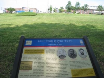
By Dave Twamley, July 4, 2011
Johnston Moves West Marker
| 1 ► North Carolina, Alamance County, Burlington — Johnston Moves West — Logisticians at Work — Carolinas Campaign — |
| Near South Main Street. | |||
| 2 ► North Carolina, Alamance County, Burlington — Occaneechi in the Service — Piedmont Indians in the Civil War — |
| 3 ► North Carolina, Alamance County, Burlington — The Regulators' Field — A Lesson for the Defeated — Carolinas Campaign — |
| On Highway 62, on the left when traveling south. | |||
| 4 ► North Carolina, Alamance County, Burlington, Alamance — Johnston Moves West — Holt's Mill — Carolinas Campaign — |
| On North Carolina 62 (State Highway 62), on the left when traveling south. | |||
| 5 ► North Carolina, Alamance County, Graham — Johnston Moves West — Ruffin Mills — Carolinas Campaign — |
| Near Boywood Road. | |||
| 6 ► North Carolina, Alamance County, Haw River — Nathaniel Polk DeShong — The Southern Diaspora — |
| On East Main Street (State Highway 49), on the left when traveling west. | |||
| 7 ► North Carolina, Alamance County, Mebane — Johnston Moves West — Hardee's Column — Carolinas Campaign |
| On State Highway 119 at Jim Minor Road, on the right when traveling south on State Highway 119. Reported missing. | |||
| 8 ► North Carolina, Alamance County, Snow Camp — Cane Creek Meeting House — Suffering for Peace — |
| On Drama Road, on the left when traveling east. | |||
| 9 ► North Carolina, Alamance County, Snow Camp — Freedom Hill Church — No Slaveholder can be a Christian! — |
| Near Drama Road when traveling east. | |||
| 10 ► North Carolina, Alamance County, Snow Camp — Micajah McPherson — We have Fought the Good Fight and Kept Our Faith — |
| On Drama Road. | |||
| 11 ► North Carolina, Avery County, Banner Elk — Banner Elk — Unionist Haven — |
| On Hickory Nut Gap Road (County Route 1342) west of North Carolina Highway 184, on the left when traveling west. | |||
| 12 ► North Carolina, Avery County, Elk Park — Cranberry Iron Mine — Iron for the Confederacy — |
| Near Elk Park Highway (State Highway 194) at U.S. 19E, on the right when traveling east. | |||
| 13 ► North Carolina, Avery County, Linville — A Woman of War — Sarah Malinda Blalock — |
| On Hospital Drive, 0.5 miles south of Newland Highway (North Carolina Highway 181), on the left when traveling south. | |||
| 14 ► North Carolina, Beaufort County, Washington — Oakdale Cemetery — To Our Confederate Dead — |
| On North Market Street (County Route 1516) at East 15th Street, on the right when traveling north on North Market Street. | |||
| 15 ► North Carolina, Beaufort County, Washington — Siege of Washington — March 30 - April 20, 1863 — |
| On East Water Street at South Bonner Street, on the right when traveling east on East Water Street. | |||
| 16 ► North Carolina, Beaufort County, Washington — Tranter's Creek — Brothers in Battle |
| Near Pactolus Highway (U.S. 264) 0.1 miles west of Voa Road, on the left when traveling west. Reported permanently removed. | |||
| 17 ► North Carolina, Beaufort County, Washington — USS Picket — Battle of Washington — |
| On West Stewart Parkway near West Main Street, on the right when traveling south. | |||
| 18 ► North Carolina, Bertie County, Windsor — Engagement at Windsor — Action on the Cashie River |
| On South Queen Street south of East Water Street (U.S. 17) when traveling south. Reported missing. | |||
| 19 ► North Carolina, Bertie County, Windsor — Engagement at Windsor — Action on the Cashie River — North Carolina Civil War Trails — |
| On South Queen Street south of West Water Street when traveling south. | |||
| 20 ► North Carolina, Brunswick County, Southport — Fort Johnston — Guardian of the Cape Fear River — |
| On East Bay Street east of South Davis Street, on the left when traveling east. | |||
| 21 ► North Carolina, Brunswick County, Winnabow — Fort Anderson — One Shovelful at a Time — Confederate Lifeline — |
| On St. Philips Road east of Plantation Road. | |||
| 22 ► North Carolina, Buncombe County, Asheville — 1st U.S. Colored Heavy Artillery — "Ready to Take the Field" — |
| On Broadway at Mt. Clare Avenue, on the right when traveling north on Broadway. | |||
| 23 ► North Carolina, Buncombe County, Asheville — Asheville's Enslaved People — Wartime Servitude — |
| Near Eagle Street at Davidson Drive, on the right when traveling east. | |||
| 24 ► North Carolina, Buncombe County, Asheville — Battery Porter — Napoleons on Stony Hill — |
| On O Henry Avenue at Battle Square, on the right when traveling north on O Henry Avenue. | |||
| 25 ► North Carolina, Buncombe County, Asheville — Battle of Asheville — Kirby's Expedition — |
| On Campus Drive at Field Drive, on the right when traveling north on Campus Drive. | |||
| 26 ► North Carolina, Buncombe County, Asheville — Landsman Riley Powers — Mountain Sailor — |
| On Overlook Road south of Springside Road (County Route 3506), on the left when traveling south. | |||
| 27 ► North Carolina, Buncombe County, Asheville — Private George Avery — South Asheville Colored Cemetery — |
| Near Dalton Street, 0.3 miles north of Wyoming Road, on the right when traveling north. | |||
| 28 ► North Carolina, Buncombe County, Asheville — Riverside Cemetery — Notable Occupants — |
| Near Birch Street west of Pearson Drive when traveling west. | |||
| 29 ► North Carolina, Buncombe County, Asheville — Smith-McDowell House — Our Businessman-Soldier — |
| Near Victoria Road, 0.1 miles south of Oakland Road, on the right when traveling south. | |||
| 30 ► North Carolina, Buncombe County, Asheville — Wartime Jail — Asheville's Prisons — |
| Near Montford Avenue at Hill Street, on the right when traveling south. | |||
| 31 ► North Carolina, Buncombe County, Fairview — Gen. William J. Palmer — Quaker Warrior — Stoneman's Raid — |
| On Charlotte Highway (Alternate U.S. 74) south of Clarke Lane, on the left when traveling south. | |||
| 32 ► North Carolina, Buncombe County, Ridgecrest — Swannanoa Gap Engagement — Blocking the Way — |
| On Yates Avenue near Old U.S. 70, on the left when traveling north. | |||
| 33 ► North Carolina, Buncombe County, Weaverville — Brothers In Service — Zebulon and Robert Vance Brithplace — |
| On Reems Creek Road (State Highway 1003), on the right when traveling north. | |||
| 34 ► North Carolina, Burke County, Morganton — Morganton — Rocky Ford Engagement — Stoneman's Raid — |
| On Lenior Road (State Highway 64). | |||
| 35 ► North Carolina, Cabarrus County, Concord — St. John's Lutheran Church — Community Sacrifice — |
| On St Johns Church Road at Mt Olive Road (County Route 2416), on the right when traveling north on St Johns Church Road. | |||
| 36 ► North Carolina, Caldwell County, Lenoir — Patterson Mill — Struck by Stoneman's Raiders — Stoneman's Raid — |
| On Yadkin River Road (County Route 1560) 0.3 miles north of North Carolina Highway 268, on the right when traveling north. | |||
| 37 ► North Carolina, Caldwell County, Lenoir — Raiders in Lenoir — St. James Episcopal Church and Prison — Stoneman's Raid — |
| On Harper Avenue Northwest at Main Street Northwest, on the right when traveling east on Harper Avenue Northwest. | |||
| 38 ► North Carolina, Camden County, Camden — Eastern North Carolina — Civil War Trails — |
| On McPherson Road (State Highway 1231) 0.1 miles south of U.S. 17, on the right when traveling south. | |||
| 39 ► North Carolina, Camden County, South Mills — Battle of South Mills — Fight for the Canal — Burnside Expedition — |
| On Canal Drive, 0.3 miles south of Main Street (U.S. 17), on the left when traveling south. | |||
| 40 ► North Carolina, Carteret County, Atlantic Beach — Hoop Pole Creek — Ferrying Troops and Equipment at High Tide — Burnside Expedition — |
| Near West Fort Macon Road at Atlantic Station Shopping Center, on the right when traveling west. | |||
| 41 ► North Carolina, Carteret County, Beaufort — Beaufort — Union Occupation and Confederate Spies — |
| On Turner Street north of Middle Lane, on the right when traveling north. | |||
| 42 ► North Carolina, Carteret County, Newport — Bogue Sound Blockhouse — Vermonters' Spirited Resistance — |
| On McCabe Road at North Carolina Highway 24, on the left when traveling north on McCabe Road. | |||
| 43 ► North Carolina, Carteret County, Newport — Newport Barracks — Winter Quarters Ablaze — |
| On Main Street at East Railroad Boulevard, on the right when traveling east on Main Street. | |||
| 44 ► North Carolina, Chowan County, Cannon Ferry — War on the Chowan River — Buffalo Country |
| On Cannons Ferry Road, 0.4 miles west of Dillard’s Mill Road, on the left when traveling north. Reported missing. | |||
| 45 ► North Carolina, Chowan County, Edenton — Edenton — Battle of Albemarle Sound — |
| On Broad Street, on the right when traveling south. | |||
| 46 ► North Carolina, Craven County, New Bern — Attmore-Oliver House — Under the Stars & Bars — |
| On Pollock Street east of Metcalf Street, on the left when traveling east. | |||
| 47 ► North Carolina, Craven County, New Bern — Battle of New Bern — Smoke and Flames — Burnside Expedition — |
| On South Front Street east of East Front Street (Business U.S. 17), on the left when traveling east. | |||
| 48 ► North Carolina, Craven County, New Bern — Greenwood Cemetery — Historic Burial Site — |
| On Cypress Street at Smith Street, on the right when traveling west on Cypress Street. | |||
| 49 ► North Carolina, Craven County, New Bern — New Bern Academy — From School to Hospital — |
| On New Street near Hancock Street. | |||
| 50 ► North Carolina, Craven County, New Bern — New Bern National Cemetery — Honoring the Union Dead — |
| On National Avenue at Court Street, on the right when traveling south on National Avenue. | |||
| 51 ► North Carolina, Craven County, New Bern — William Henry Singleton — From Slavery to Freedom — |
| On Queen Street near Johnson Street. | |||
| 52 ► North Carolina, Cumberland County, Dunn — Battle of Averasboro — Confederate First Defensive Line — Carolinas Campaign — |
| On Burnett Road (State Highway 82) south of West Thornton Road (State Highway 1736), on the left when traveling north. | |||
| 53 ► North Carolina, Cumberland County, Fayetteville — Burning of Clarendon Bridge — Confederates Evacuate Fayetteville — Carolinas Campaign — |
| On Person Street at Dunn Road, on the left when traveling west on Person Street. | |||
| 54 ► North Carolina, Cumberland County, Fayetteville — Cross Creek Cemetery — Confederate Burial Grounds — |
| On Cool Spring Street, on the left when traveling south. | |||
| 55 ► North Carolina, Cumberland County, Fayetteville — Edward J. Hale House — Civil War Publisher — Carolinas Campaign — |
| On Franklin Street at Hay Street, on the left when traveling south on Franklin Street. | |||
| 56 ► North Carolina, Cumberland County, Fayetteville — Fayetteville Arsenal — "Batter … into piles of rubble" — Carolinas Campaign — |
| On Arsenal Avenue, on the right when traveling west. | |||
| 57 ► North Carolina, Cumberland County, Fayetteville — North Carolina — Civil War Trails — |
| On Arsenal Avenue, on the right when traveling east. | |||
| 58 ► North Carolina, Cumberland County, Fayetteville — Parade Ground — Fayetteville Independent Light Infantry — |
| On Cool Spring Street at Meeting Street, on the right when traveling south on Cool Spring Street. | |||
| 59 ► North Carolina, Cumberland County, Fayetteville — The Market House — Site of a Shootout — Carolinas Campaign — |
| On Green Street at Market Square, on the right when traveling north on Green Street. | |||
| 60 ► North Carolina, Cumberland County, Fayetteville — The Sandford House — Barracks for Union Troops — Carolinas Campaign — |
| On Dick Street south of Halliday Street, on the right when traveling north. | |||
| 61 ► North Carolina, Cumberland County, Wade — Old Bluff Church — The Muddy Road to Averasboro — Carolinas Campaign — |
| On Old Bluff Church Road, 1 mile west of Sisk Culbreth Road, on the right when traveling west. | |||
| 62 ► North Carolina, Currituck County, Coinjock — Albemarle and Chesapeake Canal — Military Supply Route — |
| Near Coinjock Canal Road, 0.2 miles east of Worth Guard Road, on the right when traveling east. | |||
| 63 ► North Carolina, Currituck County, Currituck — Currituck County Courthouse — Confederate Recruiting Center — |
| On Courthouse Road (State Highway 1242) near Caratoke Highway (State Highway 168), on the right when traveling north. | |||
| 64 ► North Carolina, Currituck County, Knotts Island — Knotts Island — Salts Works Center — |
| Near Brumley Road, 0.2 miles east of South End Road (North Carolina Highway 615), on the right when traveling east. | |||
| 65 ► North Carolina, Currituck County, Maple — Hijacking Maple Leaf — Prisoners Escape through Currituck County — |
| On Caratoke Highway (State Highway 168) at Maple Road, on the right when traveling south on Caratoke Highway. | |||
| 66 ► North Carolina, Currituck County, Maple — Maple Leaf — A Great Escape |
| On Caratoke Highway (State Highway 168) at Maple Road, on the right when traveling south on Caratoke Highway. Reported missing. | |||
| 67 ► North Carolina, Currituck County, Moyock — Moyock — Shingle Landing — |
| On Shingle Landing Road, 0.1 miles north of Puddin Ridge Road, on the right when traveling north. | |||
| 68 ► North Carolina, Currituck County, Point Harbor — Currituck Sound — Avenue of War — |
| Near Kitty Hawk, 0.5 miles east of Caratoke Highway (U.S. 158), in the median. | |||
| 69 ► North Carolina, Currituck County, Shawboro — Indiantown — Chasing “Guerrillas” — |
| On South Indiantown Road, 0.4 miles north of Trotman Road, on the left when traveling south. | |||
| 70 ► North Carolina, Davidson County, Lexington — Lexington in the Civil War — Occupation and Fire — |
| On West Center Street, on the right when traveling east. | |||
| 71 ► North Carolina, Davidson County, Lexington — Pine Grove Camp — Confederate Government Seat |
| Near Yokley Road, 0.6 miles east of Ridge Road, on the left when traveling east. Reported missing. | |||
| 72 ► North Carolina, Davidson County, Lexington — The Homestead — Unexpected Houseguests — |
| On South Main Street, on the right when traveling south. | |||
| 73 ► North Carolina, Davidson County, Thomasville — Thomasville — Caring for the Sick and Wounded — |
| On E Main Street at Memorial Park Drive, on the right when traveling north on E Main Street. | |||
| 74 ► North Carolina, Davidson County, Thomasville — Thomasville — A Key Stop & Refuge — |
| On West Main Street at Trade Street, on the left when traveling west on West Main Street. | |||
| 75 ► North Carolina, Davidson County, Thomasville — Thomasville City Cemetery — Union of Combatants — |
| Near Memorial Park Drive, on the right when traveling west. | |||
| 76 ► North Carolina, Davie County, Mocksville — Davie County in the Civil War — Stoneman in Mocksville — Stoneman's Raid — |
| On Clement Street at Water Street, on the right when traveling south on Clement Street. | |||
| 77 ► North Carolina, Duplin County, Kenansville — Confederate States Armory — Cutting the Supply Line — Confederate Lifeline — |
| On Magnolia Extension (State Highway 11) at Mallard Street (State Highway 50), on the left when traveling south on Magnolia Extension. | |||
| 78 ► North Carolina, Duplin County, Kenansville — Confederate States Armory — Determined Production — Confederate Lifeline — |
| On Magnolia Extension (State Highway 11) at Mallard Street (State Highway 50), on the left when traveling south on Magnolia Extension. | |||
| 79 ► North Carolina, Duplin County, Warsaw — The War Comes to Warsaw — Lewis's Railroad Raid — Confederate Lifeline — |
| On East Hill Street at North Center Street, on the left when traveling east on East Hill Street. | |||
| 80 ► North Carolina, Durham County, Chapel Hill — Last Shots — The Creek of New Hope — Carolinas Campaign — |
| Near Farrington Road, on the right when traveling north. | |||
| 81 ► North Carolina, Durham County, Durham — Brassfield Station — A Path Both Traveled — Carolinas Campaign — |
| On S Miami Blvd. (State Highway 1959), on the right when traveling north. | |||
| 82 ► North Carolina, Durham County, Durham — Durham's Station — Prelude To Peace — Carolinas Campaign — |
| On Blackwell Street, on the right when traveling north. | |||
| 83 ► North Carolina, Durham County, Durham — North Carolina — Civil War Trails — |
| On Blackwell Street, on the right when traveling north. | |||
| 84 ► North Carolina, Durham County, Durham — West Point Truce Line — Waiting, Looting, and Shooting — Carolinas Campaign — |
| Near North Roxboro Road (U.S. 501). | |||
| 85 ► North Carolina, Durham County, Durham, Bennett Place — Bennett Place — The End of War — Carolinas Campaign — |
| Near Bennett Memorial Road at Near Road. | |||
| 86 ► North Carolina, Durham County, Durham, Bennett Place — North Carolina — Civil War Trails |
| On Bennett Memorial Road, on the right when traveling east. Reported permanently removed. | |||
| 87 ► North Carolina, Durham County, Durham, Duke Homestead — Duke Homestead — Prosperity from War — |
| Near Duke Homestead Road. | |||
| 88 ► North Carolina, Durham County, Durham, Duke Homestead — North Carolina — Civil War Trails — |
| Near Duke Homestead Road. | |||
| 89 ► North Carolina, Edgecombe County, Tarboro — Civil War Cemeteries — Buried with Honor — |
| On East St. James Street at St. David Street, on the right when traveling east on East St. James Street. | |||
| 90 ► North Carolina, Edgecombe County, Tarboro — Occupation of Tarboro — Daniel's Schoolhouse Engagement — Potters Raid — |
| On Bridges Street. | |||
| 91 ► North Carolina, Edgecombe County, Tarboro — Occupation of Tarboro — "All were burned ..." — Potter's Raid — |
| On East Wilson Street, on the left when traveling east. | |||
| 92 ► North Carolina, Forsyth County, Winston-Salem — Emancipation in Salem — "Henceforward Shall Be Free" — |
| Near South Church Street just north of Race Street, on the left when traveling south. | |||
| 93 ► North Carolina, Franklin County, Louisburg — Camp Site for Sherman's Army — Louisburg at the End of the War — |
| Near North Main Street (County Route 1229) north of College Street, on the left when traveling north. | |||
| 94 ► North Carolina, Gates County, Gatesville — Gates County Courthouse — Civil War Muster Ground — |
| On Church Street at Court Street (North Carolina Highway 137), on the left when traveling south on Church Street. | |||
| 95 ► North Carolina, Graham County, Robbinsville — Civil War in Graham County — Union and Confederate Raiders — |
| On East Main Street (County Route 1106) at Court Street, on the right when traveling west on East Main Street. | |||
| 96 ► North Carolina, Greene County, Grifton — Scuffleton Bridge — Failed to Burn — Potter's Raid — |
| On North Carolina Route 903, 0.2 miles east of Edwards Bridge Road (County Route 1004), on the left when traveling east. | |||
| 97 ► North Carolina, Greene County, Hookerton — Hookerton Defenses — Confederate Crossing and Headquarters — Potter's Raid |
| On East Main Street (State Highway 123) at South William Hooker Drive, on the right when traveling east on East Main Street. Reported permanently removed. | |||
| 98 ► North Carolina, Greene County, Snow Hill — Grimsley Baptist Church — Rest, Feed, and Forage — Potter's Raid — |
| On U.S. 13 (U.S. 258) at County Route 903, on the right when traveling north on U.S. 13. | |||
| 99 ► North Carolina, Halifax County, Roanoke Rapids — Roanoke Canal — "The importance … is evident" — |
| On Jackson Street Extended (County Road 1464) 0.1 miles west of Roanoke Avenue (State Highway 48), on the right when traveling west. | |||
| 100 ► North Carolina, Halifax County, Roanoke Rapids — Roanoke Canal — "Duly Appreciated" — Confederate Lifeline |
| On Jackson Street Extended at Roanoke Avenue (North Carolina Highway 48), on the right when traveling west on Jackson Street Extended. Reported missing. | |||
218 entries matched your criteria. The first 100 are listed above. Next 100 ⊳