By Cajun Scrambler, July 8, 2017
Soldiers Retreat Marker
GEOGRAPHIC SORT Title Sort Marker Number Sort Marker Number Sort N Marker Number Sort T Publication Order Sort Publication Order Sort A Erected Year Sort Most Viewed Sort Most Recent-Interest Sort Most Recently Changed Sort SEE FAQ #33 FOR DESCRIPTIONS
On Trails End Road west of North Palestine Road, on the right when traveling south.
On Franklin Street at North Wall Street, on the left when traveling east on Franklin Street.
On Cemetery Road, 0.2 miles north of Maple Street, on the right when traveling north.
On Main Street at South Canal Street, on the left when traveling west on Main Street.
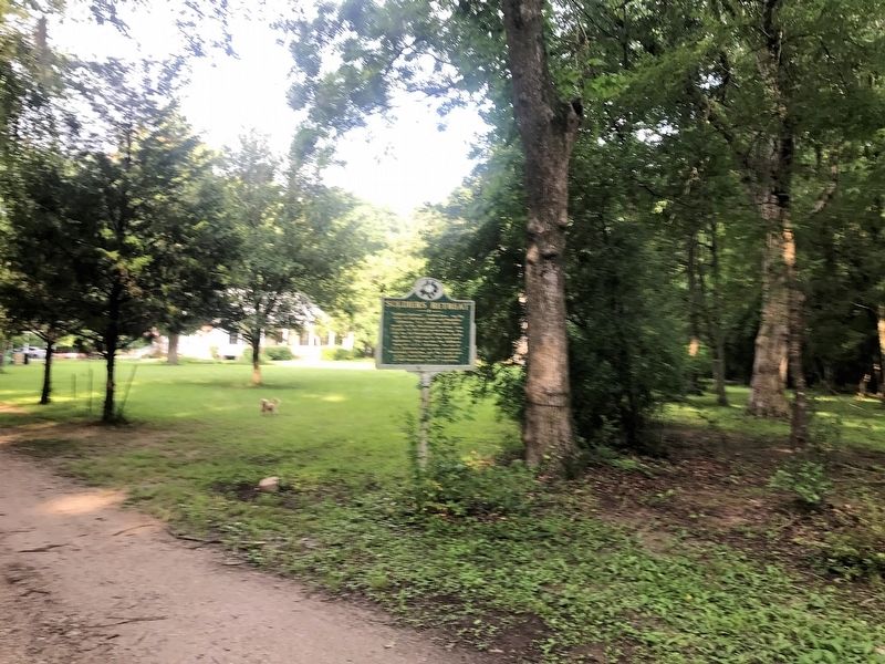
On Liberty Road at St Catherine Street and Devereaux Drive (Business U.S. 61), on the left when traveling north on Liberty Road.
On D A Biglane Street at South Canal Street, on the right when traveling east on D A Biglane Street.
On Lower Woodville Road, 0.5 miles south of John R. Junkin Road (U.S. 84), on the right when traveling south.
On Saint Catherine Street west of Orange Avenue, on the left when traveling west.
On Jefferson Street at North Union Street on Jefferson Street.
On Hutchins Landing Road east of Brick Quarters River Road, on the right when traveling east.
On Hutchins Landing Road, 0.3 miles east of Hillside Plantation Road, on the left when traveling east.
On Co-Lin Circle west of Campus Drive, on the left when traveling west.
On Jefferson Street west of North Rankin Street, on the right when traveling west.
On Hutchins Landing Road, 0.3 miles east of Hillside Plantation Road, on the right when traveling east.
On U.S. 61 at Kingston Road, on the right when traveling north on U.S. 61.
Paid Advertisement
On John R. Junkin Drive (U.S. 84) 0.6 miles east of South Canal Street, on the right when traveling east.
On S. Broadway St at Bontura Street, on the right when traveling south on S. Broadway St.
On South Union Street near Ravenna Lane, on the left when traveling west.
On Saint Catherine Street west of Abbott Street, on the right when traveling west.
On S. Broadway Street, on the right when traveling south.
On Madison Street east of North Union Street, on the left when traveling east.
On John R. Junkin Drive (U.S. 84) at Lower Woodville Road, on the right when traveling east on John R. Junkin Drive.
On Main Street west of South Pearl Street, on the left when traveling west.
Near Aldrich Street near Old Devereaux St, on the left when traveling west.
On Morgantown Road at T Waring Bennett Jr. Road, on the left when traveling north on Morgantown Road.
On South Union Street near Main Street.
On State Street at Pearl Street, on the left when traveling east on State Street.
On U.S. 61 south of Forest Plantation Road, on the right when traveling north.
On Jefferson Street near North Doctor Martin Luther King Jr. Street, on the left when traveling west.
On Martin Luther King Junior Road (Mississippi Route 555) at Airport Road (Mississippi Route 554), on the right when traveling south on Martin Luther King Junior Road.
Paid Advertisement
On U.S. 61 at Hutchins Landing Road, on the right when traveling south on U.S. 61.
On U.S. 61 near Natchez Trace Parkway, on the right when traveling north.
On Jefferson College Street near U.S. 61, on the right when traveling north.
On Jefferson College Street north of U.S. 61, on the right when traveling north.
Near Natchez Trace Parkway (at milepost 5.1), 3.3 miles south of U.S. 61. Reported missing.
On Jefferson College Street north of U.S. 61, on the right when traveling north.
On Jefferson College Street north of U.S. 61, on the right when traveling north.
On U.S. 61 at Morgantown Road, on the left when traveling west on U.S. 61.
On Huggins Road (County Highway 514) 0.5 miles east of County Road 529, on the left when traveling west.
On New Hope Road (County Road 513) 0.4 miles west of U.S. 45, on the right when traveling west.
On Bitner Road at Scenic Lake Drive, on the right when traveling north on Bitner Road. Reported missing.
On North Fulton Road, 0.3 miles north of South Tate Street (Mississippi Route 145), on the left when traveling north.
On Shiloh Road, on the right when traveling west.
On Westview Drive at Cemetery Drive, on the right when traveling west on Westview Drive.
On N Fillmore Street, on the left when traveling north.
On Main Street (State Highway 145) at Fillmore Street (State Highway 145), in the median on Main Street.
Paid Advertisement
On County Road 106 north of County Road 187, on the right when traveling north.
On South Tate Street (Mississippi Route 145) south of Cardinal Drive, on the left when traveling south.
On N. Fillmore Street (State Highway 145) at Linden Street, on the left when traveling north on N. Fillmore Street.
On Jackson Street north of Childs Street, on the right when traveling south.
On Jackson Street, on the right when traveling south.
On N. Polk Street (State Highway 145) at Woodlawn Drive, on the right when traveling north on N. Polk Street.
On Fillmore Street, on the right when traveling south.
On Fillmore Street (State Highway 145) north of Bunch Street, on the right when traveling north.
On Polk Street north of Bunch Street, on the right when traveling north.
On County Route 364 at County Route 356, on the right when traveling north on County Route 364.
On Main Street (State Highway 2) at College Street (County Highway 512), on the right when traveling east on Main Street.
On State Highway 24/33 at East Howard Street (State Highway 48), on the left when traveling north on State Highway 24/33.
On State Highway 33 north of Church Street, on the left when traveling north.
On Captain Gloster Drive (State Highway 24) at State Highway 33, on the left when traveling east on Captain Gloster Drive.
On Main Street (State Highway 24) east of Broad Street, on the right when traveling east.
Paid Advertisement
On Clinic Street east of Old Jackson Rd. (Mississippi Highway 569), on the right when traveling east.
On North Church Street, 0.1 miles Main Street (Mississippi Highway 24/48), on the left when traveling north.
On North Church Street, 0.1 miles north of Main Street (Mississippi Highway 24/48), on the left when traveling north.
On Gillsburg Road Avenue (State Highway 584) north of West Borden Avenue, on the right when traveling north.
On Main Street (State Highway 24) at Broad Street, on the right when traveling east on Main Street.
On Walnut Drive at North Church Streeet, on the left when traveling north on Walnut Drive.
On State Highway 24/48, 0.5 miles east of Peoria Road, on the right when traveling west.
On County Road 3041, 0.1 miles north of State Route 35, on the left when traveling north. Reported damaged.
On West Washington Street (Business Mississippi Route 12) west of North Jackson Street, on the left when traveling west.
On Tipton Street at East South Street, on the right when traveling north on Tipton Street.
On East Washington Street at North Huntington Street, on the right when traveling west on East Washington Street.
On South Jackson Street at West Jefferson Street, on the left when traveling north on South Jackson Street.
On Mississippi Route 12 at Mississippi Route 429, on the right when traveling east on State Route 12.
On Mississippi Route 7, 0.2 miles north of Main Street, on the left when traveling east.
On Lake Street, 0.1 miles south of Roger Street, on the right when traveling north.
On State Highway 1, 1.1 miles north of Lake Vista Road, on the left when traveling north.
Paid Advertisement
On South Chrisman Avenue at Ruby Street, on the right when traveling south on South Chrisman Avenue.
On Cotton Row at North Sharpe Avenue, in the median on Cotton Row.
On South Court Street at South Sharpe Street, on the right when traveling east on South Court Street.
On South Court Street at North Bolivar Avenue, on the right when traveling west on South Court Street.
On North Fifth Avenue at South Court Street, on the right when traveling south on North Fifth Avenue.
On West Sunflower Road (State Highway 8) at A.K. Eckles Lane, on the right when traveling west on West Sunflower Road.
On East Sunflower Road (State Highway 8) 0.2 miles east of North Davis Avenue (U.S. 278), on the right when traveling east.
On South Sharpe Avenue at Shelby Street, on the right when traveling south on South Sharpe Avenue.
On Coahoma Street at North 5th Avenue, on the right when traveling east on Coahoma Street.
On East Main Street (State Highway 444) at East Park North (Old State Highway 61), on the right when traveling west on East Main Street.
On State Highway 1, 0.6 miles north of Avondale Road, on the left when traveling north. Reported missing.
On U.S. 278 at West Mound Bayou Drive, on the right when traveling north on U.S. 278.
On North Edwards Avenue at West Martin Luther King Jr. Drive, on the right when traveling north on North Edwards Avenue. Reported permanently removed.
On Main Street (State Highway 1) north of Vorhees Street, on the right when traveling north.
On Main Street (State Highway 1) 0.1 miles north of State Highway 8, on the right when traveling north.
On Main Street (State Highway 1) at Dr Martin Luther King Street, on the right when traveling north on Main Street.
Paid Advertisement
On South Broadway Street at West 2nd Avenue (State Highway 32), on the left when traveling north on South Broadway Street.
On Public Square at Main Street on Public Square.
On Mississippi Route 7 at Avalon Road (County Road 41), on the right when traveling south on State Route 7.
On U.S. 82 at Lexington Street, on the right when traveling west on U.S. 82.
On Lexington Street just south of Magnolia Street, on the left when traveling north.
917 entries matched your criteria. The first 100 are listed above.
Next 100 ⊳