302 entries match your criteria. Entries 101 through 200 are listed.⊲ Previous 100 — Next 100 ⊳
Former U.S. Presidents: #32 Franklin D. Roosevelt Historical Markers
By Cosmos Mariner, September 7, 2017
Brewer Scout Cabin Marker
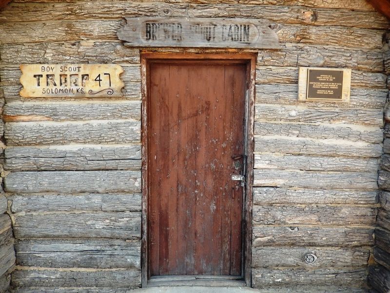
| 101 ► Kansas, Dickinson County, Solomon — Brewer Scout Cabin — |
| Near East 4th Street east of Walnut Street, on the right when traveling east. | |||
| 102 ► Kansas, Johnson County, Olathe — President Franklin Delano Roosevelt Makes a Whistle-stop in Olathe — |
| On Santa Fe Street, 0.1 miles west of Kansas Avenue, on the right when traveling west. | |||
| 103 ► Kansas, Marion County, Florence — Veterans Memorial — |
| On Main Street at 4th Street, on the right when traveling north on Main Street. | |||
| 104 ► Kansas, Marion County, Marion — Marion County Park & Lake — |
| On Lakeshore Drive, on the left when traveling west. | |||
| 105 ► Kansas, Stafford County, Quivira National Wildlife Refuge — A Brief History of the Growth of the National Wildlife Refuge System — |
| 106 ► Kentucky, Lincoln County, Stanford — History Written in Departures & Arrivals — |
| On Depot Street at Plum Street, on the right when traveling south on Depot Street. | |||
| 107 ► Kentucky, McCracken County, Paducah — 1112 — Alben W. Barkley / Barkley's Grave — |
| On Lone Oak Road (U.S. 45) at Carson Road, on the right when traveling south on Lone Oak Road. | |||
| 108 ► Kentucky, Mercer County, Harrodsburg — 45 — Fort Harrod — |
| On South College Street (U.S. 127) at West Lexington Street, on the right when traveling south on South College Street. | |||
| 109 ► Kentucky, Oldham County, LaGrange — Veterans Memorial — |
| On Main Street at 1st Avenue (Kentucky Route 53), on the right when traveling west on Main Street. | |||
| 110 ► Kentucky, Webster County, Sebree — 2270 — Sebree Colored School — |
| On U.S. 41, on the right when traveling south. | |||
| 111 ► Louisiana, Ascension Parish, Gonzales — World War II — |
| Near South Irma Boulevard, 0.3 miles north of East Worthey Street, on the right when traveling north. | |||
| 112 ► Louisiana, Ascension Parish, Gonzales — WWII - War In The Pacific — |
| Near South Irma Boulevard, 0.3 miles north of East Worthey Street, on the right when traveling north. | |||
| 113 ► Louisiana, Tangipahoa Parish, Hammond — Friendship Circle — |
| On Western Avenue, 0.2 miles west of North Oak Street, in the median. | |||
| 114 ► Maine, Cumberland County, Cape Elizabeth — CCC Headquarters — |
| 115 ► Maine, Cumberland County, Cape Elizabeth — Civilian Conservation Corps — |
| 116 ► Maine, Cumberland County, South Portland — Civilian Conservation Corps — |
| 117 ► Maine, Cumberland County, South Portland — Voyages for Victory — |
| 118 ► Maine, Washington County, Princeton — Civilian Conservation Corps — |
| On Main Street (U.S. 1) at Depot Street, on the left when traveling south on Main Street. | |||
| 119 ► Maryland, Anne Arundel County, Annapolis — Japanese Ambassador Hirosi Saito — |
| On Santee Road. | |||
| 120 ► Maryland, Baltimore, Druid Hill Park — Victorian Cages — Historic Maryland Zoo — |
| Near Safari Place, 0.2 miles north of Beechwood Drive, on the right when traveling north. | |||
| 121 ► Maryland, Baltimore, Mid-Town Belvedere — Mount Royal Station — Icon for the Industrial Age — |
| On Cathedral Street. | |||
| 122 ► Maryland, Baltimore County, Owings Mills — Lieutenant Milton Ernest Ricketts Memorial — World War II Congressional Medal of Honor Recipient — |
| On Garrison Forest Road. | |||
| 123 ► Maryland, Caroline County, Denton — On this spot Sept. 5, 1938 stood Franklin Delano Roosevelt — |
| On Market Street, on the left when traveling west. | |||
| 124 ► Maryland, Caroline County, Denton — President Roosevelt's Speech — 1938 — "The Biggest Day That Denton Had Ever Seen" — |
| On Market Street west of North 2nd Street, on the left when traveling west. | |||
| 125 ► Maryland, Dorchester County, Cambridge — Choptank River Bridge — Oyster Wars... — |
| On Rose Hill Place at Radiance Drive, on the right when traveling north on Rose Hill Place. | |||
| 126 ► Maryland, Dorchester County, Cambridge — To the memory of Franklin Delano Roosevelt — A Great American — 1954 — |
| On High Street, 0.1 miles north of Water Street, on the right when traveling north. | |||
| 127 ► Maryland, Frederick County, Emmitsburg — Thurmont — Visitor Services — Catoctin Mountain Towns & Communities — |
| On Catoctin Mountain Highway (U.S. 15) 0.5 miles south of Business U.S. 15, on the right when traveling south. | |||
| 128 ► Maryland, Frederick County, Frederick — May 17, 1943 — |
| On West Patrick Street (Maryland Route 144). | |||
| 129 ► Maryland, Frederick County, Myersville — Camp David — |
| Near Dwight D. Eisenhower Highway (Interstate 70) south of Baltimore National Pike (U.S. 40), on the right when traveling east. | |||
| 130 ► Maryland, Frederick County, Myersville — Camp David — |
| Near Dwight D. Eisenhower Highway (Interstate 70) 2 miles north of Maryland Route 17, on the right when traveling west. | |||
| 131 ► Maryland, Garrett County, McHenry — Civilian Conservation Corps — 1933 - 1942 — |
| On Maple Glade Road east of Tolliver Camp Road, on the right when traveling north. | |||
| 132 ► Maryland, Montgomery County, Bethesda — National Naval Medical Center — [Walter Reed National Military Medical Center] — |
| On Wood Road, 0.6 miles north of Rockville Pike (Maryland Route 355), on the right when traveling east. | |||
| 133 ► Maryland, Montgomery County, Bethesda — National Naval Medical Center in the 1940’s — |
| On Wood Road (Maryland Route 355) 0.6 miles north of Rockville Pike (Maryland Route 355). | |||
| 134 ► Maryland, Montgomery County, Bethesda — President Franklin D. Roosevelt dedicated the NIH Bethesda campus on this site, October 31, 1940 — |
| On Center Drive, 0.1 miles south of South Drive, on the right when traveling south. | |||
| 135 ► Maryland, Montgomery County, Potomac, Carderock — Working Hard To Survive — CCC Creates Jobs for America's Unemployed — Chesapeake & Ohio Canal National Historical Park — |
| On Macarthur Boulevard, 0.3 miles south of Clara Barton Parkway, on the left when traveling west. | |||
| 136 ► Maryland, Montgomery County, Silver Spring, Wheaton — One Tree's Life — |
| Near Glenallan Avenue east of Heurich Road, on the right when traveling east. | |||
| 137 ► Maryland, Prince George's County, Fairmount Heights — 72-09-40 — Sylvan Vista Baptist Church — 1103 60th Avenue — Documented Property, Built in 1925 — |
| On 60th Avenue at L Street, on the right when traveling north on 60th Avenue. | |||
| 138 ► Maryland, Prince George's County, Forest Heights — After the Addisons — Oxon Hill in the 19th and 20th Centuries — |
| Near National Harbor Boulevard south of Capital Beltway (Interstate 95), on the right when traveling south. | |||
| 139 ► Maryland, Prince George's County, Greenbelt — City of Greenbelt — |
| Near Crescent Avenue near Southway. | |||
| 140 ► Maryland, Prince George's County, Greenbelt — Greenbelt: A Bold Experiment — Greenbelt Park — National Park Service, U.S. Department of the Interior — |
| On Campground Road west of Park Central Road, on the right when traveling west. | |||
| 141 ► Maryland, Prince George's County, Greenbelt — Greenbelt: A Bold Experiment — Greenbelt Park — National Park Service, U.S. Department of the Interior — |
| Near Greenbelt Road (Maryland Route 193) 0.7 miles west of Southway, on the left when traveling west. | |||
| 142 ► Maryland, Prince George's County, Greenbelt — Roosevelt Center — |
| Near Centerway between Southway and Greenway. | |||
| 143 ► Maryland, Prince George's County, Hyattsville — The Treaty at Fort McIntosh / President Franklin Delano Roosevelt's "Day of Infamy" Address — |
| On Toledo Road just west of America Boulevard, on the left when traveling west. | |||
| 144 ► Maryland, Prince George's County, Laurel — National Wildlife Center — The Wisdom of Wilderness — |
| On Loop Trail at Tram Route, on the left when traveling north on Loop Trail. | |||
| 145 ► Maryland, Prince George's County, Oxon Hill, National Harbor — Franklin D. Roosevelt — 1882 - 1945 — American Way Visonary — |
| Near Waterfront Street east of National Harbor Boulevard, on the right when traveling south. | |||
| 146 ► Maryland, Washington County, Sharpsburg — Antietam Station — Railroad to Reunion — Antietam Campaign 1862 — |
| On Shepherdstown Pike (Maryland Route 34), on the left when traveling north. | |||
| 147 ► Massachusetts, Worcester County, Winchendon — Honor Roll — |
| On Front Street (Massachusetts Route 12) at Pleasant Street, on the right when traveling west on Front Street. | |||
| 148 ► Massachusetts, Worcester County, Worcester — War in the Pacific — |
| Near Front Street at Commercial Street, on the left when traveling west. | |||
| 149 ► Michigan, Mackinac County, St. Ignace — Civilian Conservation Corps — |
| Near North State Street (Business Interstate 75) at Central Hill, on the right when traveling north. | |||
| 150 ► Michigan, Ottawa County, Grand Haven — U.S. Coast Guard Women's Reserve — "SPARS" — |
| On South Harbor Drive just north of Sherman Avenue, on the left when traveling north. | |||
| 151 ► Michigan, Ottawa County, Holland, Downtown — Knickerbocker Theater — 86 East 8th Street — |
| On East 8th Street east of College Avenue, on the right when traveling east. | |||
| 152 ► Minnesota, Nicollet County, Fairfax — A New Deal for Fort Ridgely State Park — The New Deal and Fort Ridgely State Park — United States Civilian Conservation Corps — |
| Near County Highway 30, 0.7 miles west of State Highway 4, on the right when traveling west. | |||
| 153 ► Minnesota, Scott County, Shakopee — 10 — The Railroad to Shakopee 1865 — Pathways of Shakopee History — A self-guided tour on the development of the City of Shakopee — |
| Near County Road 101 (Business U.S. 169) at Sarazin Street, on the right when traveling west. | |||
| 154 ► Minnesota, Steele County, Owatonna — Rock Island Railway Station 1901 — Owatonna, Minnesota 1985 — |
| On Riverside Drive, 0.1 miles north of Hillsdale Street, on the left when traveling south. | |||
| 155 ► Missouri, Carter County, Van Buren — CCC - A Peace-Time Army — |
| On State Highway Z at Pea Vine Road (State Highway 103), on the right when traveling north on State Highway Z. | |||
| 156 ► Missouri, Marion County, Hannibal — Mark Twain Memorial Lighthouse — |
| Near Rock Street at Mark Twain Avenue (North 3rd Street) (Business U.S. 36). | |||
| 157 ► Missouri, Mississippi County, Charleston — Site of the Sharecroppers Strike of 1939 — Historical Sharecroppers Demonstration of 1939 |
| On U.S. 60, on the left when traveling east. Reported permanently removed. | |||
| 158 ► Missouri, St. Louis, Marine Villa — 2008 Cherokee — Hard Times - 1933 — Cherokee-Lemp Historic District — |
| On Cherokee Street west of Wisconsin Avenue, on the right when traveling east. | |||
| 159 ► Missouri, Wayne County, Greenville — Harry S. Truman — On the Campaign Trail at Old Greenville — |
| Near U.S. 67, 2 miles south of County Road 221, on the right when traveling south. | |||
| 160 ► Montana, McCone County, Brockway — Fort Peck Dam and Lake — |
| On Highway 200 at milepost 248 at South Flowing Wells Road, on the left when traveling west on Highway 200. | |||
| 161 ► Montana, Missoula County, Missoula — Public Hands for Public Land — Young Montanans Join Conservation Corps — |
| On Guardsman Lane at South Avenue West, on the left when traveling north on Guardsman Lane. | |||
| 162 ► Nebraska, Lincoln County, North Platte — Jeffers Family Home — |
| Near North Buffalo Bill Avenue, 0.8 miles north of Lincoln Highway (U.S. 30), on the right when traveling north. | |||
| 163 ► Nebraska, Nemaha County, Auburn — 495 — Auburn Post Office Mural — |
| On Courthouse Avenue south of 13th Street, on the right when traveling south. | |||
| 164 ► Nevada, Douglas County, Minden — Second Farmer's Bank of Carson Valley — |
| On Esmeralda Avenue at Fourth Street, on the right when traveling north on Esmeralda Avenue. | |||
| 165 ► New Jersey, Hudson County, Secaucus — Secaucus World War II Memorial — |
| On Paterson Plank Road (County Route 681) at John Street, on the left when traveling west on Paterson Plank Road. | |||
| 166 ► New Jersey, Hunterdon County, High Bridge — High Bridge Company 1268 / Civilian Conservation Corps — Voorhees State Park — |
| On Voorhees Park Main Road, on the right when traveling west. | |||
| 167 ► New Jersey, Mercer County, Trenton, Downtown — World War II Memorial — |
| On West State Street, 0.1 miles west of North Willow Street, on the right when traveling west. | |||
| 168 ► New Jersey, Monmouth County, Roosevelt — Borough of Roosevelt — Jersey Homesteads Historic District — |
| On North Rochdale Avenue (County Route 571), on the right when traveling south. | |||
| 169 ► New Jersey, Sussex County, Sussex — Public Parks: Refuge & Recreation for All — High Point State Park — |
| On New Jersey Route 23, on the right when traveling north. | |||
| 170 ► New Mexico, Chaves County, Roswell — Roswell and the New Deal — |
| On North Richardson Avenue, on the right when traveling north. | |||
| 171 ► New Mexico, Eddy County, Carlsbad — Civilian Conservation Corps Carlsbad Campsite — |
| On U.S. 285 at North 8th Street, on the right when traveling south on U.S. 285. | |||
| 172 ► New York, Albany County, Albany, Downtown — 200th Anniversary of the Birth of George Washington — |
| On South Swan Street, on the right when traveling east. | |||
| 173 ► New York, Albany County, Glenmont — This is the Capital District — Historic New York — |
| On Interstate 87, on the right when traveling south. | |||
| 174 ► New York, Bronx County, Bronx, Fieldston — Memorial Grove — Van Cortlandt Park — |
| Near Broadway (U.S. 9), on the right when traveling north. | |||
| 175 ► New York, Chemung County, Elmira — A Civil Rights Victory — The CCC At Newtown — |
| On Newtown Reservation Road, on the right when traveling west. | |||
| 176 ► New York, Dutchess County, Hyde Park — Franklin D. Roosevelt Presidential Library — |
| Near Albany Post Road (U.S. 9) at FDR Drive, on the left when traveling north. | |||
| 177 ► New York, Dutchess County, Hyde Park — Franklin Delano Roosevelt — President of the United States — 1933 - 1945 — |
| 178 ► New York, Dutchess County, Hyde Park — Freedom Court — |
| 179 ► New York, Dutchess County, Hyde Park — Home by the Hudson — |
| Near Albany Post Road (U.S. 9) at FDR Drive, on the left when traveling north. | |||
| 180 ► New York, Dutchess County, Hyde Park — Hyde Park Train Station — |
| Near River Road, 0.1 miles south of West Market Street, on the right when traveling south. | |||
| 181 ► New York, Dutchess County, Hyde Park — Hyde Park World War II Korean War Monument — |
| On Main Street at Albany Post Road (U.S. 9), on the right on Main Street. | |||
| 182 ► New York, Dutchess County, Hyde Park — Preserving a President’s View — Home of Franklin D. Roosevelt Nat’l Hist Pk — |
| On Albany Post Road (U.S. 9), on the left when traveling north. | |||
| 183 ► New York, Dutchess County, Hyde Park — Springwood — |
| Near Albany Post Road (U.S. 9) at FDR Drive, on the left when traveling north. | |||
| 184 ► New York, Dutchess County, Hyde Park — St. James Church — |
| On Albany Post Road (U.S. 9) 0.1 miles north of Circle Drive, on the right when traveling north. | |||
| 185 ► New York, Dutchess County, Hyde Park — The heart of Franklin Roosevelt — |
| Near Albany Post Road (U.S. 9) at FDR Drive, on the left when traveling north. | |||
| 186 ► New York, Dutchess County, Hyde Park — The World Mourns — |
| Near Albany Post Road (U.S. 9) at FDR Drive, on the left when traveling north. | |||
| 187 ► New York, Dutchess County, Poughkeepsie — City Downtown — A Notable Industrial and Civic Center — Greater Walkway Experience — |
| On Civic Center Plaza at Mansion Street, on the right when traveling north on Civic Center Plaza. | |||
| 188 ► New York, Dutchess County, Poughkeepsie — Dutchess County — 400 Years of History — |
| Near Parker Avenue (New York State Route 9G) 0.2 miles east of Washington Street (New York State Route 9G), on the left when traveling east. | |||
| 189 ► New York, Erie County, Buffalo, Waterfront — Dedicated to the Memory of the Brave Men — |
| On Marine Drive, 0.1 miles east of Erie Street, on the right when traveling east. | |||
| 190 ► New York, Erie County, Springville — Concord — Western New York Southtowns Scenic Byway — Godard Town Hall — |
| On Franklin Street at Mechanic Street, on the right when traveling east on Franklin Street. | |||
| 191 ► New York, Essex County, Wilmington — New York World War Veterans Memorial Highway — |
| On Whiteface Memorial Highway (New York State Route 431), on the right when traveling south. | |||
| 192 ► New York, Fulton County, Ephratah — Saltsman's Hotel — |
| On New York State Route 10 at Co. 140 and Woods Road (County Route 140), on the right when traveling south on State Route 10. | |||
| 193 ► New York, New York County, Manhattan, Alphabet City — Harry Lloyd Hopkins — August 17, 1890 – January 25, 1946 — 143 Avenue B, Manhattan — |
| On Avenue B north of East 9th Street, on the right when traveling north. | |||
| 194 ► New York, New York County, Manhattan, Alphabet City — Paderewski Tree — Tompkins Square Park |
| Near Avenue A at East 7th Street, on the right when traveling north. Reported missing. | |||
| 195 ► New York, New York County, Manhattan, Battery Park — National Park Service Sites — |
| Near State Street south of Battery Place, on the right when traveling south. | |||
| 196 ► New York, New York County, Manhattan, Greenwich Village — Fiorello La Guardia Statue — La Guardia Gardens — |
| On LaGuardia Place near Bleeker Street, on the right when traveling north. | |||
| 197 ► New York, New York County, Manhattan, Lower East Side — Luther Gulick Playground — |
| On Delancey Street at Sheriff Street, on the right when traveling east on Delancey Street. | |||
| 198 ► New York, New York County, Manhattan, Upper West Side — Theodore Roosevelt Park — 17.574 Acres — NYC Parks — |
| On West 81st Street east of Columbus Avenue, on the left when traveling west. | |||
| 199 ► New York, New York County, Manhattan, West Harlem — Roosevelt Triangle — 0.0035 acre — |
| On Morningside Avenue at Dr. Martin Luther King Jr. Boulevard, on the right when traveling south on Morningside Avenue. | |||
| 200 ► New York, Onondaga County, Syracuse, Eastside — FDR Dedicated Our Medical College Building — |
| On Irving Avenue at Waverly Avenue, on the right when traveling south on Irving Avenue. | |||
302 entries matched your criteria. Entries 101 through 200 are listed above. ⊲ Previous 100 — Next 100 ⊳