[Written on the initial marker, provided for context]
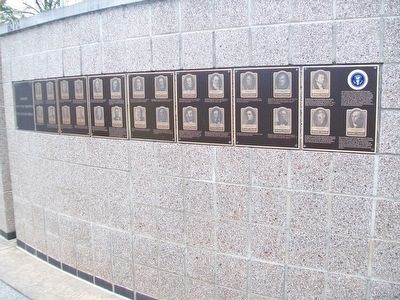
Our Constitution names the President of the United States the Commander in Chief of all the Armed Forces. Presidents who have served in our military are displayed on the following plaques. . . . — — Map (db m92389) HM WM
On County Road 63.2 at County Road 36, on the right when traveling north on County Road 63.2.
The Organic Act creating the Territory of Colorado was signed by President Buchanan on February 26, 1861. The act carved from the territories of Kansas, Nebraska, Utah and New Mexico the 104,247 square miles that became the 38th state in 1876. . . . — — Map (db m119436) HM
Near 16th Street Northwest at W Street Northwest, on the right when traveling north.
Since Meridian Hill Park opened in 1936, Washingtonians from the diverse neighborhoods surrounding the park have gathered here for performances, community events, and political protest.
When tens of thousands of people flocked to Washington, . . . — — Map (db m156670) HM
Near 16th Street Northwest north of W Street Northwest, on the right when traveling north.
Buchanan was our only bachelor president and relied upon his orphaned niece, Harriet Lane, to act as his First Lady during his years in the White House (1857 to 1861). In her estate, Harriet Lane Johnson made a bequest to fund a memorial to her . . . — — Map (db m156671) HM
Near 15th Street Northwest north of Chapin Street Northwest, on the left when traveling north.
Noted landscape architects George Burnap and Horace Peaslee, who worked in the Office of Public Buildings and Grounds, designed Meridian Hill Park under the guidance of the Commission of Fine Arts. By 1914, Burnap had completed his basic design: a . . . — — Map (db m63952) HM
Near Old North Way Northwest north of Library Walk Northwest, on the right when traveling north.
Old North was the University's main building from 1795 until the completion of the Healy building in 1879. During this period, it was not uncommon for the President of the United States to visit the University for commencement exercises, or for . . . — — Map (db m255242) HM
On 30th Street Northwest north of N Street Northwest, on the right when traveling north. Reported permanently removed.
Long a Georgetown landmark, this building was occupied from 1826 by Miss Lydia English's Georgetown Female Seminary, whose patrons and frequent visitors included Martin Van Buren, James Buchanan, Daniel Webster, Henry Clay, Andrew Johnson, . . . — — Map (db m97727) HM
On 30th Street Northwest just north of N Street Northwest, on the right when traveling north.
The Colonial, a historic building in Georgetown, was occupied from 1826 to 1861 by Miss Lydia English's Georgetown Female Seminary. After the Union Forces' defeat at the First Battle of Bull Run, the building was repurposed as an Army general . . . — — Map (db m248779) HM
On Pennsylvania Avenue Northwest at 14th Street Northwest (Highway 1), on the right when traveling west on Pennsylvania Avenue Northwest.
Site of
Joshua Tennison's Hotel 1818. John Strother 1821. Basil Williamson 1824. Frederick Barnard 1828. Proprietor of Mansion Hotel, Azariah Fuller American House 1833. City Hotel 1843. Willard's Hotel 1847-1901.
Distinguished Guests . . . — — Map (db m6618) HM
On Connecticut Avenue Northwest 0.1 miles south of Devonshire Place Northwest, on the right when traveling south.
The Woodley Park neighborhood that is now home to several thousand residents as well as the National Zoo was once sparsely settled countryside. The farmhouse shown here, known as Redwood, was built around 1819 on a hill that rose 40 feet above . . . — — Map (db m67828) HM
On Cathedral Avenue Northwest east of Woodley Road Northwest, on the right when traveling west.
The neighborhood of Woodley Park owes its name to the Woodley estate of Philip Barto Key (1767-1815). Key, uncle of Francis Scott Key, who wrote “Star Spangled Banner”, was an officer on the British side during the Revolutionary War. . . . — — Map (db m87469) HM
On Business U.S. 27 at Weatherly Street, on the left when traveling south on U.S. 27Business .
This County, created by Act of the Legislature Jan. 26, 1856, is named for Gen. Hugh A. Haralson, Member of Congress and Chairman of the Committee on Military Affairs during the Mexican War. The County Site is named for James Buchanan, last . . . — — Map (db m11177) HM
On Cumming Road at Johns Road, on the right when traveling east on Cumming Road.
In this cemetery are buried the following eminent Georgians:
JOHN MILLEDGE (1757-1818), Revolutionary officer, Congressman, Governor (1802-1806). He gave the land on which the University of Georgia is built.
GEORGE WALKER CRAWFORD . . . — — Map (db m14871) HM
On State Highway 123 at Shoals Road, on the left when traveling south on State Highway 123.
First called Lexington, Shoals was the site of what was probably the first woolen mill and iron foundry in Georgia. In 1794, Col. William Bird, Revolutionary soldier from Pennsylvania, and Benjamin A. Hamp bought several thousand acres of land . . . — — Map (db m37372) HM
On North 1st Street north of Augusta Avenue, on the left when traveling north.
This building was constructed in 1905 as a private museum for Harriet Miller Ellwood. Designed by architect William S. Ralph, it is an interesting combination of two architectural styles popular at the turn of the 20th century. The exterior was . . . — — Map (db m310644) HM
Alexander Sympson knew Lincoln when they were small boys in Kentucky. Like Lincoln, he moved to Illinois in the 1830's, and arrived in Carthage in early 1844, just as contention with the Mormons was peaking. In 1858 Sympson was the most . . . — — Map (db m57869) HM
The Gregarious General Isaac B. Curran was a prominent citizen in Lincoln's Springfield. His store here on the south side of the square was a popular gathering place for Lincoln's political opponents. Curran arrived as a young silversmith from . . . — — Map (db m180409) HM
Near E. Market Street 0.2 miles east of S. Allen Street.
Born in New Hampshire and a veteran of the War of 1812, Governor Cass was a skilled maker of treaties.
In 1831 President Andrew Jackson appointed Governor Cass Secretary of War. He later served as Minister to France.
In the mid 1840's, . . . — — Map (db m76578) HM
On U.S. 40 at E 600 Road (County Route 1029), on the right when traveling west on U.S. 40.
In 1855 the new town of Lecompton was named the capital of Kansas Territory. President James Buchanan appointed a governor and officials to establish government offices in Lecompton, and construction began on an elegant capitol building. In the . . . — — Map (db m50755) HM
On East Woodson Avenue at Boone Street, on the right when traveling west on East Woodson Avenue.
In 1855 the new town of Lecompton became the capital of Kansas Territory. President James Buchanan appointed a governor and officials to establish government offices in Lecompton, and construction began on an elegant capitol building. In the fall . . . — — Map (db m287499) HM
Near Interstate 70 10 miles west of S Lawrence Trafficway (State Highway 10).
In 1855, the new town of Lecompton was named the capital of Kansas Territory. President James Buchanan appointed a governor and officials to establish government offices in Lecompton, and construction began on an elegant capitol building. In the . . . — — Map (db m88763) HM
On U.S. 60 at Kentucky Road 144, on the right when traveling west on U.S. 60.
Six miles north are birthplace and grave of Joseph Holt, 1807-1896. He was commissioner of patents, postmaster general, and secretary of war in President Buchanan's administration, 1857-1861. Lincoln named him judge advocate general of the Union . . . — — Map (db m160290) HM
On State Road 144, on the right when traveling south.
This is birthplace and grave of Joseph Holt, 1807-96. He served as Commissioner of Patents, Postmaster General, and Sec. of War in Pres. Buchanan's Administration. 1857-61.
Lincoln named him Judge Advocate General of the Union army in 1862. Holt . . . — — Map (db m160293) HM
On State Road 144, on the right when traveling west.
Breckinridge County native Joseph Holt played an important role in keeping Kentucky in the Union during the Civil War. He also prosecuted the Lincoln assassination conspirators.
Born on January 6, 1807, Holt attended Centre College in Danville, . . . — — Map (db m160297) HM
On State Road 144, on the right when traveling south.
The second-son of a wealthy Breckinridge County family, Joseph Holt inherited 10,000 acres of lush farmland here along the Ohio River. Though he was away for many years, this place was always home.
Influential and Powerful
Joseph Holt . . . — — Map (db m160296) HM
On Elm Street at North 2nd Street, on the left when traveling east on Elm Street.
This famous stagecoach stop on the old Louisville & Nashville Turnpike was built ca. 1797 by James Young, founder of West Point, Ky. At this inn John James Audubon wrote about seeing large flocks of passenger pigeons. Jenny Lind stopped here briefly . . . — — Map (db m122121) HM
On Kentucky Route 109 0.2 miles north of Route 1508, on the right when traveling north.
Samuel Casey, 1788-1859, Treasurer of the United States, 1853-59, under Presidents Pierce and Buchanan. He resided 1811-1859 in Caseyville, three miles west. Elected clerk of Circuit and County Courts; later, 1830-32, member of the State Senate. — — Map (db m123922) HM
On St. Mary Street (State Highway 1) 0.4 miles north of Welcome Road, on the right when traveling north.
Land grant by France to Joseph Jacques Naquin. American patent by order of President James Buchanaan. Recorded 7th June 1858. 6th and 7th generation Naquins on land. — — Map (db m92133) HM
On First Street, on the right when traveling north.
John Slidell was an American politician and diplomat. Born in New York City in 1793, he later moved to New Orleans, where he practiced law from 1819 to 1835. He married Mathilde Deslonde, a member of a respected family. A member of the state House . . . — — Map (db m103417) HM
On Cony Street at Bangor Street (U.S. 201/202), on the right when traveling west on Cony Street. Reported missing.
Constructed facing the Kennebec River in 1799 by Arthur Lithgow, this majestic Federal style dwelling in 1807 became home to Reuel Williams, one of Augusta's most prominent nineteenth century citizen. The 14-room house featured an . . . — — Map (db m110889) HM
On Delaware Avenue (Maryland Route 7) 0.1 miles east of Creswell Ave., on the right when traveling east.
The home of John A. J. Creswell who nominated James Buchanan for President in 1856 and turned Republican in 1861. He was successively Assistant-Adjutant General of Maryland, member of the House of Representatives, Senator and Postmaster by . . . — — Map (db m145436) HM
Near North Court Street at West Church Street, on the right when traveling south. Reported missing.
At the dedication of the Roger Brooke Taney Bust in Frederick on September 26, 1931, Chief Justice Charles Evans Hughes concluded that “it is unfortunate that the estimate of Chief Justice Taney’s judicial labors should have been so largely . . . — — Map (db m290572) HM
On West Memorial Boulevard just west of South Potomac Street ( Route 65), on the right when traveling west.
1838
Hagerstown appoints Richard Sheaby and Allen Barber as police constables. Two additional posts are filled in 1842.
1841
The Franklin Railroad begins service between Hagerstown and Harrisburg. The Baltimore and Ohio Railroad . . . — — Map (db m146001) HM
On Main Street at Crossett Lane, on the right when traveling east on Main Street.
Union House / Chandler Hotel The Union House opened as a hotel in 1846. Two Presidents slept here, including James K. Polk, the 11th President, who stayed during a trip through the Northeastern part of the country. He was joined by his . . . — — Map (db m136695) HM
On South Burdick Street near W. Cedar Street, on the right when traveling north.
The only resident of Kalamazoo to be elected governor of Michigan during its first 150 years, Epaphroditus Ransom lived and farmed on this site. Born in Massachusetts in 1796, Ransom came to Michigan in 1834. An attorney, he soon became the area’s . . . — — Map (db m74527) HM
On North Shore Drive (County Highway 61) 0.8 miles south of Old North Shore Road (County Road 290), on the left when traveling south.
This town site, named after President Buchanan, was laid out in October 1856. From September 1857 until May 1859 the place though little less than wilderness, was the seat of the U.S. Land Office for the Northeastern District of Minnesota. After the . . . — — Map (db m43806) HM
On Lake Road (New York State Route 19) 0.2 miles north of Lynnwood Drive, on the right when traveling south.
Home of Simeon B. Jewett
1801-1869
Political leader, jurist, partner of Henry R. Selden, U.S. Marshal, Northern N.Y. under President Buchanan. — — Map (db m65368) HM
On East Church Street at North Smithwick Street, on the left when traveling east on East Church Street.
Asa Biggs (1811-1878), a prominent North Carolina politician and jurist, and his wife, Martha, built this Federal and Greek Revival—style house and lived here from 1835 to 1862. Biggs practiced law from his office just across Smithwick Street. . . . — — Map (db m152853) HM
On Vine Street at Third Street East on Vine Street.
When it opened May 30, 1850, the 340-room hotel located on this site was considered one of the finest hotels in the world. Abraham Lincoln stayed here on September 17-18, 1859, while campaigning for the Ohio Republican Party. Lincoln also stayed at . . . — — Map (db m98117) HM
Near Grant Street at Forbes Avenue, on the right when traveling north.
A mass meeting was held December 27th, 1860 to protest against removing war munitions from the Allegheny Arsenal to the south. The order was countermanded by President James Buchanan. — — Map (db m202805) HM
On Business Pennsylvania Route 220, on the right when traveling south.
Medicinal values of these springs discovered about 1796. It soon became a leading resort visited by numerous notables. James Buchanan used the Springs as his summer White House while President. — — Map (db m202853) HM
On Grant Street west of 5th Avenue ( Route 68), on the left when traveling west.
The Sutton-Ditz Museum & Fulton Library is listed on The National Register of Historic Places. Tour the museum to discover the treasured artifacts and exhibits of the rich history and culture of Clarion County. Research history and genealogy . . . — — Map (db m203977) HM
Near N West Street west of Dickinson Avenue when traveling west.
These three buildings are the three oldest structures on campus. Together they form Dickinson’s Historic Triangle.
West College, “Old West”, to your left
West College was designed in 1803 by Benjamin Latrobe, the architect . . . — — Map (db m152465) HM
On W High Street (U.S. 11), on the right when traveling west.
West College – known affectionately as Old West – traces its roots to February 1803, when the college’s main building burned to the ground after four years of costly construction. In a bind, the college trustees appealed for help. . . . — — Map (db m35322) HM
On Lincoln Way East (U.S. 30) east of Main Street (U.S. 11), on the right when traveling west.
Formed on September 9, 1784 from Cumberland County and named for Benjamin Franklin. Site of Falling Spring, noted limestone trout stream. Birthplace of James Buchanan, 15th President of the United States. Chambersburg, county seat, was laid out 1764. — — Map (db m2142) HM
On Stoney Batter Road, on the left when traveling north.
"To secure for the purpose of a site for a monument … an acre or more of ground at Stony Batter, near Mercersburg, Pennsylvania, the birth place of my uncle James Buchanan, and thereon to erect a suitable monument with proper . . . — — Map (db m58648) HM
On Stoney Batter Road, on the left when traveling north.
This monument marks the birthplace of James Buchanan, fifteenth President of the United States Born 23 April 1791 Died 1 June 1868 — — Map (db m58641) HM
On Stoney Batter Road, on the left when traveling north.
"It is a rugged but romantic spot, and the mountain and mountain stream under the scenery captivating. I have warm attachments for it…"James Buchanan on Stony Batter
The Buchanans enjoyed living on the edge of the . . . — — Map (db m58653) HM
On Stoney Batter Road, on the left when traveling north.
“The incorruptible statesman whose walk was upon the mountain ranges of the law.”
Life long friend Jermiah S. Black
U.S. Attorney General 1857-1860, U.S. Secretary of State 1860-1861
Imagine stepping back in time to April 23, 1791. Packhorses and wagons were pulling into a bustling trading post owned by Scotch-Irish immigrant James Buchanan. There was probably a spring chill to the air. Perhaps the sun shone brightly overhead, . . . — — Map (db m166791) HM
On N. Main Street near Seminary Street, on the right when traveling north.
James Buchanan, lawyer, statesman, diplomat, 15th President of the U.S., born in Stony Batter, lived here 1796-1807. Sgt. Patrick Gass, carpenter for winter quarters on the Lewis & Clark expedition, 1803-06, worked here as an apprentice, 1794-95. — — Map (db m8016) HM
On S. Main Street at Seminary Street, on the right when traveling south on S. Main Street.
Built c. 1798 and used as a dormitory of Marshall College, the "Old Mansion House" was acquired by Col. Murphy in 1845 who managed it as a prominent hotel until 1864. It was rumored to be a station on the underground railroad.
Soon to be . . . — — Map (db m8041) HM
On S. Main Street near Seminary Street, on the right when traveling south.
James Buchanan, a Representative and a Senator from Pennsylvania and the 15th President of the United States; born at Cove Gap, near Mercersburg, Franklin County, Pa., April 23, 1791; moved to Mercersburg, Pa. with his parents in 1796; was privately . . . — — Map (db m202788) HM
On N. Main Street near Seminary Street, on the left when traveling north.
Built by Thomas Lane. Was later occupied by the family of Elliott Lane, a brother. Here, Harriet Lane, niece of James Buchanan, and mistress of the White House during his Presidency, was born. — — Map (db m8018) HM
On Mercerburg Academy Road south of McFarland Road, on the right when traveling south.
Passed his schoolboy days in Mercersburg, became a lawyer, member of the legislature and of Congress, Minister to Russia, member of the United States Senate, Secretary of State, Minister to Great Britian and fifteenth President of the United States. . . . — — Map (db m202030) HM
On Buchanan Trail (Pennsylvania Route 16) at Stoney Valley Road, on the right when traveling west on Buchanan Trail.
President 1857 – 1861. Was born April 23, 1791, a half-mile from here. The cabin itself was moved to Mercersburg, 1850, and in 1925 to Chambersburg. In 1953, it was removed to The Mercersburg Academy campus where it may be seen. — — Map (db m202801) HM
On Stoney Batter Road, on the right when traveling north.
To Stony Batter the birthplace of James Buchanan ← James Buchanan ---------------------- Born April 23, 1791.Passed his school-boy days in Mercersburg, became a lawyer, member of legislature and of Congress, Minister to Russia, member of . . . — — Map (db m58659) HM
On Lincoln Highway East (Pennsylvania Route 16), on the left when traveling east.
Carved out of a remote wilderness, McConnellsburg served the flood of travelers heading west in the late 18th century. Taverns, like the Fulton House, sprang up all along the packhorse trail from Philadelphia to Pittsburgh.
Whether by . . . — — Map (db m167242) HM
On Orange Street 0.1 miles west of Lime Street, on the left when traveling west.
Congregation traces its origin to 1742. The first regular pastor was Rev. John D. Woodhull, Revolutionary patriot. First building completed here in 1770; present edifice dedicated 1851. James Buchanan, 15th President of the U.S., was a member. — — Map (db m122389) HM
On West Frederick Street east of Race Avenue, on the left when traveling south.
In 1853 James Buchanan, president of the Board of Trustees and later the fifteenth president of the United States, chose this as the site of the newly merged Franklin & Marshall College. The College Building, which became known as Old Main in the . . . — — Map (db m157472) HM
On Harrisburg Avenue 0.4 miles west of West Liberty Street, on the right when traveling west.
Franklin College, established in Lancaster in 1787, is the thirteenth oldest institution of higher education in the United States. The college's founders included four signers of the Declaration of Independence, four members of the Constitutional . . . — — Map (db m161172) HM
On S. Queen Street, on the right when traveling north.
Lawyer, statesman, diplomat, and fifteenth President of United States, lies buried in this cemetery, about 350 yards southeast. His home, Wheatland, located on Marietta Avenue, is marked with a bronze tablet. — — Map (db m5117) HM
Fifteenth President of the United States, lies buried at Woodward Hill Cemetery located five blocks to the south on Queen Street. — — Map (db m84451) HM
On South Queen Street (Pennsylvania Route 72) south of West Vine Street, on the left when traveling north.
At the root of Lancaster City's history, one major element is consistent...diversity. In the mid 1700s, the first citizens were from a variety of ethnic and religious backgrounds — German, Scots-Irish, and English.
❖ German . . . — — Map (db m136450) HM
On North Queen Street (Pennsylvania Route 72) at East King Street (Route 462), on the left when traveling north on North Queen Street.
Since its establishment in 1730, Lancaster City has been a bustling, vibrant community with a rich history. Founded by James Hamilton, an English businessman, the city was designed to be the county seat, with a Courthouse placed in the center of . . . — — Map (db m5201) HM
Associate Judge of Lancaster County
Member of Legislature
Delegate to State Convention which
Ratified the Constitution of
the United States
Ironmaster of Lancaster County
Warden and Vestryman of St. James Church
Father of Ann - Buried . . . — — Map (db m5210) HM
On North Market Street at William Henry Place, on the right when traveling north on North Market Street.
Operated 1742 to 1760 by borough fathers. Organized 14 August 1760 by leading citizens as Lancaster's first independent volunteer fire company. Active members included George Ross, Jasper Yeates, William Henry, Robert Fulton Sr, and James . . . — — Map (db m225744) HM
On Marietta Avenue (Pennsylvania Route 23) at N President Avenue, on the right when traveling east on Marietta Avenue.
James Buchanan Home has been designated a Registered National Historic Landmark Under the provisions of the Historic Sites Act of August 21, 1935 this site possesses exceptional value in commemorating and illustrating the history of the United . . . — — Map (db m54353) HM
Wheatland was built in 1828 for William Jenkins and his family. James Buchanan bought the home in 1848, and ran his 1856 presidential compaign from the mansion. He gave political speeches from this porch. — — Map (db m212983) HM
On Columbia Avenue (Pennsylvania Route 462), on the right when traveling east.
Home of President James Buchanan from 1849 to his death is a few blocks away. Statesman and diplomat, as Member of Congress, U.S. Senator, Secretary of State and Minister to England. Elected President in 1856. — — Map (db m180407) HM
On President Avenue at Harrisburg Pike, on the right when traveling south on President Avenue.
The home of James Buchanan, statesman, diplomat and the fifteenth President of the United States (1857-61), is located on Marietta Avenue, seven blocks south. Buchanan maintained Wheatland as his home from 1848 until he died there on June 1, 1868. — — Map (db m157225) HM
Near Milnor Street at Grant Avenue, on the right when traveling east.
This historic mansion and estate was built as a summer home circa 1850 in the Italianate style by Charles Macalester, Jr., a prosperous businessman and banker. He held close personal relations with Presidents Jackson, Van Buren, Polk, Pierce, . . . — — Map (db m194951) HM
In the Musical Fund Hall here in June 1856, John C. Frémont was nominated for President of the U.S. He lost the election to James Buchanan. Formed in 1854, the Republican Party opposed the extension of slavery; Lincoln was its first nominee elected . . . — — Map (db m81986) HM
On Elk Street south of 12th Street, on the left when traveling south.
Brig. Gen. McCalmont was a Franklin attorney whose law office was at this location. He was the Assistant Attorney General under President James Buchanan, serving from 1858 through 1861. In 1862, as a Captain in the Union Army, he . . . — — Map (db m138137) HM
Morris Island, across the water directly in front of you, was the scene of the Civil War's first hostile cannon fire, preceding even the bombardment of Fort Sumter. By January 1861, Union troops occupying For Sumter were surrounded by Southern . . . — — Map (db m30724) HM
On Pine Street north of Fourth Street, on the right when traveling north.
This house was the birthplace of Lucy P. Holcombe Pickens (June 11, 1832 - Aug. 8, 1899), a noted beauty of ante-bellum days and the most famous person born in La Grange. Mrs. Pickens is the only woman whose likeness has appeared on American . . . — — Map (db m37276) HM
Near South Rhodes Street north of East Cemetery Street, on the right when traveling north.
Tennessee State Senator 1821 - 1825
Tennessee State Representative 1831 - 1833
U.S. Congressman 1839 - 1845
Governor of Tennessee 1845 - 1847
Postmaster General of the United States 1857 - 1859
Born in Brunswick County, Virginia August . . . — — Map (db m151140) HM
On Marcy Trail, on the right when traveling south.
Edward Fitzgerald “Ned” Beale was a significant figure in 19th century America. In his long career, he was a naval officer, military general, explorer, diplomat, rancher and frontiersman. He fought in the U.S. - Mexico War, emerging as a . . . — — Map (db m93344) HM
On North Upper Broadway south of Lipan Street, on the right when traveling south.
Forbes Britton (1812-1861), a Virginian and graduate of the U.S. Military Academy, came to Corpus Christi as an army captain in Mexican War, 1846. He returned as a civilian, and with his wife Rebecca (Millard) had this classical revival house . . . — — Map (db m118375) HM
Near East Capitol Boulevard north of East 300 North, on the left when traveling north.
[panel 1] Following the days of their severest persecutions in the winter of 1846-7, when the Mormon pioneers, driven from their beloved city of Nauvoo, Illinois, by mob violence, were scattered across the frozen plains of Iowa, there came . . . — — Map (db m167225) HM
On U.S. 460 just east of the Kentucky State Line, on the left when traveling west.
Buchanan County. Formed in 1858 from Tazewell and Russell and named for James Buchanan, President of the United States, 1857–1861.
Kentucky. The first permanent settlement was made at Harrodsburg in 1774. Kentucky County was . . . — — Map (db m89744) HM
On Red Bud Highway (Virginia Route 80) just west of Chimney Rock Road, on the right when traveling west.
Buchanan County. Area 514 square miles. Formed in 1858 from Tazewell and Russell, and named for James Buchanan, President of the United States, 1857–1861.
Russell County. Area 496 square miles. Formed in . . . — — Map (db m104942) HM
On Ruritan Circle at Ruritan Road, on the right when traveling west on Ruritan Circle.
By 1967, when the photograph below was taken, Sterling had grown from a railroad stop known as Guilford to a large residential development. Beginning in 1860, the station served local farmers. Trains carried grain, produce, and dairy products to . . . — — Map (db m20146) HM
On Russell Road NW (Alternate U.S. 58) at Valley Street NW (Alternate U.S. 58), on the left when traveling west on Russell Road NW.
In 1773, the Rev. Charles Cummings became
the first minister of the Sinking Spring
Presbyterian congregation, among the
earliest in Southwest Virginia, and the first
meetinghouse was soon constructed here of
logs. The earliest marked grave in . . . — — Map (db m104672) HM
On North Lewis Street (U.S. 33) at Factory Road (West Virginia Route 5), on the right when traveling east on North Lewis Street.
Built this home in 1837 on a 1000-acre tract, and laid out the town of Glenville in 1845. As a member of the Virginia Assembly, he urged the building of the Parkersburg-Staunton Turnpike. As a Congressman, in 1842, Hays appointed Thomas Jonathan . . . — — Map (db m17557) HM
Built in 1834-1835 by Stephen Henderson First Summer White House Occupied by Martin Van Buren John Tyler Millard Fillmore Franklin Pierce James Buchanan — — Map (db m85210) HM
Near 25th Avenue at 5th Street, on the right when traveling east.
On the night of September 13-14, 1814, an artillery soldier named Francis Scott Key watched as the British attacked Fort McHenry. With bombs bursting mid-air, and in dawn’s early light, the American flag remained. Key was so inspired by the sight, . . . — — Map (db m185571) HM
On State Highway 28 9 miles west of U.S. 191, on the right when traveling west.
One of only three significant engagements of the Utah War, the incident at Simpson's Hollow played a key role in the conflict. The Utah War (1857-1858) was the result of a lack of communication between the U.S. Government and the Utah Territory . . . — — Map (db m67038) HM
On State Highway 28 9 miles west of U.S. 191, on the right when traveling west.
A Legacy of Distrust
In 1857, the Buchanan Administration faced a series of national challenges. Civil war loomed on the horizon, the New York stock market was in trouble, Federal troops were sent to quash unrest in Kansas and Washington . . . — — Map (db m67041) HM