118 entries match your criteria. The first 100 are listed. The final 18 ⊳
New Hampshire Historical Highway Markers
Marker series sponsored by the NH Division of Historical Resources and NH Department of Transportation (green background, white lettering, with the multi-colored state seal on top).
By Kelly Marsh, November 2, 2023
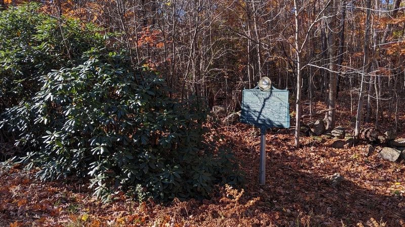
Dudley Leavitt marker and the really big Rhododendron
Author and publisher of almanacs first appearing in 1797. Best known was "Leavitt's Farmers' Almanac and Miscellaneous Year Book" which was continued after his death for about 45 years. This publication provided
information vital to domestic and . . . — — Map (db m235449) HM
One of the earliest highways in New Hampshire, it was authorized in 1765 as a supply route from the tide-water port of Durham to the colony's northern settlements in the Coos. This section of the road through Gilmanton was built in 1770 nine . . . — — Map (db m235104) HM
This rustic cottage was once the home of Thomas Murphy and his wife, Lady Blanche, daughter of the Earl of Gainsborough. Thomas was the organist at the church on the Earl's estate. The commoner and the lady eloped to America, where Thomas taught at . . . — — Map (db m77640) HM
Since Thomas Cole's visit in 1828, New Hampshire's splendid scenery has been an enduring inspiration to countless landscape artists. From 1850 to 1890 this region was particularly favored for their easels. Benjamin Champney (1817-1907), New . . . — — Map (db m74557) HM
The high steel trestle above was built in 1893 to replace a wrought iron trestle of 1875, and was strengthened in 1930 and 1950. Named for American Artist Godfrey N. Frankenstein (1820-1873), the adjacent cliff and gulf were formidable barriers to . . . — — Map (db m77698) HM
In 1771, Timothy Lash of Lancaster and Benjamin Sawyer of Conway made a bargain with Governor John Wentworth to bring a horse through Crawford Notch in order to prove the route’s commercial value. The pair succeeded by dragging and lowering the . . . — — Map (db m239145) HM
Nearby is the birthplace of the Granville brothers Zantford (Granny), Thomas, Robert, Mark and Edward and sisters Pearle and Gladys. With Madison natives Hiram Jones, Harry Jones, and Elson Ward, they formed the Granville Brothers Aircraft Co. in . . . — — Map (db m192062) HM
Abenaki Tower, dedicated in 1924, is located on N'dakinna, the traditional lands of the Abenaki Peoples past and present. The lookout is located near the junction of two trails: the Sobagw (Ocean) Trail and the Awasebi (Beyond the Water) Trail. . . . — — Map (db m234614) HM
The nearby granite marker is the first known monument in New Hampshire marking the reparation and reburial of an Indigenous individual. In 1809, the remains of a reportedly 7-foot tall Abenaki man were found along the banks of the Melvin River: . . . — — Map (db m234612) HM
Born October 11, 1872, in a modest cottage
1.7 miles southeast of here on Horseshoe Road,
Stone graduated from Amherst College and
Columbia Law School, returning to the latter
as Dean, 1910-1924. Attorney General in President Coolidge’s . . . — — Map (db m74560) HM
Spofford Village attained national stature in the 19th century for the manufacture of bits, augers, and gimlets in a series of shops powered by Partridge Brook. Beginning about 1825, Benjamin Pierce, members of the Hopkins family, and others also . . . — — Map (db m85874) HM
In 1772 "the people called Methodist" held their first religious meeting in this state on the James Robertson farm, 1.2 miles north of here, on Christian Street, with Philip Embury as the preacher. On June 20, 1803, Francis Asbury spoke here using . . . — — Map (db m85918) HM
In the Holman and Merriman Machine Shop opposite this location, George A. Long of Northfield (Mass.) in 1875 built a steam propelled four wheel automobile with a fifth wheel for steering. This vehicle, fired by hardwood charcoal, had a bicycle-type . . . — — Map (db m74561) HM
Formed in 1856, the firm Newhall & Stebbins began manufacturing the Granite State Field Mower in 1860. Machined out of cast iron with few bolts, the mowers were intended for use on the uneven terrain of New England farms. In 1870 the company . . . — — Map (db m74562) HM
About 150 feet north of here stood the famous Hampshire Pottery Works founded by James Scolly Taft for the manufacture of earthenware. In 1878 Majolica ware was a major product, followed in 1883 by the addition of useful and decorative art objects . . . — — Map (db m85873) HM
Civil Rights activist Daniels worshiped at St. James Episcopal Church during his high school years. Born in Keene, he graduated from Virginia Military Institute before entering the Episcopal Theological School in Cambridge, MA. While studying for . . . — — Map (db m85872) HM
The first of two famous Keene glass factories was established near this site in 1814 and produced window glass for the New England area until 1853. Another glass works (1815-1842), 1.5 miles southeast of here on Marlboro Street, made bottles and . . . — — Map (db m74563) HM
The first bridge across this river was built approximately ¼ mile north of this location in 1785 by Col. Enoch Hale. This toll bridge, replaced in 1840, was recognized in the 18th century as one of America's outstanding bridges because of its . . . — — Map (db m85922) HM
This church, built on the northeast corner of Cole Cemetery in 1762, was moved in sections by ox cart in 1779 to this location, then known as Federal Hill. A steeple with a bell cast by the Paul Revere Foundry was added in 1826. This edifice is . . . — — Map (db m90195) HM
Completed in 1869 for $139,500, this unique railway was built through the genius and enterprise of Herrick and Walter Aiken of Franklin and Sylvester Marsh of Campton. Over three miles long, the average grade to the 6,293-foot summit is one foot in . . . — — Map (db m77797) HM
The small man-made 'islands' in the river were used to secure a chain of boom logs which divided the Androscoggin River during the colorful and dramatic annual log drives, when the Brown Paper Company and the International Paper Company shared the . . . — — Map (db m74564) HM
On the knoll north of this site, William Sessions and his nephew, Cyrus Wheeler erected "the first building that could be honored with the name of house" in what is now Berlin, NH. Sessions helped clear many other farms in the area. In the 20th . . . — — Map (db m87972) HM
The village of Zealand grew up in 1875 to serve the logging industry. Henry owned 10,000 acres in the heart of the White Mtns., with a 10-mile railroad to move logs from forest to sawmill. The village had a post office, school, store, housing, and . . . — — Map (db m74556) HM
Abel Crawford and son, Ethan Allen Crawford, built the first Crawford House in 1828. It was run by Ethan's brother, Thomas, until sold in 1852. Fires in 1854 and 1859 destroyed the original inn and a replacement. Col. Cyrus Eastman erected the . . . — — Map (db m75236) HM
Mount Washington Hotel
Standing to the east, the Mount Washington Hotel was completed in 1902 as one of the largest, most modern grand hotels in the White Mountains, one of the few built in a single campaign. Designed by New York architect . . . — — Map (db m77641) HM
For whom the Notch is named, included Abel and his sons, Thomas J. and Ethan Allen. They established the first regional hotels and pioneered in opening the White Mountain area to the public. Ethan and his wife, Lucy Howe Crawford, author of an 1846 . . . — — Map (db m44299) HM
At this point you stand on the 45th parallel halfway between the Equator and the North Pole. At this point you stand also at longitude 71° 24' West from Greenwich, England. A line from this point through the center of the earth would emerge in the . . . — — Map (db m75603)
New Hampshire has held the first-in-the-nation presidential primaries since 1920. With the first presidential "beauty contest" in 1952, our citizens have personally met the candidates and by popular ballot have declared their preference for their . . . — — Map (db m74566) HM
On July 10, 1885, at 6 a.m., a slide from Cherry Mountain's northern peak left a deep gash from Owl's Head to the valley. A million tons of boulders, trees and mud loosed by a cloudburst rolled and tumbled a tortuous two miles, destroying Oscar . . . — — Map (db m77633) HM
Known as Granny Stalbird, Deborah Vicker came through Crawford Notch c.1796 as cook for Col. Joseph Whipple. It is said she brought the first bible to the north country. She married Richard Stalbird and settled on land deeded to her by Whipple in . . . — — Map (db m77632) HM
Born nearby, this inventor and scientist gained unique distinction as a pioneer aeronaut in the United States. He organized and directed a military balloon force during the Civil War and later invented a number of important and basic devices for . . . — — Map (db m77635) HM
Lancaster, founded in 1763, lies on the bed of glacial Lake Coos, formed as the glaciers receded 14,000 years ago. Today, the Connecticut, an American Heritage River, flows along the bottom of the ancient lake.
You stand at a gateway to The . . . — — Map (db m75697) HM
The Lodge atop Mt. Prospect was the summer home of John Wingate Weeks (1860-1926), renowned "Father of the Eastern National Forests," author of The Weeks Act, passed by the U.S. Congress, March 1, 1911. The Act enables the government to buy . . . — — Map (db m77613) HM
This Structure, erected by Major Jonas Wilder, from boards planed and nails wrought on the site, originally possessing a four-fireplace chimney and Indian shutters, is Coos County's first two-storey dwelling. Construction was initiated on the noted . . . — — Map (db m77609) HM
Named for Fridjof Nansen, the Greenland explorer, Berlin's first ski club formed in 1872. The club sponsored the "Big Nansen" constructed in 1936–38 by the National Youth Administration and the City of Berlin. At the time, it was possibly the . . . — — Map (db m87929) HM
Darby Field, a New Hampshire settler, accomplished this difficult feat in 1642 from a southerly approach. Partly guided by Indians and with only primitive equipment at his disposal, he is thus alleged to be the originator of all Mount Washington . . . — — Map (db m77638) HM
In 1832 the settlers of the area between Indian Stream and Hall's Stream, claimed by both Canada and the United States, set up the independent republic of Indian Stream. Yielding to New Hampshire in 1836, Indian Stream became part of Pittsburg and . . . — — Map (db m75611) HM
In 1876 Abel Watson and his son Laban converted their farm on this site, facing King Ravine on Mt. Adams, into a summer boarding house. Enlarged in 1884 and subsequently, the Ravine House became a key institution in opening up the northern . . . — — Map (db m77634) HM
In the spring of 1944 a high fence and four guard towers transformed a former Civilian Conservation Corps camp on this site into New Hampshire's sole World War II prisoner of war camp. Approximately 250 German and Austrian soldiers, most captured . . . — — Map (db m87928) HM
Hunter, trapper, fisherman and guide, well and favorably known by the region's early settlers, "The Lone Indian of the Magalloway" was the last survivor of a band of Abnaki inhabiting the Upper Androscoggin. Blinded by accidents, Metallak died a . . . — — Map (db m75602) HM
The dramatic process of conveying lumber logs and pulpwood from northern New Hampshire forests to manufacturing centers, by driving them down the Connecticut River, spanned the turn into the Twentieth Century. Hardy crews of "white-water men" . . . — — Map (db m75601) HM
The Boston, Concord & Montreal Railroad was chartered in 1844. Construction of the main line began in Concord in 1846. The tracks were completed to Laconia in 1848, to Ashland in 1849, and to Wells River, Vermont in 1853. The B. C&M RR merged with . . . — — Map (db m74567) HM
Nearby, on Pleasant Street, is the birthplace and childhood home of George Hoyt Whipple, pathologist, researcher and teacher. Dr. Whipple’s most significant research led to the development of the liver therapy for pernicious anemia. For his work, he . . . — — Map (db m74568) HM
Settled in 1766 by Jaasiel Harriman whose cabin was near the Great Rock. His nine year old daughter Mercy carried dirt in her apron to the top of this unique rock formation. Here she planted corn, pumpkins and cucumbers, making the first garden . . . — — Map (db m74569) HM
Erected in 1928, this riveted steel Warren truss span was built to replace a wooded span destroyed in the 1927 flood. This efficient truss design is based on a series of equilateral triangles with verticals added for strength. Boston Bridge Works . . . — — Map (db m75772) HM
Alderbrook developed around a sawmill built by H.C. Libbey in 1877. The Village grew to include a post office, a dozen company-owned houses, a boarding house, school and railroad station. The mill employed as many as 40 to 60 men and cut as much as . . . — — Map (db m77642) HM
By 1920 the adjacent road, Rt. 302 was part of the Teddy Roosevelt (TR) Trail, which ran from Maine to Oregon. It was an important way for tourists to access the White Mountains. After the 1927 floods, many bridges needed to be . . . — — Map (db m44289) HM
Hiram W. Merrill (1822-1898) of Plymouth, N. H., built this bridge in 1870 to replace a span of 1829 that had been burned by an arsonist. The bridge employs a truss design patented by Col. Stephen Harriman Long (1784-1864) of Hopkinton, N. H. It is . . . — — Map (db m198713) HM
In this area of Easton (formerly part of Landaff and before that, Lincoln), the settlement of Wildwood once stood. At the turn of the 20th century Wildwood was a center for the "slash and run" logging of Mt. Moosilauke. The Village included a . . . — — Map (db m75773) HM
In 1963, an emerging Franconia College purchased the former Forest Hills grand hotel, built on this site in 1882. Bending the norms of higher education, the college offered self-directed study, and administrative decisions were made by faculty and . . . — — Map (db m235620) HM
Due west stands New Hampshire's sole-surviving example of a post-Revolutionary furnace for smelting local iron ore. The industry flourished during first half of 19th century. It produced pig and bar iron for farm tools and cast iron ware, including . . . — — Map (db m116365) HM
"The Corner" was part of a mile-wide strip of land claimed by both Haverhill and Piermont, and finally divided between them. Haverhill Corner's architecture reflects its history as Grafton County seat (1793–1891), home of Haverhill Academy . . . — — Map (db m88003) HM
The last of five 19th century bridges which have existed at this location was erected in 1866 by a local entrepreneur, Moody Bedell, who had operated a ferry service here prior to the first bridge in 1805. The 396-foot structure was the largest . . . — — Map (db m87999) HM
Born in Boston and a veteran of the 1758 Battle of Ticonderoga. As a known participant in the Boston Tea Party, for his own and his children’s safety, he walked to North Haverhill in early 1774. He later served in the Northern Army under Gen. Gates . . . — — Map (db m77798) HM
The rivers’ junction two miles north was rendezvous for Rogers Rangers after their destruction of St. Francis, Que., Oct. 4, 1759. Pursuing Indians and starvation had plagued their retreat and more tragedy awaited here. The expected rescue party . . . — — Map (db m77799) HM WM
Constructed in 1829 by the towns of Bath and Haverhill at a cost of about $2,400, this is one of the oldest covered bridges in the United States. Built with 3-by-10-inch planks that were probably sawn at an adjacent mill, the span is the earliest . . . — — Map (db m77800) HM
Proprietor of more than half the Town of Holderness, this jurist, congressman and senator was New Hampshire’s first attorney general and second chief justice. In 1788 he spurred the State’s approval of the proposed Federal Constitution, thus . . . — — Map (db m74570) HM
On the night of September 19–20, 1961, Portsmouth, NH couple Betty and Barney Hill experienced a close encounter with an unidentified flying object and two hours of “lost” time while driving south on Rte 3 near Lincoln. They filed . . . — — Map (db m74571) HM
A reminder of bygone days, this stone structure was used to make wood into charcoal for the nearby iron smelters. Pine knots, a waste material from the adjacent lumber mill, were a prime source for charcoal. Charcoal production through this kiln, . . . — — Map (db m77674) HM
Here, from 1867 to 1909, the world famous Kilburn brothers, Benjamin and Edward, produced and distributed thousands of stereoscopic views. Their collection, largest in the world and collector's items today, provided popular parlor entertainment . . . — — Map (db m116285) HM
Willowdale was established around a sawmill that was built in 1812. The village thrived because sawmills, gristmills, and a factory producing sawmill machinery were powered by the Ammonoosuc River. After the Littleton Lumber Company opened in 1870, . . . — — Map (db m74572) HM
Orford's seven Ridge houses were built over a period of time from 1773 to 1839 by professional and business men of the town. The Bulfinch-style house of John B. Wheeler, built in 1814-1816, southern-most in the row, was designed by a Boston . . . — — Map (db m32090) HM
Named for local farmer Jacob Smith, the first bridge at this site was begun before 1786 and completed with the aid of a lottery authorized in that year. In 1850, contractor Harmon Marcy of Littleton, N.H. built a new bridge at a cost of about $2,700 . . . — — Map (db m74575) HM
This is the site of the longest continuous stream gaging in New Hampshire. Daily measurement of the level of the Pemigewasset River was begun here in 1886 by the Locks and Canals Company of Lowell, Massachusetts, which controlled flowage in the . . . — — Map (db m74576) HM
In 1929, on the slopes of the hill to the east, Austrian-born Sig Buchmayr established the first organized ski school in the United States. Sponsored by Peckett's-on-Sugar Hill, one of the earliest resorts to promote the joys of winter vacationing . . . — — Map (db m77666) HM
In 1973 Norris Cotton celebrated 50 years of elected public service, having served in both the state legislature and Congress. Born in Warren in 1900, Cotton worked his way through Phillips Exeter Academy and Wesleyan University before being elected . . . — — Map (db m88006) HM
This is considered to be the site of Colonel John Goffe's log dwelling. In 1744 Goffe build a gristmill on Bowman's Brook, later run by his son, Major John Goffe (1727–1813), and his grandson, Theodore Atkinson Goffe (1769–1860). The . . . — — Map (db m88052) HM
Born in Francestown, this ardent Jacksonian rose to hold some of the nation's highest offices. After serving his state as legislator, judge, and Governor, he became
U. S. Senator, Secretary of Navy, Secretary of Treasury, and U.S. Supreme Court . . . — — Map (db m225997) HM
The Pierce Homestead was built in 1804 by Benjamin Pierce, a general in the American Revolution, twice governor of New Hampshire (1827-28, 1829-30), and father of Franklin Pierce, the 14th President of the United States (1853-57). Franklin Pierce . . . — — Map (db m83659) HM
Samuel Blodgett began a canal to bypass the steep falls in 1793, with money provided by a lottery. The canal was finished in 1807. Mills then sprang up on both sides of the river below the falls. The world renowned Amoskeag Manufacturing Company . . . — — Map (db m64872) HM
Marker Front: The first credit union in the U.S. was founded here in 1908, the inspiration of Monsignor Pierre Hevey, the pastor of Sainte-Marie Parish. Monsignor Hevey sought to improve the economic stability of the French-speaking mill . . . — — Map (db m65149) HM
Nearby stands the boyhood home of Samuel Wilson (1766 to 1854) who was generally known as “Uncle Sam.” He supplied beef to the Army in 1812. The brand on his barrel was “U.S.” The transition from U.S. to Uncle Sam followed and became the popular . . . — — Map (db m75238) HM
One of three New Hampshiremen to sign the Declaration of Independence, Matthew Thornton, physician, soldier, patriot, agitated against the Stamp Act of 1765, presided over the Provincial Congress in 1775, served in the State Senate and as an . . . — — Map (db m74577) HM
Was the original town, chartered by Massachusetts Bay Colony in 1673, which embraced parts of New Hampshire and Massachusetts. The New Hampshire portion of this area, following determination of the province boundary in 1741, was subsequently . . . — — Map (db m88053) HM
This brass four-pounder, cast in 1743, was captured August 15, 1777 at the Battle of Bennington by Gen. John Stark's troops. Gen. Stark presented "Old Molly" to the New Boston Artillery Company of the 9th Regiment of New Hampshire Militia, for its . . . — — Map (db m225989) HM
TEMPLE GLASS FACTORY
Was located at a secluded site in the southwest portion of Temple township. Founded in 1780 by Robert Hewes who employed Hessian mercenaries from the British Army trained in the art of glass-blowing. This early attempt to . . . — — Map (db m235453) HM
Just north of this point, on the boundary between Bow and Concord a large cavalcade of enthusiastic citizens met President Jackson and escorted him to New Hampshire’s Capital. His official reception by the State Government on the following day, . . . — — Map (db m77801) HM
The unusual name of the former Union church that stood nearby from 1839-1958 came from its elaborate interior that was embellished with scripture, homilies and other decorations made from found materials like cotton gauze, paper and worsted wool. . . . — — Map (db m235443) HM
Born in Concord in 1890, Elizabeth Gurley Flynn was a nationally known labor leader, civil libertarian and feminist organizer. She joined the Industrial Workers of the World at age 17 where her fiery speeches earned her the nickname "The Rebel . . . — — Map (db m223514) HM
Lies buried in nearby Minot enclosure. Native son of New Hampshire, graduate of Bowdoin College, lawyer, effective political leader, Congressman and U.S. Senator, Mexican War veteran, courageous advocate of States’ Rights, he was popularly known as . . . — — Map (db m77802) HM
While living at her "Pleasant View" home (1892 - 1908) once on this site, Mrs. Eddy founded The First Church of Christ, Scientist in Boston, Mass., headquarters of the Christian Science movement. From "Pleasant View" some six miles from her . . . — — Map (db m77803) HM
Since 1920, New Hampshire has held its presidential primary election before any other state. Changes in New Hampshire law in 1949 made the primary a direct selection of presidential aspirants, not a mere choice of delegates pledged to specific . . . — — Map (db m115923) HM
The State Capitol Building of New Hampshire was built in 1816-19 by Stuart J. Park. It is constructed of New Hampshire granite quarried in Concord. The original part was occupied June 2, 1819 and is the nation's oldest State Capitol in which a . . . — — Map (db m77813) HM
One tenth of a mile east of here stands the only house in Concord owned (1842-1848) by Franklin Pierce, 14th President of the United States. Removed to this site in 1971 from Montgomery Street, it was restored by the Pierce Brigade. Opened to the . . . — — Map (db m130013) HM
Built in 1889 on the granite abutments of an older span, this is the world's oldest surviving covered railroad bridge. It was probably designed by Boston & Maine Railroad engineer Jonathan Parker Snow (1848–1933) and built by carpenter David . . . — — Map (db m88024) HM
Born in a house bordering this common, he migrated to Minneapolis in 1855. There, he, his brother George, and his nephew Charles, established the famous Pillsbury flour milling business. Three times elected Governor of Minnesota and noted . . . — — Map (db m88015) HM
Born in Andover, Mass. June 21, 1736, Enoch Poor settled in Exeter, becoming a successful merchant and ship-builder. In 1775 he was appointed colonel in the 3rd New Hampshire Regiment. Poor was at Stillwater, Saratoga and Monmouth, and served under . . . — — Map (db m75241) HM
The historic Town House of Exeter stood near this site. Here on January 5, 1776, the Provincial Congress adopted and signed the first state constitution thereby establishing an independent state government, the first of the thirteen colonies. The . . . — — Map (db m75242) HM
Built about 1721 as one of New Hampshire’s earliest brick houses, and enlarged and clapboarded in the 1750s, this dwelling served as the state treasury during the Revolution. Here were born John Taylor Gilman (1753-1828), who was elected governor . . . — — Map (db m75243) HM
Founded by Rev. John Wheelwright in 1638, Exeter was one of the four original towns in the colony. Following New Hampshire’s provisional declaration of independence on January 5, 1776, it served as the capital of the new state during the period of . . . — — Map (db m75244) HM
Distinguished participant in the founding of the Republic as signer of the Declaration of Independence and Articles of Confederation, and prominent in this State as Chief Justice of two courts and first holder of the title of Governor. An innovator . . . — — Map (db m75245) HM
Boundary disputes among the early river
settlements caused this area to be called
Bloody Point. By 1640 Trickey's Ferry
operated between Bloody Point and Hilton's
Point in Dover. In 1712 the meeting house was erected and the parish set off, . . . — — Map (db m224489) HM
Extending 36 miles from Piscataqua Bridge in Durham to the Merrimack River in East Concord, this highway was originally a toll road. The first of more than 80 New Hampshire turnpikes built by private corporations in the nineteenth century, this was . . . — — Map (db m77814) HM
Upon invitation of President Monroe, issued at the request of the Congress, Marquis de LaFayette, Revolutionary War hero, revisited the United States for a goodwill tour which included an extensive visit to New Hampshire towns. He passed this spot . . . — — Map (db m77815) HM
The Town of Nottingham was created by a Royal Charter in 1722. A plan of the town was completed in 1724; at that time the design of the Nottingham Square was laid out with house lots and the intersecting streets Bow, Fish, King and North. The . . . — — Map (db m235102) HM
The town of Portmouth purchased this land in 1753 for 150 pounds from Col. John Hart, Commander of the N.H. Regiment at Louisburg. General William Whipple, signer of the Declaration of Independence, Gov. John Langdon, signer of the Constitution, . . . — — Map (db m74579) HM
The Bypass was part of a major New Deal project to move U.S. Route 1 traffic away from the congested streets of downtown Portsmouth. The Bypass created a second Piscataqua River crossing into Maine via the Interstate (Sarah M. Long) Bridge. The . . . — — Map (db m235619) HM
The receiving station for the first Atlantic cable, laid in 1874, is located on Old Beach Road opposite this location. The remains of the Sunken Forest (remnants of the Ice Age) may be seen at low tide. Intermingled with these gnarled stumps is the . . . — — Map (db m74580) HM
About six miles offshore, these nine rocky islands served Europeans as a fishing station before the first mainland settlements were made in 1623. Capt. John Smith (1580-1631) named the group "Smiths Isles" in 1614. The codfish that "shoaled" or . . . — — Map (db m165413) HM
118 entries matched your criteria. The first 100 are listed above. The final 18 ⊳